Daily
One regular dose of Earth from above
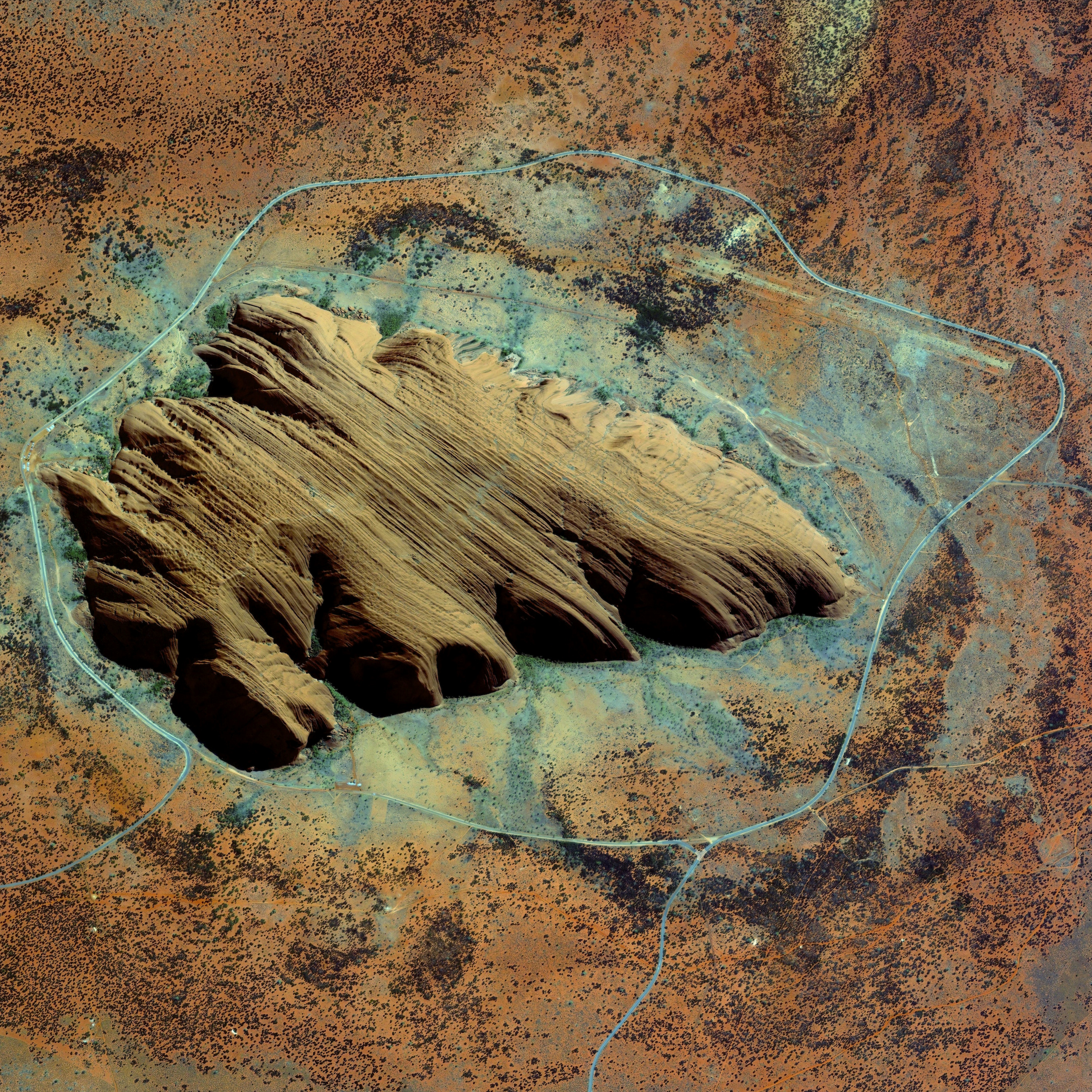
Uluru / Ayers Rock
-25.345000°,131.036111° - Maxar Technologies
Uluru, or Ayers Rock, is a large sandstone formation in the Northern Territory of Australia. The monolith — rising to a height of 2,831 feet (863 m) with a perimeter of 5.8 miles (9.4 km) — is a sacred site to the Aboriginal people who settled there 10,000 years ago. While the first Australian tourists arrived at Uluru in 1936, annual visitor numbers rose to more than 400,000 by the year 2000. Increased tourism at the site provides regional and national economic benefits, but also creates an ongoing challenge to balance conservation, cultural values, and visitor needs.
Schwetzingen Palace
49.384167°,8.570556° - Maxar Technologies
Schwetzingen Palace is located in the German state of Baden-Württemberg. Built in stages from 1700 until 1750, the grounds of the palace feature ornate gardens that were designed in the styles of the the "French formal garden" and the "English landscape garden."
Beni River
-10.382100°,-65.390300° - United States Geological Survey
The Beni River flows for roughly 680 miles (1,100 km) through northern Bolivia. Scattered along the river are numerous oxbow lakes, which are curved bodies of water that form when a meander from the main stem of a river is cut off, creating a freestanding body of water. Dark green colors in the image indicate forest and lighter green shades indicate grassland or sparse forest.
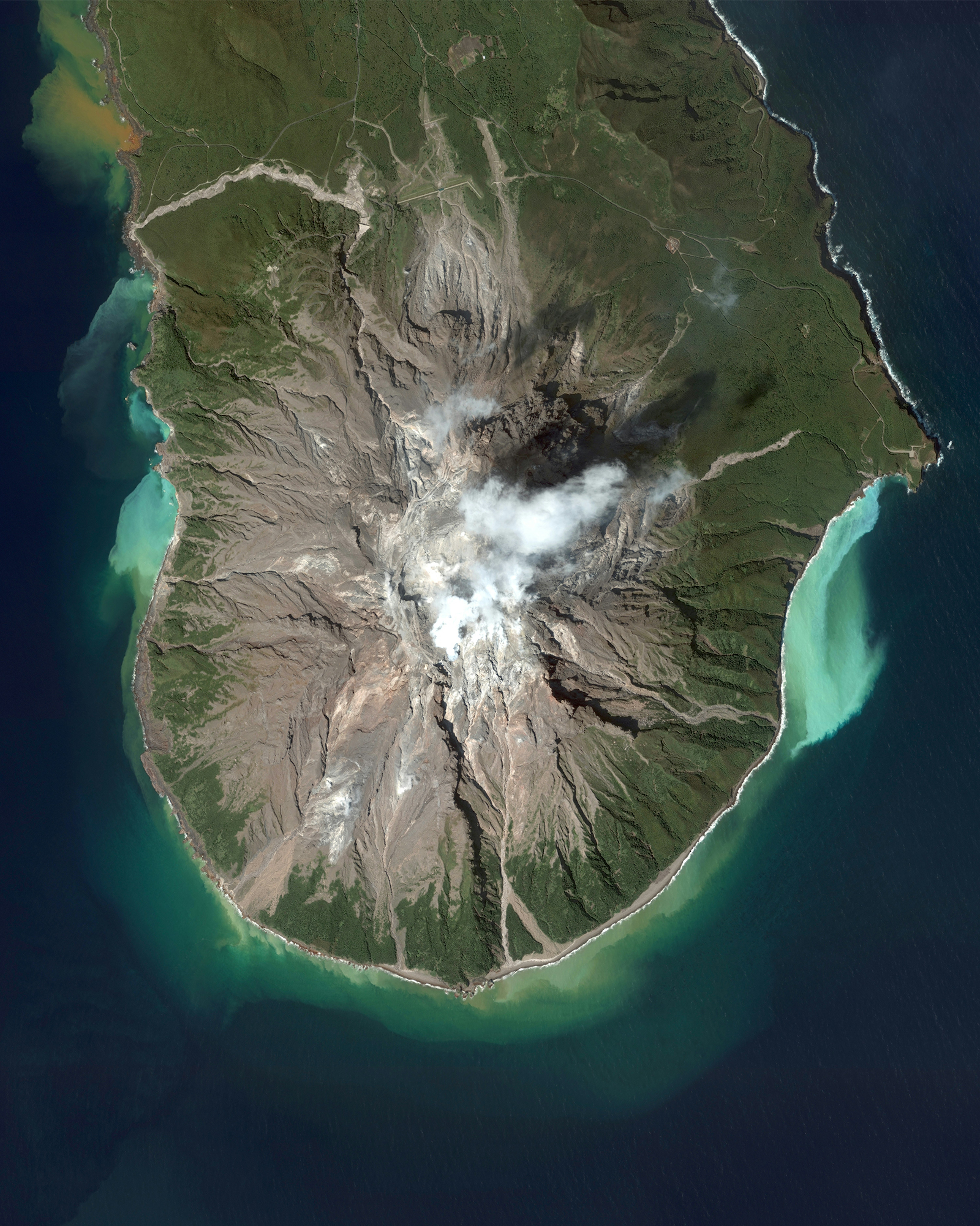
Iōjima
30.790833°,130.296111° - Maxar Technologies
Iōjima — not to be confused with Iwo Jima — is an island located 59 miles (110 km) south of Kagoshima, Japan. Iōjima experiences frequent volcanic activity, which results in massive amounts of sulfur dioxide flowing into the sea. This causes the surrounding waters to turn yellow, green, and teal as seen here. The island has a total area of 4.5 miles (11.65 sq km) and a population of 142 people.
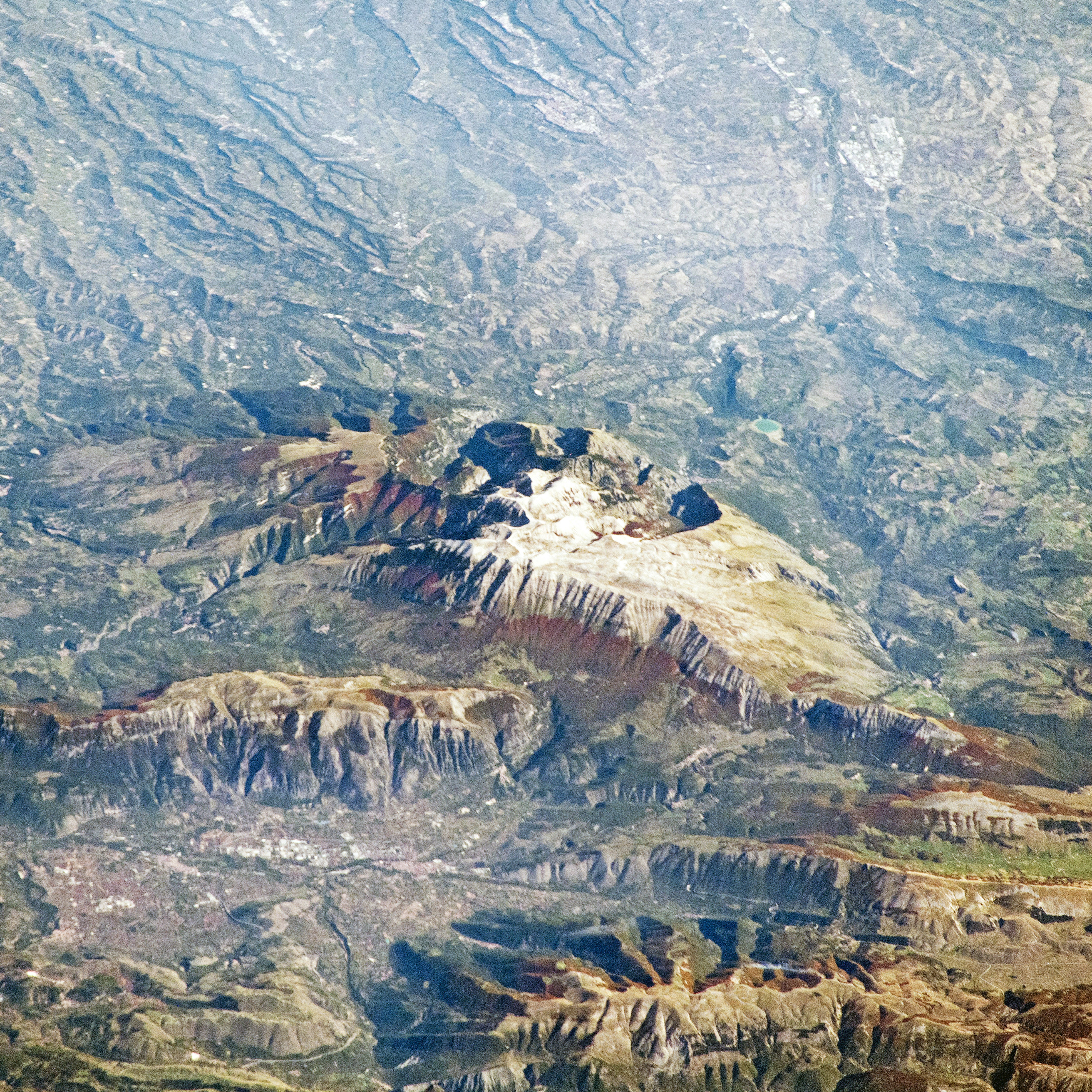
Maiella Massif
42.086944°,14.087500° - NASA
This Overview, taken by an astronaut aboard the International Space Station, shows an oblique view of the Maiella Massif in Italy’s Central Apennine Mountains. A massif is a compact group of connected mountains, usually isolated from other mountains in a range. Located about 25 miles (40 km) from the coastline of the Adriatic Sea, the Maiella Massif abruptly rises to more than 9,000 feet (2,700 m) above sea level.
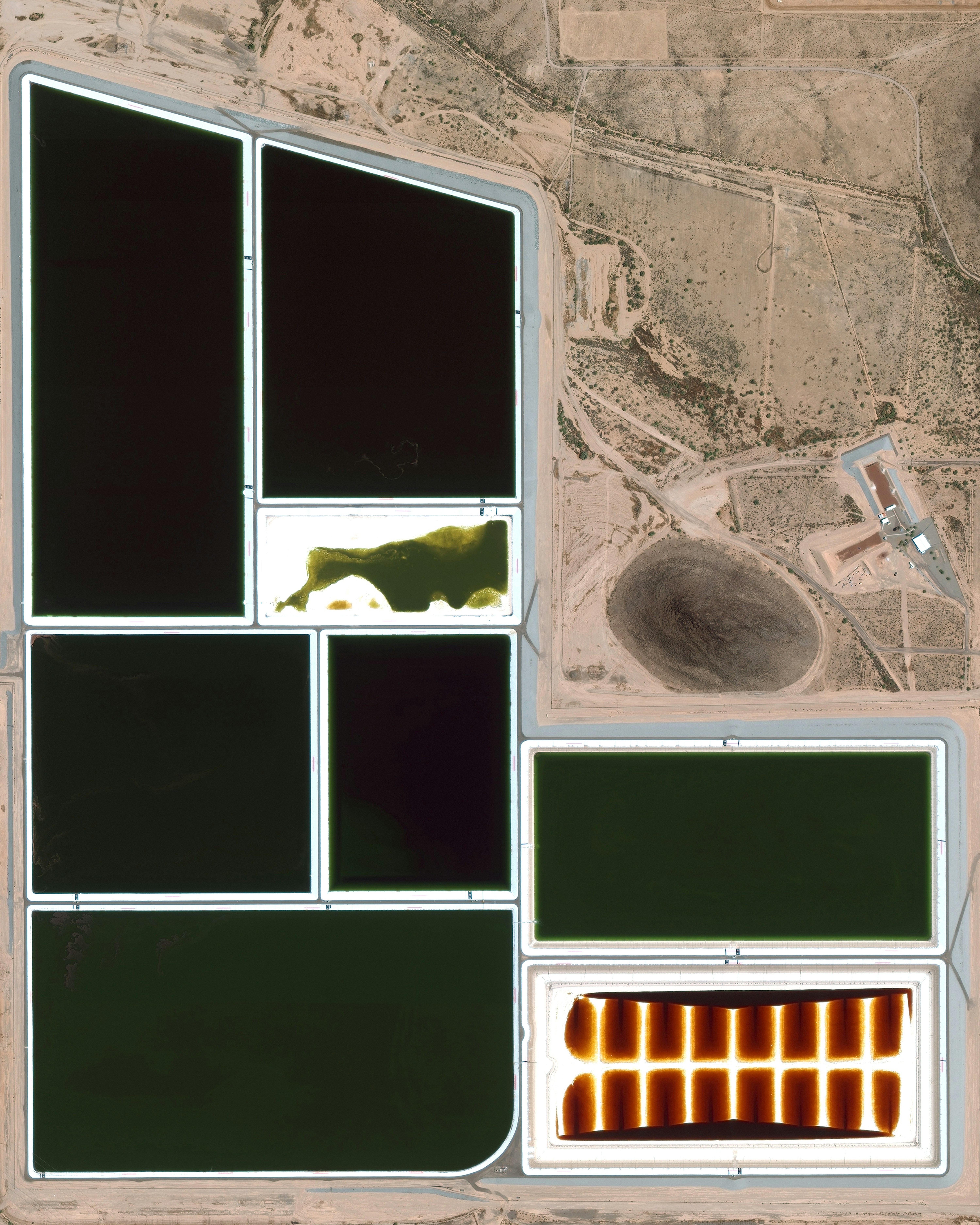
Palo Verde Nuclear Generating Station
33.389158°,-112.865096° - Maxar Technologies
Waste ponds are seen at Palo Verde Nuclear Generating Station near Tonopah, Arizona. As the most powerful nuclear power plant in the United States, the facility produces an average of 3.3 gigawatts, or enough power to serve roughly 4 million people. Additionally, since it is the only major nuclear power plant that is not located near a large body of water, this facility evaporates water from the treated sewage of several nearby cities to provide cooling for the steam that it produces. This image was featured in our story "Rethinking Nuclear Power."Read the full story →
Arlit Uranium Mine
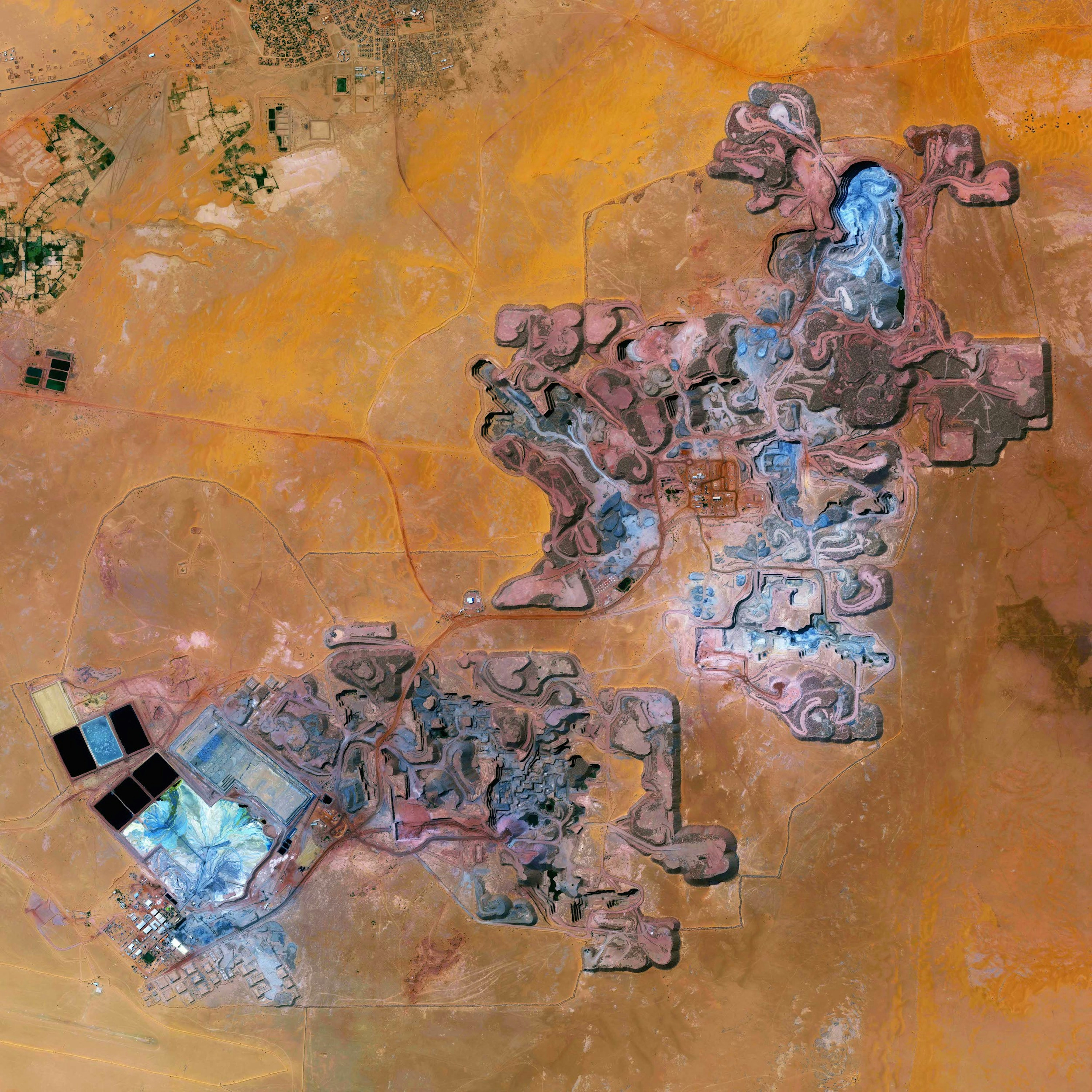
18.760752°,7.318642° - Maxar Technologies
The Arlit Uranium mine is located in Arlit, Niger. French nuclear power generation as well as the French nuclear weapons program are dependent on the uranium that is extracted from the mine - more than 3400 tonnes per year. This image was featured in our story "Rethinking Nuclear Power."Read the full story →
Thailand Colored Roofs
14.042500°,100.669700° - Maxar Technologies
Brightly-colored roofs are seen here in Khlong Sam, a tambon located in the Pathum Thani Province of central Thailand. Many buildings in Thailand have ceramic tile roofs, painted in lighter shades to reflect sunlight and keep indoor areas cooler. These buildings, all constructed within the past 20 years, were likely painted in a uniform color that varied depending on the time they were built.
Baton Rouge Refinery
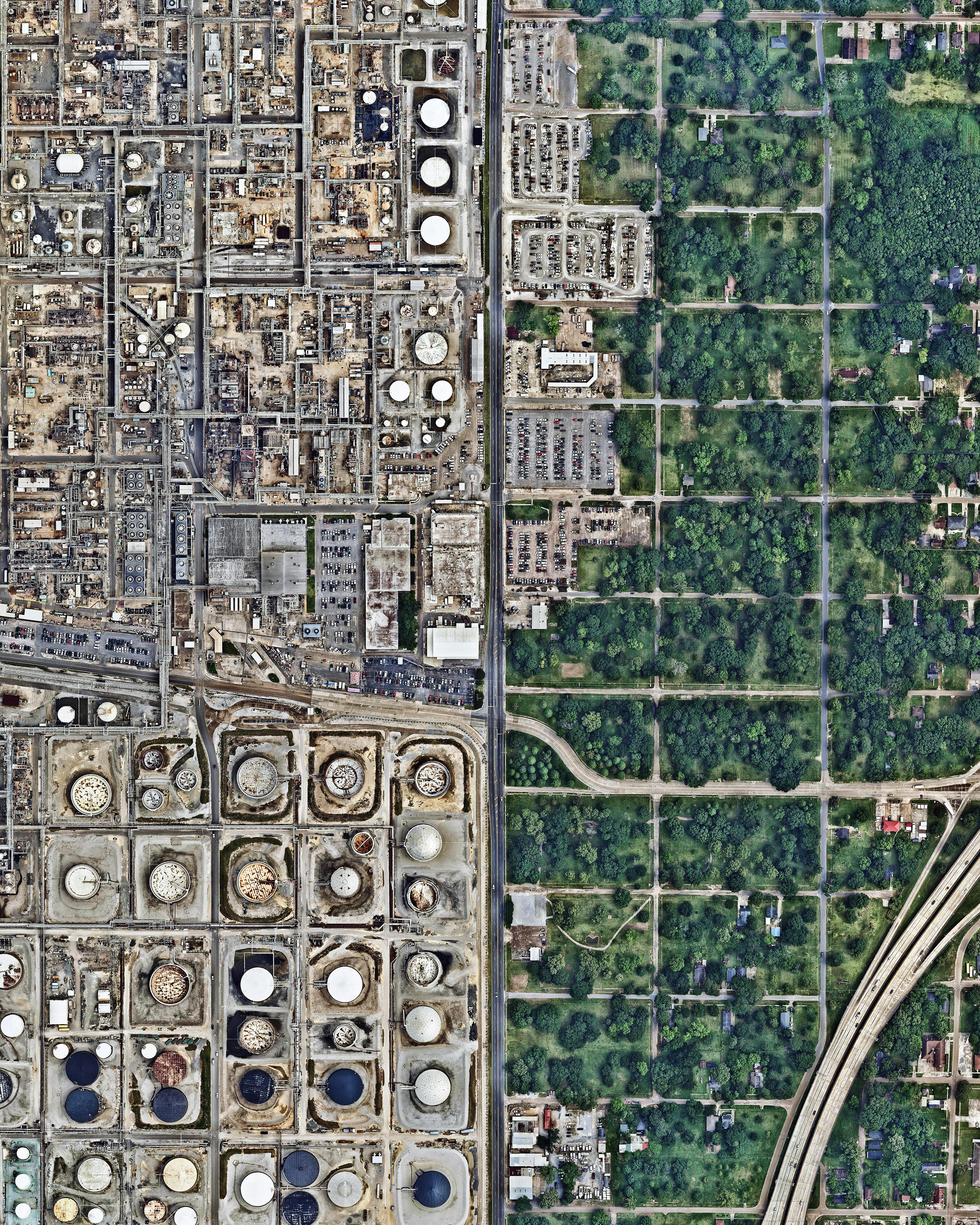
30.485015°,-91.169420° - Nearmap
A residential neighborhood sits adjacent to a large oil refinery in Baton Rouge, Louisiana. Owned by ExxonMobil, this facility is the fourth largest of its kind in the United States and the 12th largest in the world, with an input capacity of more than 502,000 barrels per day. This refinery is one of many industrial plants along the Mississippi River between Baton Rouge and New Orleans, an 85-mile stretch known as "Cancer Alley" because of the abundance of cancer cases that have occurred there.
Albenga
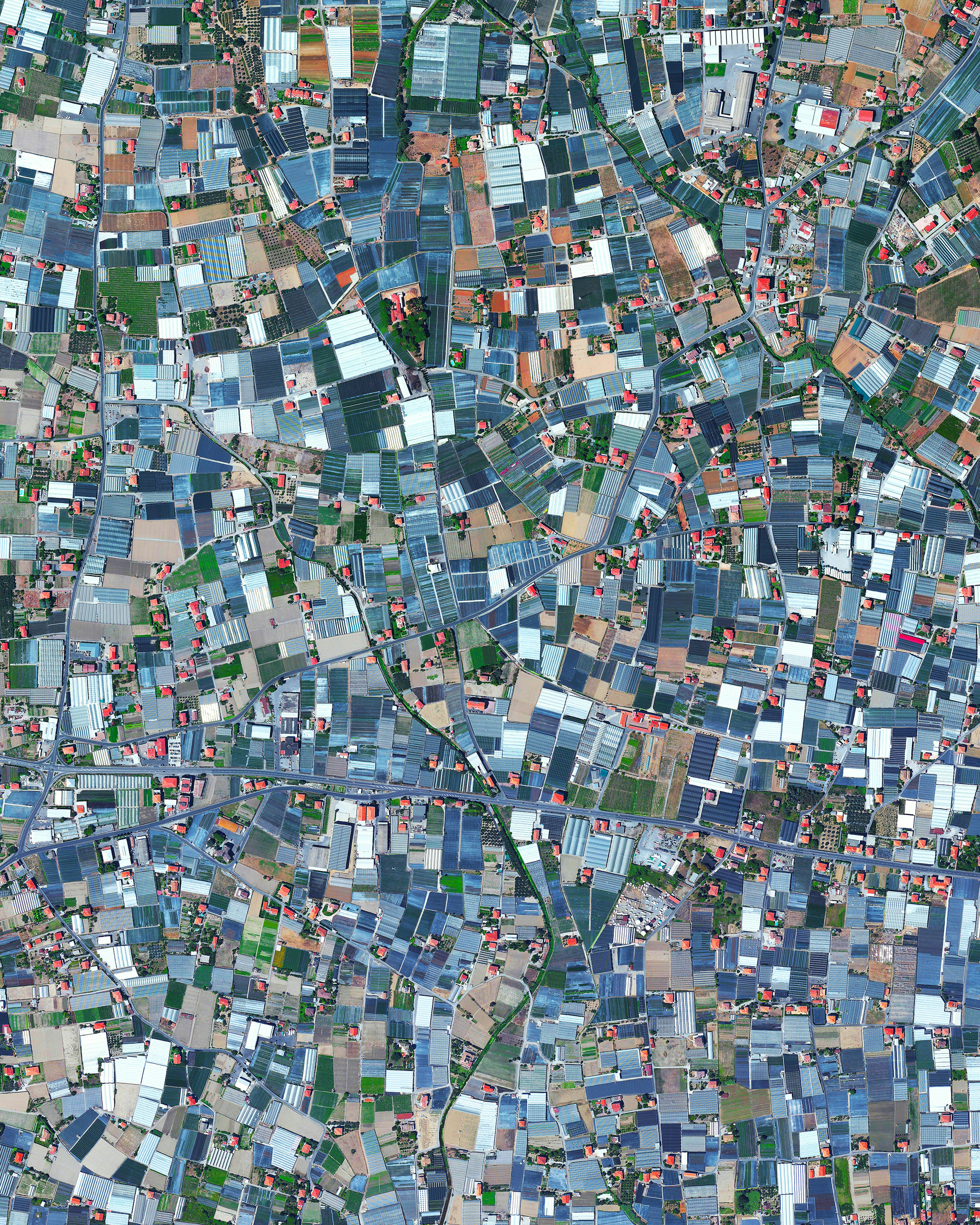
44.049985°,8.216569° - Maxar Technologies
Albenga is a city situated on the Gulf of Genoa in Italy. The economy of Albenga is primarily driven by tourism, local commerce, and agriculture. When viewing the town from above, it’s easy to see the amount of space dedicated to agriculture because of the widespread use of greenhouses or "plasticulture." The use of plastic covering is designed to increase produce yield, increase produce size, and shorten growth time.
Alabama Tornadoes
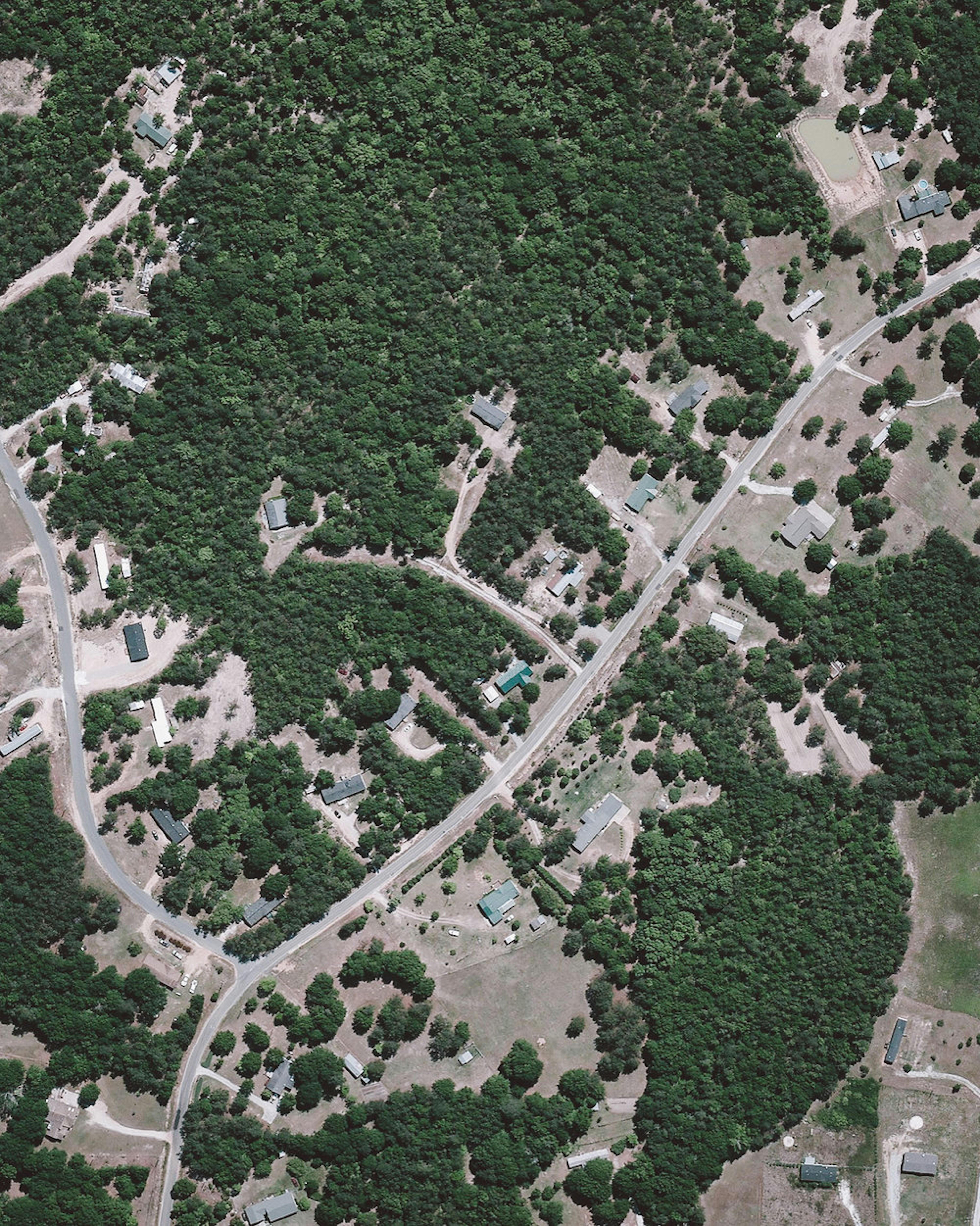
32.477972°,-85.367750° - Maxar Technologies
Have a look at these Overviews to see the destruction caused by four tornadoes that tore through Lee County, Alabama, on Sunday. Latest news reports say 23 people were killed in the disaster and nearly 80 more were injured. Many trees, homes and other structures were destroyed. According to the National Weather Service, these tornadoes were among a group of 34 that struck Alabama, Florida, Georgia and South Carolina over the weekend — with one in Lee County reaching wind speeds of 170 mph (273 km/h).
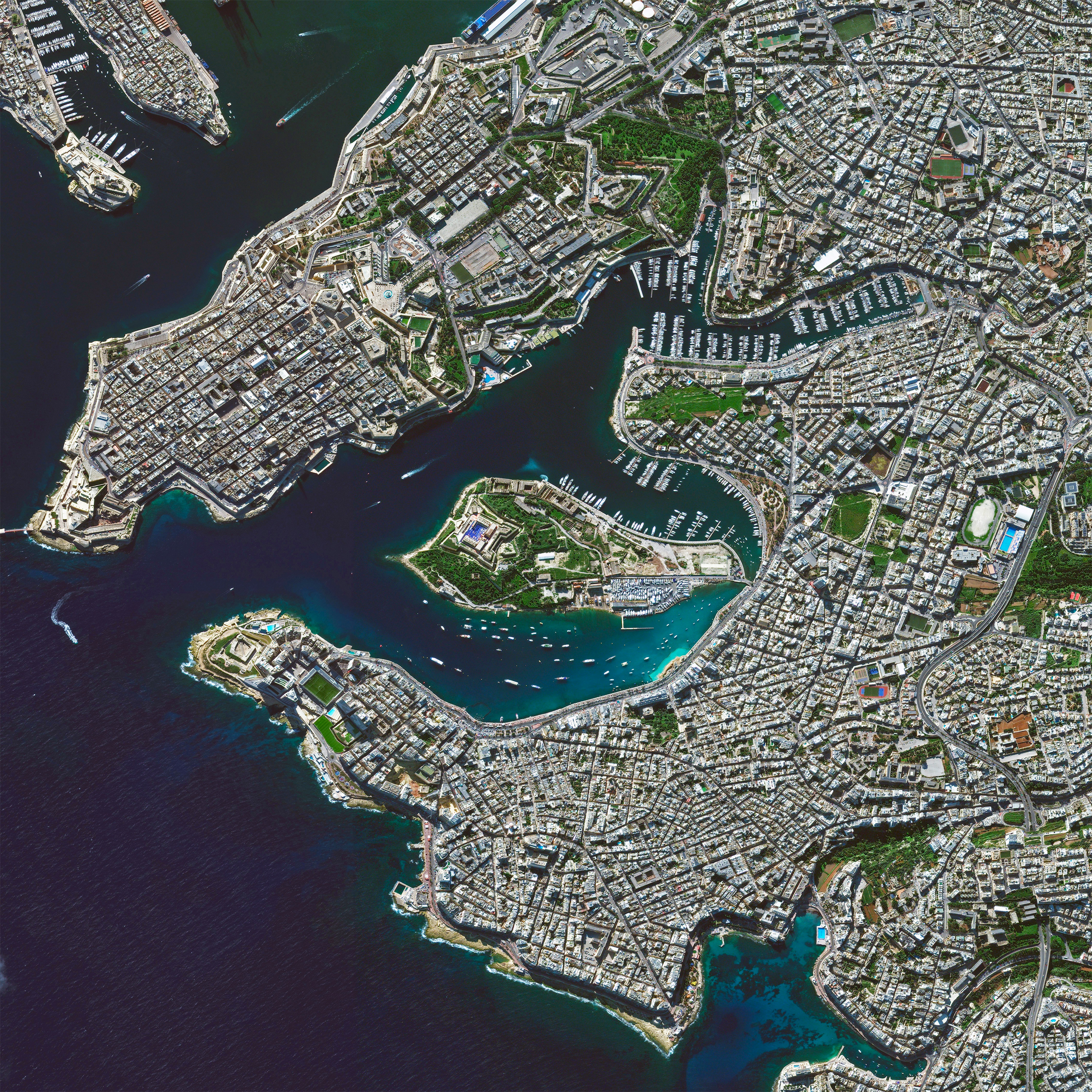
Marsamxett Harbor
35.901667°,14.508056° - Maxar Technologies
Marsamxett Harbor is a natural harbor on the east coast of the island of Malta. The harbor is mostly used for leisure activities and has the greatest number of yacht berthing options available on the island. At its center is Manoel Island, home to an eighteenth century star fort, Fort Manoel.
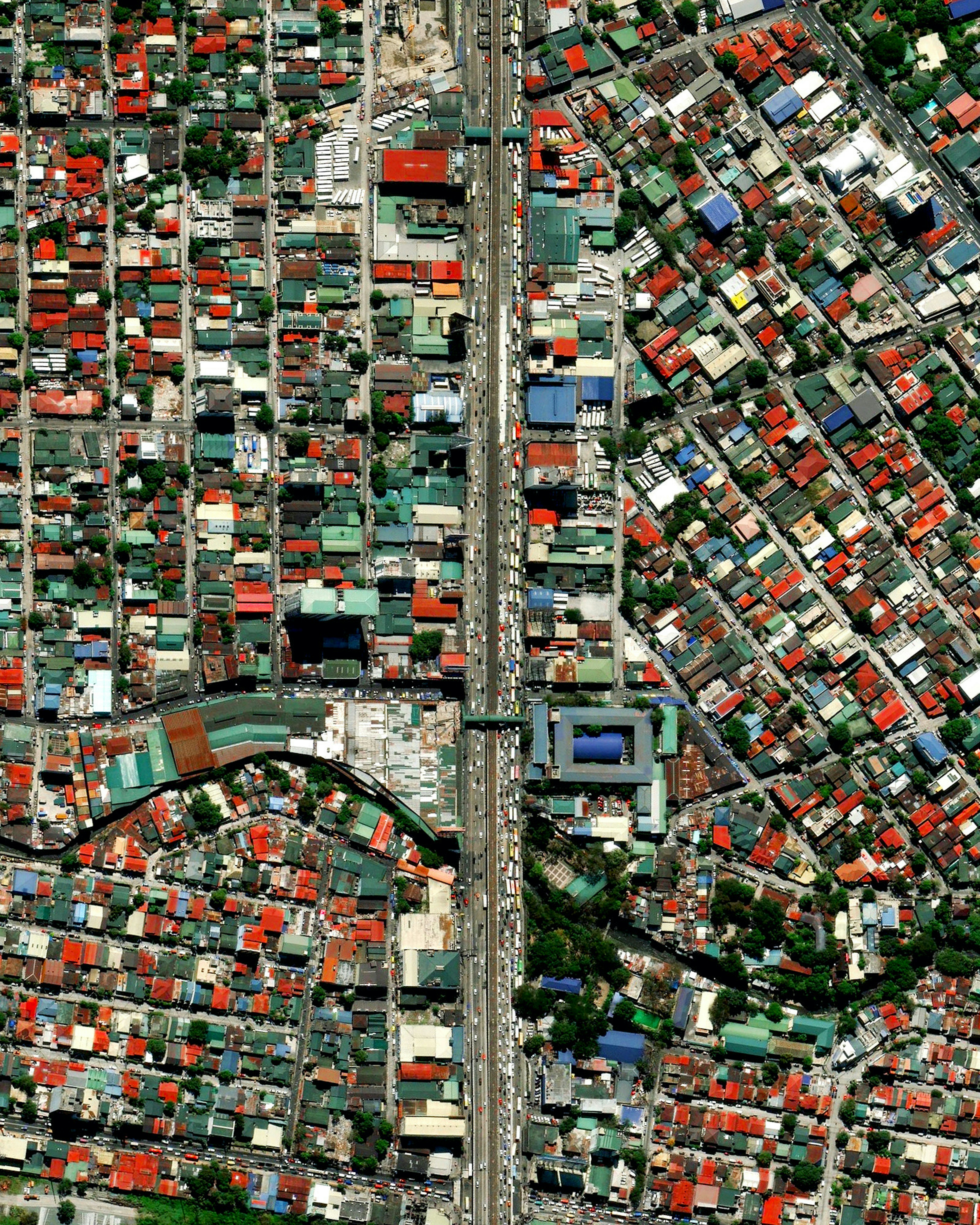
Manila Traffic
14.628830°,121.046250° - Maxar Technologies
Cars and trucks sit in bumper-to-bumper traffic along the EDSA Highway in Manila, Philippines. Manila is recognized as the densest city in the world and also has some of the worst traffic on the planet. In addition to its large population, the city lacks quality infrastructure or additional modes of reliable transport. Furthermore, laws that have been implemented to limit the number of cars on the road or to mitigate the city’s poor urban design are rarely followed. In total, 71% of the air pollution in the Philippines comes from automobiles and the dirty air that they produce has been considered a life-threatening problem to Manila’s 12 million residents. This Overview is from our "Peak Car" feature.Read the full story →
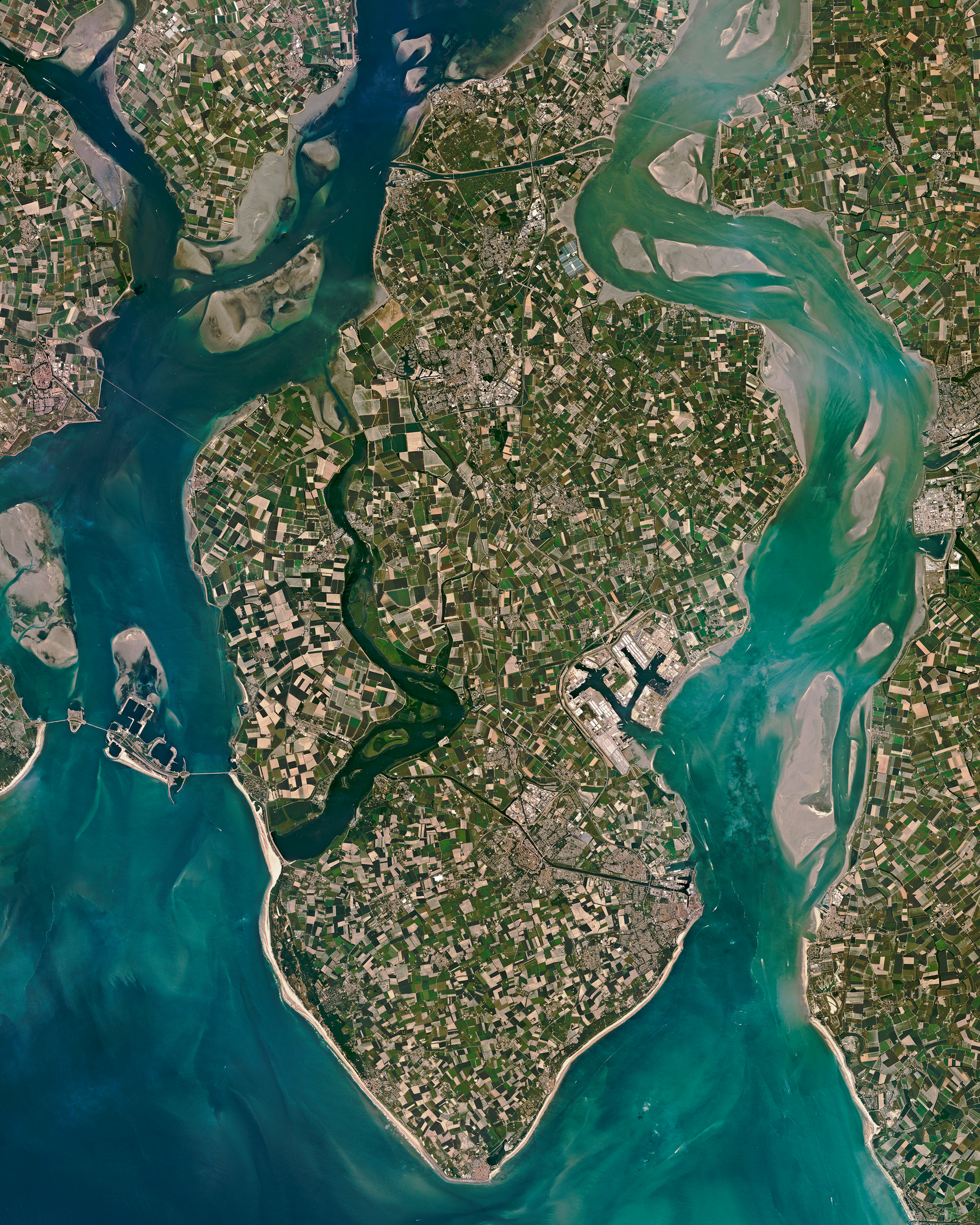
Midden-Zeeland
51.521602°,3.728104° - Planet
Midden-Zeeland is the central peninsula of Zeeland, the westernmost and least populous province of the Netherlands. Located at the mouth of several major rivers — including the Scheldt, Rhine and Meuse — Zeeland has more than 21,000 acres (8,550 hectares) of arable farmland and at least 3,100 farms. Popular crops grown in this region include onions, potatoes, grain legumes, sugar beets, and flax.
Peak Car
32.281981°,-86.328442° - Nearmap
Have we reached “Peak Car”? This Overview shows cars parked next to the Hyundai manufacturing plant in Montgomery, Alabama, USA — a facility that can make 400,000 vehicles per year. We have an estimated 1 billion automobiles on our planet with 80 million new cars sold each year. As countries around the world begin to focus on traffic-reducing policies and curbing global emissions, the average distance traveled per person in automobiles may have hit its peak.Read the full story →
Vinh Citadel
18.670180°,105.669457° - Maxar Technologies
A citadel lies at the center of Vinh, a city in the Nghệ An Province of Vietnam. Initially constructed of clay in 1804, it was quickly reinforced with stone in 1831, taking on its hexagonal, star-shaped form inspired by style of French architect Vauban. Today, the citadel contains the Vinh City Stadium, Xo Viet Nghệ Tinh history museum, and other attractions.
Casco Viejo
8.953356°,-79.535985° - Maxar Technologies
The Cinta Costera, meaning “Coastal Beltway”, is a 1.5-mile (2.5 km) marine viaduct in Panama City, Panama. Consisting of a roadway and pedestrian bridge, the viaduct surrounds Casco Viejo, the city’s historic district. The highway has caused significant protest by the local population as the Brazilian firm who built it (Odebrecht) has admitted paying nearly $800 million in bribes to politicians across 12 countries for its projects.
Davis-Monthan Air Force Base Aircraft Boneyard
32.151087°,-110.826079° - Maxar Technologies
The largest aircraft storage and preservation facility in the world is located at Davis-Monthan Air Force Base in Tucson, Arizona, USA. The boneyard—run by the 309th Airspace Maintenance and Regeneration Group—contains more than 4,400 retired American military and government aircraft.
Turkish Lakes Region
37.783333°,31.550000° - NASA
This Overview, taken by an astronaut on the International Space Station, shows Lake Egirdir (top) and Lake Beysehir (bottom) — two of Turkey’s largest freshwater lakes. Located in the Turkish Lakes Region on the Anatolia Plateau, these lakes are among many in the area fed by runoff water from the Sultan Mountains. Lake Beysehir and Lake Egirdir are home to at least 181 bird species and are designated conservation areas.
Malaspina Glacier
59.919167°,-140.532778° - Maxar Technologies
Glacial ice and debris form incredible patterns around the edges of the Malaspina Glacier in southeastern Alaska. Located at the head of the Alaska Panhandle, the glacier is roughly 40 miles (65 km) wide and 28 miles (40 km) long, covering an area of about 1,500 square miles (3,900 square km). Decades of aerial photographs and radar data have shown that the Malaspina Glacier lost about 66 feet (20 m) of thickness between 1980 and 2000 — enough shrinkage to contribute 0.5% of the rise in global sea level.
