Explore
 About
About Search


Overview uses satellite and aerial imagery to demonstrate how human activity and natural forces shape our Earth. This perspective provides a powerful look at the planet where we live and the civilization we are creating. Through our daily posts, products, licensing, and collaborations we aim to inspire the Overview Effect.
 Daily Overview
Our regular dose of Earth from above

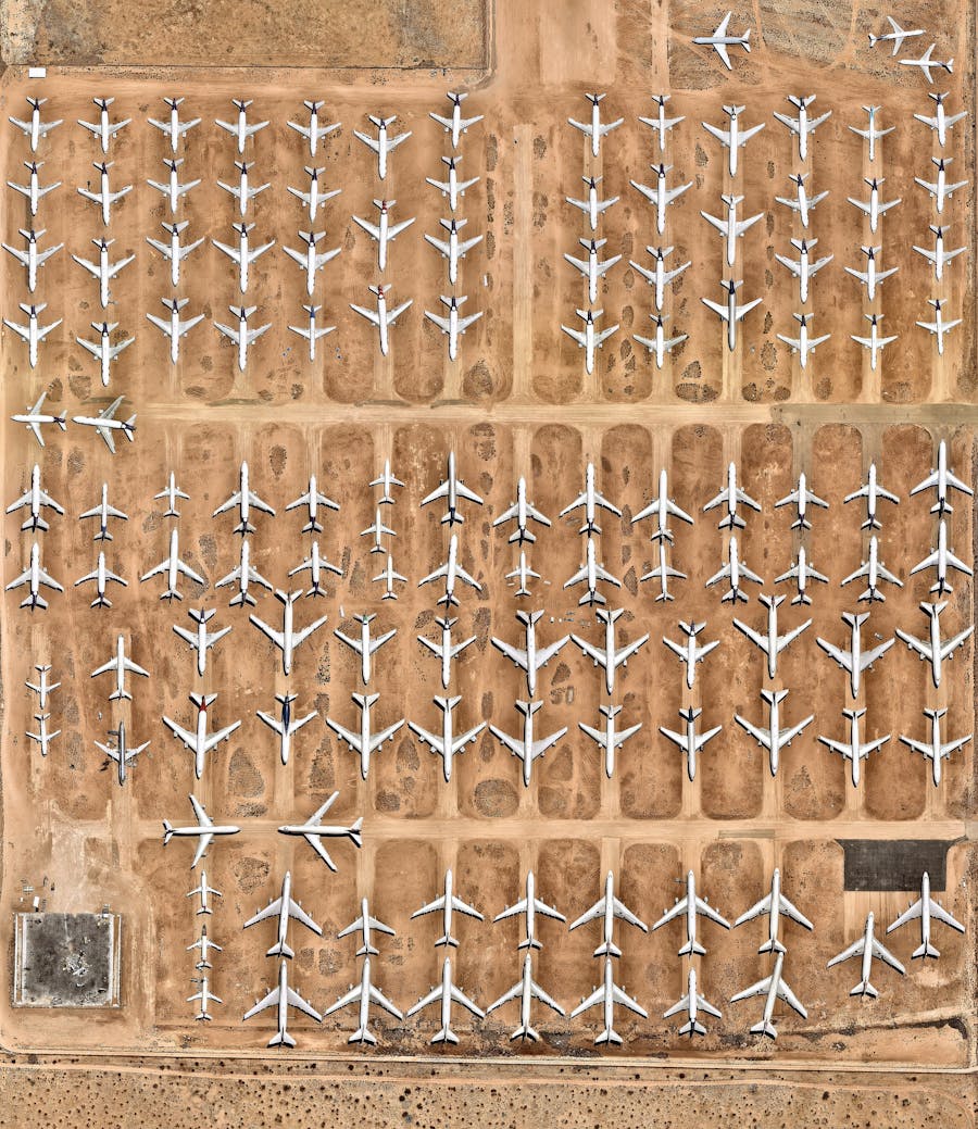
Pima Air & Space Museum
32.139959°, -110.864970°
Spread across 80 acres of Arizona desert, the Pima Air & Space Museum holds more than 400 retired aircraft, including a Boeing VC-137B that carried Presidents Eisenhower and Kennedy as Air Force One before its retirement in 1998. Swipe to see a detailed Overview of the plane. Air Force One rarely changes, which makes recent news notable: a $400M Boeing 747 gifted by Qatar entered service as the newest one this month, only to be pulled from service weeks later for upgrades. It marks just the third generational change to the fleet since the jet era began, the latest turn in the story of the select aircraft that carry the sitting US president.
View on Instagram →
1,250+ Overviews
Discover places and patterns from around the world
 Shop
Shop
Feel the Overview Effect in your home with books and prints