Explore
 Shop
Shop About
About Search
Overview Index
Davis-Monthan Air Force Base
32.171449°, -110.848683° - Tucson, Arizona, USAThe largest aircraft storage and preservation facility in the world is located at Davis–Monthan Air Force Base in Tucson, Arizona. The facility - run by the 309th Aerospace Maintenance and Regeneration Group - contains more than 4,400 retired American military and government aircraft.
Maxar Technologies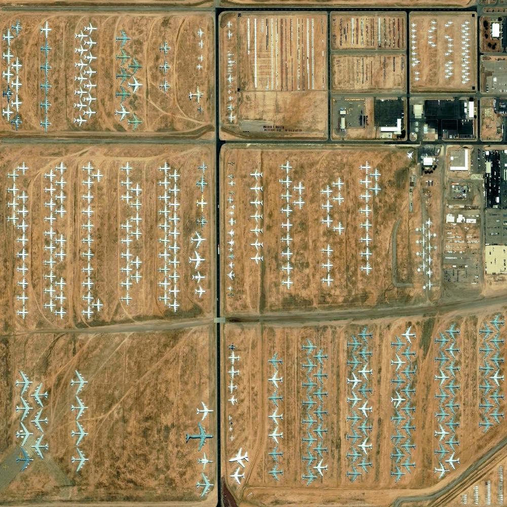
Davis-Monthan Air Force Base Aircraft Boneyard
32.151087°, -110.826079° - Tucson, Arizona, USAThe largest aircraft storage and preservation facility in the world is located at Davis-Monthan Air Force Base in Tucson, Arizona, USA. The boneyard—run by the 309th Airspace Maintenance and Regeneration Group—contains more than 4,400 retired American military and government aircraft.
Maxar Technologies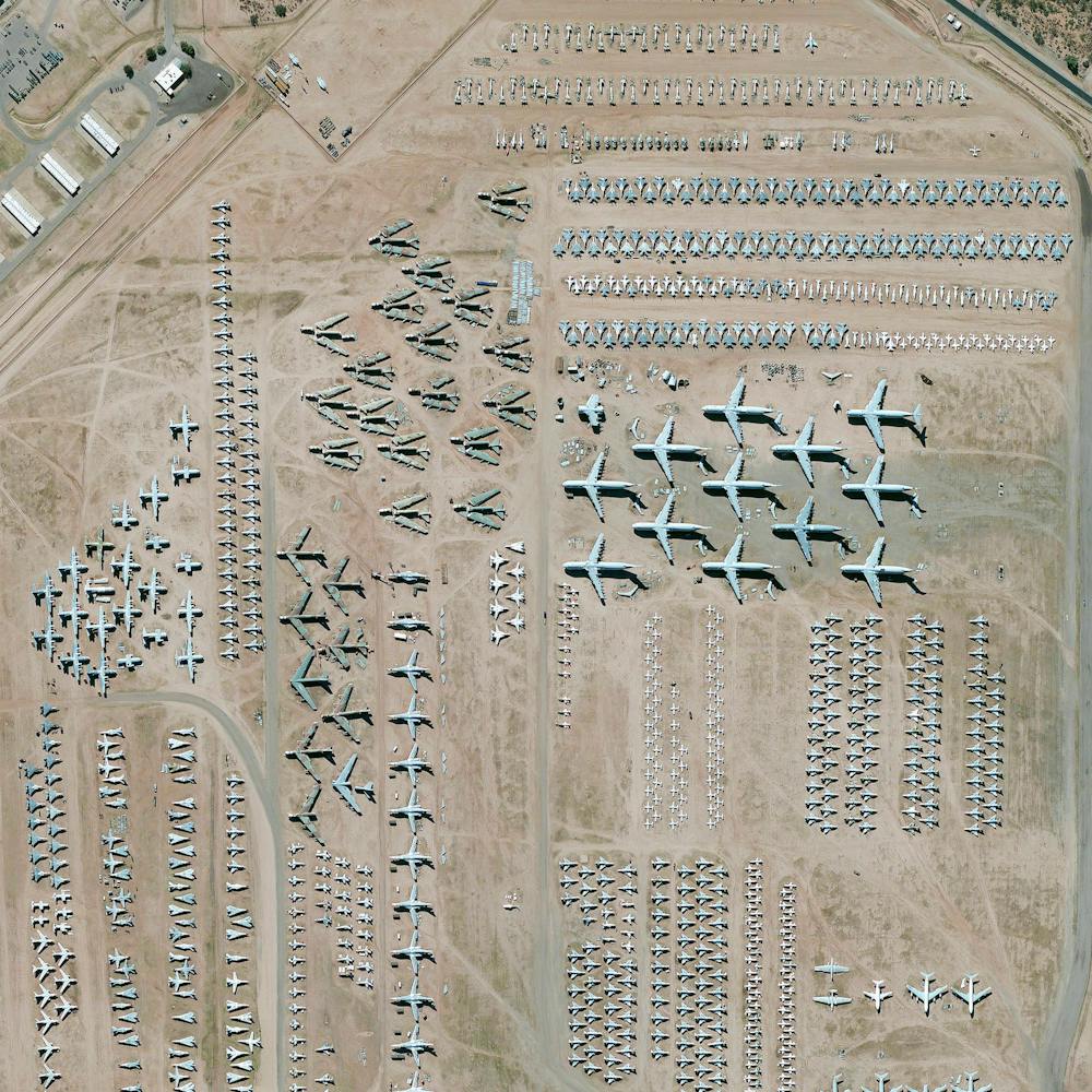
Deforestation
-17.387750°, -60.562131° - Santa Cruz, BoliviaDeforestation of the rainforest is visible in Santa Cruz, Bolivia. Deforestation in the country has primarily been driven by the expansion of mechanized agriculture and cattle ranching. This Overview highlights the country’s struggle to expand food production in order to meet the needs of its growing population, and the sacrificial destruction of its forests that has taken place to do so. Deforestation rates have been stable though relatively high, at about 200,000 hectares a year.
Maxar Technologies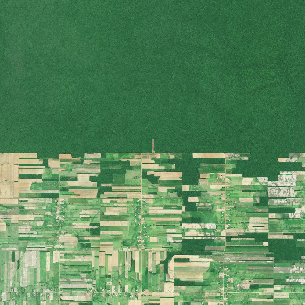
Del Ray Beach
26.476432°, -80.155327° - Del Ray Beach, Florida, USAThis Overview captures residential communities in Delray Beach, Florida, USA. According to the 2010 census, 20.4% of the town’s 34,156 households are vacant.
Maxar Technologies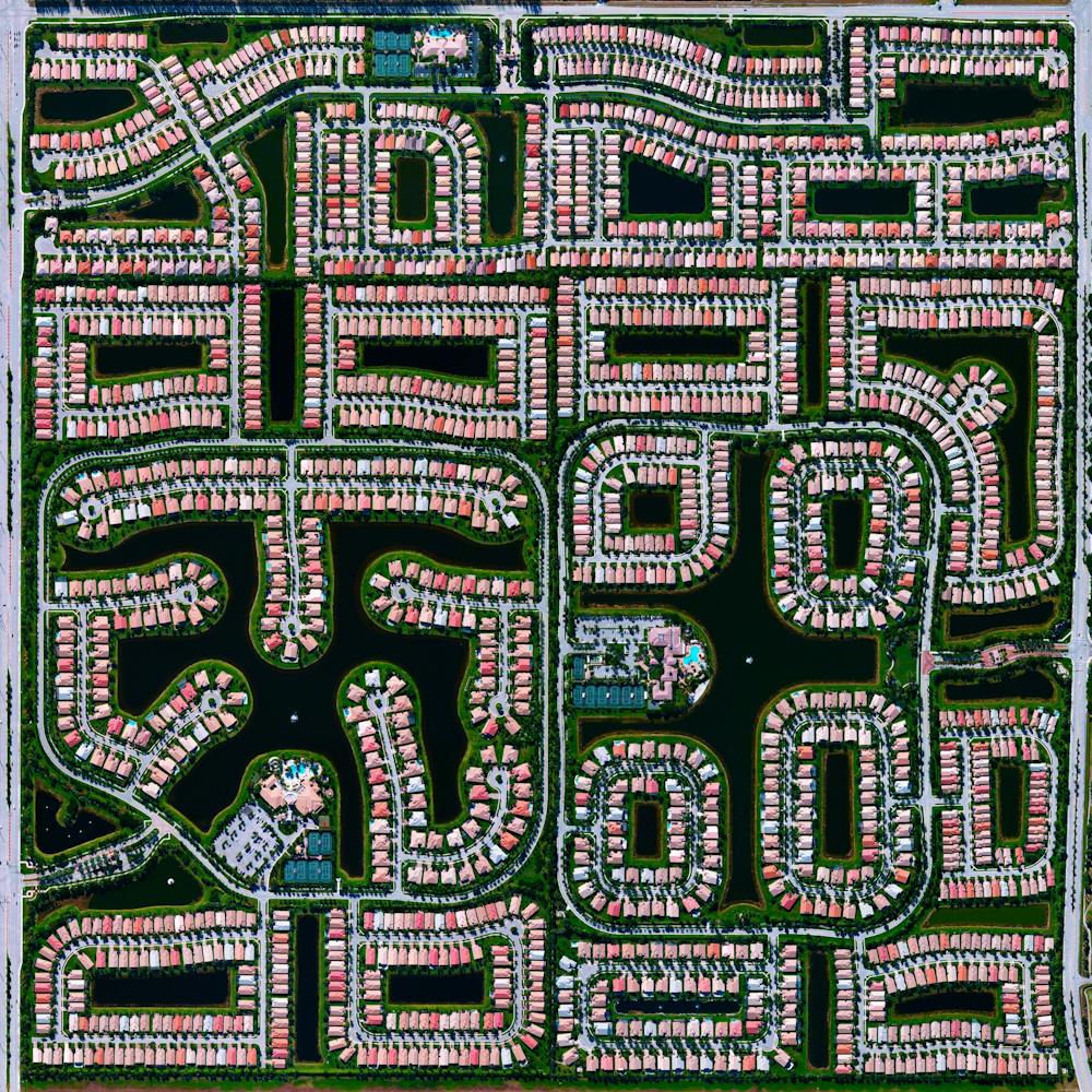
Del Ray Beach
26.475548°, -80.156470° - Del Ray Beach, Florida, USAA residential community is seen here in Delray Beach, Florida, USA. Because many cities in the state of Florida contain master-planned communities, often built on top of waterways in the latter half of the twentieth century, there are a number of intricate designs such as this one that are visible from the Overview perspective.
Maxar Technologies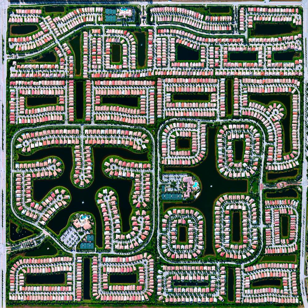
Delhi
28.614656°, 77.057758° - Delhi, IndiaDelhi, India contains approximately 16 million residents. The neighborhoods of Santosh Park and Uttam Nagar, both pictured here, are home to some of the city’s poorest people and contain its most built-up and densely populated land. Numerous studies have shown a correlation between the wealth of a residential area and its total number of trees and the amount of green space. This Overview is a particularly striking example of that trend.
Maxar Technologies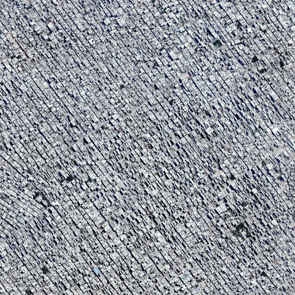
Dendritic drainage systems
30.327274°, 48.829255° - Shadegan Lagoon, IranA dendritic drainage pattern is seen around the Shadegan Lagoon by Musa Bay in Iran. Dendritic literally means branched, as in resembling the pattern of a tree. This shape develops when streams move across relatively flat and uniform rock or over a surface that resists erosion.
Maxar Technologies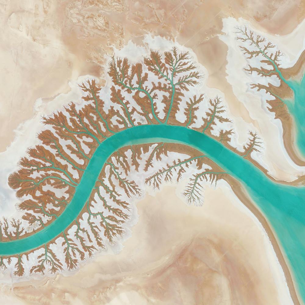
Denver International Airport
39.861667°, -104.673056° - Denver, Colorado, USADenver International Airport in Colorado covers more than 33,000 acres (52 square miles), making it is the largest airport in the United States by total land area. The facility is the 18th-busiest airport in the world and the 6th busiest in the United States by passenger traffic with more than 54 million passengers.
Maxar Technologies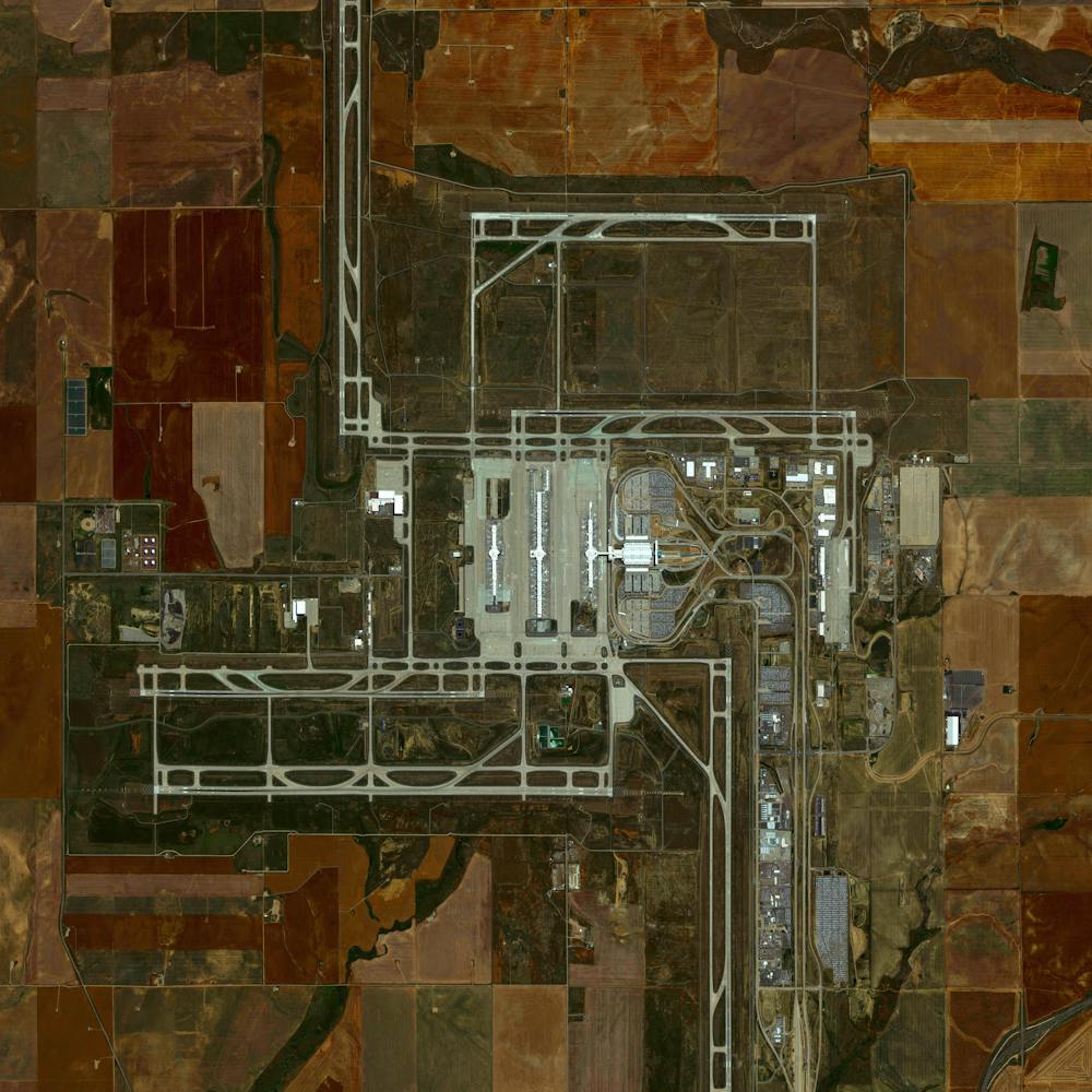
Desert Breath
27.380339°, 33.632154° - Hurghada, EgyptDesert Breath” - located in the Egyptian desert near Hurghada on the Red Sea - is a double-spiral art piece. Because the 89 protruding cones that make up one spiral are constructed from the sand that was dug to create the 89 depressed cones of the other spiral, in due time, with erosion, the area of approximately one million square feet will revert back to its original state.
Maxar Technologies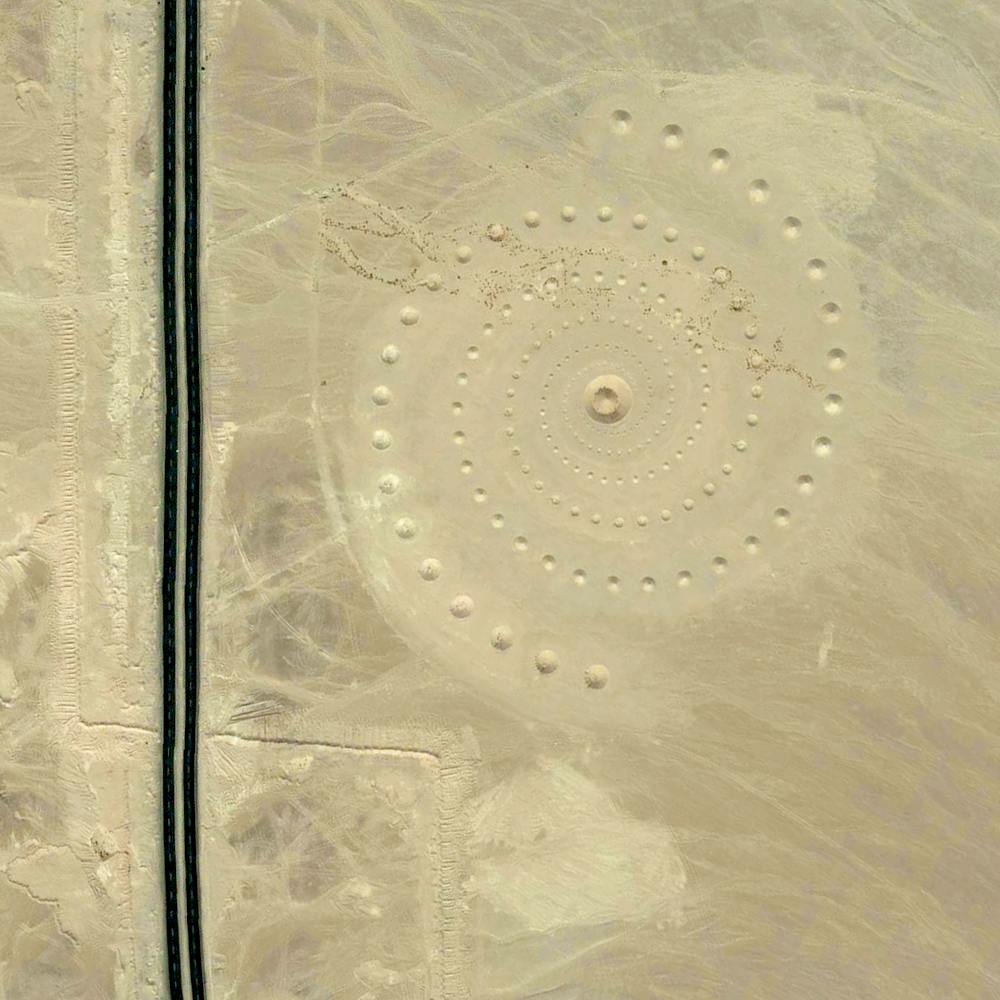
Desert Shores
36.212194°, -115.268917° - Las Vegas, NevadaDesert Shores is a 682-acre master planned community in northwest Las Vegas, Nevada. Constructed in 1988, it has more than 3,300 housing units ranging from condominiums to large, custom-built homes. At the center of Desert Shores are four man-made lakes, the largest of which — Lake Jacqueline — is flanked by the other three.
Nearmap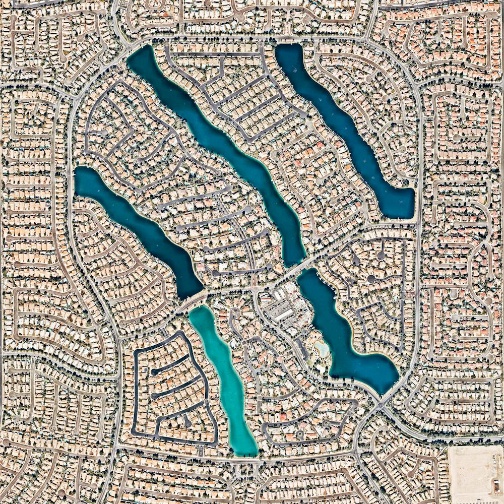
Desert Shores Community
36.210784°, -115.267040° - Las Vegas, Nevada, USAThe Desert Shores Community in Las Vegas, Nevada contains 3,351 units and four man-made lakes.
Maxar Technologies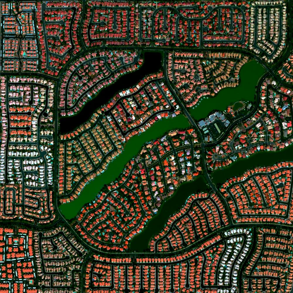
Detroit
42.331389°, -83.045833° - Detroit, Michigan, USADetroit is the largest and most populous city in the state of Michigan, with 4.3 million residents in its metropolitan area. It is best known as the center of the U.S. automobile industry, housing the headquarters of General Motors, Ford and Chrysler. Detroit is also a major port on the Detroit River, which is shown flowing through the city in this Overview — does anyone know why the river has two shades?
Nearmap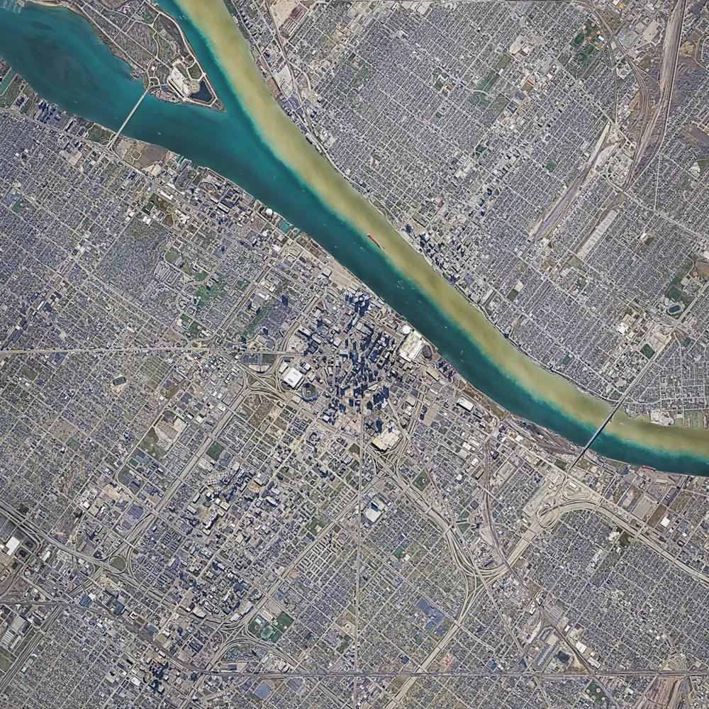
Detroit Metropolitan Airport (DTW)
42.212500°, -83.353333° - Romulus, MichiganDetroit Metropolitan Airport covers more than 11 square miles in Romulus, Michigan. Concourse A at McNamara Terminal, seen here at left, is the world's second-longest airport terminal building, extending a length of one mile (Kansai Airport in Japan has a 1.7 mile long terminal). Detroit Metro is the 16th busiest facility in the United States, serving more than 32 million passengers each year.
Maxar Technologies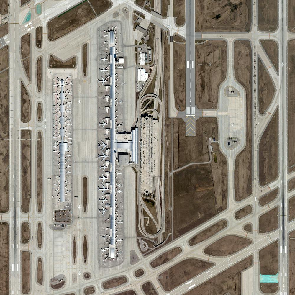
Diavik Diamond Mine
64.496111°, -110.273333° - Lac de Gras, CanadaThe Diavik Diamond Mine is located on the Lac de Gras lake in the Northwest Territories of Canada, 120 miles (193km) south of the Arctic Circle. The mine produces approximately 7.5 million carats of diamonds each year. In standard weight, that’s an annual output of 1500 kilograms or 3,300 pounds. In this Overview, the most distinguishable areas of the facility are its two primary open pits, waste ponds, processing facilities, and an airstrip capable of landing aircraft as large as 737s and C-130s.
Maxar Technologies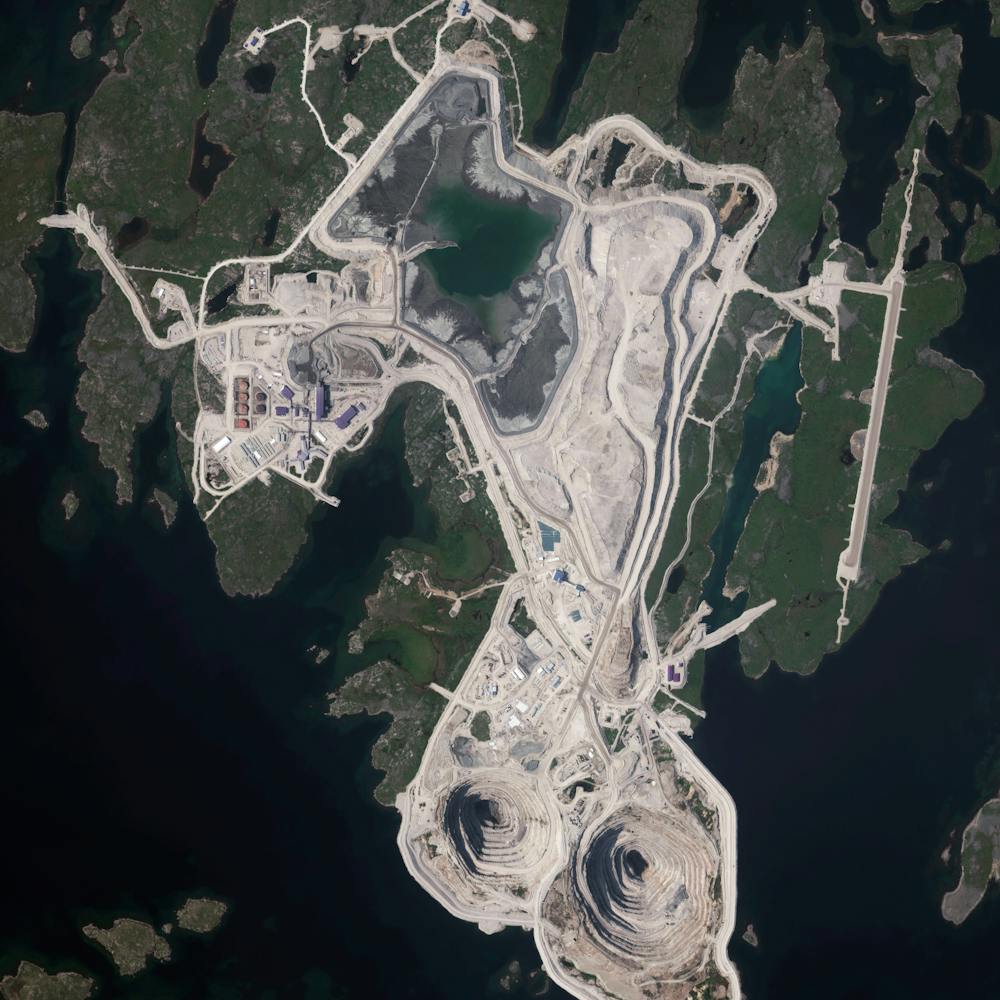
Discovery Bay
37.908611°, -121.600278° - Discovery Bay, California, USADiscovery Bay is a waterfront community built on a network of man-made dikes in Contra Costa County, California, USA. Development of the area began in 1964 is now home to roughly 13,352 residents. As seen in this Overview, many residents have private docks with boat access to the Sacramento–San Joaquin River Delta.
Maxar Technologies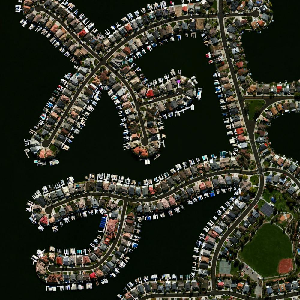
Dnieper River Snowdrifts
51.193056°, 30.523833° - RussiaSwirling snow drifts accent the terrain surrounding the Dnieper River, which flows for roughly 1,400 miles (2,200 km) from Russia to the Black Sea. The Dnieper is the longest river in the Ukraine and Belarus, and the fourth-longest river in Europe. This amazing image was captured by European Space Agency astronaut Thomas Pesquet while aboard the International Space Station in February 2017.
NASA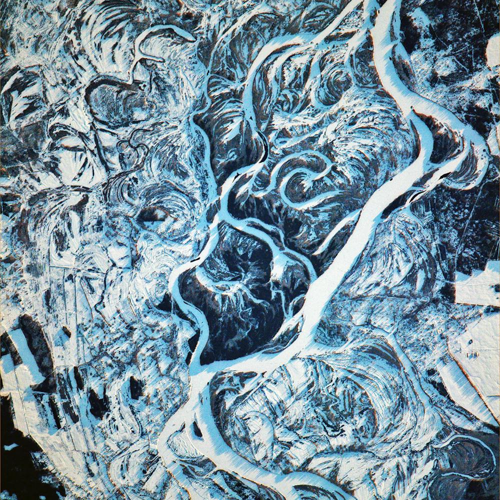
Donghai Bridge Wind Farm
30.770000°, 121.994000° - Shanghai, ChinaTurbulence fields form behind the turbines of the Donghai Bridge Wind Farm in Shanghai, China. These streaks occur when wind hits the turbines' towers or when certain meteorological conditions cause the turbines to create condensation (i.e. clouds) of very humid air.
Maxar Technologies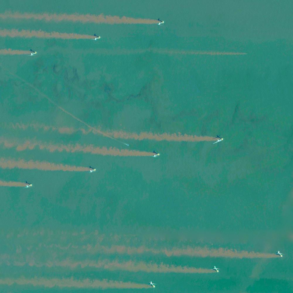
Dorsoduro Sestiere - Venice
45.430361°, 12.333444° - Venice, ItalyThis Overview shows part of the Dorsoduro sestiere in Venice, Italy. A sestiere — which comes from the Italian “sesto,” meaning sixth — is a subdivision of an Italian town or city divided into six districts. Dorsoduro is Venice’s university district and is filled with bars, restaurants, indie shops, vintage fashion boutiques and art galleries, such as the Peggy Guggenheim Collection.
Maxar Technologies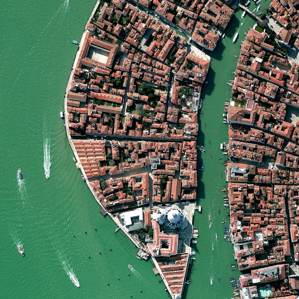
Douro Valley, Portugal
41.167121°, -7.773069° - Port VineyardsTerraced hillsides are seen in the Douro Valley of northern Portugal. The steep slopes are covered with of grape vines that rise from the Douro River below. The region is recognized as the home of port wine - a sweet, red wine that is often served with dessert.
Maxar Technologies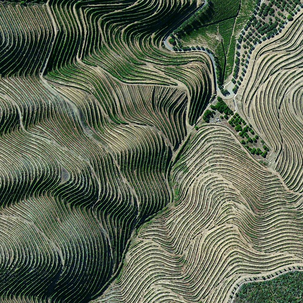
Dubai Whirlpool Interchange
25.055816°, 55.248835° - 25.055363°, 55.248780°A whirlpool interchange connects three major roads by the Miracle Garden in Dubai, United Arab Emirates. When construction of this junction began in 2006, Dubai contained 30,000 industrial cranes — 25% of all cranes on the planet.
Maxar Technologies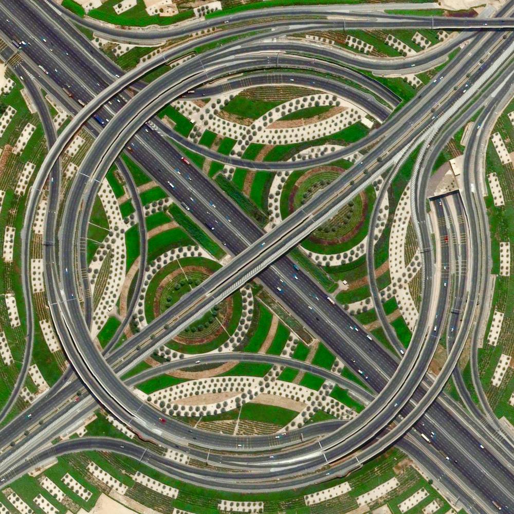
DuSable Harbor
41.885597°, -87.611850° - Chicago, Illinois, USASailboats are docked at DuSable Harbor in Chicago, Illinois, USA. The facility is located on Lake Michigan in the heart of the city’s downtown area and contains 420 slips for boats between 30 to 60 feet in length.
Nearmap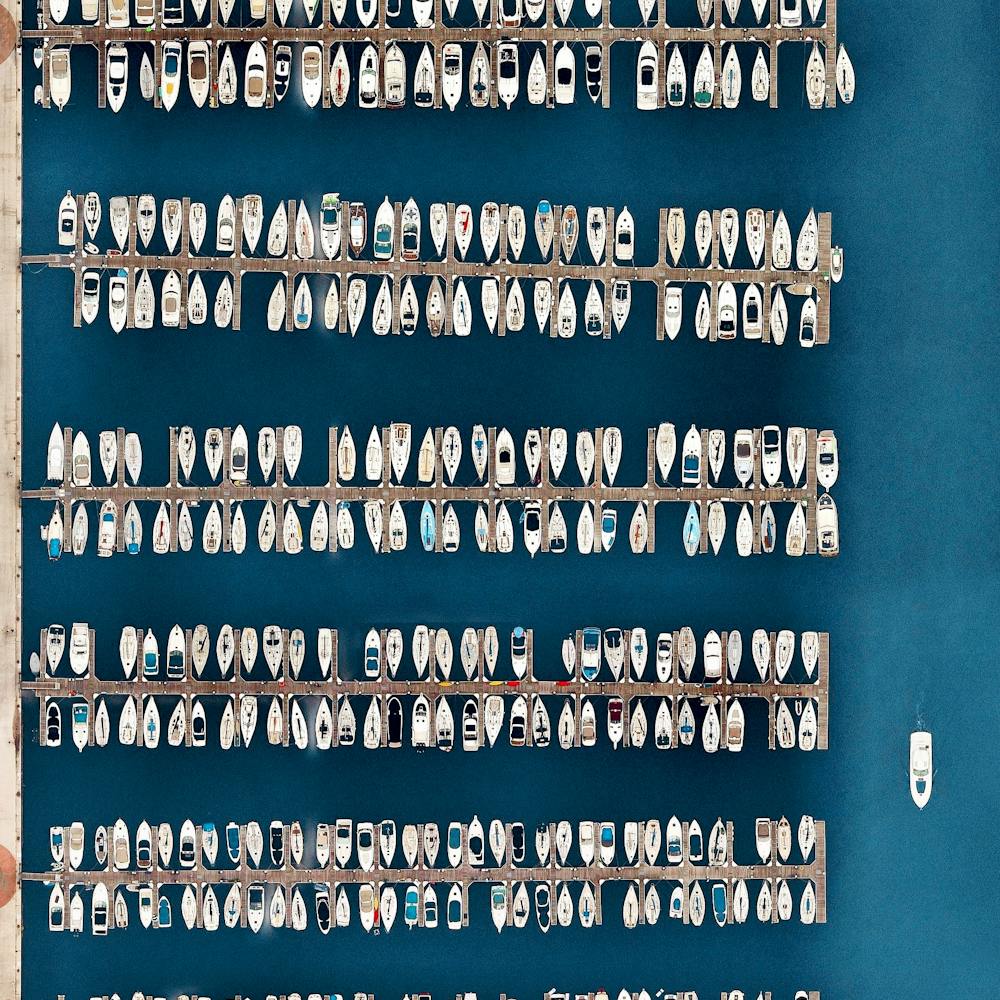
Dutch Tulips
52.276361°, 4.557083° - Lisse, NetherlandsCheck out this Overview, which captures the blooming tulip fields in Lisse, Netherlands. These vibrant flowers are at their peak in April of each year. This incredible image, along with several others, is on display right now at our exhibition at theprintspace in Shoreditch, London. We're also selling prints of it, and – thanks to theprintspace – we are able to offer FREE shipping throughout Europe during the exhibition, which ends November 26th! Visit to take advantage of this exclusive offer.
Maxar Technologies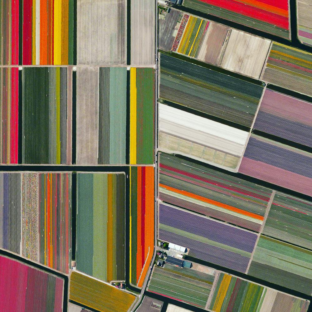
Eagles Super Bowl Parade
39.965570°, -75.180966° - Philadelphia, Pennsylvania, USAMillions of fans flooded the streets of Philadelphia, Pennsylvania, yesterday to attend the Super Bowl parade for the Eagles’ championship victory. Official estimates suggest more than two million fans were in attendance, including a massive collection of people seen here in front of the Philadelphia Museum of Art.
Maxar Technologies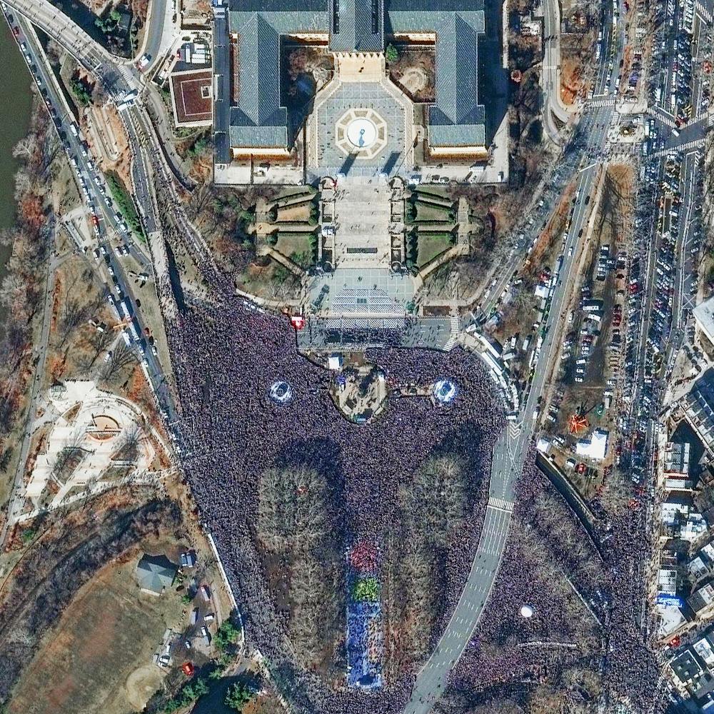
Eastern State Penitentiary
39.968390°, -75.172652° - Philadelphia, PennsylvaniaThe haunted house at the Eastern State Penitentiary in Philadelphia, Pennsylvania is consistently ranked among the scariest Halloween attractions in the United States. The prison operated from 1829 until 1971 and housed notorious criminals like the gangster Al Capone. The facility was also the first of its kind to be constructed in a “wagon-wheel” layout with seven wings of cellblocks radiating from a central hub. Hope everyone has a safe and scary Halloween!
Nearmap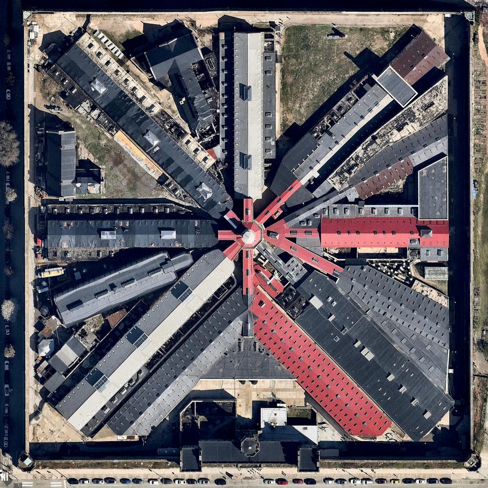
Egyptian Agricultural Development
30.122944°, 31.133676° - Awsim, EgyptAgricultural development encircles the towns of Ausim and Shinbari in the Cairo Governorate of Egypt. The towns are located within the fertile area surrounding the Nile River, the country’s main source of water because it has no effective rainfall. The roughly 55 billion cubic meters of water that are used from the river each year represents more than three quarters of the country’s resources for usable water.
Maxar Technologies
Eixample District - Barcelona
41.392184°, 2.164928° - Barcelona, SpainThe Eixample district in Barcelona, Spain, is characterized by its strict grid pattern and apartments with communal courtyards. This thoughtful and visionary design was the work of Ildefons Cerdà. His plan features broad streets that widen at octagonal intersections to create greater visibility with increased sunlight, better ventilation, and more space for short-term parking.
Maxar Technologies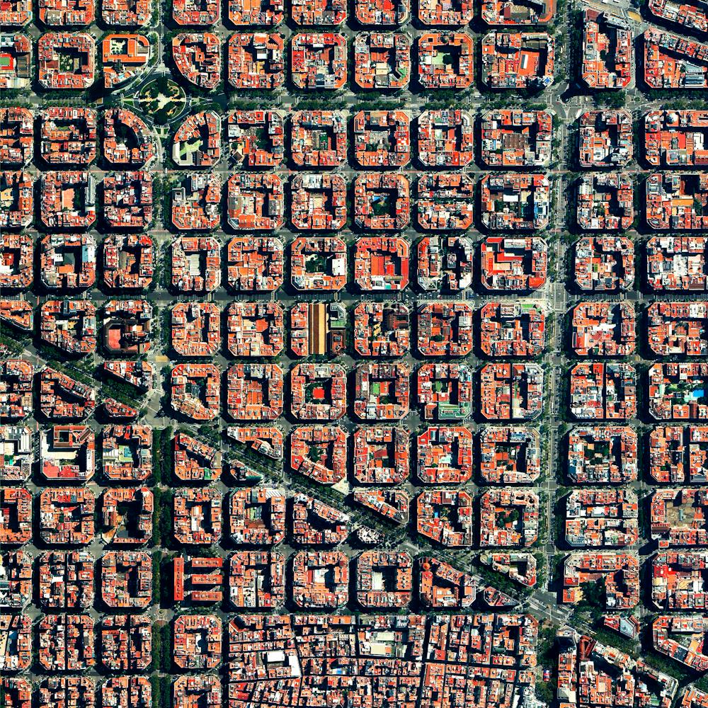
Elliott Bay Marina
47.628735°, -122.387261° - Seattle, Washington, USABoats and buoys are moored at Elliott Bay Marina, a private marina in Seattle, Washington. Located in the city’s Magnolia neighborhood, it has 1,250 slips ranging in size from 32 to 63 feet (9.75 to 19.2 meters) and 10 miles (16 km) of docks.
Nearmap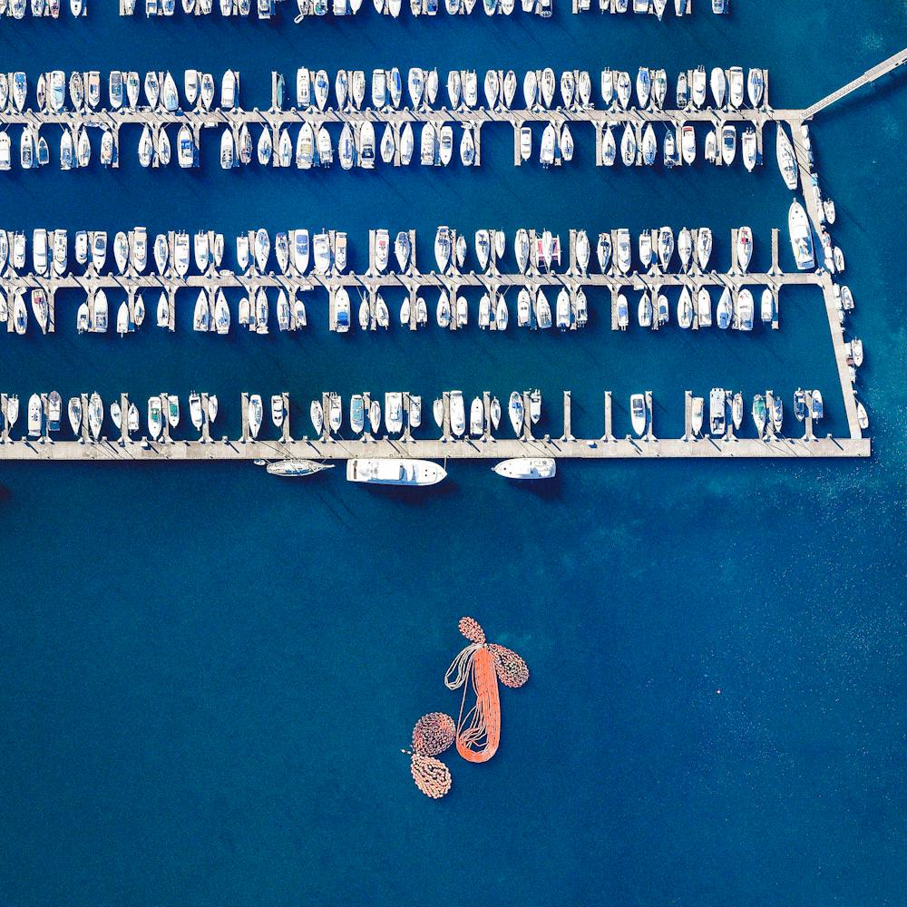
Erg Iguidi
27.452222°, -4.451528° - AlgeriaThe Erg Iguidi is a large erg in the Tindouf Province of southwestern Algeria. An erg — also called a dune sea — is a broad, flat area of desert covered with windswept sand and little or no vegetation. Part of the greater Sahara Desert, the Erg Iguidi’s narrow, linear dunes stretch for roughly 250 miles (400 km) into northern Mali and Mauritania.
Maxar Technologies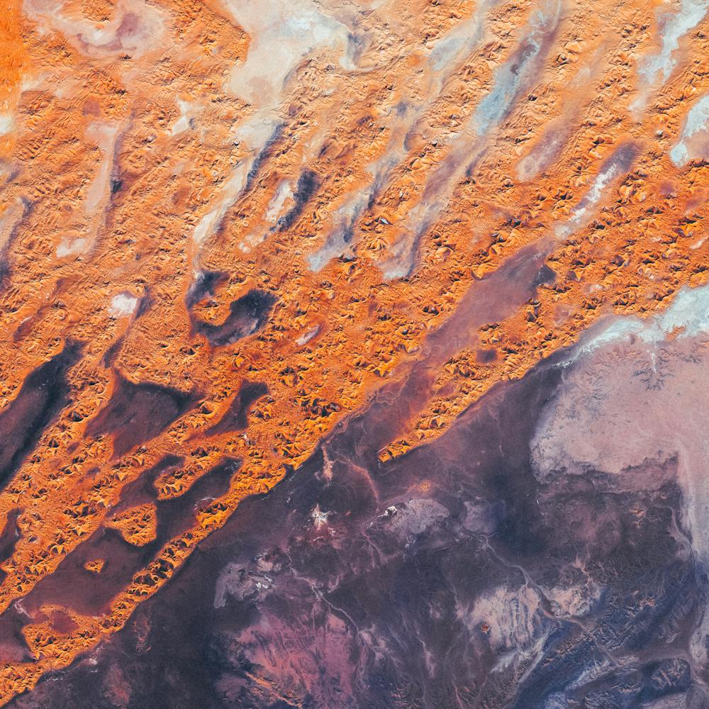
Espel
52.724167°, 5.644167° - Espel, NetherlandsThe village of Espel - located in the province of Flevoland, Netherlands - is home to 774 inhabitants. The farms in the region specialize in the growth of flower bulbs.
Maxar Technologies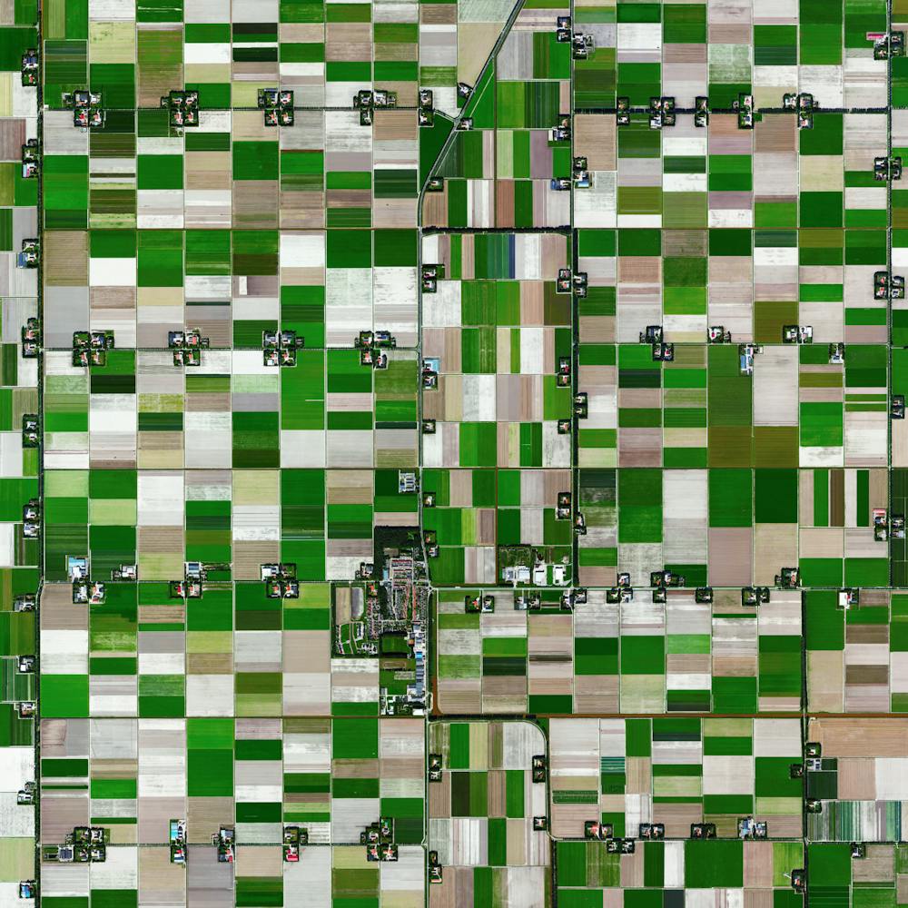
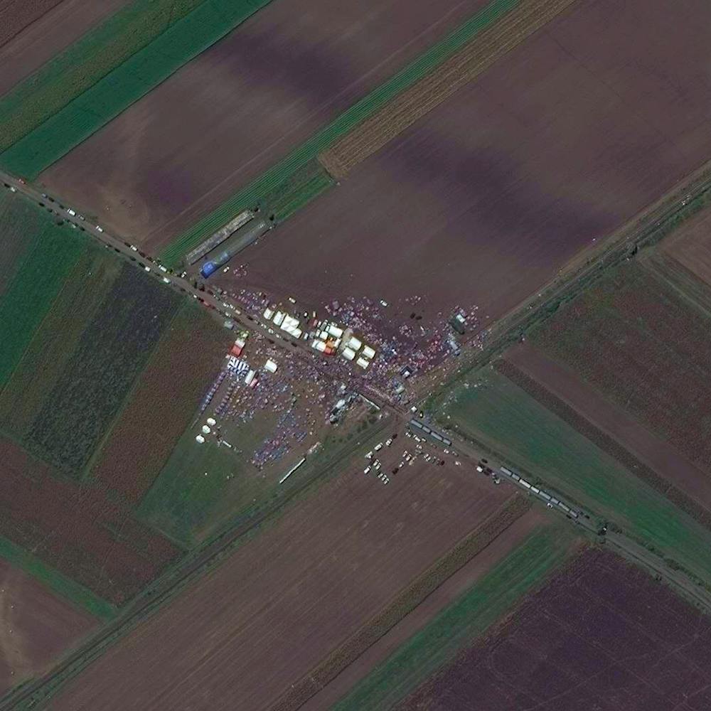
European migrant crisis
46.181700°, 20.010900° - Röszke, HungaryAs many of you know, Europe is currently being overwhelmed by a flood of migrants and refugees from the Middle East, many of whom are fleeing the devastation in Syria. Last week, the country of Hungary sealed its borders, forcing the travelers to go elsewhere. On September 13th, two days before the borders were closed, huge numbers of refugees came together in the Hungarian town of Röszke near the border with Serbia. This Overview shows that gathering as hundreds of migrants set up temporary shelter with tents and buses.
Maxar Technologies