Overview Index
Shadegan Lagoon
30.456750°, 48.929444° - Musa Bay, IranDendritic drainage systems are seen around the Shadegan Lagoon by Musa Bay in Iran. The word ‘dendritic’ refers to the pools’ resemblance to the branches of a tree, and this pattern develops when streams move across relatively flat and uniform rocks, or over a surface that resists erosion.
Maxar Technologies
Shanghai - Low Angle
31.234722°, 121.506389° - Shanghai, ChinaCheck out this incredible perspective of Shanghai, China, captured by a Planet satellite at a low angle. With more than 24 million residents, Shanghai is the most populous city in China and the second-most populous city proper in the world. Many of Shanghai's landmarks are visible in this Overview, including the Oriental Pearl Tower, the Jin Mao Tower, and the Shanghai World Financial Center.
Planet
Shanghai at night
31.230416°, 121.473701° - Shanghai, ChinaShanghai, China - seen here at night from the International Space Station - is the largest city in China with a population of more than 24 million people. Image courtesy of Nasa.
Maxar Technologies
Shanghai Interchange
31.118920°, 121.388230° - Shanghai, ChinaA highway interchange connects three major roads - the S20, G60, and S4 - in Shanghai, China. The city is home to roughly 2.5 million cars and 24 million people.
Maxar Technologies
Sheep's Meadow
40.770784°, -73.977618° - Central Park, New YorkSheep Meadow covers 15 acres on the west side of Central Park in New York. As seen in this Overview, the meadow often draw massive crowds of sunbathers looking for a place to lay out, and can attract up to over 30,000 visitors a day in the summer months.
Maxar Technologies
Shivaji Nagar No: 1 and No: 2
19.061699°, 72.927082° - Mumbai, IndiaShivaji Nagar No: 1 and No: 2 are two densely populated neighborhoods in Mumbai, India. The area is home to more than 200,000 residents, primarily immigrants from Uttar Pradesh and Bihar (located in Eastern and Northern India, respectively) as well as Bangladesh who have come to Mumbai in search of a better life. The vast majority of the homes here do not have plumbing, running water taps, bathtubs, or toilets.
Maxar Technologies
Shuangyu Island
24.374639°, 118.063139° - Shuangyu Island, ChinaShuangyu Island, also known as Double Fish Island, is a man-made island under construction in Xiamen Bay, Southeast China. Its design, which depicts a pair of dolphins circling each other, calls for roughly 8.8 billion gallons (33.3 billion liters) of reclaimed land to create. The island is slightly more than one mile (1.68 km) in diameter with about 7 miles (11.4 km) of coastline. When finished, it will house a high-end ecological resort.
Maxar Technologies
Singapore Tankers
1.255944°, 103.781000° - SingaporeCheck out this Overview, which captures cargo ships and tankers — some weighing up to 300,000 tons — outside of the entry to the Port of Singapore. The facility is the world's second-busiest port in terms of total tonnage, shipping a fifth of the world's cargo containers and half of the world's annual supply of crude oil.
Maxar Technologies
Skellig Michael
51.771130°, -10.539963° - County Kerry, IrelandSkellig Michael is an island located roughly seven miles west of the Iveragh Peninsula in County Kerry, Ireland. Between the 6th and 8th century a Celtic Christian monastery was established here and was occupied until the 12th century. You may also recognize it as the secret island from the seventh Star Wars movie where Luke Skywalker hides out.
Maxar Technologies
SLC Aircraft Rescue Firefighter Training Center
40.805778°, -111.988306° - Salt Lake City, Utah, USAThe charred body of an airplane sits on the grounds of the Salt Lake City Aircraft Rescue Fire Fighter Training Center, just outside of the city’s international airport. Opened in 1997, this facility was the first training center of its kind in the Western United States. However, due to its age and cost of maintenance, the center is expected to close this June.
Maxar Technologies
Soekarno-Hatta International Airport (CGK)
-6.127523°, 106.651512° - Jakarta, Java, IndonesiaSoekarno-Hatta International Airport in Jakarta, Indonesia is the 9th busiest airport in the world, serving approximately 57.8 million passengers each year.
Maxar Technologies
Solar Pandas
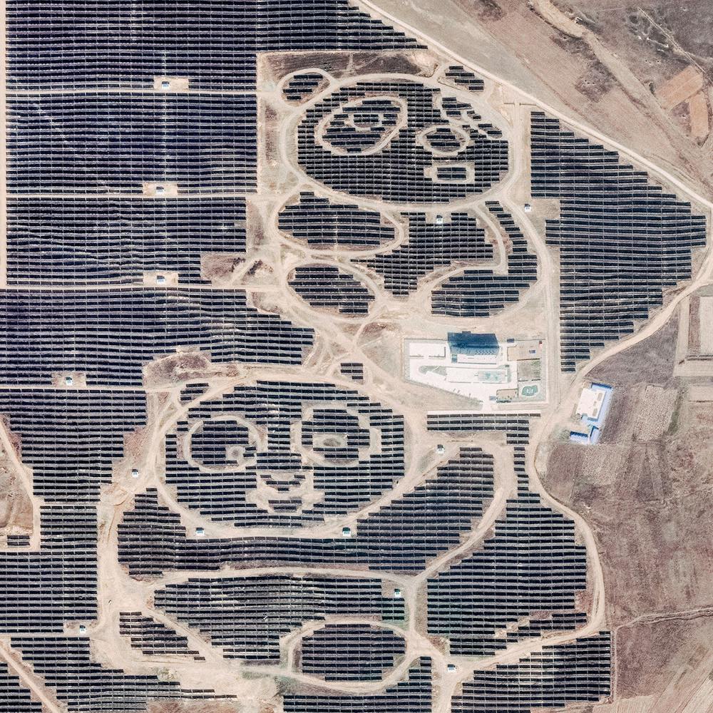
39.973222°, 113.484361° - Datong, Shanxi Province, ChinaTwo pandas are formed by solar panels at the Panda Green Energy power plant in Datong, Shanxi Province, northern China. Built in cooperation with the United Nations Development Program, this solar farm covers roughly 1,500 acres and includes an education center that teaches children about sustainable and renewable energy.
Maxar Technologies
Somalia Coast
5.000000°, 48.266667° - El Hur, SomaliaWaves roll into the shores of Somalia, by the village of El Hur. Located on the Horn of Africa, Somalia has the longest coastline on the mainland continent, stretching for more than 3,000 kilometers (1880 miles).
Maxar Technologies
Songjeong Dong
35.093187°, 128.849009° - Busan, South KoreaThe colorful roofs of Songjeong-dong - an industrial district in Busan, South Korea - are seen in this Overview. The striking colors that you see here result from the use of aluminum roofing, which is used for its low cost and longevity.
Maxar Technologies
Sound of Speed Airshow
39.771944°, -94.909694° - St. Joseph, Missouri, USAIn this Overview, spectators explore a variety of aircraft during the Sound of Speed Airshow, which took place last weekend at Rosecrans Memorial Airport in St. Joseph, Missouri. The event included aerial performances and ground displays of dozens of aircraft, including U.S. Navy Blue Angels, C-130 Hercules transporters, P-51 Mustangs, an F-16 Viper, and more.
Nearmap
Southern California Airplane Boneyard
34.597500°, -117.383056° - Victorville, California, USAIn this Overview, 25 airplanes are parked in a cluster at the Southern California Logistics Airport in Victorville, California. Also known as Victorville Airport, it is home to Southern California Aviation, a large transitional facility for commercial aircraft. No commercial passenger services are offered at the airport except for fixed-based operator and charter flights.
Nearmap
Soybean fields
-12.366667°, -44.966667° - São Domingos, Brazil / São Desidério, BrazilSoybeans fields straddle the border of São Domingos and São Desidério, Brazil. In 2014, Brazil became the world’s top producer of the crop with a harvest of 90 million metric tons.
Maxar Technologies
Spaghetti Junction
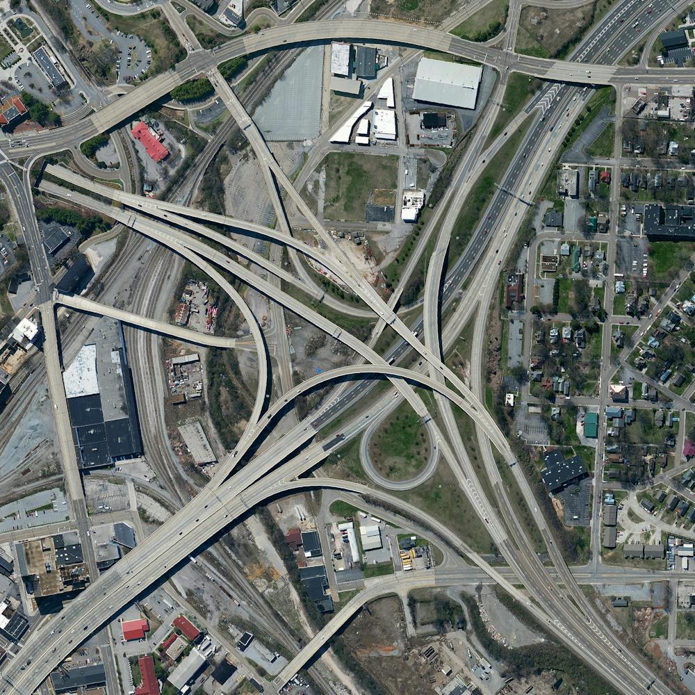
35.966384°, -83.929399° - Knoxville, Tennessee, USAA highway interchange connect Interstates 40 and 275 outside of Knoxville, Tennessee, USA. Because of its intertwined construction, a structure like this is commonly called a “spaghetti junction.”
Maxar Technologies
Spain Greenhouses
36.868331°, -2.368688° - Almeria, SpainGreenhouses in Almeria, Spain, cover approximately 20,000 hectares of land (more than 75 square miles). The use of plastic covering (known as "plasticulture") is designed to increase produce yield, increase produce size, and shorten growth time. For a sense of scale, this Overview shows roughly six square miles. This image is on display right now at our exhibition at theprintspace in Shoreditch, London. We're also selling prints of it, and – thanks to theprintspace – we are able to offer FREE shipping throughout Europe during the exhibition, which ends November 26th! Visit to take advantage of this exclusive offer.
Maxar Technologies
Spiral Jetty
41.437611°, -112.669556° - Great Salt Lake, Utah, USAThis Overview captures Spiral Jetty, an earthwork sculpture by Robert Smithson, consisting of a 1,500-foot-long (460 m), 15-foot-wide (4.6 m) counterclockwise coil jutting from the northeastern shore of the Great Salt Lake in Utah, USA. Smithson reportedly chose this site because of the vibrant colors of the water (salt-tolerant bacteria and algae thrive here in 27% salinity) and its connection with the primordial sea.
Maxar Technologies
Springvale Botanical Cemetery
-37.946001°, 145.175793° - Victoria, AustraliaSpringvale Botanical Cemetery is the largest crematorium and memorial park in the state of Victoria, Australia. It is located in Springvale, a southeastern suburb of Melbourne, and has been in operation since 1901. Originally called The Necropolis Springvale, it was renamed in 2006 to reflect its large gardens, which boast hundreds of varieties of roses, bunya-bunya pine trees, an a Red River Gum tree believed to be about 400 years old.
Nearmap
St. George Airport Tracks
37.089806°, -113.591806° - St. George, Utah, USAWhat do you think is happening in this Overview? From our perspective, it looks like someone got excited while driving a road-striping truck. Regardless of how it happened, this vibrant display is found on the grounds of the former St. George Municipal Airport in St. George, Utah. Now closed, the facility was used for general aviation from 1972 until it was replaced by another airport in 2011. Head over to our Instagram and let us know your best guess in the comments!
Nearmap
St. Kilda Evaporation Ponds
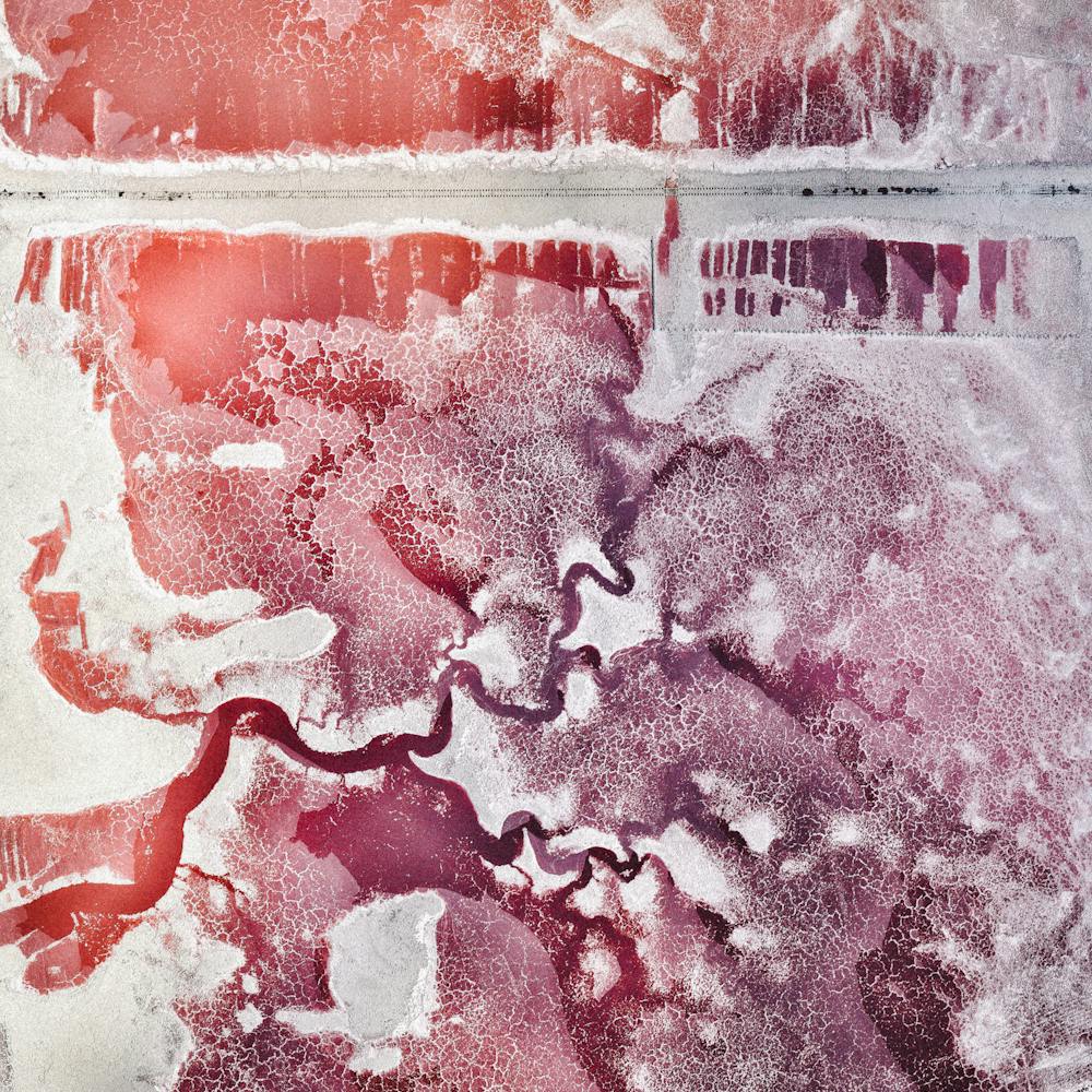
-34.748278°, 138.544556° - St. Kilda, South AustraliaCheck out the amazing shades of red in this saltwater evaporation lagoon near St. Kilda, South Australia. This small suburb of Adelaide is surrounded by such ponds, which are filled in the spring and harvested in autumn. Salt taken from the ponds used to make soda ash, a key ingredient in the production of glass, paper, soaps and detergents.
Nearmap
St. Peter’s Basilica
41.903816°, 12.443306° - Vatican CityHappy Easter! St. Peter’s Basilica, located within Vatican City in Rome, Italy, is regarded as one of the holiest Catholic sites and one of the greatest churches in all of Christendom. Construction of the church began in 1506 and was completed in 1626. The facility is seen here during the Pope’s mass on Easter Sunday in 2015.
Maxar Technologies
Stade de France
48.924444°, 2.360000° - Saint Denis, FranceIn a less than an hour, France will square off against Portugal in the finals of Euro 2016 — the championship tournament of European football (soccer) that takes place every four years. The match will be played in Stade de France, the nation’s largest stadium that has a seating capacity of 81,338. Enjoy the game!
Maxar Technologies
Staten Island Boat Graveyard
40.556107°, -74.216520° - Staten Island, New York, USAThe Staten Island Boat Graveyard is a marine scrapyard located in Arthur Kill on the northern shore of Staten Island, New York. Founded in the 1930s, it serves as a dumping ground for wrecked tugboats, barges, ferries and other vessels from all decades of the 20th century. Some of these boats have historic significance, including the submarine chaser USS PC-1264 — the first World War II U.S. Navy ship to have a predominantly African-American crew — and the New York City Fire Department fireboat Abram S. Hewitt, which served as the floating command post at the 1904 sinking of the passenger ferry PS General Slocum, a disaster that killed more than 1,000 people.
Nearmap
Statue of Liberty
40.689167°, -74.044444° - New York City, New York, USAThe incredible shot shows the Statue of Liberty in New York City. The colossal copper structure depicts a robed female figure — Libertas, the Roman goddess of liberty — who bears a torch and a tablet upon which is inscribed the date of the American Declaration of Independence — July 4, 1776. The statue is an American icon of freedom and a welcoming sight to immigrants arriving from abroad.
Nearmap
Stelvio Pass
46.528611°, 10.452777° - Eastern Alps, ItalyThe Stelvio Pass in northern Italy is the highest paved roadway in the Eastern Alps, with an elevation of 2,757 meters (9,045 feet) above sea level. Only accessible in the summer months, the road and its 75 hairpin turns are sometimes scaled during the famous Giro d’Italia cycling race.
Maxar Technologies
Subang Jaya
3.045338°, 101.585428° - 3.045338°, 101.585428°Subang Jaya is a municipality in the Greater Kuala Lumpur Petaling District of Malaysia. Before it was turned into a residential community in 1974, this area housed a rubber plantation for a major Malaysian conglomerate. It was granted municipal status in 1997 and has since grown rapidly into a global city and regional education hub.
Maxar Technologies
Sun City
33.624205°, -112.285054° - Sun City, Arizona, USASun City, Arizona, USA opened as a retirement community on January 1, 1960. That day, more than 100,000 people showed up to see the new development, resulting in a cover story in Time magazine. The community was built on the old ghost town of Marinette and covers 14.6 square miles. Today, Sun City has a population of roughly 37,000 people.
Maxar Technologies