 Explore
 Shop
Shop About
About Search
Overview Index
Our Lady of Almudena Cemetery
40.419444°, -3.640556° - Madrid, SpainOur Lady of Almudena Cemetery in Madrid, Spain is one of the largest cemeteries in the world. The number of gravesites - estimated at five million - is greater than the population of Madrid itself.
Maxar Technologies
Palamanova
45.904944°, 13.309944° - Palmanova, ItalyThe town of Palmanova, Italy, is recognized by its concentric layout known as a “star fort.” The rationale for this construction was that an attack on any individual wall could be defended from the two adjacent star points by shooting the enemy from behind. The three rings that surround Palmanova were completed in 1593, 1690, and 1813.
Maxar Technologies
Palm Jumeirah
25.114667°, 55.137797° - Dubai, United Arab EmiratesThe Palm Jumeirah in Dubai, United Arab Emirates is an artificial island that was created with 3.3 billion cubic meters of sand and 7 million tons of rock.
Maxar Technologies
Palm Springs International Airport (PSP)
33.829722°, -116.506667° - Palm Springs, California, USAA single airplane waits at the international terminal of Palm Springs International Airport in Palm Springs, California. The airport is highly seasonal, operating a majority of its flights in the winter, and it has been called one of America's most “stress-free" airports. In 2017, it handled slightly more than 2.1 million passengers across 12 airlines.
Nearmap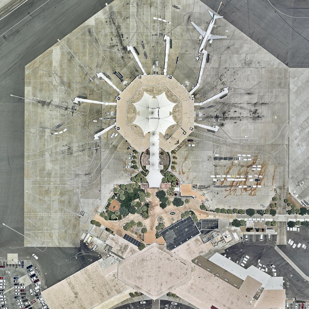
Palm Tree Plantation
3.187112°, 101.498676° - Kuala Lumpur, MalaysiaPalm tree plantations surround the city of Kuala Lumpur, Malaysia. Oil-producing palm trees were introduced to the country in the 1970s in order to diversify the local agriculture, which was heavily reliant on the rubber tree at the time. The trees are cultivated in terraces, cut into the contours of hills, to avoid erosion caused by streaming water. Malaysia is now one of the world's largest suppliers of palm oil, exporting nearly 18 million tonnes per year.
Maxar Technologies
Palmanova
45.904892°, 13.317671° - Palamova, ItalyThe town of Palmanova, Italy is recognized by its concentric layout known as a star fort. The rationale for this construction was that an attack on any individual wall could be defended from the two adjacent star points by shooting the enemy from behind. The three rings that surround Palmanova were completed in 1593, 1690, and 1813.
Maxar Technologies
Palu, Indonesia Earthquake Aftermath (Juxtapose)
-0.885333°, 119.858722° - Palu, IndonesiaThese Overviews show Palu, Indonesia, before and after it was hit by a magnitude 7.5 earthquake and a roughly 30-foot-high (9 m) tsunami late last month. At first glance, we notice a considerable amount of sediment and debris from the storm has washed into Palu Bay, and as we zoom in, we see more detailed damage to the city’s infrastructure, including the Jembatan Palu IV Bridge. Palu was hardest hit by the disaster, but other areas on the island of Sulawesi were also affected. The death toll has risen well above 2,000 and more than 80,000 people have been left homeless or otherwise displaced, with miles of coastline destroyed.
Maxar Technologies
Pama, Austria
48.047364°, 17.034543° - Pama, AustriaAgricultural development is seen around the village of Pama, Austria. The area has a population of roughly 1,100 and primarily produces wheat, rye, oats, and barley.
Maxar Technologies
Paris
48.865797°, 2.330882° - Paris, FranceThe street plan and distinctive appearance of central Paris, France is largely due to the vast public works program commissioned by Emperor Napoléon III and directed by Georges-Eugène Haussmann, between 1853 and 1870. Haussmann’s renovation of Paris included the demolition of crowded and unhealthy medieval neighborhoods and the building of broad, diagonal avenues, parks, squares, sewers, fountains, and aqueducts.
Maxar Technologies
Parking Lot For Illegal Volkswagens
34.597500°, -117.383056° - Victorville, California, USAThousands of diesel-powered Volkswagens are parked at Southern California Logistics Airport in Victorville, California. While this facility is known for its airplane graveyard, Volkswagen has leased enough land here to park 21,0000 vehicles. Following its emission scandal in 2015, the company gave customers the option to sell their cars back to the company. More than 340,000 customers have elected to return their vehicles so far.
Nearmap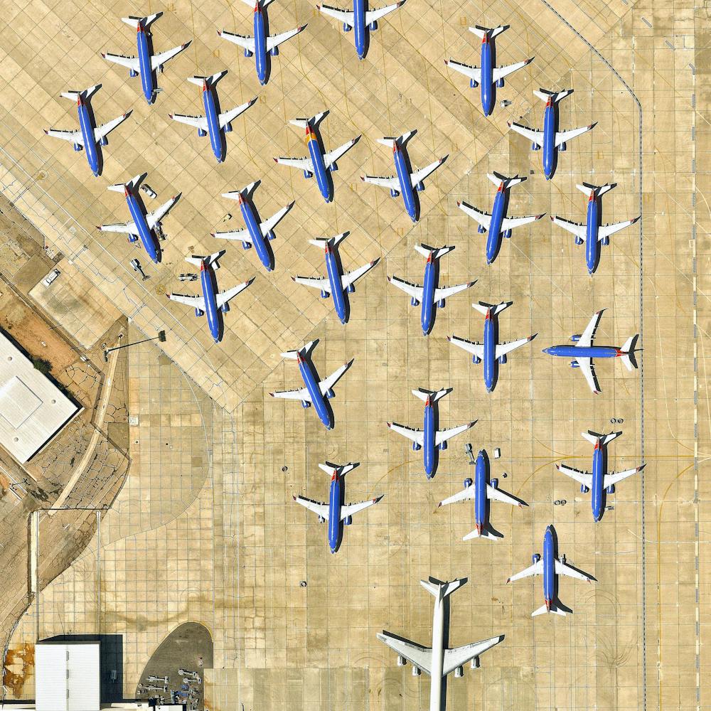
Pembrokeshire
52.014500°, -5.087222° - Pembrokeshire, WalesPembrokeshire is a county in the southwest of Wales. The area is home to Pembrokeshire Coast National Park, which includes a 186-mile walking trail known as the Pembrokeshire Coast Path. This image is on display right now at our exhibition at theprintspace in Shoreditch, London. We're also selling prints of it, and – thanks to theprintspace – we are able to offer FREE shipping throughout Europe during the exhibition, which ends November 26th! Visit to take advantage of this exclusive offer.
Maxar Technologies
Perito Moreno Glacier
-50.536843°, -73.195237° - Santa Cruz Province, ArgentinaThe Perito Moreno Glacier is located in Santa Cruz Province, Argentina. The 250 square kilometer (97 square mile) ice formation stretches for 30 kilometres (19 miles) and represents the world’s third largest reserve of fresh water.
Maxar Technologies
Petare, Venezuela
10.483861°, -66.803028° - Petare, VenezuelaPetare is a city in northern Venezuela, and is part of the greater Caracas urban area. With a population of nearly 370,000, it is considered one of the largest slums in the world. Homes in Petare are packed tightly together and many are stacked on top of each other along landslide-prone hills.
Maxar Technologies
Philadelphia
39.945667°, -75.164889° - Philadelphia, Pennsylvania, USAPhiladelphia is the largest city in the Commonwealth of Pennsylvania and the sixth-most populous city in the United States, with a population of more than 1.5 million. The city played a pivotal role during the American Revolution, when it provided a setting for the signing of the Declaration of Independence in 1776 and the U.S. Constitution in 1787.
Nearmap
Philadelphia Auto Processing Facility
39.908861°, -75.136806° - Philadelphia, Pennsylvania, USAThousands of automobiles await shipment and distribution at the Philadelphia Auto Processing Facility in South Philadelphia, Pennsylvania. Located on the Delaware River, this 84-acre (34-hectare) facility handles both imports and exports. With connections to Interstates 95 and 76 and two large railways, it is a major supply chain hub for the U.S. automobile industry.
Nearmap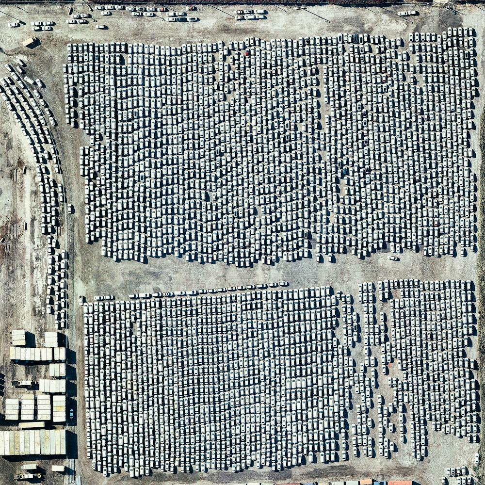
Philadelphia Car Processing Facility
39.903861°, -75.142944° - Philadelphia, Pennsylvania, USAHundreds of vehicles are parked in a processing lot near the Port of Philadelphia, Pennsylvania. Since 2010, hundreds of thousands of Hyundai and Kia vehicles have arrived at “PhilaPort” — located on the Delaware River — aboard cargo ships from South Korea. After processing, these vehicles are delivered to dealerships across the country by truck and by rail.
Nearmap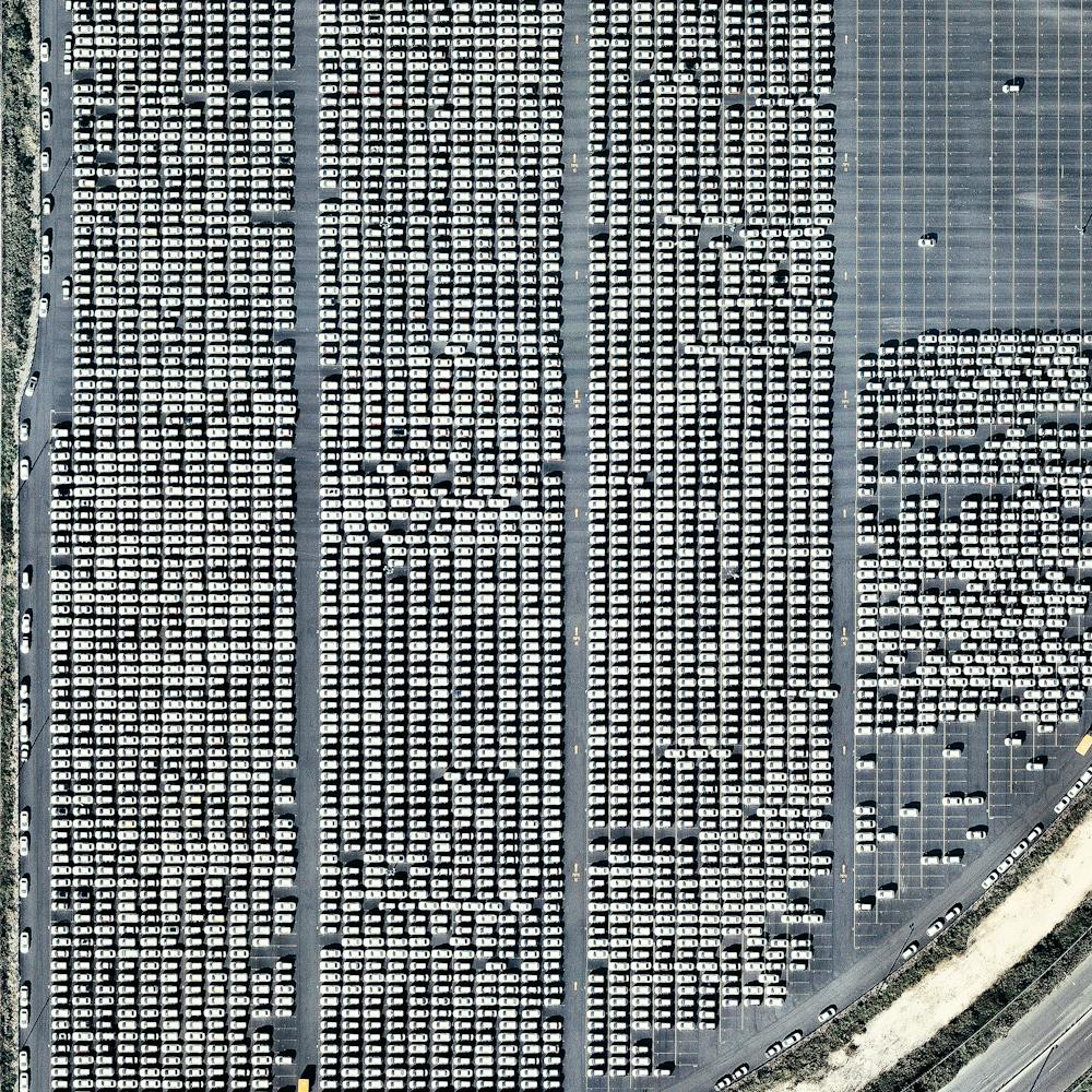
Pier 84 - Hudson River Park
40.764167°, -74.002194° - New York City, New York, USAPier 84 is the largest public pier and one of the highest trafficked areas in Hudson River Park. Located near 42nd Street in the heart of Manhattan, New York City, the pier has a large open area on its western end, an interactive fountain, restaurant concession and dockage for large boats.
Nearmap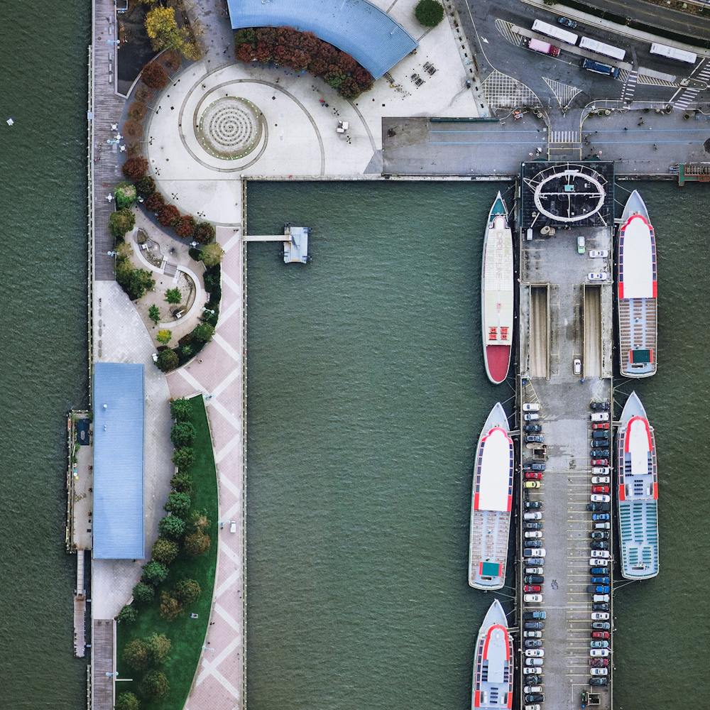
Pierce County Container Terminal
47.253944°, -122.369778° - Tacoma, Washington, USAThe Pierce County Container Terminal is part of the Port of Tacoma, located in Washington State. The 140-acre (56.7 hectare) facility has two berths totaling 2,087 feet (636 m) in length and seven cranes. Every year, the Port of Tacoma handles between 9 and 13 million tons of cargo and more than $25 billion of commerce.
Nearmap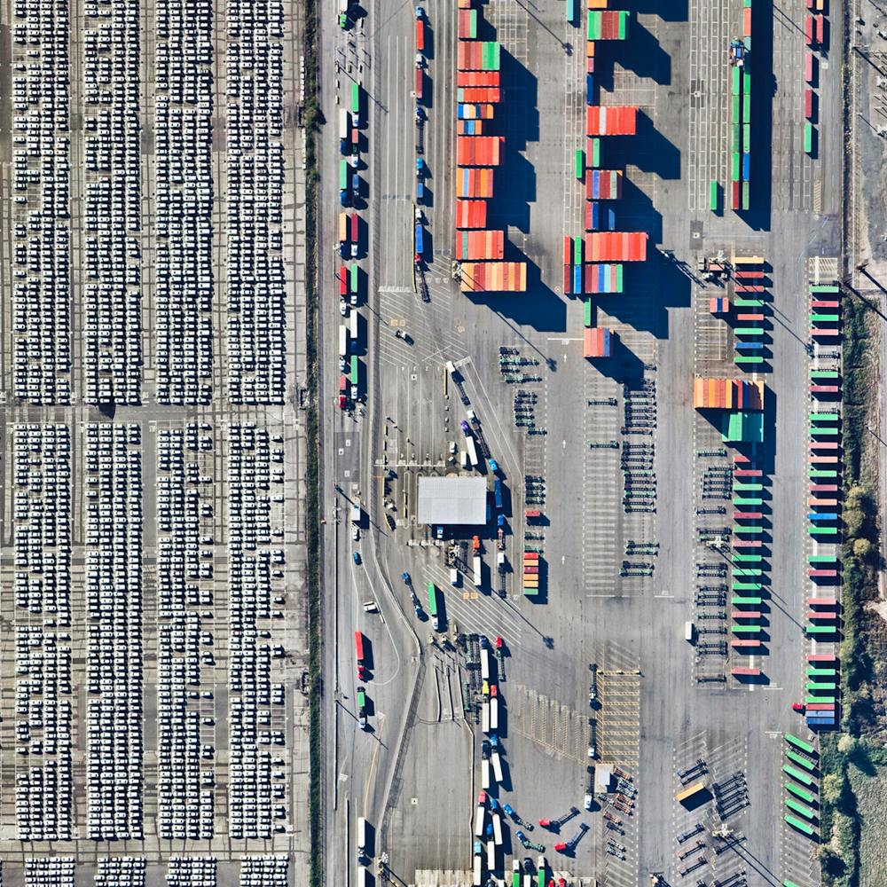
Pinal Airpark
32.505891°, -111.330164° - Marana, Arizona, USAPinal Airpark is located in Marana, Arizona, United States. The facility primarily functions as a boneyard for hundreds of civilian commercial aircraft because the area's dry, desert climate reduces corrosion. The site, which was constructed in 1942, opened up for public viewing for the first time this past year.
Maxar Technologies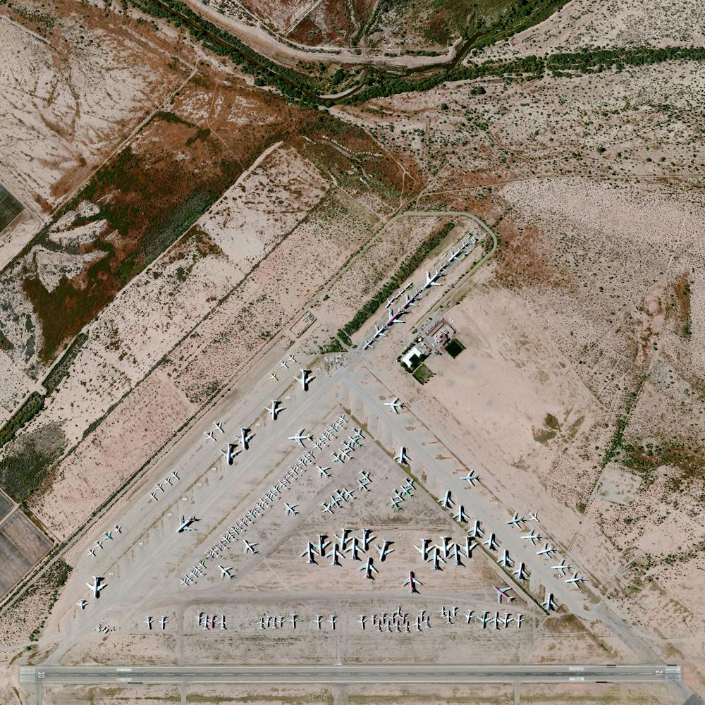
Piraeus
37.936194°, 23.642250° - Piraeus, GreecePiraeus is a port city in Greece, roughly 7 miles (12 km) outside Athens. Since ancient times, it has served as a vital trade and transportation hub, and its port is currently the busiest passenger port in the country. In fact, the Port of Piraeus was the busiest in all of Europe in 2014, when it handled 18.6 million passengers.
Maxar Technologies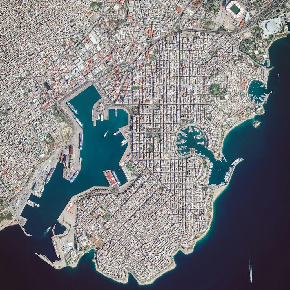
Piraeus Marina
37.937737°, 23.645820° - Piraeus, GreeceThe Piraeus Marina is located on the Bay of Zea and is surrounding by gridded streets in the Greek city of Piraeus. The city was developed in the early 5th century BC, when it was selected to serve as the port destination of classical Athens. Now, the city contains the second largest passenger port in the world, which services about 20 million passengers every year.
Maxar Technologies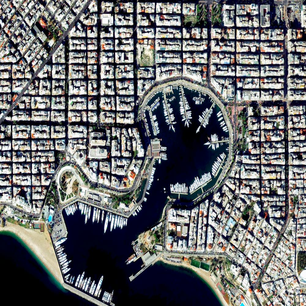
Pivot Irrigation Fields
37.631920°, -100.706842° - Copeland, Kansas, USAPivot irrigation fields cover the landscape north of Copeland, Kansas, USA. Powered by electric motors, lines of sprinklers rotate 360 degrees to evenly irrigate crops.
Maxar Technologies
Plaça de Tetuan
41.394921°, 2.175507° - Eixample District, Barcelona, SpainPlaça de Tetuan is a major square located in the Eixample district of Barcelona, Spain. The area characterized by its strict grid pattern, octagonal intersections, and apartments with communal courtyards.
Maxar Technologies
Plaça de Tetuan - Barcelona
41.394917°, 2.175500° - Barcelona, SpainPlaça de Tetuan is a major square located in the Eixample District of Barcelona, Spain. This area is characterized by its strict grid pattern, octagonal intersections, and apartments with communal courtyards. At the square’s center is a monument of Dr. Bartomeu Robert Yarzábal, who served briefly as Mayor of Barcelona at the turn of the 20th century.
Maxar Technologies
Plane Over Oxnard Fields
34.197694°, -119.230056° - Oxnard, CaliforniaA plane flies over strawberry fields in Oxnard, California. From above, these fields have a silvery color because they are covered to protect berries from animal pests. During peak harvesting season — from April to June — more than 10 million pints of strawberries are shipped out of California every day, supplying the United States with 85% of its strawberries.
Nearmap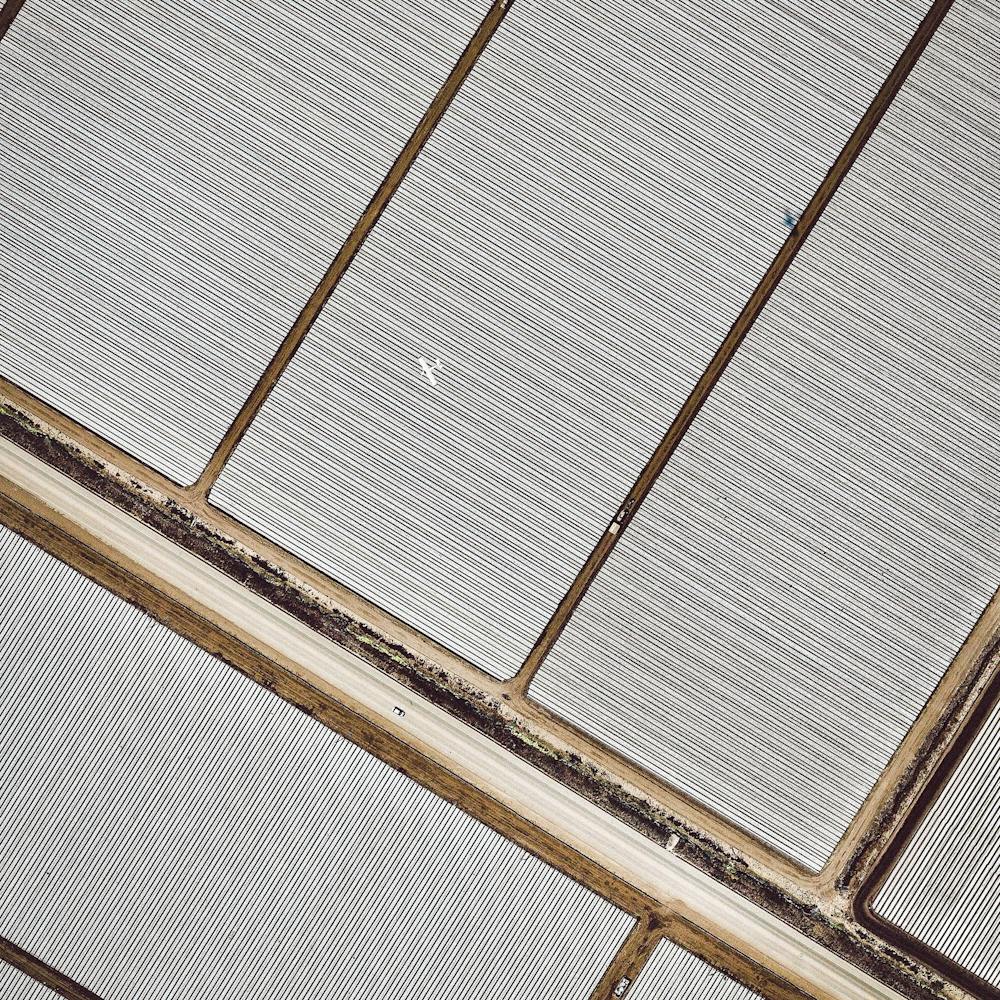
Plaza Del Ejecutivo
19.419889°, -99.088028° - Mexico City, MexicoRadiating streets surround the Plaza Del Ejecutivo in the Venustiano Carranza district of Mexico City, Mexico. This district — which is home to more than 430,000 people — contains three of Mexico City’s large traditional markets, including La Merced, Mercado de Sonora, and Mercado Jamaica.
Maxar Technologies
Plymouth Rock Boats
41.958333°, -70.661944° - Plymouth, Massachusetts, USABoats are moored in the waters by Plymouth Rock in Massachusetts, USA. A nearby site onshore is recognized as the disembarkation point of William Bradford and the Mayflower Pilgrims who founded Plymouth Colony in 1620. The following year, in 1621, a feast was held to celebrate a bountiful harvest, which is commonly recognized as the first Thanksgiving.
Nearmap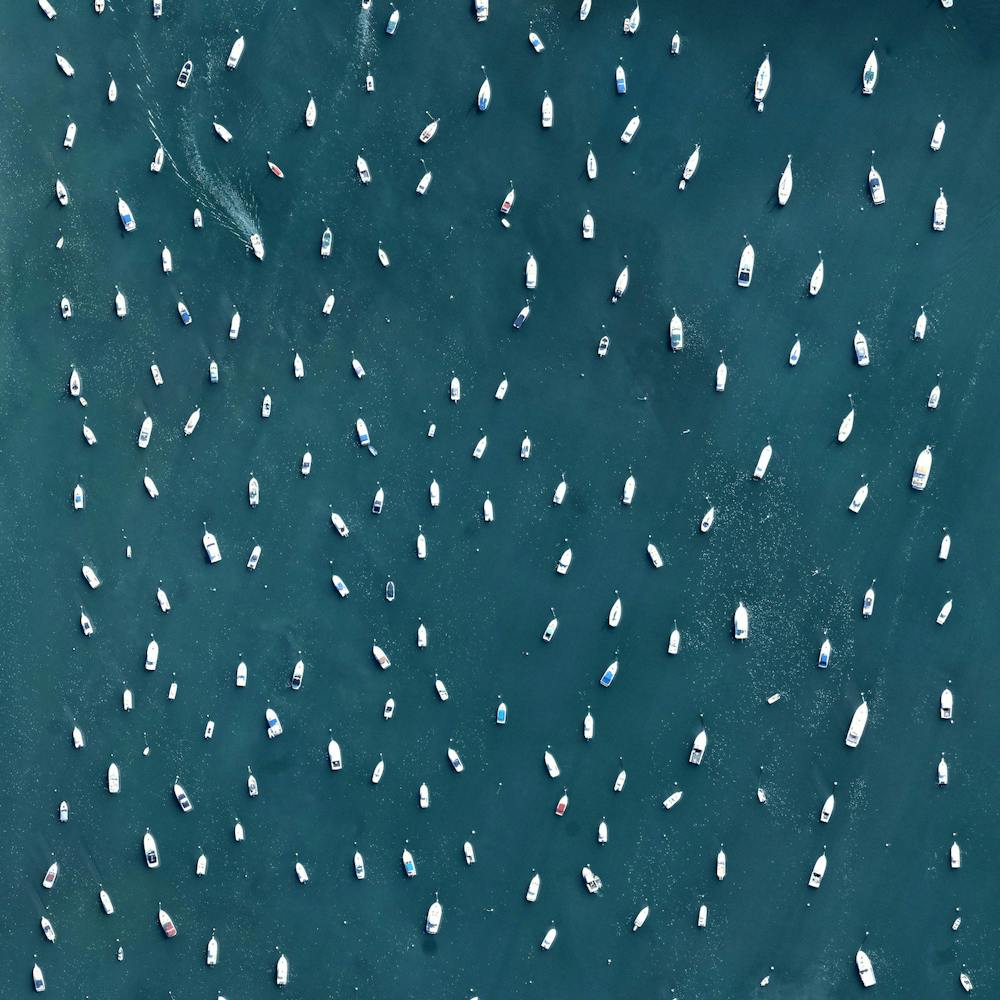
Polk Power Plant
27.722905°, -81.989787° - Bradley Junction, FloridaThe TECO Polk Power Station occupies 2,837 acres (1,148 hectares) in Bradley Junction, Polk County, Florida. This integrated coal gasification combined-cycle power plant produces roughly 1,400 megawatts of electricity — enough to serve 75,000 homes in the greater Tampa area. This Overview shows the facility surrounded by reclaimed water, which it cleans and uses in the process of generating electricity.
Maxar Technologies
Port Everglades
26.087166°, -80.119158° - Broward County, FloridaMassive cruise ships are anchored at Port Everglades in Broward County, Florida, United States. The facility is the third busiest cruise port in the world with 3.6 million passengers passing through each year. In total, the worldwide cruising industry accounts for $29.4 billion USD with more than 19 million passengers traveling each year.
Maxar Technologies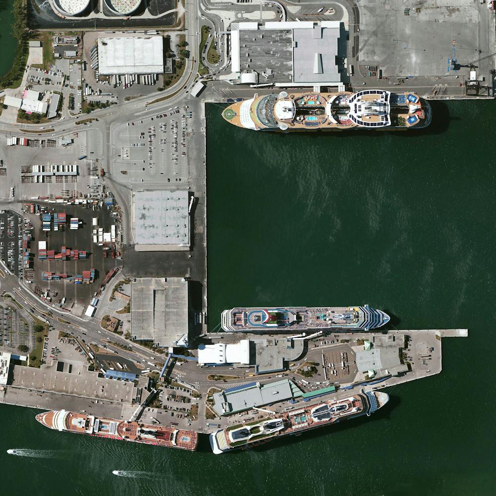
Port Grimaud
43.272222°, 6.580278° - Port Grimaud, FrancePort Grimaud is a seaside town located on the French Riviera by the Gulf of Saint Tropez. The development consists of French “Fisherman” style houses built upon channels in a Venetian manner.
Maxar Technologies