Overview Index
Alta Wind Energy Center
35.021111°, -118.320556° - Tehachapi Mountains, CaliforniaLocated in the Tehachapi Mountains of California, the Alta Wind Energy Center is the largest wind farm in the US, and third largest onshore farm in the world. The facility plans to reduce carbon dioxide emission by more then 5.2 million metric tons over the next 25 years, which is roughly the same as eliminating 446,000 cars off the road.
Maxar Technologies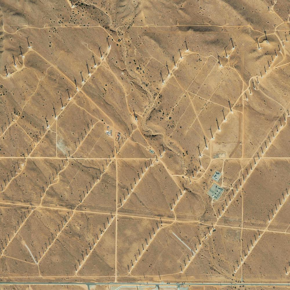
Arlit Uranium Mine
18.760752°, 7.318642° - Arlit, NigerThe Arlit Uranium mine is located in Arlit, Niger. French nuclear power generation as well as the French nuclear weapons program are dependent on the uranium that is extracted from the mine - more than 3400 tonnes per year.
Maxar Technologies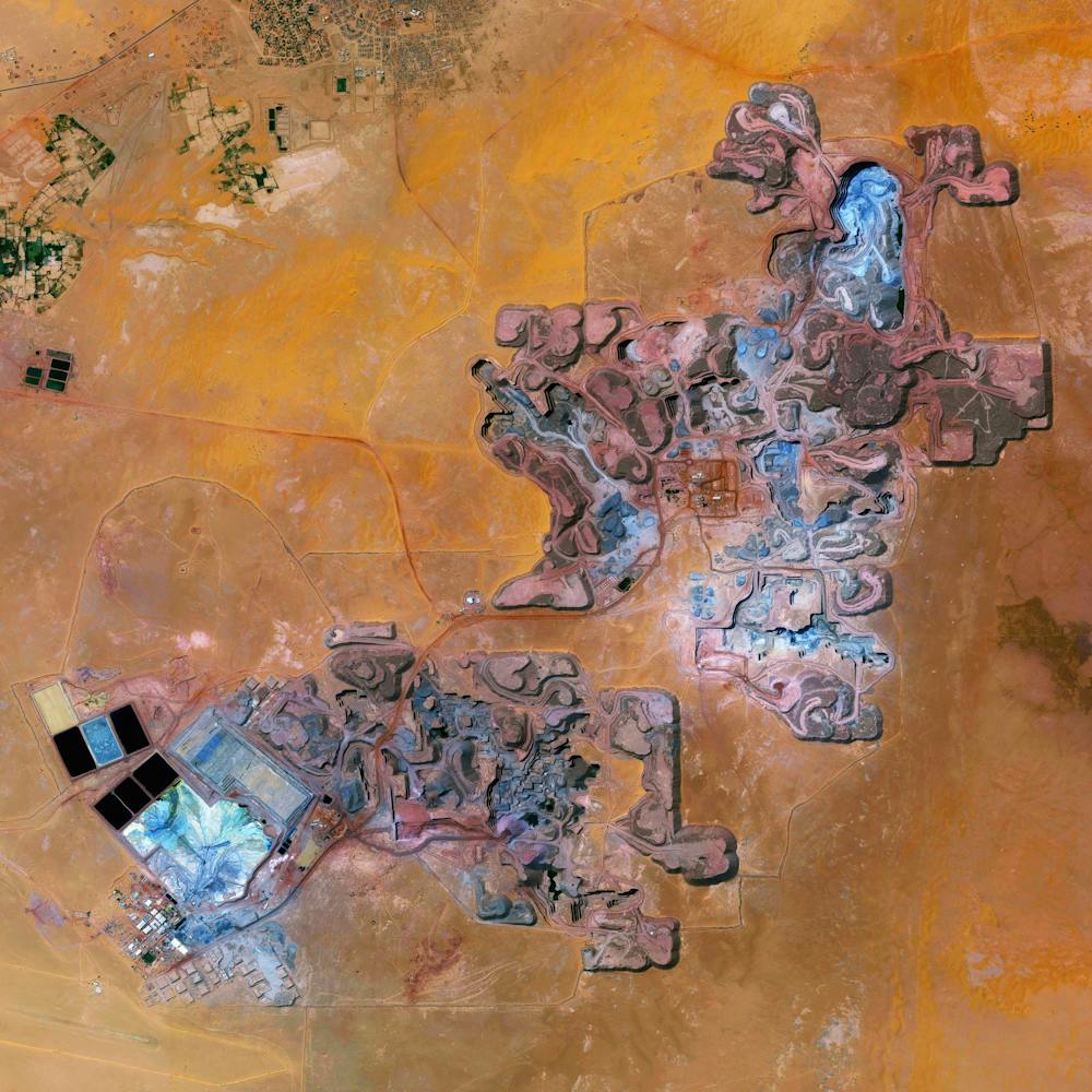
Bandar Imam Khomeini Chemical Complex
30.471667°, 49.099444° - Khuzestan Province, IranThe Bandar Imam Khomeini petrochemical complex is Iran’s largest supplier of petrochemicals for export, generating millions of tons of petroleum-based products every year. Located in Iran’s southwestern Khuzestan Province, the complex is seen in this Overview adjacent to Musa Bay, a shallow estuary that empties into the Persian Gulf.
Maxar Technologies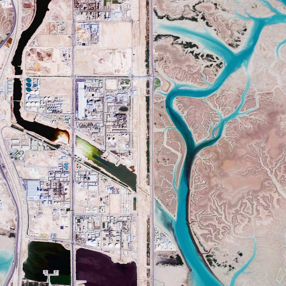
Baton Rouge Refinery
30.485015°, -91.169420° - Baton Rouge, Louisiana, USAA residential neighborhood sits adjacent to a large oil refinery in Baton Rouge, Louisiana. Owned by ExxonMobil, this facility is the fourth largest of its kind in the United States and the 12th largest in the world, with an input capacity of more than 502,000 barrels per day. This refinery is one of many industrial plants along the Mississippi River between Baton Rouge and New Orleans, an 85-mile stretch known as "Cancer Alley" because of the abundance of cancer cases that have occurred there.
Nearmap
Bayannur Wulanyiligeng Wind Farm
41.963889°, 108.308333° - Inner Mongolia, ChinaThe Bayannur Wulanyiligeng Wind Farm in Inner Mongolia, China, consists of at least 200 wind turbines and can generate nearly 850,000 megawatt hours (850 billion watt hours) of power per year at full operation. Power from the wind farm is sold to the North China Power Grid to substitute for power generated by thermal power plants, thus reducing carbon emissions. The wind farm has the capacity to reduce carbon dioxide emissions by more than 760,000 tonnes annually.
Maxar Technologies
Brick Kilns
23.767575°, 90.318299° - Dhaka, BangladeshKilns for firing and making bricks are scattered across the landscape in Dhaka, Bangladesh. Almost all bricks in the country are made using a 150-year-old process where soil is mixed with water, formed into bricks using wooden molds, left to dry in the sun, and then burned in these orange, traditional kilns. As the widespread use of old kilns has hampered air quality in the country, local groups and the government have been working to increase the use of "clean" brick kilns with more sustainable technology.
Maxar Technologies
Chinese Floating Solar Farm
32.580123°, 116.589000° - Huainan, ChinaSolar panels sitting atop a man-made lake in Huainan, China, make up the world’s largest floating solar farm. Sungrow Huainan Solar Farm is capable of producing enough electricity to power 15,000 homes and floats above an area formerly used for coal mining.
Maxar Technologies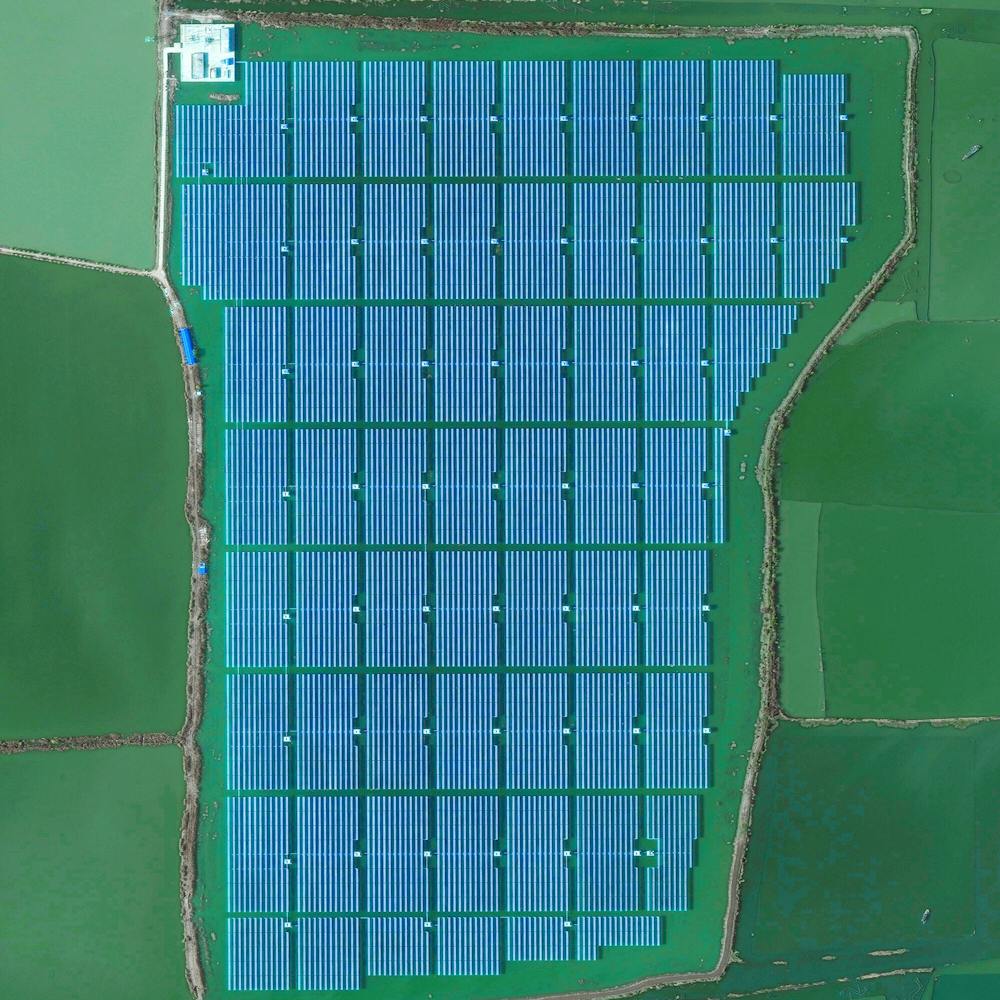
Coal Trains in Alliance, Nebraska
42.082523°, -102.890045° - 42.082523°, -102.890045°Coal trains — some full, others empty — idle in a railyard next to a pivot irrigation circle in Alliance, Nebraska, USA. The city is located in the Powder River Basin — one of the world’s largest coal-mining areas — and serves as a stopping point for trains en route to power plants in the Midwest and Southern parts of the country.
Maxar Technologies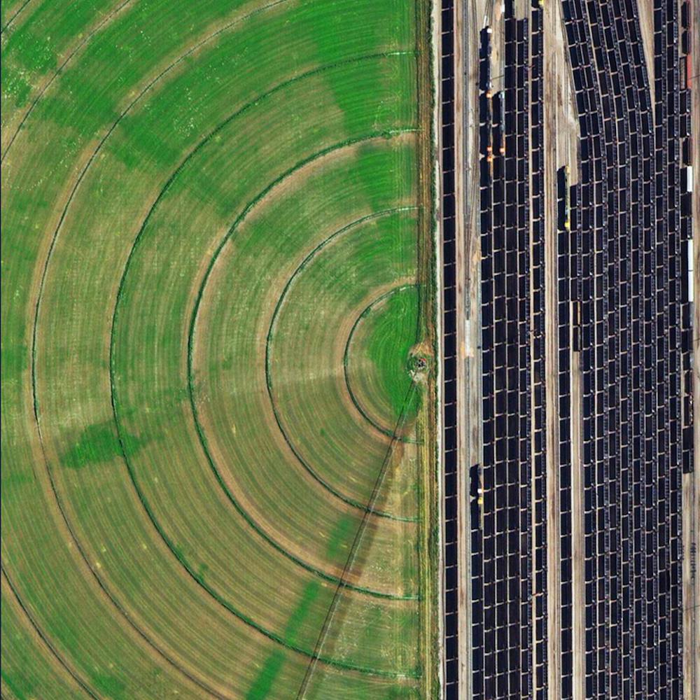
Corpus Christi Oil Refinery
27.833444°, -97.524750° - Corpus Christi, Texas, USACheck out this Overview, which shows a maze of pipes and other equipment at an oil refinery in Corpus Christi, Texas. Due to its position on the Port of Corpus Christi — the fifth largest U.S. port and deepest inshore port on the Gulf of Mexico — much of the city’s economy is driven by the oil and petrochemicals industry. An average of 400,000 barrels of crude oil per day were exported from this port during 2018.
Nearmap
Crescent Dunes Solar Energy Project
38.238972°, -117.363721° - Tonopah, Nevada, USAThe Crescent Dunes Solar Energy Project near Tonopah, Nevada powers up to 75,000 homes during peak electricity periods. So how does it work? The project uses 17,500 heliostat mirrors to collect and focus the sun’s thermal energy to heat molten salt flowing through a 540-foot (160 m) tall solar power tower. The molten salt then circulates from the tower to a storage tank where it is used to produce steam and generate electricity. One last thing - look closely at the lower left corner of this Overview and you’ll see an airplane flying over the complex!
Maxar Technologies
Donghai Bridge Wind Farm
30.770000°, 121.994000° - Shanghai, ChinaTurbulence fields form behind the turbines of the Donghai Bridge Wind Farm in Shanghai, China. These streaks occur when wind hits the turbines' towers or when certain meteorological conditions cause the turbines to create condensation (i.e. clouds) of very humid air.
Maxar Technologies
Grande Dixence Dam
46.080556°, 7.403889° - Hérémence, SwitzerlandThe Grande Dixence Dam in the canton of Valais in Switzerland is the tallest gravity dam in the world with a height of 935 feet (285 m). A gravity dam resists the horizontal thrust of the contained water, in this case the Dixence River, entirely by its own weight. The Grand Dixence took 14 years to construct, contains approximately six million cubic meters of concrete, and generates power for more than 400,000 Swiss homes.
Maxar Technologies
Hoover Dam
36.015844°, -114.738804° - Arizona / Nevada, USAHoover Dam is a 221-meter-high (726-foot), 379-meter (1,244-foot) concrete arch-gravity dam, located on the Colorado River at the border of Arizona and Nevada, USA. Constructed between 1931 and 1936 during the Great Depression, a workforce of approximately 20,000 poured a total of 3.33 million cubic meters (4.36 million cubic yards) of concrete to complete the structure – enough to pave a two-lane highway from San Francisco to New York City.
Nearmap
Kooragang Island Coal
-32.875306°, 151.767778° - Kooragang Island, New South Wales, AustraliaLarge piles of coal await shipment on Kooragang Island, part of the Port of Newcastle in New South Wales, Australia. Established in 1984 with a capacity of 15 million tonnes per annum, the island now has a capacity of at least 120 million tonnes per annum. In July 2013, a record 10.3 million tonnes of coal was processed through the Port of Newcastle, with 83 of 114 ships loaded at the Kooragang Island terminal.
Nearmap
Lebrija 1 Solar Power Plant
37.007978°, -6.049281° - Lebrija, SpainThe Lebrija 1 Solar Power Plant in Lebrija, Spain is comprised of approximately 170,000 individual mirrors installed on 6,048 parabolic troughs. If placed next to one another, the troughs would extend for 60 kilometers.
Maxar Technologies
Oil Field Service Ships
5.263871°, 115.257724° - 5.263871°, 115.257724°Oil field service ships anchor offshore of Labuan, a territory of Malaysia that is located off the coast of Borneo. In addition to being an offshore financial center, Labuan is a support hub for deepwater oil and gas activities in the region. The economy of Labuan is heavily dependent on its fossil fuel resources, which account for 65% of its exports.
Maxar Technologies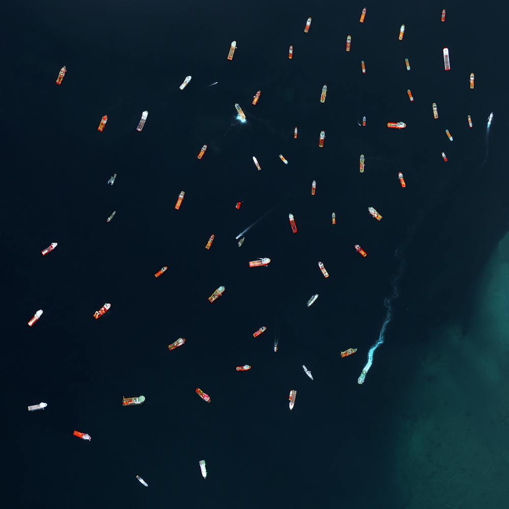
Oil platform
46.166667°, 51.583333° - Kashagan Field, Caspian Sea, KazakhstanTwo boats pass through the sea walls surrounding an oil extraction platform in Kazakhstan’s zone of the Caspian Sea. This area is known as the Kashagan Field, an offshore oil field that is estimated to have a recoverable reserve around 13 billion barrels of crude oil. However, due to harsh conditions - specifically sea ice during the winter, yearly temperature variation from −35 to 40 °C (−31 to 104 °F), extremely shallow water, and high levels of hydrogen sulfide that eventually need to be removed from the extracted oil - many consider it to be one of the most challenging oil megaprojects in the world.
Maxar Technologies
Oroville Dam Spillway
39.539222°, -121.496833° - California, USAWater rushes down the main spillway of the Oroville Dam, located on the Feather River in northern California. At 770 feet high (235m), the dam is the tallest in the United States and serves mainly for water supply, hydroelectricity generation, and flood control. Amid heavy rainfall in February 2017, this spillway was significantly damaged and more than 180,000 people living downstream were evacuated.
Nearmap
Ouarzazate Solar Power Station - Noor 3
31.009167°, -6.862222° - Ouarzazate, MoroccoNoor 3 is one of four sections of the Ouarzazate Solar Power Station in the Drâa-Tafilalet region of Morocco. The solar concentrator contains thousands of mirrors that focus the sun’s thermal energy to heat molten salt flowing through a massive central tower. The molten salt then circulates from the tower to a storage tank, where it is used to produce steam and generate electricity. This segment of the facility opened in spring of this year and is expected to begin delivering power to Morocco’s electricity grid by October.
Maxar Technologies
Polk Power Plant
27.722905°, -81.989787° - Bradley Junction, FloridaThe TECO Polk Power Station occupies 2,837 acres (1,148 hectares) in Bradley Junction, Polk County, Florida. This integrated coal gasification combined-cycle power plant produces roughly 1,400 megawatts of electricity — enough to serve 75,000 homes in the greater Tampa area. This Overview shows the facility surrounded by reclaimed water, which it cleans and uses in the process of generating electricity.
Maxar Technologies
Seville Solar Concentrator
37.560556°, -5.331417° - Seville, SpainThe Gemasolar Solar Concentrator in Seville, Spain, contains 2,650 heliostat mirrors that focus the sun’s thermal energy to heat molten salt flowing through a 460-foot-tall (140m) central tower. The molten salt then circulates from the tower to a storage tank, where it is used to produce steam and generate electricity. In total, the facility displaces approximately 30,000 tonnes of carbon dioxide emissions every year.
Maxar Technologies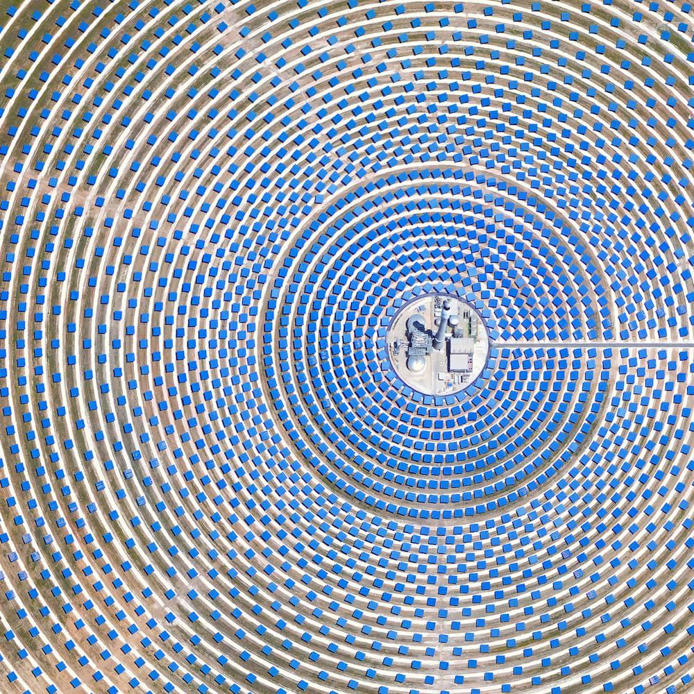
Solar Pandas
39.973222°, 113.484361° - Datong, Shanxi Province, ChinaTwo pandas are formed by solar panels at the Panda Green Energy power plant in Datong, Shanxi Province, northern China. Built in cooperation with the United Nations Development Program, this solar farm covers roughly 1,500 acres and includes an education center that teaches children about sustainable and renewable energy.
Maxar Technologies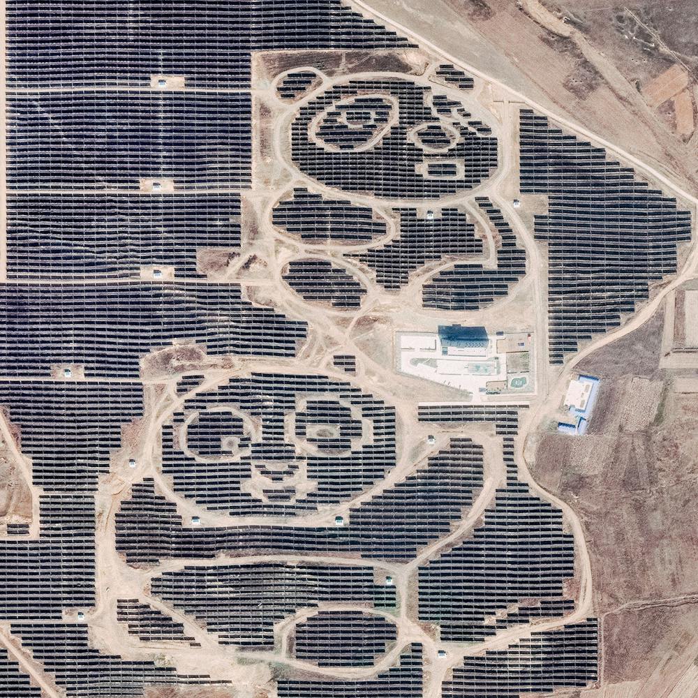
Tumencun Solar Panels
35.790861°, 114.156167° - Tumencun, ChinaSolar panels cover the hillsides of Tumencun, a small township in China's Henan Province. In 2017, China accounted for more than half of the world's investment in solar energy, putting forth $86.5 billion of a $160.8 billion global total. With these funds, China added an estimated 53 gigawatts of new solar capacity — more than all other countries combined.
Maxar Technologies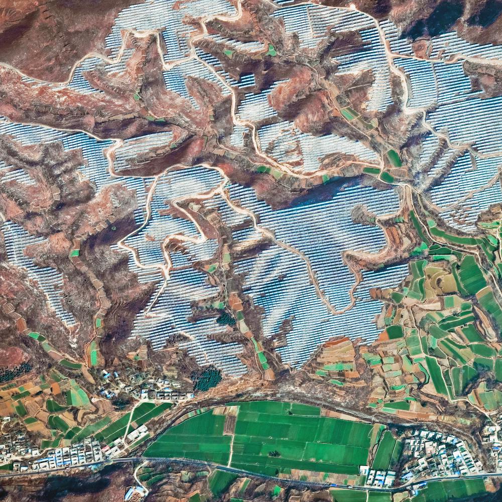
Xiluodu Dam
28.259850°, 103.649500° - Xiloudu, ChinaWater from the Jinsha River surges through the Xiluodu Dam near Xiluodu, China. Arch dams like this one are designed so that the force of the contained water presses against the arch, compressing and strengthening the structure by pushing it into its foundation. At 937 feet (286 meters), the dam in Xiluodu is the fourth tallest in the world and is primarily used for hydroelectric power generation.
Maxar Technologies
- «
- ‹
- 1
- ›