Daily
One regular dose of Earth from above
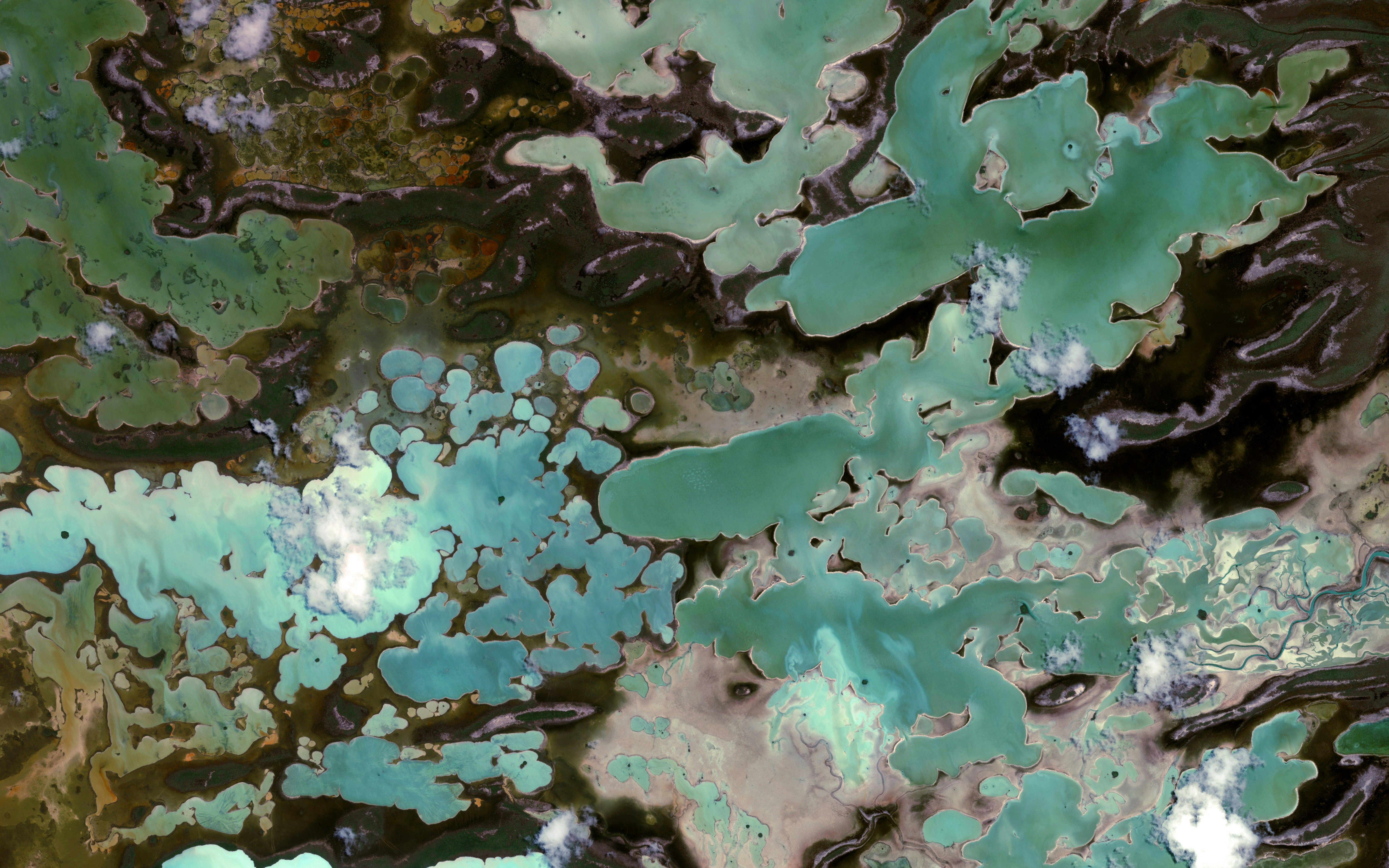
West Side National Park
24.568192°,-78.154290° - Maxar
West Side National Park is a 2,343-square-mile (6,070-sq.-km) marine protected area on the western half of Andros Island, the Bahamas. A mix of shallow tidal flats, mangrove creeks and Caribbean pines, the park has little infrastructure and is only accessible by boat. It serves as an important feeding area for the West Indian Flamingo, a productive fish nursery and a refuge for many endemic and endangered species.
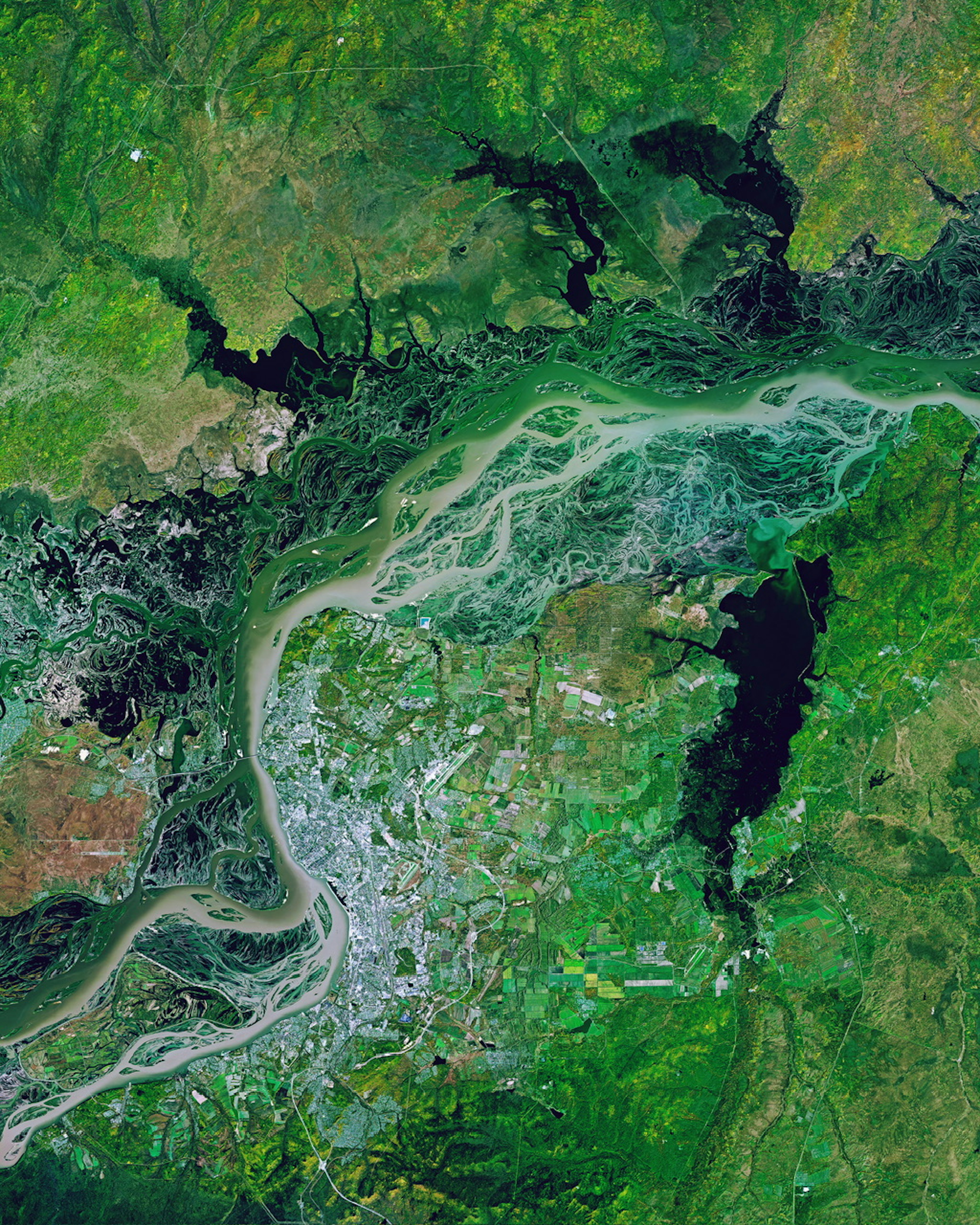
Amur River
48.536111°,135.000000° - Planet
The Amur River passes through the city of Khabarovsk, spreading out into a dramatic braided pattern on its path through eastern Russia. As the world’s tenth-longest river, the Amur flows 1,755 miles (2,824 km) to form much of the border between the Russian Far East and Northeastern China. The first permanent bridge across the Amur was built in Khabarovsk in 1916, allowing the Trans-Siberian Railway to cross the 1.6-mile (2.6 km) span more efficiently.
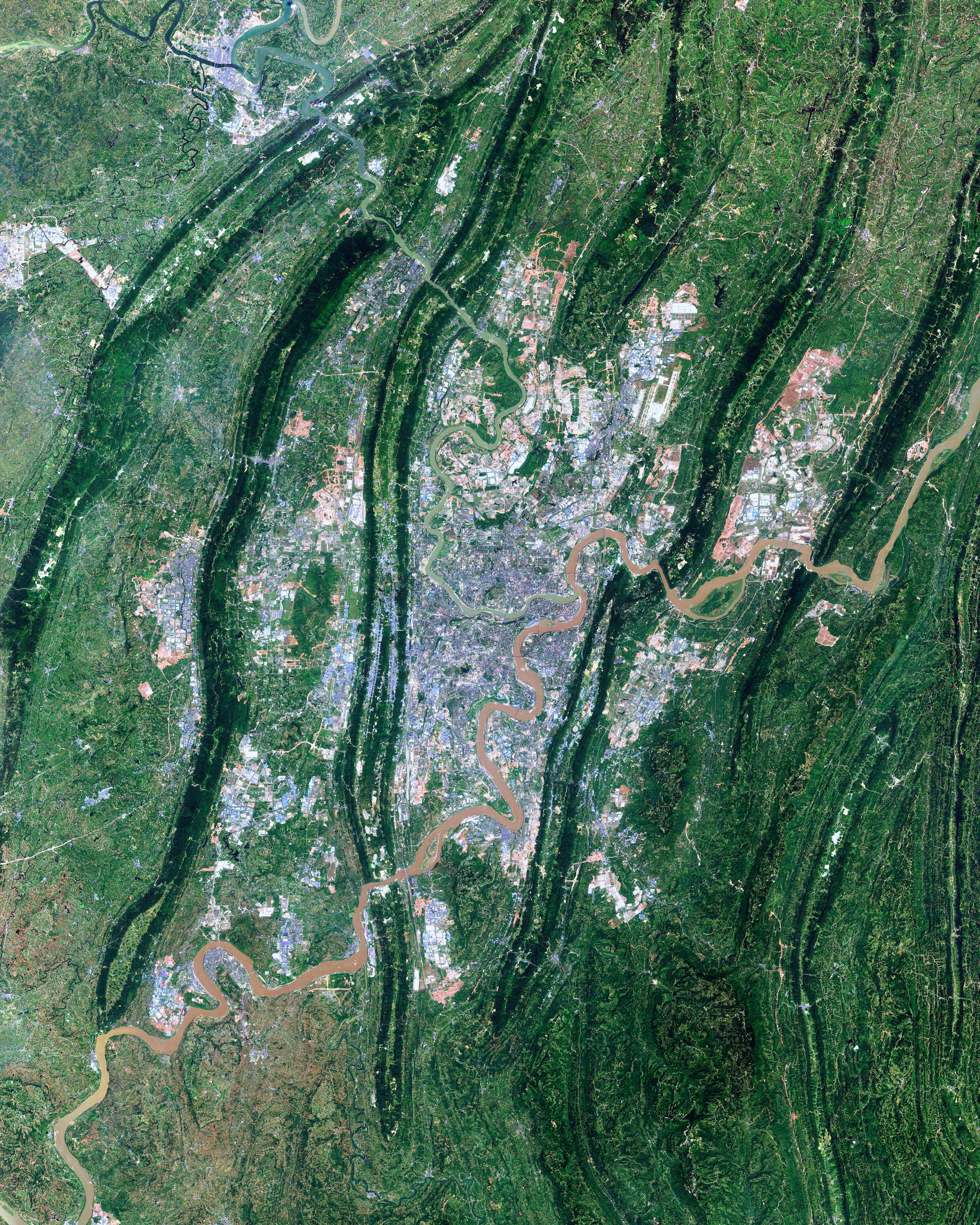
Chongqing Metropolis
29.563700°,106.550400° - Maxar
Chongqing is a sprawling municipality at the confluence of the Yangtze and Jialing rivers in southwestern China. The metropolis covers an area the size of Austria – 31,816 square miles (82,403 square km) – and is crisscrossed by folds of mountain ranges, valleys, gorges and caves. Chongqing is China’s most populous municipality, with about 32 million people living across its 26 districts, eight counties and four autonomous counties.
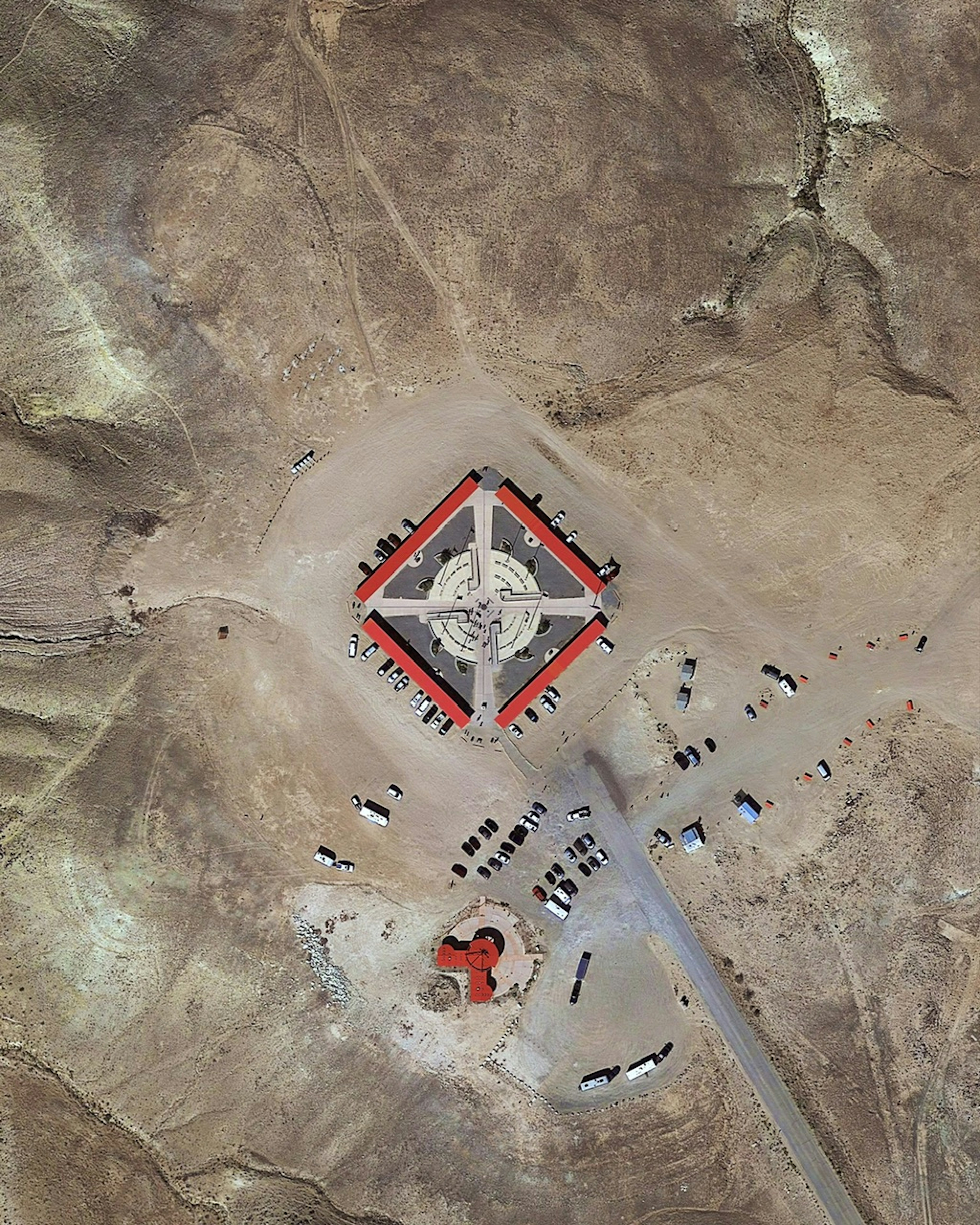
Four Corners Monument
36.998977°,-109.045172° - Maxar
Four Corners Monument marks the quadripoint in the Southwestern United States where the states of Arizona, Colorado, New Mexico, and Utah meet. It is the only point in the United States shared by four states, and it also marks the boundary between two semi-autonomous Native American governments: the Navajo Nations and the Ute Mountain Ute Tribe. Visitors to the monument can position themselves at its center and “stand in four states at once.”
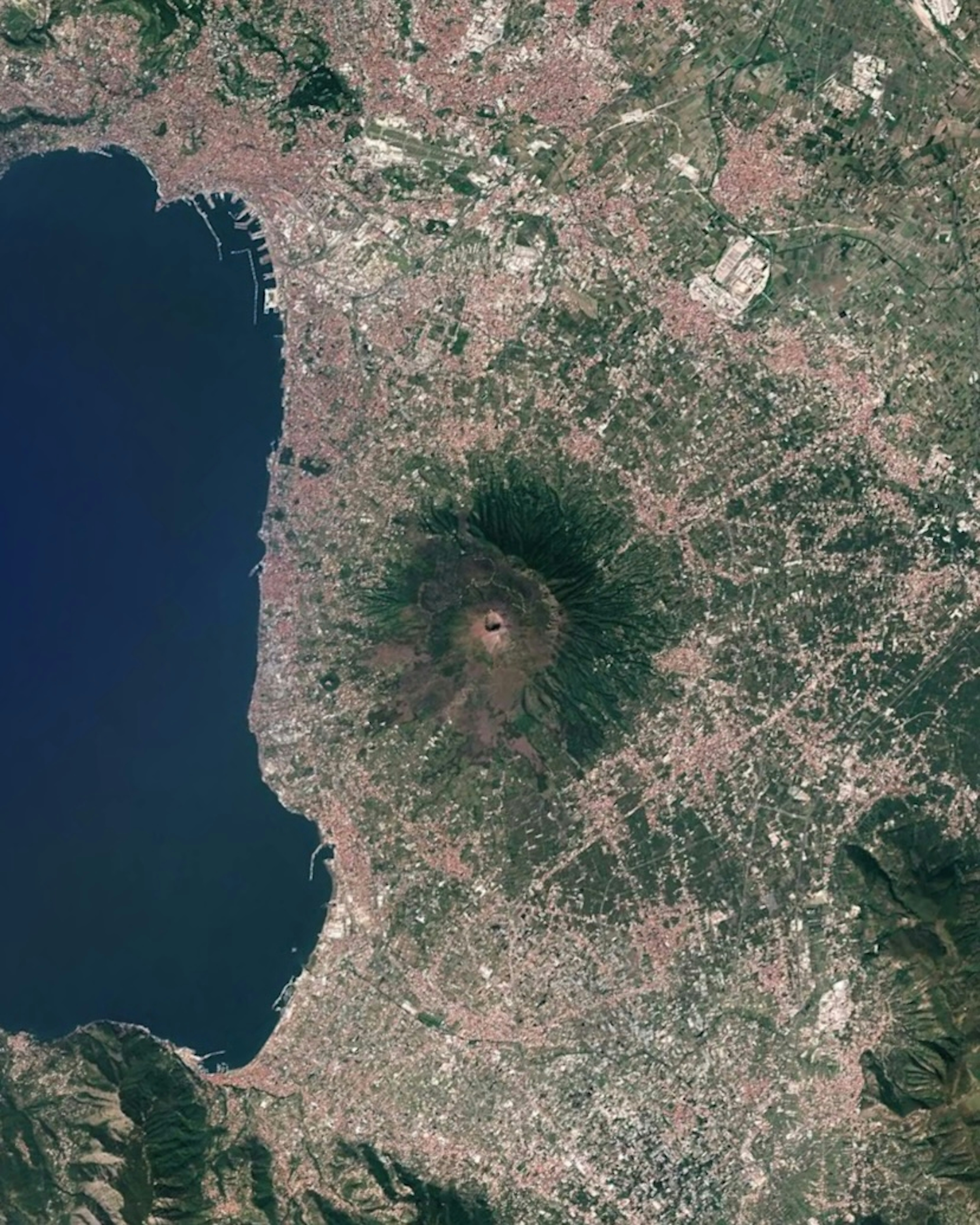
Naples and Vesuvius
40.833300°,14.250000° - Google Timelapse
The Metropolitan City of Naples is the third-largest city in Italy and one of the most densely populated areas in Europe, with more than 3 million inhabitants. Its population has continued to grow in recent decades, despite its proximity to Mount Vesuvius, an active volcano. Around 600,000 people live in Vesuvius’s “zona rossa” — an area around its slopes designated for quick evacuation if an eruption occurs.
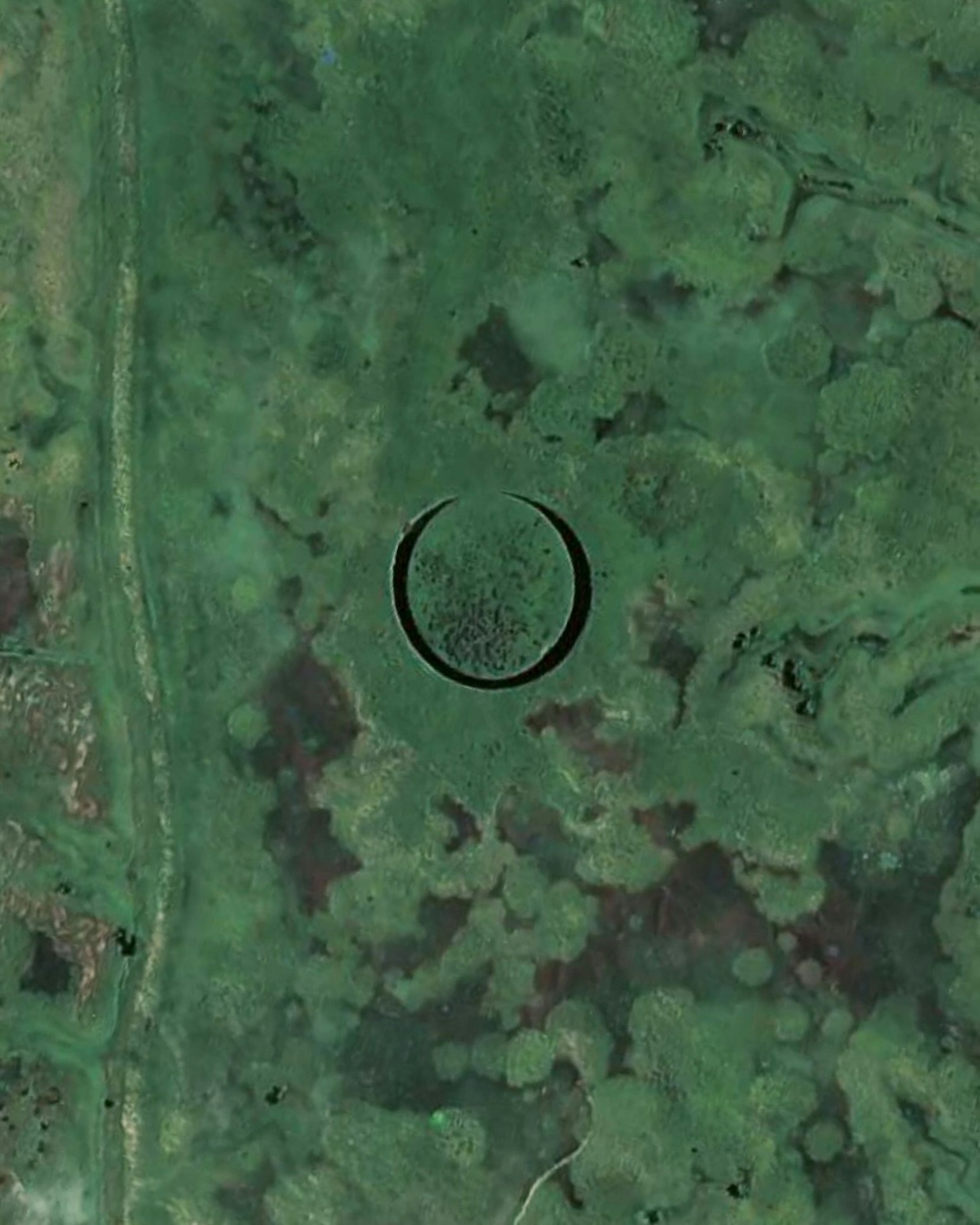
El Ojo
-34.252137°,-58.829684° - Maxar
El Ojo, or “The Eye,” is an unusual island found in the marshland of the Parana Delta, in northeastern Argentina. Circular and about 387 feet (118 m) in diameter, the island appears to float and rotate on its axis, surrounded by a thin channel of water. Some say El Ojo hides a UFO base, but researchers believe a slow-moving water current beneath the island naturally spins it, and this rotation has caused it to gradually erode into a circular shape.
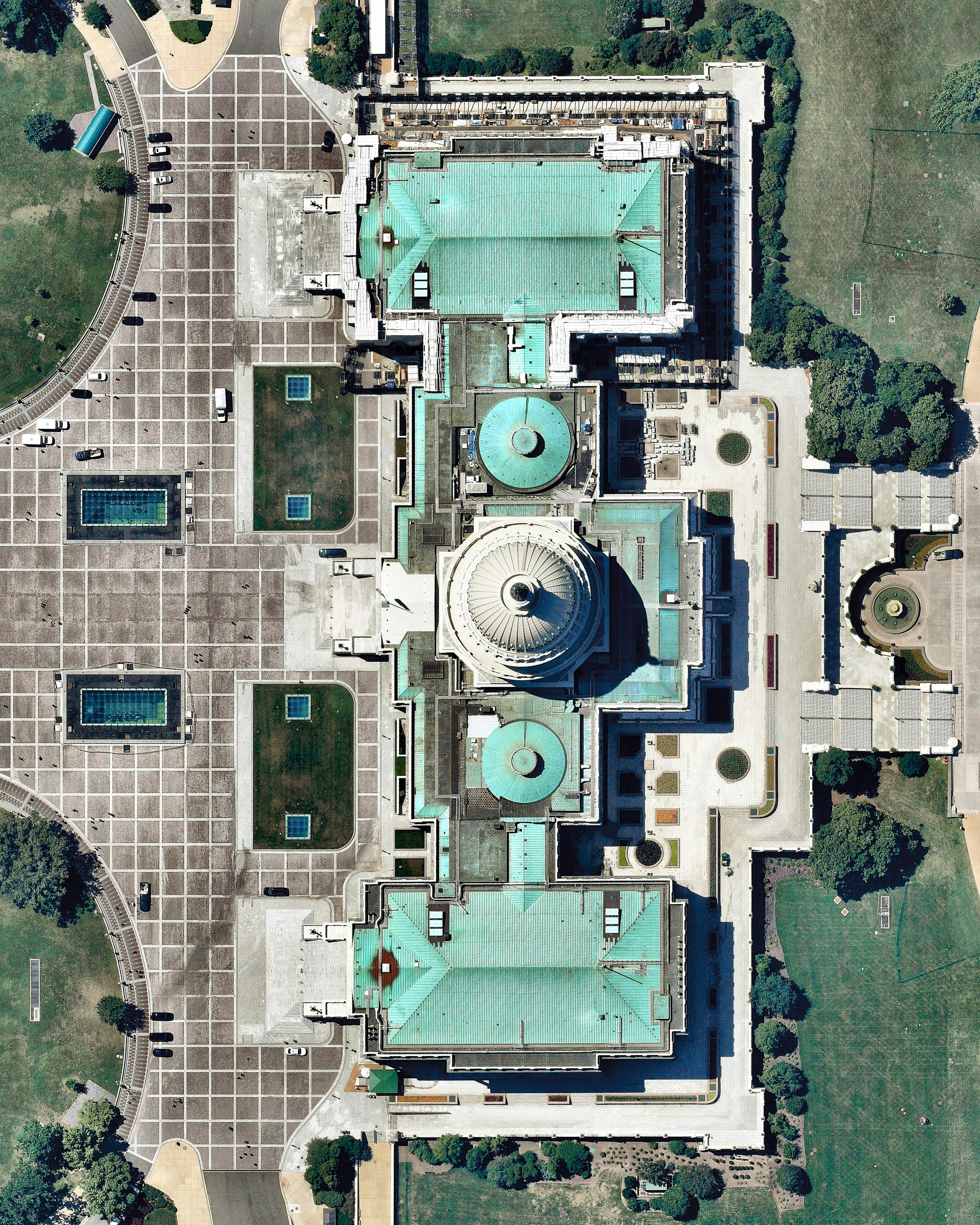
US Capitol Building
38.889806°,-77.009056° - Nearmap
The United States Capitol, often called the Capitol Building, is the meeting place of the United States Congress and the seat of the legislative branch of the U.S. federal government. It is located on Capitol Hill at the eastern end of the National Mall in Washington, D.C. Today is Election Day in the USA, and although it is an off-year, important state and local elections are taking place across the nation. If you have not done so already, we encourage you to cast your vote!
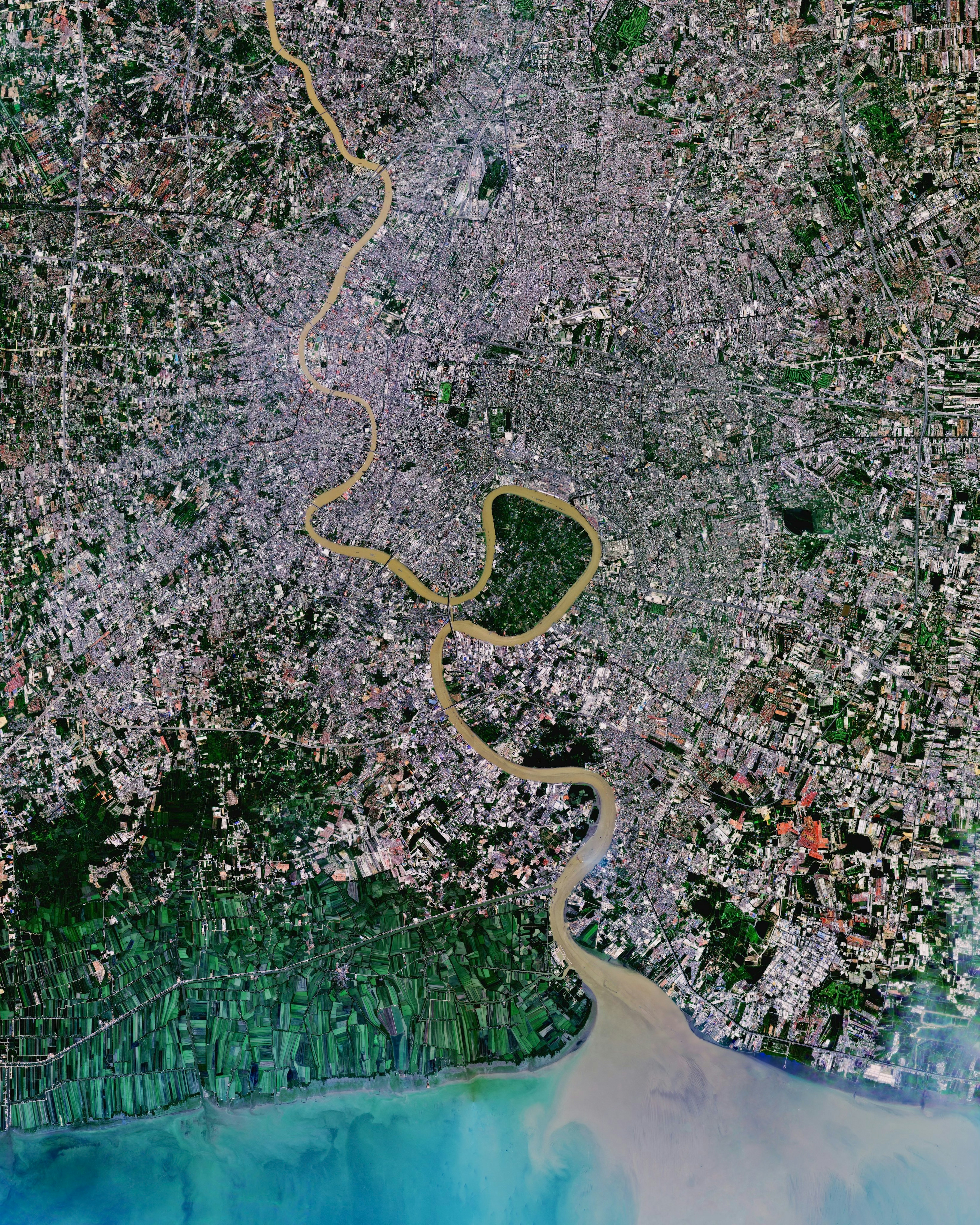
Bangkok
13.752500°,100.494167° - Planet
Bangkok, the capital city of Thailand, is a sprawling urban center home to more than 10 million people. It is one of the most densely populated cities in the world, with an average of about 14,000 people per square kilometer. Located on the Chao Phraya River, it is a city of vibrant contrasts, with ancient temples still standing amid modern skyscrapers.
El Alto-La Paz
-16.504722°,-68.163333° - Google Timelapse
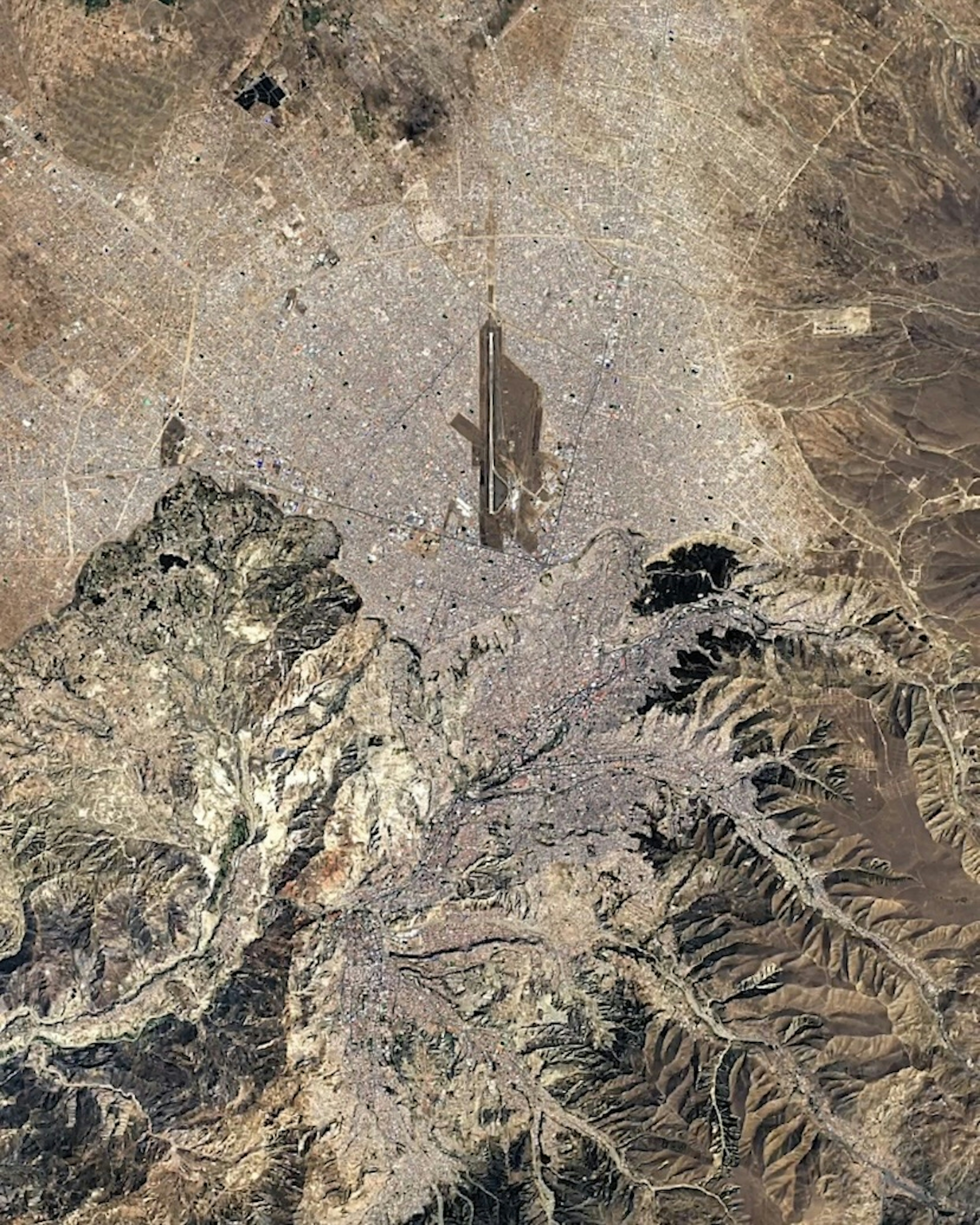
The El Alto-La Paz metropolitan area, in western Bolivia, has grown dramatically in recent decades. Much of its population boom is owed to El Alto, which has grown tenfold since the mid-1970s, from about 100,000 residents to nearly 1 million today. El Alto is located adjacent to, and above, La Paz in the Altiplano highlands — it is the highest major city in the world at an average elevation of 4,000 meters (13,123 ft).
Alcatraz Island
37.826667°,-122.422778° - Nearmap
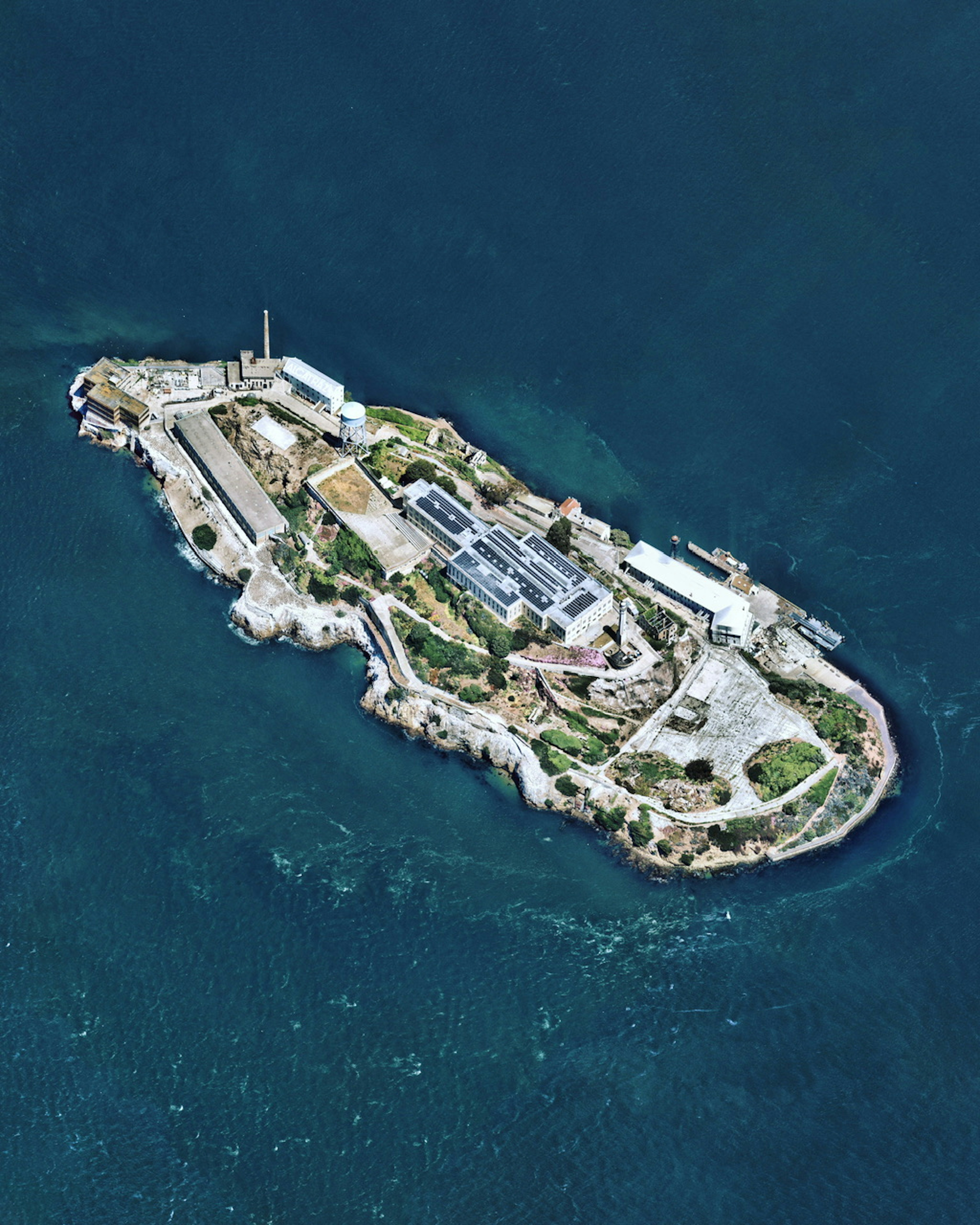
Alcatraz is a small island 1.25 miles (2 km) offshore from San Francisco, California. Originally developed in the mid-19th century with a lighthouse and military fortifications, Alcatraz was converted into a federal prison in 1934. Strong currents around the island and cold water temperatures made escape nearly impossible, earning Alcatraz Federal Penitentiary a reputation as one of the most notorious prisons in American history. The prison closed in 1963, and the island is now a major tourist attraction.
Port of Callao
-12.052222°,-77.139167° - Maxar
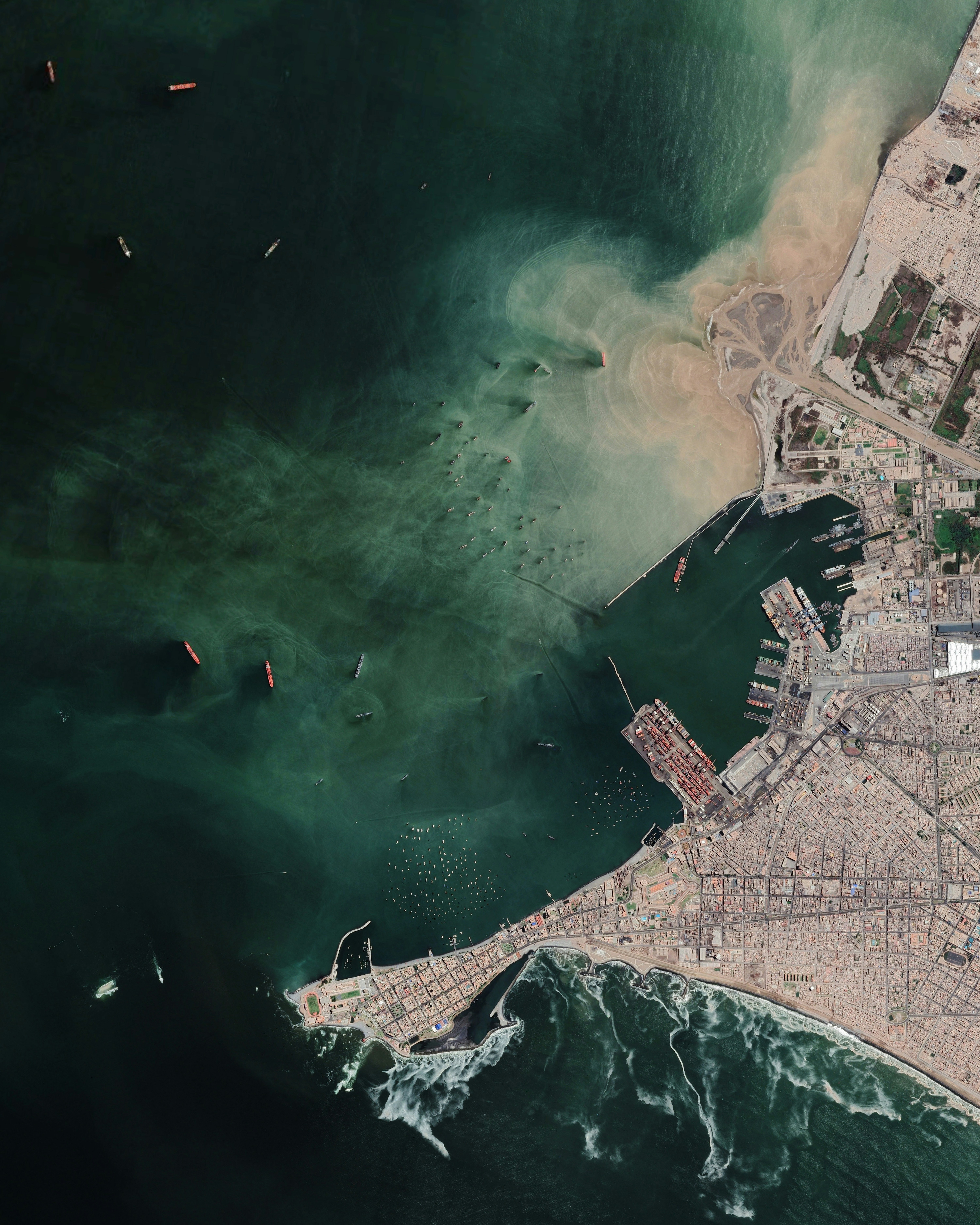
The Port of Callao is a maritime port on the central coast of Peru, serving as the de facto port for the city of Lima. It is one of the busiest ports in Latin American and the Caribbean, moving more than 2.3 million twenty-foot equivalent units (TEUs) of cargo in 2018. Just north of the port is the Rímac River, seen in this Overview depositing large amounts of sediment into the Pacific Ocean.
Littleton Corn Maze
39.552208°,-105.100049° - Nearmap
Nothing says Halloween like pumpkin patches and corn mazes! Here’s a corn maze at the Denver Botanic Gardens Chatfield Farms in Littleton, Colorado. Do you think you could navigate through this seven-acre (28,000-square-meter) maze?
Lençóis Maranhenses Timelapse
-2.533333°,-43.116667° - Planet / Google Timelapse
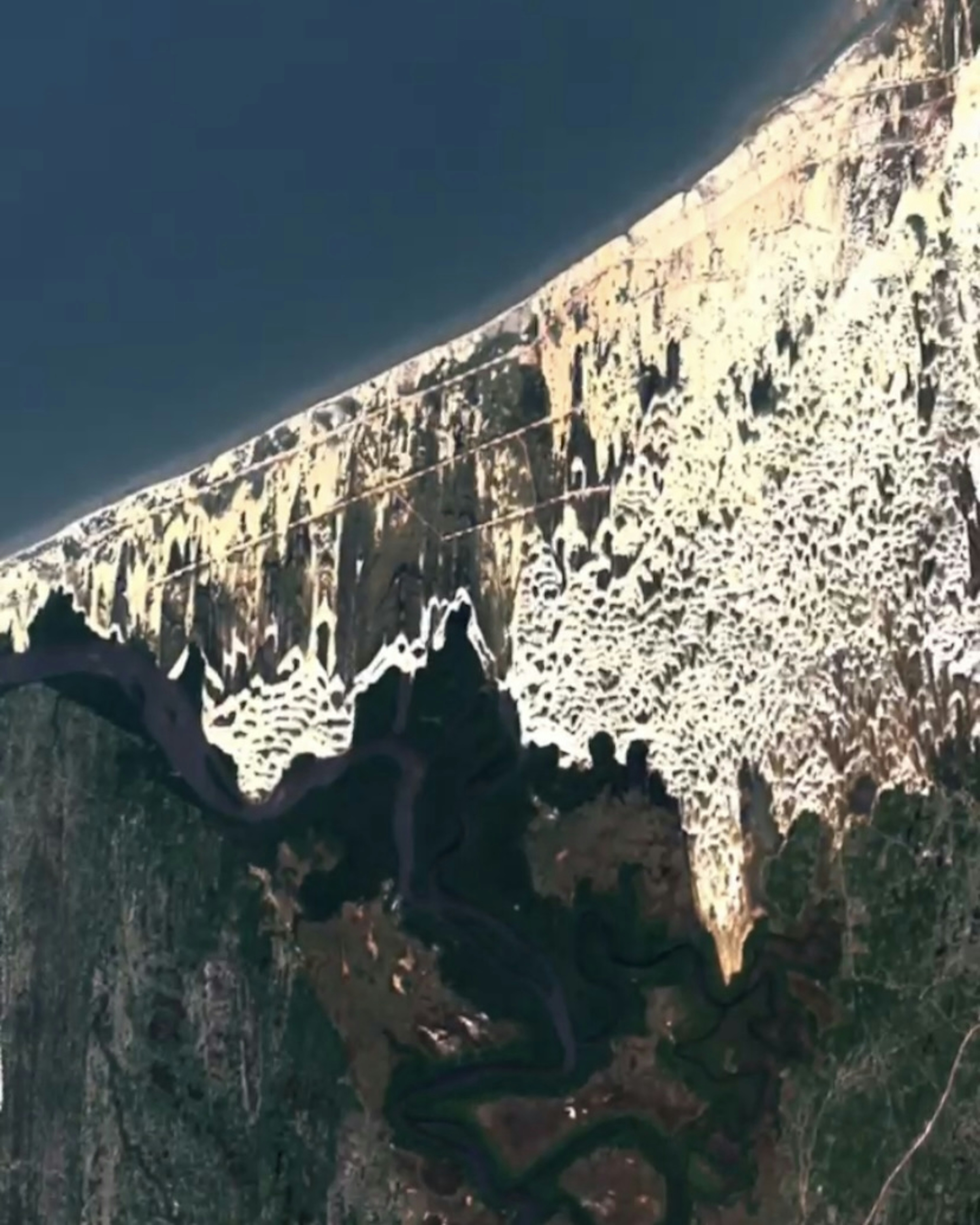
Visit our Instagram @dailyoverview to see a Timelapse of sand dunes shifting over time in a section of Brazil’s Lençóis Maranhenses National Park. Sand is carried to the park from the interior of the country by the Parnaíba and Preguiças rivers, where it is then driven back inland by coastal winds that blow up to 50 kilometers (31 miles) per hour. The tallest dunes in the park rise to heights of 40 meters (130 feet).
Besni District
37.532097°,37.943359° - Maxar
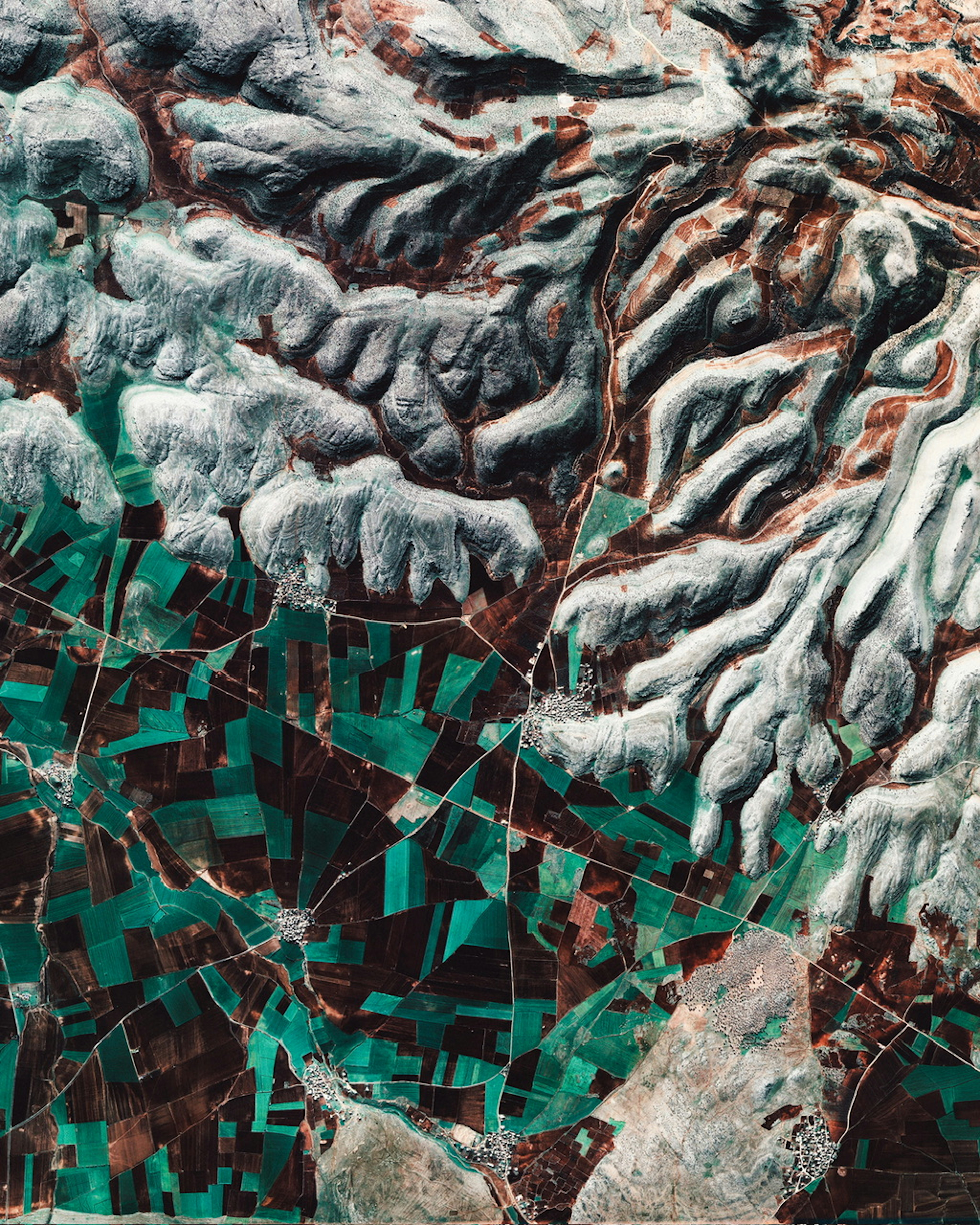
Farmland creates a vibrant pattern against the foothills of the Taurus Mountains in Besni District, southeastern Türkiye. This region contains human settlements that date back thousands of years and is not far from the Fertile Crescent, where agriculture first emerged. Crops grown here include pistachios, pomegranates, almonds, walnuts, olives, apples and mulberries.
Acapulco
16.863611°,-99.882500° - Maxar
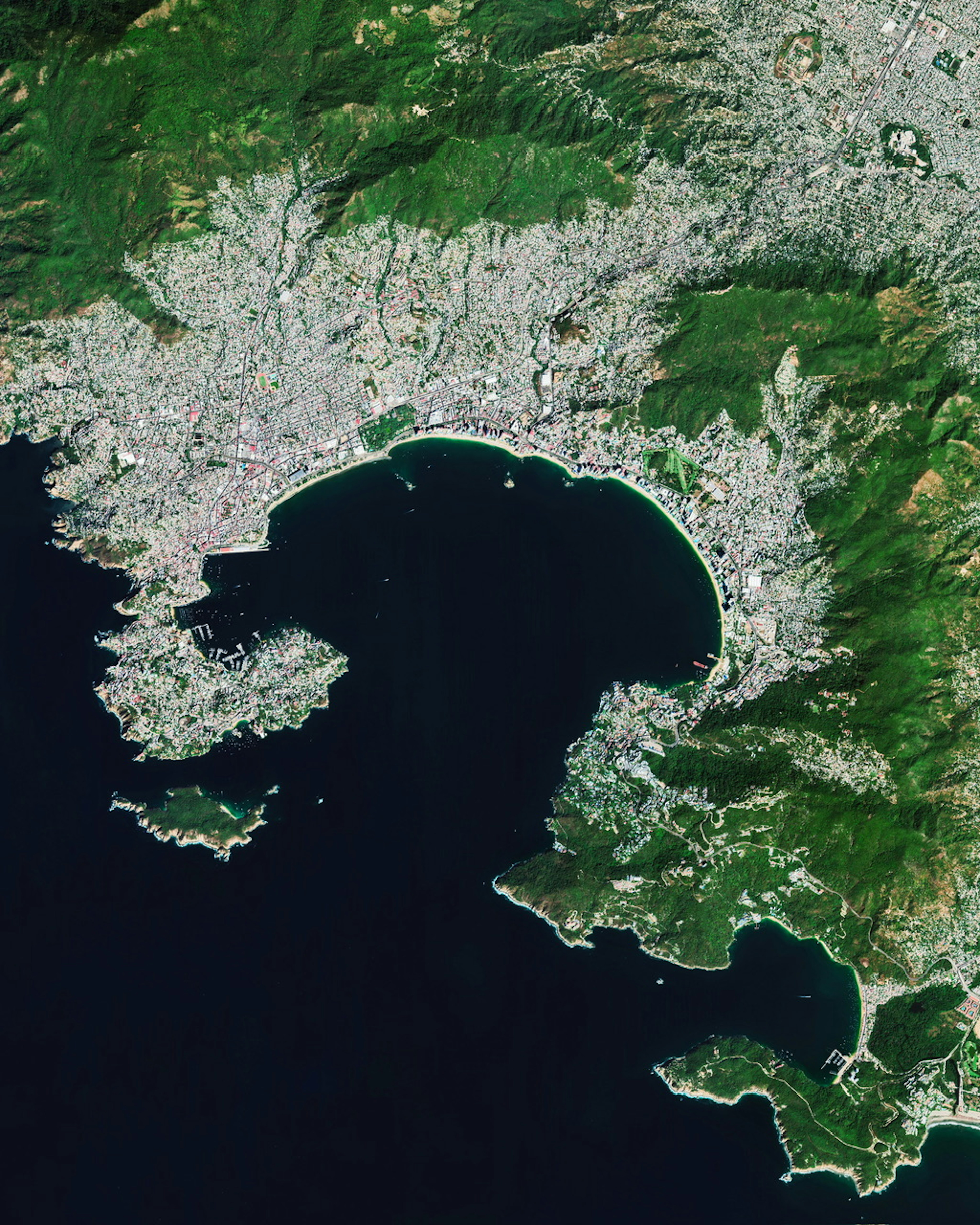
Acapulco, a resort city on Mexico’s Pacific Coast, was struck overnight by Hurricane Otis as a Category 5 storm with 165-mph (265-kmh) winds. Otis caught many by surprise, rapidly intensifying by more than 110 mph (177 kmh) in just 24 hours. Acapulco, a city of more than 852,000, had all power and internet service knocked out, effectively cutting it from outside communication.
Taal Volcano
14.010000°,120.997500° - Maxar
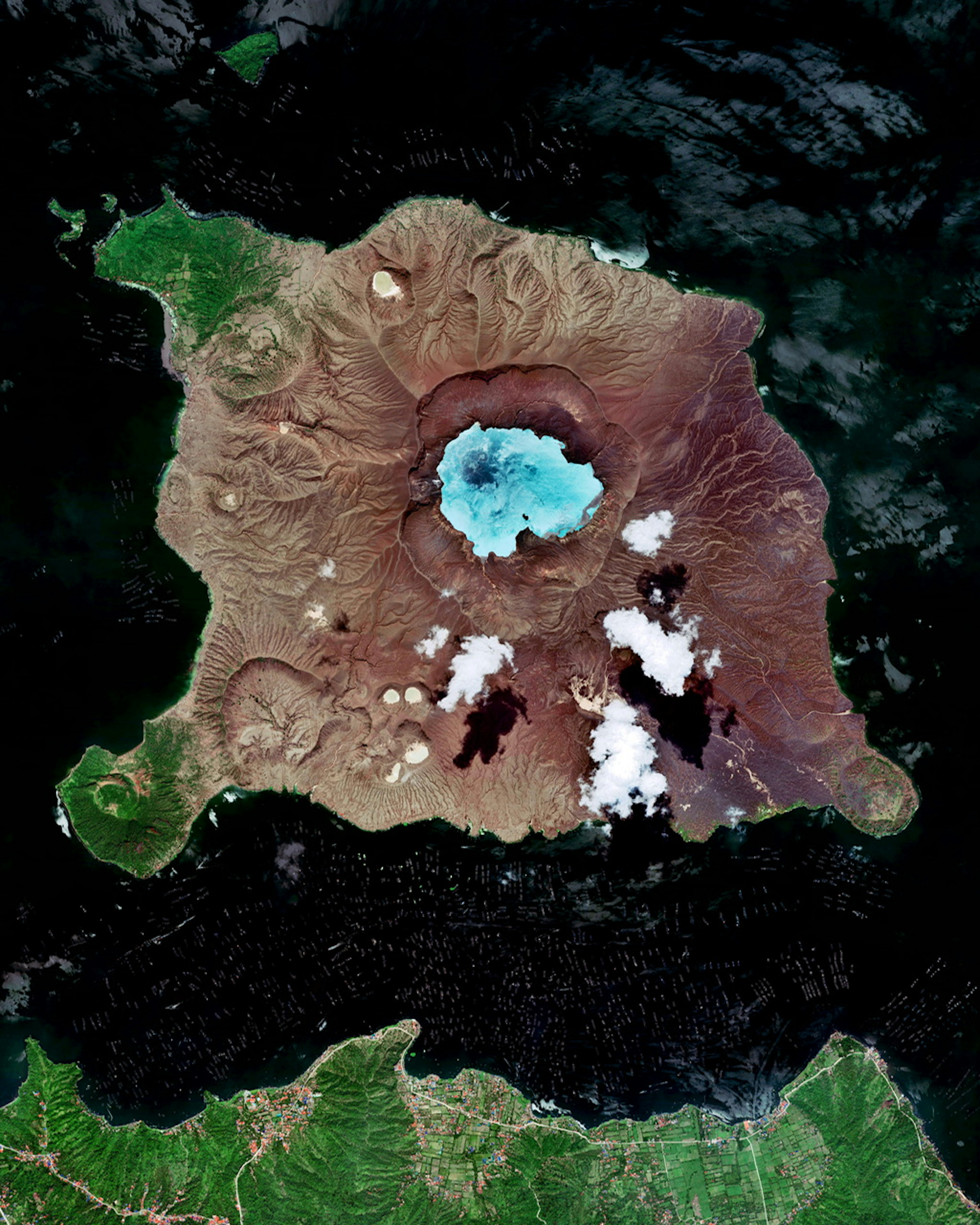
Taal is an active stratovolcano located on the southwestern end of Luzon Island, Philippines. It has a crater lake at its center, and the entire 8.9-square-mile (23 sq. km) volcanic island lies within a larger caldera, also known as Taal Lake. Even its crater lake contains a small island, Vulcan Point, which is one of few "islands in a lake on an island in a lake on an island" in the world.
Dalma Island
24.516667°,52.316667° - Maxar
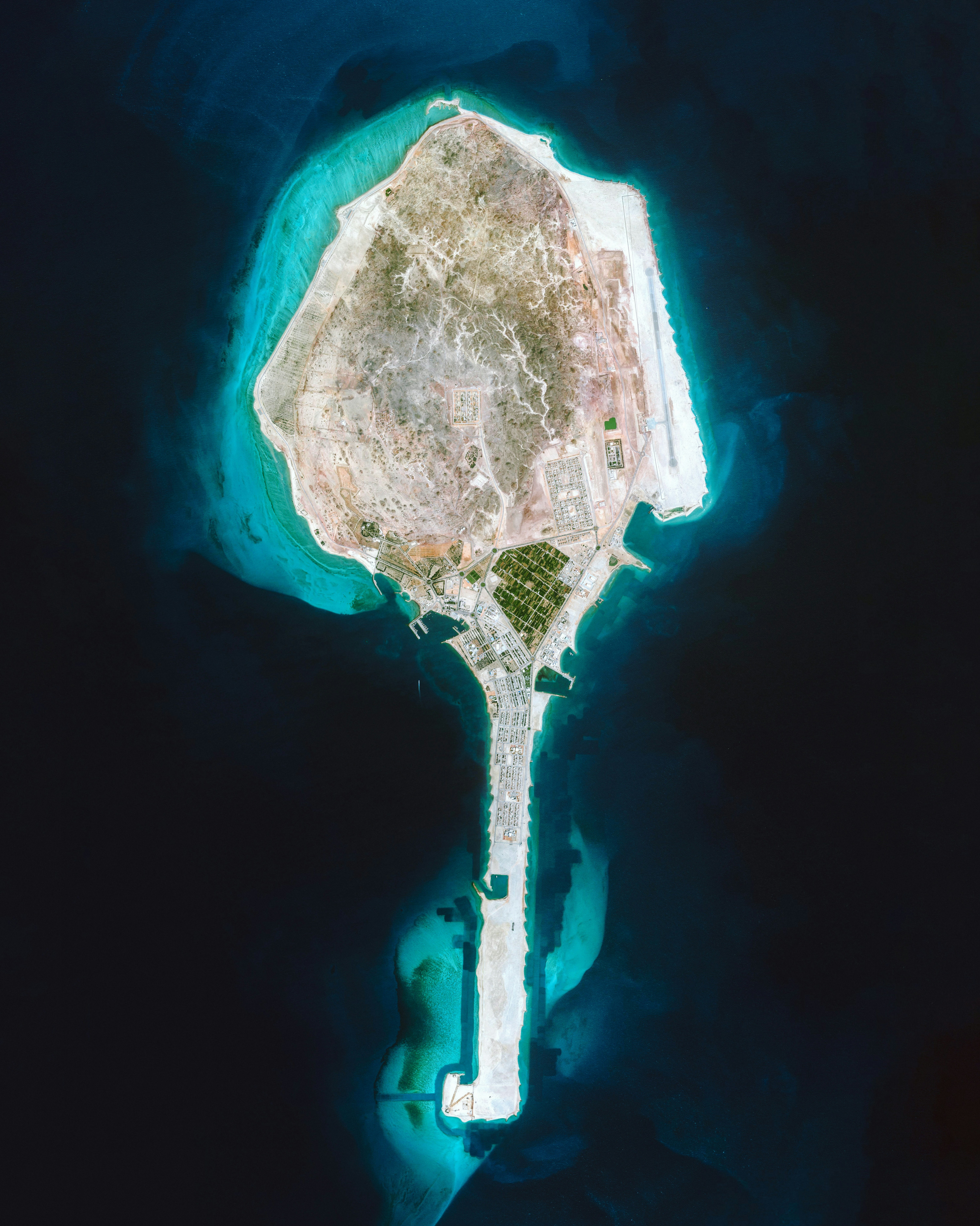
Dalma Island, part of the UAE, is located in the Persian Gulf approximately 26 miles (42 km) off the coast of Abu Dhabi. It has a population of about 10,000, most of whom are fishermen or farmers. With multiple freshwater wells, Dalma is able to support extensive vegetable fields and fruit orchards.
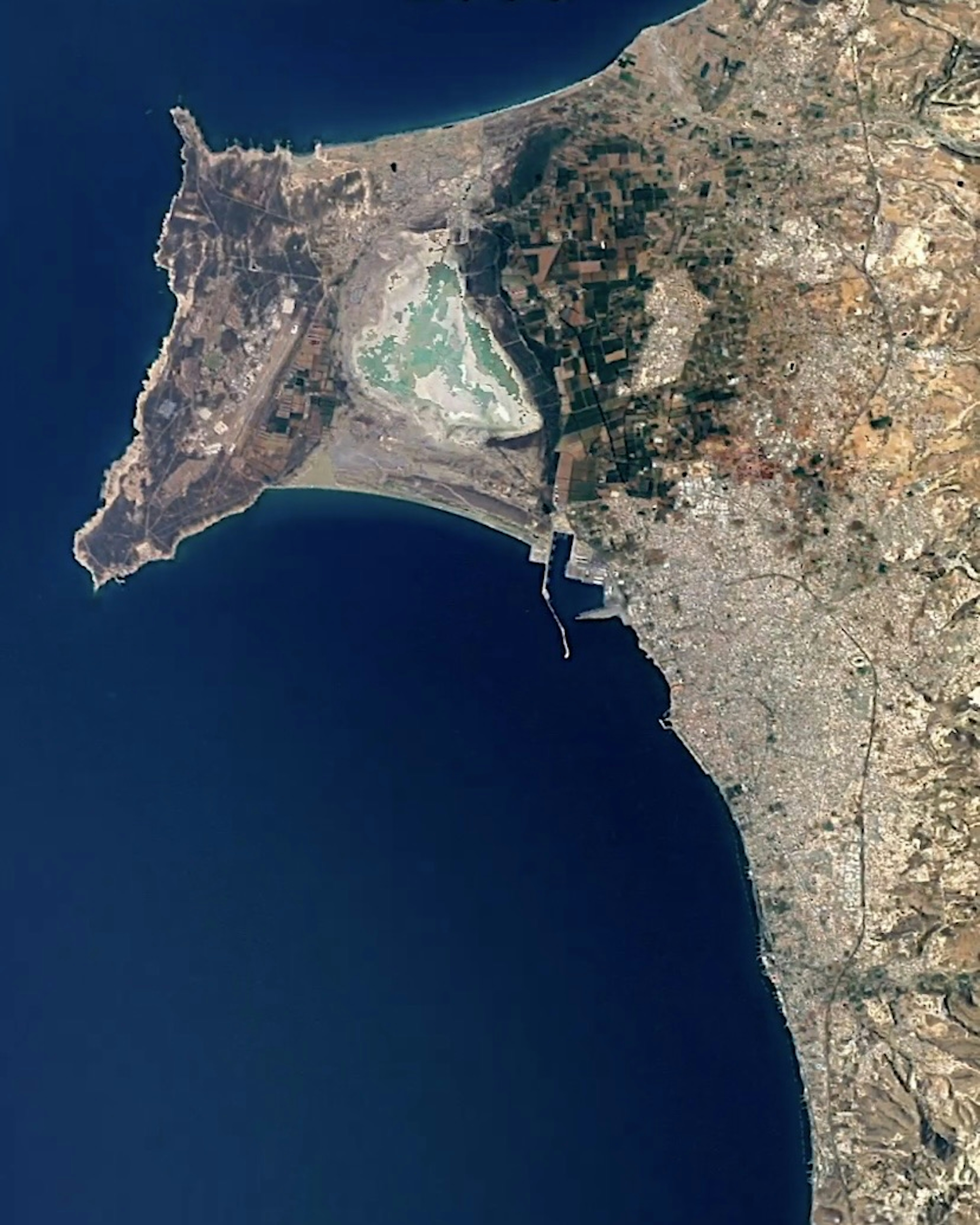
Limassol Salt Lake
34.612819°,32.964386° - Google Timelapse
Limassol Salt Lake is the largest inland body of water on the island of Cyprus, covering 4.11 square miles (10.65 sq km). Since its deepest point is only about three feet (one meter), it frequent dries and refills, causing its appearance to vary from the Overview perspective. It is considered one of the eastern Mediterranean region’s most important wetlands, providing a seasonal habitat for thousands of greater flamingos.
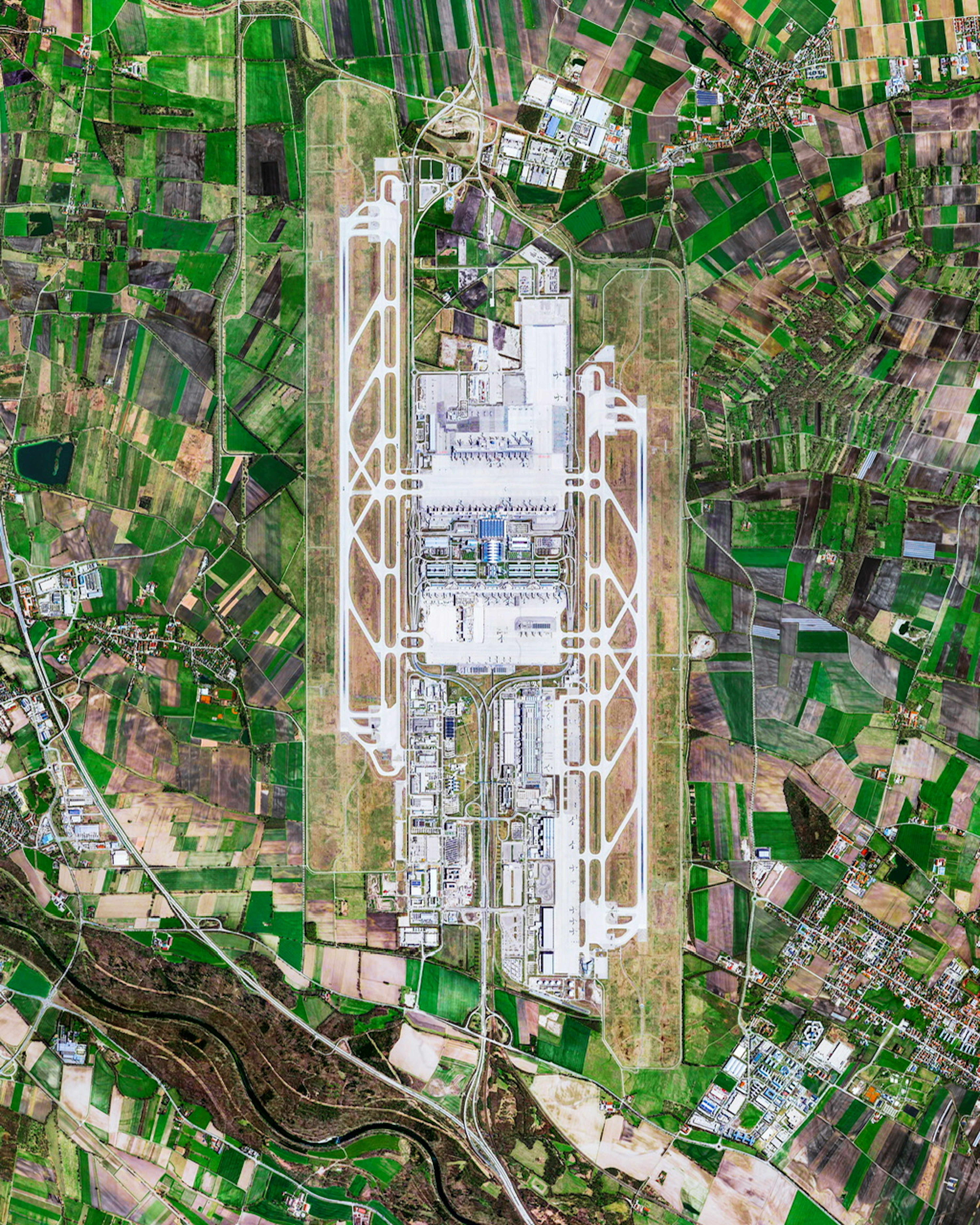
Munich Airport
48.353889°,11.786111° - Maxar
Munich Airport, also called Munich Franz Josef Strauss Airport, is an international airport serving Munich and Upper Bavaria, Germany. In 2019, it was the second-busiest passenger airport in Germany and the ninth-busiest in Europe, handling 47.9 million travelers. The airport is located northeast of Munich near the town of Freising, surrounded by farm fields and the Isar River.
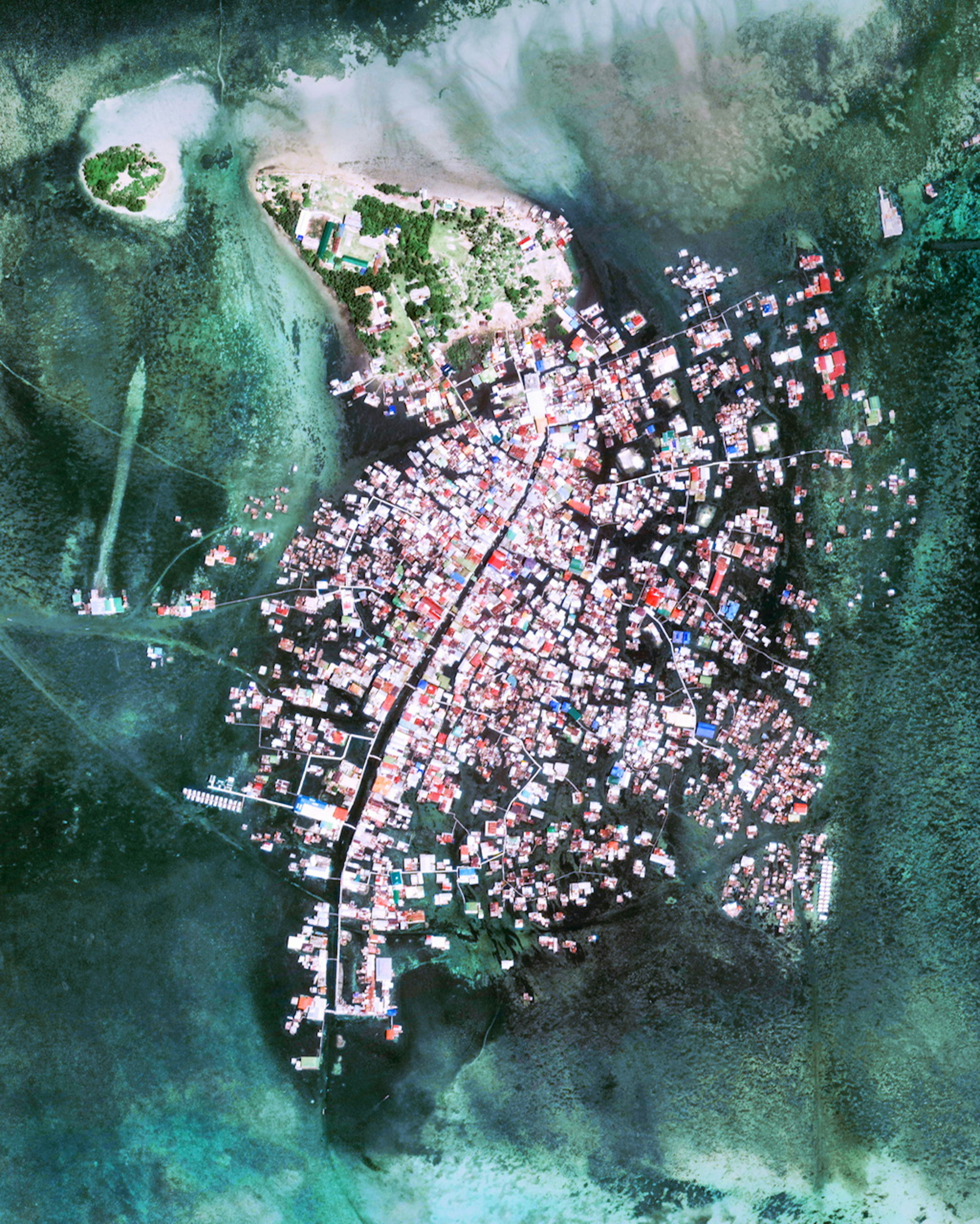
Sitangkai
4.661528°,119.391872° - Maxar
Sitangkai is a town in Tawi-Tawi Province, Philippines, with most of its infrastructure built atop stilts or piles of coral stones in the Celebes Sea. Although footbridges mostly connect one structure to another, boats are the primary mode of transportation, earning Sitangkai the nickname, “Venice of the Philippines.” It is the southernmost place in the Philippines, with a population of about 37,000.
