Daily
One regular dose of Earth from above
Wuhan, China
30.587222°,114.288056° - Planet
Wuhan, China, has made international news headlines in recent weeks after a coronavirus outbreak is believed to have originated in one of the city’s seafood markets late last year. The city is currently under quarantine to stop the spread of the virus, which has infected more than 4,400 people and killed more than 100 worldwide. Wuhan’s population of 11 million, combined with residents from other travel-restricted areas nearby, makes for a total quarantined population of more than 50 million.
PS10 Solar Power Plant
37.442222°,-6.254167° - Maxar Technologies
The PS10 Solar Power Plant is a commercial concentrating solar power station near Seville in Andalusia, Spain. It consists of 624 movable heliostat mirrors — each with a surface area of 1,300 square feet (120 square m) — that concentrate the sun’s rays to the top of a 377-foot (115-m) high tower containing a solar receiver and steam turbine. PS10 produces about 23,400 megawatt-hours of electricity per year.
Moselle Vineyards
49.837463°,6.825530° - Maxar Technologies
Vineyards surround the Moselle River in the Trier-Saarburg district of Germany. The region is recognized for its production of Riesling wines, with 9,000 hectares of land (roughly the size of Manhattan) dedicated to grape growing.
Sant Antoni de Portmany
38.977245°,1.300852° - Maxar Technologies
Ibiza is an island located in the Mediterranean Sea off the eastern coast of Spain. Covering 220 square miles (572 square km), Ibiza is roughly 10 times larger than the island of Manhattan in New York City. Sant Antoni de Portmany, the second largest town on the island, is seen here.
Port of Felixstowe
51.954171°,1.310158° - Maxar Technologies
The Port of Felixstowe is the busiest port in the United Kingdom, handling approximately 48% of the country’s containerized trade. The facility is able to accommodate ships that extend more than 1,312 feet (400 m) and have a cargo carrying capacity that is greater than half the volume of the Empire State Building.
Lanzarote
29.035000°,-13.633000° - NASA
The landscape of Lanzarote, one of the Spanish-owned Canary Islands, has been shaped by hundreds of years of volcanic activity. Located about 78 miles (125 km) off the north coast of Africa, the island contains numerous volcanic “tuff cones,” the largest of which — Caldera Blanca — measures 3,760 feet (1,140 m) across and 1,500 feet (450 m) tall. Lanzarote’s unique terrain and desert-like climate has been used to train astronauts and test Mars rovers.
Juba, South Sudan
4.862191°,31.579705° - Maxar Technologies
Juba is the capital and most populous city of South Sudan, with an estimated population of about 525,000. It became the world’s newest capital city in July 2011, when South Sudan declared its independence from the Republic of the Sudan. Juba has more than doubled in size since 2005, when a peace agreement ended the Second Sudanese Civil War, but its infrastructure is still being repaired from damages it suffered during the conflict.
Iguazu Falls
-25.695306°,-54.436735° - Maxar Technologies
Iguazu Falls, the largest waterfall system in the world, is located on the border of Argentina and Brazil. Approximately half of the Iguazu River flows into a long and narrow chasm called the Devil's Throat — the u-shaped falls seen here — that is roughly 269 feet (82 m) high. The total number of waterfalls at Iguazu fluctuates between 150 and 300, depending on the water level.
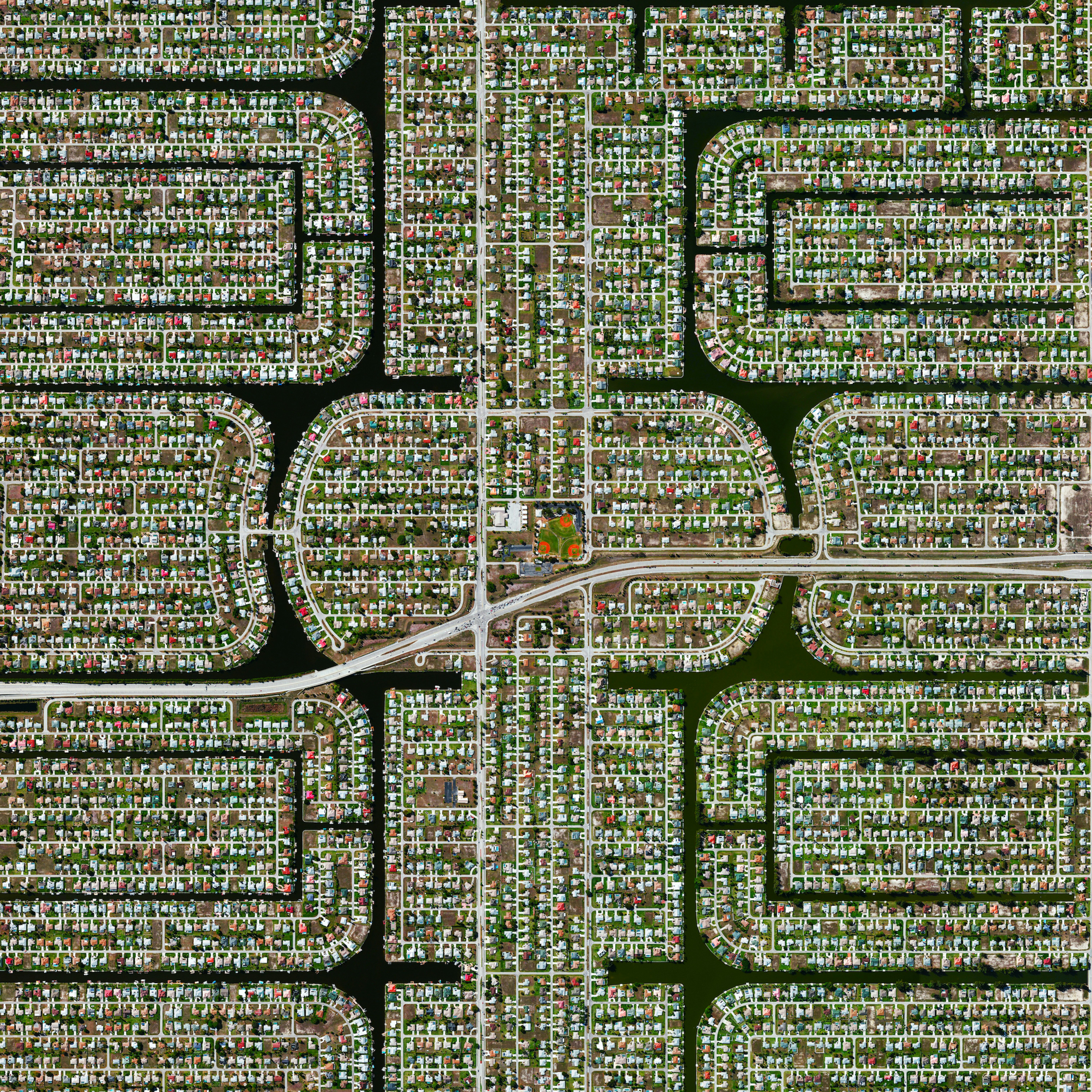
Cape Coral
26.604391°,-81.000000° - Maxar Technologies
Because many cities in the state of Florida contain master-planned communities, often built on top of waterways in the latter half of the twentieth century, a number of intricate designs are visible from the Overview perspective. Here is one particular development in Cape Coral, a city with a population of nearly 190,000 people. Cape Coral is the largest city between Tampa and Miami and has more than 400 miles (640 km) of navigable waterways.
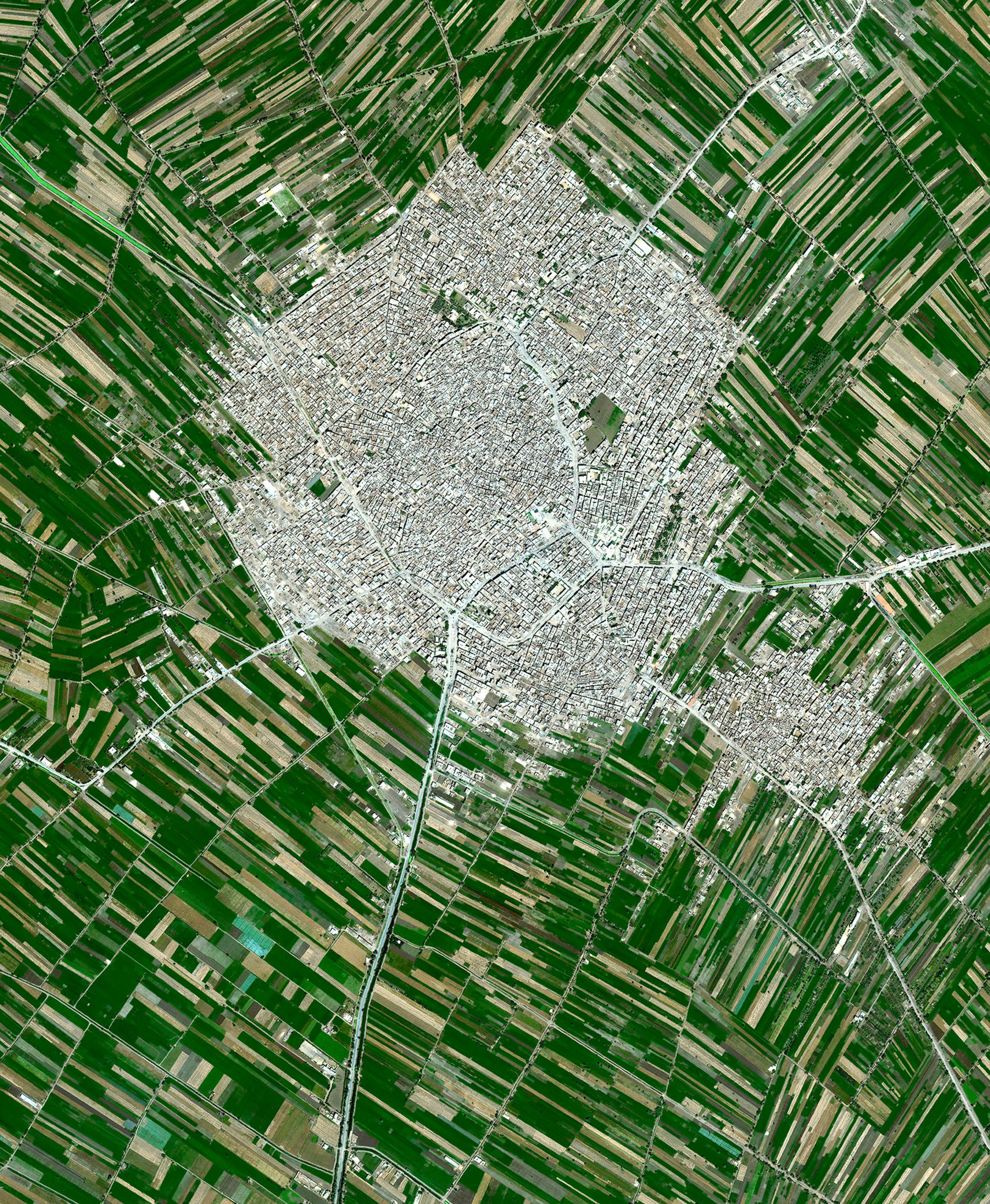
Egyptian Agricultural Development
30.122943°,31.133676° - Maxar Technologies
Agricultural development encircles the towns of Ausim and Shinbari in the Cairo Governorate of Egypt. The towns are located within the fertile area surrounding the Nile River, the country’s main source of water because it has no effective rainfall. The roughly 55 billion cubic meters of water that are used from the river each year represents more than three quarters of the country’s resources for usable water.
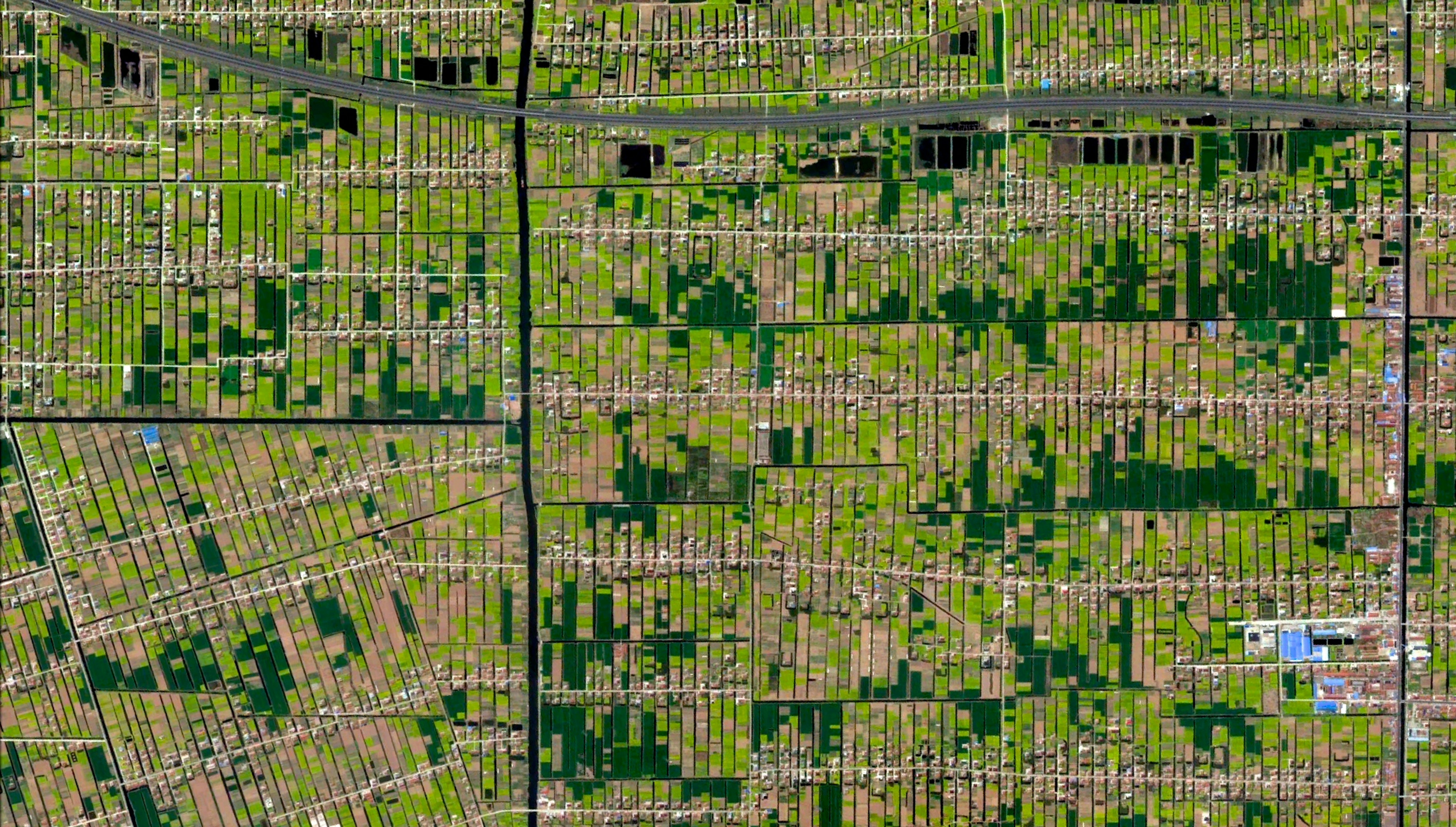
Jiulongzhen
31.887639°,121.646788° - Maxar Technologies
Individual homes and agricultural lots stretch across the landscape of Jiulongzhen in the Anhui Province of China.
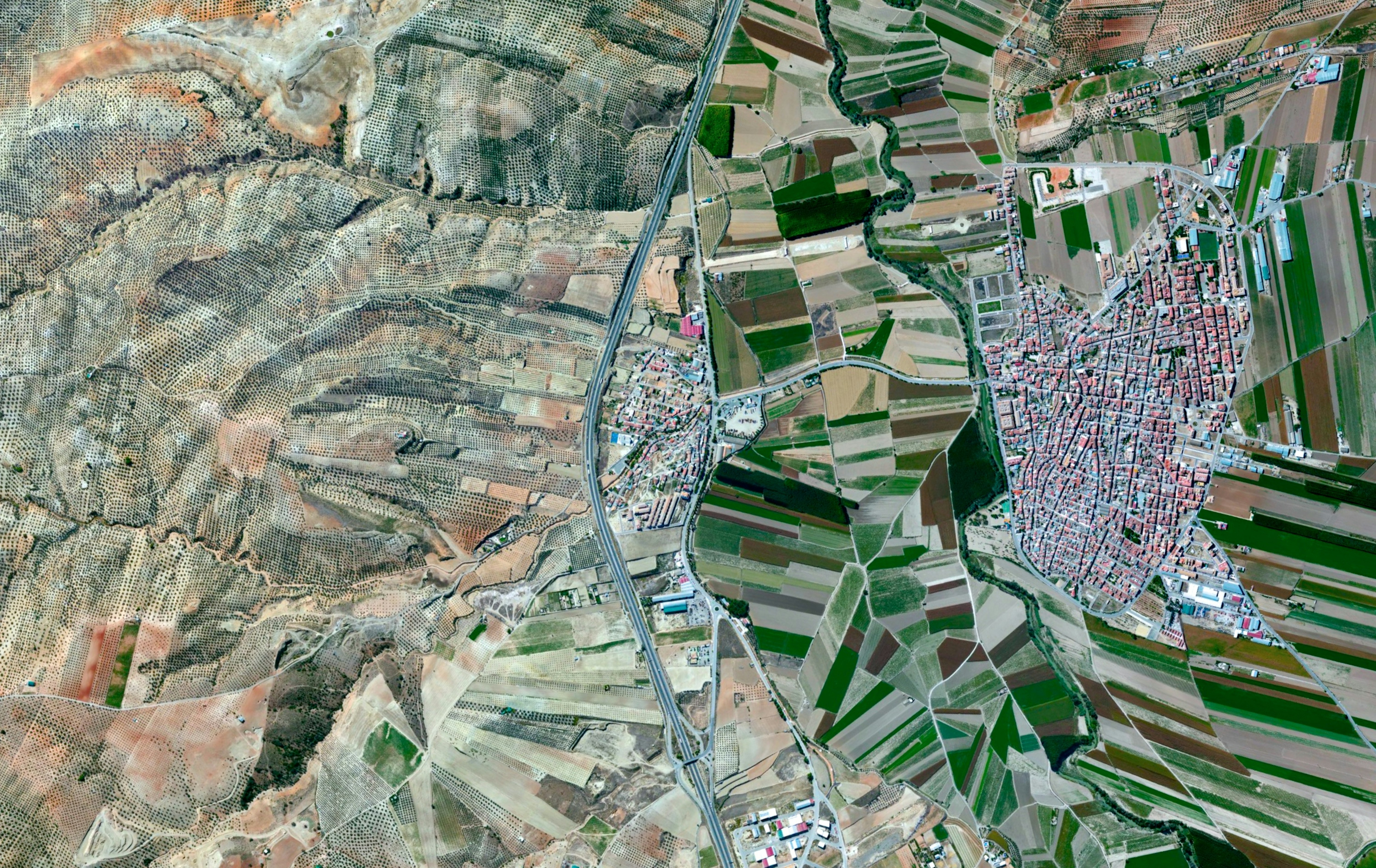
Huétor Tájar
37.194722°,-4.046389° - Maxar Technologies
Agricultural development surrounds Huétor Tájar, a small town located in the province of Granada, Spain. The primary crops grown in the municipality are asparagus and olives.
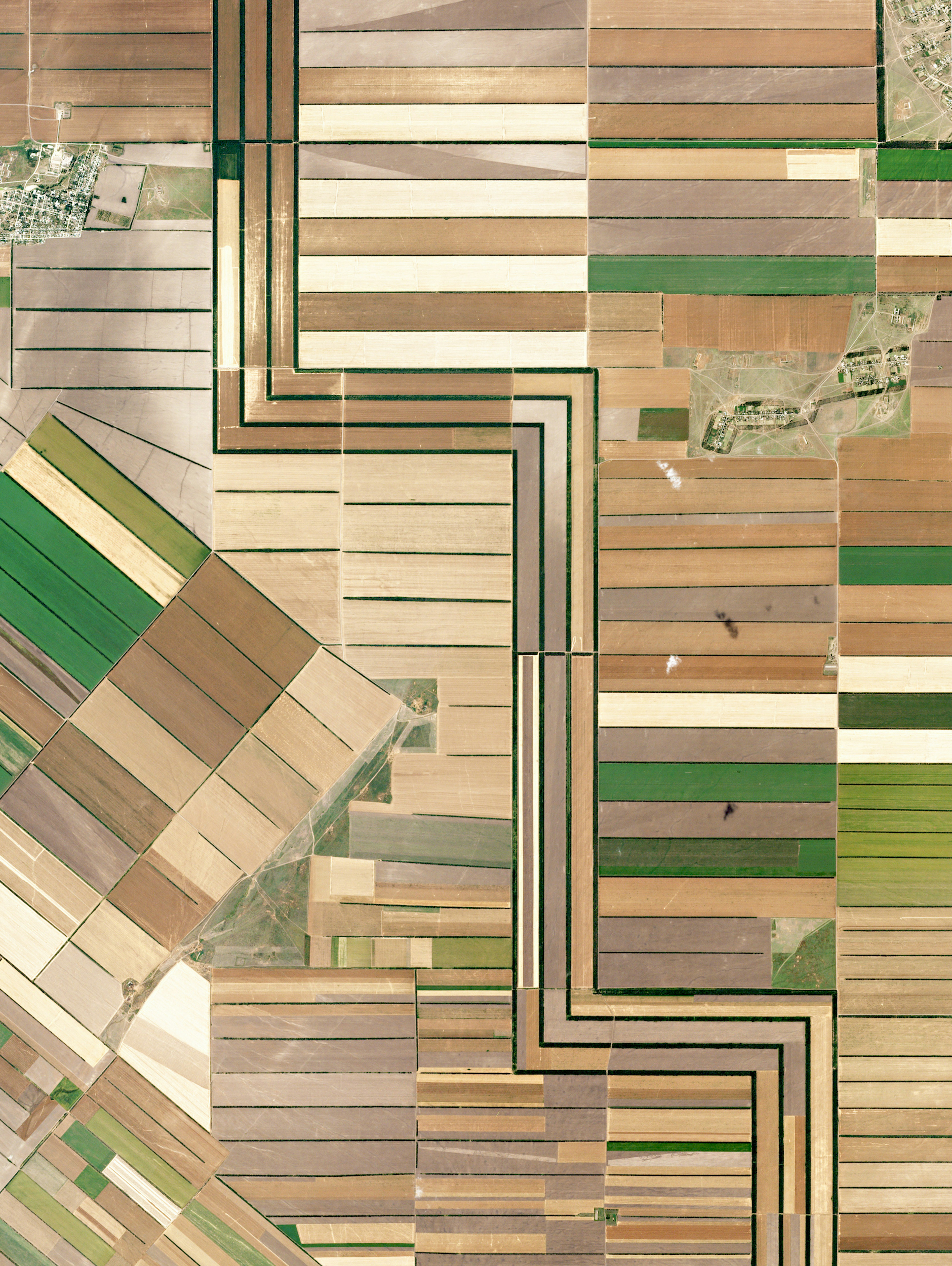
Stavrapol Krai
45.465429°,43.612853° - Planet
Agricultural development in Stavrapol Krai, Russia is made possible with water that travels down from the Caucasus Mountains. The region’s temperate climate supports grape and grain crops.
Meridian, California
38.925233°,-121.714577° - Maxar Technologies
Agricultural development in Meridian, California, is partitioned by irrigation canals that originate at the Sacramento River. On average, 9.6 million acres of cropland across the state are irrigated with 11 trillion gallons of water every year. As of 2014, farmers in California cultivated approximately half of the United State’s fruits, vegetables, and nuts.
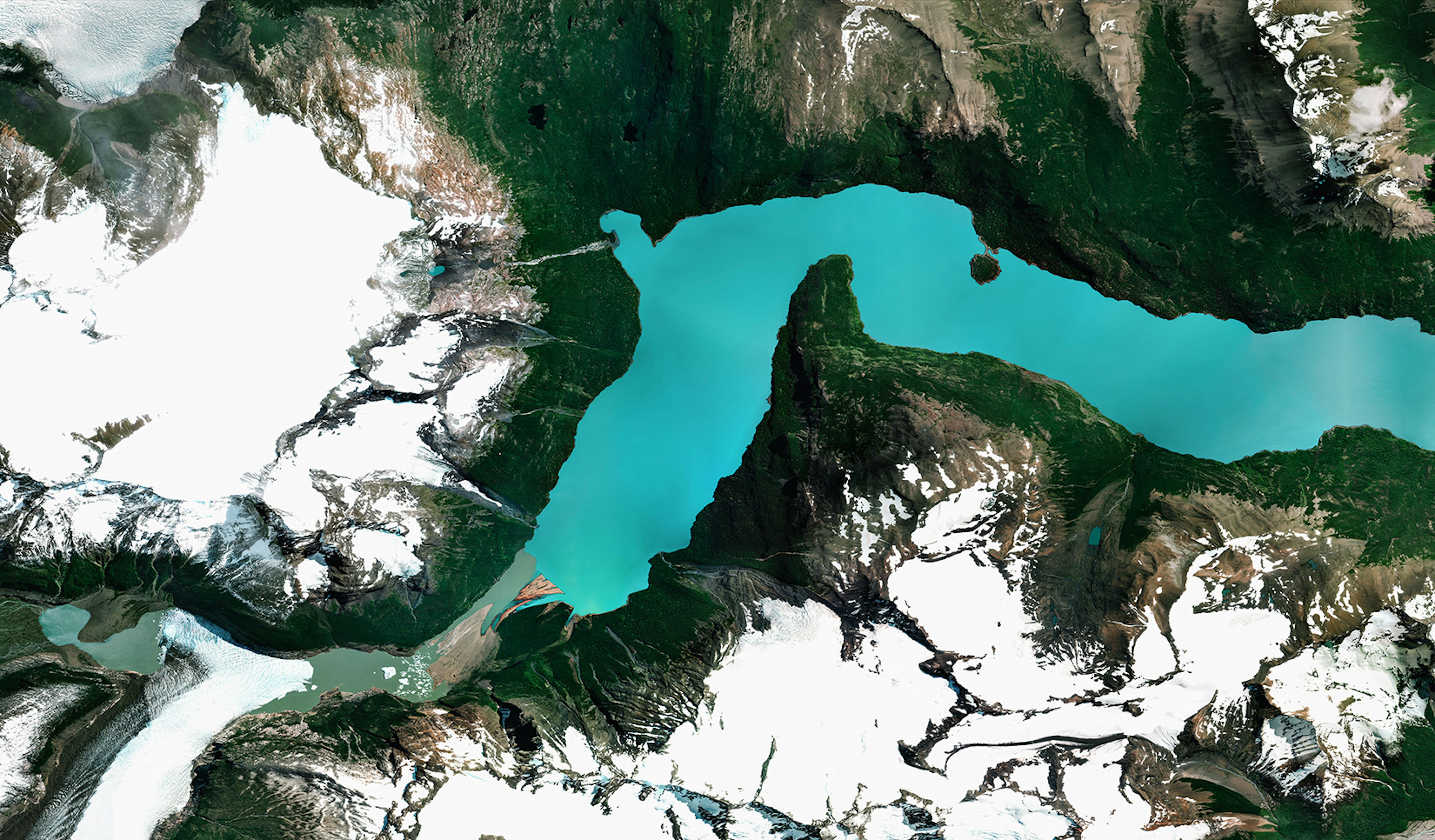
Lago Argentino
-50.216667°,-72.416667° - Maxar Technologies
Lago Argentino is the largest freshwater lake in Argentina, with a surface area of 546 square miles (1,415 square km). Located in the Patagonia region on Argentina’s southern tip, it is fed by glacial meltwater from several nearby rivers. Due to its position within Los Glaciares National Park, the lake is also a popular tourism and fishing site.
Adelaide Rift Complex
-29.791018°,137.823069° - Maxar Technologies
Rock formations of the Adelaide Rift Complex are visible in the South Australian Outback. The swirling patterns are composed of folded and faulted sediments that were deposited there in a large basin more than 540 million years ago. Since then, the land folded and faulted to become a large mountain range and then underwent extensive erosion to become the relatively low ranges that we see today. For a sense of scale, this Overview is approximately 100 square miles.
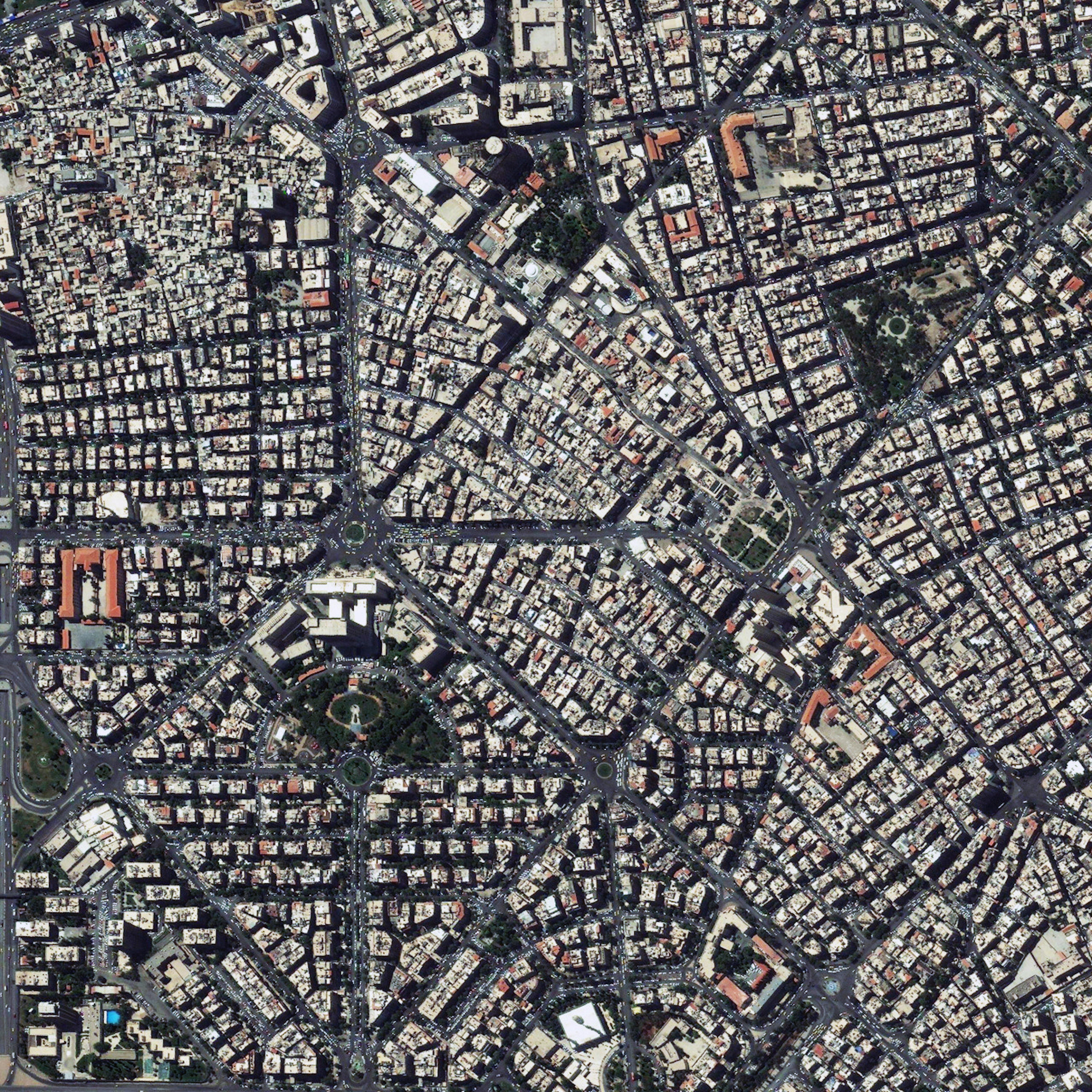
Damascus
33.521239°,36.286614° - Maxar Technologies
Damascus is the capital and most populous city in Syria, with more than 1.7 million residents. It is one of the world's oldest continuously inhabited cities, with its earliest settlement dating back to approximately 6300 BC. Damascus is a major cultural hub in the Arab world; however, in September 2019 — eight years into the Syrian Civil War — it was named the world’s least livable city by the Economist Intelligence Unit.
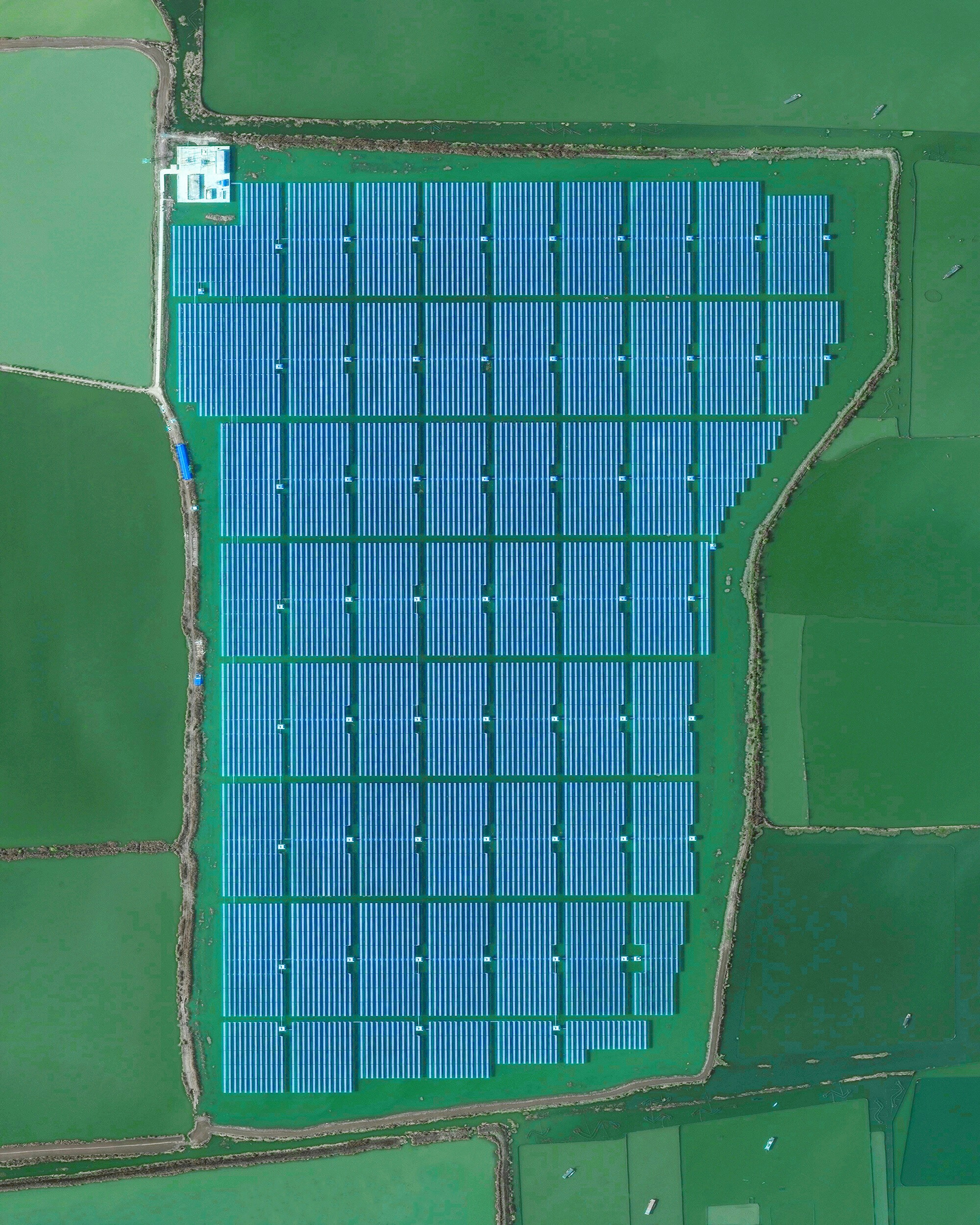
Chinese Floating Solar Farm
32.580123°,116.589000° - Maxar Technologies
Solar panels sitting atop a man-made lake in Huainan, China, make up the world’s largest floating solar farm. Sungrow Huainan Solar Farm is capable of producing enough electricity to power 15,000 homes and floats above an area formerly used for coal mining.
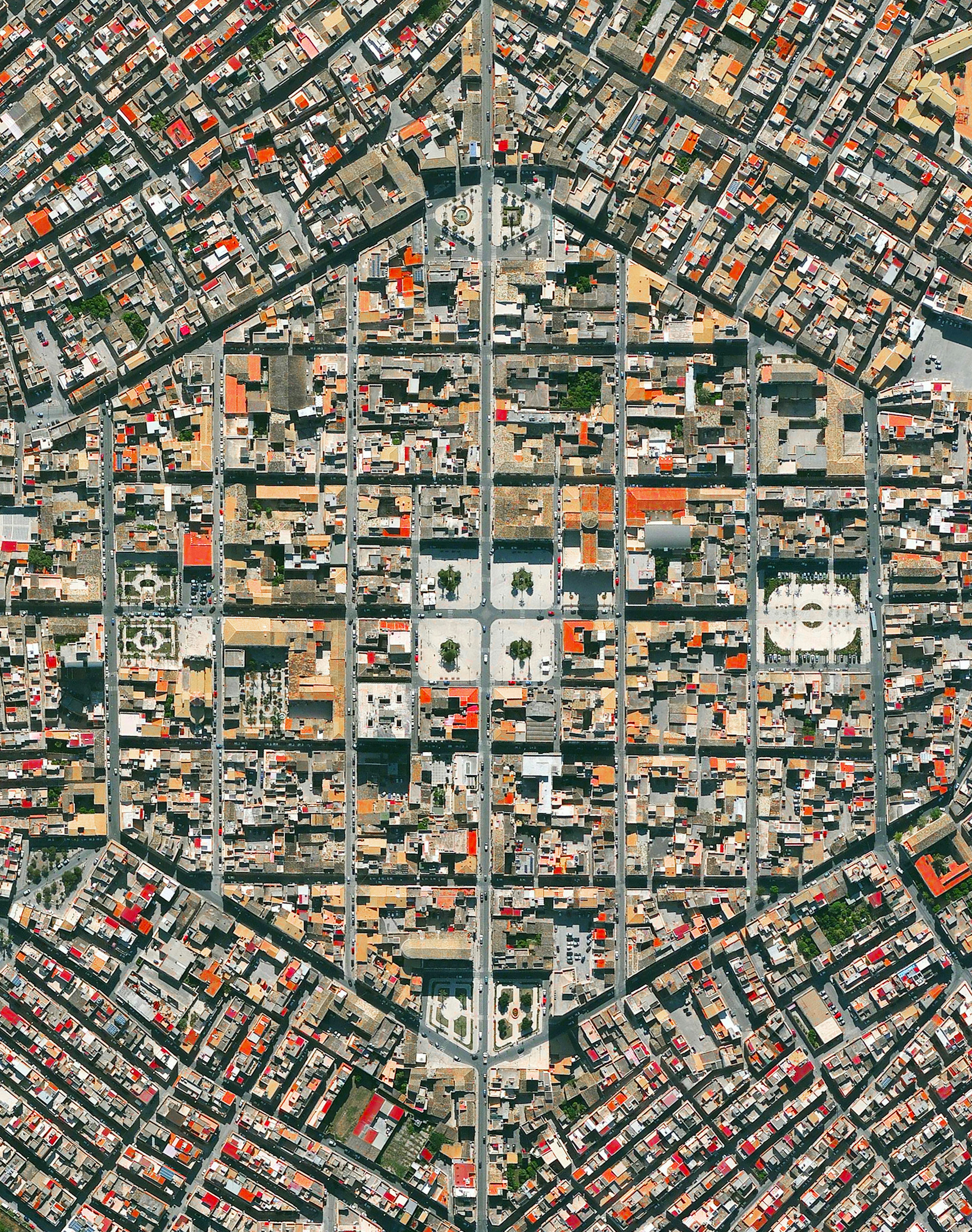
Avola
36.909495°,15.134978° - Maxar Technologies
Avola is a city located in the province of Syracuse, Sicily. After Avola was destroyed by an earthquake in 1693, the city was reconstructed in a new location using a geometric, hexagonal plan created by the friar architect Angelo Italia.
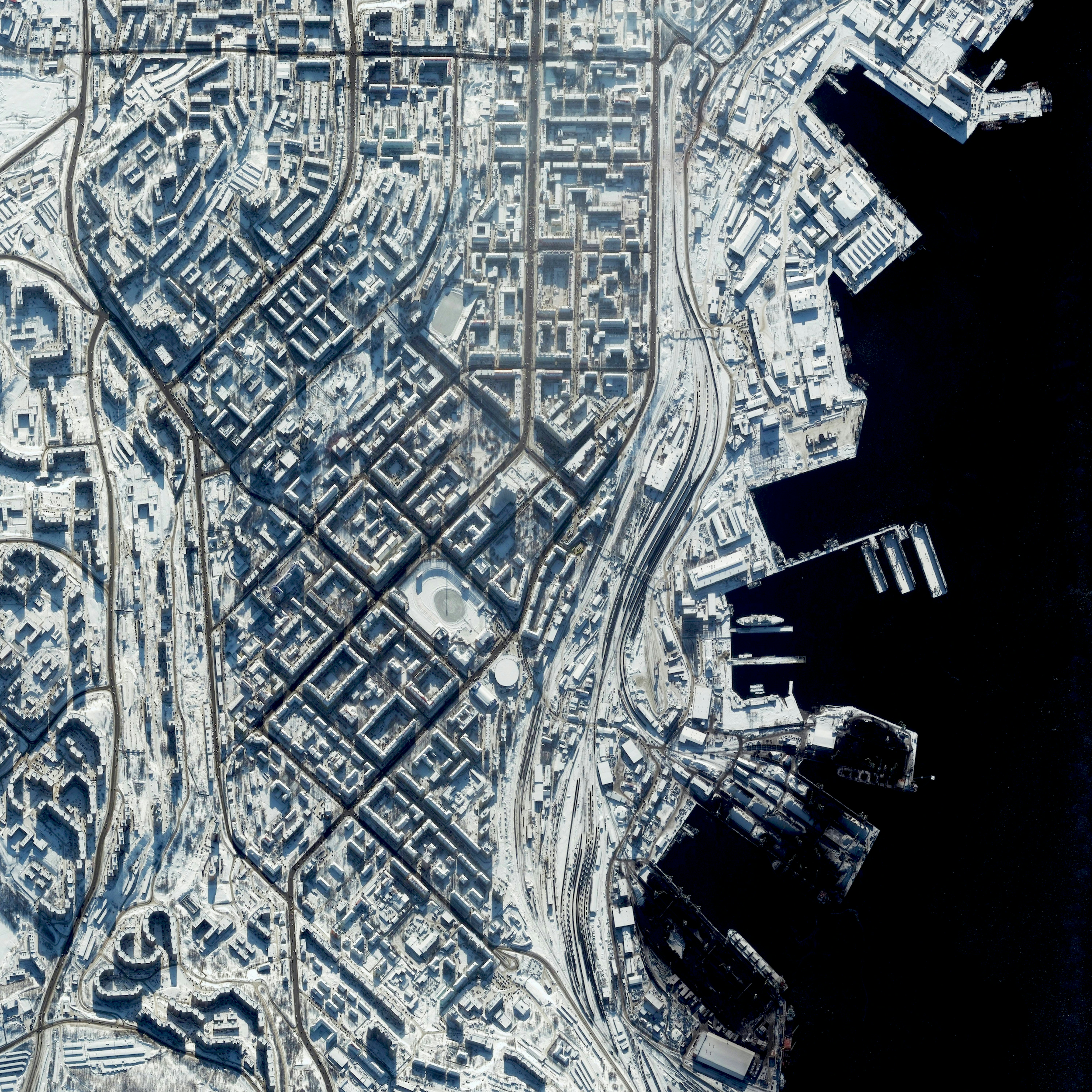
Murmansk
68.966667°,33.083333° - Maxar Technologies
Murmansk is a city located in the extreme northwest of Russia. With a population of nearly 300,000, it is the largest establishment north of the Arctic Circle. The record low temperature here is a blistering -39.4 degrees celsius (-38.9 degrees fahrenheit).


