Daily
One regular dose of Earth from above
Navigator of the Seas
25.779197°,-80.179708° - Nearmap
The Navigator of the Seas was the largest cruise ship in the world upon its commissioning voyage in 2002, and it remained so until 2005. It is now only the thirtieth largest ship as the industry continues to build larger-capacity models to keep up with growing customer demands. With accommodations for 4,000 passengers and 1,200 crew members, the ship contains a surfing simulator, a basketball court, multiple pools, and an outdoor movie screen. Over a single day, cruise ships like the Navigator emit as much carbon dioxide as a million cars, while dumping hundreds of gallons of untreated sewage into the ocean. Read the full story →
Bourtange
53.006600°,7.192000° - Maxar Technologies
Bourtange is a star fort located in the Groningen Province of the Netherlands. It was constructed in 1593, during the Eighty Years’ War, to control the only road between Germany and the city of Groningen. Today, the fort serves as a historical museum and the surrounding village of Bourtange has an population of 430.
Paris Cemetery
48.904221°,2.410638° - Maxar Technologies
Cimetière parisien de Pantin is the largest cemetery in Paris, France, both in number of graves and land area. Since opening in November 1886, more than one million people have been buried here, with nearly 5,000 interments taking place each year. Pantin is a garden-style burial ground, with more than 8,000 trees and a network of 20 miles (32 km) of roads that allow motor vehicle access.
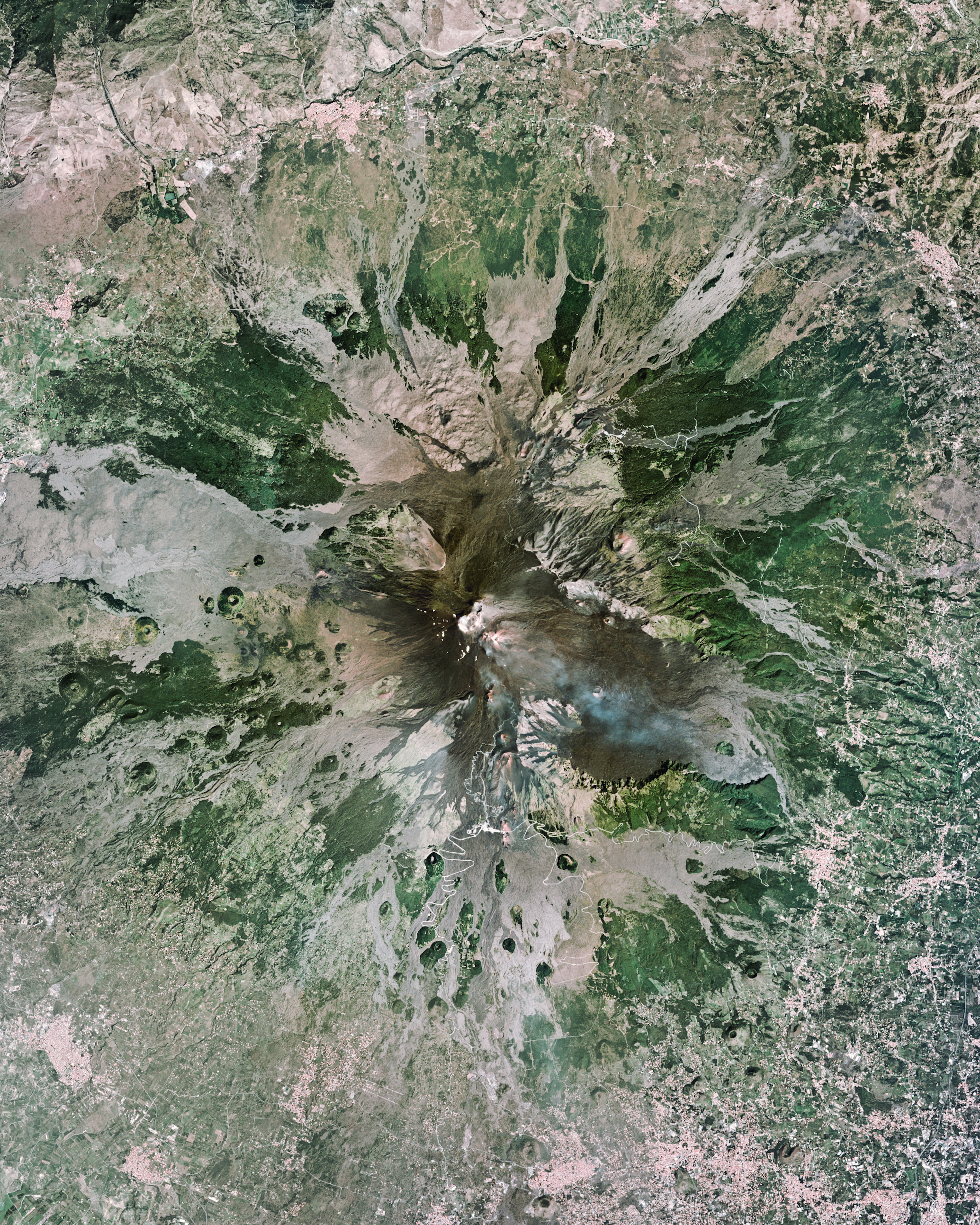
Mount Etna
37.755000°,14.995000° - Planet
Mount Etna is an active stratovolcano on the east coast of Sicily, Italy, between the cities of Messina and Catania. At a height of 10,912 feet (3,326 m), it is by far the largest active volcano in Italy — roughly two and a half times taller than Mount Vesuvius. Etna is one of the world’s most active volcanoes and has erupted at least 49 times since January 1955.
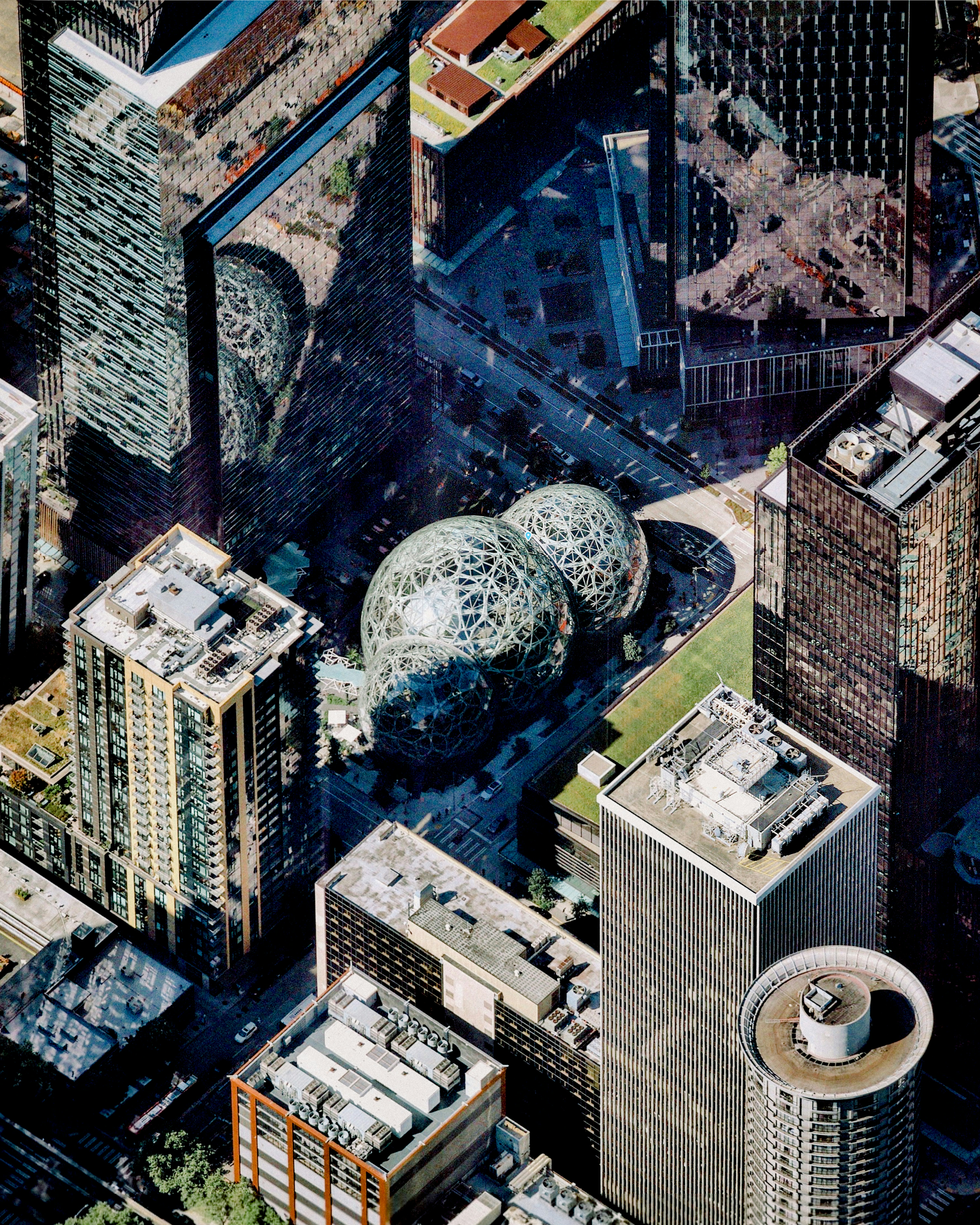
Amazon Spheres
47.615556°,-122.339444° - Nearmap
The Amazon Spheres are three spherical conservatories that make up part of Amazon’s headquarters in downtown Seattle, Washington. The glass domes, which range from 80 to 95 feet (24-29 meters) in height, contain 40,000 plants from 50 countries and serve as an employee lounge and workspace. Public access is provided as part of weekly guided tours and a twice-monthly reservation program.
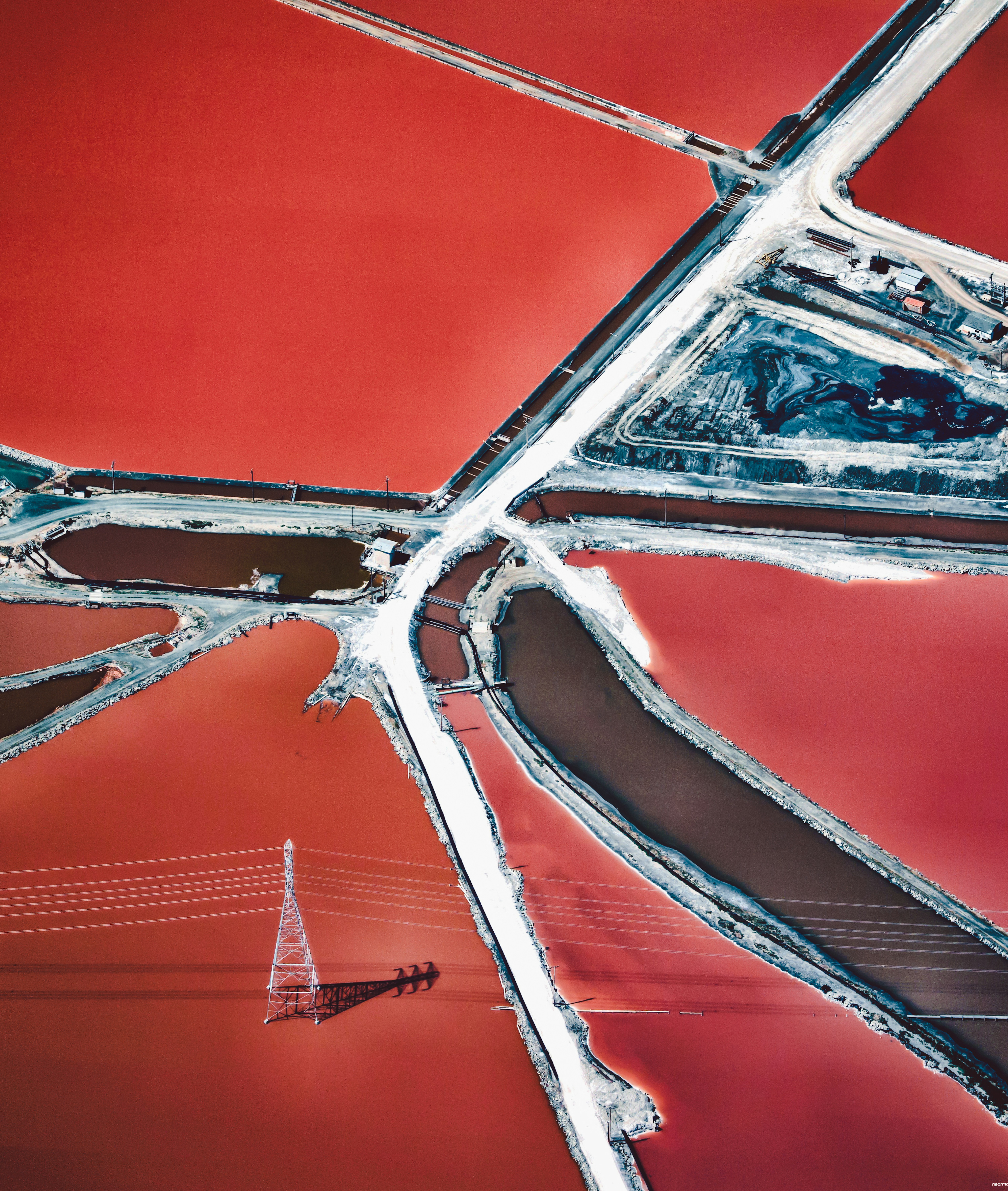
San Francisco Salt
37.502806°,-122.034250° - Nearmap
Electric wires stretch across bright red salt ponds in San Francisco Bay, California. Here, sea water is channelled into large ponds and exits through natural evaporation, leaving the salt behind to be collected. The massive ponds get their vibrant reddish colors from the algae that thrive in the extremely salty water.
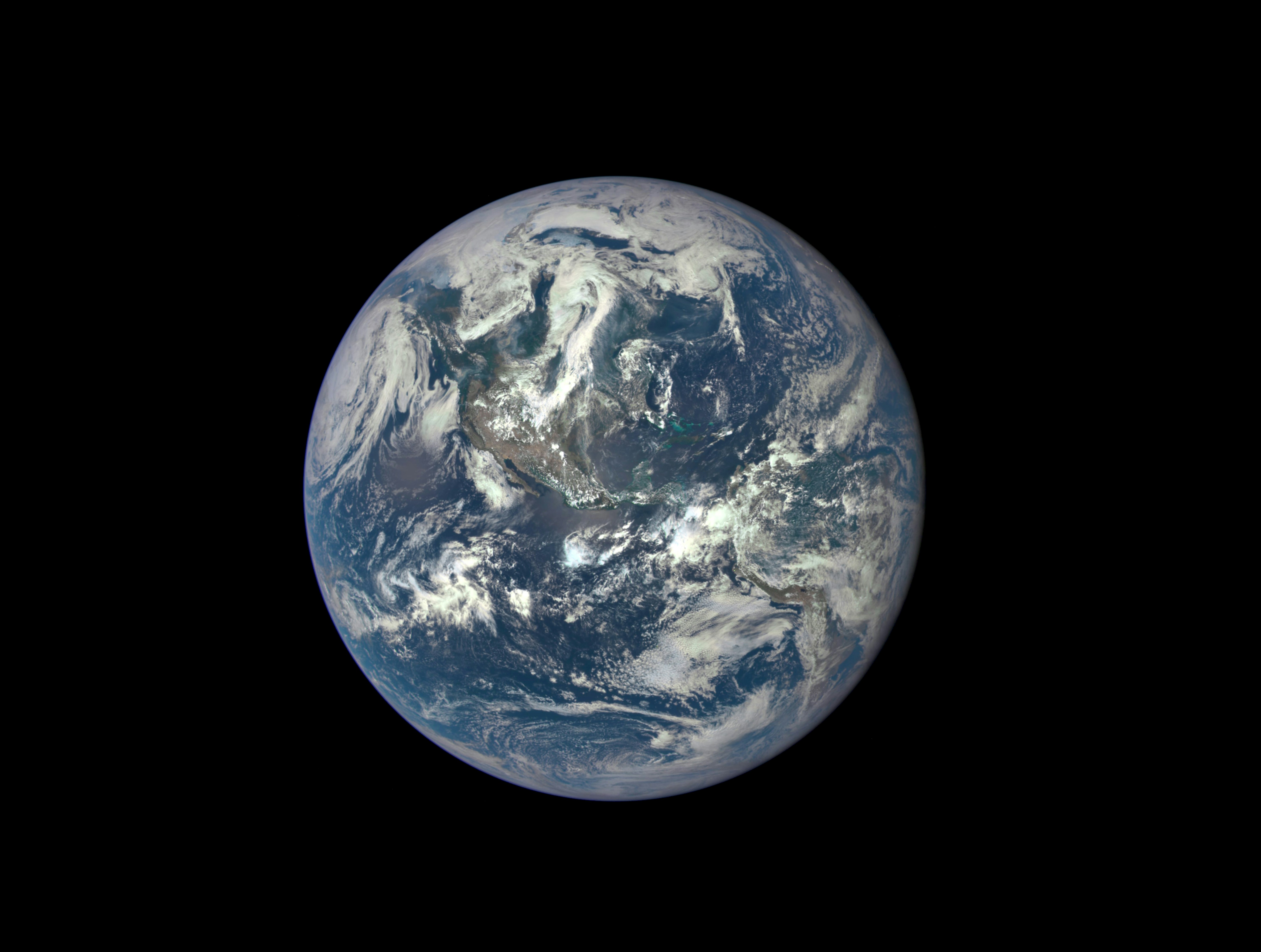
Earth from DSCVR
25.034280°,-77.396280° - NASA
The first photograph captured by the camera onboard the Deep Space Climate Observatory (DSCVR) satellite, which orbits approximately 1 million miles away from Earth on July 6, 2015. This image was made by combining three separate photos to get a full picture of the planet. DSCVR’s camera will continue to provide a daily stream of Earth images, allowing for both real-time and ongoing observation of the planet. In this image, North and Central America are visible, along with the centrally-located shallow, turquoise waters of the Caribbean Sea.Read the full story →
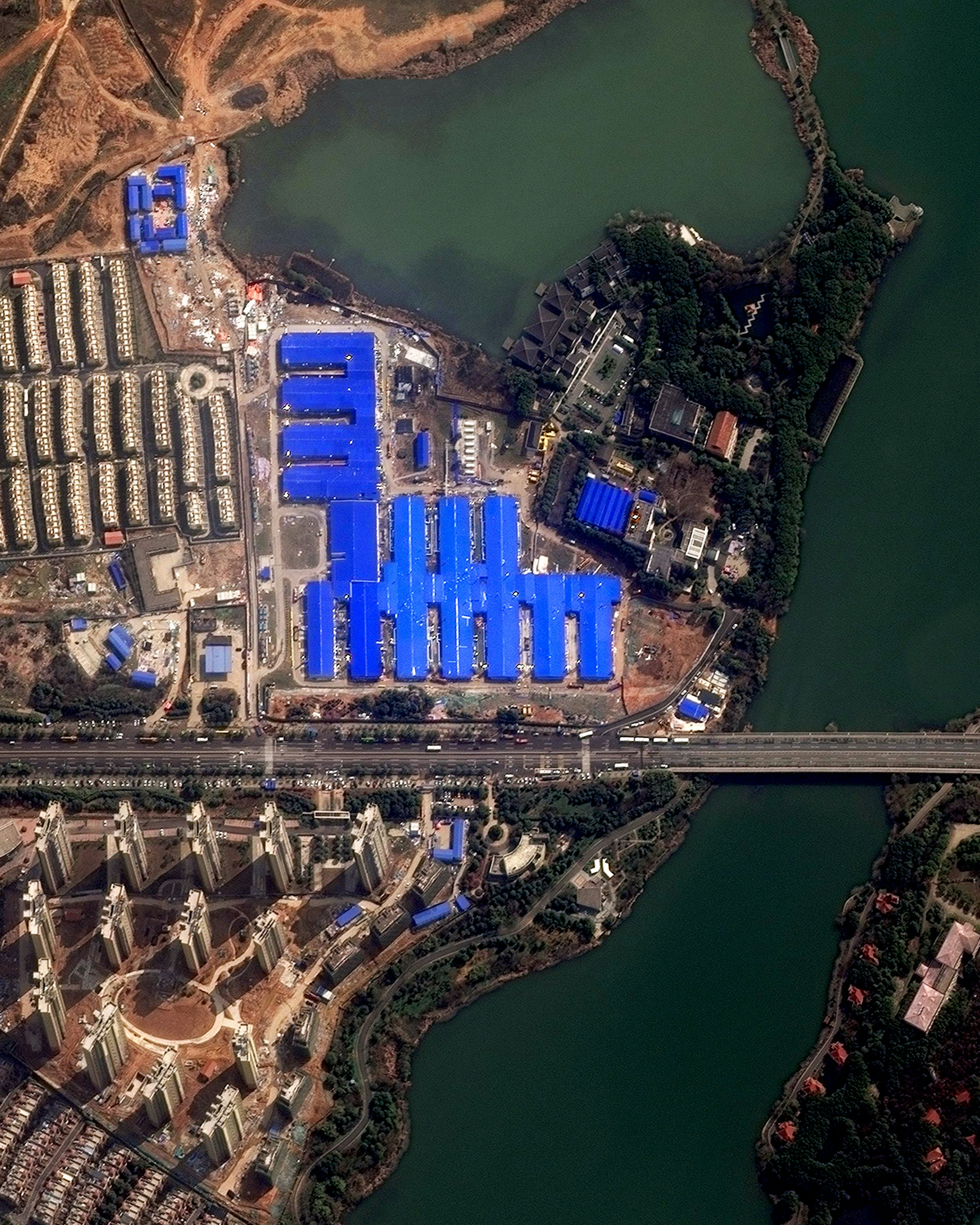
Wuhan Hospital Construction
19.373908°,-99.088439° - Maxar
Huoshenshan Hospital in Wuhan, China was built over a 10 day period between January 23 and February 2. With more than 7,000 people working around the clock, the facility was a major step in the Chinese government’s response to slow the spread of COVID-19. The facility has 1,000 beds with 30 intensive care units, medical equipment rooms, and quarantine wards. Field hospitals like this one are one of the ways China has slowed the spread of the virus. As of today, China has reported a second consecutive day of no new confirmed cases in Hubei province, the epicenter of the pandemic. This image was featured in our story "Perspective on the Coronavirus."Read the full story →
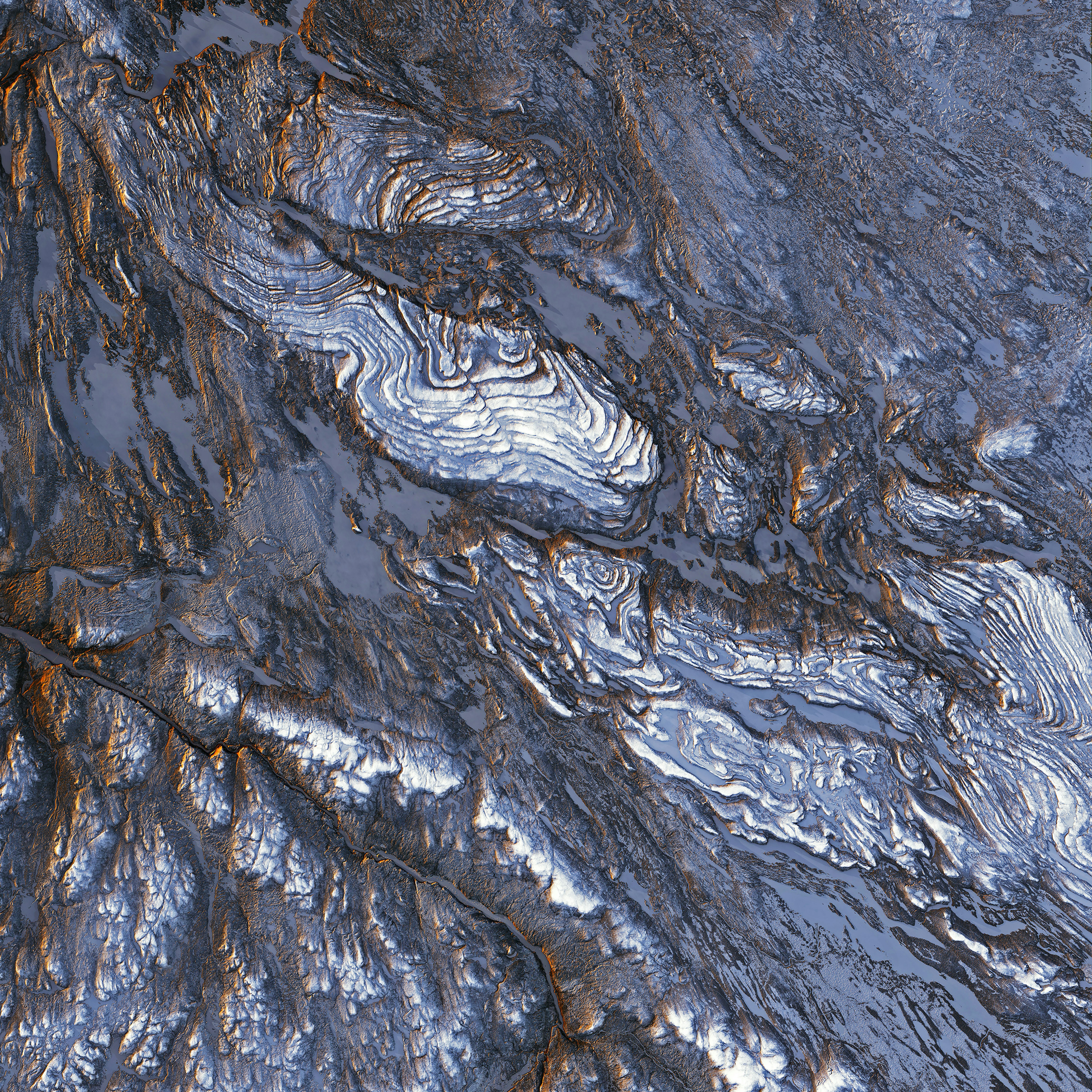
New Quebec Orogen
56.000000°,-67.500000° - NASA
Swirling folds of basaltic rock can be seen in the New Quebec Orogen, a large geologic belt in northeastern Canada. This area, also known as the Labrador Trough, covers an area of about 98,000 square miles (254,000 square km) and was formed some 2.17 billion years ago as molten rock erupted from rifts in the Earth’s crust flooded the landscape with basalt. The cliff face of each flow or “step” in this formation stands between 160 and 230 feet (50-70 m) tall.
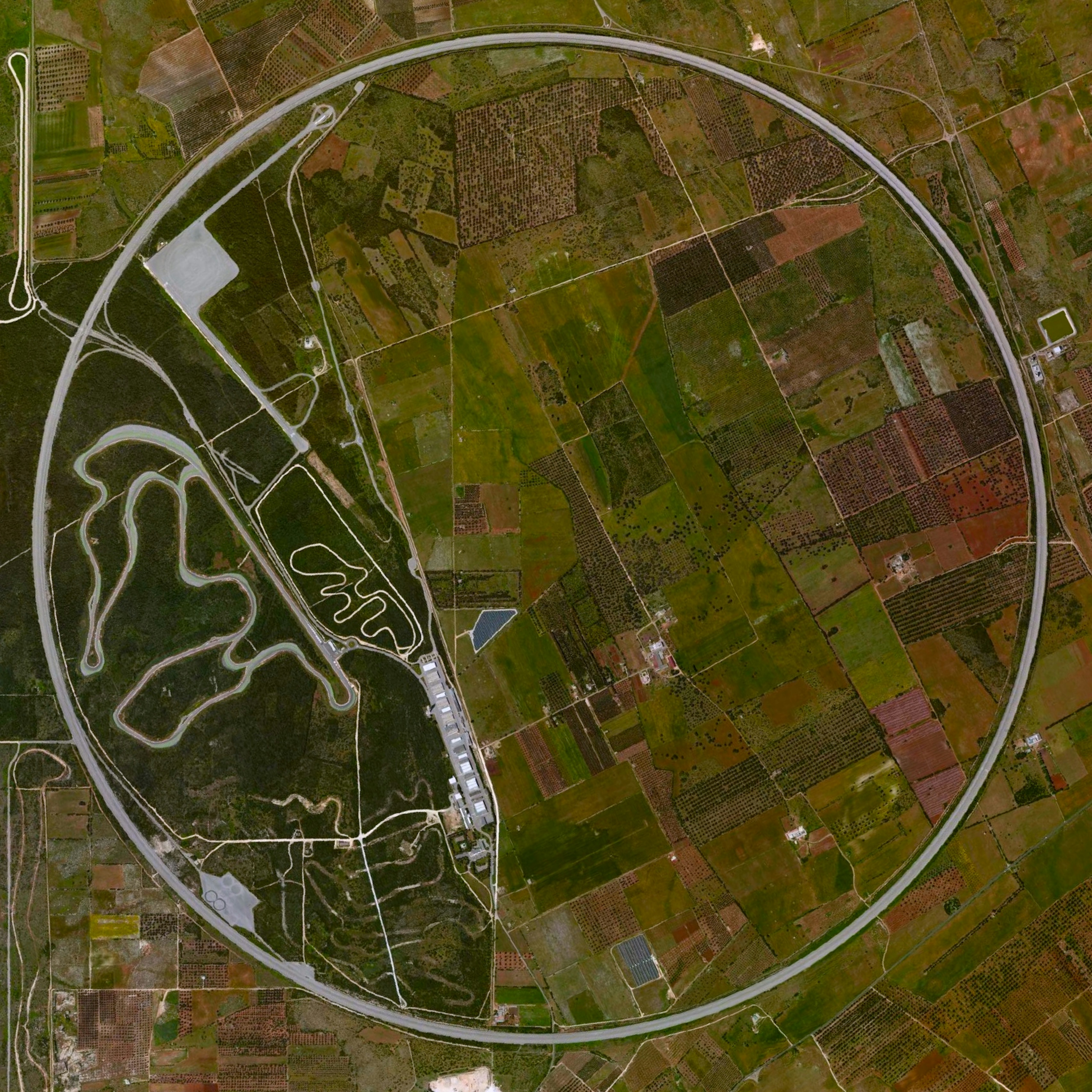
Nardò Ring
40.327222°,17.826111° - Maxar Technologies
The Nardò Ring is a high speed, 7.8 mile long, circular test track in Nardò, Italy. Each of the ring’s four lanes has a determined “neutral speed” and is banked in such a manner that one can drive as if the road were straight.
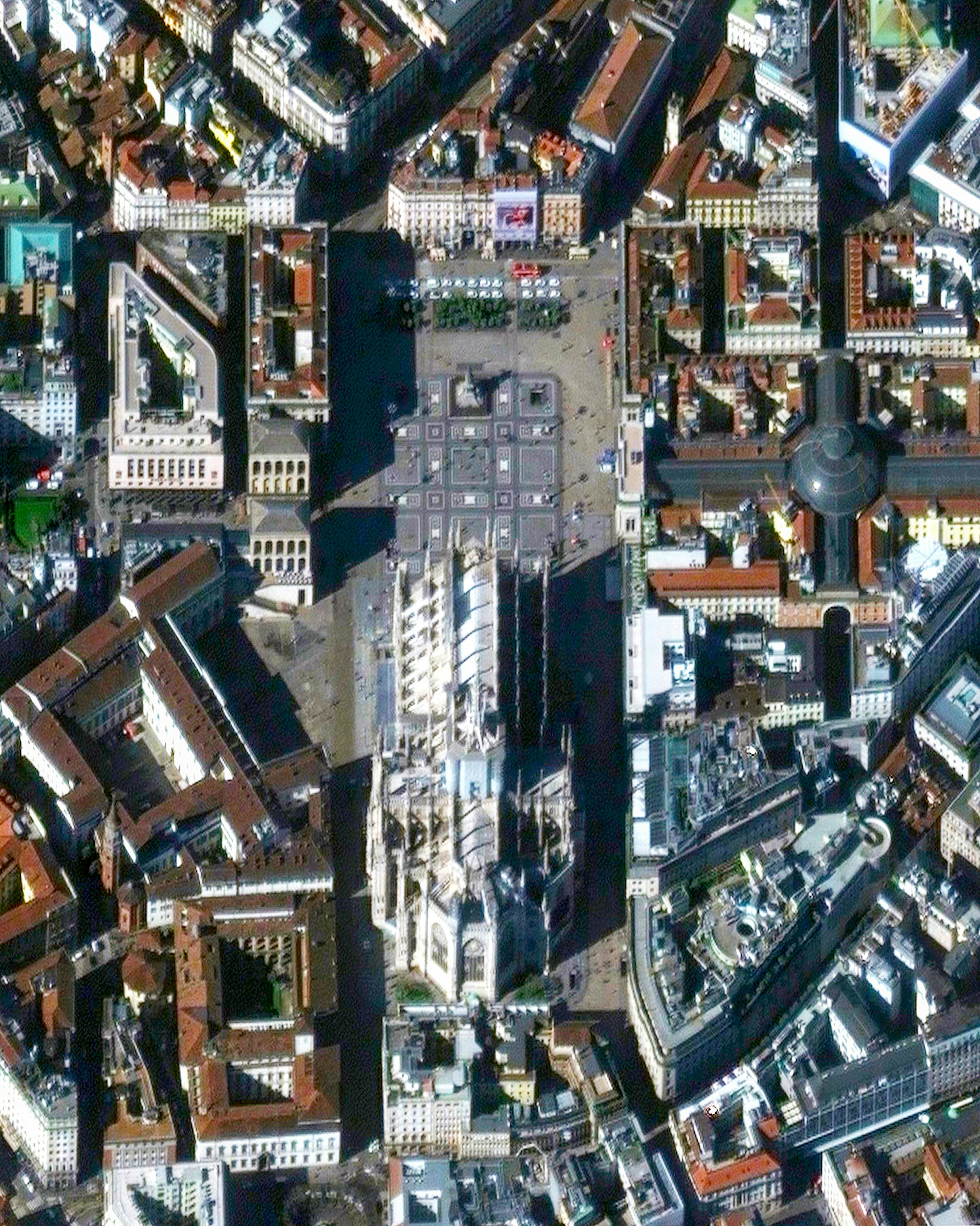
Duomo di Milano
45.464048°,9.189653° - Maxar
The plaza outside of Duomo di Milano, the largest cathedral in Milan, Italy, can be seen nearly empty last week (March 4) during a nationwide lockdown in an effort to slow the spread of COVID-19. As a means of limiting the number of cases, health organizations have recommended taking preventative measures such as limiting public gatherings until more data can be gathered about the spread of the virus. We’ll do our best to continue to provide big picture perspectives during this time. Please take your health and the health of those around you seriously - wash your hands and employ social distancing as much as possible. Be safe!
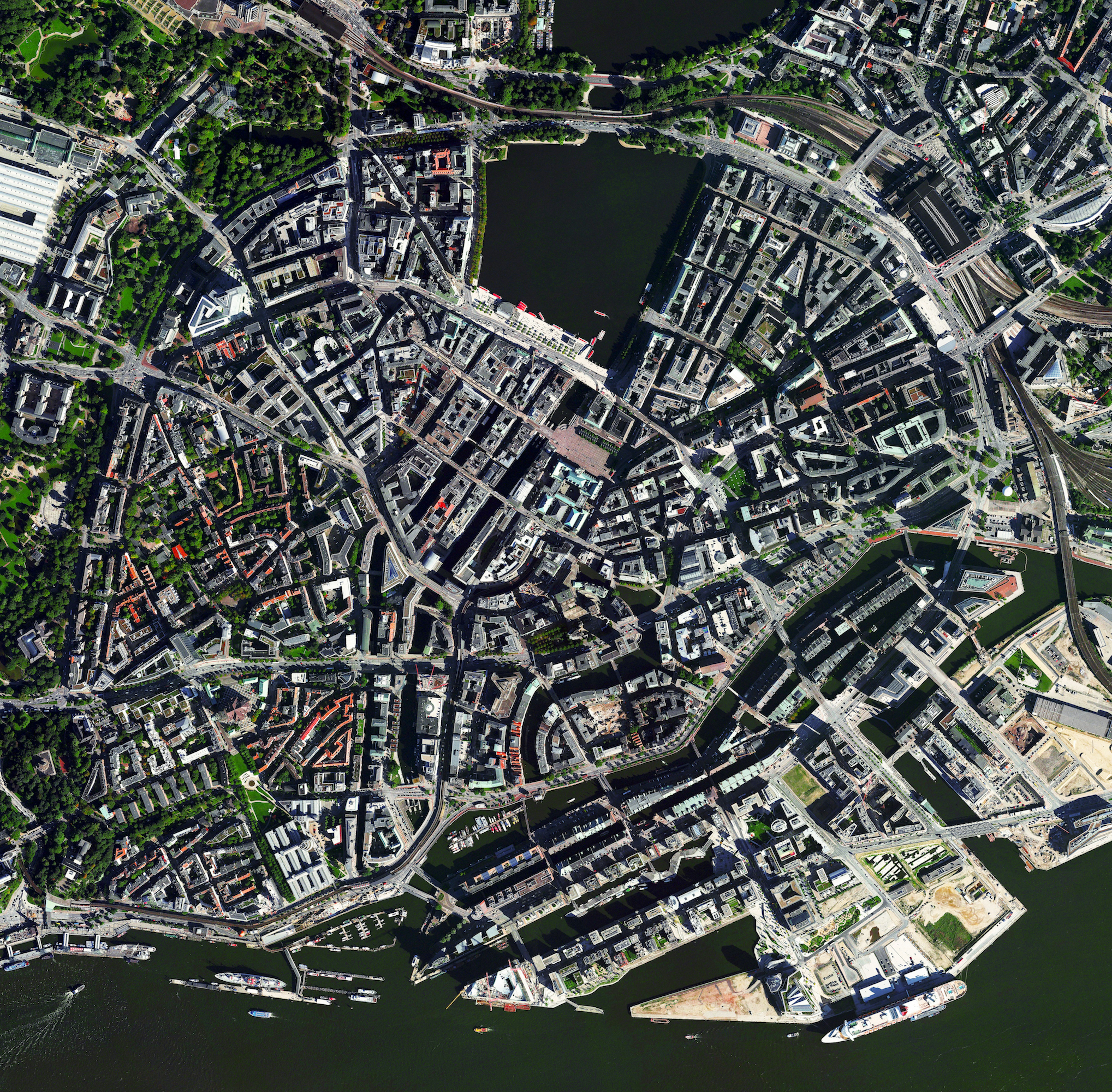
Hamburg
53.550530°,9.969369° - Maxar Technologies
Hamburg is the second largest city in Germany and seventh largest in the European Union, with a population of more than 1.8 million. The city center is seen here situated around the Binnenalster, one of two artificial lakes built within its limits. Located on the River Elbe, Hamburg contains the third busiest port in Europe, shipping roughly 145 million tonnes of goods every year.
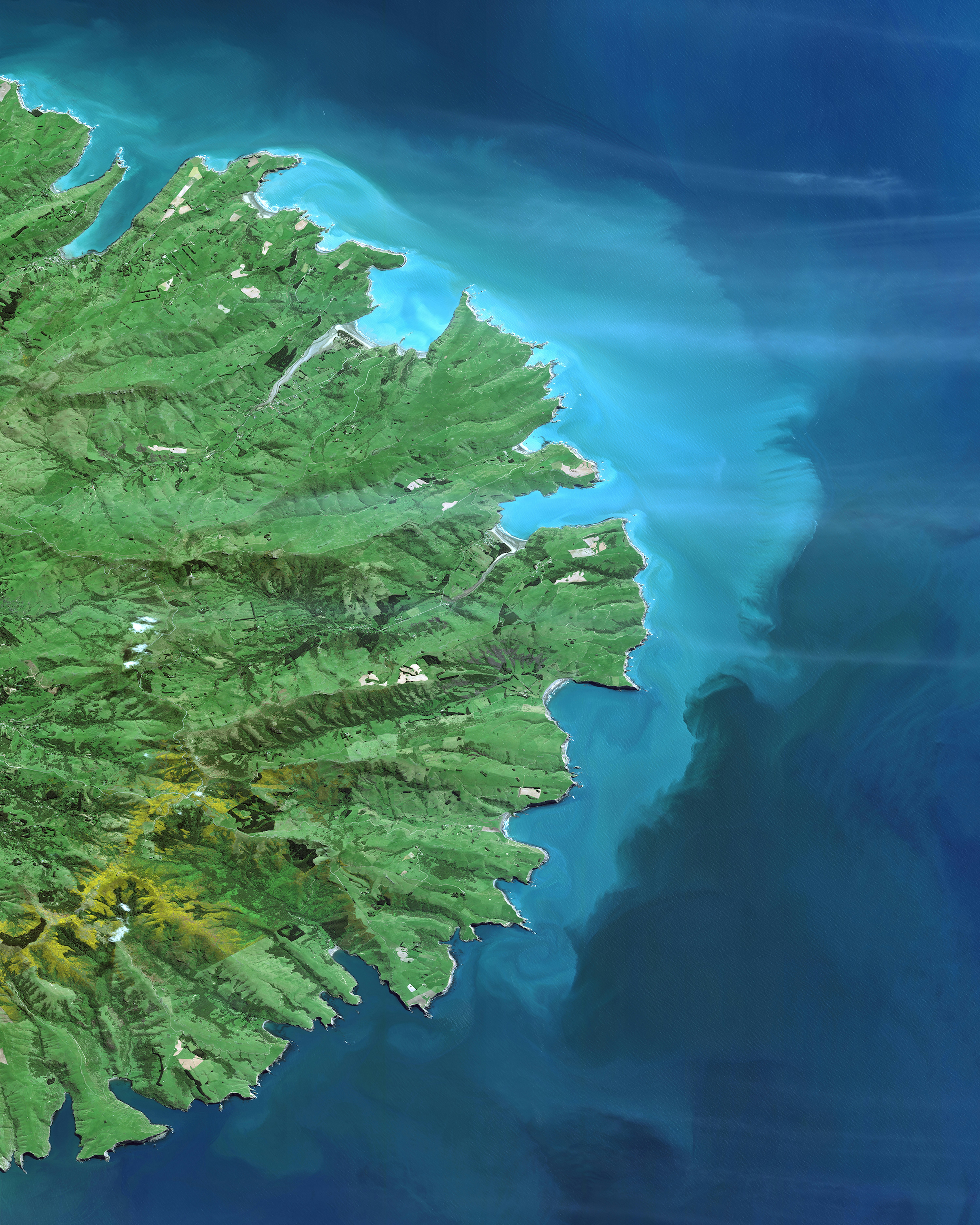
Banks Peninsula
-43.750000°,172.833000° - Maxar Technologies
Check out this amazing Overview of the Banks Peninsula, which juts off the east coast of New Zealand's South Island. The landmass, which is volcanic in origin, has an area of roughly 440 square miles (1,150 sq. km) and encompasses two large harbors and many small bays and coves. It is believed that forests once covered 98% of the Banks Peninsula, yet — as the result of deforestation — less than 2% of the native forest cover remains today.
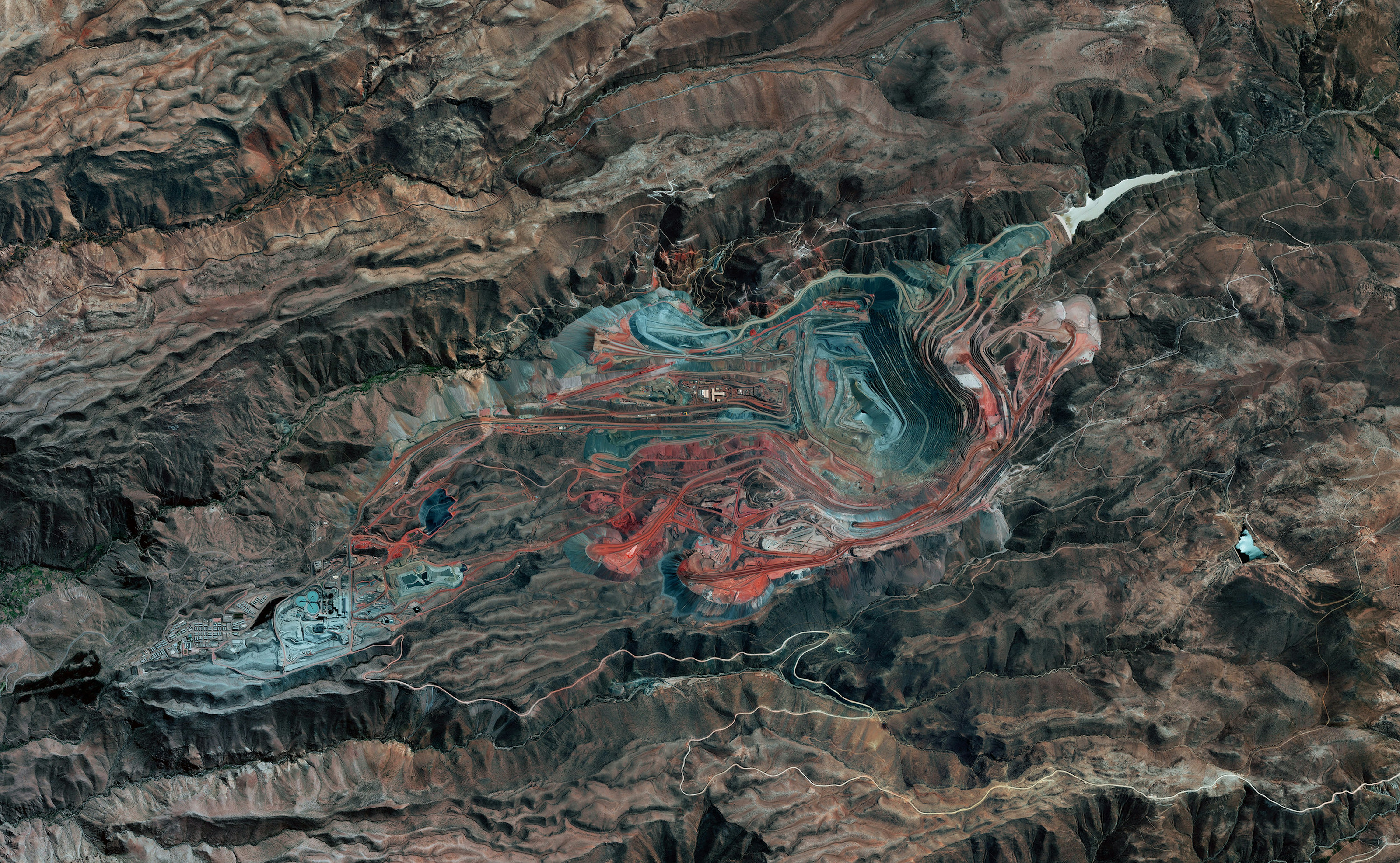
Cuajone Mine
-17.040645°,-70.711594° - Maxar Technologies
The Cuajone Mine is located near the district of Torata, in the southern range of the Peruvian Andes. The mine is best known for its copper deposits, but other materials such as silver, zinc, and molybdenum have been extracted from it as well. Operations began in 1970, and by 2009 accounted for 16% of the country's copper production.
Hvar Soccer Pitch
43.166781°,16.446197° - Maxar Technologies
A football (soccer) pitch is nestled along the waterfront of Križna Luka, a neighborhood on the Croatian island of Hvar. Located in the Adriatic Sea, Hvar is about 115 square miles (298 square km) in size and has slightly more than 11,000 residents. The pitch shown in this Overview is the home ground for the NK Hvar football club and has the capacity to seat 1,000 fans.
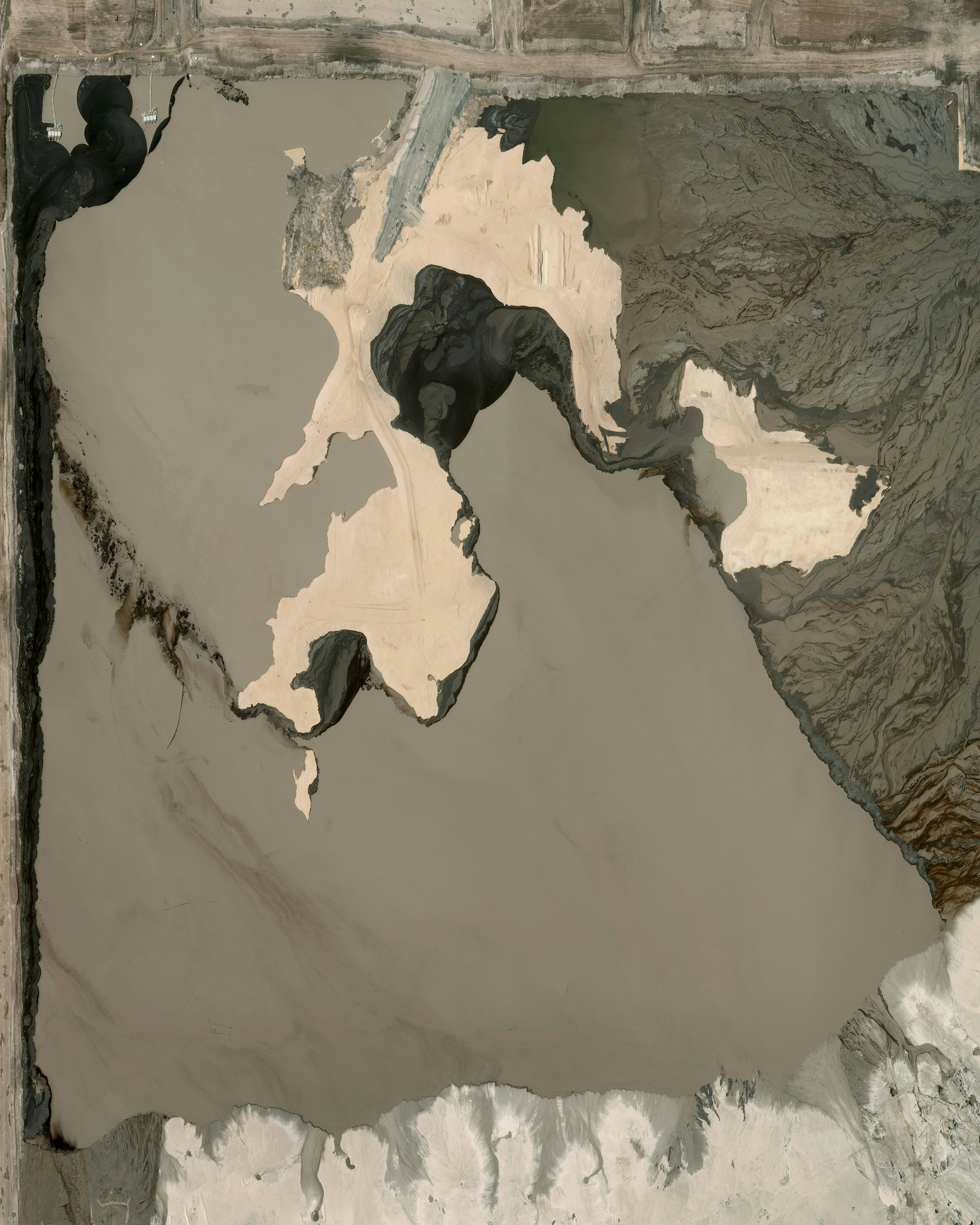
Athabasca Oil Sands
57.020000°,-111.650000° - Maxar Technologies
Waste ponds can be seen at the Athabasca oil sands in Canada. The area contains the largest known deposits of bitumen on Earth. Bitumen is a semi-solid form of crude oil that naturally occurs as a mixture of sand, clay, and water. The additional energy required to mine and then remove the sand from the bitumen leads to the release of more carbon emissions than in any other form of oil production. Extraction takes place by injecting hot water into deep wells so the sands liquefy and can be pumped up to the surface. This waste pond is roughly four square miles (10 square kilometers).
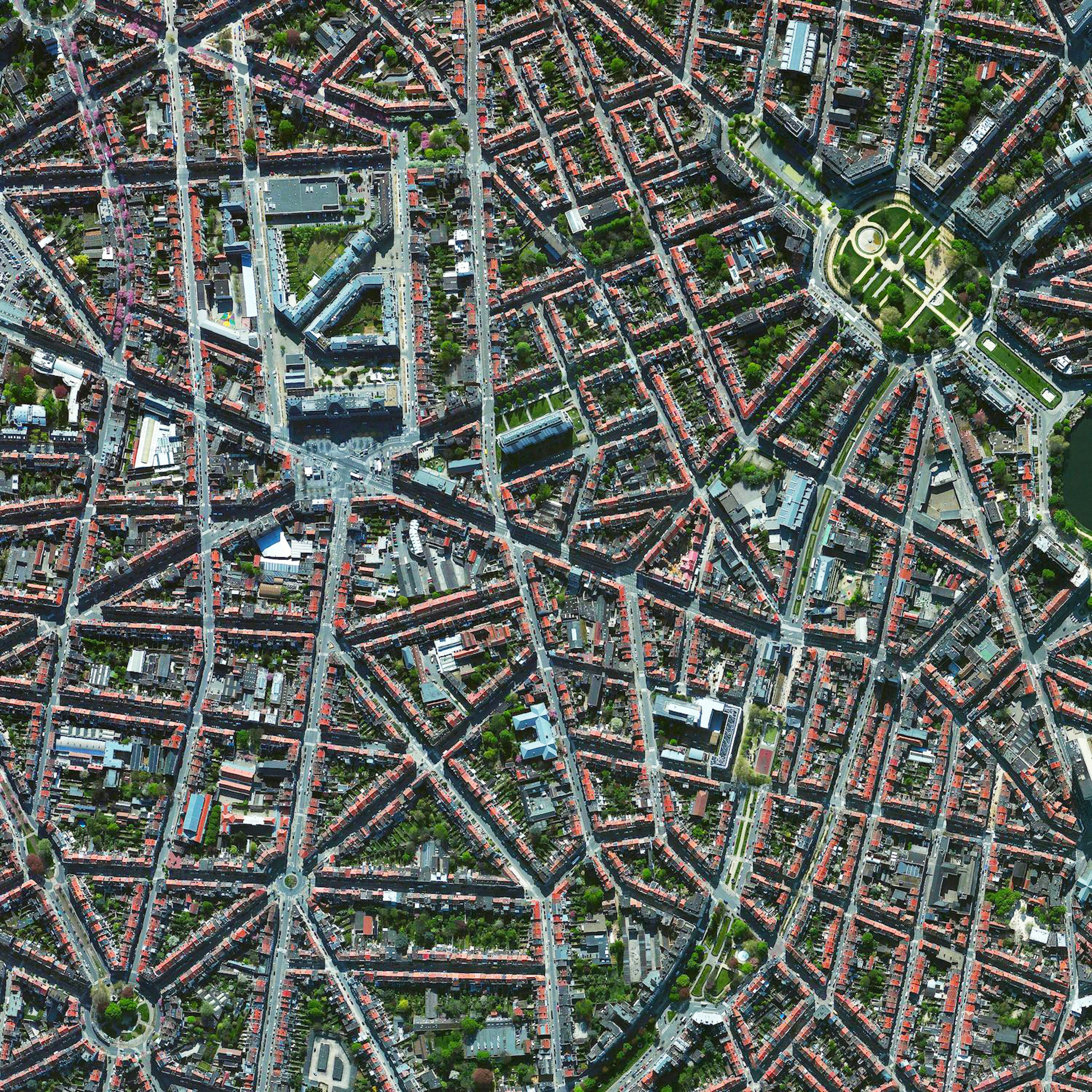
Brussels
50.855457°,4.377279° - Maxar Technologies
The City of Brussels is the capital of Belgium and the largest municipality in the greater Brussels Capital Region. The city proper has a population of roughly 176,000, while more than 1.2 million people live in the Capital Region. Brussels is the de facto capital of the European Union and a hub for rail, road and air traffic, earning it the nickname “Crossroads of Europe.”
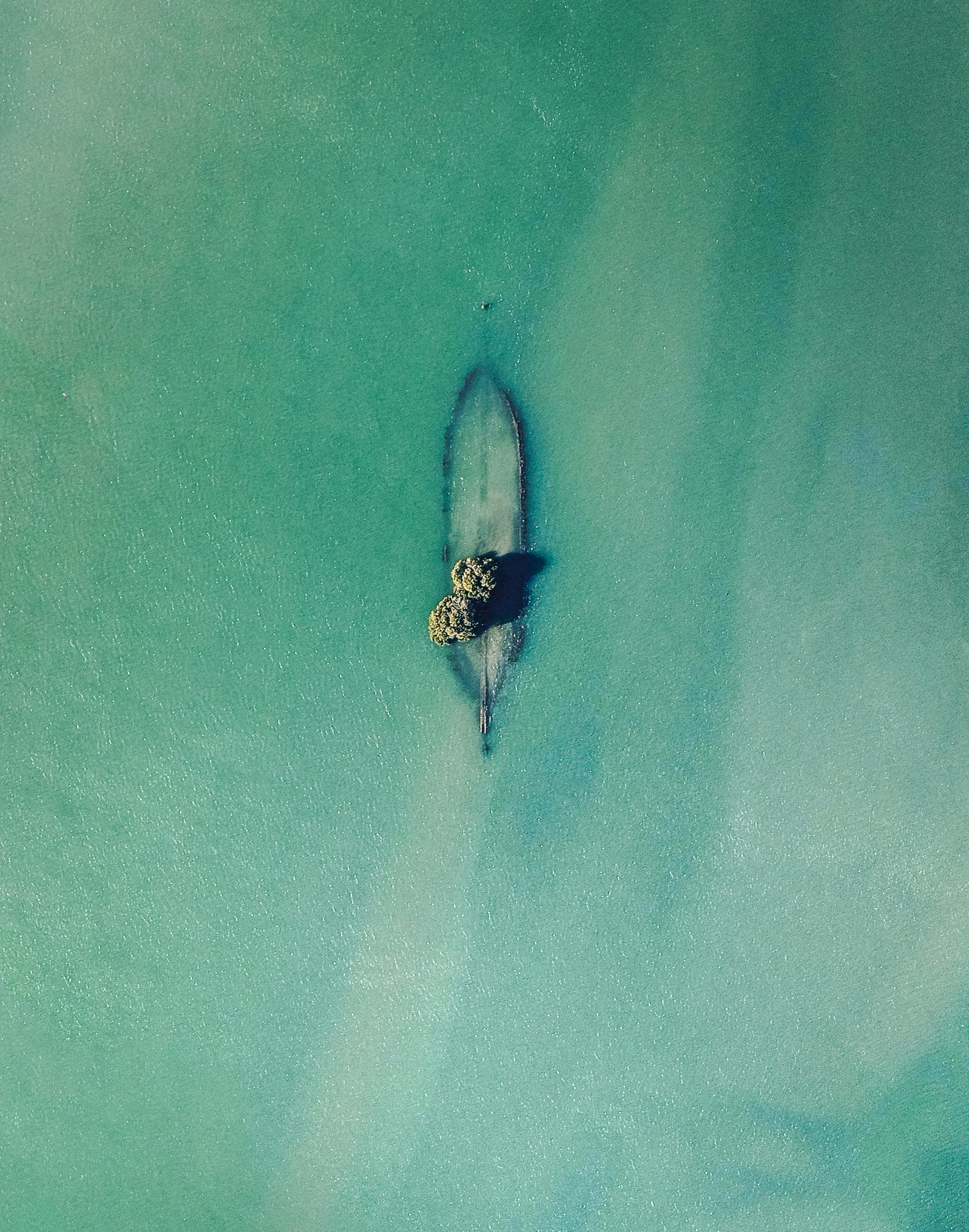
Angas Inlet Trees
-34.812361°,138.540000° - Nearmap
Trees grow inside the hull of a sunken ship in the Angas Inlet, an arm of the Gulf St. Vincent in Adelaide, Southern Australia. In this inlet and others nearby can be found the remains of more than 30 iron and wooden ships abandoned up until 1945. They serve as canoeing attractions and bird roosts for upwards of 200 species of local and migratory birds.
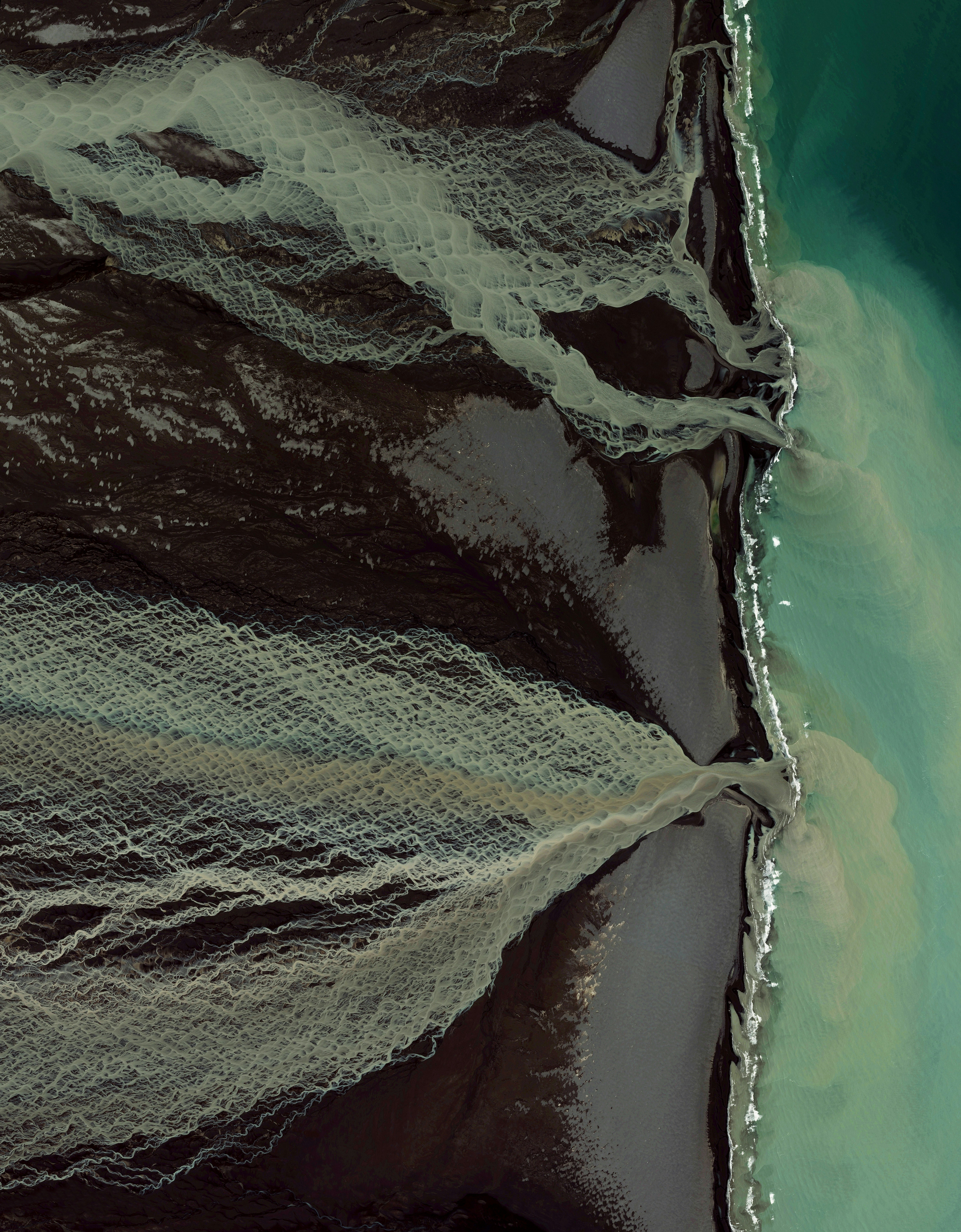
Glacial Melt
63.775112°,-18.096280° - Maxar Technologies
Glacial melting and flooding occurs every year by the Skafta River in Iceland. As the water travels down towards the North Atlantic Ocean, incredible patterns are created on the hillsides. Rising lava, steam vents, or newly opened hot springs can all cause this rapid ice melt, leading to a sizable release of water that picks up sediment as it flows down from the glaciers.
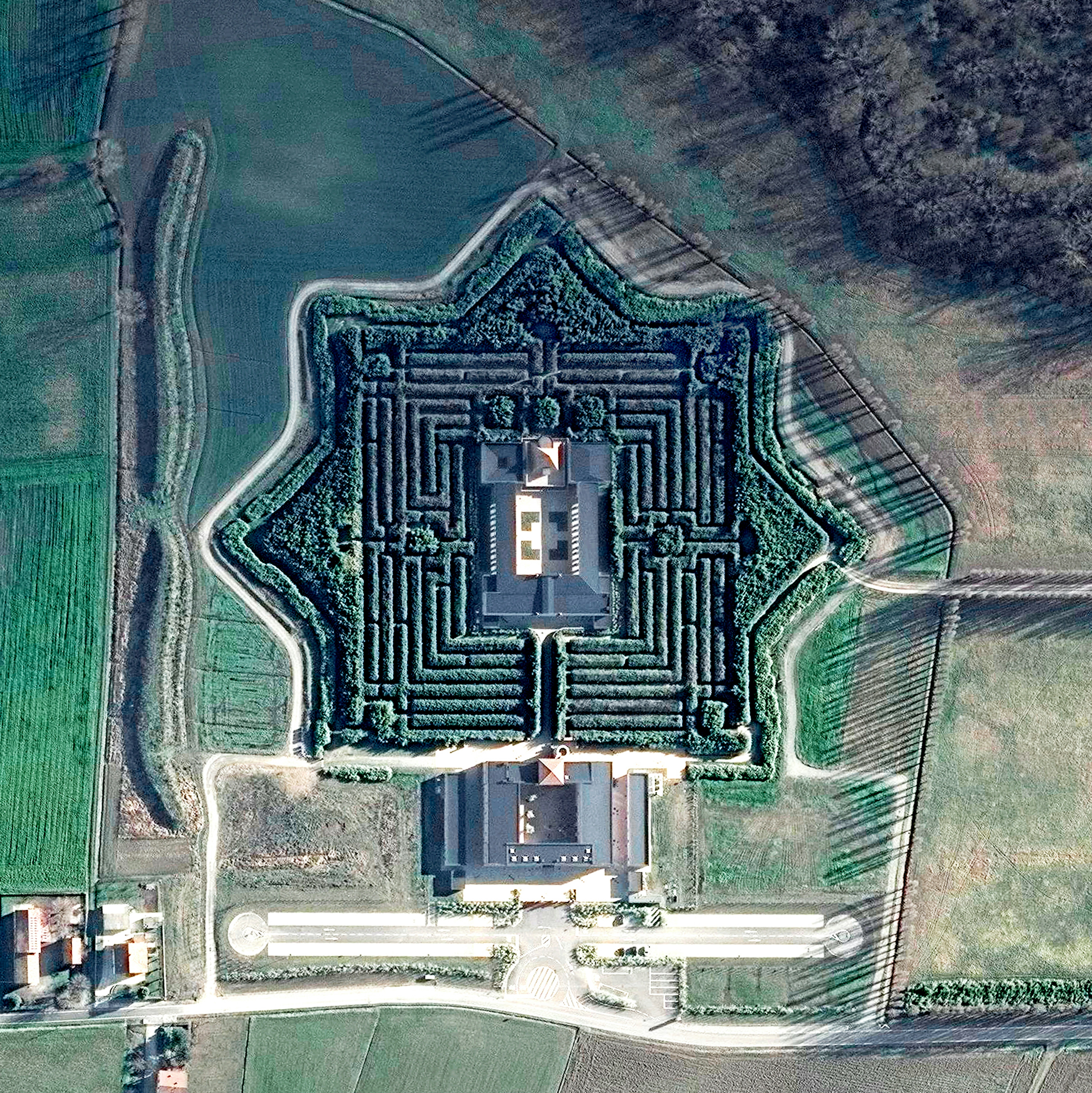
Labirinto della Masone
44.853672°,10.146420° - Maxar
Labirinto della Masone, located just outside of Parma, Italy, is the world’s largest bamboo labyrinth. Taking the shape of an eight-pointed star, the labyrinth is made up of 200,000 bamboo plants, some as much as 49 feet (15 m) tall. For a sense of scale, this entire complex covers about 17 acres (6.87 hectares).


