Daily
One regular dose of Earth from above
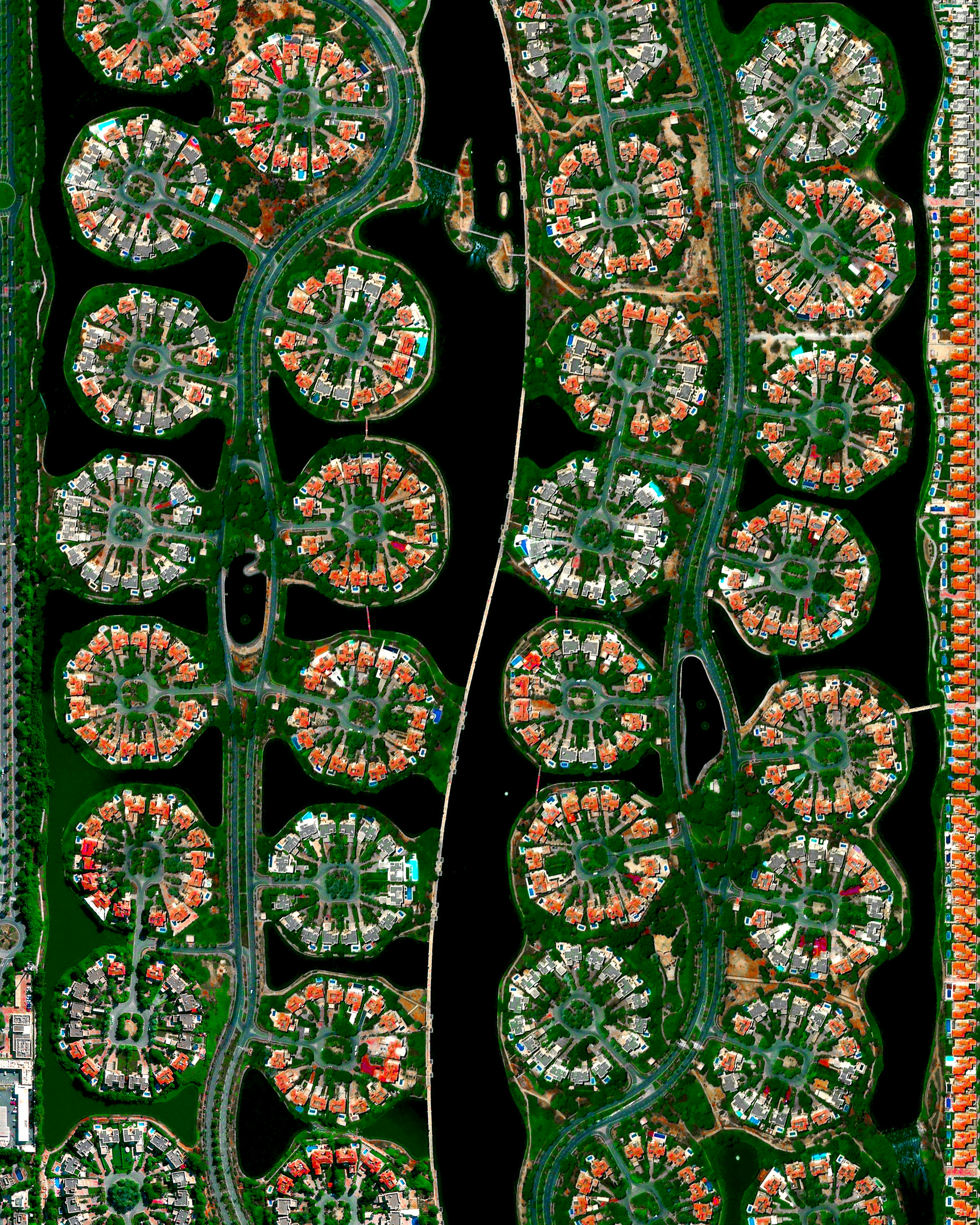
Jumeirah Islands
25.058000°,55.153680° - Maxar
Jumeirah Islands is a housing development in Dubai, United Arab Emirates. Located just inland of the Dubai Marina, the area consists of 50 small islands — called “clusters” — sitting in an artificial lake filled with sea water. Forty-six of the clusters are residential, each containing 16 villas, and the other four contain a restaurant, supermarket, gym, beauty salons and other commercial amenities.
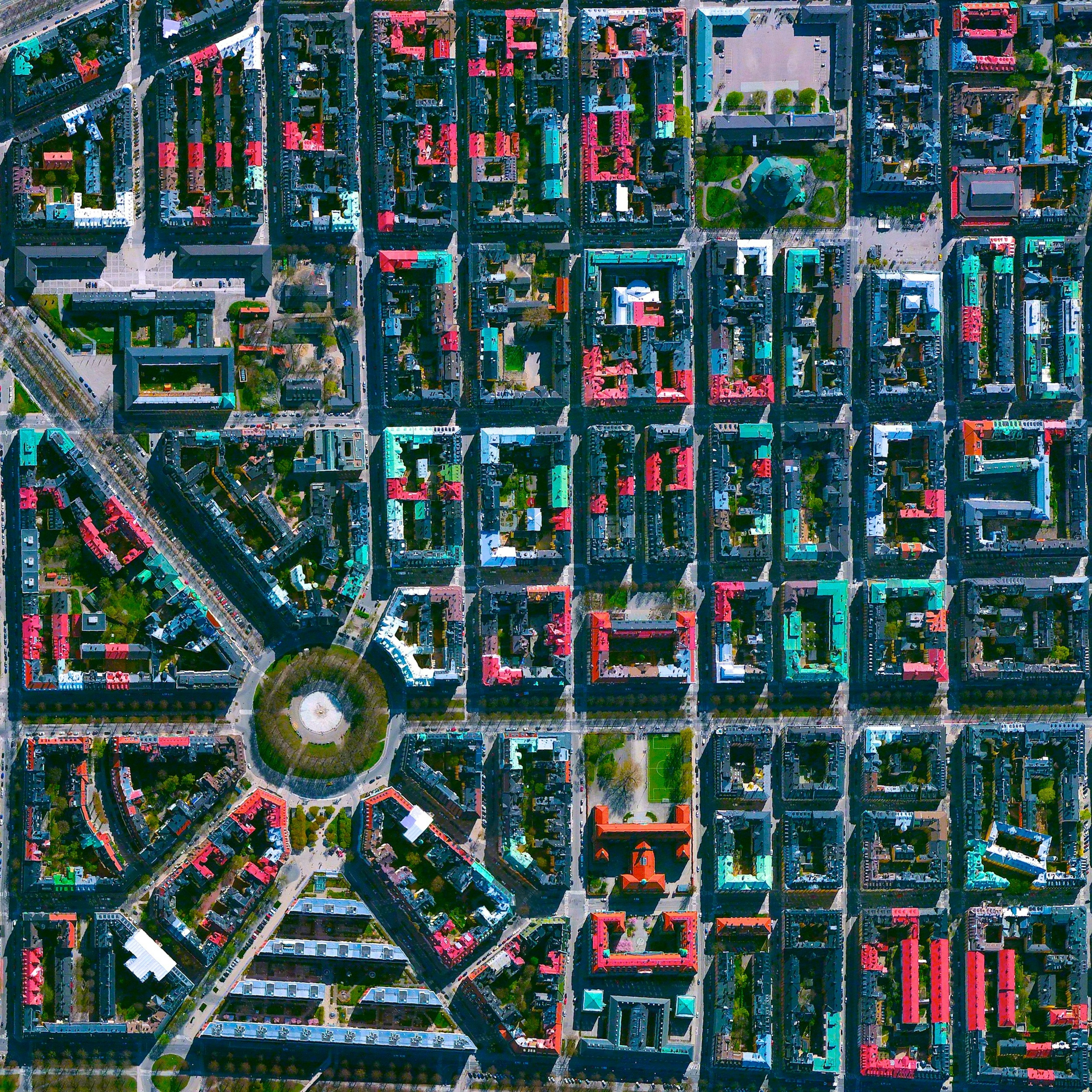
Östermalm
59.337571°,18.088176° - Maxar
Östermalm is one of the largest districts in Stockholm, Sweden, and contains some of the city’s most expensive real estate. It is also home to Diplomatstaden, a neighborhood with many embassies and ambassadorial residences. Stockholm, the nation’s capital, is spread across fourteen islands and has a population of 1.6 million in its urban area.
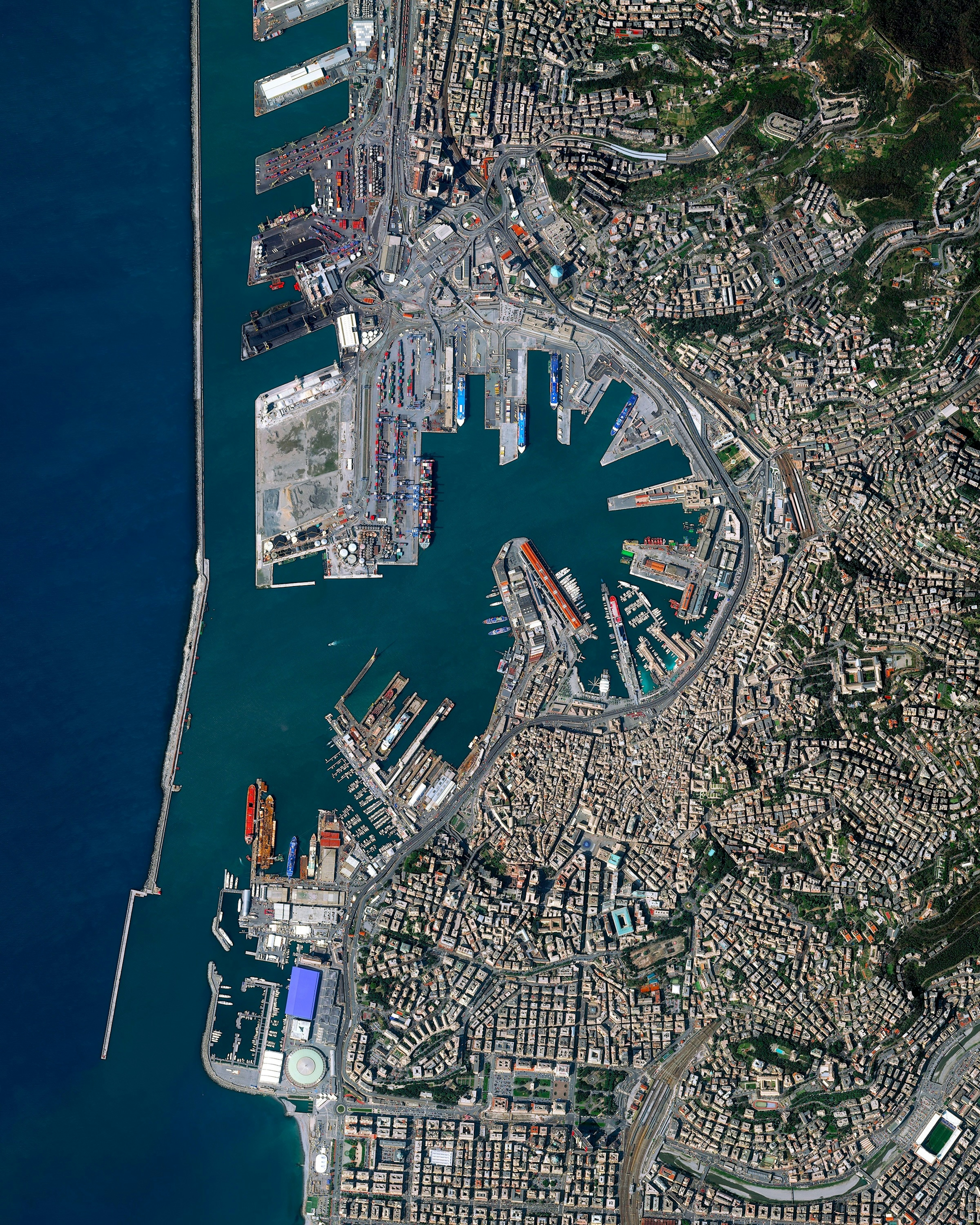
Port of Genoa
44.402800°,8.916670° - Maxar
The Port of Genoa is the busiest facility of its kind in Italy with a yearly trade volume of 51.6 million tonnes. The port can accommodate the movement of up to 4 million ferry passengers, 1.5 million cars, and 250,000 trucks every year. With the city’s location on the Mediterranean Sea, Genoa has been positioned as a major center of trade and travel since its creation in the 11th century.
Port of Richmond Cars
37.907655°,-122.368465° - Nearmap
Cars await processing at the Port of Richmond, located on San Francisco Bay in California. Richmond handles the most automobile cargo of any port on the San Francisco Bay, processing at least 150,000 vehicles every year. Yesterday, the state of California announced that a statewide ban on the sale of new gasoline-powered cars will be in place by 2035 — part of the state’s efforts to combat global warming amid a record-setting year of wildfires.
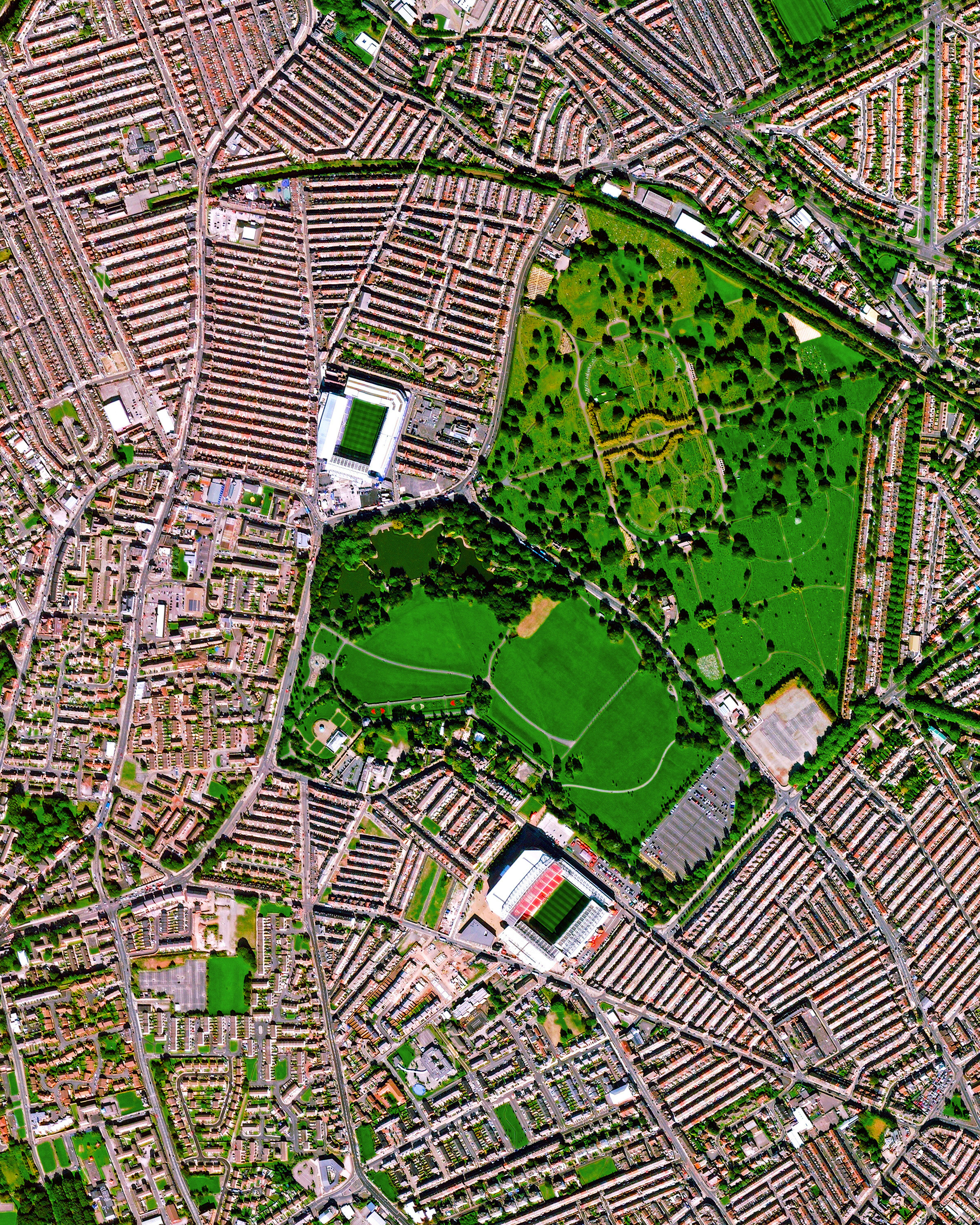
Liverpool Stadiums
53.436959°,-2.962843° - Maxar
This Overview captures the neighborhoods of Walton and Anfield in Liverpool, England. Although they are less than a mile apart, these two districts each have their own English Premier League football stadium — Goodison Park (top), home of Everton F.C.; and Anfield Stadium, home of Liverpool F.C. Both 40,000-plus capacity stadiums can be seen here, surrounded by the city’s iconic back-to-back houses.
Teluk Panglima Garang
2.936996°,101.452317° - Maxar
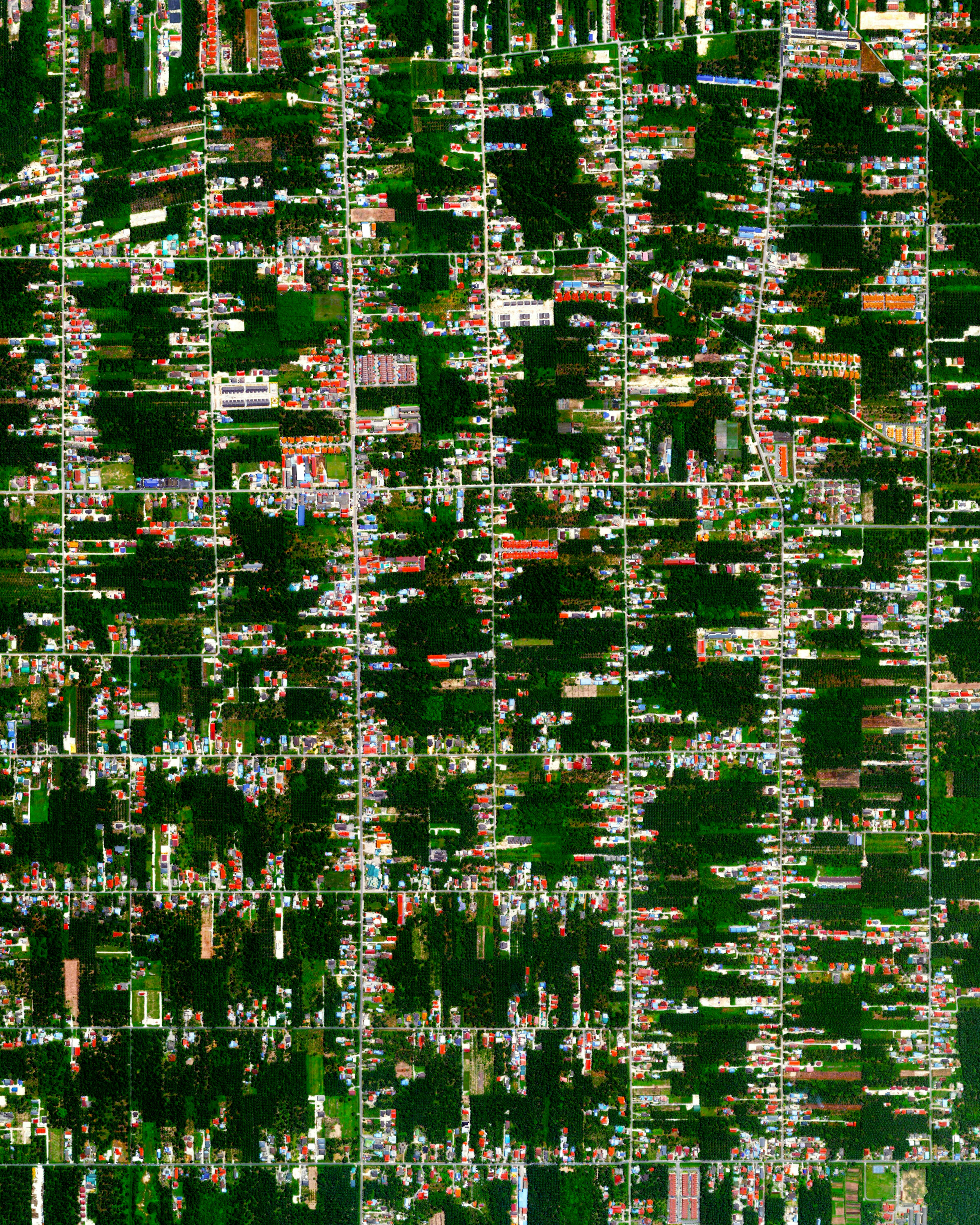
Residential development is seen among tracts of palm trees and other vegetation in the town of Teluk Panglima Garang, Malaysia. In the early 20th century, this area was mostly made up of small agricultural villages, but has since grown due to industrial activity and palm oil production. With relatively new road networks and infrastructure, many manufacturers here transport their goods to the city of Kuala Lumpur and its international airport.
Hanoi Old Quarter
21.035294°,105.851554° - Maxar
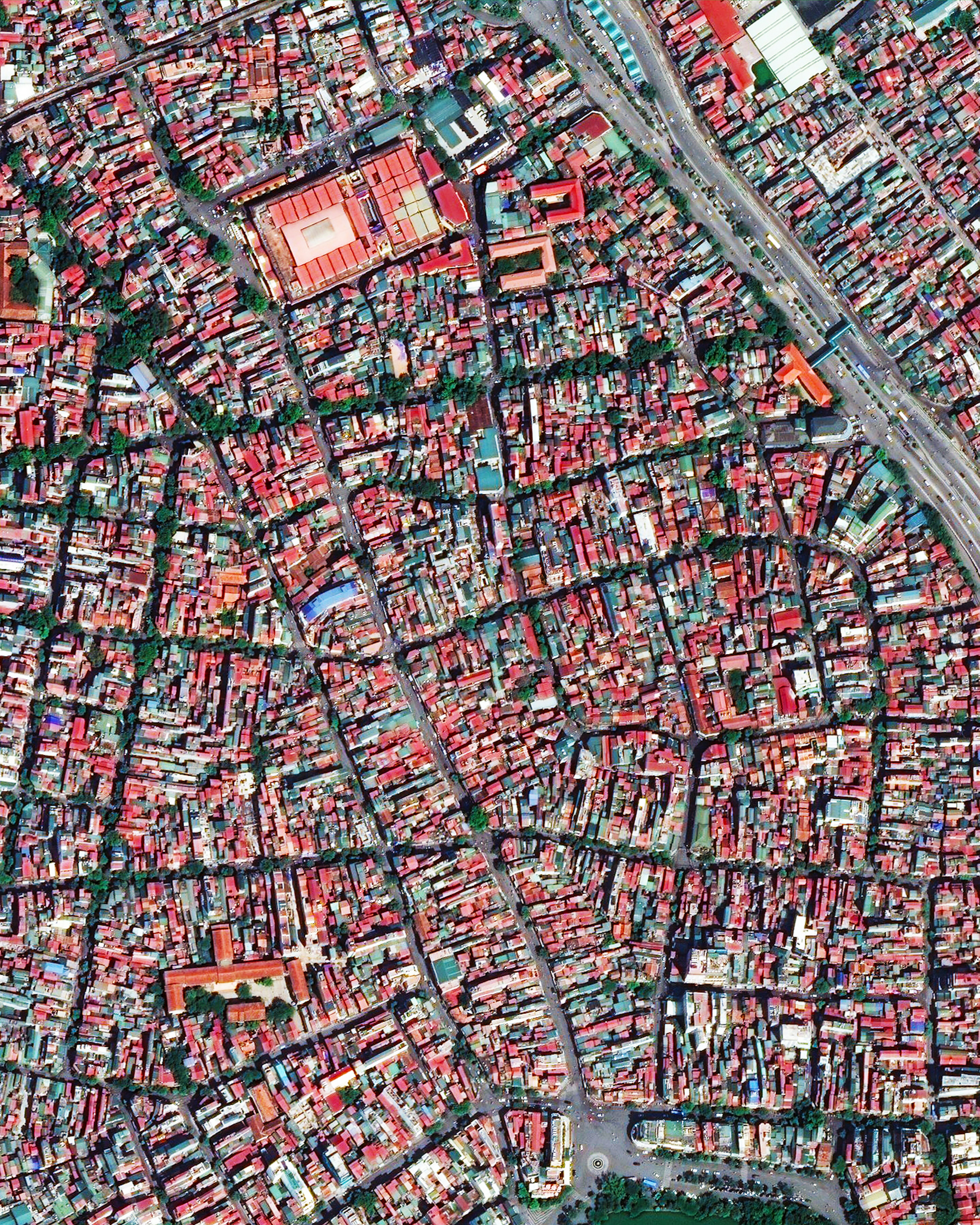
The Hoàn Kiếm District in Hanoi, Vietnam, is a hub for business and tourism. Shown here is the district’s “Old Quarter,” which contains many historic temples, pagodas and shophouses and is characterized by its small street blocks and alleys. Hanoi is the capital city of Vietnam and is the second largest Vietnamese city, with more than 8 million residents.
Sutro Tower
37.755230°,-122.452840° - Vjeran Pavic / The Verge
Sutro Tower emerges from orange skies as smoke and ash blocked out nearly all sunlight over San Francisco, California yesterday. This other-worldly glow darkened the city, even in the middle of the day. Scientists say intense updrafts from the blazes have pushed smoke particles as high as 50,000 feet (15,000 m) into the atmosphere. Sutro is a 977-foot-tall (298 m) TV and radio antenna tower situated on Twin Peaks in San Francisco.
Greenland Ice Melt Timelapse
69.621400°,-49.758500° - NASA
Each year during the spring and summer, the surface of Greenland transforms from a solid white to one where blue streams and lakes emerge. This melting contributes directly to sea level rise because the water that is frozen here is situated on top of a large land mass (in contrast to floating sea ice that makes up much of the rest of the Arctic ice). In this Timelapse, clear differences in ice coverage and melting can be observed at roughly the same time of year from 2014 to 2016. Scientists estimate that half of the ice loss from Greenland has been caused by increased air and surface temperatures and the other half from the speeding up of the flow of ice into the sea from glaciers, propelled by a warmer ocean.
Berlin
52.534336°,13.425719° - Maxar
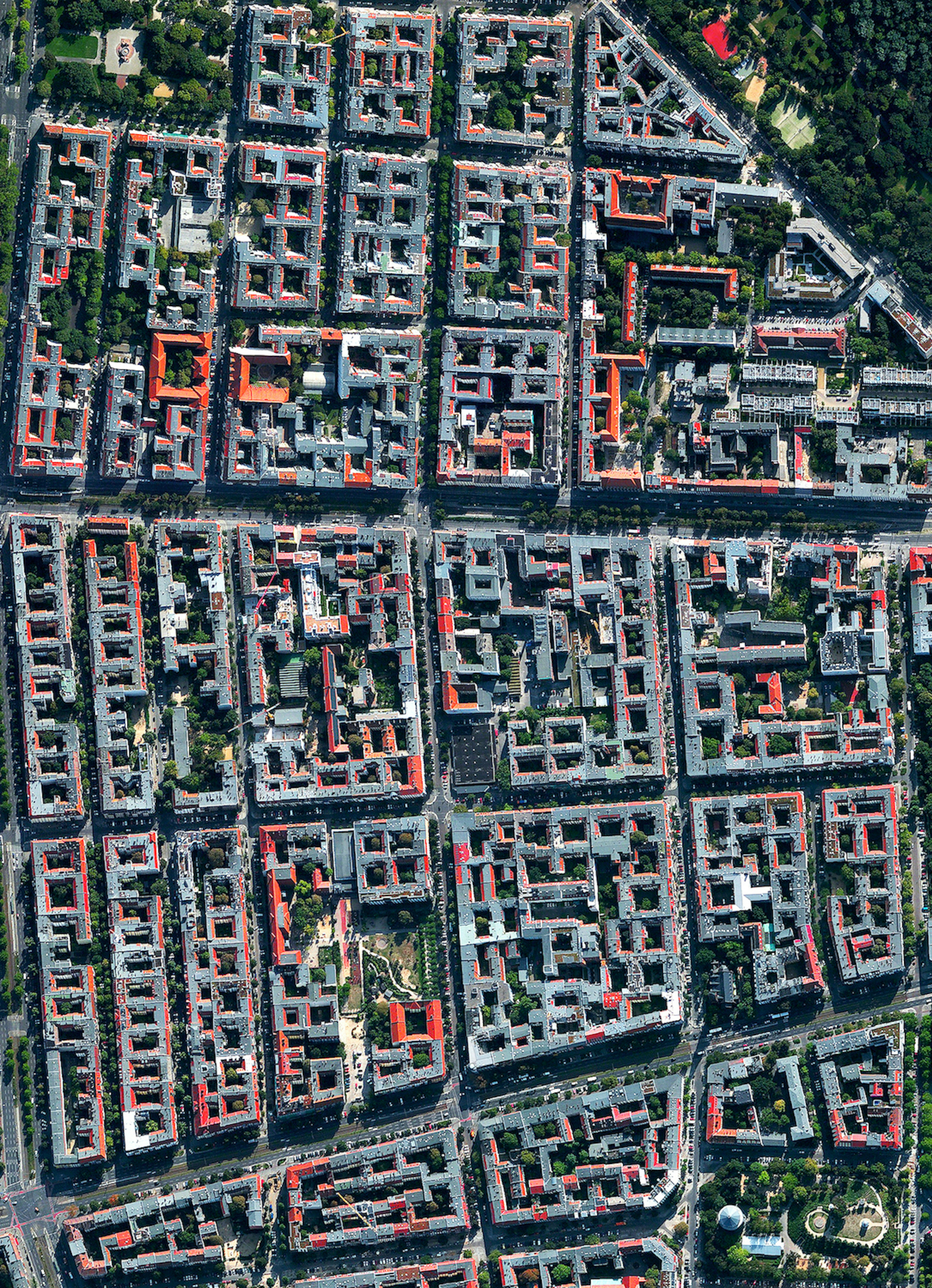
This Overview captures the Winsviertel and Bötzowviertel quarters in Prenzlauer Berg, Berlin, Germany. This area is characterized by relatively uniform, five-story apartment buildings built in closed blocks. More often than not, these blocks are quite large and have abundant backyards — some even have a perimeter of more than a kilometer (0.6 miles).
Odessa, Ukraine
46.485722°,30.743444° - Maxar
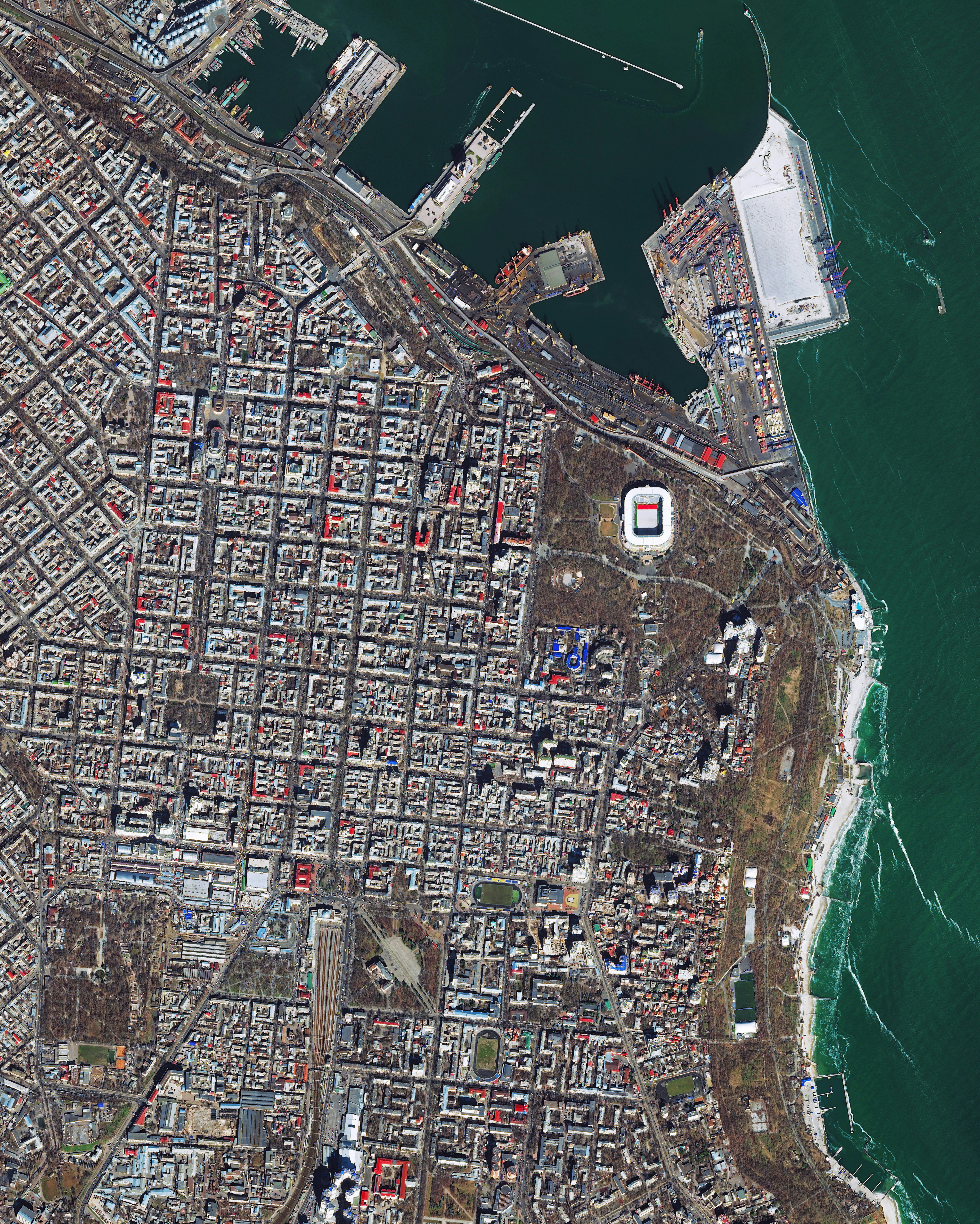
Odessa, Ukraine, is a a major seaport and transport hub located on the northwestern shore of the Black Sea. It is also the third-largest Ukrainian city, with about one million residents. This Overview shows the gridded streets of the city’s center surrounding Shevchenko Park, which contains the Chornomorets Football Stadium.
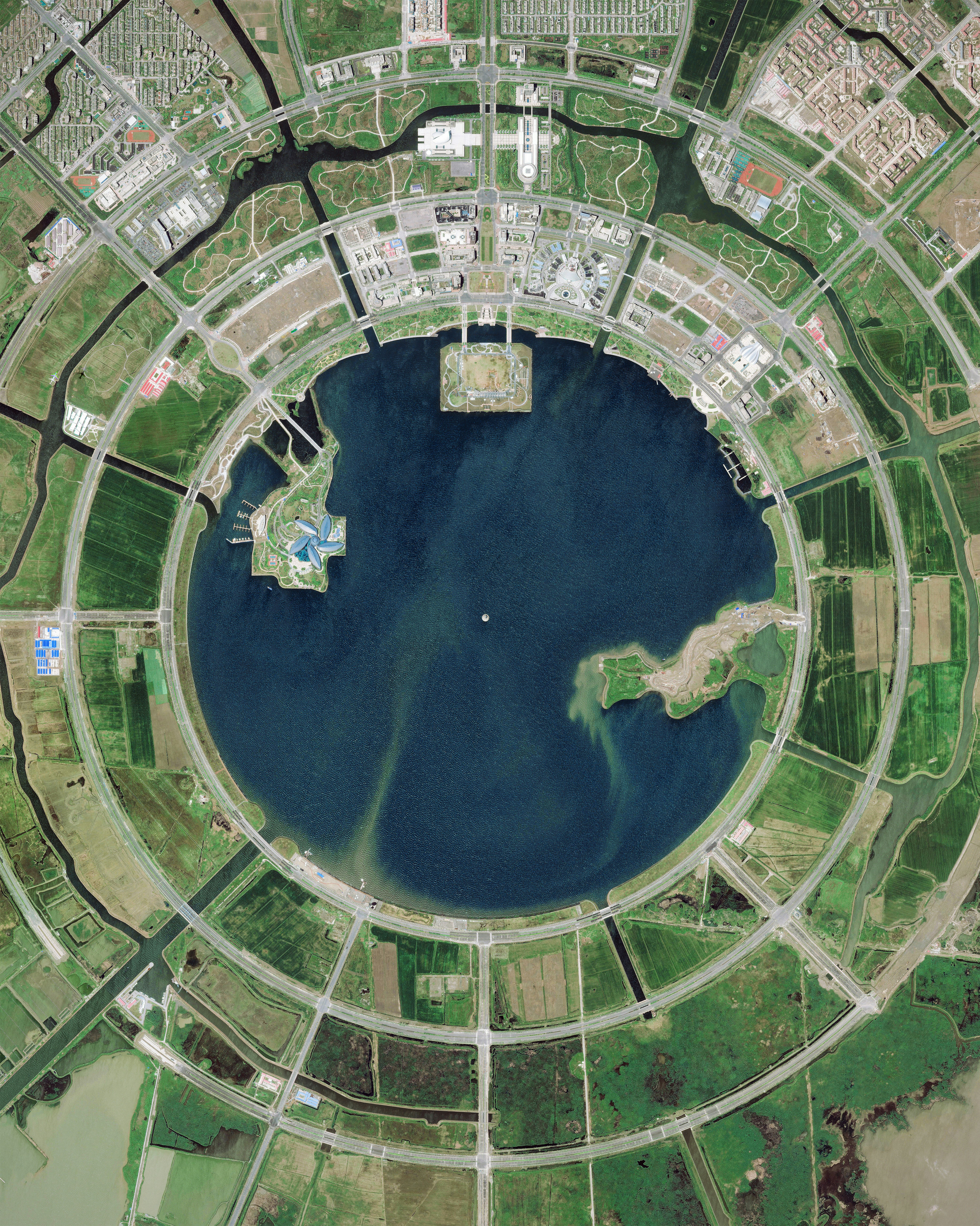
Nanhui New City
30.900000°,121.933333° - Maxar
Nanhui New City is a planned city under construction in the Pudong district of Shanghai, China. Scheduled to be completed this year, the city aims to attract 450,000 residents and 10 million tourists annually. Much of Nanhui New City, which surrounds the circular Dishui Lake, is built upon land reclaimed from the sea.
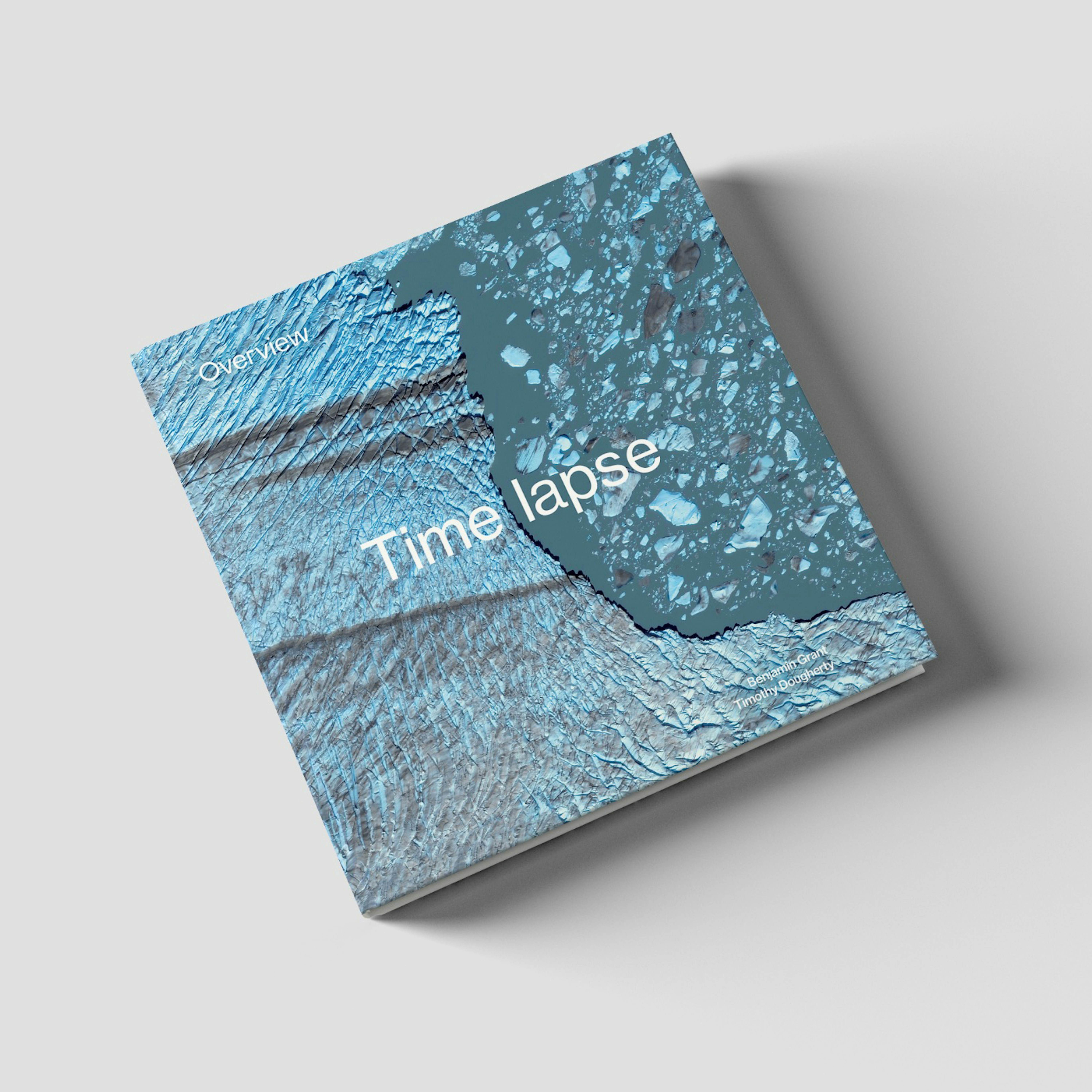
Overview Timelapse
37.819929°,-122.478255° - Maxar
Overview Timelapse is a photographic survey of the state of change on Earth today. With human activity driving this transformation faster than ever, visible signs can now be seen across the planet. With more than 250 new, mesmerizing images such as sprawling cities and the patterns created by decades of deforestation, this book offers a fresh perspective of change on Earth from a larger-than-life scale.
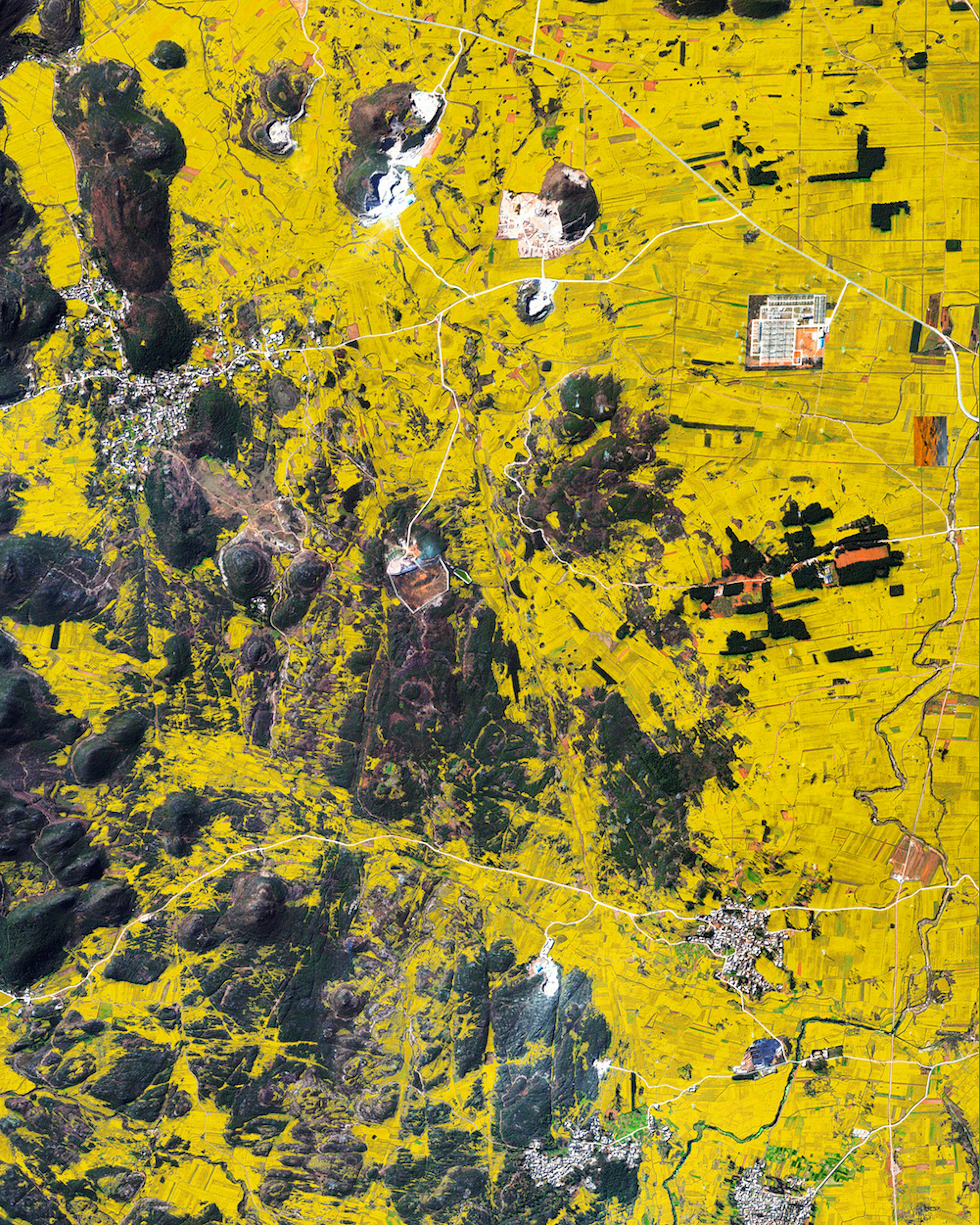
Luoping County Canola Flowers
24.885000°,104.308056° - Maxar
Canola flower fields cover the mountainous landscape of Luoping County, China. The crop is grown for the production of oil, which is extracted by slightly heating and then crushing the flower seeds. Canola oil is primarily used as a source of biodiesel and is also a key ingredient in many foods.
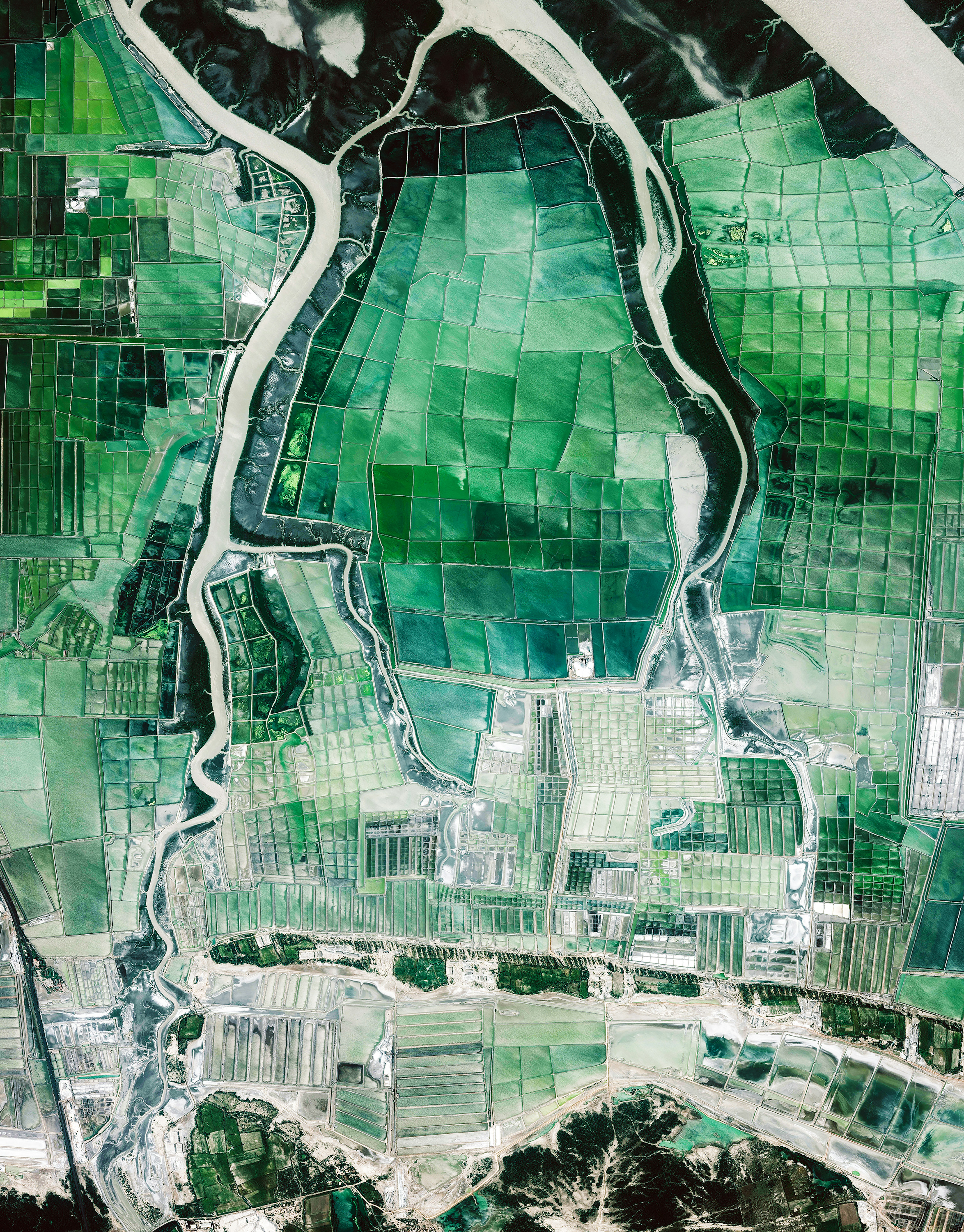
Rann of Kutch
22.981875°,70.512101° - Maxar
Thousands of saltwater evaporation ponds can be seen near the Rann of Kutch in Gujarat, India. Located along the Arabian Sea, this 10,000-square-mile (26,000-square-km) salt marsh is one of the largest in the world. More than 78% of India’s national salt requirement is sourced from Gujarat.
Trieste Marine Terminal
45.630962°,13.761526° - Maxar
Water swirls offshore of the Trieste Marine Terminal, located on the Adriatic Sea in Trieste, Italy. Part of the larger Port of Trieste, this terminal handles containerized cargo and has steadily grown its throughput from 60 twenty-foot equivalent units (TEUs) in 2003 to more than 340 TEUs in 2019. During the 19th century, when the Austro-Hungarian Empire was one of the Great Powers of Europe, Trieste was its most important seaport.
Hurricane Laura
25.000000°,-90.000000° - NASA
Hurricane Laura made landfall near the Louisiana-Texas border this morning, coming ashore as the region’s strongest storm in more than a century. The storm hit the Gulf Coast of Louisiana as a Category 4 hurricane and has since weakened to a Category 2, but it is maintaining wind speeds of 110 mph (177 km/h). Coastal residents have evacuated in anticipation of a massive storm surge, which could spread up to 30 miles (48 km) inland. With a warming climate, scientists predict that there may not necessarily be more hurricanes, but there will likely be more Category 4 and 5 hurricanes that carry higher wind speeds and more precipitation. This image was captured by NASA’s NOAA-20, a weather satellite that picks up temperature differences and then overlays that data over cities at night imagery.
Cimetière Parisien de Pantin
48.904221°,2.410638° - Maxar
Cimetière parisien de Pantin is the largest cemetery in Paris, France, both in number of graves and land area. Since opening in November 1886, more than one million people have been buried here. Pantin is a garden-style burial ground, with more than 8,000 trees and a network of 20 miles (32 km) of roads that allow motor vehicle access.
Río Cauto
20.584069°,-77.153502° - NASA
The Río Cauto forms a colorful delta as it empties and drops sediment into the Gulf of Guacanayabo in southeastern Cuba. Flowing for about 230 miles (370 km), the Cauto is Cuba’s longest river and one of only two navigable rivers in the country. Its delta is an internationally recognized wetland and is home to several species of mangrove, as well as the endangered Cuban parakeet and Cuban tree duck.
Malé, Maldives
4.175278°,73.508889° - Maxar
Malé is the capital and most populous city in the Republic of Maldives, a nation of islands in South Asia. With a population of about 133,000 in an area of 2.24 square miles (5.8 square km), it is the fifth most densely populated island on Earth. Since it has no surrounding countryside, all of Malé’s utilities are located in the city proper and sewage is pumped unprocessed into the sea.
