Daily
One regular dose of Earth from above
Arvaikheer
46.266111°,102.777778° - Maxar
Arvaikheer is a town in central Mongolia, nestled against the hills of the Khangai Mountains. The town’s brightly colored roofs are a hub for nearly 30,000 residents who are known for their traditional crafts, goat herding, and equestrian sports. Arvaikheer, which means “Barley Steppe,” is the most temperate place in Mongolia with only 30 degrees Celsius difference between its average temperatures in January and July.
Tappan Zee Bridge
41.071275°,-73.897268° - Maxar
The Tappan Zee Bridge is a twin cable-stayed bridge crossing the Hudson River north of New York City. Construction on this larger-capacity, replacement bridge began in 2013 to handle increased traffic to and from the major metropolitan area. Once the large replacement project was finished in 2017, the old, inactive bridge was demolished. The new bridge has a shared-use path for bicycles and pedestrians and was built with the capacity for a future commuter rail line to be built at a later date. Approximately 140,000 automobiles cross the bridge every day.
Paragominas Bauxite Mine
-3.245423°,-47.702873° - Maxar
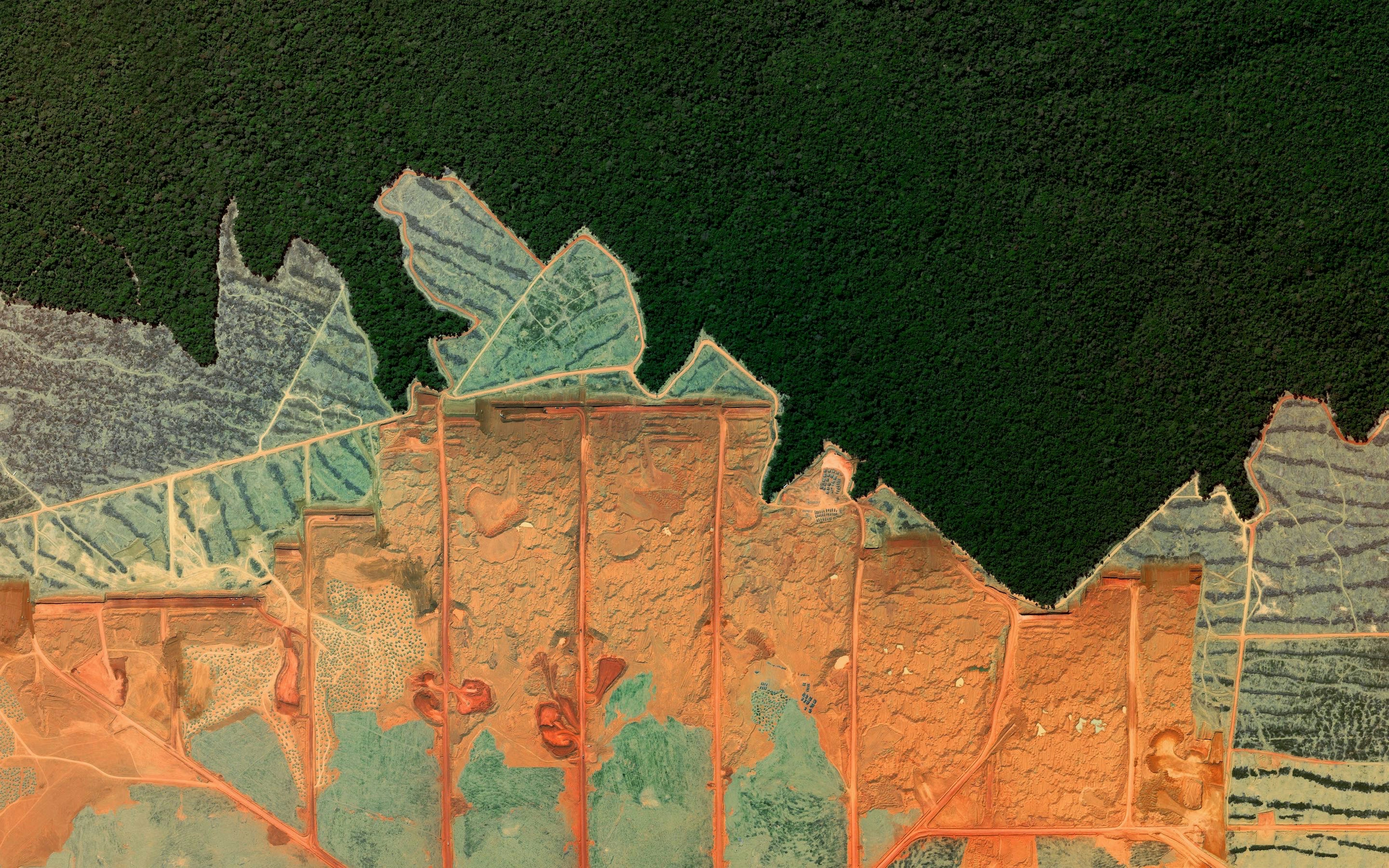
Aluminum is the third most abundant element in the earth’s crust, but it does not naturally occur as a metal. The first step in producing aluminum is mining its ore—bauxite. The Paragominas Bauxite Mine in Brazil, seen here, produces more than 5 million tons (4.5 million metric tons) of bauxite every year, and represents one of the largest reserves of the material in the country.
San Juan River
37.206194°,-109.995583° - Maxar
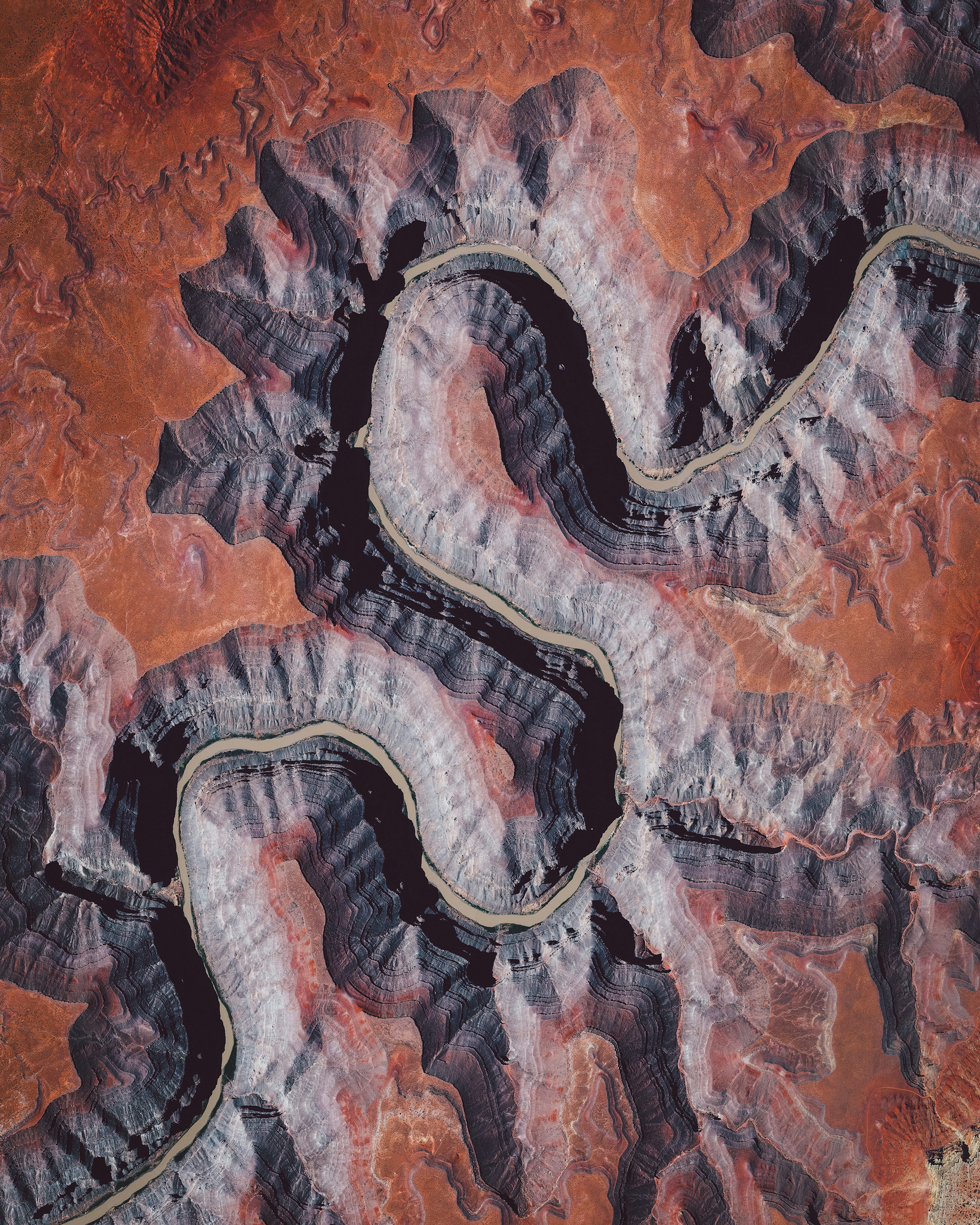
In this Overview, the San Juan River is shown meandering through southeastern Utah, not far from Goosenecks State Park. It is a major tributary of the Colorado River and provides drainage to the Four Corners region of Colorado, New Mexico, Utah and Arizona. The San Juan is one of the muddiest rivers in North America, carrying an average of 25 million U.S. tons of silt and sediment each year.
Chicago
41.888889°,-87.626667° - Nearmap
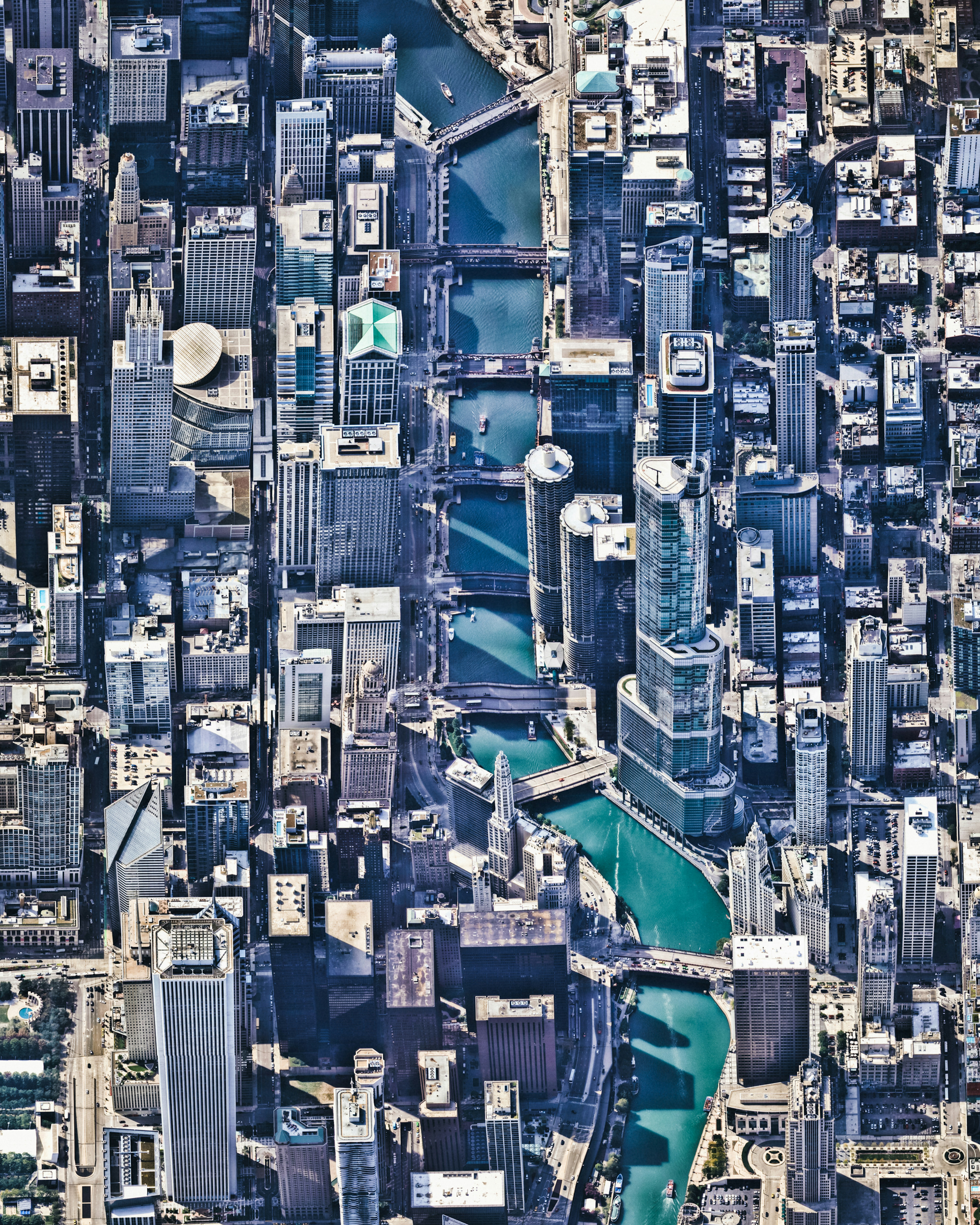
Chicago, Illinois, is the third most populous city in the United States, with about 2.7 million residents. This Overview shows the Chicago River flowing through the city center, dividing The Loop (left) and Near North Side (right) communities. Many of the city’s notable skyscrapers can be seen from this perspective, including the Crain Communications Building, Trump International Hotel and Tower, and Tribune Tower.
The White House
38.897778°,-77.036389° - Nearmap
Located in the heart of Washington, D.C., the White House is the official residence and workplace of the President of the United States. Construction of the 55,000-square-foot (5,100-square-meter) neoclassical building was completed in 1800 and numerous additions and renovations have taken place in the decades since.
Belo Horizonte
-19.916667°,-43.933333° - Maxar
Belo Horizonte is the sixth largest city in Brazil with a population of approximately 2.7 million people. The city was constructed at the end of the 19th century with a planned, symmetrical array of perpendicular and diagonal streets in its downtown area. The roads are named after the Brazilian states and the indigenous tribes of Brazil.
Melbourne Skeleton Mural
-37.711934°,144.992803° - Nearmap
A mural of a pink skeleton covers the grounds at Reservoir Skatepark in northern Melbourne, Australia. This piece spans roughly 20,000 square feet (1,858 sq. m) and is one of many large murals in the area created by local artist Kitt Bennett. For a sense of scale, 20,000 square feet is nearly half the size of an American football field.
Mount Rainier
46.852886°,-121.760374° - Planet
Mount Rainier is an active stratovolcano located about 60 miles (96 km) southeast of Seattle, Washington. Located within the Cascade Range, the 14,411-foot (4,392 m) tall peak is the most topographically prominent mountain in the contiguous United States and is snow-capped year round. The origin of its name is believed to mean “mother of waters” as it is the source of numerous rivers, seen here descending from its peak.
Great Smoky Mountains National Park
35.600000°,-83.516667° - Maxar
Fall foliage covers the landscape in Great Smoky Mountains National Park. The park straddles the Tennessee and North Carolina border, is home to some of the tallest mountains in the Eastern United States, and is bisected by the Appalachian Trail. This Overview is featured in our story, "In Nature We Trust."Read the full story →
Aral Sea
45.510578°,58.757118° - Maxar
The Aral Sea, located on the border of Kazakhstan and Uzbekistan, was once the fourth largest lake in the world. From 2001 to 2018, water levels have been gradually decreasing over time as a result of irrigation projects that began in the 1960s to support agricultural development, primarily for cotton, in the adjacent Kyzylkum Desert. By diverting the Syr Darya and the Amu Darya rivers, the Aral Sea has continued to evaporate without its primary sources of water replenishment. Due to the massive reduction of water levels, the surrounding region has experienced colder winters, hotter summers, massive dust storms, and the complete devastation of its fishing industry.
Scrapped Cruise Ships
38.829544°,26.930941° - Chris McGrath / Getty Images
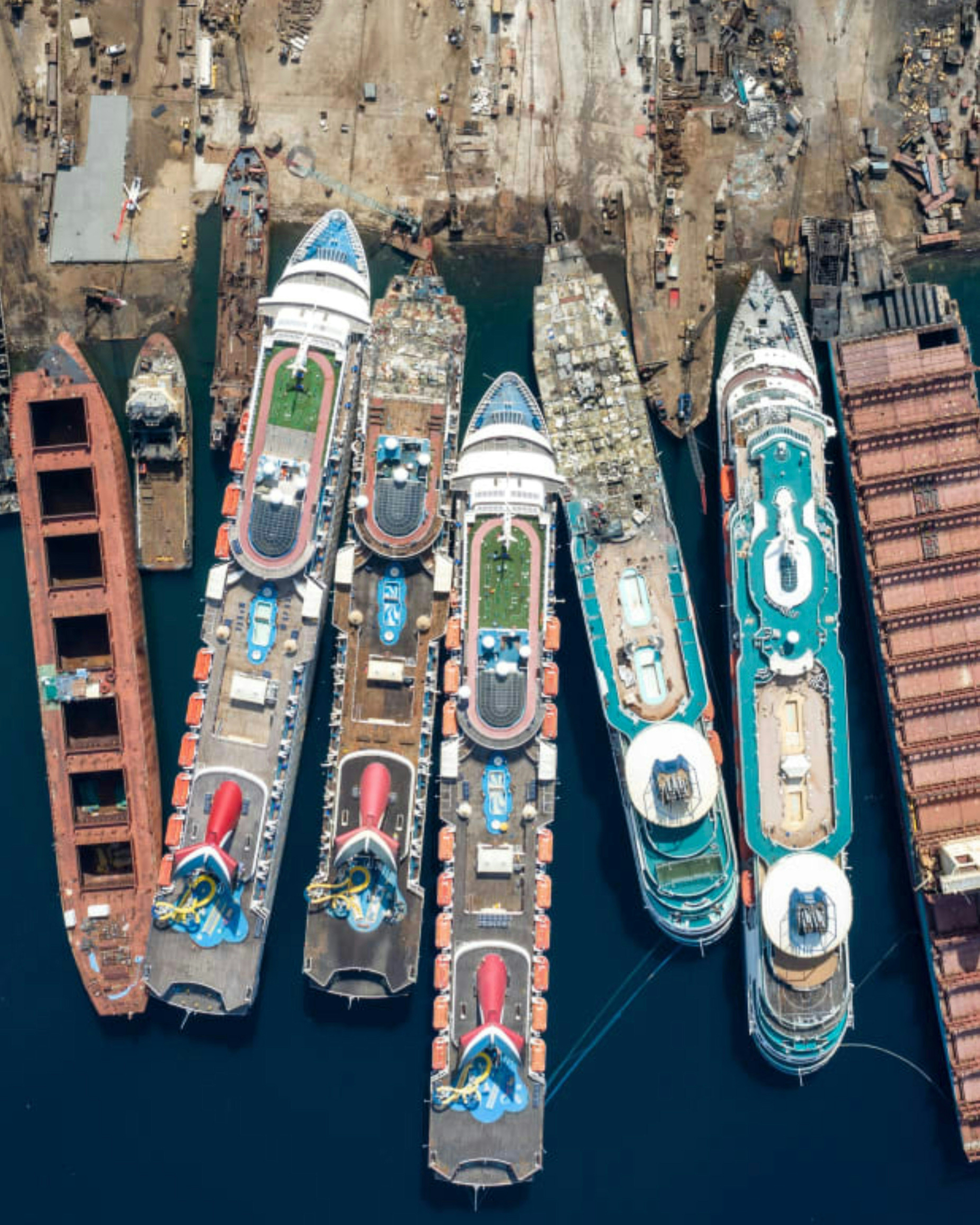
Cruise ships are disassembled for scrap metal at the Aliağa ship breaking yard in Izmir, Turkey. Before this year, most cruise ships would sail for decades before being scrapped, but the COVID-19 pandemic and government-issued “no sail” policies have brought the cruise industry to a halt, forcing many companies to downsize their fleets. Ships that arrive at Aliaga are torn apart and all items inside are removed and sold to other businesses or collectors. You’ll notice an additional ship has been added to the more recent, zoomed-in shot that’s shown here first.
Crescent Dunes Solar Energy Project
38.238972°,-117.363721° - Maxar
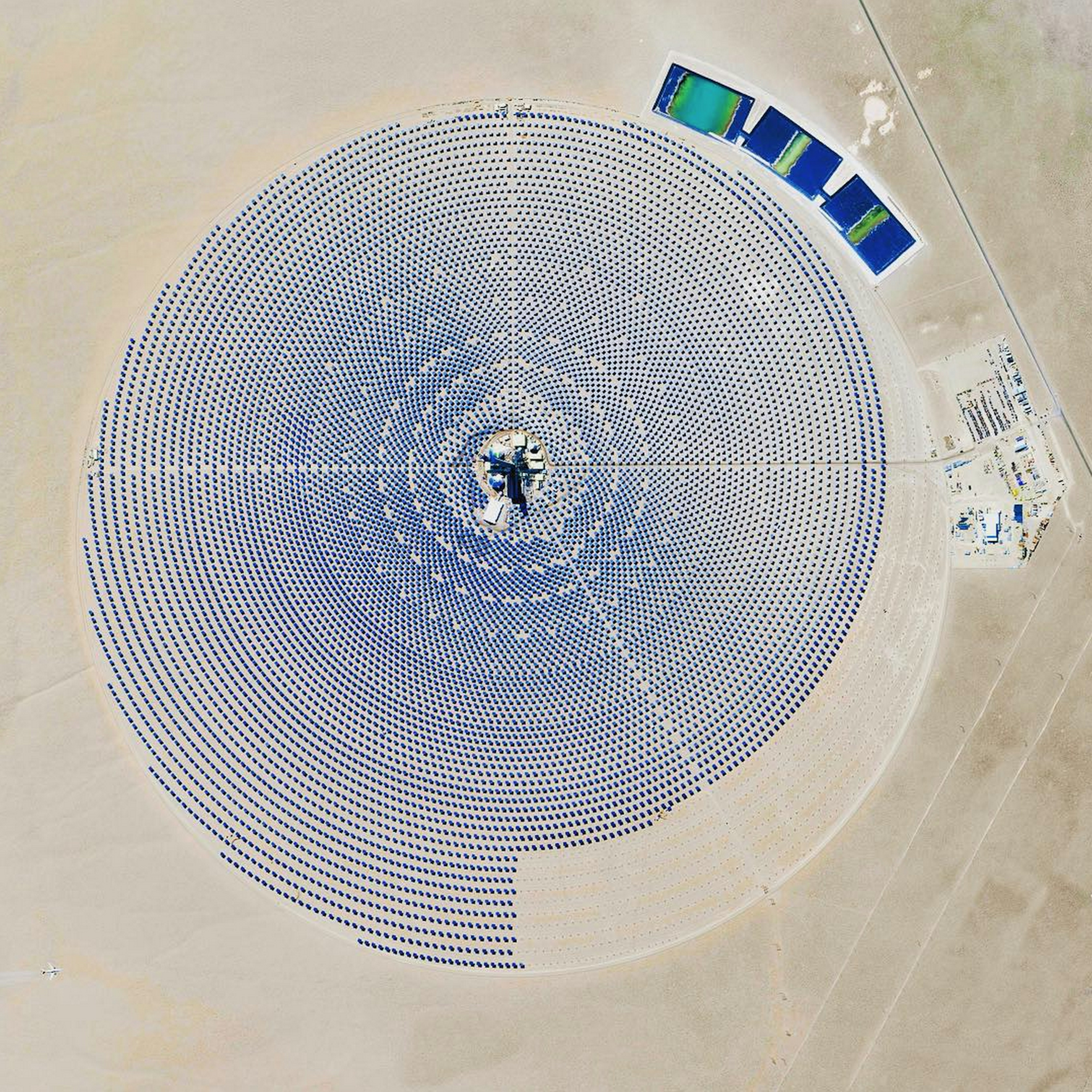
The Crescent Dunes Solar Energy Project near Tonopah, Nevada powers up to 75,000 homes during peak electricity periods. So how does it work? The project uses 17,500 heliostat mirrors to collect and focus the sun’s thermal energy to heat molten salt flowing through a 540-foot (160 m) tall solar power tower. The molten salt then circulates from the tower to a storage tank where it is used to produce steam and generate electricity. One last thing - look closely at the lower left corner of this Overview and you’ll see an airplane flying over the complex!
Vltava River
49.716318°,14.329931° - Maxar
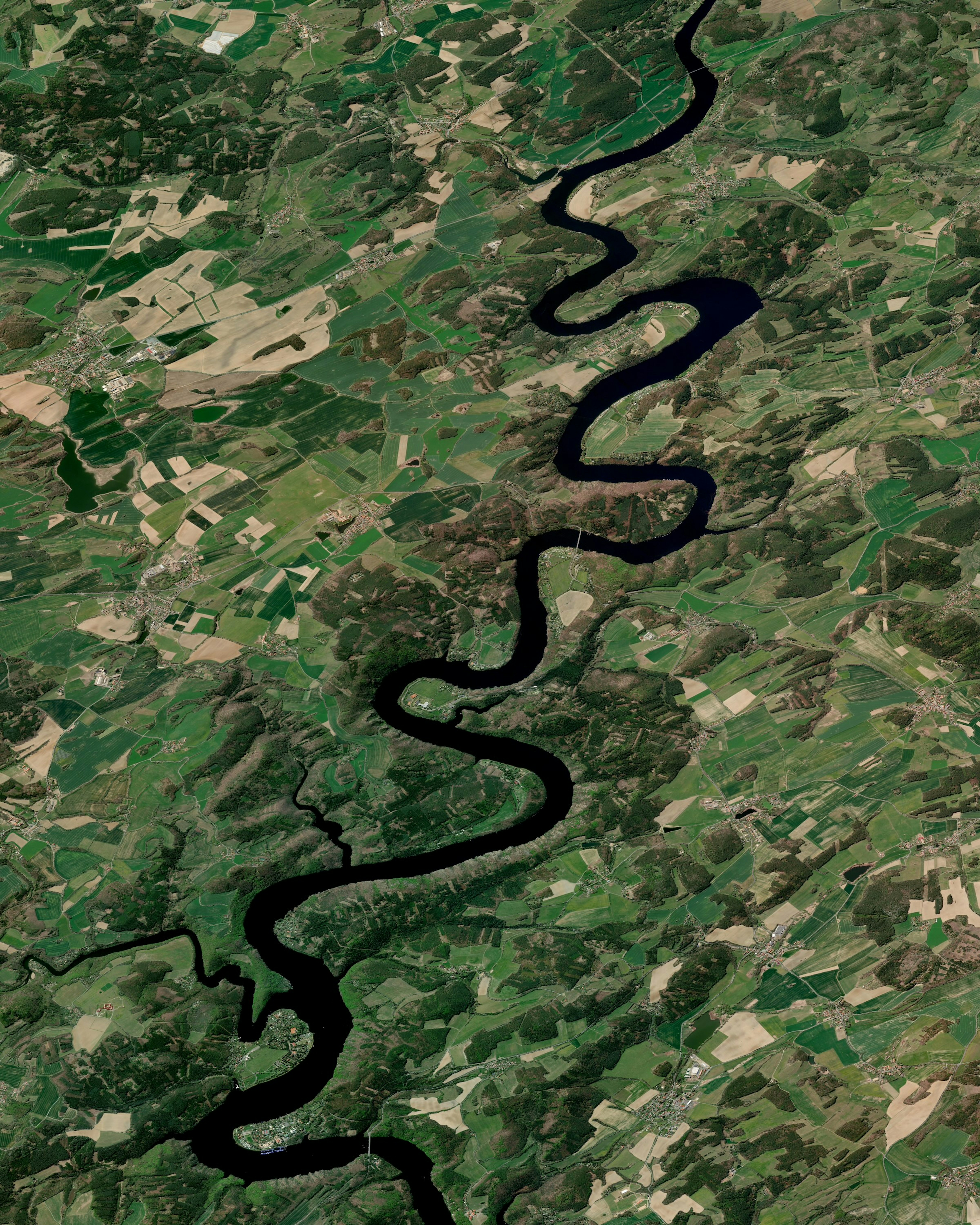
The Vltava is the longest river in the Czech Republic, flowing for 270 miles (430 km) across the country. Known as the “Czech national river,” it begins near the southern border and travels north across Bohemia, passing through Prague before merging with the Elbe in the city of Mělník. The river has a basin of more than 10,800 square miles (28,000 square km), which is about a third of the Czech Republic’s entire territory.
Paris at Night
48.856613°,2.352222° - NASA
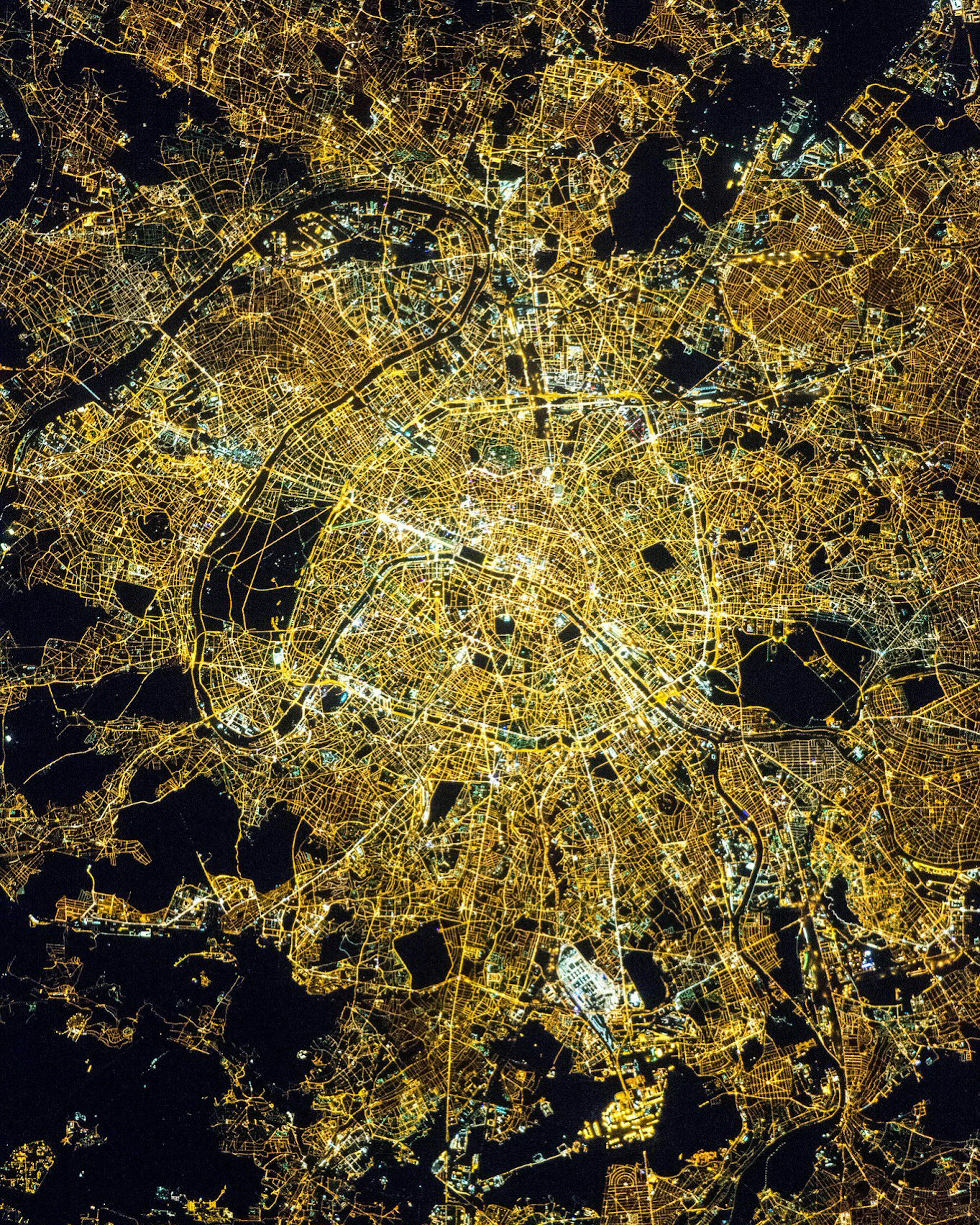
Check out this incredible shot of Paris at night. Paris is often called the “City of Light,” a name that originates from its implementation and illumination of 56,000 gas lamps in the 1860s. Today, the city receives half of its energy (and its light) from nearby energy plants that simultaneously generate electricity and heat (called “cogeneration”). Thirty-five percent of the city’s power is generated by the Nogent Nuclear Power Plant while nationally, France gets 75 percent of its power from nuclear plants.
Valparaíso
-33.029080°,-71.646361° - Maxar
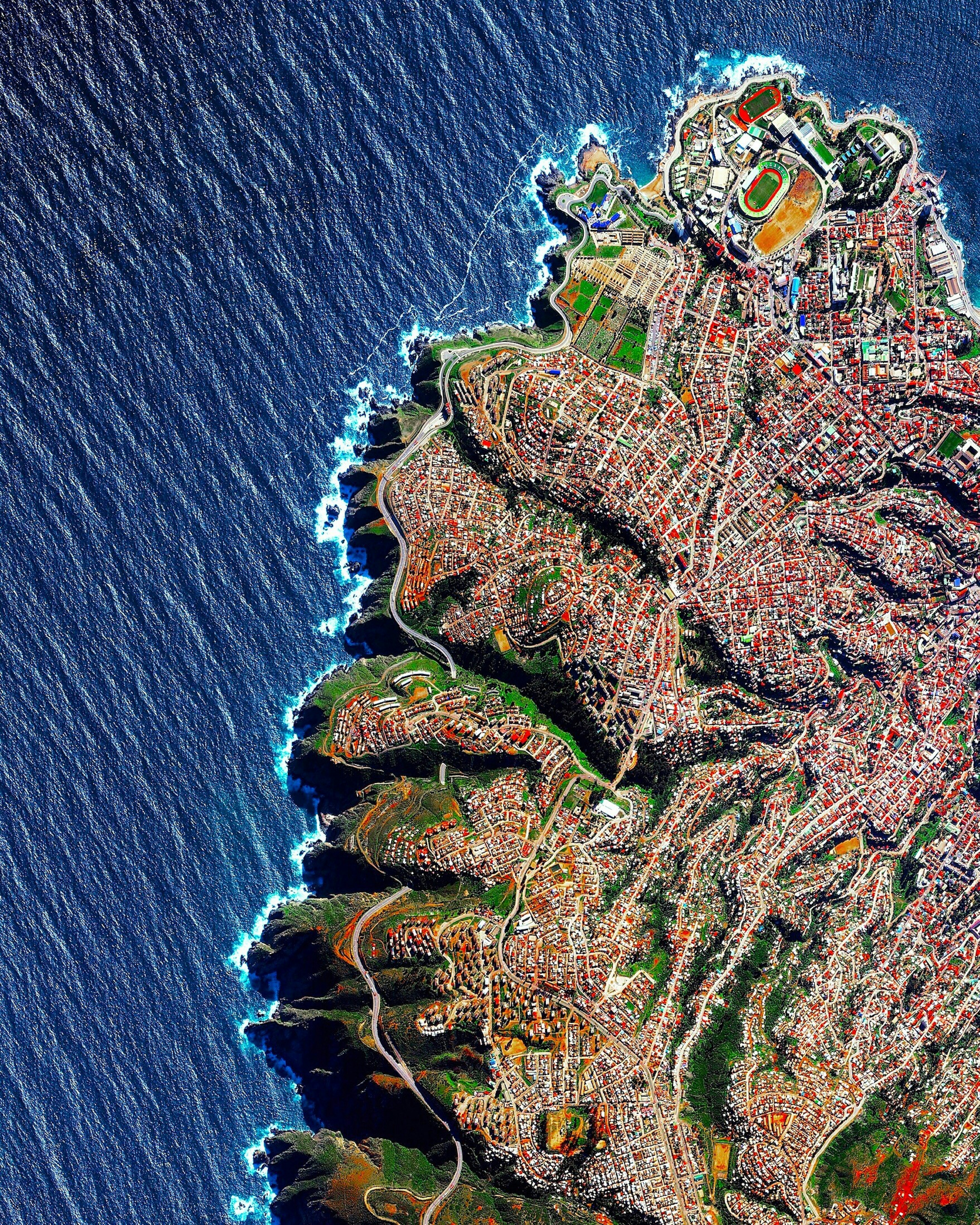
Valparaíso, Chile, is built upon dozens of steep hillsides overlooking the Pacific Ocean. Known as “The Jewel of the Pacific,” the city is the sixth largest in the country and has approximately 285,000 residents. Valparaíso is home to Chile’s first public library, South America’s first volunteer fire department, and the world’s longest running Spanish language newspaper in continuous publication.
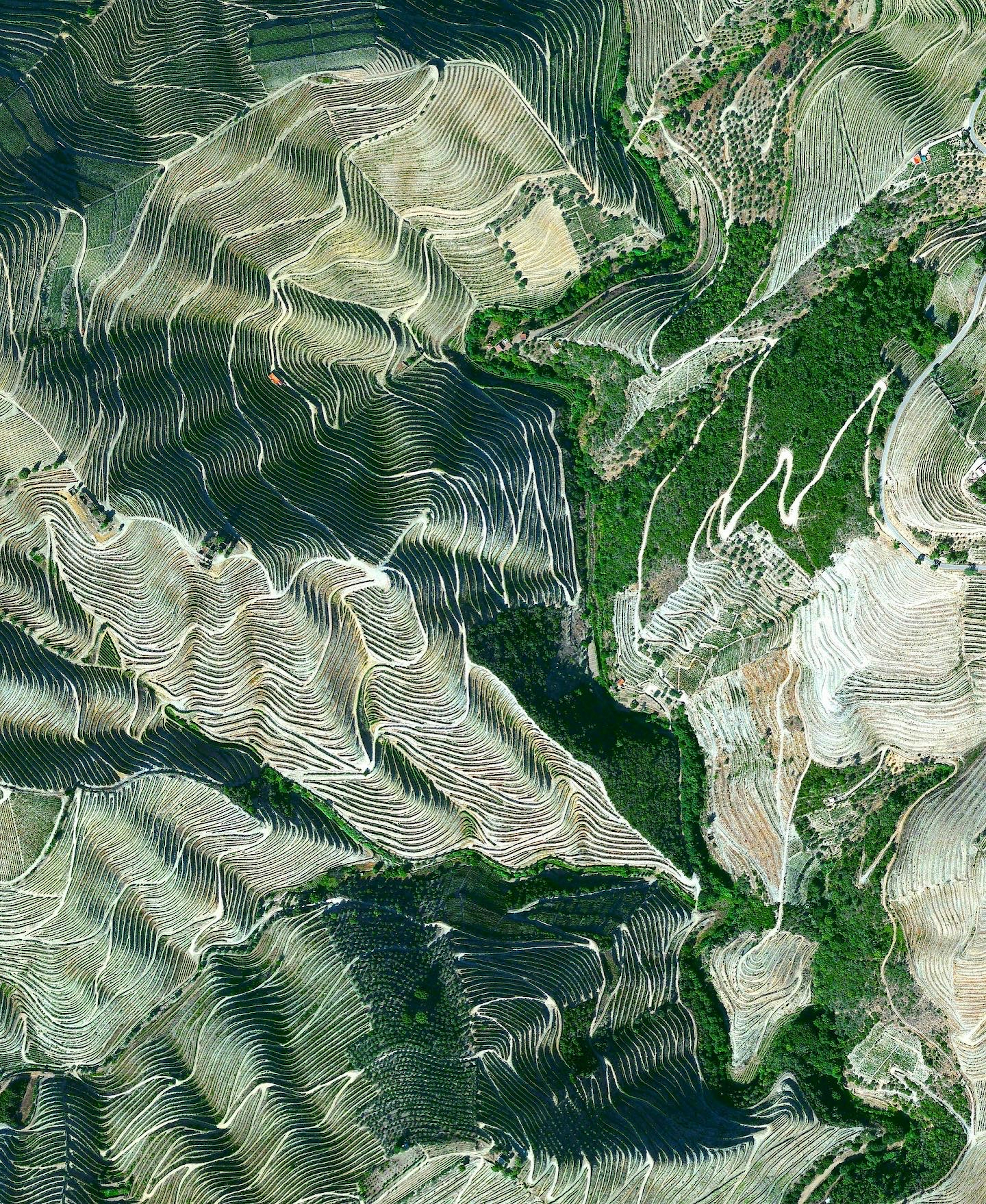
Douro Valley, Portugal
41.167121°,-7.773069° - Maxar
Terraced hillsides are seen in the Douro Valley of northern Portugal. The steep slopes are covered with grape vines that rise from the Douro River below. The region is recognized as the home of port wine — a sweet, red wine that is often served with dessert.
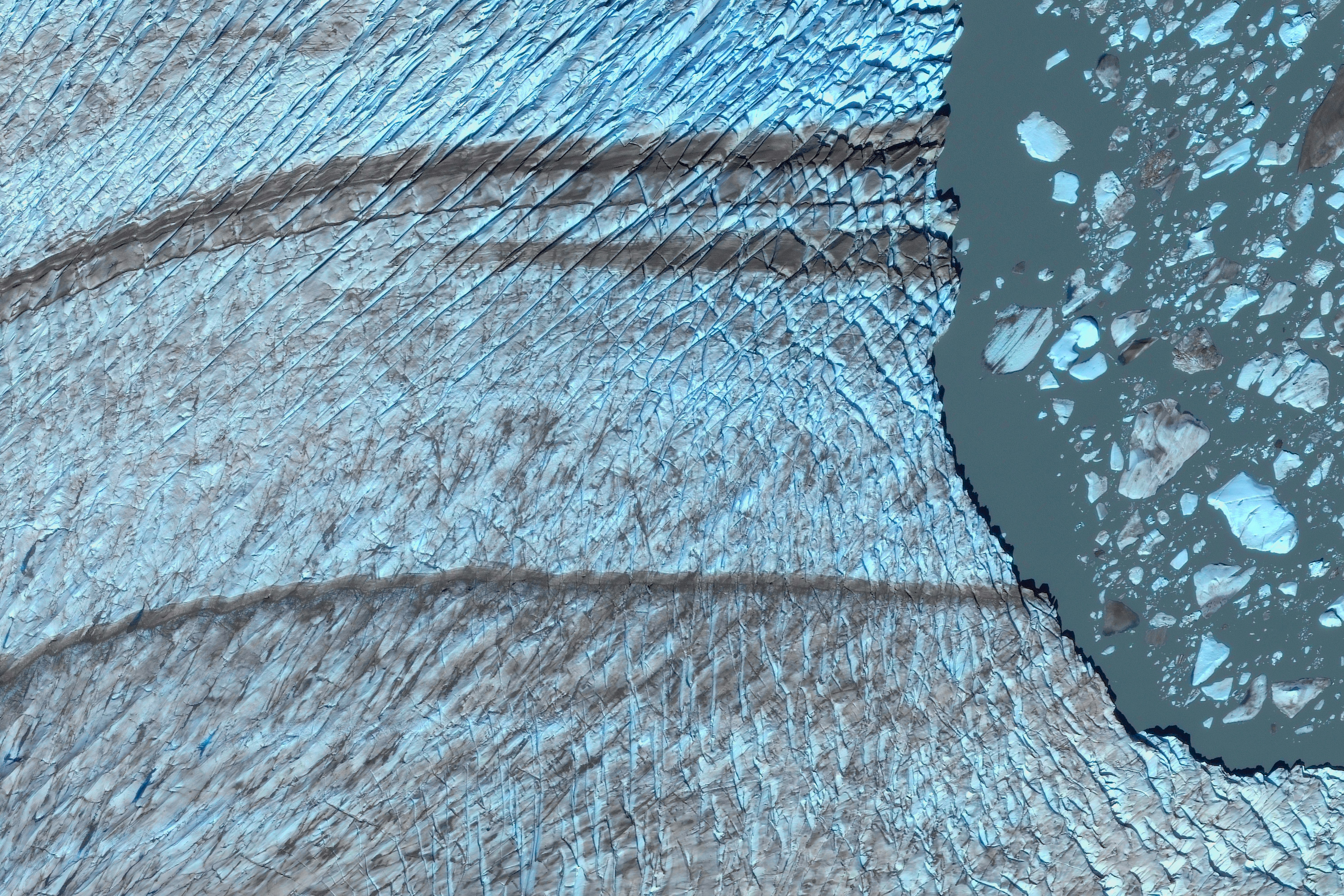
Occidental Glacier
-48.850300°,-74.064300° - Maxar
From the cover of our new book "Overview Timelapse". The Occidental Glacier is located in the Southern Patagonian Ice Field of Chile. In this image from May 2019, massive icebergs and an ice mélange fill the lake at the toe of the glacier. Recent measurements of the Patagonian ice fields (taken using satellite photography) show that they have been receding and thinning at an accelerating rate in recent years. Between 2002 and 2017, the ice shrank by roughly 23 gigatons per year—a volume of water equivalent to roughly ten Olympic-size swimming pools.
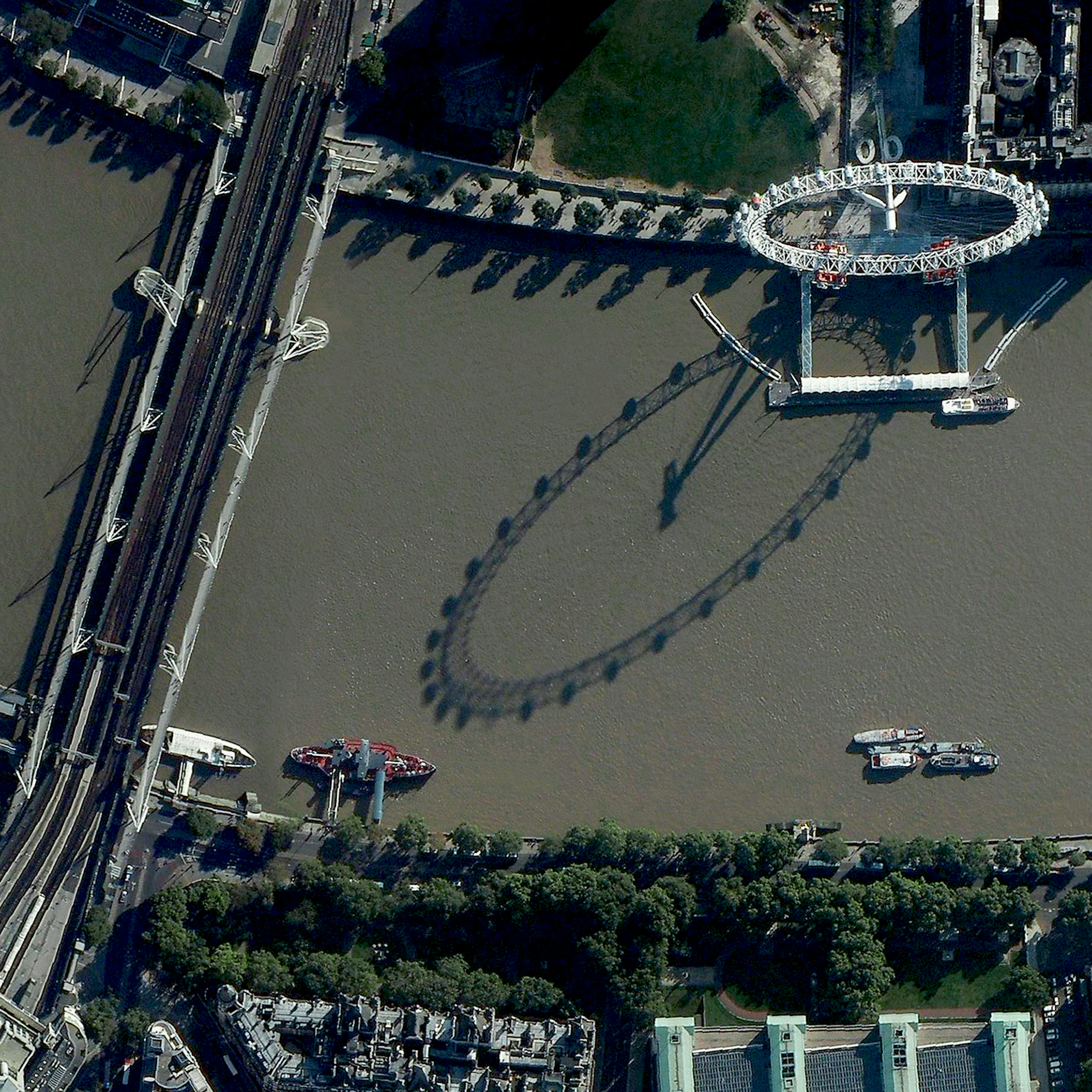
London Eye
51.503300°,-0.119400° - Maxar
The London Eye casts a shadow on the River Thames in London, England. The ferris wheel is the fourth tallest structure of its kind in the world at 443 feet (135 m) and has a wheel diameter of 394 feet (120 m). Each one of its 32 passenger capsules holds up to 25 people, who have the ability to sit or walk around freely while the wheel rotates.
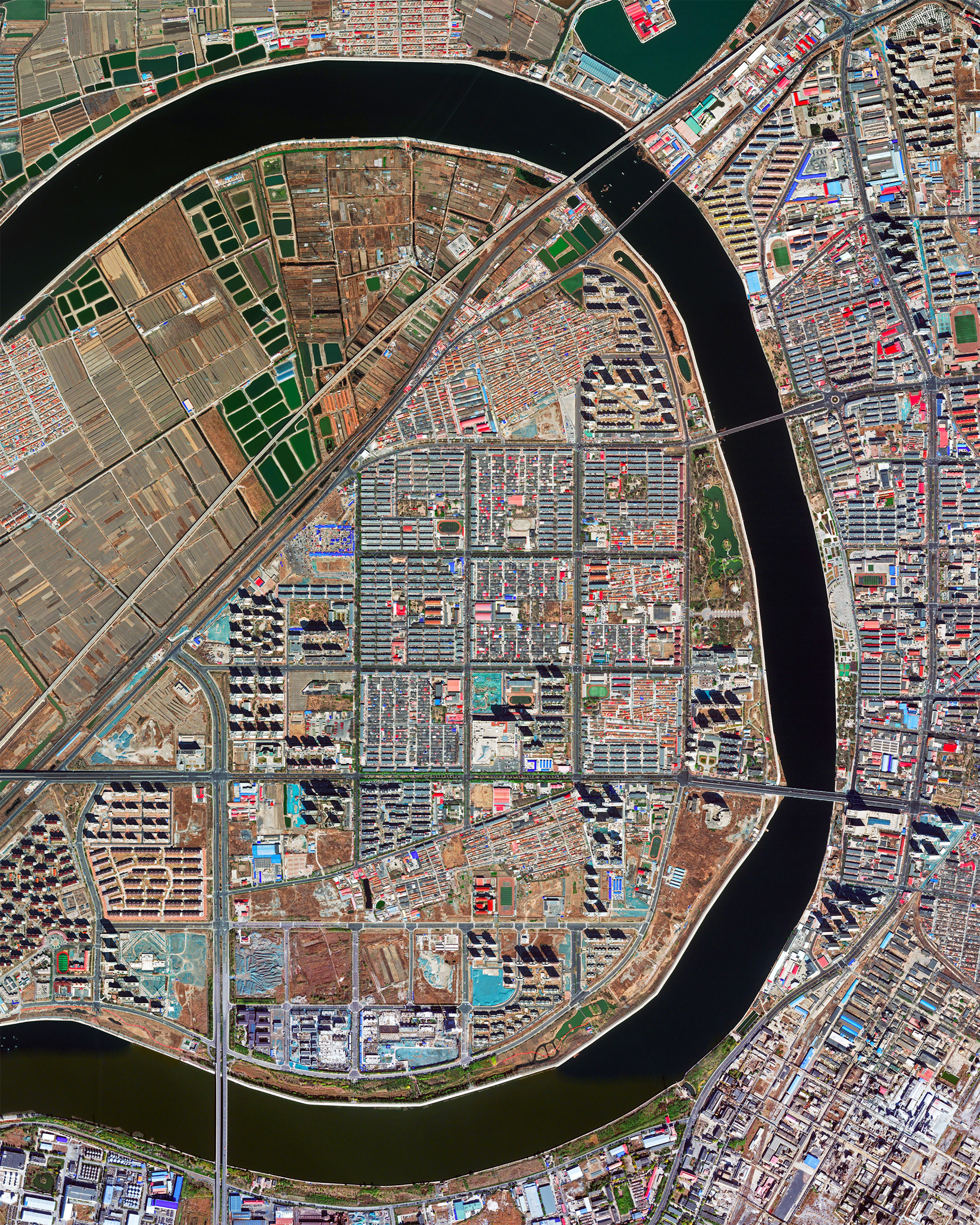
Binhai New Area
39.245825°,117.796044° - Maxar
Gudao River curves through the Binhai New Area in eastern Tianjin, China. State-level “new areas” like Binhai are given special economic and development support from the Chinese Central Government to speed up the city’s economy and attract new business. With about one million residents, Binhai houses just a fraction of Tianjin’s total population of 15.6 million.


