Daily
One regular dose of Earth from above
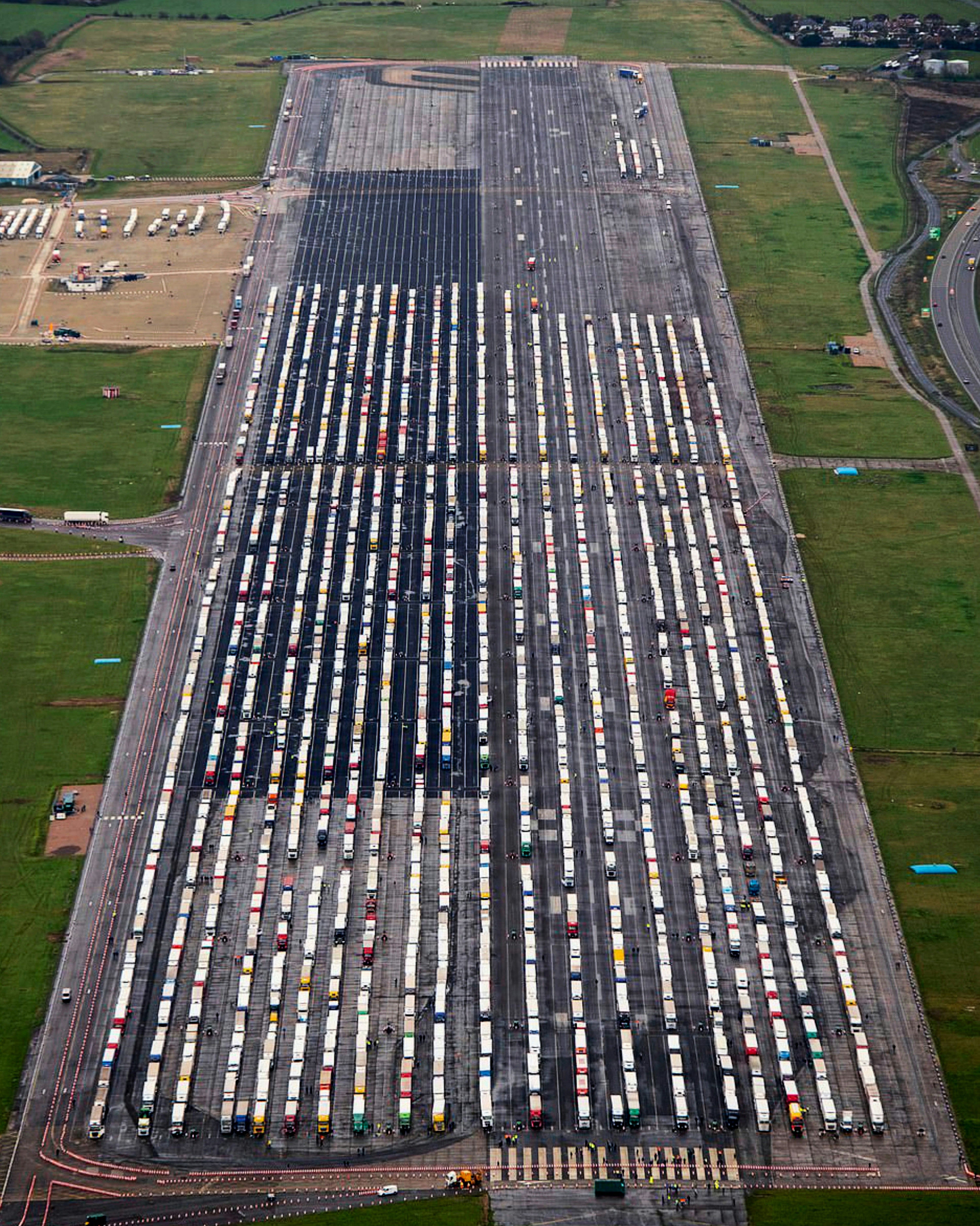
Kent Lorry Park
51.342222°,1.346111° - William Edwards/AFP/Getty Images
Hundreds of semi-trailer trucks line up on the tarmac of Manston Airport in Kent, southeastern England. The closed airport has been used as a “lorry park” since Sunday, when France announced a travel ban from the United Kingdom in response to the identification of a new COVID-19 strain in England. The border was reopened yesterday morning to essential travelers who test negative for COVID-19, slowly alleviating a backup of several thousand cargo trucks. This morning, after four and a half years of Brexit negotiations, the European Union and the UK finalized terms on a free trade deal, narrowly avoiding a no-deal scenario that would have begun January 1st.
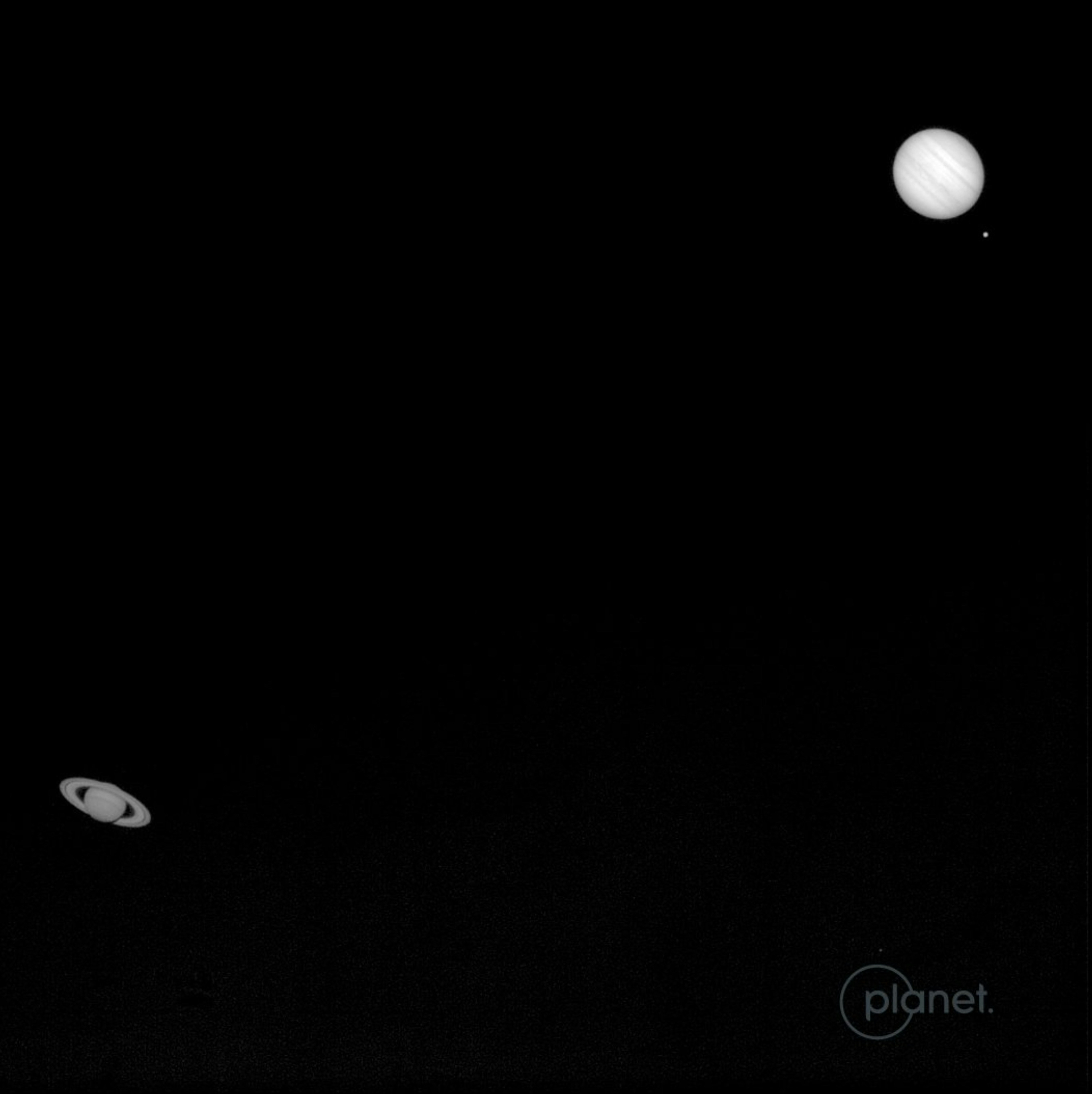
Saturn-Jupiter Conjunction
0.000000°,0.000000° - Planet
While we normally focus on satellite imagery of Earth, today we turn our cameras in the other direction to share this once-in-our-lifetime view. A Planet SkySat captured this shot of the Jupiter and Saturn conjunction on December 21st, when the two planets made their closest night sky pass in nearly 800 years. Although they are really 456 million miles (734 million km) apart, during this vibrant conjunction — called the “Christmas Star” — they appeared so close that both could be covered by a pinkie finger at arm’s length.
Abandonment of Deir ez-Zor
35.333333°,40.150000° - Maxar
This Overview shows Deir ez-Zor, the largest city in eastern Syria, before (2012) and during (2018) the Syrian Civil War. Extended periods of drought in the late 2000s and early 2010s forced Syrian farmers and others dependent on the agriculture industry into cities like Deir ez-Zor, exacerbating existing political unrest. This tension is believed to be a major factor in setting off the Syrian Civil War, the ultimate cause of the world’s largest refugee crisis, with over 5 million refugees fleeing to neighboring countries, Africa, and Europe to escape the conflict.
New Mexico Potash Ponds
32.510823°,-103.955313° - Maxar
Evaporation ponds are seen at the Intrepid Potash Mines near Carlsbad, New Mexico, USA. These mines produce muriate of potash and sulfate of potash magnesium, two mineral salts used in fertilizer. Salt is dried in these massive solar ponds after being pumped to the surface from underground brines. Water in the ponds is dyed with vibrant colors to reduce the time it takes for potash to crystallize — darker water absorbs more sunlight, causing it to evaporate more quickly.
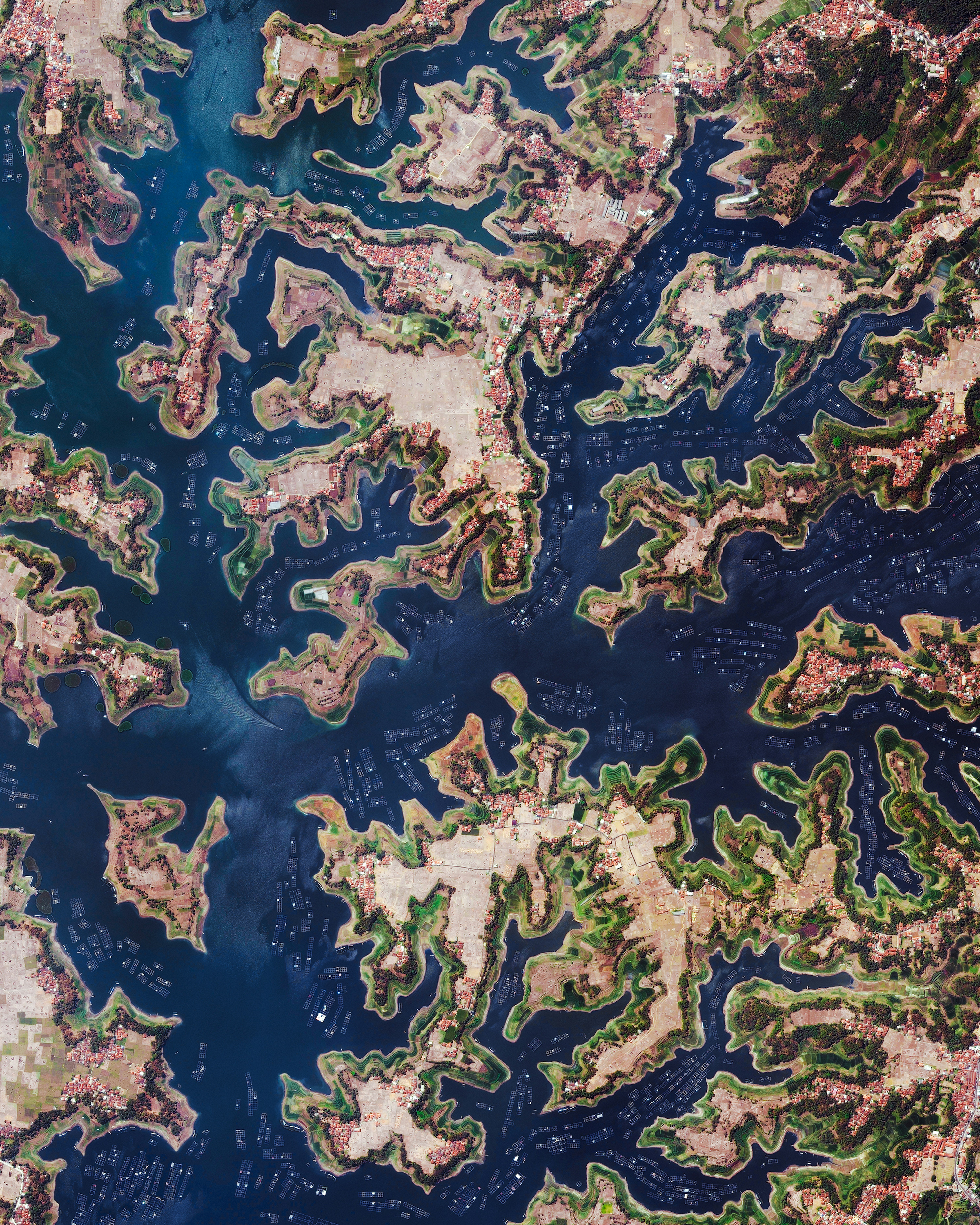
West Java Aquaculture
-6.931700°,107.429800° - Maxar
Aquaculture operations are seen along much of the shoreline of the Saguling Dam Reservoir in West Java, Indonesia. Located at the headwater of the Citarum River, the reservoir’s primary purpose is hydroelectric power generation, but it also provides water for net-cage fish farming and rice paddy irrigation. The Citarum River is listed as one of the most polluted rivers in the world, primarily due to contamination from the Indonesian textile industry.
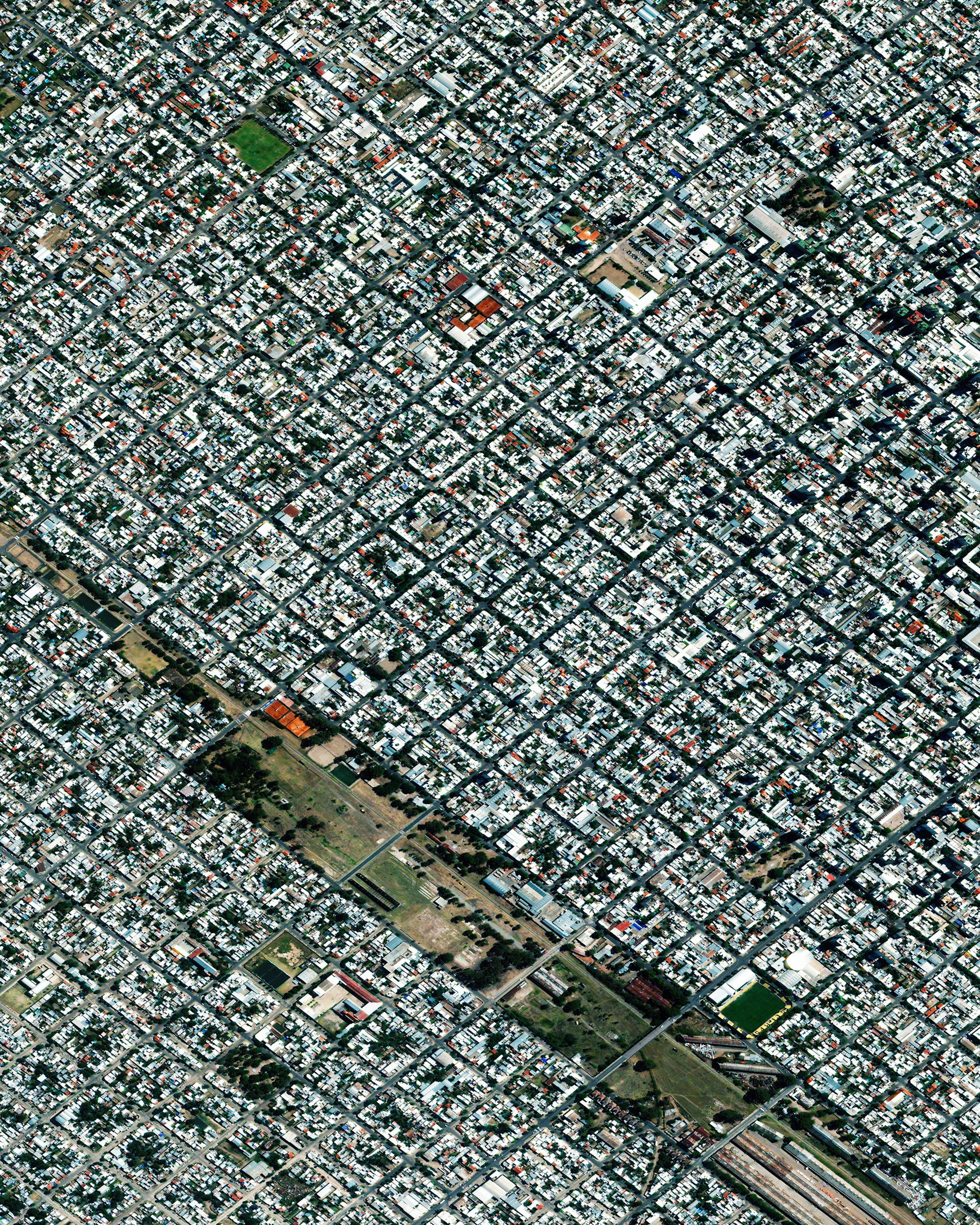
Bahía Blanca
-38.716667°,-62.266667° - Maxar
Bahía Blanca is a city in the Buenos Aires province of Argentina, home to more than 300,000 people. Its name, which translates to “White Bay,” derives from the color of the salt that builds up along its Atlantic coastline. Bahía Blanca has the typical features of a city founded by the Spanish and their descendants — a strict grid pattern with main buildings surrounding rectangular courtyards.
Wind Farm Turbine Factory
34.711753°,-92.184710° - Maxar
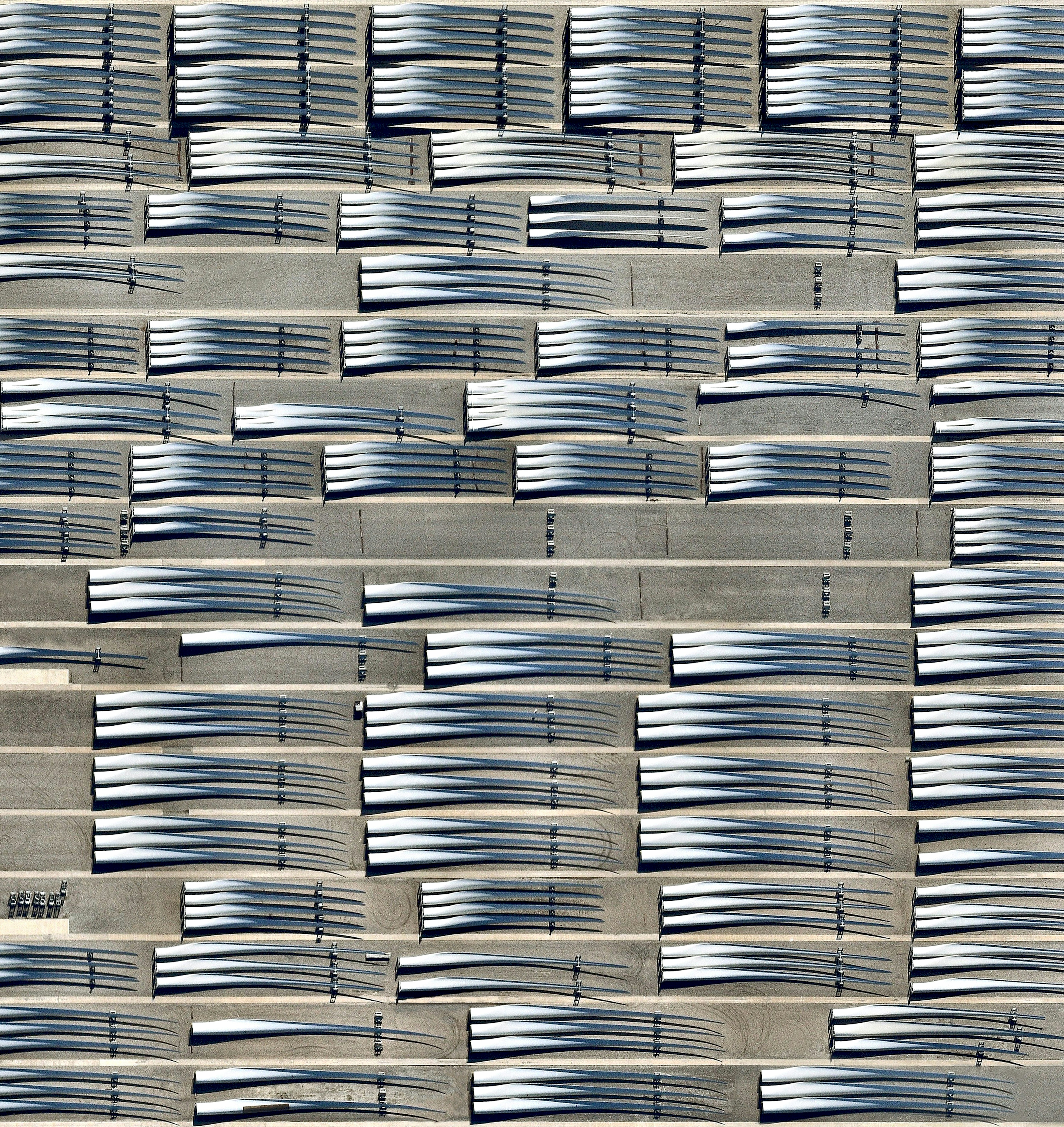
Blades for wind turbines are seen here, grouped together at a manufacturing facility in Little Rock, Arkansas, USA. Individual blades are transported from this facility to wind farms on top of trucks and then assembled on-site. For a sense of scale, the longest blades here are 350 feet (107 meters) long, or 1.3 times the length of a New York City block.
Koolan Island
-16.125278°,123.738333° - Maxar
Koolan Island is located off the Kimberley Coast of Western Australia, about 80 miles (130 km) north of Derby. The 6,375-acre (2,580-hectare) island is rich in high-grade iron ore and has been open-pit mined since 1963. In 1994 — after 68 million tonnes of ore had been extracted — the mine was temporarily closed and intentionally flooded with seawater, allowing a marine ecosystem to develop within the bounds of the pit. Mining recommenced in 2007 and continues today.
Pondera County, Montana
48.306111°,-112.251111° - Maxar
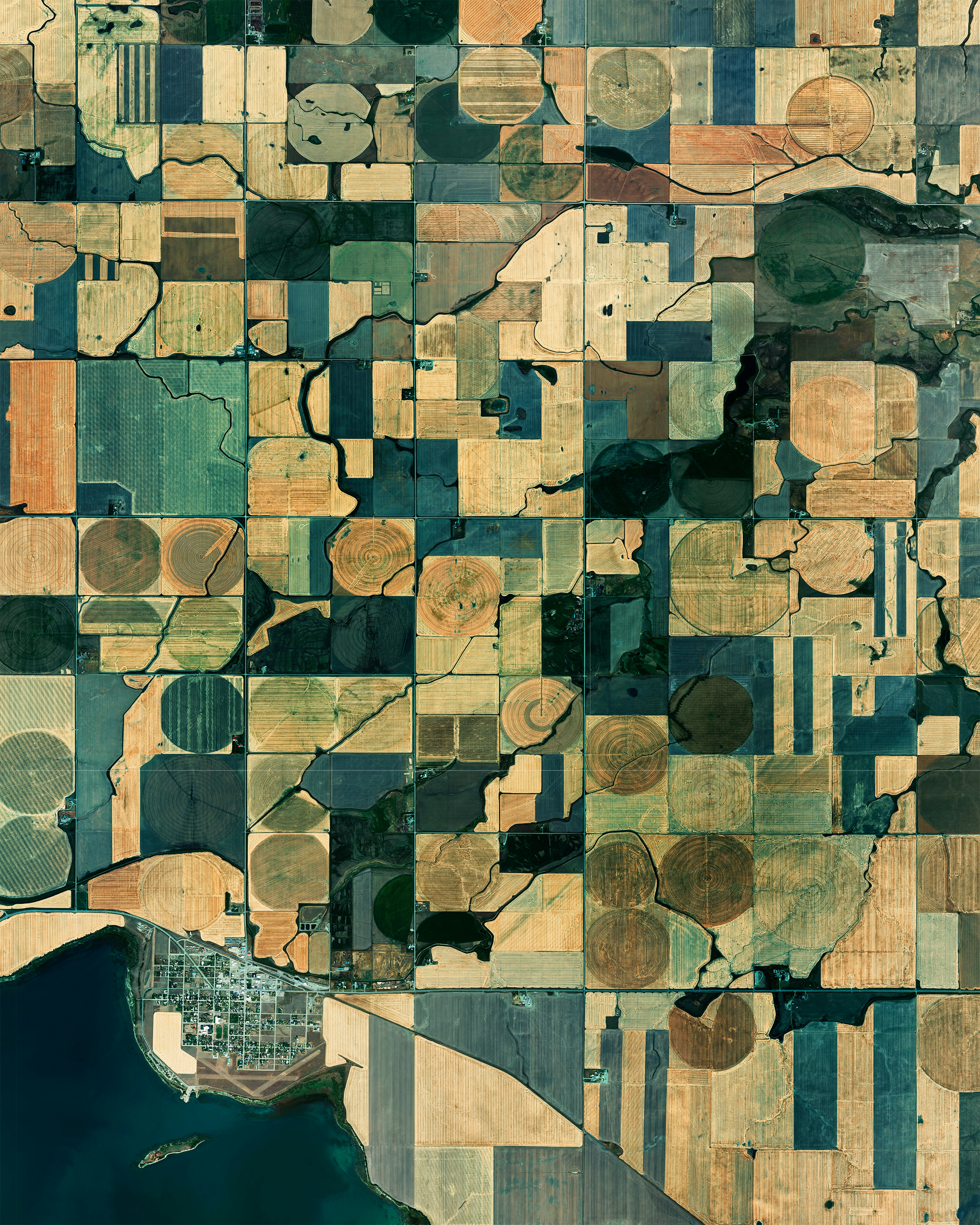
An extensive patchwork of farmland is seen here in Pondera County, Montana, USA. Located on the eastern edge of the Rocky Mountains less than 50 miles (80 km) south of Canada, the county averages fewer than 4 people per square mile. In the bottom left corner of this Overview is the town of Valier — population 509 — where agriculture and cattle ranching are the main industries.
Suez Canal
30.565472°,31.886110° - Maxar
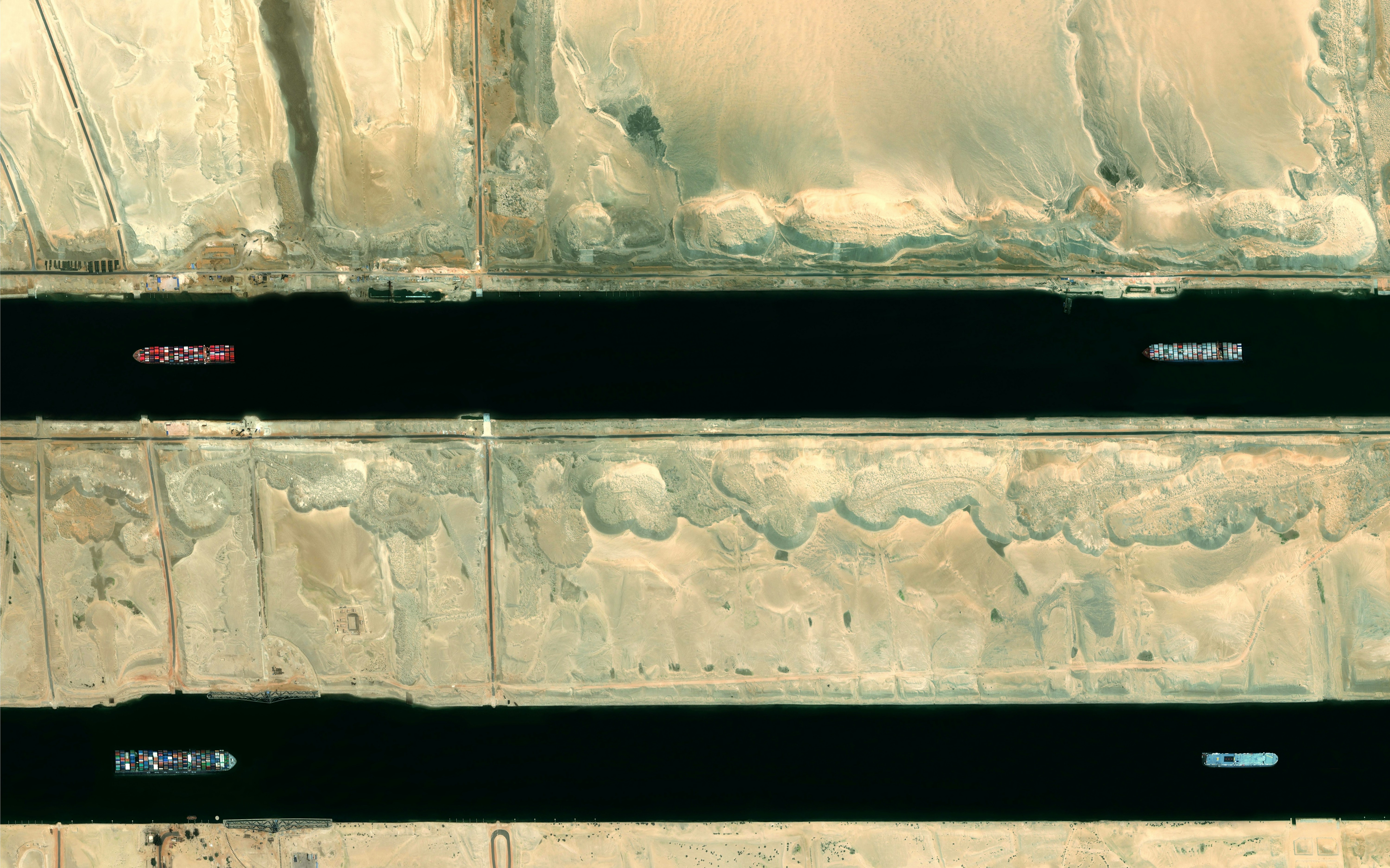
Cargo ships pass through the Suez Canal in Egypt. Officially opened in 1869 as a way to connect the Mediterranean Sea and the Red Sea, the 120-mile long (193 km) channel has more than 18,000 ships pass through its waterways each year. In 2014, the Egyptian government began a construction project to expand and widen the Ballah Bypass, in order to shorten the transit time through the canal. This expansion nearly doubled the capacity of the canal, from 49 to 97 ships per day.
Olympic Dam Mine
-30.440000°,136.873056° - Maxar
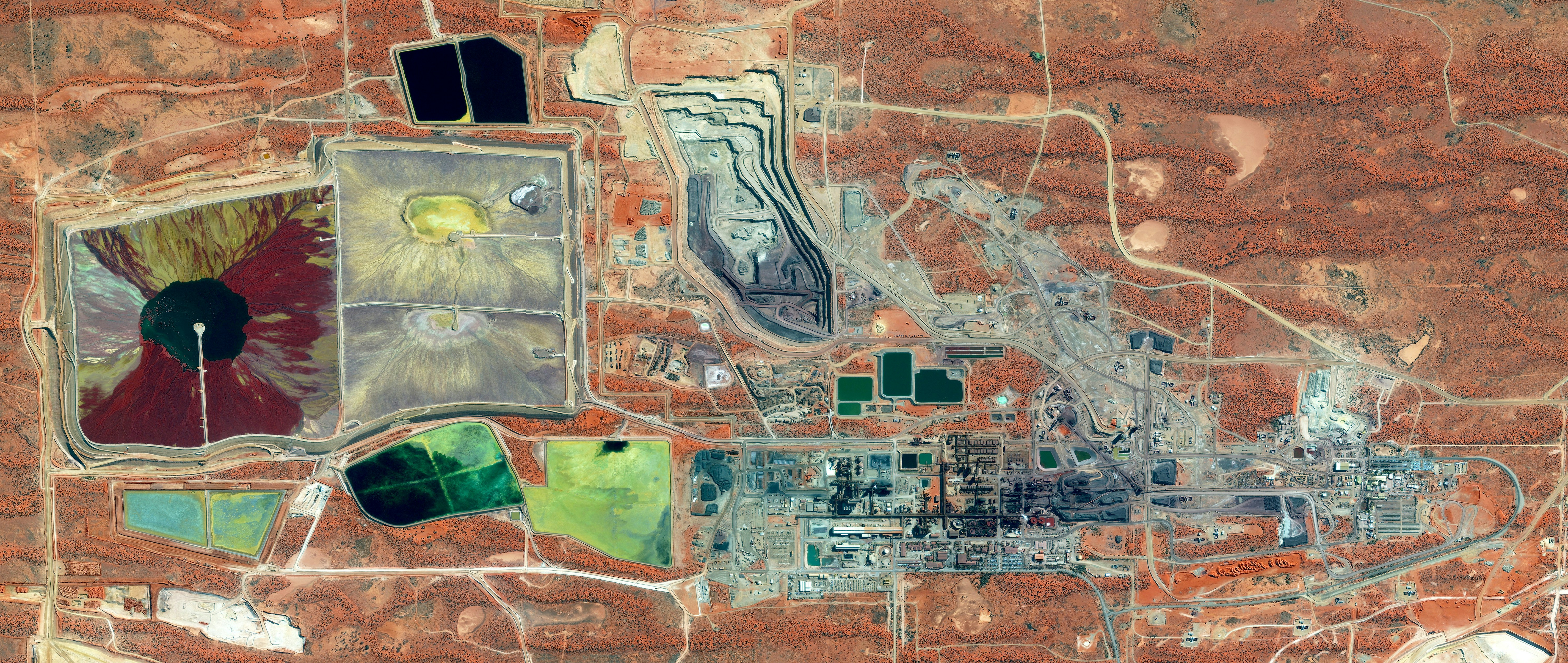
The Olympic Dam Mine in South Australia contains the largest known deposit of uranium in the world and is the country’s largest producer of uranium oxide, or “yellowcake.” Mining uranium is the first step in the process of nuclear power generation. Before it can be fabricated into a fuel, the uranium must be enriched through the process of isotope separation.
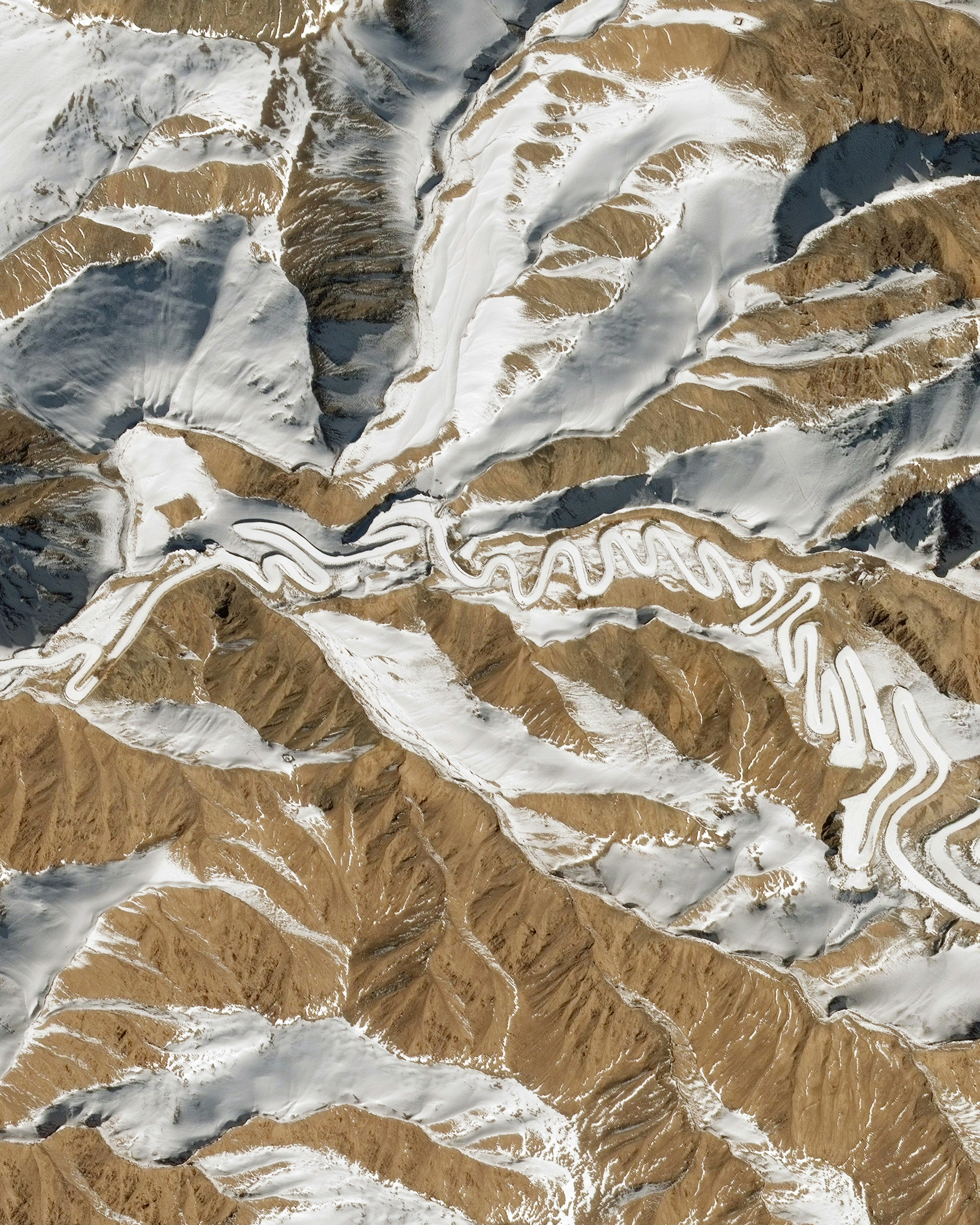
Panlong Ancient Road
37.635771°,75.509934° - Maxar
This Overview shows a small section of the “Panlong Ancient Road” in southwestern Xinjiang, China. Located near the Chinese border with Tajikistan, this route snakes for 47 miles (75 km) through the Pamir Mountains, rising 13,450 feet (4,100 meters) above sea level. Some reports claim it has more than 600 hairpin turns.
Lençóis Maranhenses National Park
-2.533333°,-43.116667° - Airbus
Lençóis Maranhenses National Park is a 380,000-acre (155,000 hectare) protected area in northeastern Brazil. The park’s interior contains miles of rolling sand dunes, the valleys of which fill with freshwater lagoons during the rainy season and are prevented from draining by impermeable rock beneath. Lençóis Maranhenses has 43 miles (70 km) of Atlantic coastline and is home to a range of species, including four that are endangered — the scarlet ibis, the neotropical otter, the oncilla and the West Indian manatee.
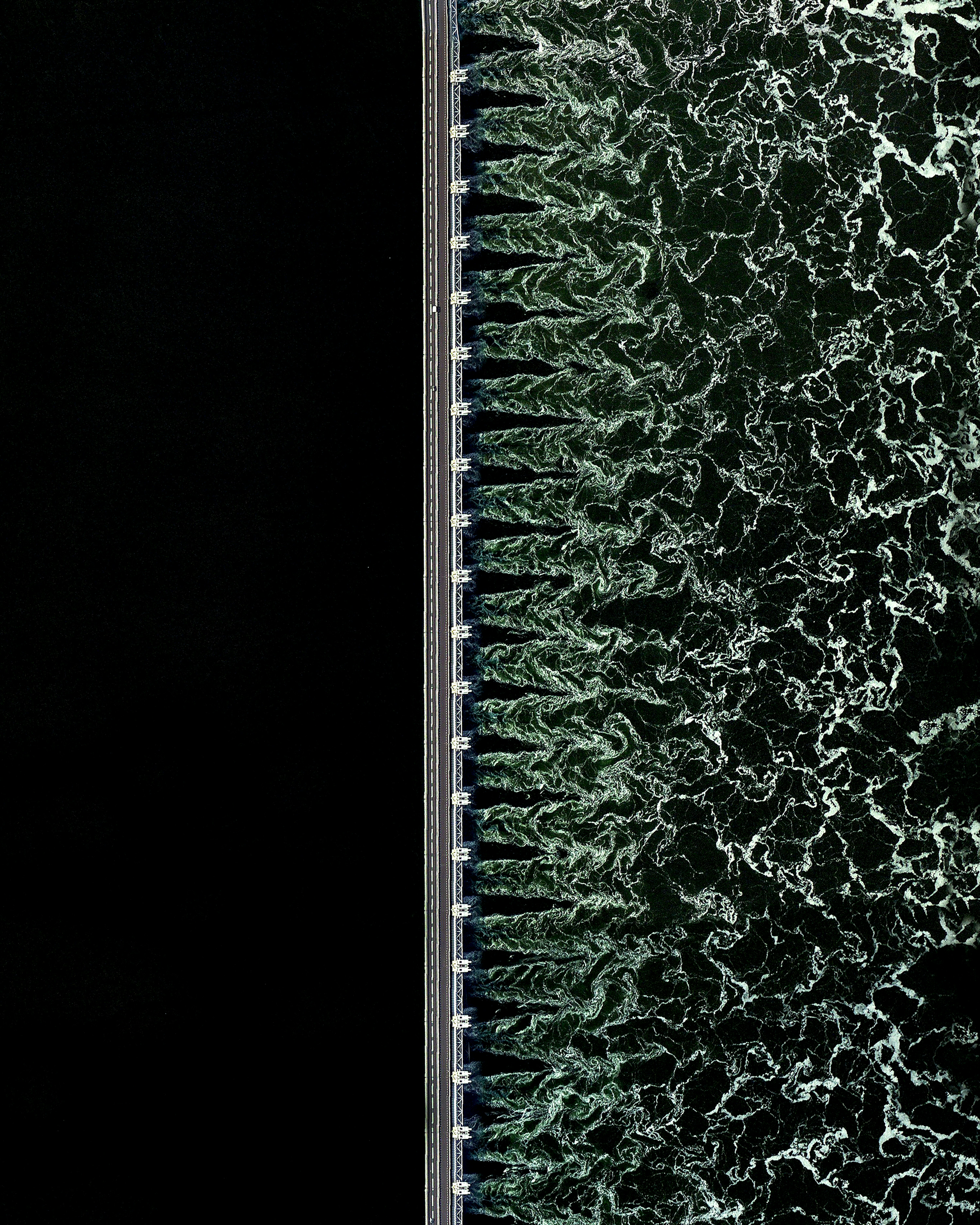
Oosterscheldekering
51.608691°,3.681047° - Maxar
The Oosterscheldekering (Eastern Scheldt storm surge barrier) is the largest in a series of 13 dams designed to protect the Netherlands from North Sea flooding. It spans about 5.6 miles (9 km) between the islands of Schouwen-Duiveland and Noord-Beveland, containing large sluicegate-type doors that can be closed under adverse weather conditions. Designed to last more than 200 years, the Oosterscheldekering is sometimes referred to as the eighth Wonder of the World.
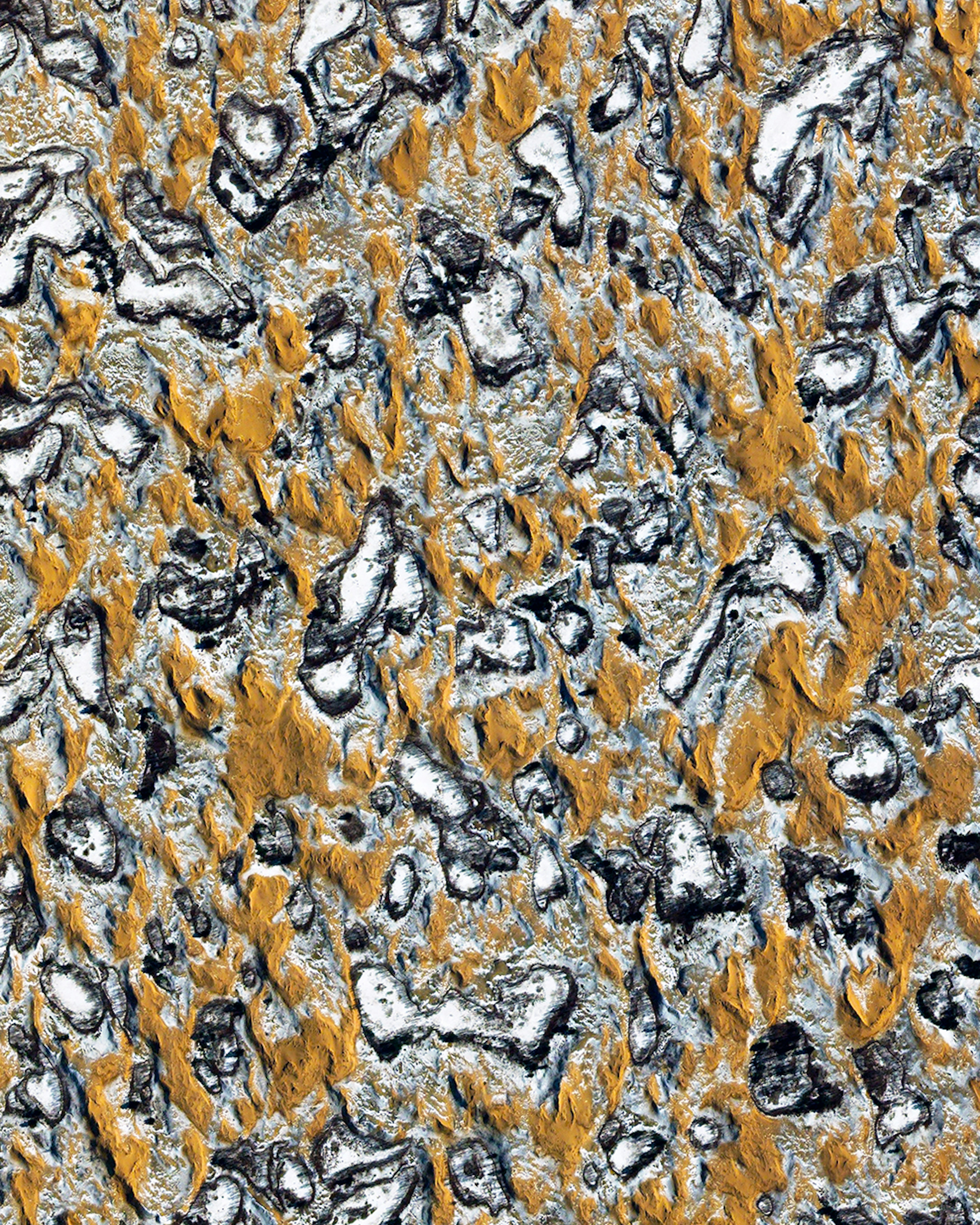
Oleshky Sands
46.558401°,33.087683° - Maxar
Sand mixes with snow in the Oleshky Sands, a semi-arid desert of southern Ukraine. This 62-square-mile (161-square-kilometer) region contains sand dunes as tall as 16 feet (5 meters) and is the second-largest desert in Europe. The origin of Oleshky Sands is uncertain — one theory says it is a dried riverbed of the Dnieper River; another points to over-grazing by millions of sheep pastured in the area during the 18th and 19th centuries.
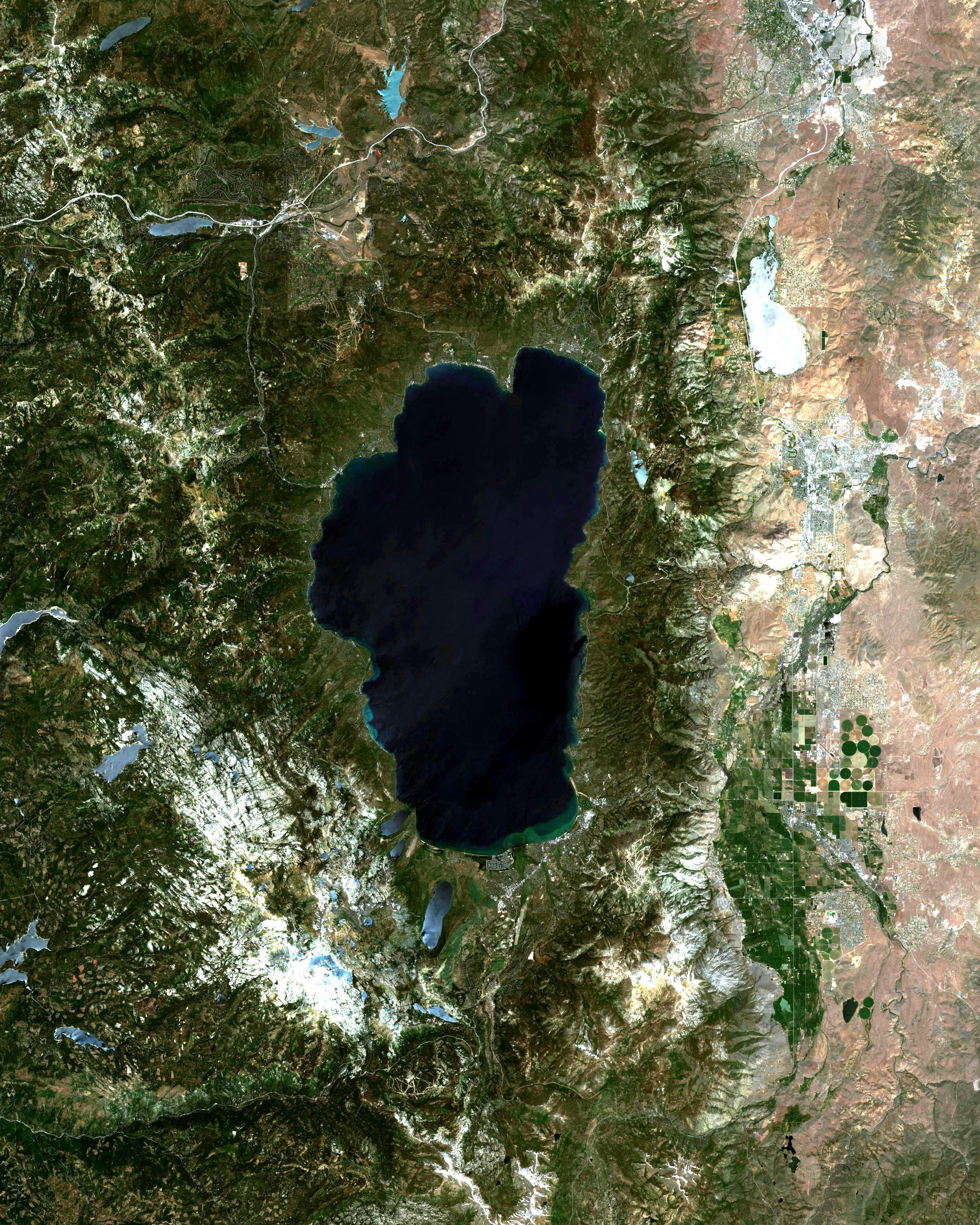
Lake Tahoe
39.000000°,-120.000000° - Airbus Space
Lake Tahoe is a large freshwater lake on the California-Nevada border in the USA. Nestled in the Sierra Nevada mountain range with a surface elevation of 6,225 feet, it is the largest alpine lake in North America and trails only the five Great Lakes as the largest lake by volume in the United States. Lake Tahoe is a major tourist attraction and a destination for winter sports and summer outdoor recreation.
Boynton Beach
26.528056°,-80.076389° - Airbus Space
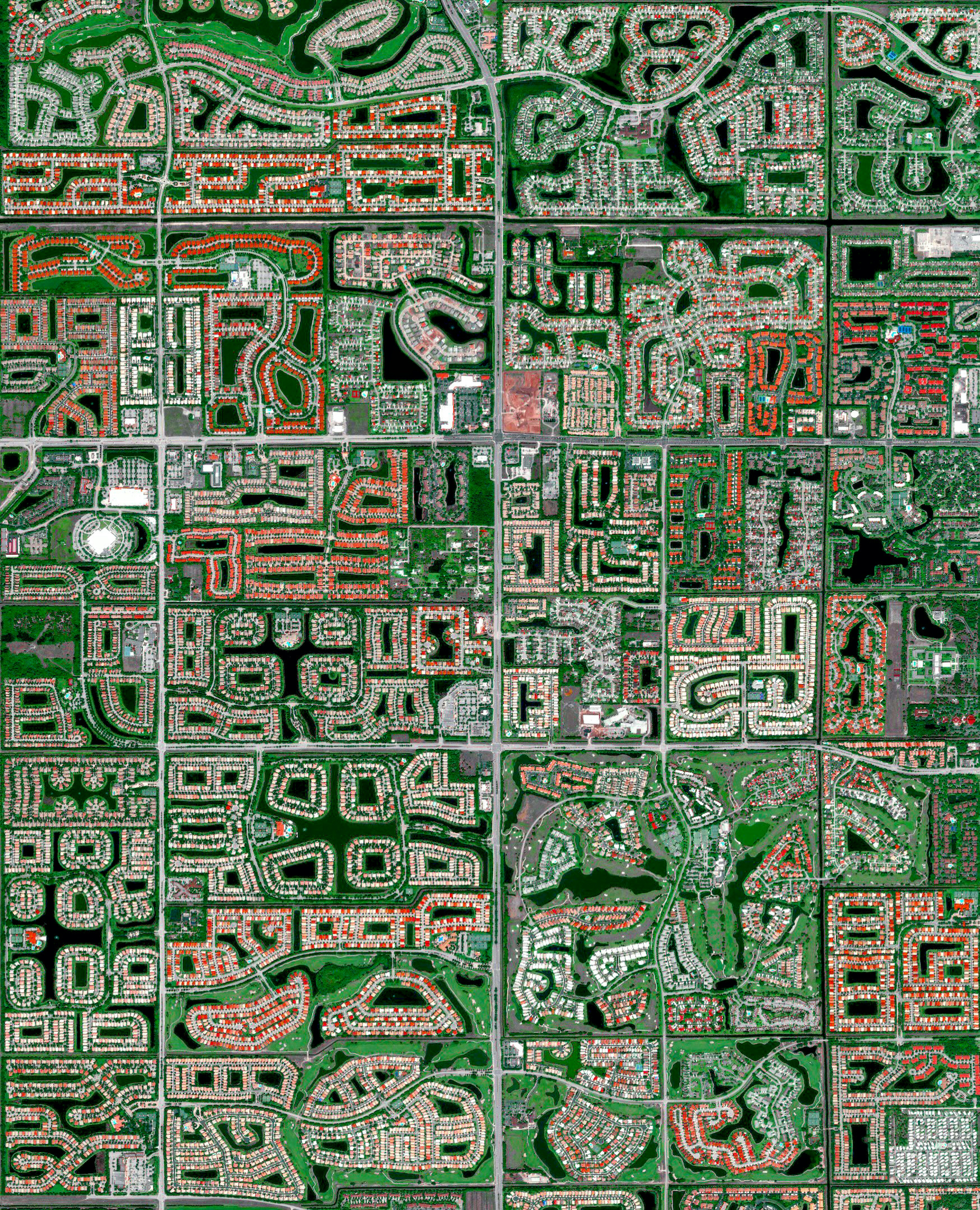
Residential developments cover the landscape in Boynton Beach, Florida, USA. Because many cities in the state contain master-planned communities, often built on top of waterways in the latter half of the twentieth century, there are a number of intricate designs that are visible from the Overview perspective. Boynton Beach is home to roughly 78,000 residents.
Rio Grande do Norte
-5.740000°,-36.550000° - Maxar
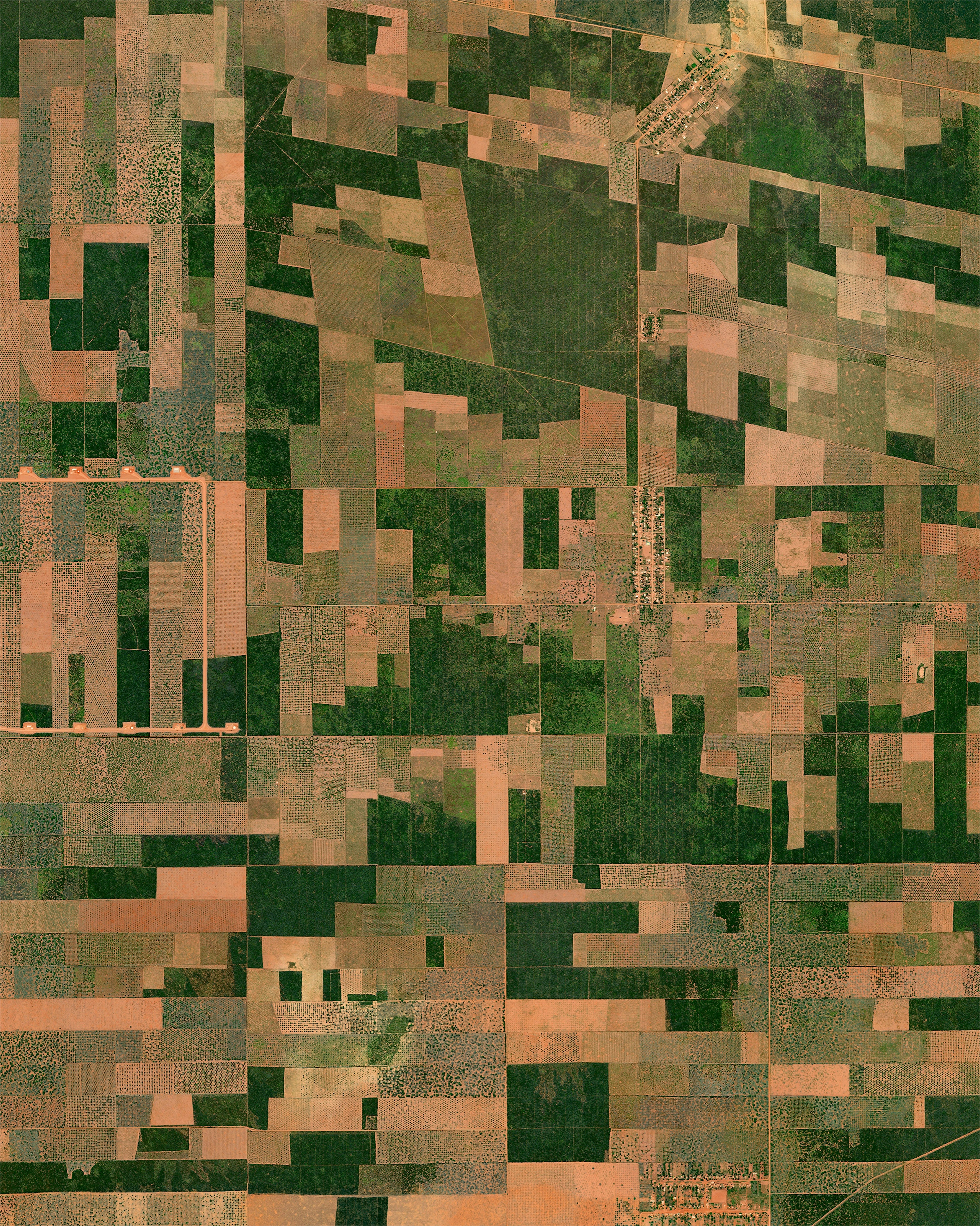
In Rio Grande do Norte, on Brazil’s northeastern tip, a vast rainforest has been diminished to small patches to make way for agricultural land. The Atlantic Rainforest — or Mata Atlântica — used to stretch from this region into southern Brazil, Paraguay and Argentina, but less than 10% of it remains today. Although Rio Grande do Norte is the fifth-smallest Brazilian state by land area, it supplies 70% of the nation’s melons and is famed for its mango and cashew fields.
Behesht-e-Zahra
35.536000°,51.370000° - Maxar
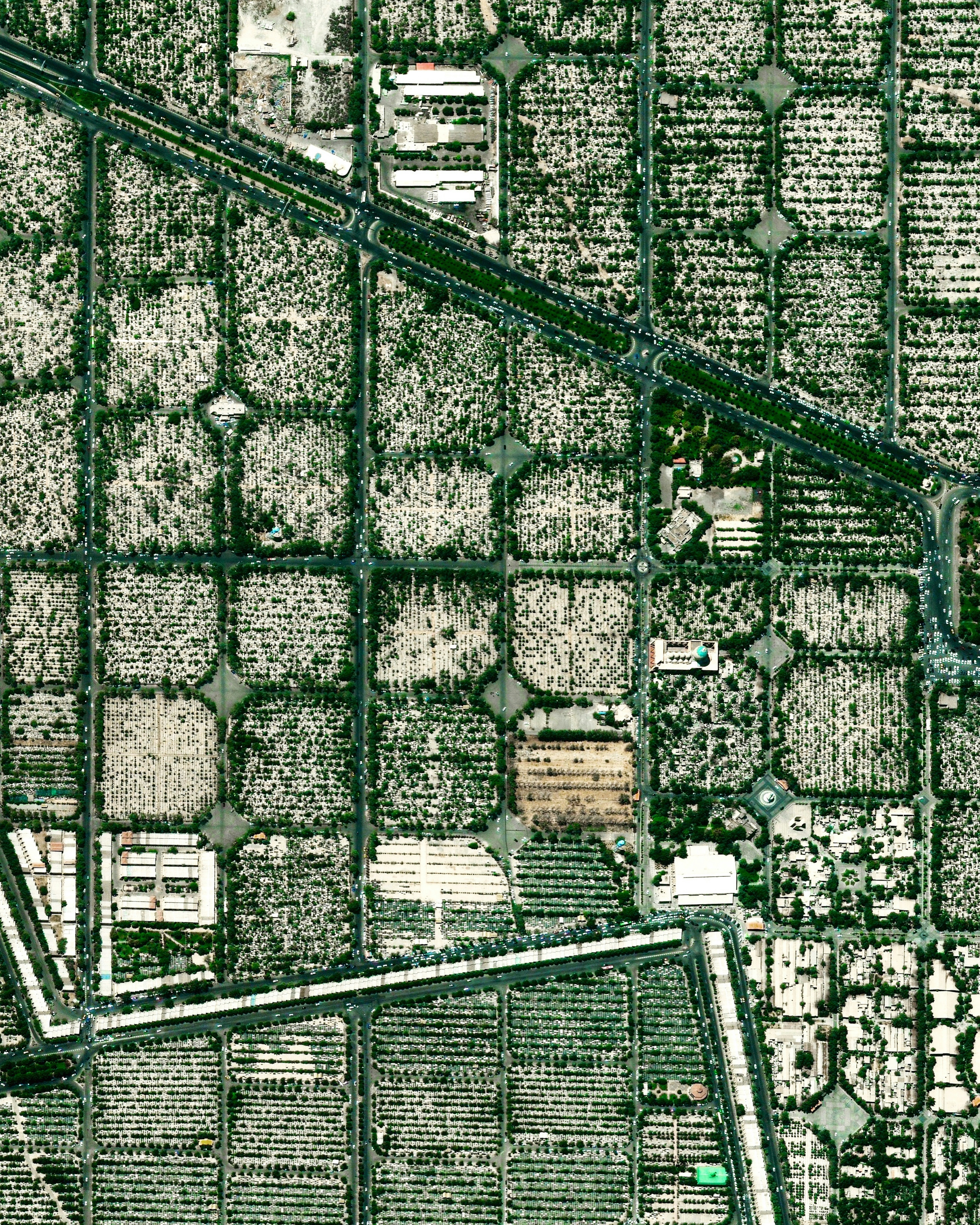
Behesht-e-Zahra is the largest cemetery in Iran, with more than 1.6 million graves. Located in the southern part of metropolitan Tehran, the cemetery has been rapidly expanding in recent weeks to meet the need for Coronavirus-related deaths — burying roughly 350 dead every day. Schools, mosques and shops are closed throughout Iran, and a curfew of 6:00 pm has been imposed to combat COVID-19, which state officials say is killing one Iranian every four minutes.
Washington Sawmill
46.111028°,-122.958868° - Nearmap
This Overview shows the Longview Softwood lumber milling facility, located on the Oregon-Washington border in Longview, Washington. Felled trees arrive at this facility by boat and are then stacked in huge piles like these and taken by forklift into the mill. Producing 7.7 million square feet (720,000 square meters) of processed lumber every year, the facility maintains the highest capacity of any sawmill in the United States.
