Daily
One regular dose of Earth from above
Mississippi River Delta
29.647500°,-89.914900° - Airbus Space
The Mississippi River Delta is the confluence of the Mississippi River with the Gulf of Mexico off the southern tip of Louisiana, USA. It is the nation’s largest drainage basin and the seventh largest river delta on Earth, containing more than 4,200 square miles (11,000 square kilometers) of coastal wetlands. Its current shape, described as a “bird-foot delta” reflects the dominance the river exerts over other hydrologic and geologic forces in the northern Gulf of Mexico.
Pyiduangsu Hluttaw
19.775348°,96.104724° - Maxar
Pyiduangsu Hluttaw, or The Assembly of the Union, is the national-level bicameral legislature of Myanmar. It is housed in a 31-building parliamentary complex in the capital city of Nay Pyi Taw, along with the nation’s Supreme Court, Presidential Palace, and other government headquarters. On Monday, just hours before a new session of Myanmar’s parliament was scheduled to open here, the country’s military seized power in a coup, detaining leader Aung San Suu Kyi and other members of her democratically elected ruling party.
Borkou, Chad
19.789330°,18.550998° - Airbus Space
Check out the amazing rock formations on display in this Overview of Chad’s Borkou Region. Covering more than 93,000 square miles (240,000 square km) in the Sahara Desert, Borkou is the largest region in the country but houses less than 1% of its population — just 97,251 people. In the top left of this Overview is Emi Koussi, a pyroclastic shield volcano and the highest point in Chad at 11,204 feet (3,415 meters).
Tahoe Keys
38.931667°,-120.013611° - Maxar
Tahoe Keys is a waterfront gated community in El Dorado County, California, USA. Built in the 1960s, the community consists of more than 1,500 homes on a series of canals that connect to Lake Tahoe. Its construction destroyed half of the Upper Truckee Marsh, the primary filter for river water entering the lake, and has since been called the most environmentally damaging intrusion on the lakeshore in Lake Tahoe’s human history.
Soekarno-Hatta International Airport (CGK)
-6.127523°,106.651512° - Airbus Space
Soekarno-Hatta International Airport is the primary airport serving the Jakarta metropolitan area in Indonesia. It handled 66.9 million passengers in 2018, making it the 18th busiest airport in the world and the busiest in Southeast Asia. The airport’s boarding pavilions are examples of classic Indonesian architecture with roofs built in the Javanese stepped-roof style.
Dagenham
51.539700°,0.142200° - Maxar
Dagenham is a suburban town in East London, England with about 106,000 residents. This particular area is part of the Becontree estate, a 4-square-mile (10-square-kilometer) borough that was the largest public housing project in the world when it was constructed between 1921 and 1935. The 26,000-dwelling estate was intended to offer “homes fit for heroes” for World War I veterans.
Goryokaku
41.796944°,140.756944° - Maxar
Goryōkaku — meaning, literally, “five-point fort” — is a star fort in the city of Hakodate, Japan. The fortress was built by the Tokugawa shogunate in the mid-1800s to protect the Tsugaru Strait from a possible Russian invasion. Today, Goryōkaku serves as a park for the city’s 280,000 residents, as well as a national Special Historic Site and a hub for cherry-blossom viewing in the spring.
Sepang Goldcoast Resort
2.598436°,101.683153° - Maxar
Sepang Goldcoast Resort is a hotel in Selangor Darul Ehsan, Malaysia. It features over-water bungalows that extend out in a palm-shaped formation into the waters of the Malacca Straits.
Bratsk Pulp Mill
56.113654°,101.602842° - Maxar
Timber is frozen in the Angara River by a pulp mill in Bratsk, Russia. A pulp mill is a manufacturing facility that converts felled trees and wood chips into thick fiber board that is shipped to a paper mill for further processing. The facility in Bratsk handles about 540,000 cubic yards (413,000 cubic meters) of wood per year.
Cochabamba, Bolivia
-17.383333°,-66.166667° - Maxar
Cochabamba is a city in central Bolivia with roughly 630,000 residents — the nation’s fourth most populous municipality. Like other large cities in the Andean highlands of South America, Cochabamba is a city of contrasts. Its central districts, seen here, are generally equipped with modern urban amenities and house many of its formal businesses and commercial industries, while some of the city’s outskirts contain simple adobe homes and unpaved roads.
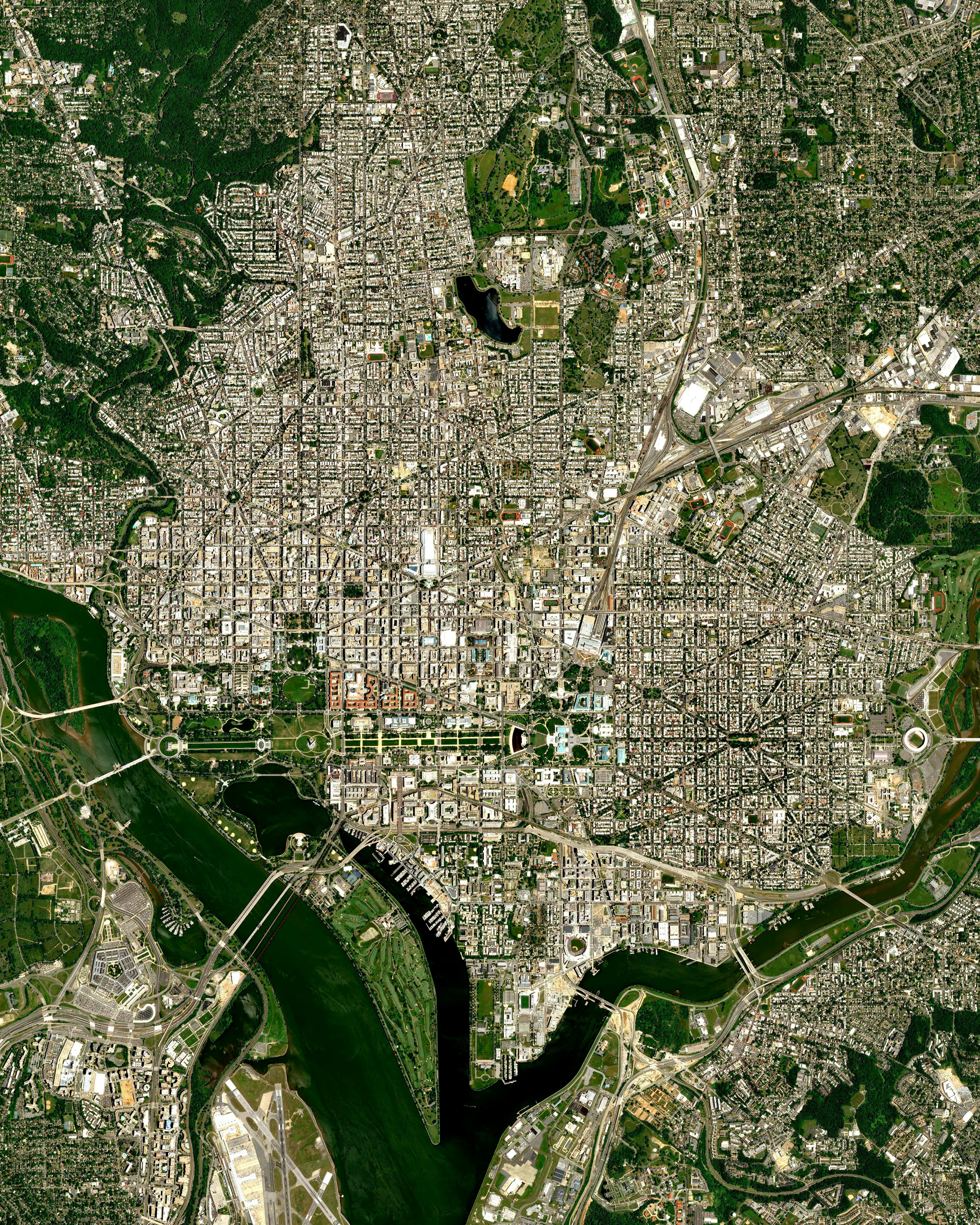
Washington, D.C.
38.910100°,-77.014700° - Airbus
Today is Inauguration Day in the USA, and Washington, D.C., is bustling with activity as Joseph R. Biden Jr. is sworn in as the nation’s 46th President. Here we see an Overview of the capital city in its entirety — situated on the Potomac River between the states of Maryland and Virginia. Nearly all presidential inaugurations since 1801 have been held in Washington, D.C., and most have taken place at the Capitol Building, where today’s swearing-in ceremony takes place.
Our Lady of Almudena Cemetery
40.419444°,-3.640556° - Maxar
Our Lady of Almudena Cemetery in Madrid, Spain, is one of the largest cemeteries in Western Europe. The number of gravesites — estimated at 5 million — is greater than the population of Madrid itself. For nearly a century, from 1884 to 1973, Our Lady of Almudena served as the main cemetery for the entire capital city.
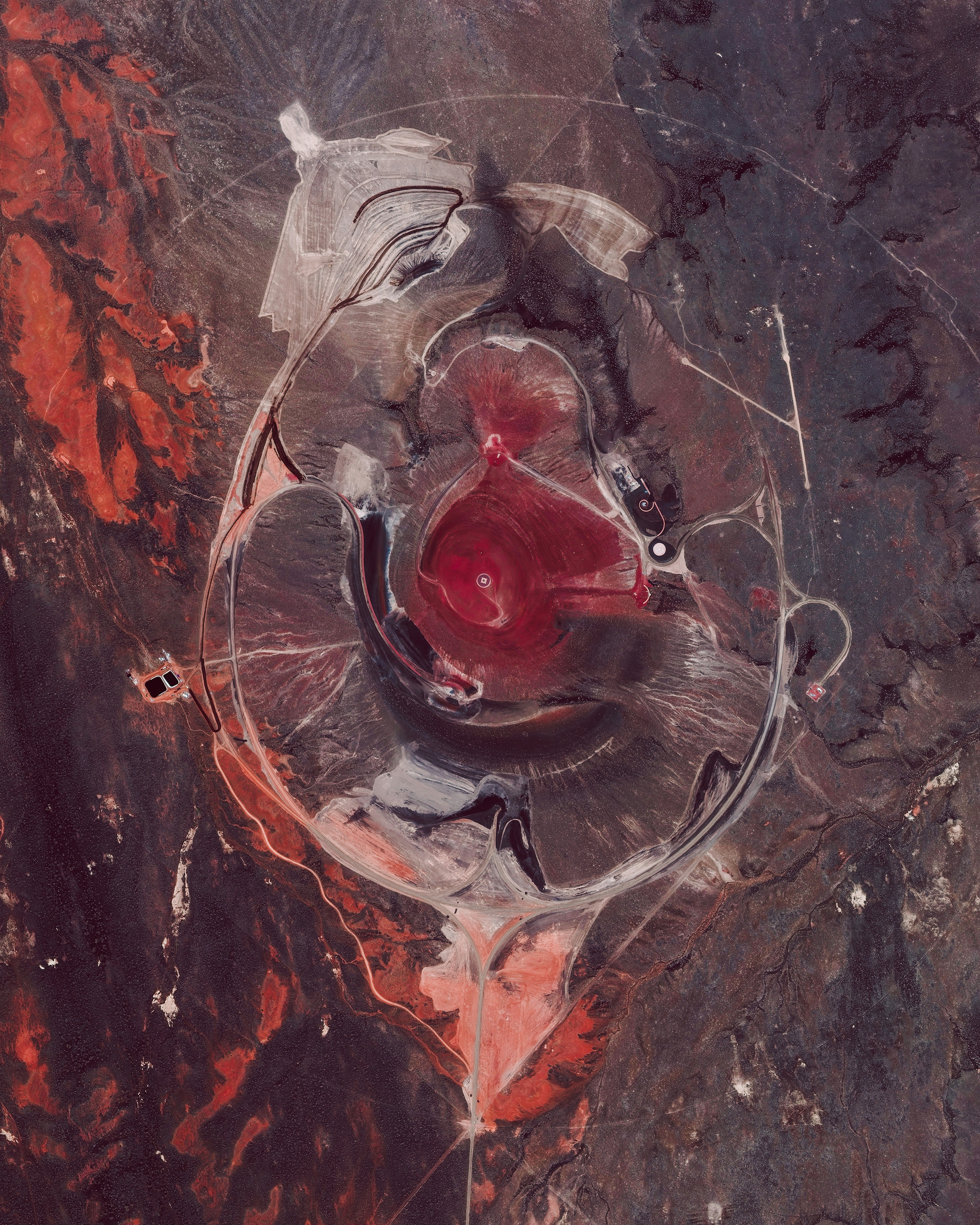
Roden Crater
35.425909°,-111.258776° - Maxar
The Roden Crater is a cinder cone from an extinct volcano located in the Painted Desert region of northern Arizona, USA. The 400,000-year-old, 3-mile-wide (4.8 km) crater is the site of a land art project in progress. Artist James Turrell is transforming its inner cone into a massive naked-eye observatory designed specifically for viewing and experiencing skylight, solar and celestial phenomena.
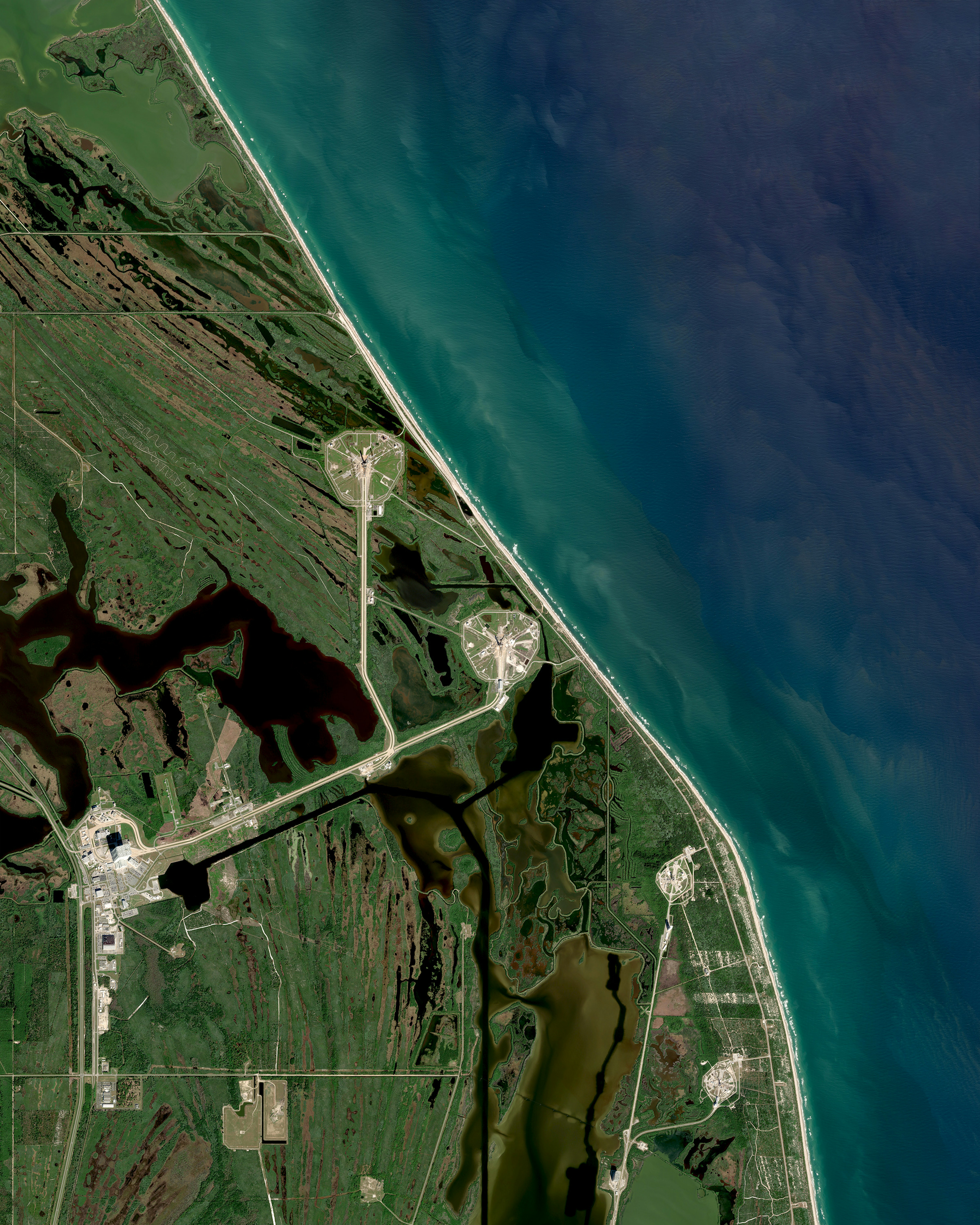
Cape Canaveral
28.608151°,-80.605671° - Maxar
Rocket launch pads are seen here in Cape Canaveral, Florida, USA. This region — called the “Space Coast” — is well known as the site of both the Kennedy Space Center and the Cape Canaveral Space Force Station. All of the NASA-launched crewed spaceflights have departed from one of these two bases, beginning with Project Mercury in 1961.
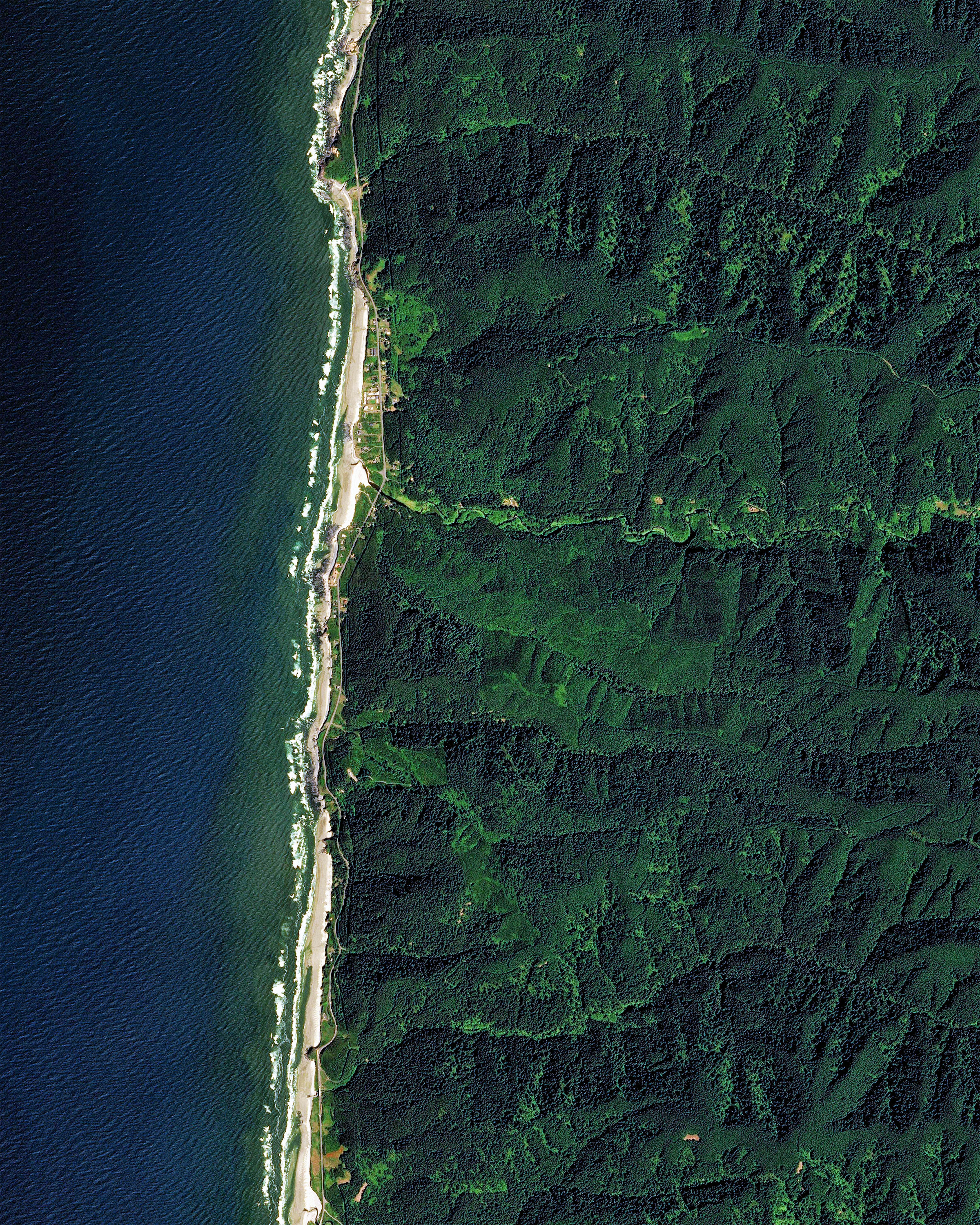
Siuslaw National Forest
44.333333°,-123.916667° - Airbus
The Siuslaw National Forest encompasses more than 630,000 acres (2,500 square km) along the central coast of Oregon, USA. It is made up of a variety of ecosystems — from coastal forests to sand dunes — and contains numerous aquatic habitats along its seashore, its 1,200 miles (1,900 km) of rivers and streams, and its 30 lakes. The national forest also contains Marys Peak, the highest point in the Oregon Coast Range at 4,097 feet (1,249 m).
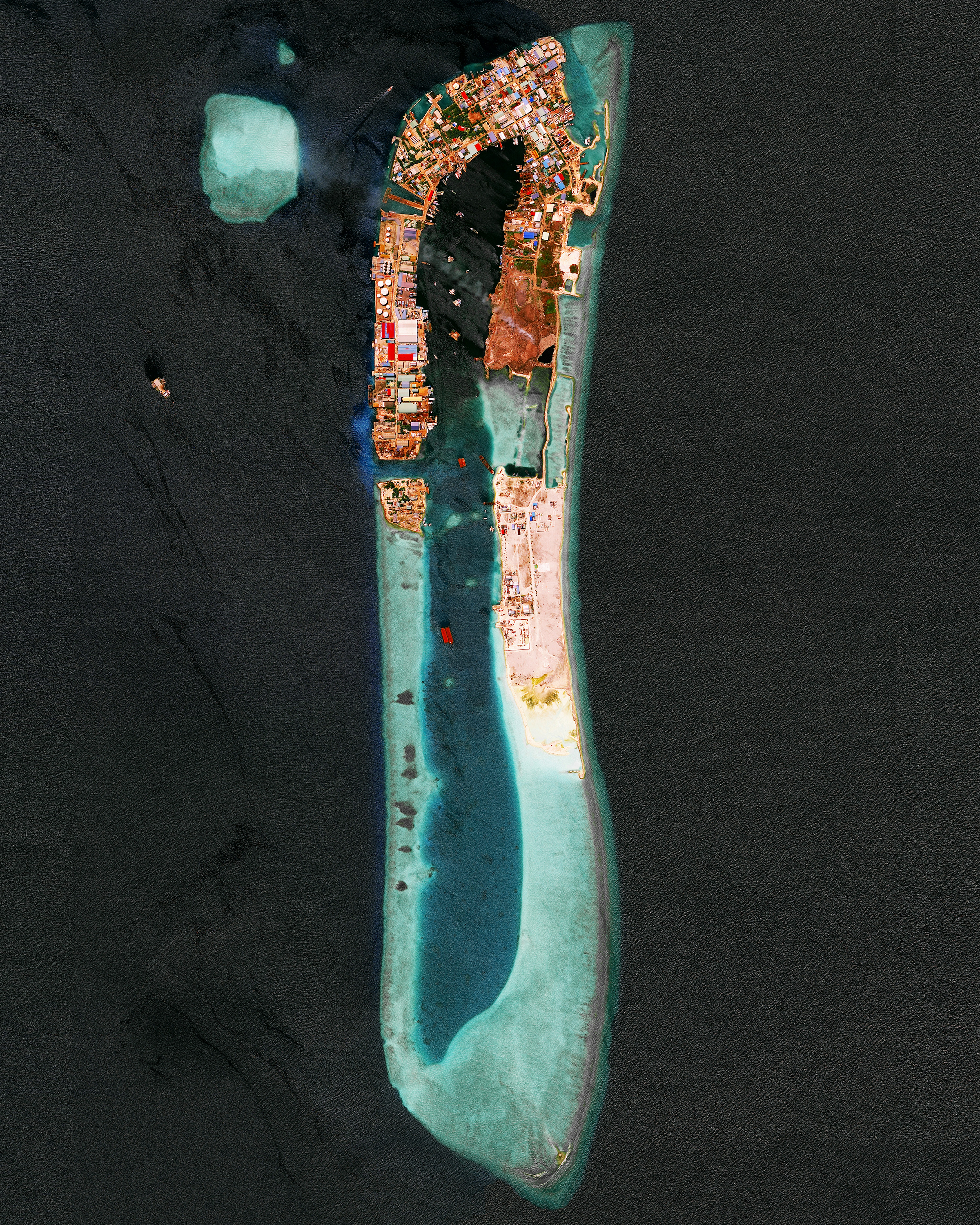
Thilafushi
4.183333°,73.433333° - Maxar
Thilafushi is an artificial island built from reclaimed land that receives waste generated in the Maldives. It is estimated that at least 330 tonnes of waste is brought to Thilafushi every day, most of which comes from Malé, the nation’s capital city. Because the waste is used to continue the land reclamation process and increase the size of the island, the area of Thilafushi is growing about 1 square meter (11 square feet) per day.
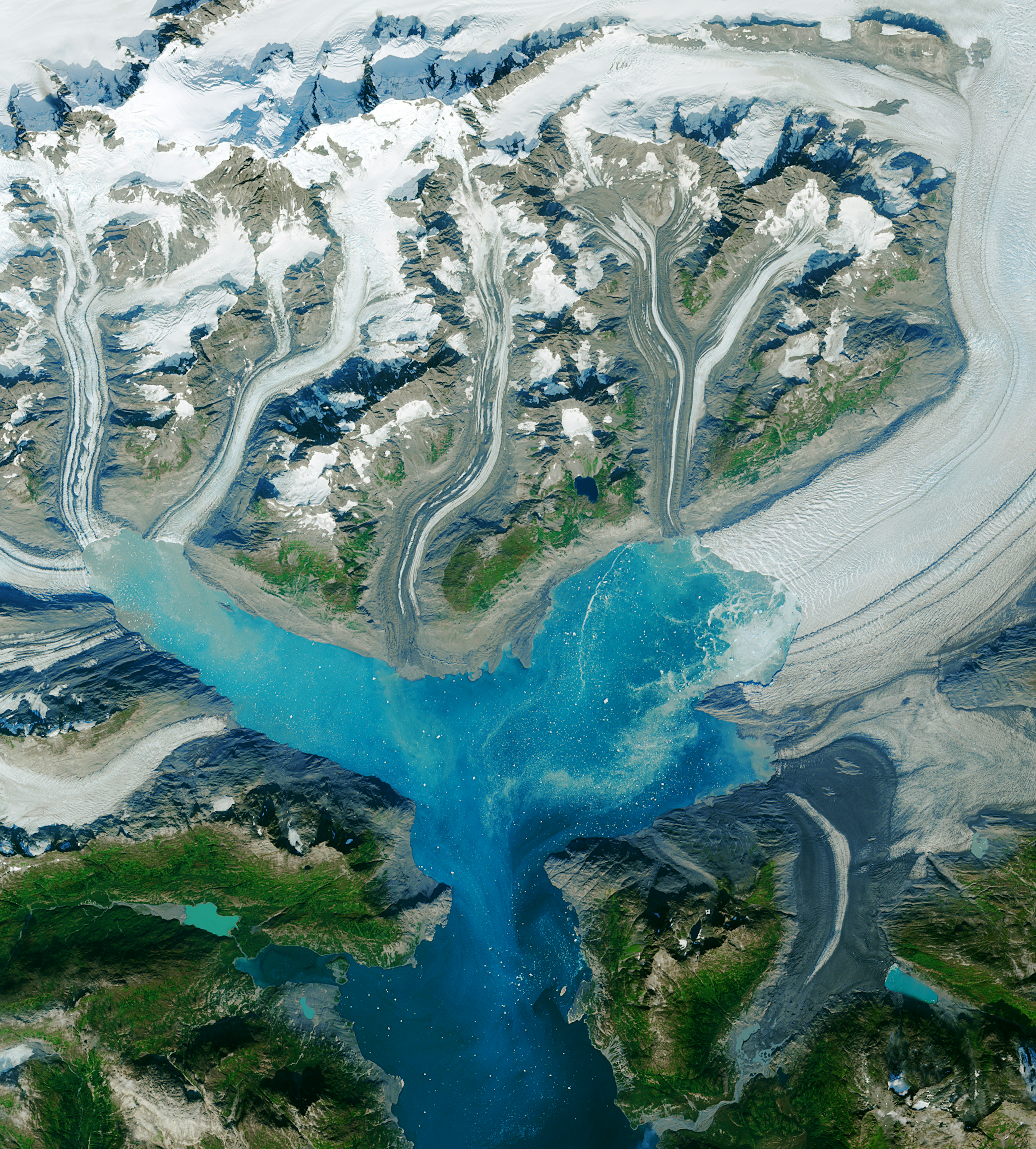
Columbia Glacier
61.219722°,-146.895278° - ESA - European Space Agency
The Columbia Glacier in southeastern Alaska is one of the most rapidly receding ice floes in the world. Since the 1980s, the glacier has lost more than half its total volume, which as led to a retreat of the ice more than 12 miles (19 kilometers) to the north. By 2008, the glacier had retreated back to the top of the surrounding inlet and split into separate glaciers that have continued to calve (break off at the end) on various fronts since.
Choji-dong
37.311251°,126.773632° - Maxar
Choji-dong is a neighborhood of roughly 55,000 people in the city of Ansan, South Korea. The Korean government has intensively driven development of Ansan, particularly in this area, with an emphasis on manufacturing. The striking blue color shown here results from the use of aluminum roofing, which is used for its low cost and longevity.
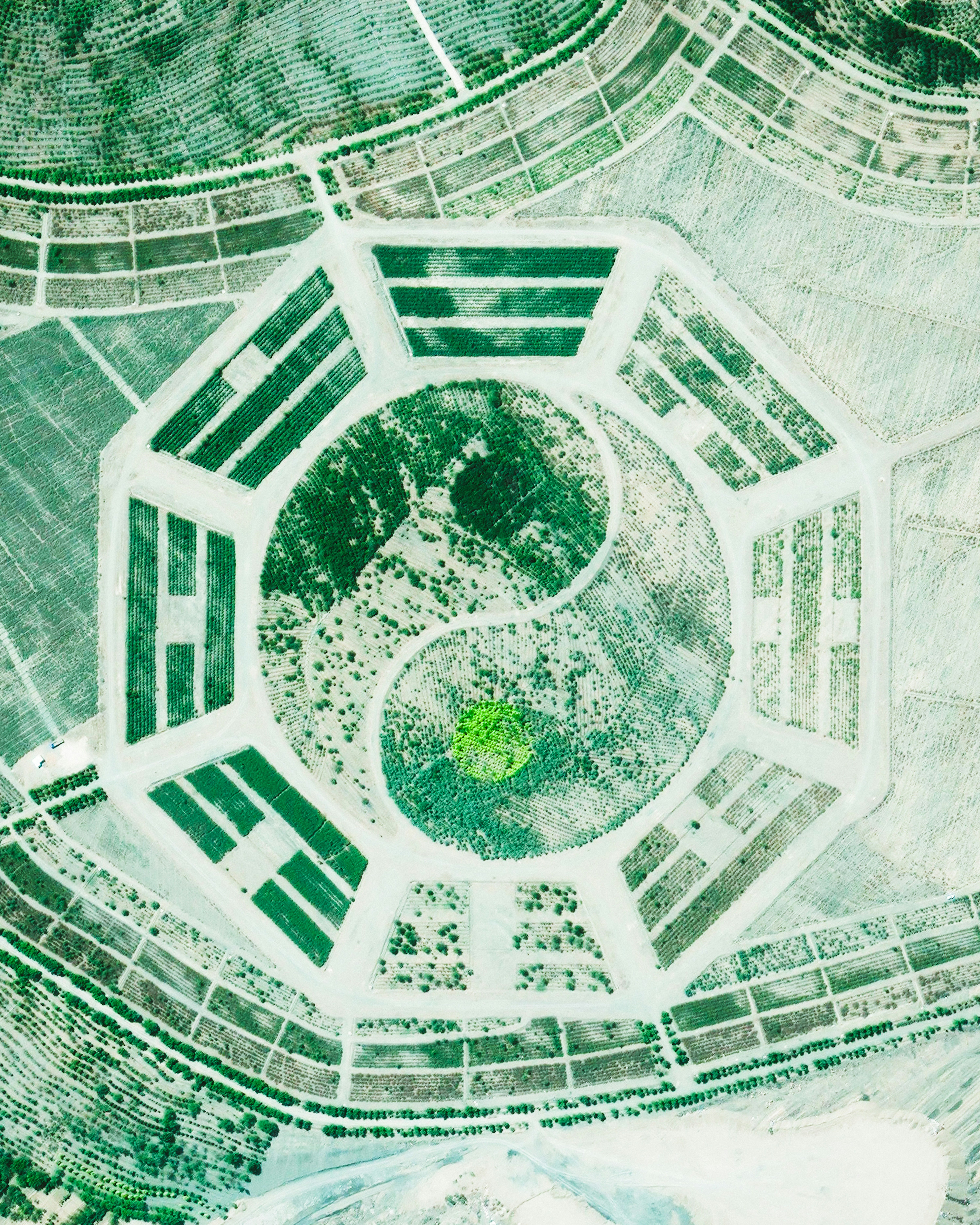
Colorado Bagua Arrangement
38.506944°,-102.151694° - Maxar
A crop-formed Bagua arrangement is seen here in Kiowa County, Colorado, USA. An important symbol in Taoist cosmology, the Bagua consists of a yin-yang surrounded by eight sets of three-line patterns. This particular arrangement, known as Fu Xi or “Earlier Heaven,” represents the ancient Chinese understanding of the universe — yin and yang depict heaven and earth, and the eight surrounding diagrams symbolize sky, earth, thunder, wind, water, fire, mountain and lake.
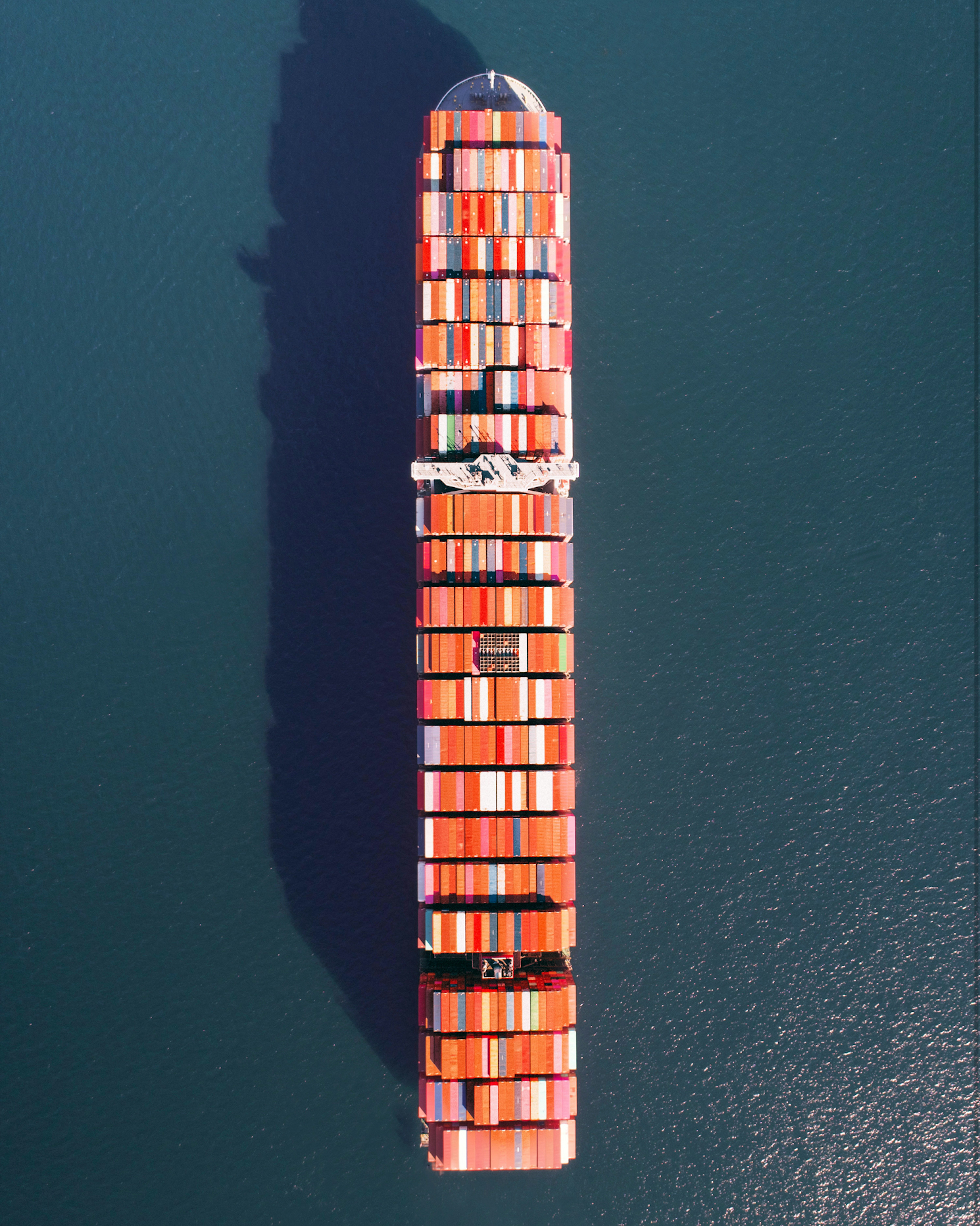
Freighter at Port of Long Beach
33.754185°,-118.216458° - The Drone Booth
A freighter full of containerized cargo waits outside the Port of Long Beach in California, USA. With an annual container volume of 8.1 million twenty-foot equivalent units, it is the second-busiest container port in the nation, after the neighboring Port of Los Angeles. The port is a major gateway for US-Asian trade, with top imports from China, Vietnam, South Korea and Japan consisting of crude oil, electronics, plastics, furniture and clothing.


