Daily
One regular dose of Earth from above
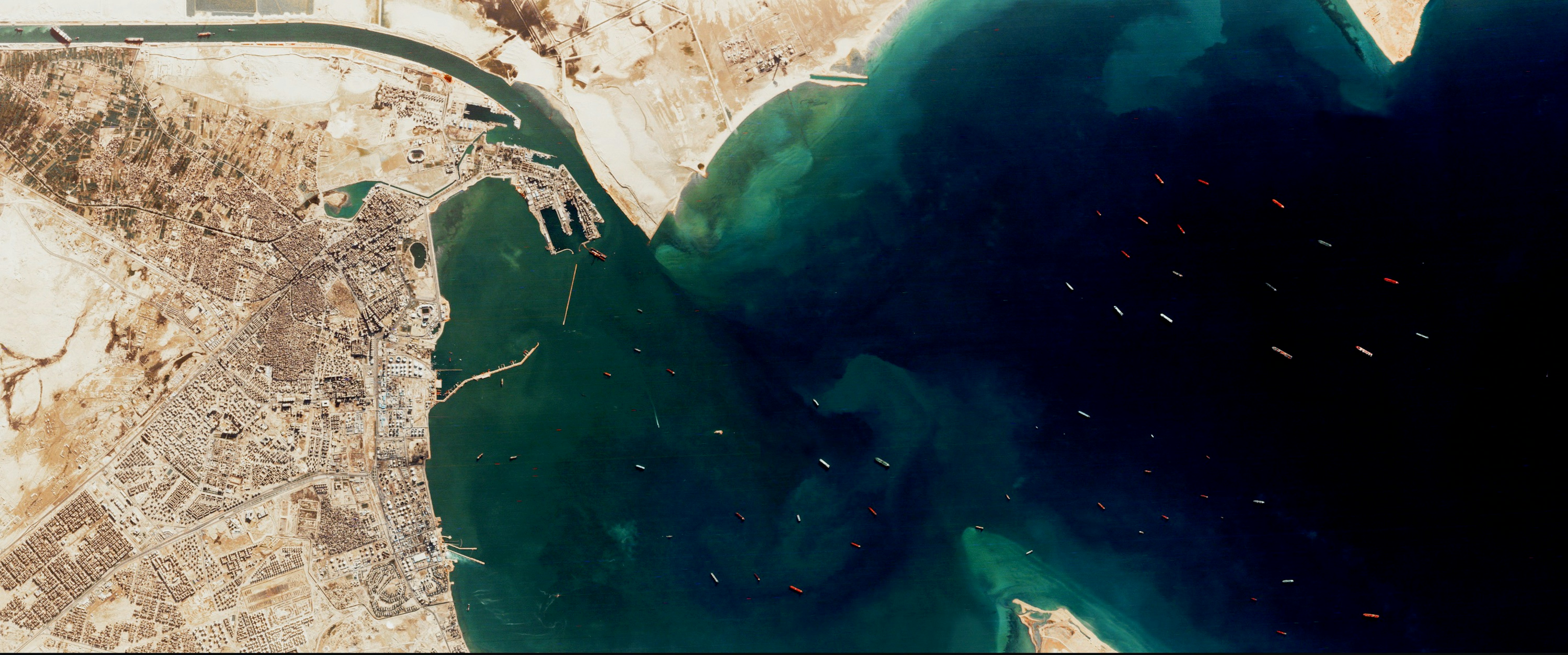
Ships Wait Outside Suez
29.942874°,32.547150° - Planet
This Overview gives us a bigger picture of the situation unfolding at the Suez Canal. In the upper-left corner, we see the “Ever Given,” a 1,312-foot-long (400 meter) container ship, stuck across the width of the canal. The rest of the frame shows the resulting traffic jam, with dozens of ships waiting outside the canal in the Gulf of Suez. The Ever Given has been stuck here since Tuesday, when strong winds pushed it aground on one of the canal’s banks.
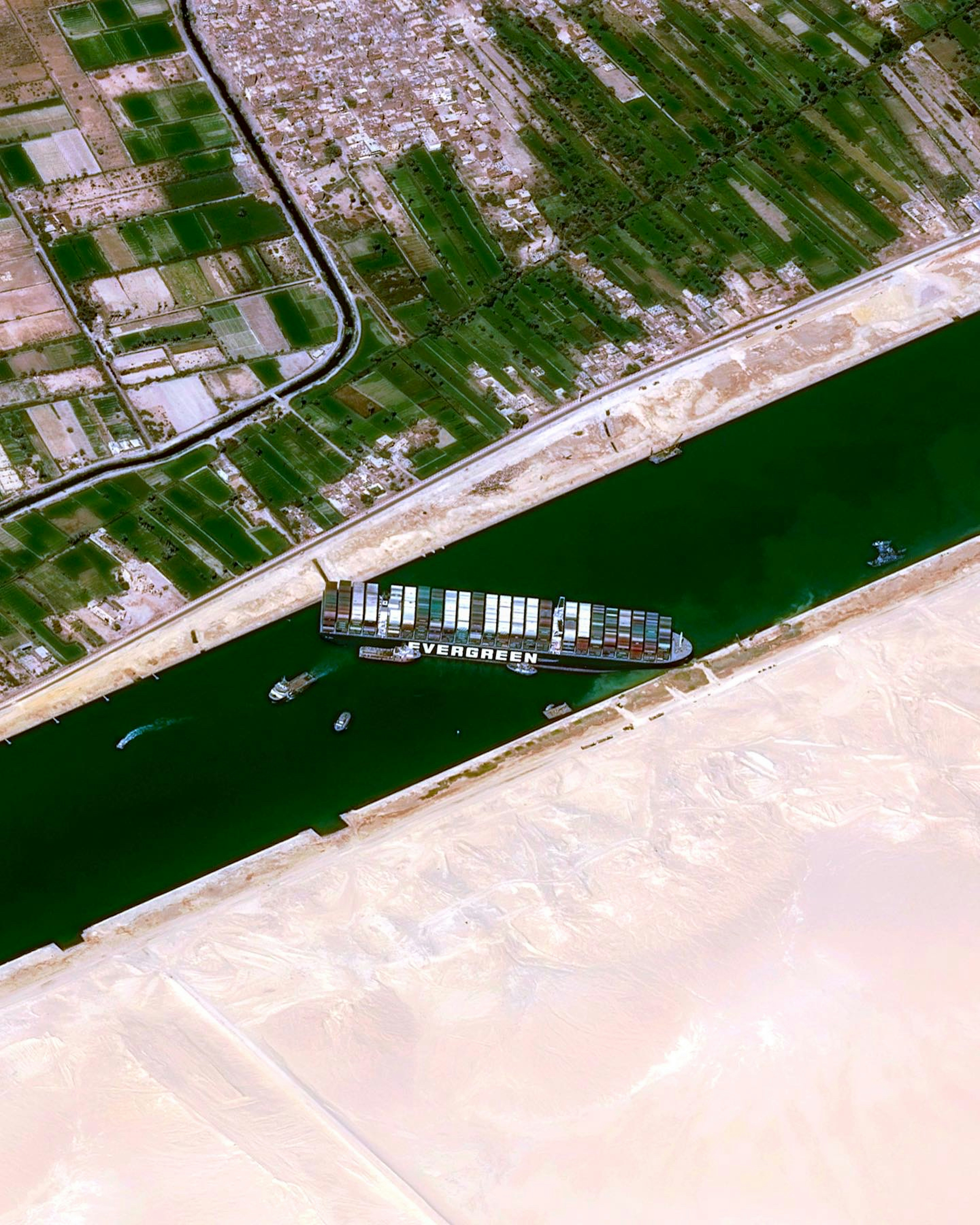
Ship Stuck in Suez
30.862907°,32.315920° - Airbus Space
A large container ship has been stuck in the Suez Canal since Tuesday, after strong winds pushed it aground on one of the canal’s banks. The 1,312-foot-long (400 meters) “Ever Given” is large enough to block the entire width of the canal, leaving hundreds of other vessels stuck at both ends. The canal, which connects the Red to Mediterranean Seas, facilitates the passage of roughly 18,000 ships per year, or 50 ships per day.
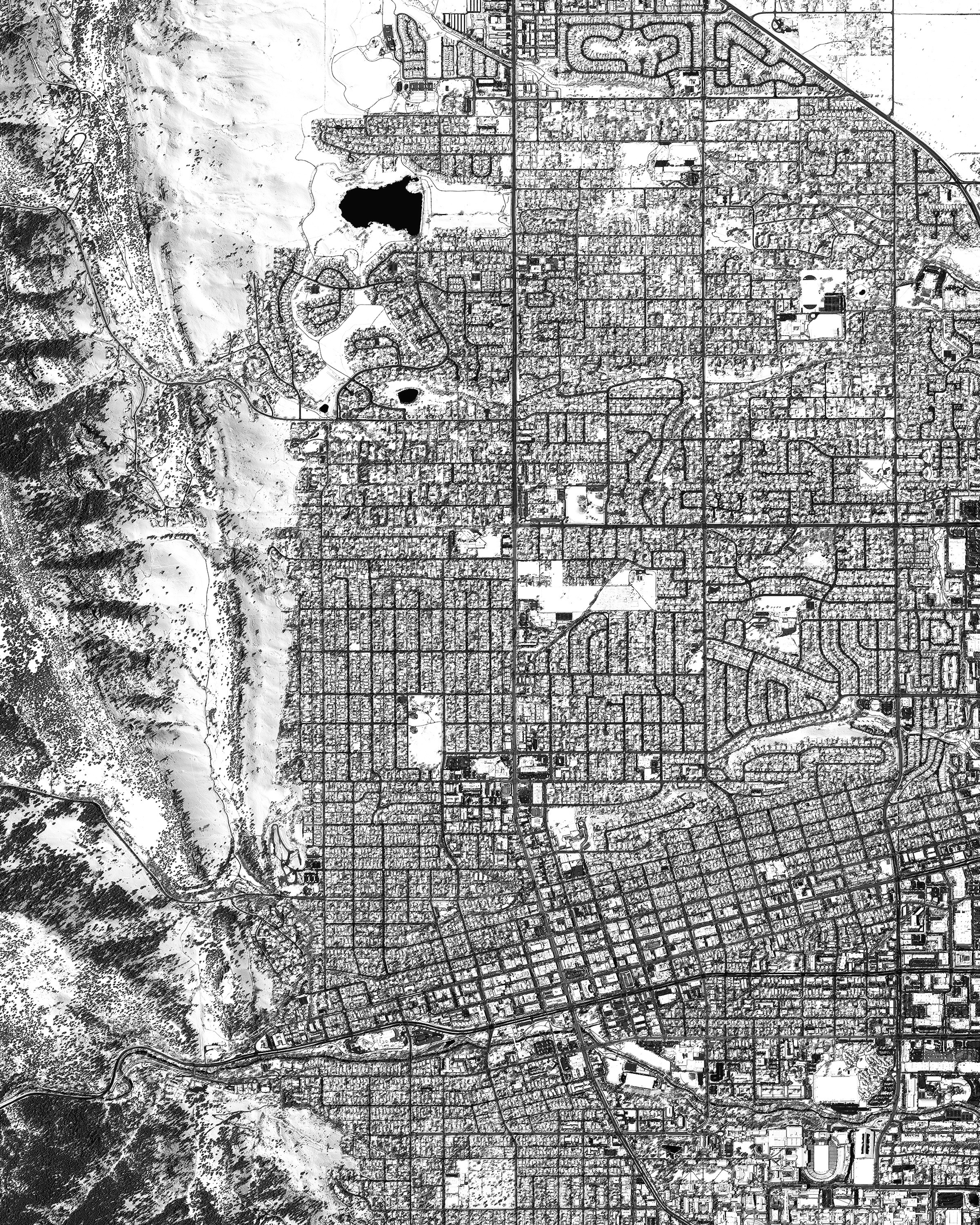
Boulder, Colorado
40.015000°,-105.270556° - Maxar
Our thoughts are with the people of Boulder, Colorado and all those affected by yesterday’s tragedy there. This Overview shows a snow-covered Boulder at the foothills of the Rocky Mountains, where it sits at 5,430 feet (1,655 meters) above sea level. The city is home to just over 100,000 people, nearly triple the population it had 60 years ago.
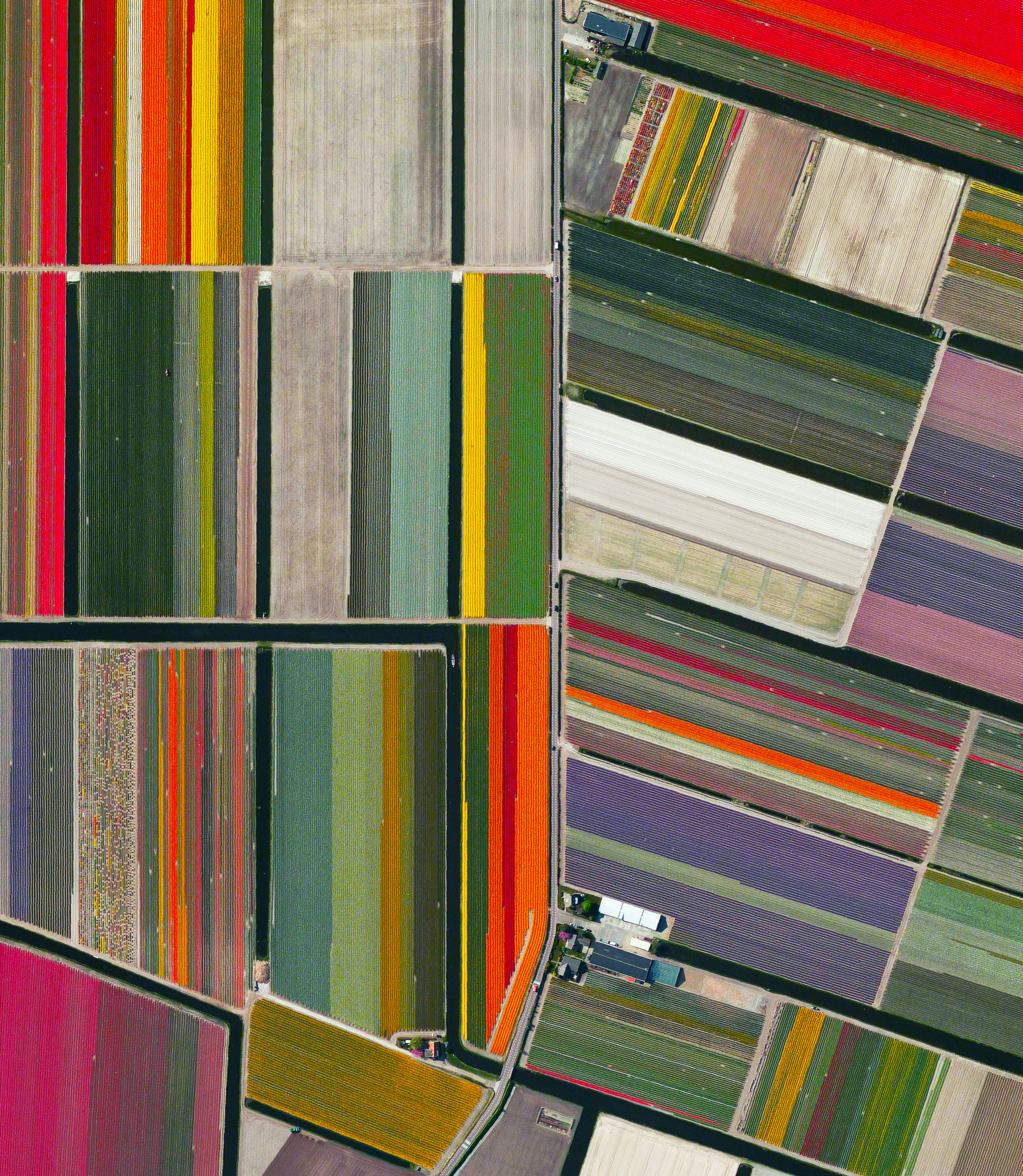
Dutch Tulips
52.276361°,4.557083° - Maxar
Tulip fields bloom in Lisse, Netherlands. The Dutch produce a total of 4.3 billion tulip bulbs each year. Slightly more than half of the total harvest (2.3 billion) is grown into cut flowers. Of these, 1.3 billion are sold in the Netherlands and the remainder is exported: 630 million flowers to Europe and 370 million elsewhere.
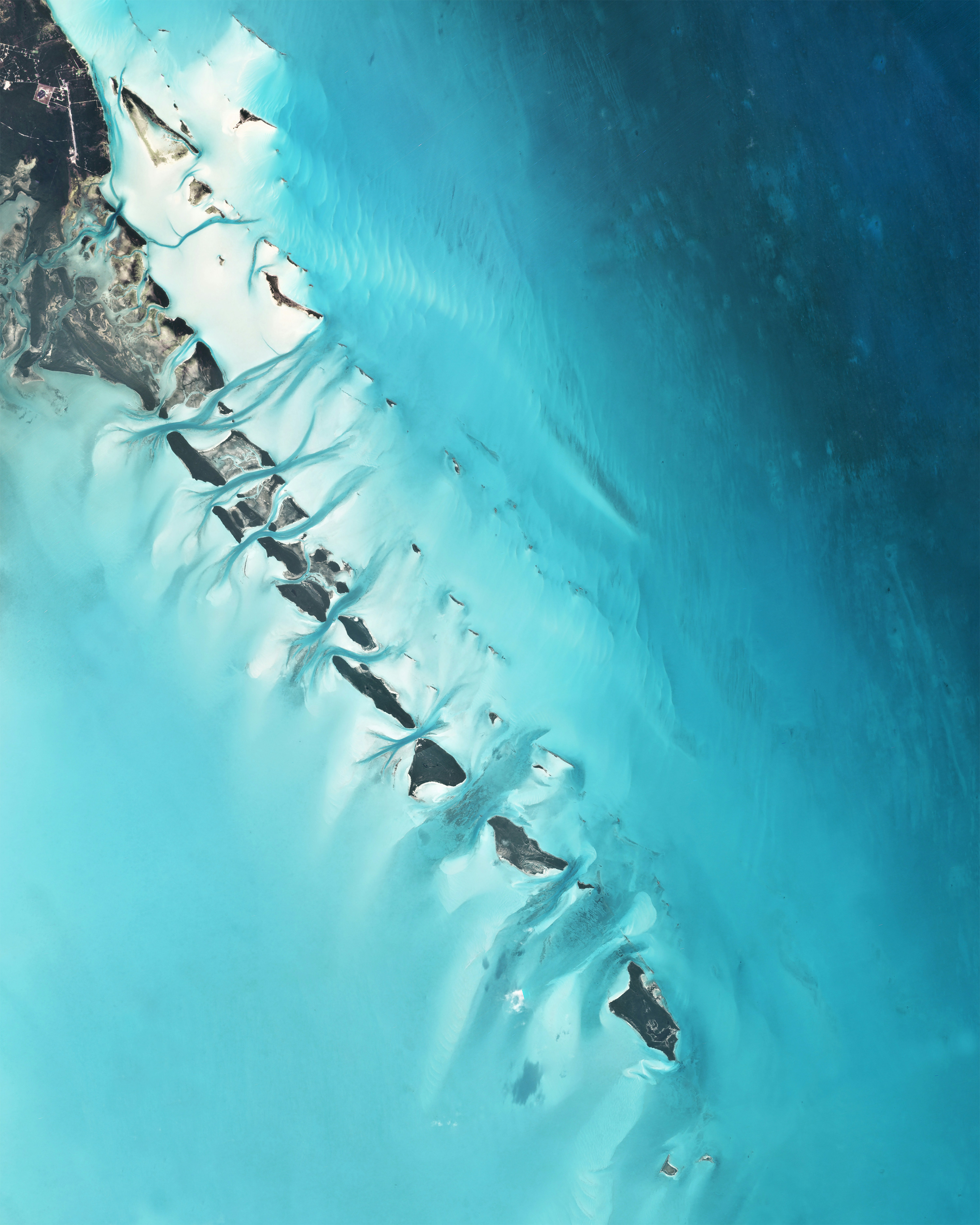
Exuma Cays
23.467185°,-75.883175° - Planet
Several cays extend off the western coast of Great Exuma Island in the Bahamas. Great Exuma is the largest of more than 365 islands in the Exuma district, with an area of 61 square miles (158 square kilometers). Much of the water surrounding the Bahamas is shallow, letting more light reflect off sand and corals on the ocean floor to produce the beautiful light blue shades seen here.
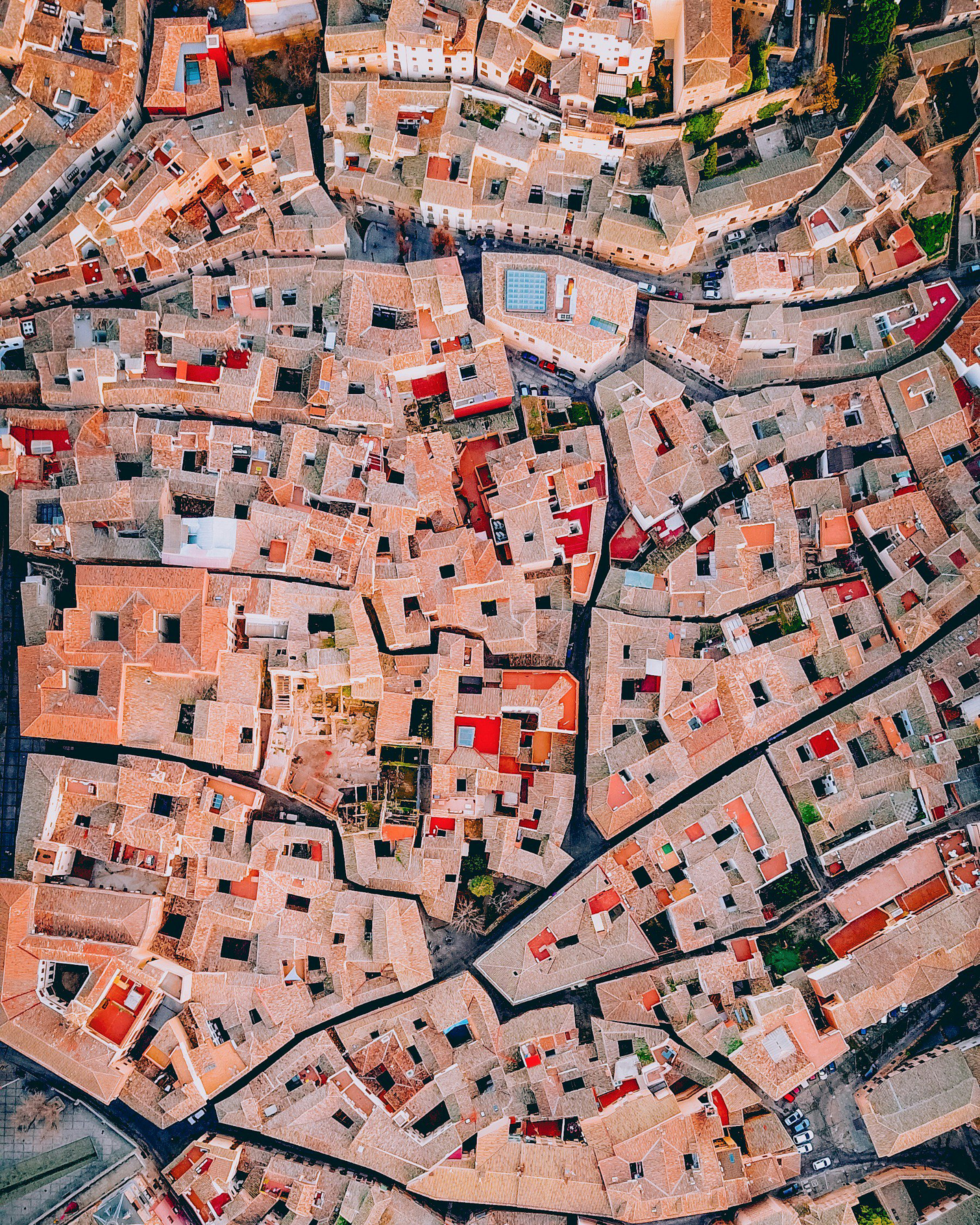
Toledo, Spain
39.856667°,-4.024444° - ZekeDrone
Check out this incredible drone shot of Toledo, Spain. Located on a mountaintop with a 150-degree view, Toledo’s old city is famous for its many historic sites, including the Alcázar fortress and the Zocodover marketplace. The city is located in central Spain and is home to roughly 84,000 residents.
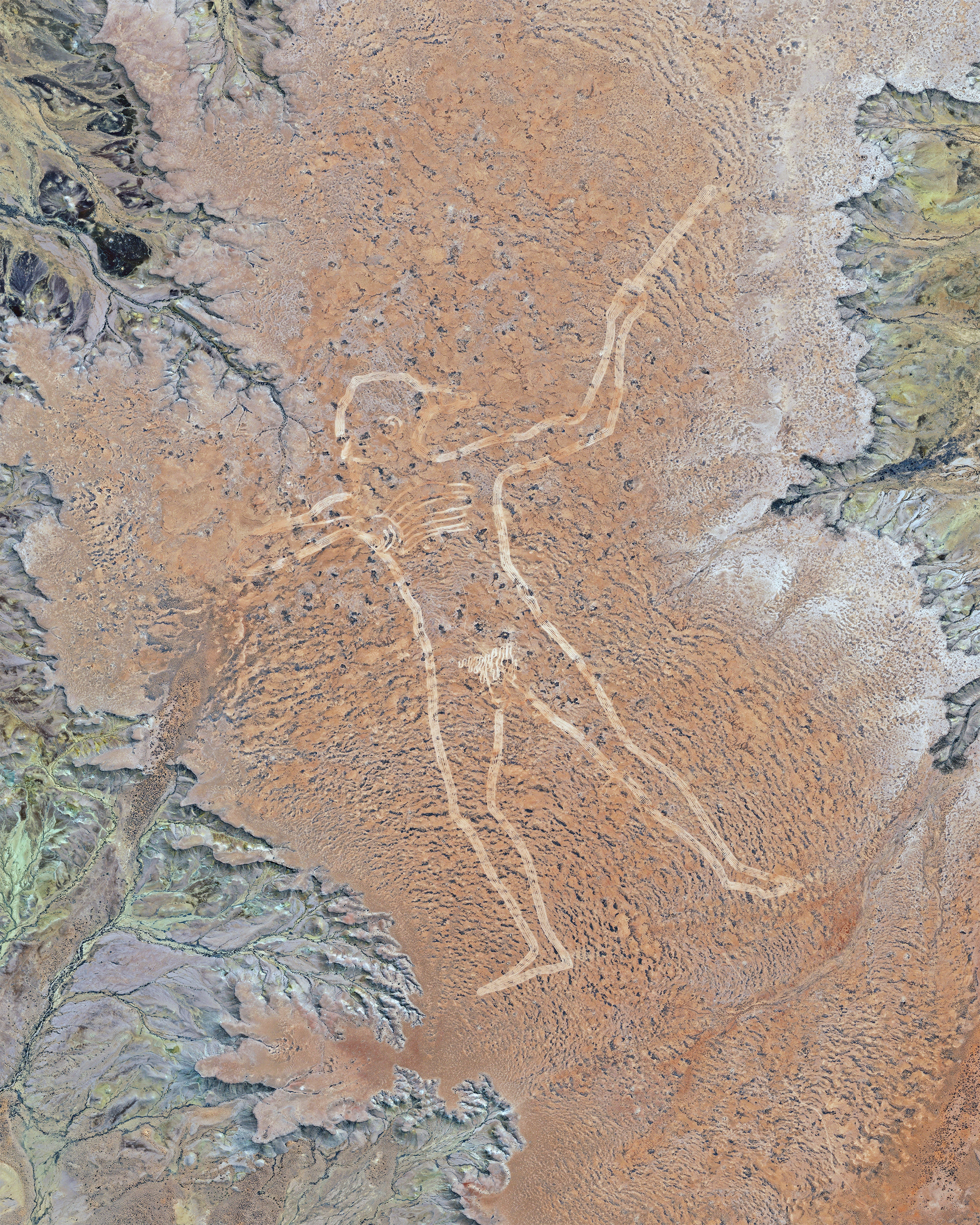
Marree Man
-29.530000°,137.465500° - Maxar
The Marree Man, also known as Stuart’s Giant, is a modern geoglyph atop a plateau at Finnis Springs, 37 miles (60 km) west of Marree, South Australia. It depicts an indigenous Australian man hunting with a boomerang or stick and is 1.7 miles (2.7 km) tall with a perimeter of 17 miles (28 km). Although it is one of the largest geoglyphs in the world, its origin remains a mystery, with no one claiming responsibility for its creation.
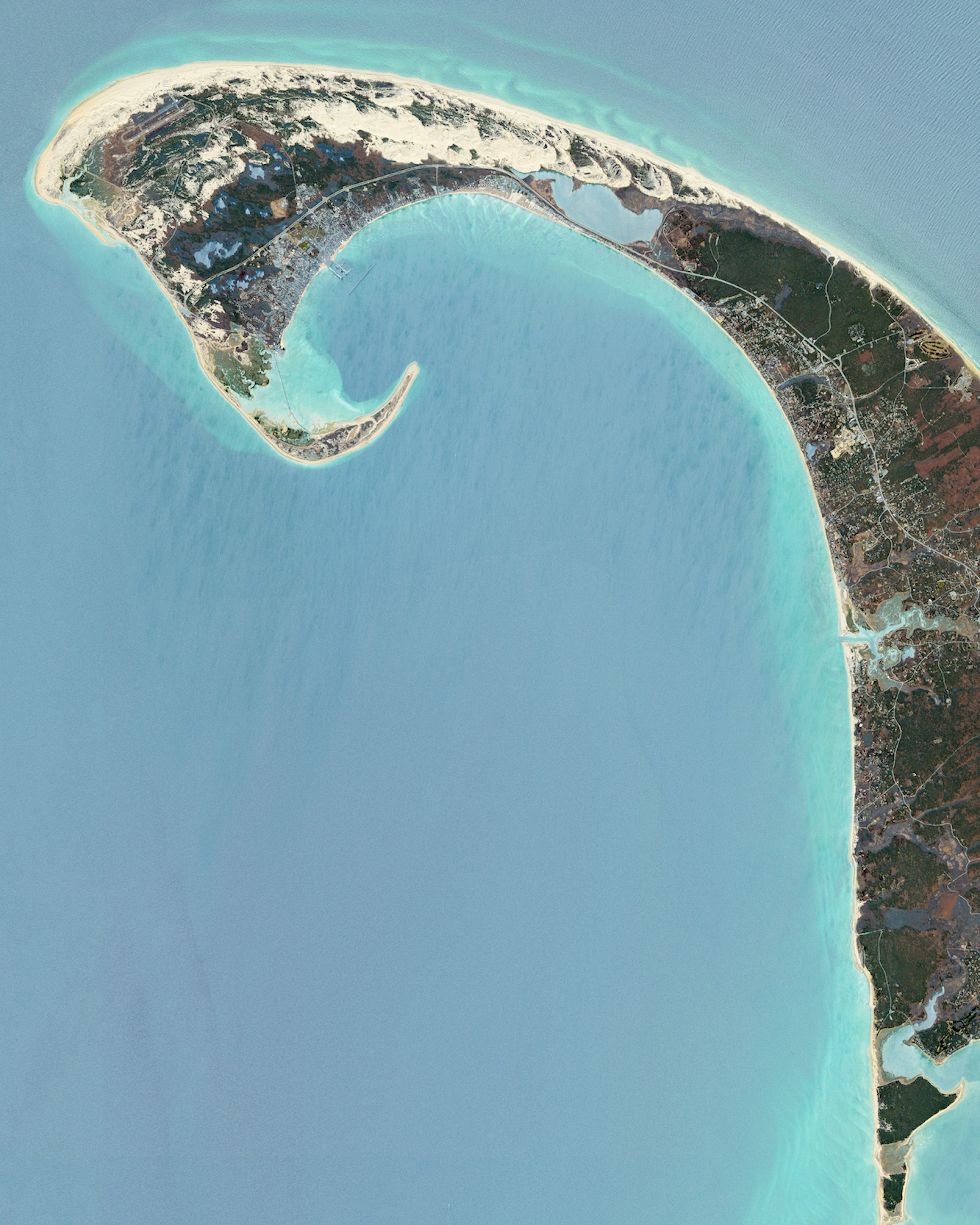
Cape Cod
41.797291°,-70.868541° - Maxar
Cape Cod is a hook-shaped peninsula that extends into the Atlantic Ocean off southeastern Massachusetts, USA. The 15 towns on the cape are a popular summer destination with quaint villages, seafood shacks, lighthouses, and many beaches. The three towns at the northernmost tip of the cape — Wellfleet, Truro, and Provincetown — are visible in this Overview.
Ireland
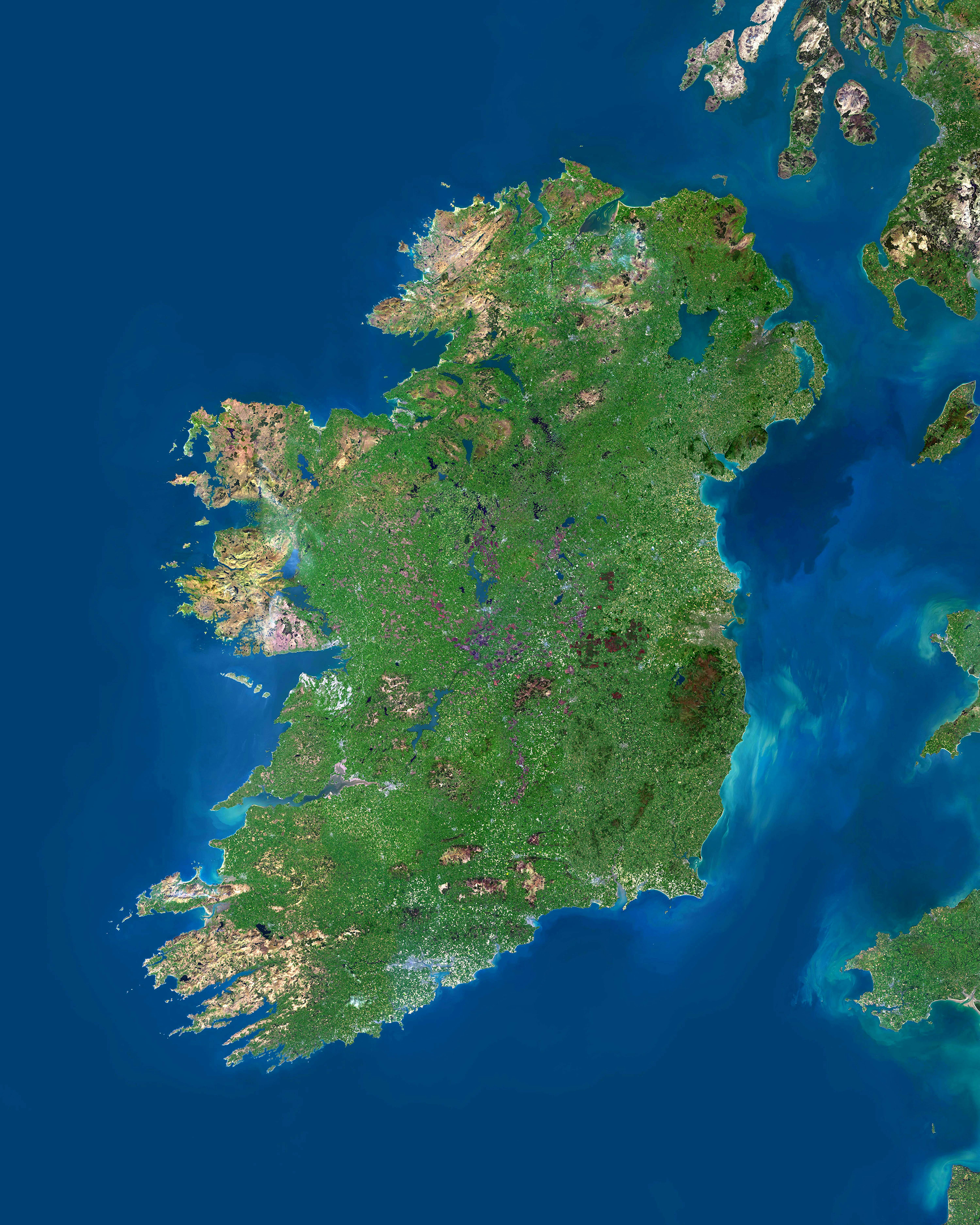
53.413695°,-8.010306° - Airbus Space
Happy St. Patrick’s Day! Paying homage to the patron saint of Ireland, today is a symbolic holiday for Irish people and all those of Irish descent. Here we see the entirety of Ireland — including Northern Ireland — which has a population of about 6.6 million people. The so-called ’Emerald Isle’ covers 32,595 square miles (84,421 square km), making it the 20th largest island on Earth.
Cape Nelson
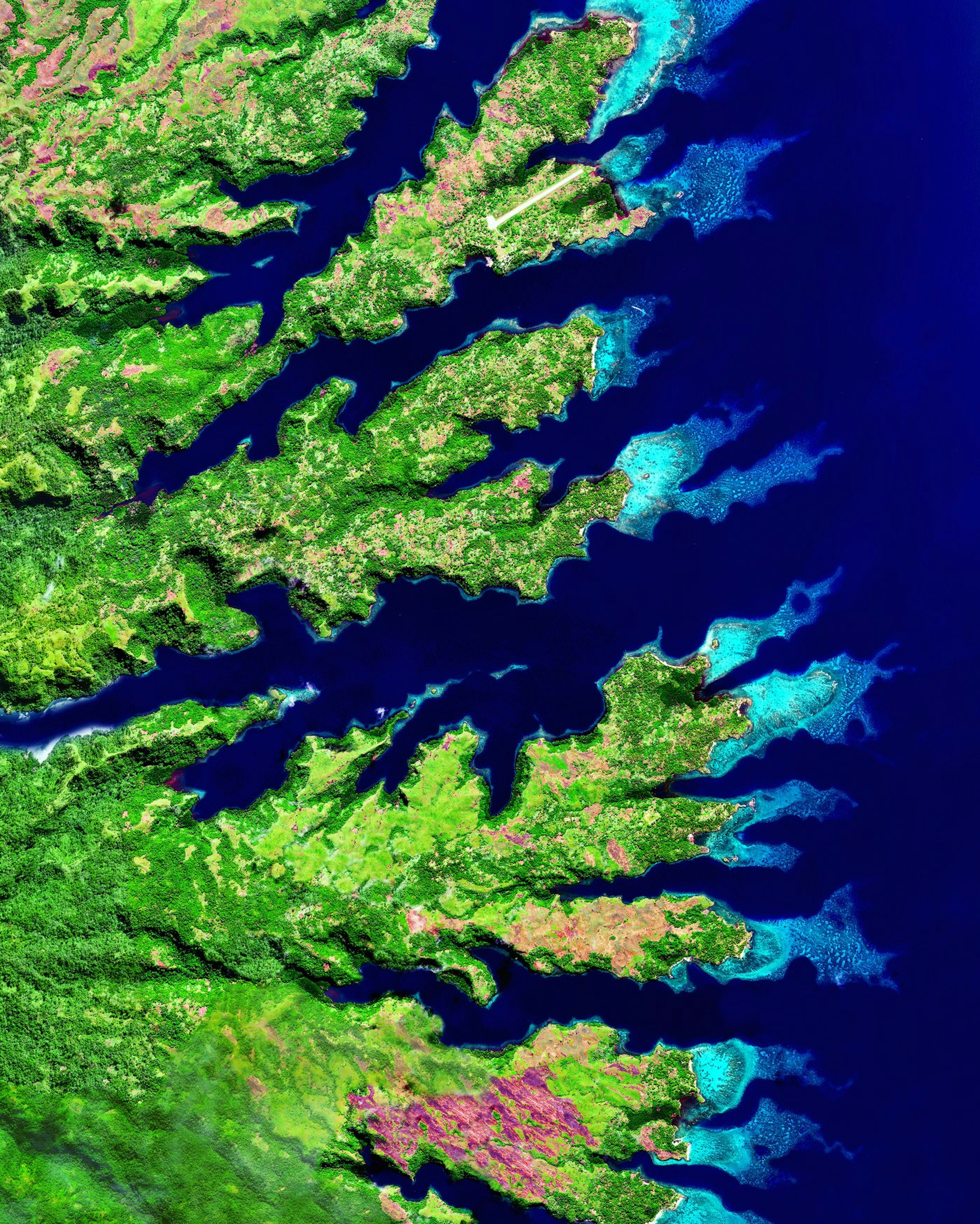
-8.997500°,149.250278° - Maxar
Cape Nelson is located on the north coast of Oro Province, Papua New Guinea. Its coastline is characterized by its many rias, or drowned river valleys, locally referred to as ‘fjords’. On the top of this Overview, we can also see the single airstrip at Tufi Airport, which services flights to the capital city of Port Moresby and other regional destinations.
Los Caracoles Pass
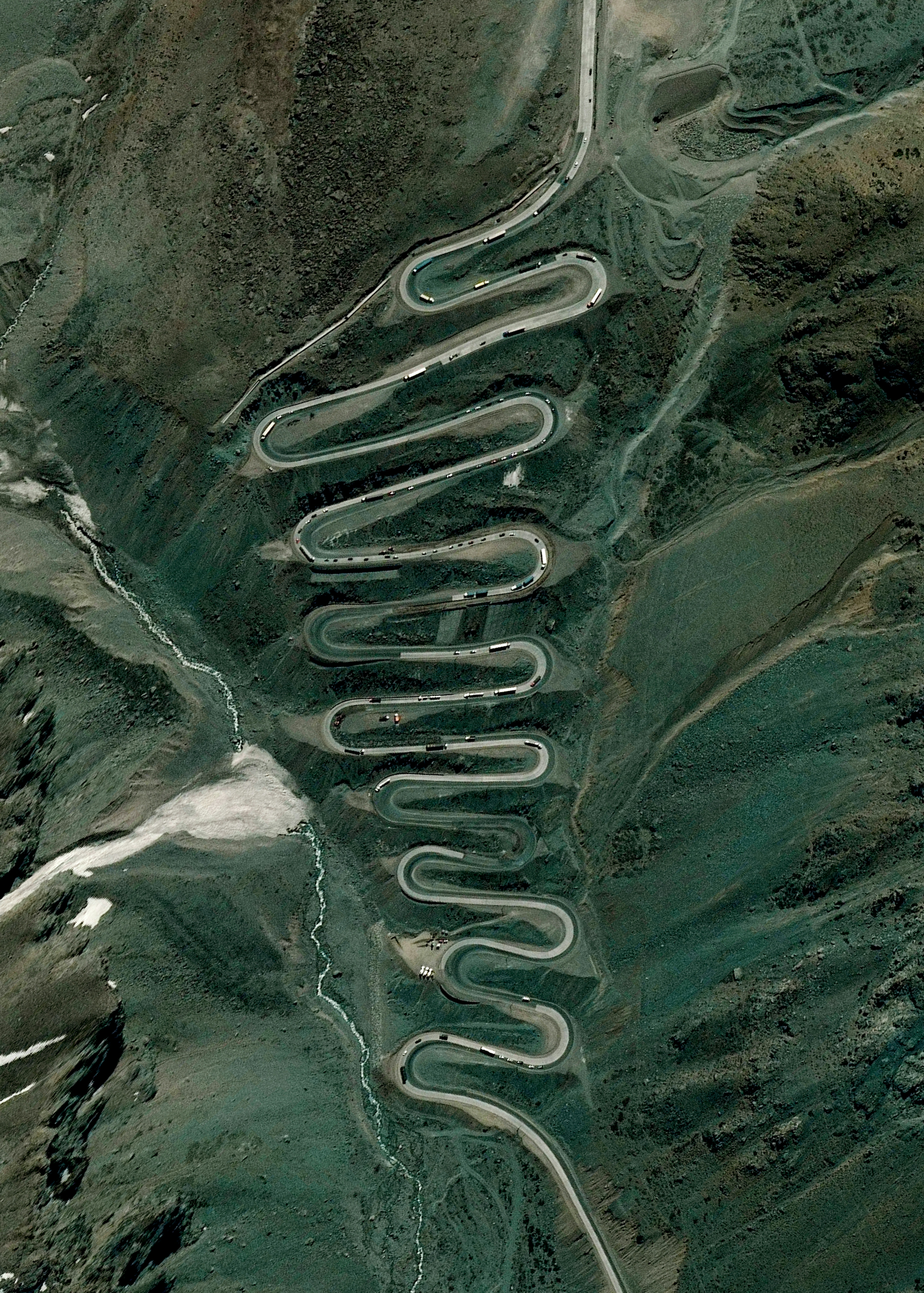
-32.851667°,-70.137778° - Maxar
Los Caracoles Pass — or "The Snail's Pass" — is a twisting mountain road located in a remote section of the Andes Mountains on the Chilean side of the border with Argentina. The path climbs to an elevation of 10,419 feet (3,175 m), has no roadside safety barriers, and is frequented by large trucks.
Las Palmas
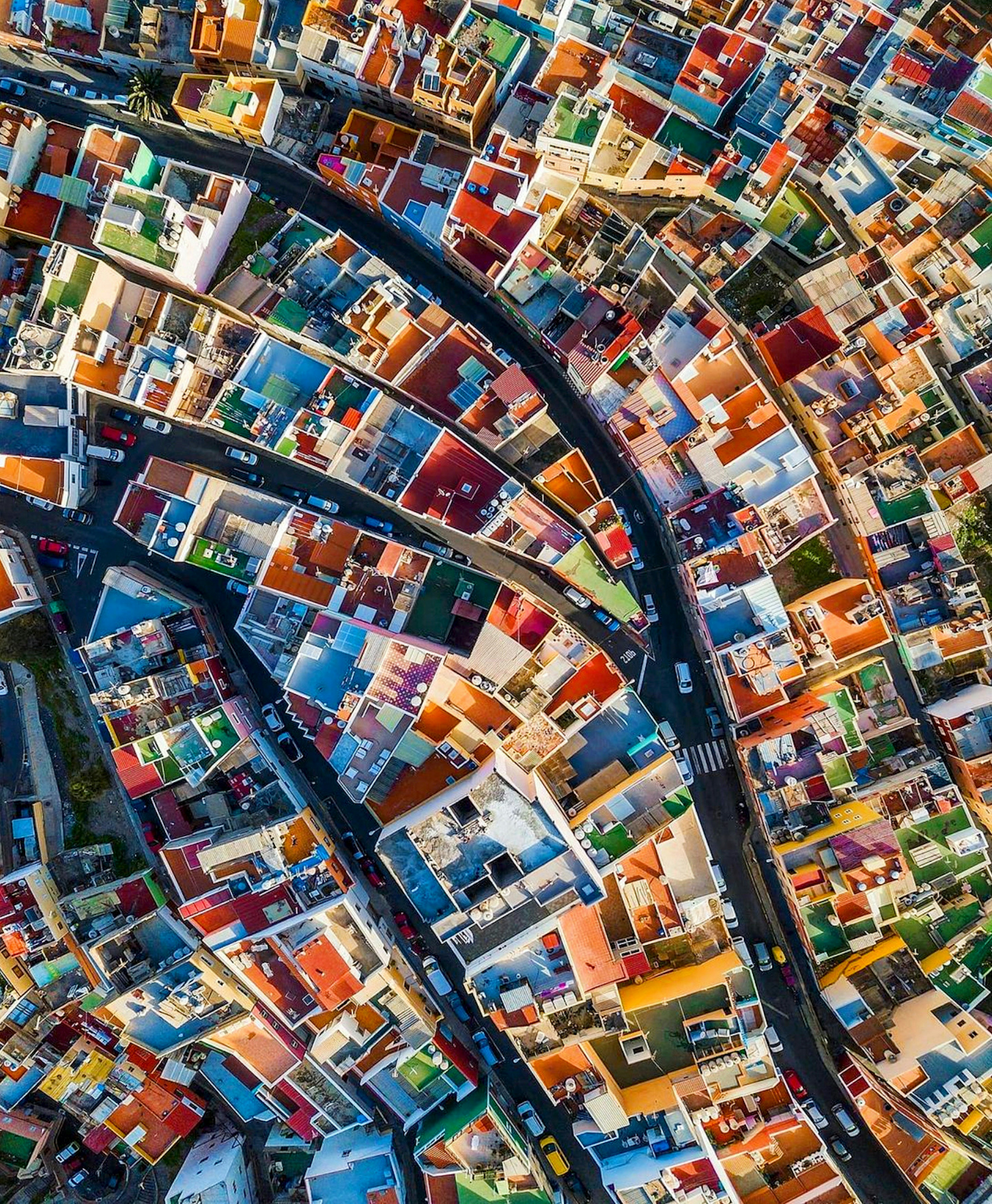
28.150000°,-15.416667° - Sebastien Nagy
Colorful rooftops are seen in the San Juan District of Las Palmas, Canary Islands, Spain. Las Palmas is located on the island of Gran Canaria, about 93 miles (150 km) off the Moroccan coast, and experiences a hot desert climate. Not only are the pastel-colored buildings charming to look at, but their color helps reflect the sun's heat, keeping interiors cool during hot days.
Student Art in Joshua, Texas
32.449936°,-97.381464° - Nearmap
Student art covers a parking lot at Joshua High School in Joshua, Texas. Located just south of the Dallas-Fort Worth metropolitan area, Joshua is a small city of roughly 7,800 residents. This particular high school serves students in grades 10 through 12 and allows each member of the graduating class to paint a parking space for their respective car.
Interceptor Cleaning the Klang River
3.046954°,101.444996° - Maxar
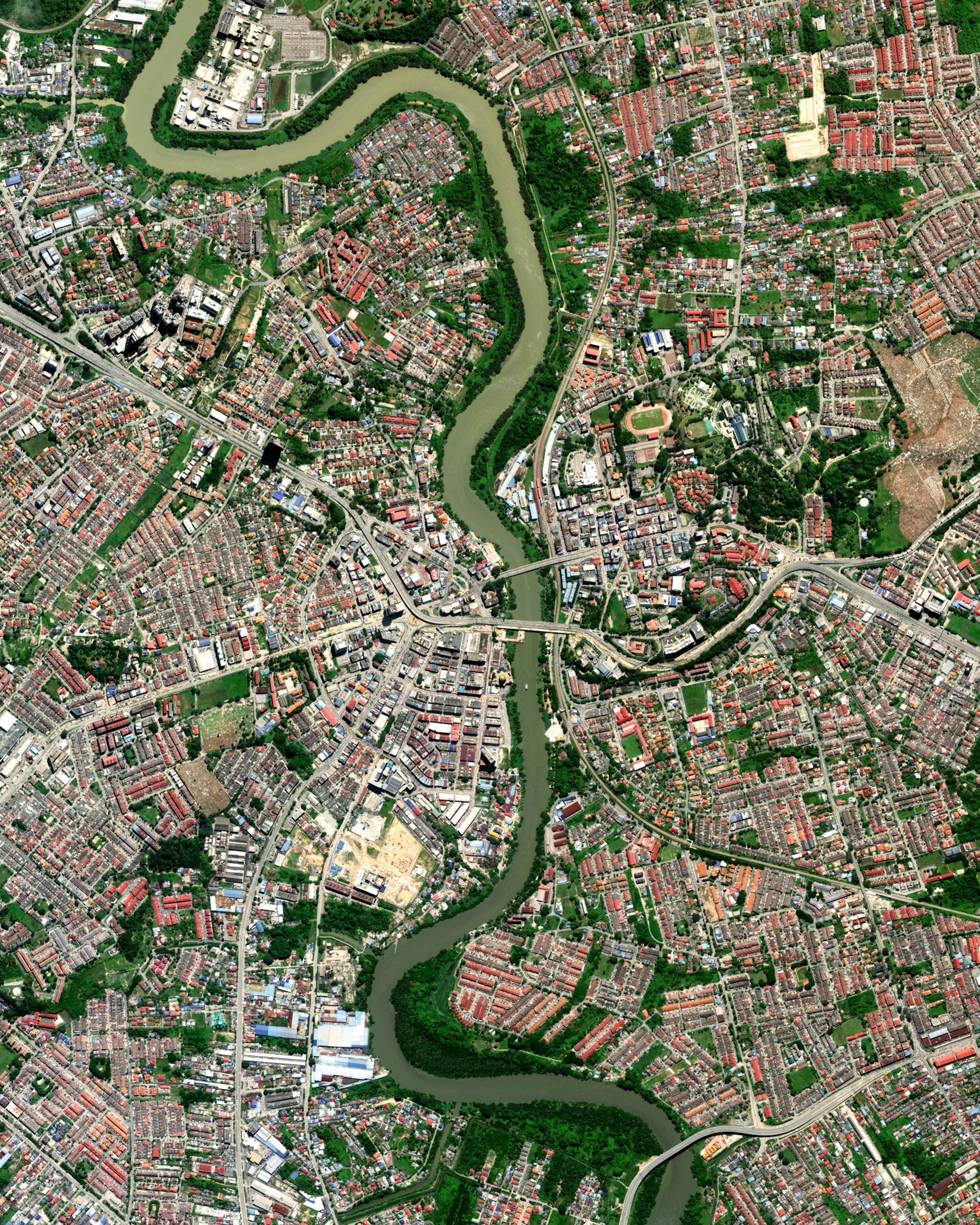
The Interceptor, created by The Ocean Cleanup, is the first scalable solution to prevent plastic from entering the world’s oceans from rivers. It is 100% solar-powered, extracts plastic autonomously, and is capable of operating in the majority of the world’s most polluting rivers. This is Interceptor 002 - seen in the Klang River of Malaysia. The Klang River, which flows through Kuala Lumpur and Selangor and eventually into the Straits of Malacca, is one of the 50 most polluting rivers worldwide, according to the research compiled by The Ocean Cleanup. Follow us on Instagram at @dailyoverview to see the Interceptor up close!
Peberholm
55.600000°,12.750000° - Maxar
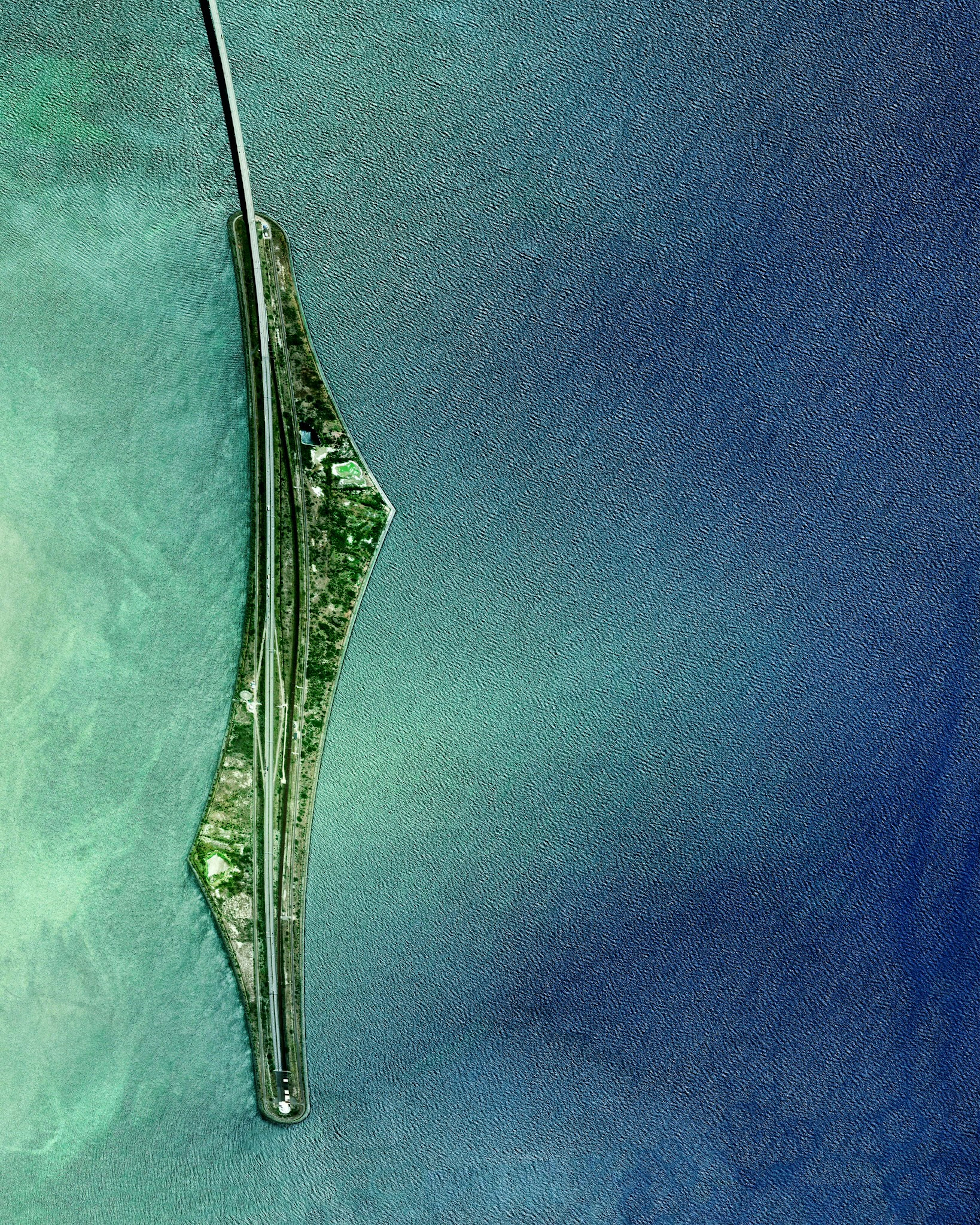
Roughly halfway across its span from Malmo, Sweden and Copenhagen, Denmark, the Øresund Bridge becomes an undersea tunnel. This junction happens on the artificial island of Peberholm, shown in this Overview roughly 66 feet (20 m) above sea level. The entire bridge system stretches nearly 5 miles (8 km), making it the longest combined road and rail bridge in Europe.
Lima
-12.117500°,-77.043056° - Maxar
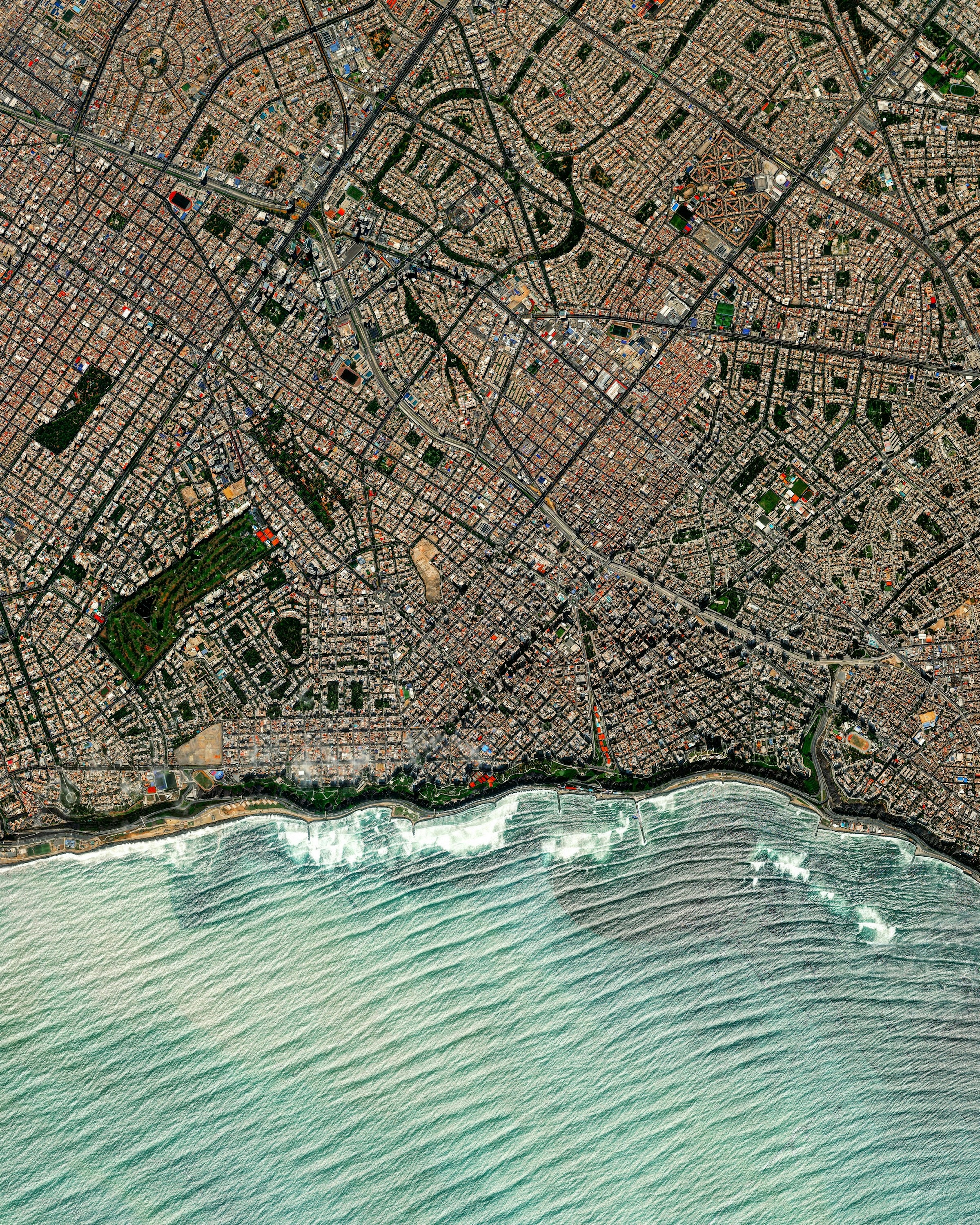
Waves roll into the shores of Lima, Peru. The Miraflores neighborhood, seen here, is one of the most affluent and touristed districts of the capital city, containing many hotels, restaurants, bars, nightclubs, and department stores. Miraflores is part of Peru’s Costa Verde, or “green coast,” which has several beaches that attract swimmers, surfers, and paragliders in the summer months.
Dubai Skyscrapers
25.263056°,55.297222° - Carsten Witte
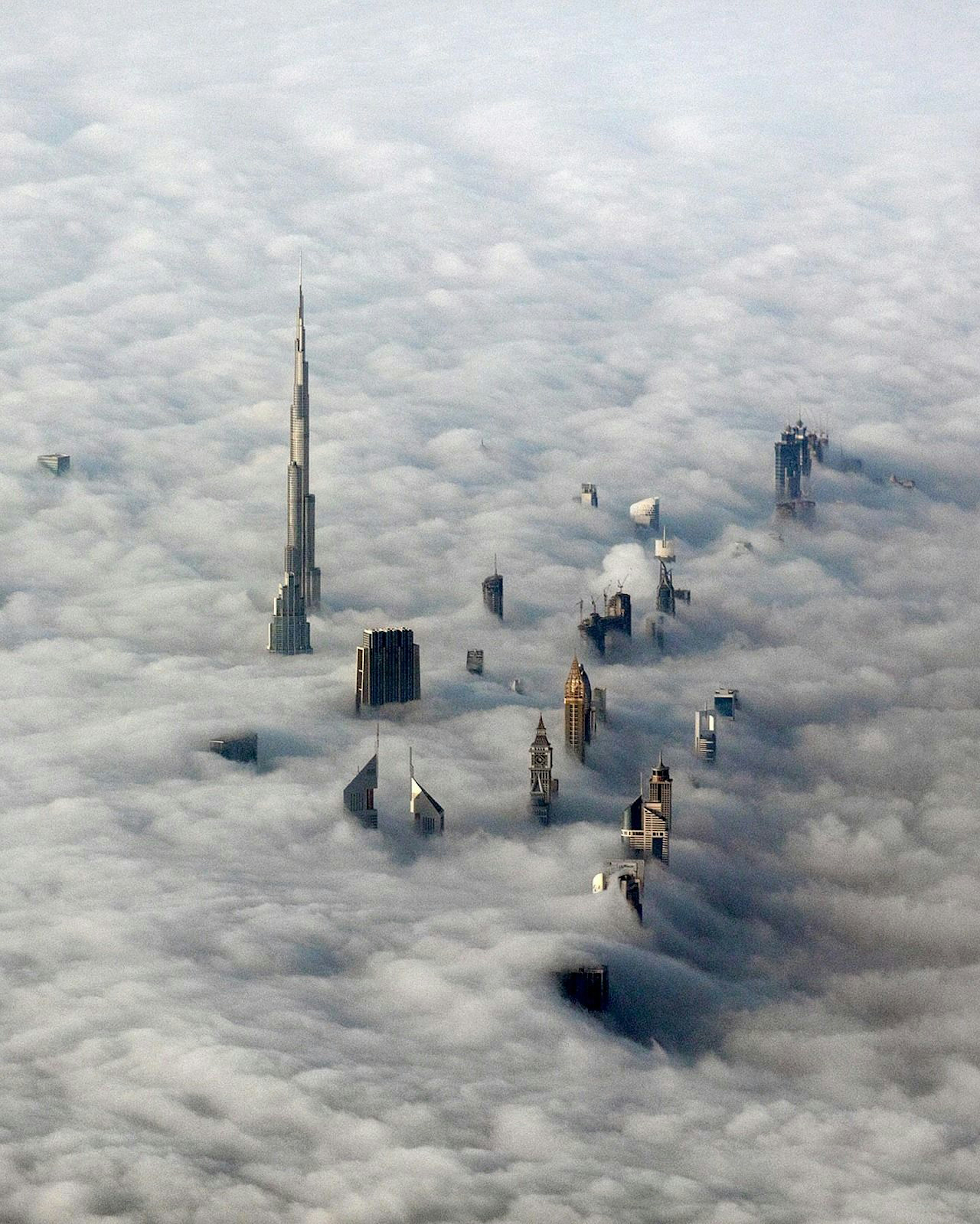
Check out this photograph of skyscrapers peeking through the clouds over Dubai, United Arab Emirates. The city has built more skyscrapers higher than ⅔ km (2,200 ft), ⅓ km (1,100 ft), or ¼ km (820 ft) than any other city on the planet.
San Francisco International Airport (SFO)
37.621313°,-122.378955° - Nearmap
San Francisco International Airport (SFO) is the 7th busiest airport in the United States and the 24th busiest in the world by passenger count. Due to the limited travel during the Covid pandemic, the total number of passengers decreased 71% in 2020 to only 16 million.
Mars Reconnaissance Orbiter
0.000000°,0.000000° - NASA
For those who asked us to show more imagery of Mars, you’re in luck! Check out this shot captured by the Mars Reconnaissance Orbiter, which has been taking photos of the Red Planet since 2006. The orbiter’s mission is search for signs of water, either past or present, to determine how it and other geological forces have shaped the planet’s surface. Follow us on Instagram at @dailyoverview to see more of Mars' diverse landscapes, including dunes, rock faults, impact craters, valleys, and even carbon dioxide ice.
Makati City
14.550000°,121.033333° - Maxar
Makati is one of sixteen cities that make up Metropolitan Manila, the capital of the Philippines. It is home to more than 580,000 permanent residents, but its population can more than double during the daytime as large numbers of people enter the city to work, shop and do business. As seen in this Overview, the architecture of the city is a fascinating blend of Spanish colonial-style buildings and modern skyscrapers.
