Daily
One regular dose of Earth from above
Noor III
31.059494°,-6.870344° - Maxar
Noor III is the newest stage of the Ouarzazate Solar Power Station in Ouarzazate, Morocco. This site utilizes a concentrated solar power (CSP) tower design with 7,400 heliostat mirrors that focus the sun’s thermal energy toward the top of a 820-foot-high (250 meters) tower at its center. At the top of the tower, there is molten salt, which is used in this process due to its ability to get very hot (500–1022°F / 260–550°C). The molten salt then circulates from the tower to a storage tank, where it is used to produce steam and generate electricity. The Noor III CSP tower can produce and then store enough energy to provide continuous power to the surrounding area for ten days.
Budapest at Night
47.492500°,19.051389° - NASA
Budapest, Hungary photographed at night from the International Space Station. Amid the lights of the capital city is the dark void of the Danube, Europe’s second-longest river. Budapest’s metropolitan area spans 2,944 square miles (7,626 square km) and houses roughly 3.3 million people — one-third of Hungary’s total population.
Central Park From a Helicopter
40.782222°,-73.965278° - Benjamin Grant
Check out Central Park captured from helicopter by our founder, Benjamin Grant. Located in the middle of Manhattan in New York City, the park spans 843 acres -- or 6% of the borough. One of the most influential innovations in the park's design was its "separate circulation" systems for pedestrians, horseback riders, and automobiles. This concealed "crosstown" commercial traffic in sunken roadways, and densely planted shrub belts in order to maintain a rustic ambiance.
Polignano a Mare
41.000000°,17.216667° - Maxar
Check out this Overview of Polignano a Mare, Italy. Located on the Adriatic Sea, the town is a popular tourist destination with its limestone cliffs, white-washed houses, and deep blue waters. It is also renowned for its beaches, most notably Cala Porto which is known for its white and aquamarine-colored pebbles.
Loco Hills Oil Rigs
32.823349°,-104.128032° - Maxar
Oil rigs checker the landscape around Loco Hills, New Mexico. Thousands of drilling platforms like these can be seen throughout southeastern New Mexico and western Texas, covering a region known the Permian Basin. This basin, which contains one of the world’s thickest deposits of rock from the Permian geologic period, accounted for more than one-third of U.S. domestic oil production in 2019.
Fortaleza
-3.718333°,-38.542778° - Maxar
Waves roll into the coast of Fortaleza, Brazil. Located in the northeast of the country on the Atlantic Ocean, Fortaleza has nearly 16 miles (25 km) of urban beaches. It’s nearly 2.7 million residents make it the 5th most populous Brazilian city, behind São Paulo, Rio de Janeiro, Brasília and Salvador, respectively.
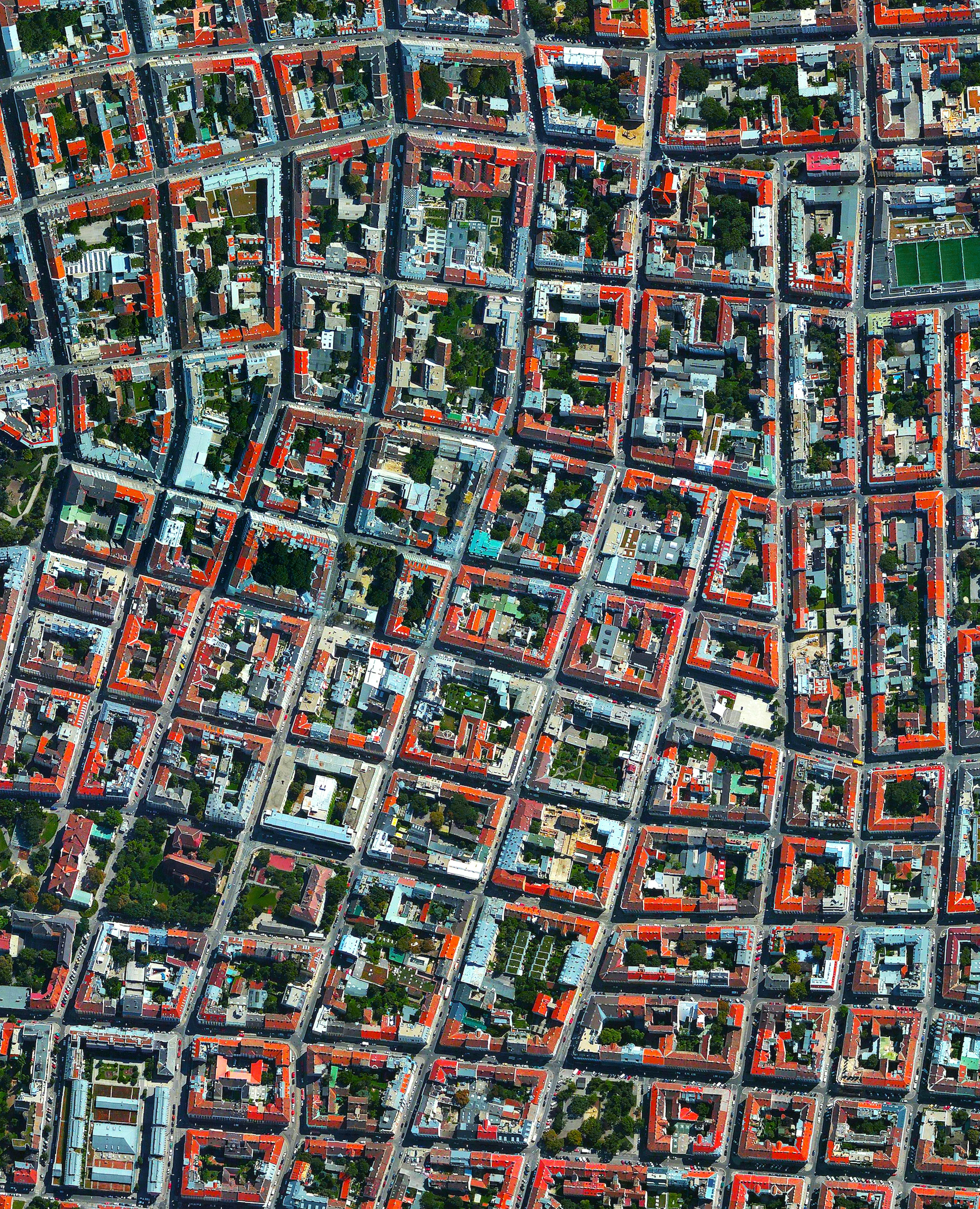
Währing District
48.233056°,16.314722° - Maxar
The Währing District in northwestern Vienna, Austria, is home to roughly 52,000 people and is captured in this Overview. It contains several parks including Türkenschanzpark, one of the largest in the city and the site of Vienna’s University of Natural Resources and Life Sciences. Währing is a predominantly residential district with a number of wealthy neighborhoods.
Hastings Island
10.109656°,98.296127° - Airbus Space
Hastings Island is one of more than 800 islands in Myanmar’s Mergui Archipelago. Seen here with the smaller South Phipps and Barwell islands, Hastings is covered by dense mangrove jungle and has white sandy beaches on its western side. The Mergui Archipelago is one of Asia’s last virtually untouched island regions, sparsely populated by indigenous people and visited by only a couple thousand tourists per year.
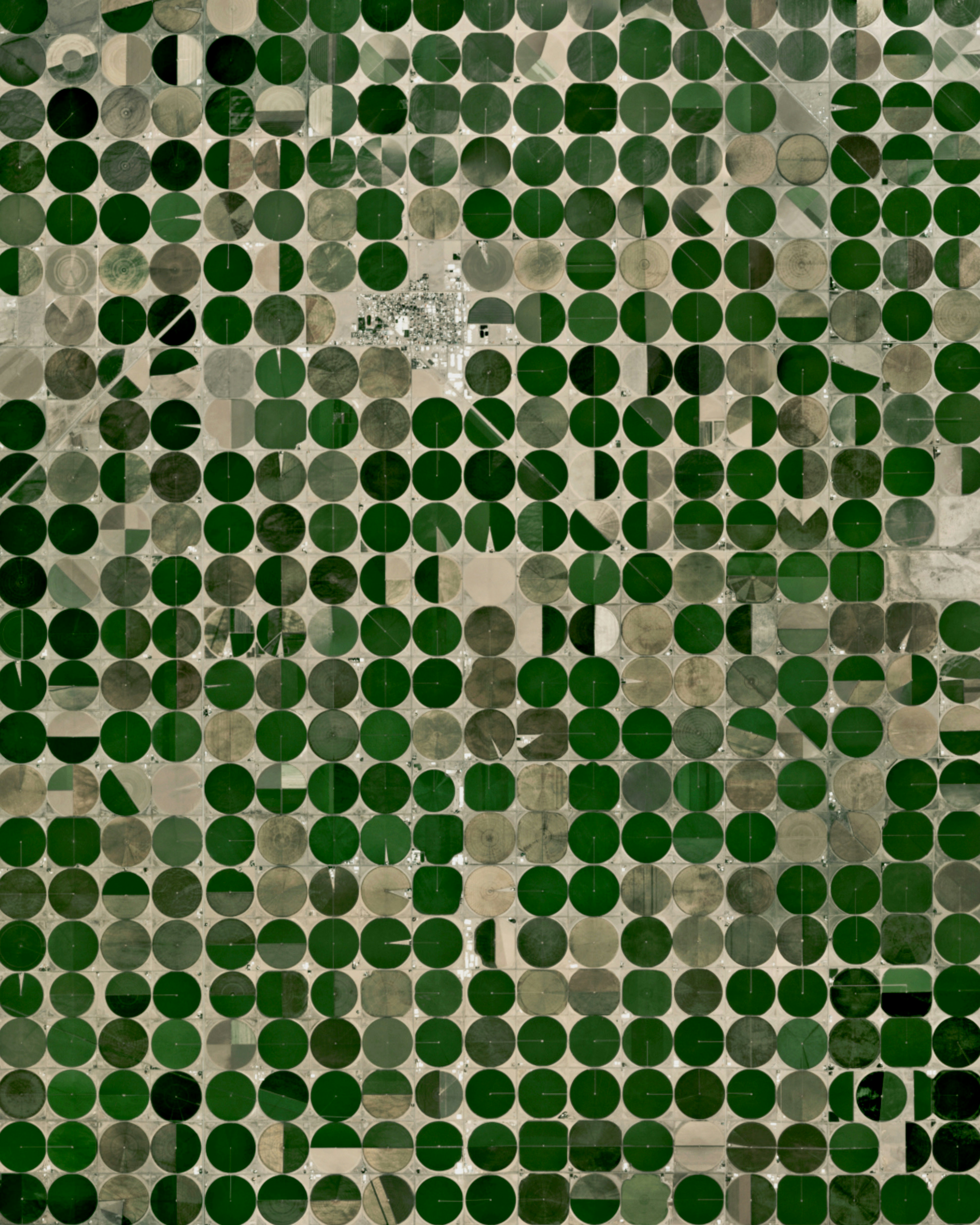
Center, Colorado
37.751351°,-106.110195° - Planet
Hundreds of pivot irrigation circles surround the town of Center, Colorado. Located on the border of Rio Grande and Saguache counties, about one-third of the town’s industry is based in agriculture or grocery wholesaling. The circles form when lines of sprinklers, powered by electric motors, rotate 360 degrees to evenly irrigate crops.
Venice Grand Canal
45.438000°,12.336000° - Sebastien Nagy
Check out this awesome drone shot of the Grand Canal flowing through Venice, Italy. One of the major water-traffic corridors in the city, the Grand Canal is 2.4 miles (3.8 km) long, between 98 and 295 feet (30-90 m) wide, and has an average depth of 16 feet (5 m). Near the top of this image — where the canal bends — we can see the famous Ponte di Rialto, a 16th-century stone pedestrian bridge and major Venetian tourist attraction.
Hoover Dam
36.015844°,-114.738804° - Nearmap
The Hoover Dam is a concrete arch-gravity dam in the Black Canyon of the Colorado River, situated on the border of Nevada and Arizona. Standing 726.4 feet (221.4 m) tall and 1,244 feet (376 m) long, it impounds Lake Mead, the largest reservoir in the United States by volume. Construction of the Hoover Dam between 1931 and 1936 served as a massive public works project of the Great Depression, employing thousands of workers — in fact, when the dam was authorized, nearly 20,000 unemployed individuals flocked to Las Vegas (a city of just 5,000 at the time) in hopes of finding work.
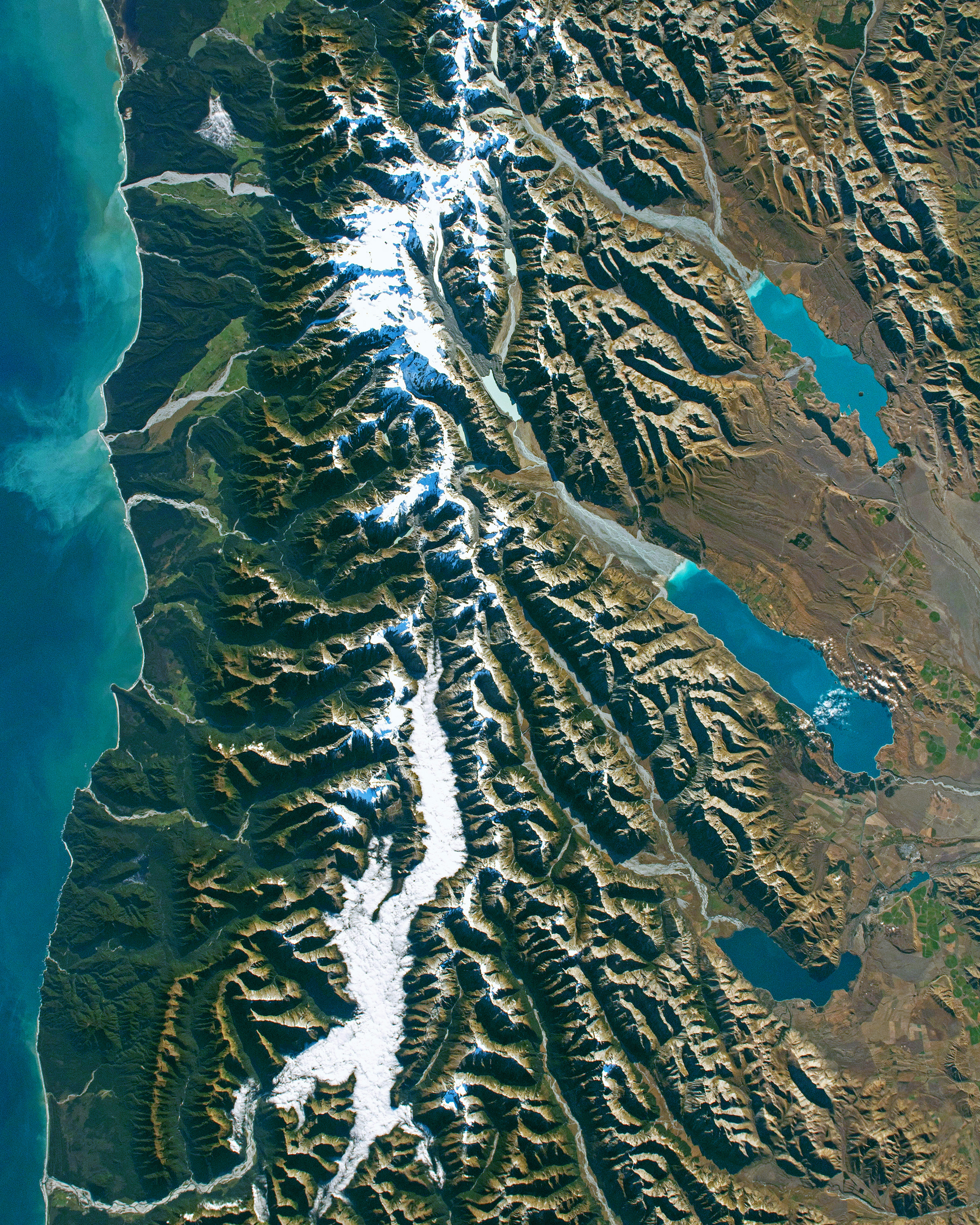
Southern Alps
-43.595000°,170.141944° - NASA
The Southern Alps (Kā Tiritiri o te Moana) is a mountain range that extends along much of the length of New Zealand’s South Island. This Overview, captured by an astronaut onboard the International Space Station, shows the range’s highest elevation areas including Aoraki / Mount Cook, the nation’s highest point at 12,218 feet (3,724 m) above sea level. To the east of the Southern Alps is a series of turquoise glacial lakes — the three seen here are Lake Tekapo (top), Lake Pukaki, and Lake Ohau (bottom).
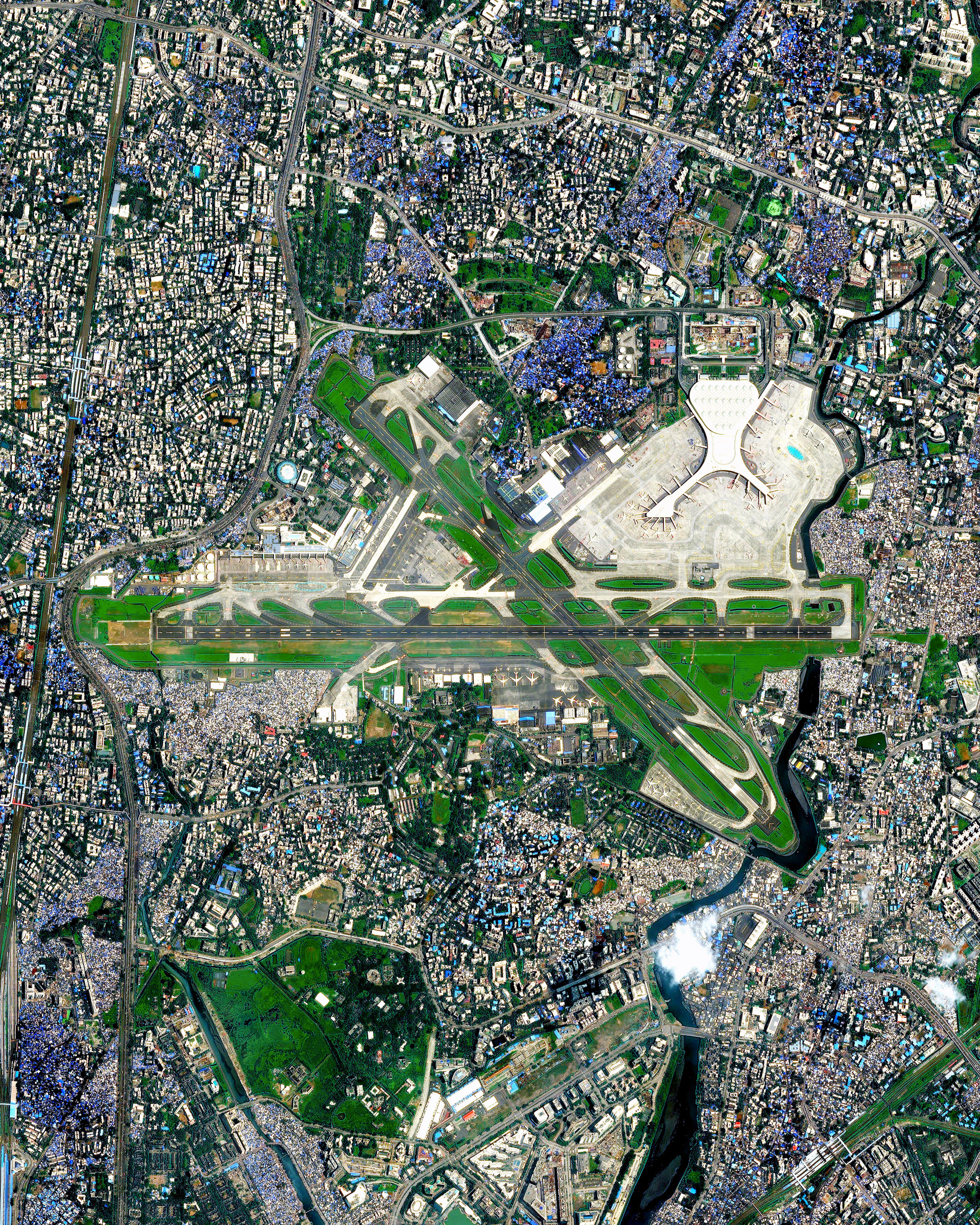
Chhatrapati Shivaji Maharaj International Airport
19.088611°,72.868056° - Airbus Space
Chhatrapati Shivaji Maharaj International Airport (BOM) is the primary international airport serving India’s Mumbai Metropolitan Area. It has three terminals and two runways spread across 1,850 acres (750 hectares) in the suburbs of Santacruz and Sahar Village. BOM is the second busiest airport in the nation by total passenger traffic, serving 49.8 million travelers in 2018.
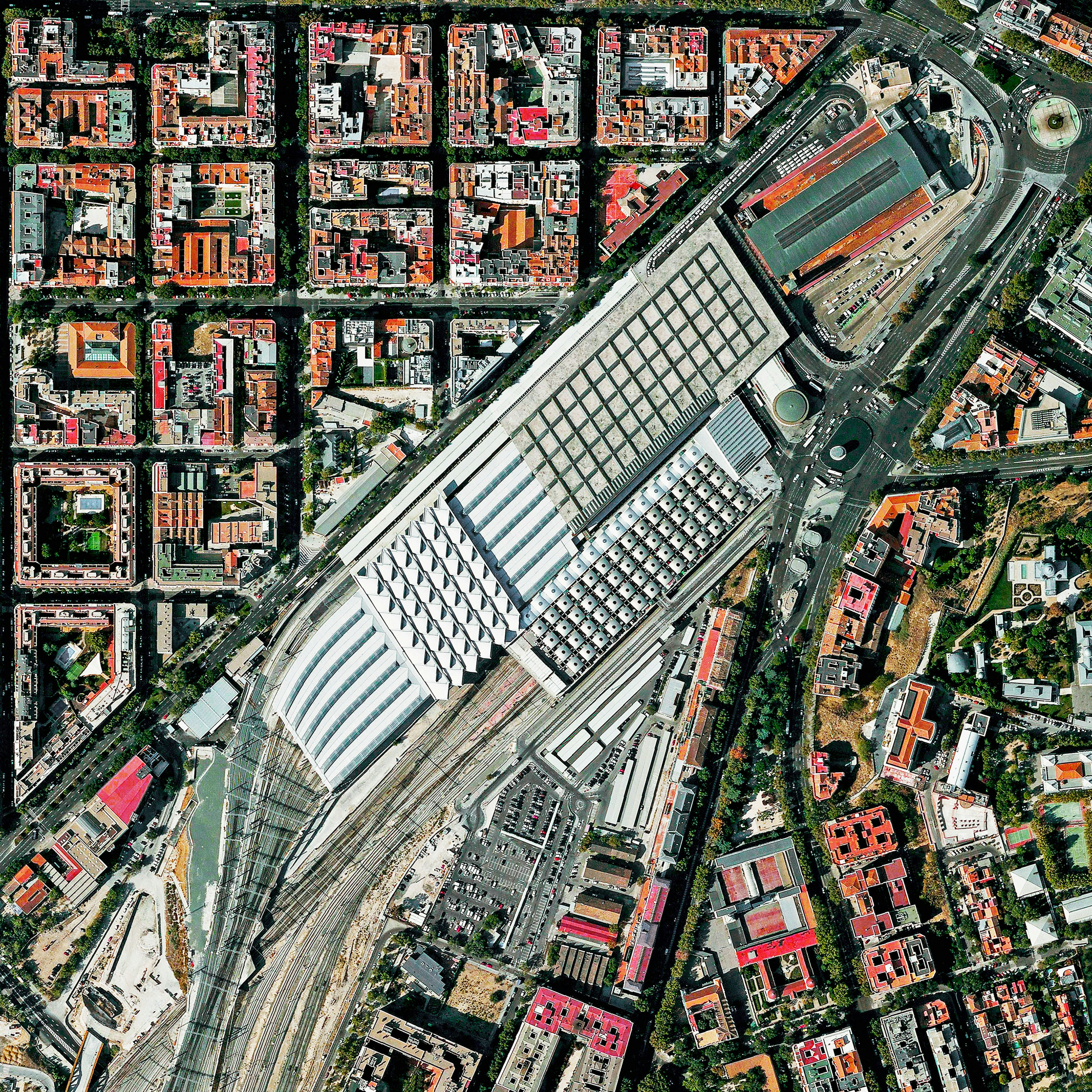
Madrid Atocha Railway Station
40.406667°,-3.689444° - Maxar
The Atocha Railway Station is the largest train station in Madrid, Spain. The facility serves as a hub for commuter trains, intercity and regional trains from the south, and AVE high-speed trains. In 1992, the station’s original terminal building was converted into a concourse with shops, a nightclub, and a 43,055-square-foot (4,000 square meter) tropical botanical garden.
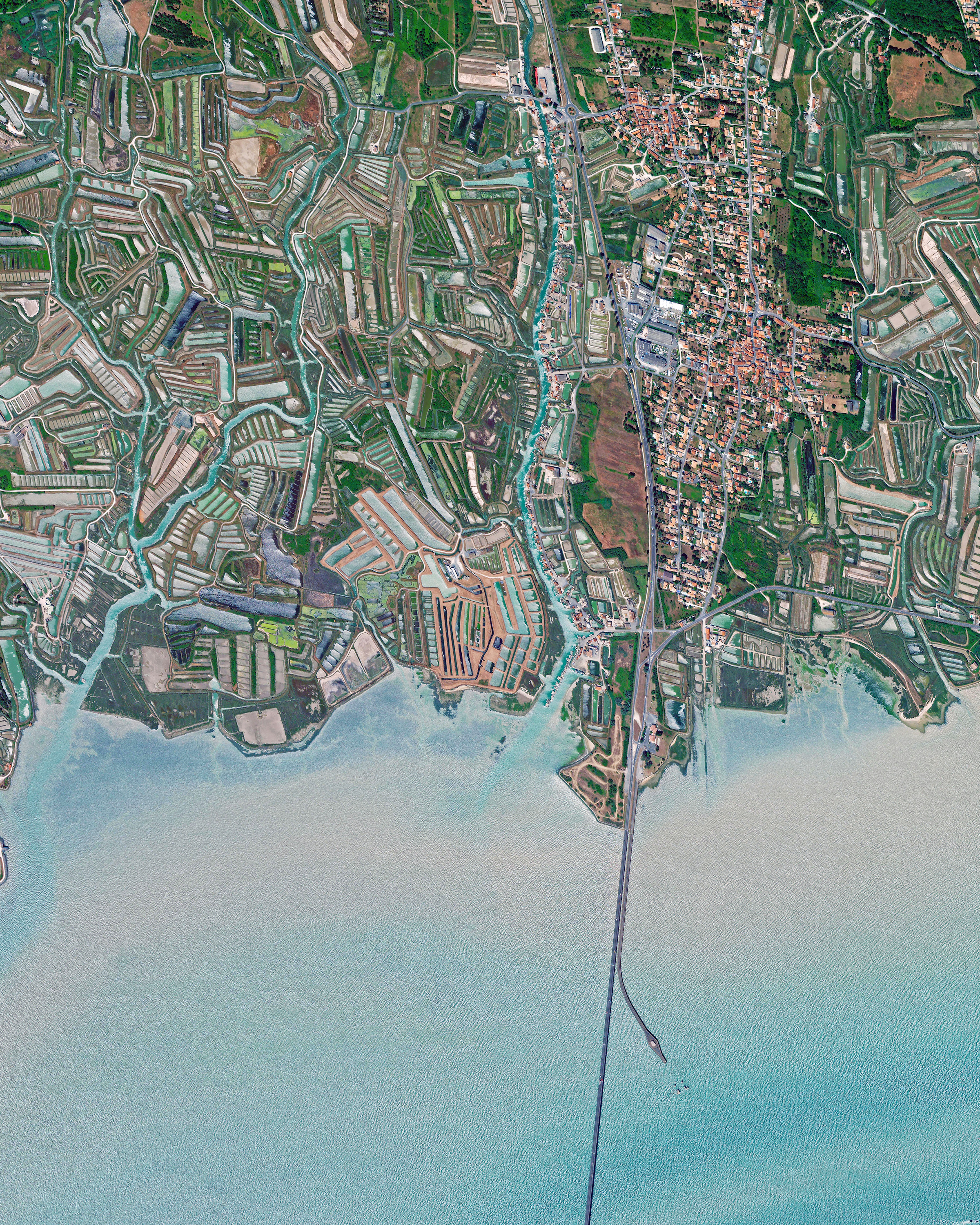
Île d'Oléron
45.863074°,-1.206273° - Maxar
Île d'Oléron is an island off the west coast of France in the Bay of Biscay. It is known worldwide for its many salt marshes and oyster farms, which can be seen here along the island’s southern coast. Oléron has about 21,000 inhabitants and is the second largest island in Metropolitan France, after Corsica, with an area of 67 square miles (174 square km).
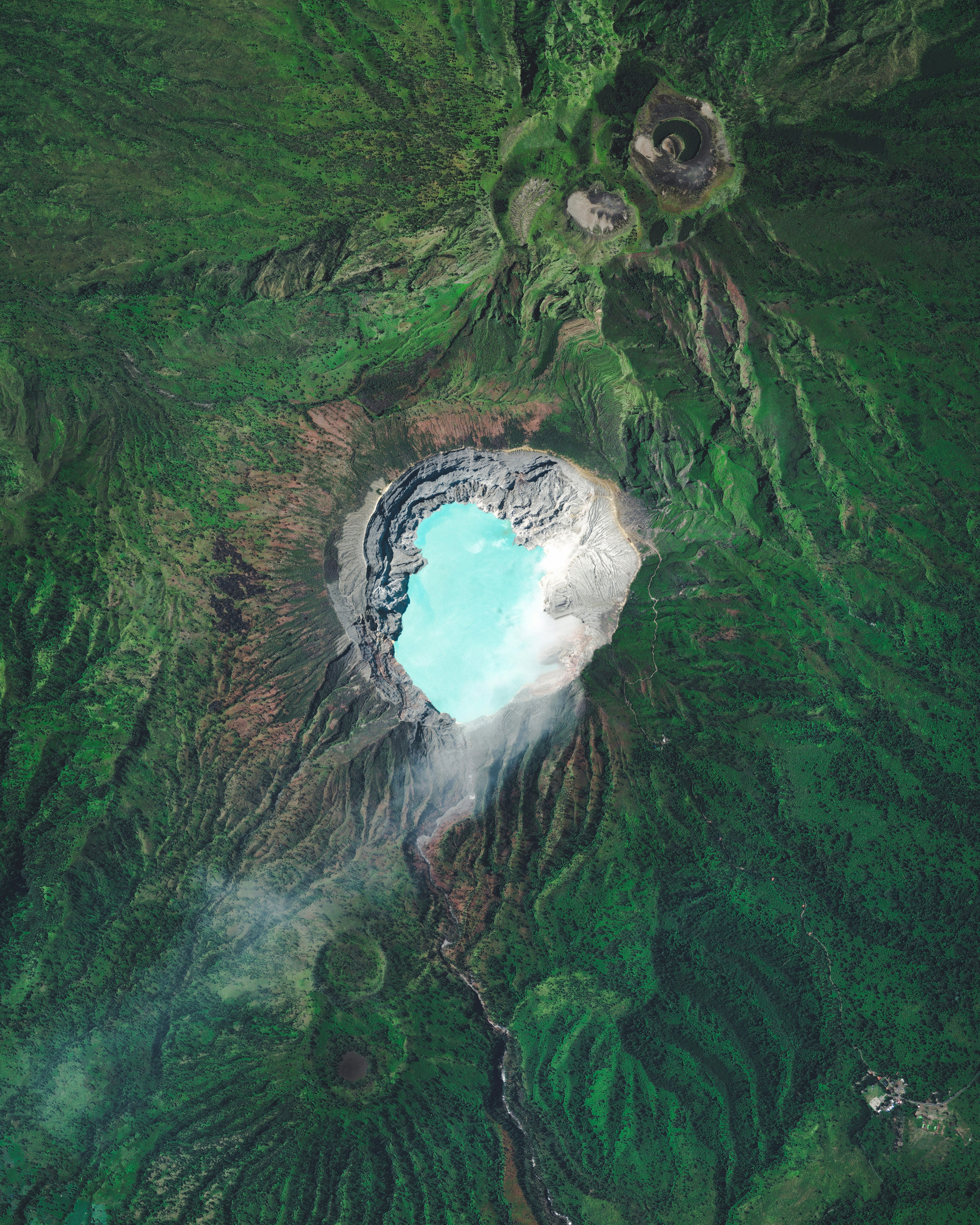
Kawah Ijen
-8.058000°,114.242000° - Maxar
Kawah Ijen is a stratovolcano in the East Java Province of Indonesia. It has a 0.6-mile-wide (1 km) turquoise-colored acidic crater lake, which is the site of a major sulfur mining operation. At night, when sulfuric gases make contact with fresh air, electric blue flames can be seen rising from volcano up to 16 feet (5 m) high.
Dhahran Interchange
26.353639°,50.136889° - Maxar
A clover leaf interchange connects the King Abdulaziz and Prince Mohammed Bin Fahd roads in Dhahran, Saudi Arabia. The city’s extensive highway network is strategically important to its oil industry and local population; however, as car ownership in Saudi Arabia has soared in recent years, roads have become congested at peak times.
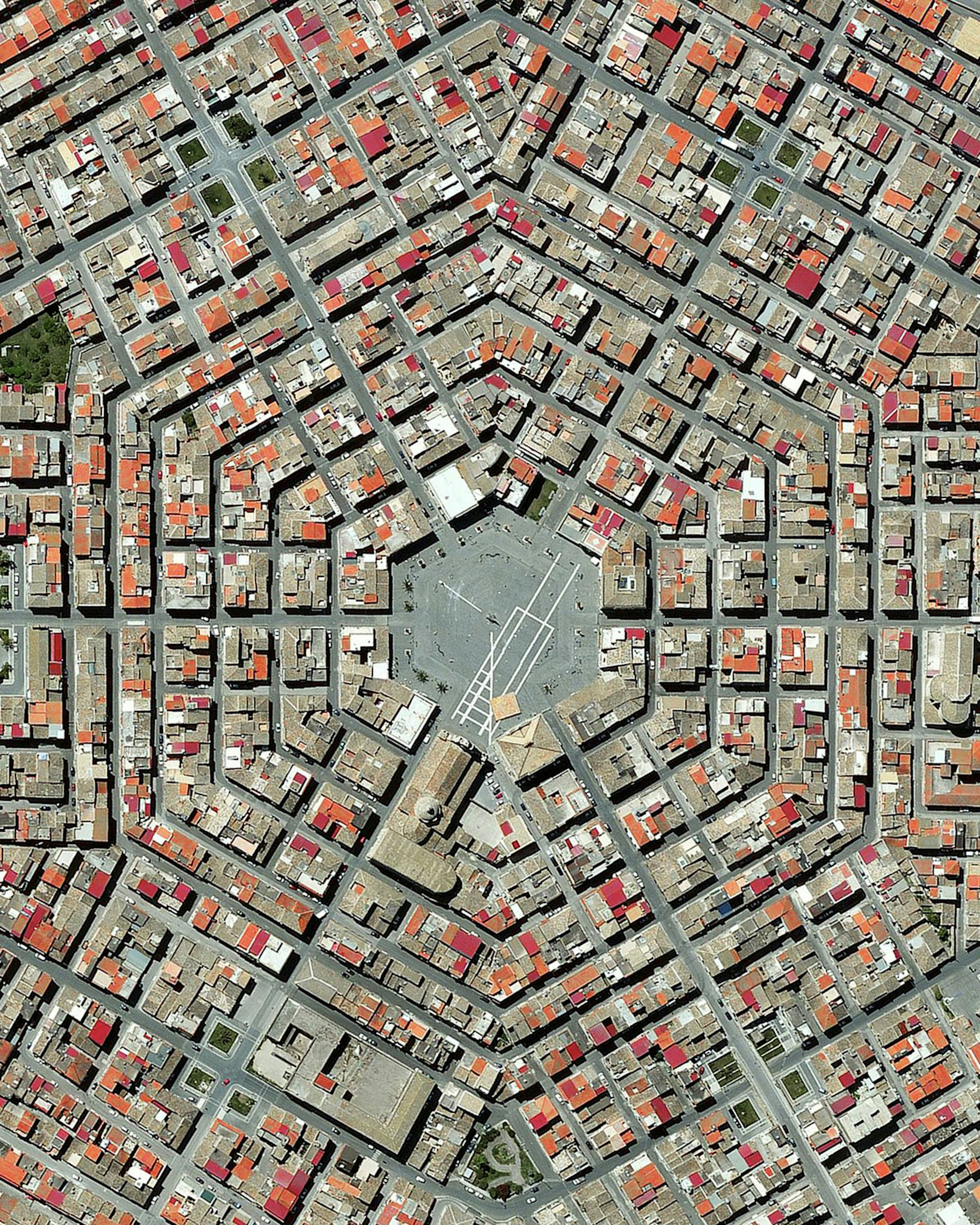
Grammichele
37.214722°,14.636389° - Maxar
Grammichele is located on the island of Sicily in southern Italy. The town was constructed in 1693 with a distinctive hexagonal street plan after an earthquake destroyed the nearby old town of Occhialà. Grammichele is home to about 13,000 people.
Wadi Rum
29.574298°,35.412261° - Maxar
May the Fourth be with you! Wadi Rum is a village in Jordan that has been populated by humans since prehistoric times (8th century BC). Early inhabitants left their mark in the form of rock paintings, which have been thoroughly analyzed by historians. The area has also served as a film set for many movies, including “Rogue One: A Star Wars Story” and “Star Wars: The Rise of Skywalker.”
Cambridge Gulf
-14.979640°,128.091861° - Maxar
An array of colors can be seen in the wetlands of Cambridge Gulf, located on the north coast of Western Australia’s Kimberley region. The western shore of the gulf, shown here, is backed by sandstone hills and fringed with colonies of mangroves and mudflats, which appear when the tide is low. Cambridge Gulf experiences two large tidal flows per day between 23 and 30 feet (7-9 meters).


