Daily
One regular dose of Earth from above
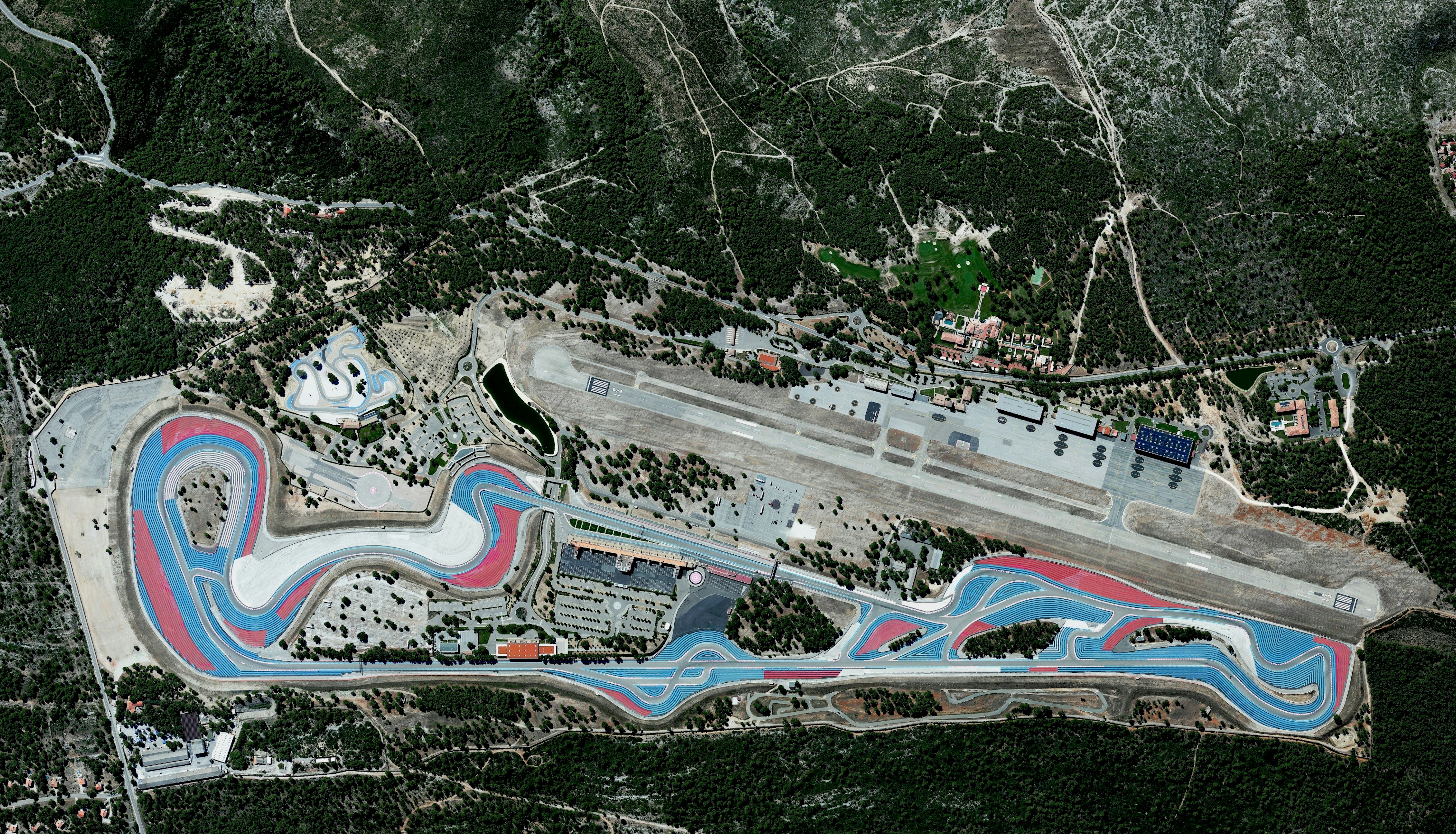
Circuit Paul Ricard
43.250556°,5.791667° - Maxar
Circuit Paul Ricard is a motorsport track at Le Castellet, near Marseille, France. The track is known for its distinctive black and blue runoff areas, called the Blue Zone. Additional deeper runoff areas, known as the Red Zone, use a more abrasive surface designed to maximize tire grip and minimize braking distance.
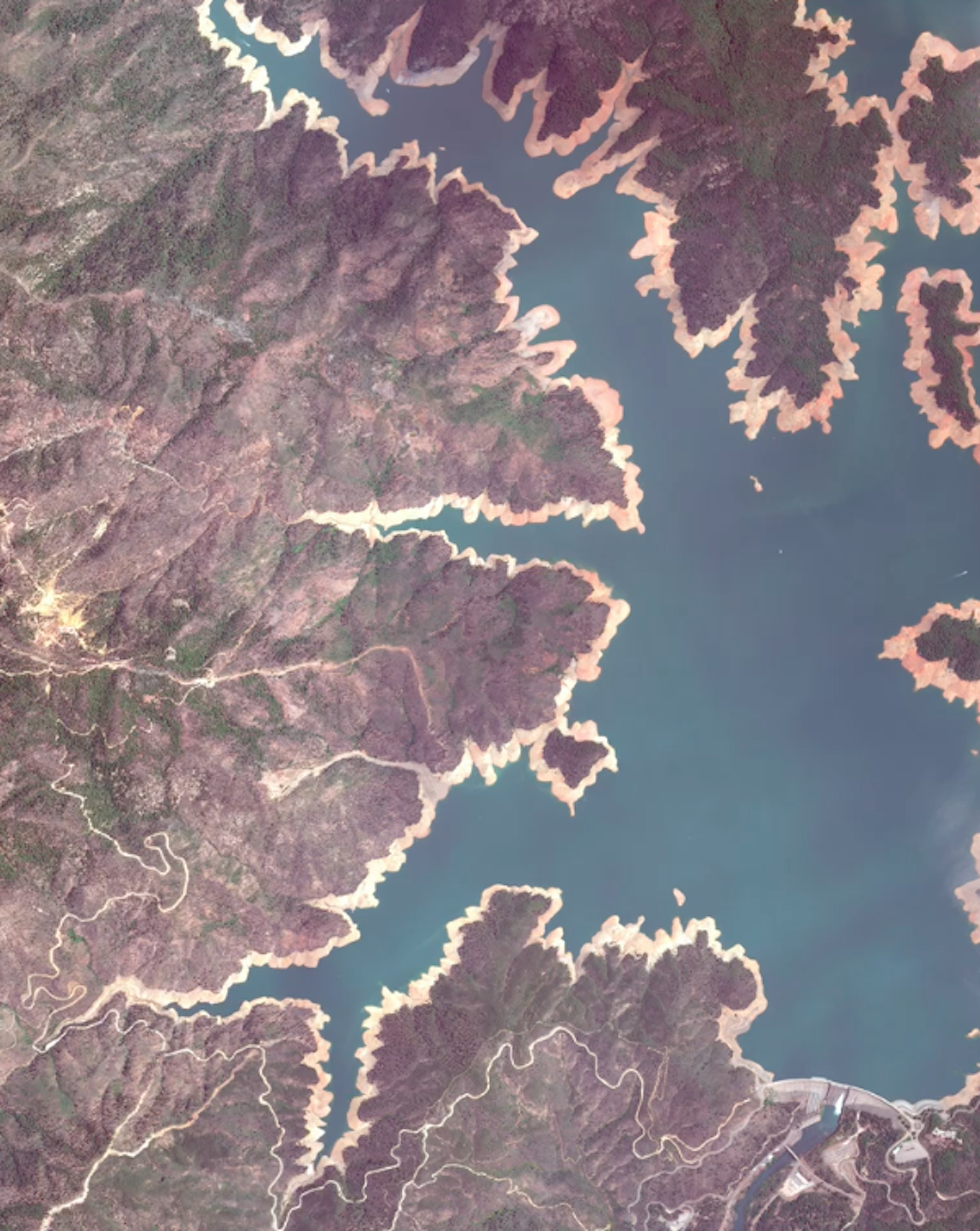
Shasta Lake
40.760200°,-122.371900° - Maxar
This Overview shows Shasta Lake in Northern California in late May 2021. Surface elevation of the reservoir — formed by the impounding of the Sacramento River — was at 959 feet (292.3 m) in this image, down from 1,016 feet (309.6 m) in the previous June. This difference of 57 feet (17.4 m) equates to a volume loss of more than 1.1 million acre feet, or 359 billion gallons — enough water to fill an Olympic swimming pool 550,000 times. Currently, about 95% of California is experiencing a severe drought as rising temperatures dwindle snowpack and reservoirs across the state see record-low inflows. Follow us on Instagram @dailyoverview to see a Timelapse of the reservoir's water levels.
San Sebastián
43.321389°,-1.985556° - Maxar
San Sebastián, or Donostia, is a coastal city on the Bay of Biscay in northern Spain. It sits at the mouth of the River Urumea and has been built to a large extent on the river's wetlands over the last two centuries. San Sebastián’s 186,000 residents enjoy its three beaches — Concha, Ondarreta, and Zurriola — which are all visible in this Overview.
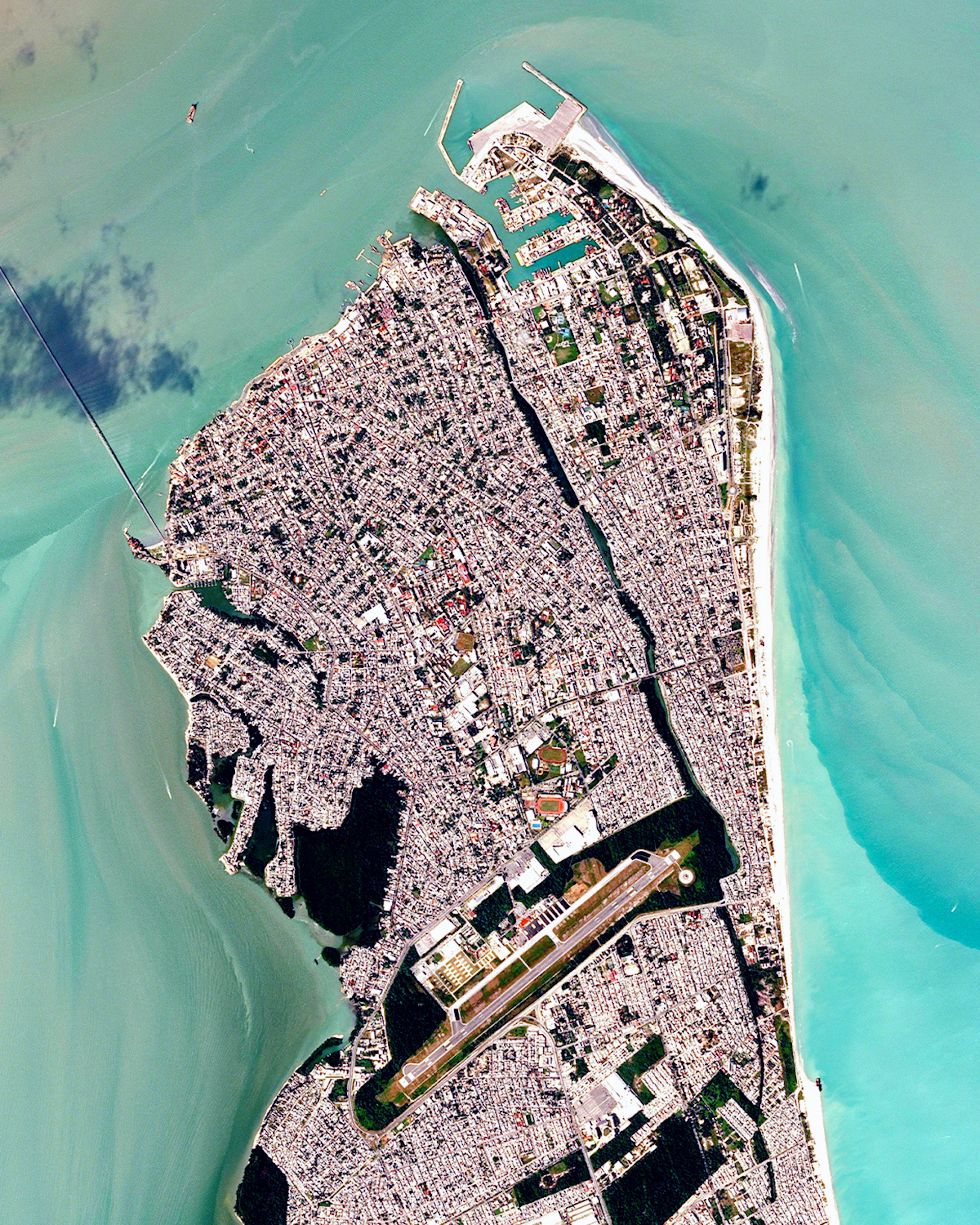
Ciudad del Carmen
18.633333°,-91.833333° - Airbus Space
Ciudad del Carmen is a city on the southwest end of Carmen Island in Campeche, Mexico. Located in the Laguna de Términos on the coast of the Gulf of Mexico, it has a population of nearly 170,000. The city was a small fishing neighborhood until the 1970s, when oil discovered in the region caused it to grow and develop substantially.
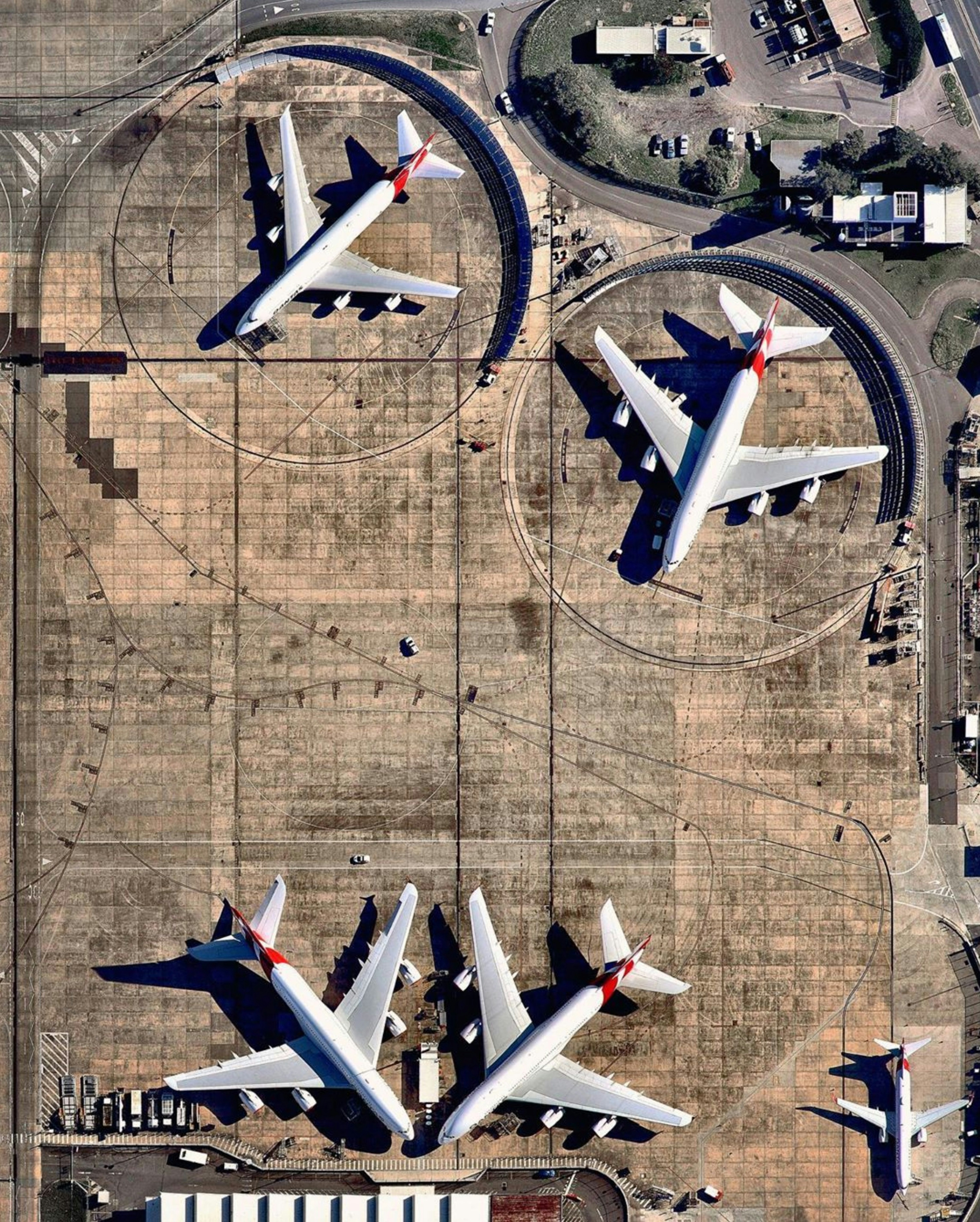
Sydney Airport Plane Maintenance
-33.927265°,151.177861° - Nearmap
Sydney Airport in New South Wales, Australia. At the top of this Overview, we see a Boeing 747 (left) and an Airbus A380 (right) parked in front of blast deflector fences, massive structures that protect people and property during engine tests. As the busiest airport in Australia, the facility handles more than 42 million passengers each year.
Downtown Chicago
41.882686°,-87.623325° - Airbus Space
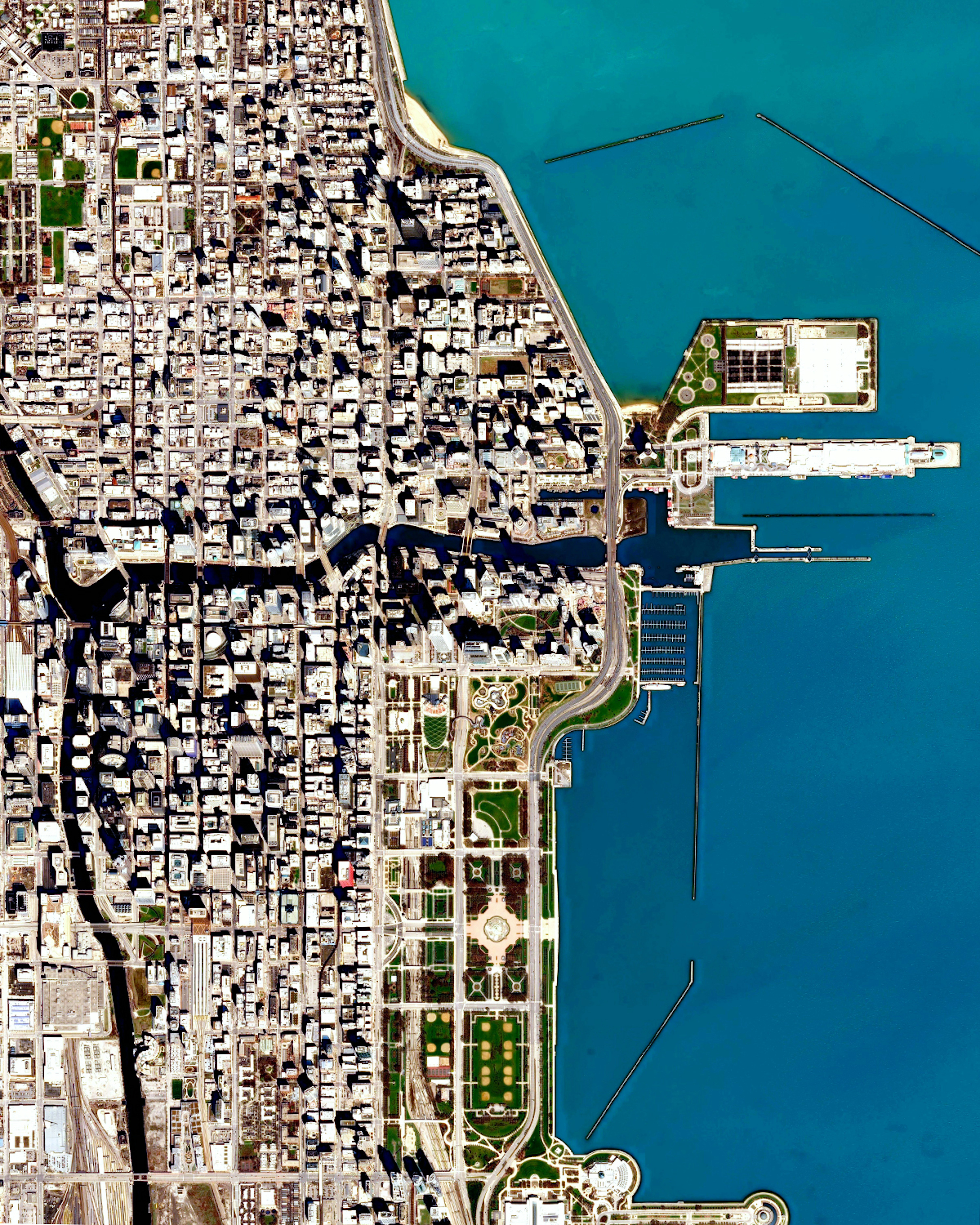
Check out this Overview of Downtown Chicago, Illinois, along the banks of Lake Michigan. The two neighborhoods shown here — The Loop and Near North Side — contain a majority of the city’s large commercial businesses, retail establishments, restaurants, hotels and famous attractions. Navy Pier, Grant Park, and the Cloud Gate sculpture (“The Bean”) are all visible from this perspective.
Marseille
43.296400°,5.370000° - Maxar
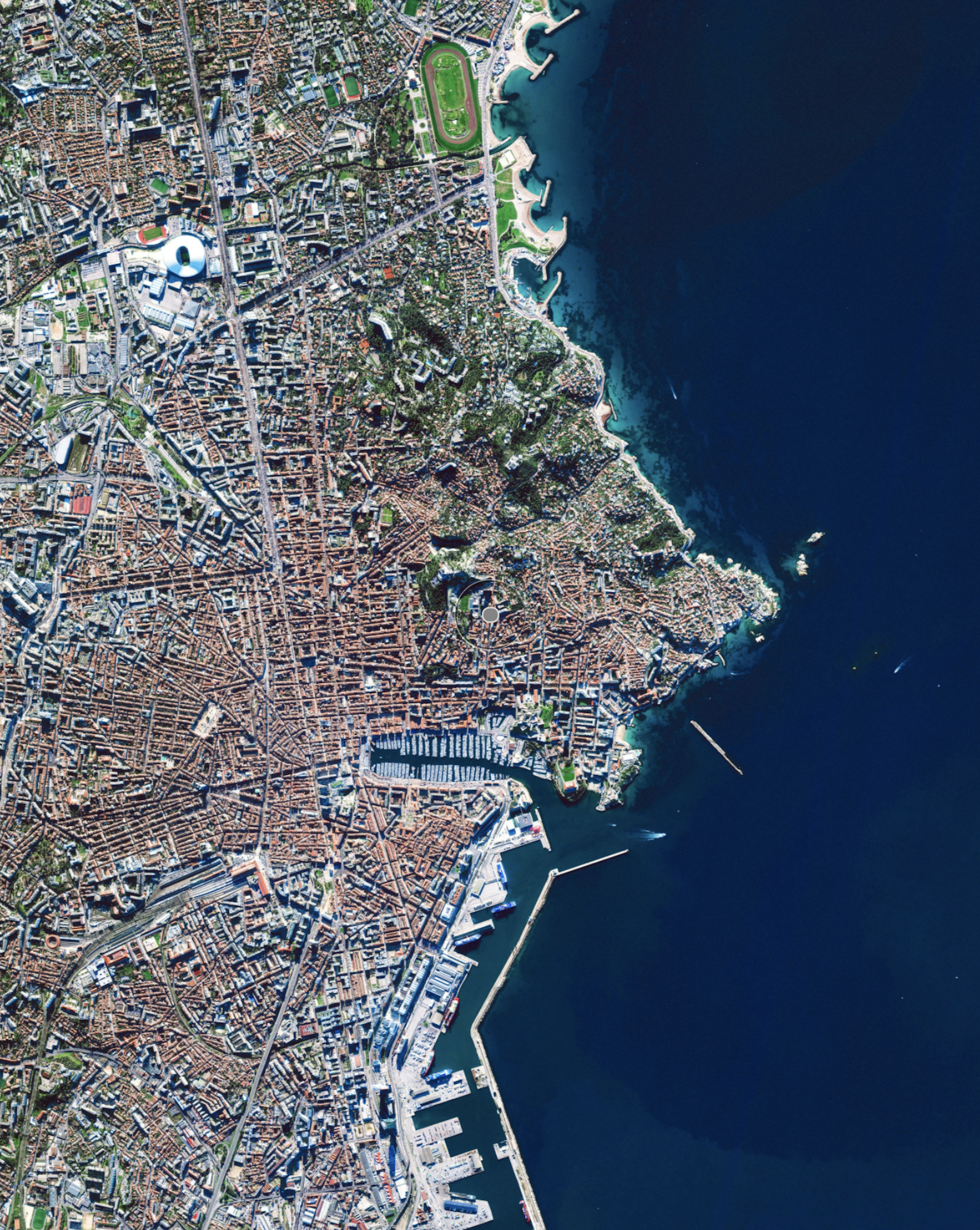
Marseille is a port city in southern France, located on the Mediterranean Sea. It has been a hub of immigration and trade since its founding by the Greeks around 600 B.C., and today is France’s largest port for both commerce and cruise ships. Marseille is home to about 1.5 million people and has numerous theaters, art galleries, cinemas, museums and other cultural attractions.
Roebuck Bay Beach
-17.969389°,122.237861° - Nearmap
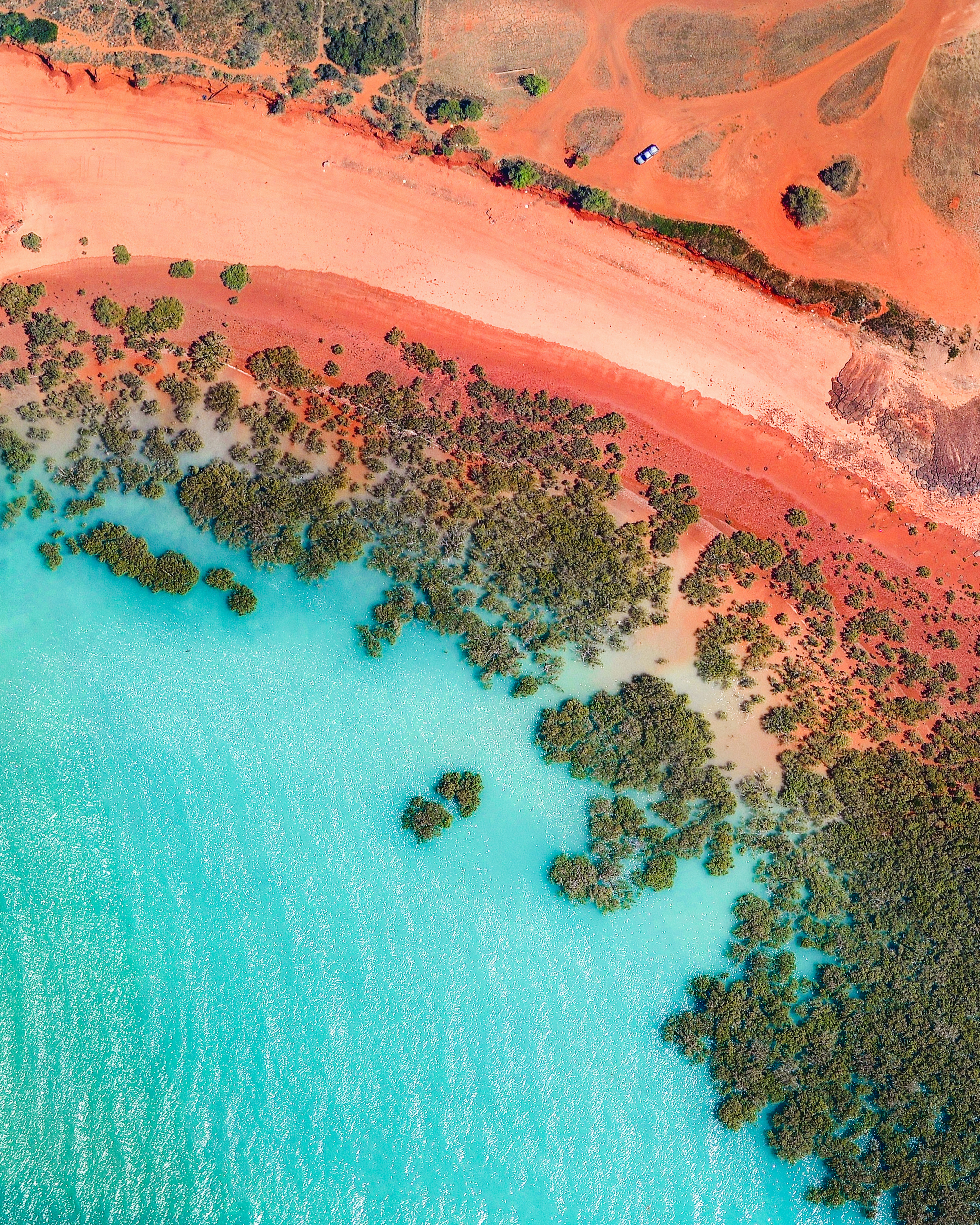
The aquamarine water of Roebuck Bay rolls onto red sand in Broome, Western Australia. A coastal town, Broome is home to roughly 14,000 people, but its population can grow to upwards of 45,000 per month during peak tourist season from June to August.
Auckland
-36.840556°,174.740000° - Airbus Space
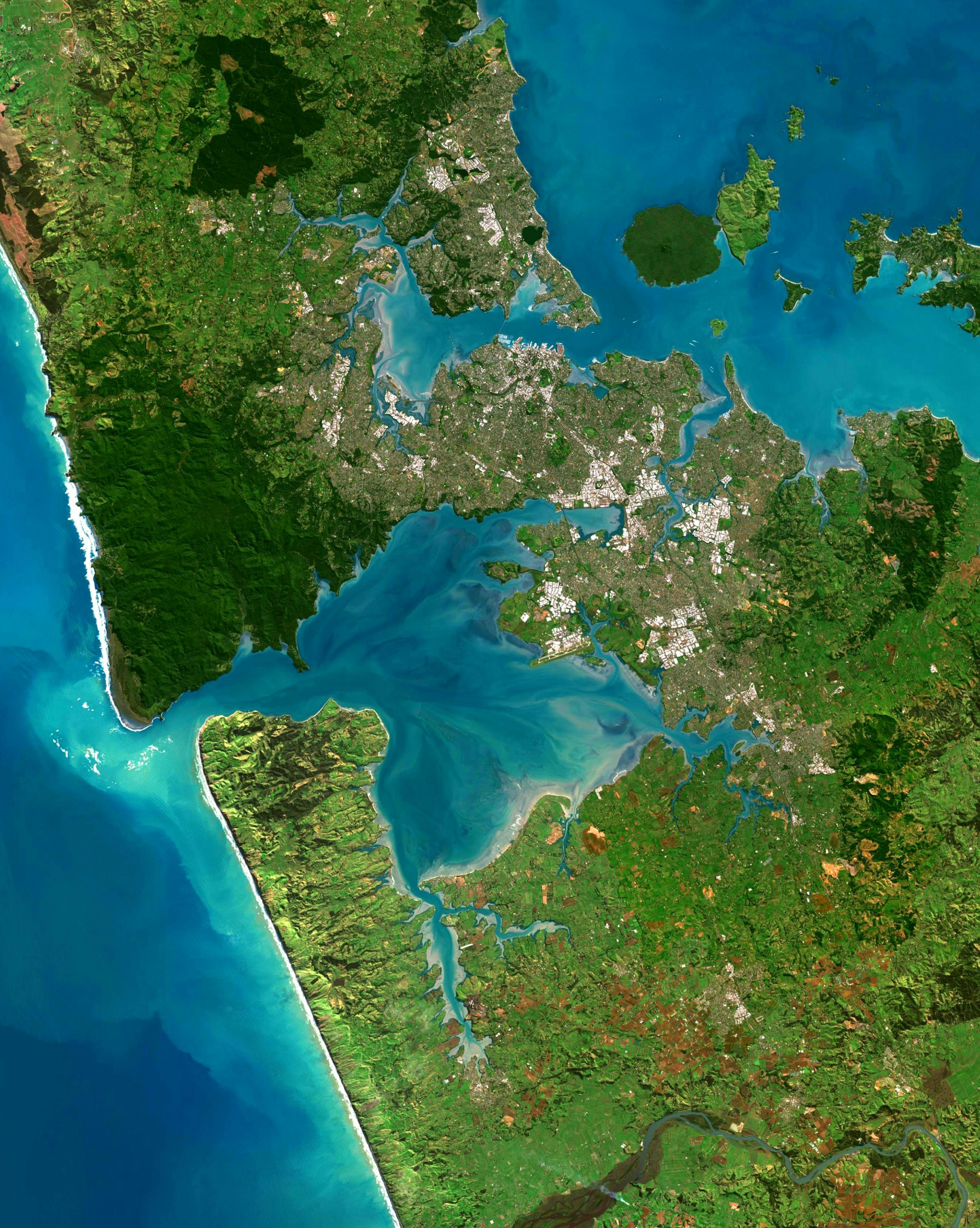
Auckland, New Zealand has been named the world’s most liveable city in The Economist's Global Livability Index. This year’s list was heavily influenced by the Covid-19 pandemic, which caused European cities to drop while cities in Australia, Japan and New Zealand climbed in the rankings. This Overview shows the entirety of Auckland, situated between numerous harbors and mountain ranges.
Cincinnati
39.100000°,-84.516667° - Airbus Space
Cincinnati is a major city in the U.S. state of Ohio, home to slightly more than 300,000 residents. It is located on the northern side of the confluence of the Licking and Ohio rivers, the latter of which marks the state line with Kentucky. Within this Overview are the stadiums for all three of Cincinnati’s major league sports teams — the Cincinnati Reds of Major League Baseball; the Cincinnati Bengals of the National Football League; and FC Cincinnati of Major League Soccer.
Molokini Crater
20.632167°,-156.496167° - Maxar
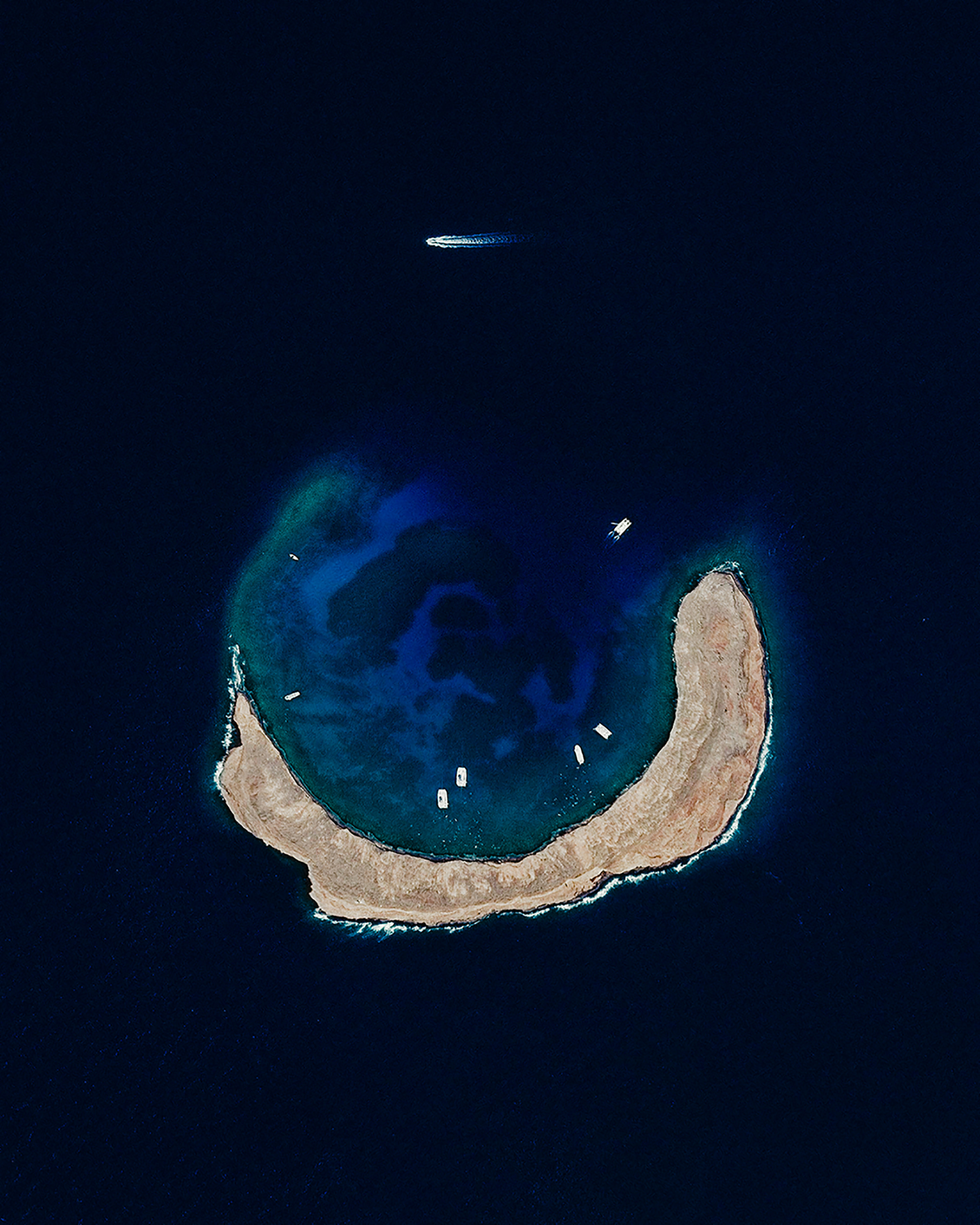
Molokini is a small, uninhabited islet located between the Hawaiian Islands of Maui and Kahoolawe. It is formed by a crescent-shaped, partially submerged volcanic crater roughly 0.4 miles (0.6 km) in diameter. A lush reef inside the Molokini Crater is home to about 250 species of fish, making it a popular destination for scuba divers and snorkelers.
Fès el-Bali
34.061111°,-4.977778° - Maxar
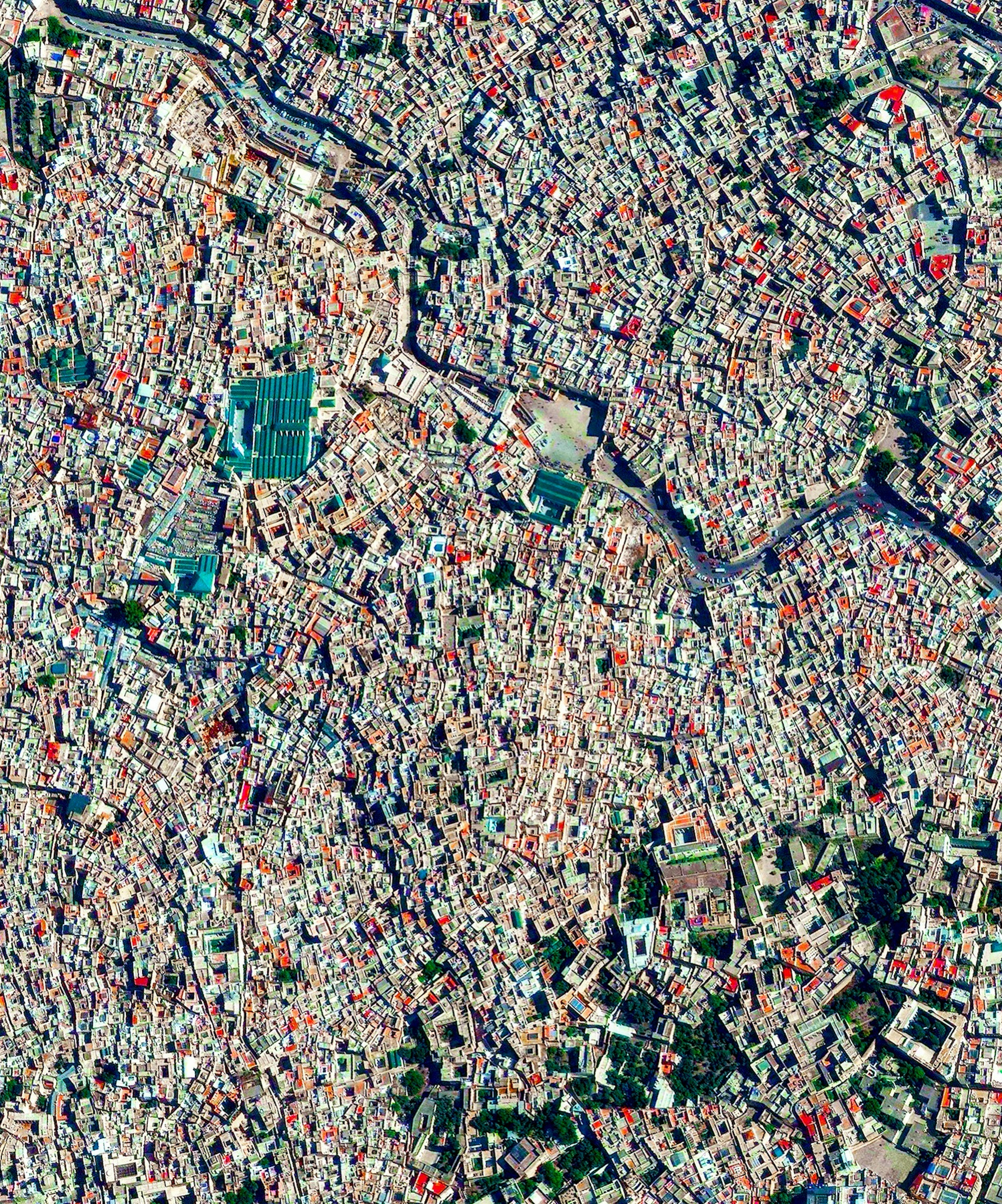
Fès el-Bali is the oldest walled part of the city of Fez, Morocco. Its network of very narrow streets and alleyways — some of which are only two feet wide — make it accessible only to pedestrians and occasionally bicycles or motorbikes. With a total population of 156,000, the area is believed to be the biggest car-free urban neighborhood in the world.
Çankaya, Ankara
39.909666°,32.863205° - Airbus Space
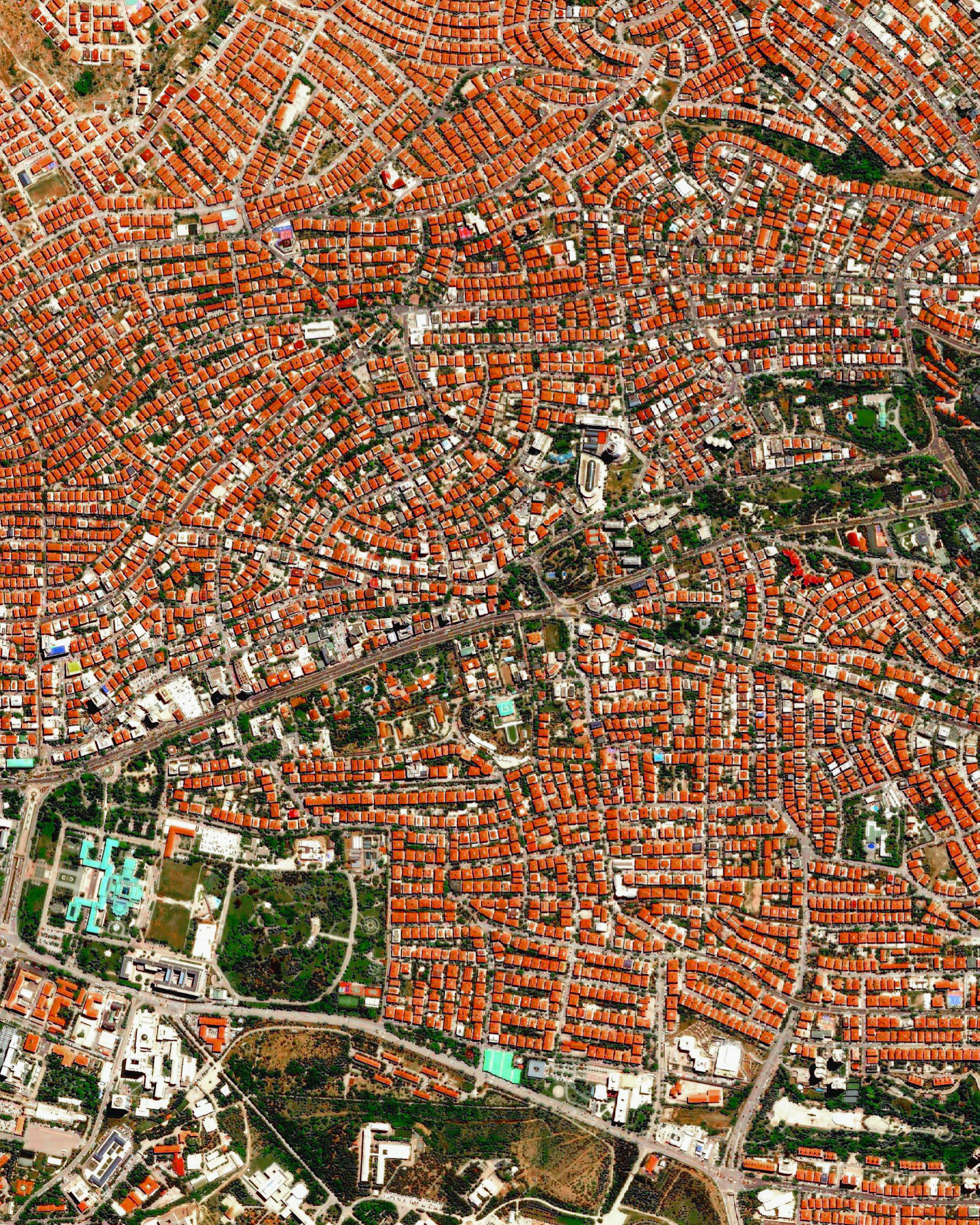
Ankara is the capital and second-largest city of Turkey, with upwards of 5 million residents. This Overview shows traditional red-tiled roofs in the city’s Çankaya district, which contains many government buildings, embassies, museums, theaters, and universities. The light blue building in the bottom left houses the Grand National Assembly of Turkey, the nation’s parliament.
Tekesi Bagua City
43.214866°,81.839622° - Airbus Space
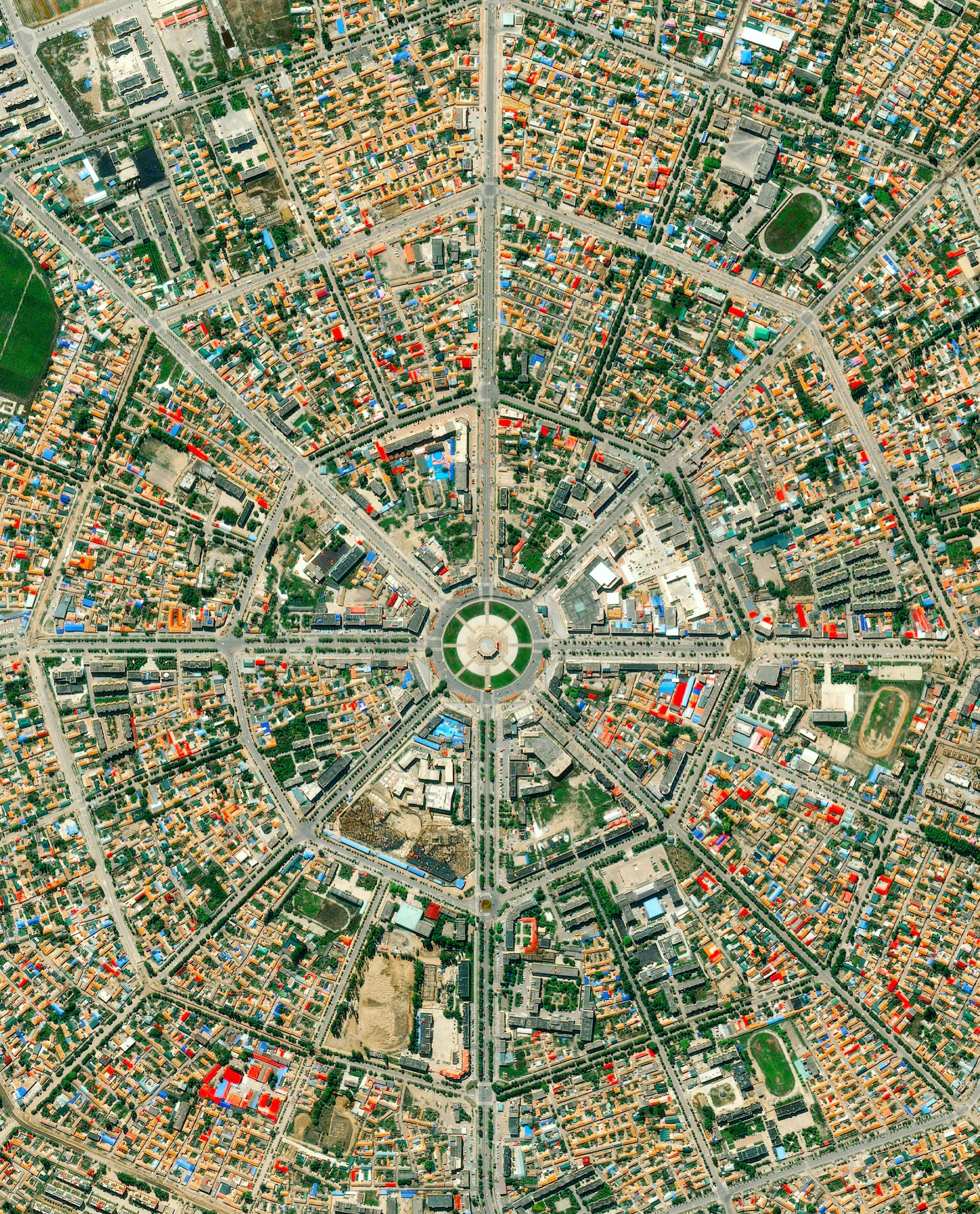
Tekesi Bagua City is located in China’s Xinjiang Uyghur Autonomous Region. Founded in 1937, the city is famous for its planned layout in the shape of a Bagua — an arrangement of eight symbols used in Taoist cosmology to represent the fundamental principles of reality. The center of Tekesi Bagua radiates out onto eight streets and is connected by four ring roads from the center to the city's edge.
Shanghai at Night
31.230416°,121.473701° - NASA
Shanghai — seen here at night from the International Space Station — is the largest city in China with a population of more than 24 million people.
San Francisco National Cemetery
37.799722°,-122.464444° - Nearmap
In honor of Memorial Day in the United States, we’re sharing this Overview of San Francisco National Cemetery, located in the Presidio of San Francisco, California. More than 30,000 American military veterans and their families are buried here, including Civil War generals, Medal of Honor recipients, Buffalo Soldiers, and a Union spy. Established in 1884, it is the oldest national cemetery on the U.S. West Cost.
Insein Prison
16.892715°,96.097986° - Maxar
This Overview adds an aerial perspective to today’s @nytimes report on Insein Prison near Yangon, Myanmar. The prison – the circular structure and surrounding buildings seen at center – is notorious worldwide for its inhumane conditions, corruption, abuse of inmates, and use of mental and physical torture. Though it was already at double its 5,000-person capacity, Insein has received an influx of political prisoners since the Myanmar military seized control of the nation in a February 1st coup.
Goma
-1.679444°,29.233611° - Maxar
Goma is a city of about 670,000 people in the eastern Democratic Republic of the Congo. It is located on the northern shore of Lake Kivu, just 8 miles (13 km) south of the active Nyiragongo Volcano. This week, tens of thousands of residents are evacuating the city after authorities warned that the volcano, which first erupted last weekend, could erupt again soon.
Grounded Planes at Roswell
33.301556°,-104.530556° - Maxar
This Overview from November 2020 shows hundreds of airplanes parked at the Roswell International Air Center in Roswell, New Mexico. Scenes of grounded planes like this were commonplace throughout last year as COVID-19 upended the airline industry, but air travel is now on the rebound. Although major U.S. airports are still serving far fewer travelers than they did before the pandemic, average daily passenger volumes have risen consistently in 2021, from roughly 600,000 in early January to as high as 1.8 million this week.
Noor III
31.059494°,-6.870344° - Maxar
Noor III is the newest stage of the Ouarzazate Solar Power Station in Ouarzazate, Morocco. This site utilizes a concentrated solar power (CSP) tower design with 7,400 heliostat mirrors that focus the sun’s thermal energy toward the top of a 820-foot-high (250 meters) tower at its center. At the top of the tower, there is molten salt, which is used in this process due to its ability to get very hot (500–1022°F / 260–550°C). The molten salt then circulates from the tower to a storage tank, where it is used to produce steam and generate electricity. The Noor III CSP tower can produce and then store enough energy to provide continuous power to the surrounding area for ten days.
