Daily
One regular dose of Earth from above
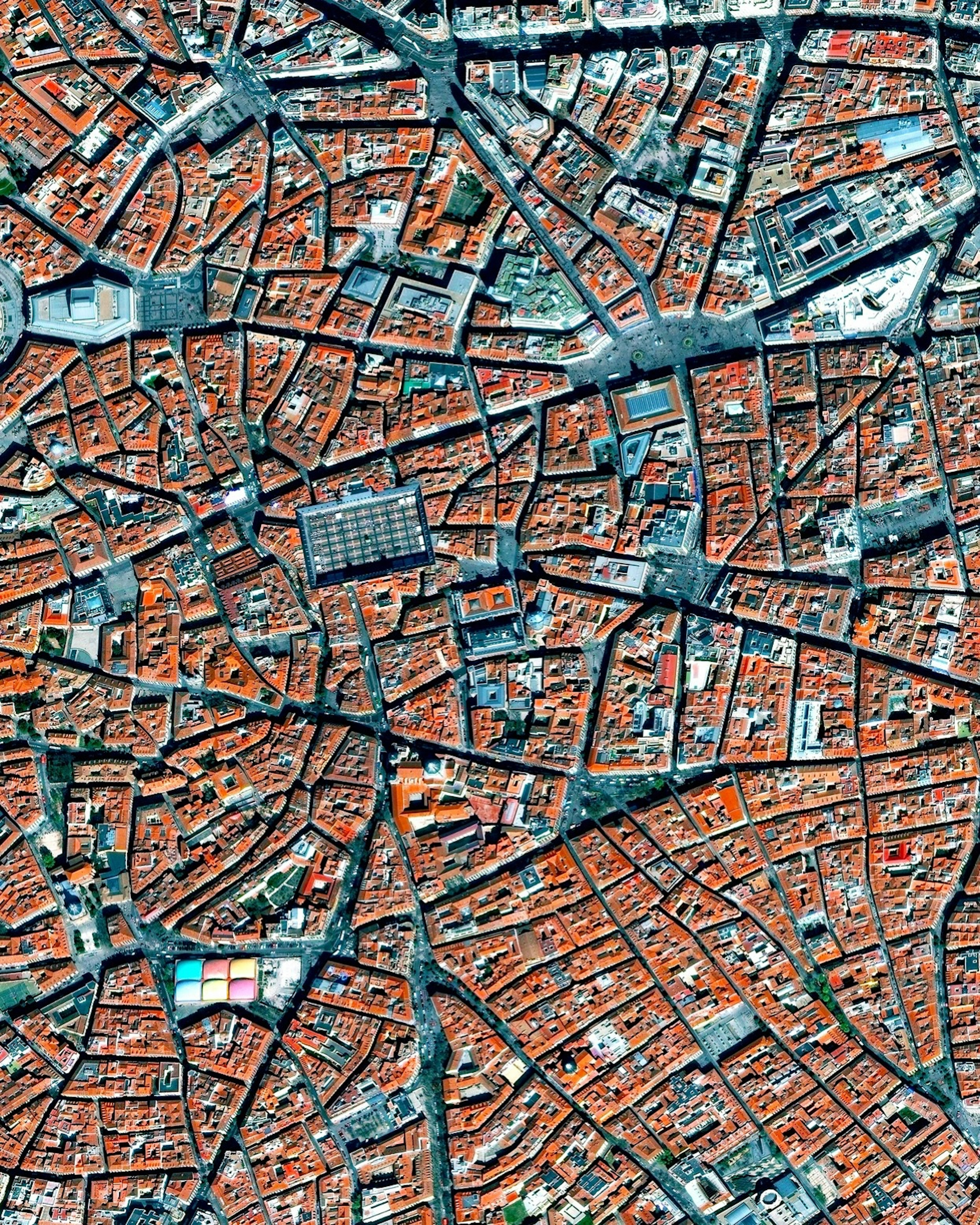
La Latina, Madrid
40.411500°,-3.710972° - Maxar
La Latina is a neighborhood located in the center of Madrid, Spain. The area was named after an old hospital of the same name that was founded in 1499. In the lower left of this Overview, you can also see the popular Mercado de la Cebada market, with its six-panel, multi-colored rooftop.
Crowds Flee Afghanistan
34.565833°,69.213056° - Maxar
Chaos has unfolded at Hamid Karzai International Airport in Kabul, Afghanistan, in recent days as thousands attempt to flee the Taliban-controlled country. This Overview shows crowds lined up on the tarmac near a departing American C-17 aircraft. Those fleeing Afghanistan must navigate numerous Taliban-controlled checkpoints before they can enter the airport.
Dallas/Fort Worth International Airport (DFW)
32.896944°,-97.038056° - Maxar
Dallas/Fort Worth International Airport covers more than 27 square miles (70 sq. km) in Texas — an area larger than the island of Manhattan. It handled 39.3 million travelers in 2020, down from more than 75 million the previous year because of COVID-19. Still, this volume made DFW the fourth-busiest airport in the world that year by passenger traffic.
Seville
37.386089°,-6.000710° - Maxar
The River Guadalquivir flows through the center of Seville, Spain. With about 1.5 million residents in its metropolitan area, Seville is the largest city in the autonomous community of Andalusia and the fourth-largest in Spain. Near the center of this Overview — amid the city’s many red tile roofs — is the Plaza de Toros de la Maestranza, a 12,000-seat, eighteenth century bullring.
IJsseloog
52.600000°,5.750000° - Maxar
IJsseloog is an artificial island used as a depository to store polluted silt in the middle of the IJssel River in Flevoland, Netherlands. Silt is granular material, smaller than sand but larger than clay, and may occur as soil or as sediment mixed in suspension with water. IJsseloog can hold 20 million cubic metres (706 million cubic feet) of silt, which is roughly 8,000 Olympic-sized swimming pools worth.
Port Hercules
43.735056°,7.425139° - Maxar
Port Hercules, the only deep-water port in Monaco, provides anchorage for up to 700 vessels. The area of the port (2.02 square kilometres or 0.78 square miles) comprises approximately 8% of the entire country.
South Boston
42.336111°,-71.045833° - Nearmap
South Boston — more popularly known as “Southie” — is a densely populated neighborhood of Boston, Massachusetts. It was once a predominately working class Irish Catholic community, but has recently become a popular neighborhood for young professionals and families. At the top of this Overview is Fort Independence, one of the oldest continuously fortified sites of English origin in the United States.
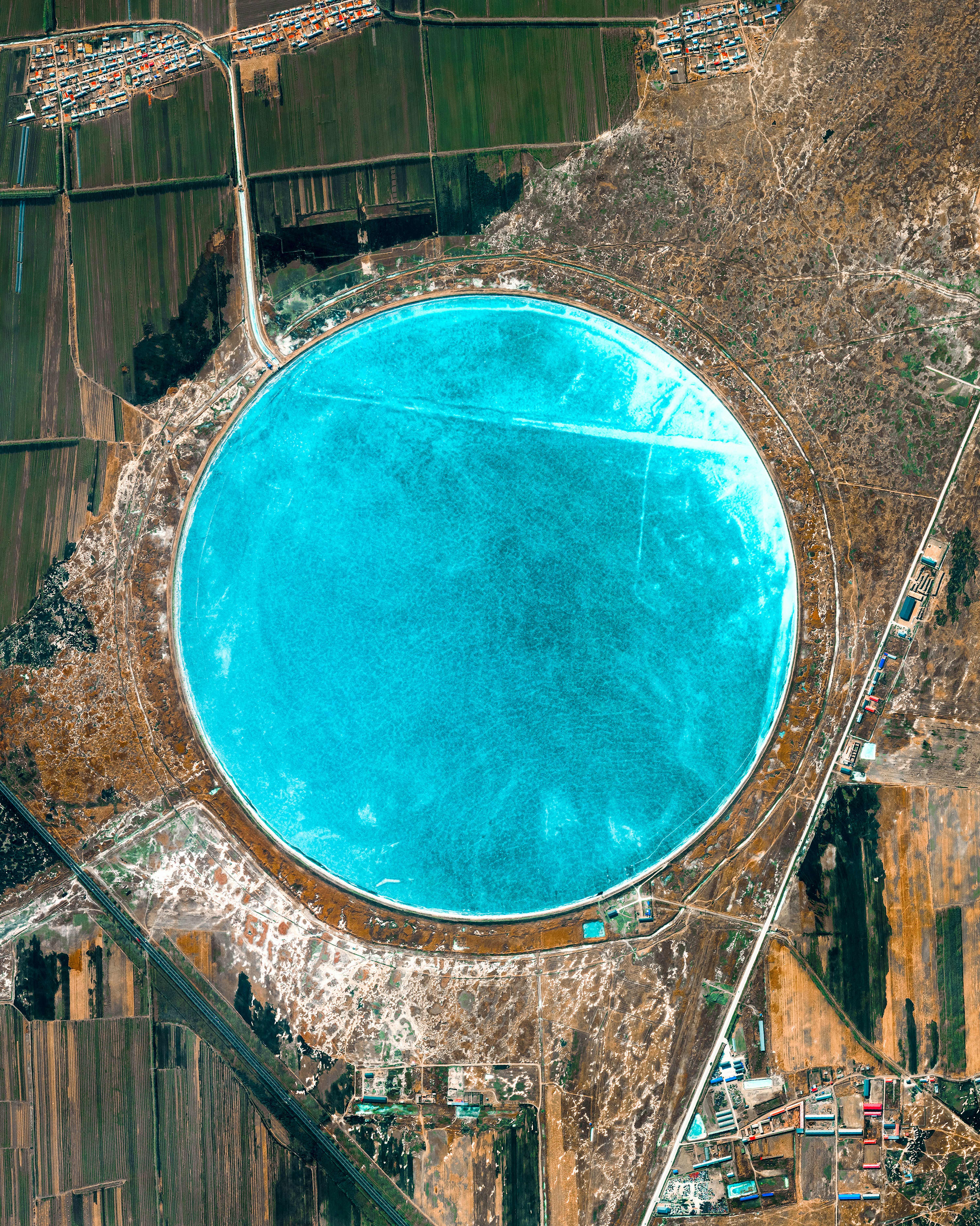
Pingyuan Reservoir
45.995097°,125.985003° - Maxar
Clear blue water fills the Pingyuan Reservoir, located just outside of Zhaodong City in northeastern China. Water stored here serves the more than 100,000 inhabitants of Zhaodong and surrounding farms of Heilongjiang Province, which grow soybeans, maize, wheat, potatoes, beets and flax. For a sense of scale, the Pingyuan Reservoir covers about 1.32 square miles (3.4 square kilometers) — roughly the same area as Central Park in Manhattan.
Kikori River Delta
-7.428366°,144.428927° - Airbus Space
Clouds float over the Kikori River Delta in southern Papua New Guinea. Part of the Gulf of Papua, this coastal mangrove forest is considered one of the most important wetland regions in the Asia-Pacific due to its cultural and biodiversity value. It is a habitat for Indo-Pacific humpback and Australian snubfin dolphins, both listed as “vulnerable” on the IUCN Red List of Threatened Species.
Chaos at Kabul Airport
34.565833°,69.213056° - Maxar
Chaos unfolded earlier today at Hamid Karzai International Airport in Kabul, Afghanistan, where thousands of people rushed to the airport in hopes they would be evacuated on departing jets. As shown in this image, hundreds crowded onto the tarmac and runways, desperately clinging to outgoing planes. After quickly sweeping through other areas of Afghanistan, the Taliban has now taken control of Kabul, the capital city and home of 4.6 million people.
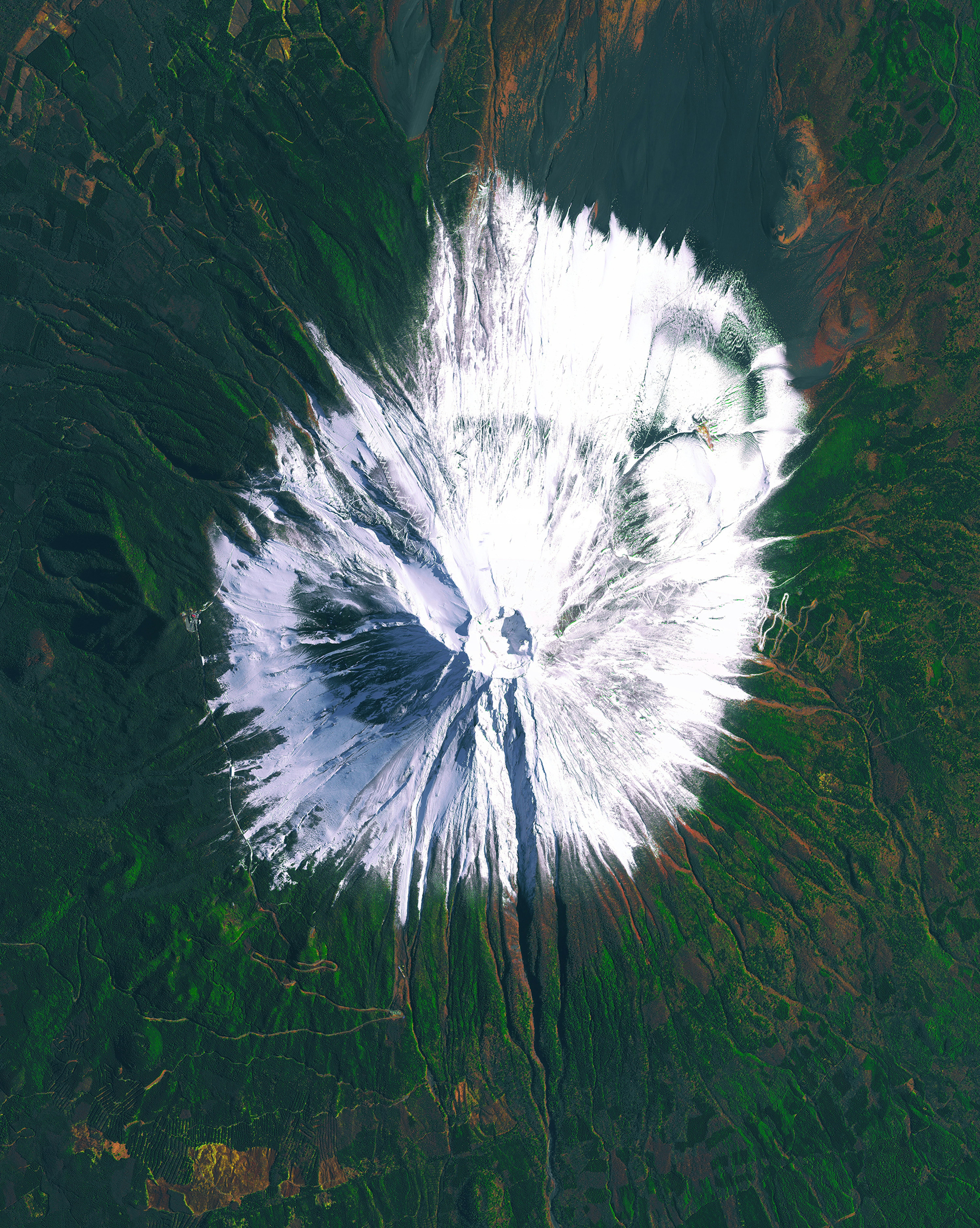
Mount Fuji
35.362727°,138.730265° - Maxar
Mount Fuji is an active stratovolcano and the tallest peak in Japan, rising 12,389 feet (3,776 meters). Fuji has an extremely symmetrical cone, which is snow‑capped for several months of the year. During warmer months, climbing routes make it possible for hundreds of thousands of people to hike the volcano each year.
Gardens of Versailles
48.808056°,2.108333° - Maxar
The Gardens of Versailles are situated across 2,000 acres (8 square kilometers) of land behind the Palace of Versailles, 12 miles (19 kilometers) outside of Paris, France. The grounds are landscaped in the classic French garden style, including one section known as The Orangerie — seen here at bottom left — that contains more than one thousand (primarily orange) trees.
Munich
48.133333°,11.566667° - Airbus Space
Munich is the capital and most populous city of Bavaria, in southeastern Germany. It straddles the River Isar, a tributary of the Danube, and has an eclectic mix of historic and modern architecture along its many avenues and squares. Upwards of 1.5 million people live in Munich proper, and roughly 6 million inhabit the city’s metro area.
Rio Madre de Dios
-11.888269°,-71.408443° - Maxar
The Rio Madre de Dios swirls in the rainforests of Peru. Oxbow lakes — the U-shaped branches coming off the main river — form when a wide meander from the main stem of a river is cut off, creating a free-standing body of water.
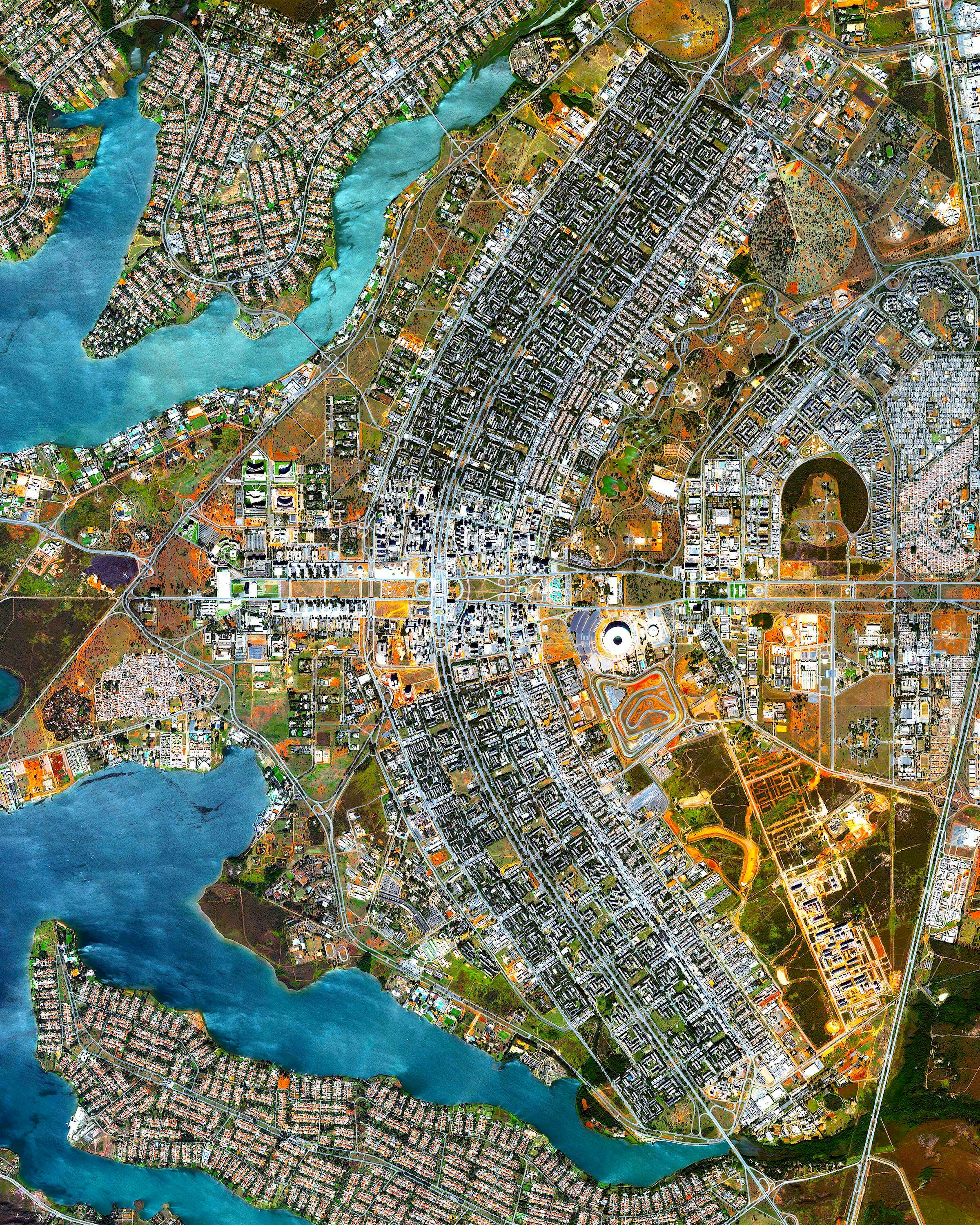
Brasilia
-15.793888°,-47.882777° - Maxar
This Overview captures the urban plan of Brasilia, Brazil. The city was founded on April 21, 1960, in order to move the capital from Rio de Janeiro to a more central location within Brazil. The design — resembling an airplane from above — was developed by Lúcio Costa and prominently features the modernist buildings of the celebrated architect Oscar Niemeyer at its center.
The First Overview Puzzle
52.276361°,4.557083° - Maxar
Today we’re excited to announce our first PUZZLE where we turned one of my favorite Overviews — Dutch Tulips — into a mesmerizing (and challenging!) 1000-piece adventure. When complete, the puzzle blooms at a colorful 20x27 inches on recycled paper. Click the “Shop” link below to learn more and place an order!
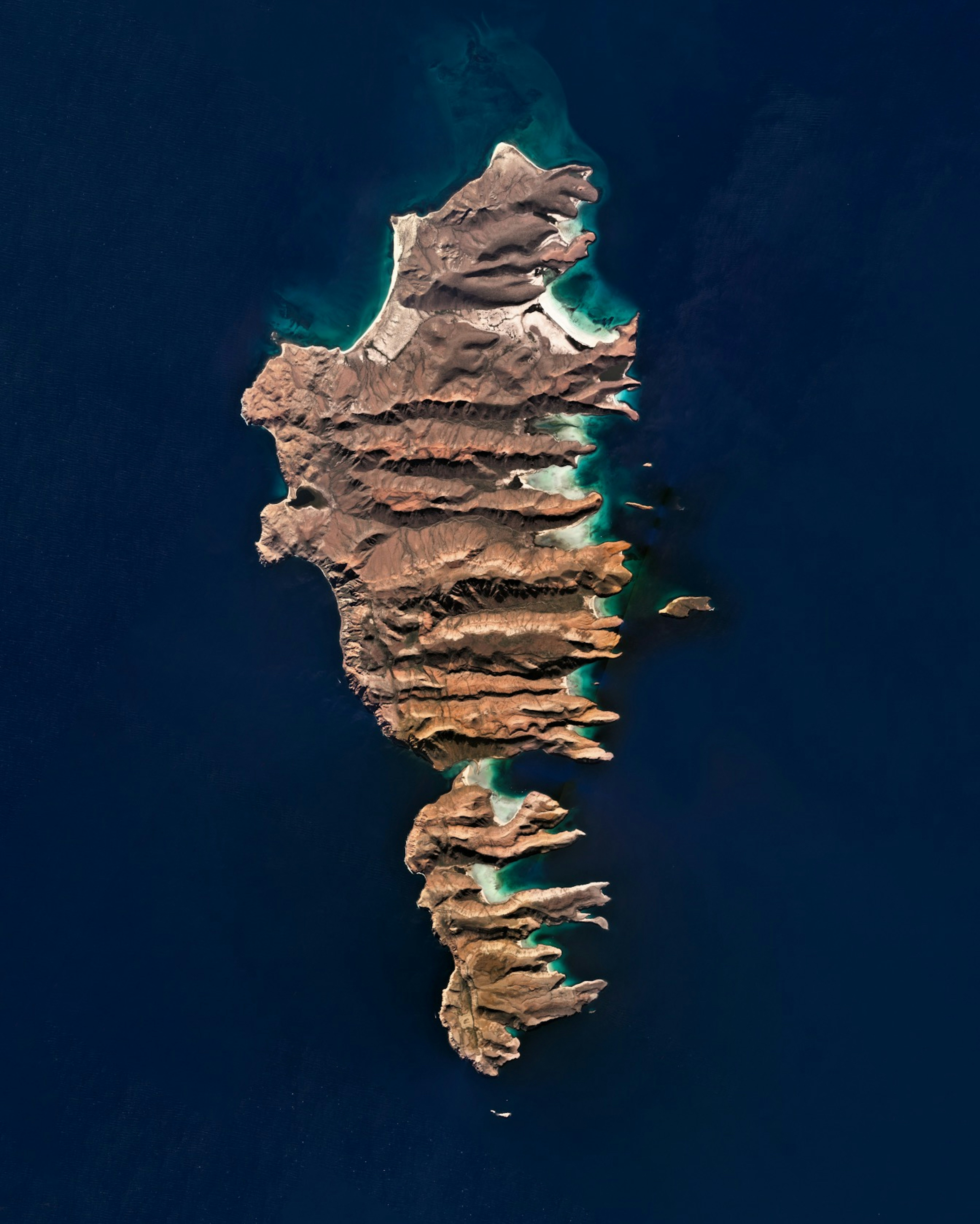
Islas Espíritu Santo and Partida
24.471389°,-110.332500° - Planet
Isla Espíritu Santo and Isla Partida are islands in the Gulf of California, located offshore Baja California Sur, Mexico. Both islands are uninhabited and were once connected, but are now separated by a small canal. Despite pressure from real estate developers to construct a resort on Espíritu Santo, the two islands have been part of a UNESCO Biosphere Reserve since 1995.
Fires in Southern Turkey
36.836889°,31.515933° - Maxar
Multiple wildfires have scorched Southern Turkey over the past week, burning as much as 250,000 acres so far. That's nearly the total area of Hong Kong. This Overview shows smoke and charred forests near the Manavgat Dam, roughly 45 miles (72 km) east of Antalya. Wildfires are common in this region during the summer months, but this year’s fire season is Turkey’s worst in a decade. At least eight people have been killed as the fires continue to spread through villages and coastal vacation resorts.
Qurayyah IPP
25.827142°,50.136421° - Maxar
Qurayyah IPP is a large, gas-fired combined cycle power station in Qurayyah, Saudi Arabia. It is one of the largest plants of its kind in the world by capacity, operating at 3,927 megawatts. Qurayyah is located on the Persian Gulf in Saudi Arabia’s Eastern Province, which contains a majority of the kingdom’s oil and gas fields.
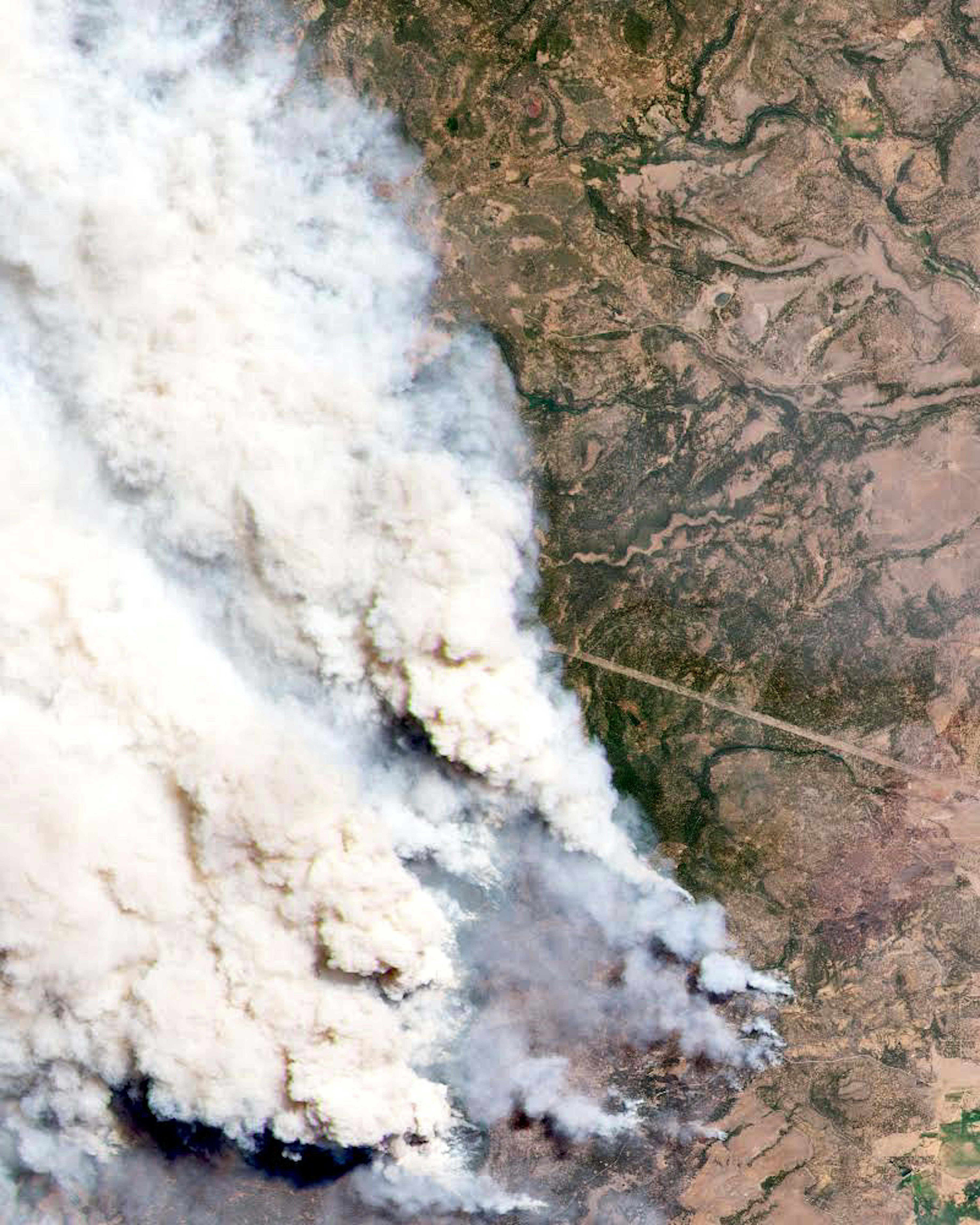
Bootleg Fire
42.627996°,-120.964973° - Planet
The Bootleg Fire in southern Oregon is the largest active wildfire in the United States, having burned more than 410,000 acres (1,660 square km) in the past three weeks. This Overview shows the blaze on July 9th, just a few days after it was sparked by lightning on July 6th. More than 2,220 workers have managed to contain roughly 53% of the fire, yet at least 160 homes have been destroyed and another 2,000 residences are under evacuation orders.
