Daily
One regular dose of Earth from above
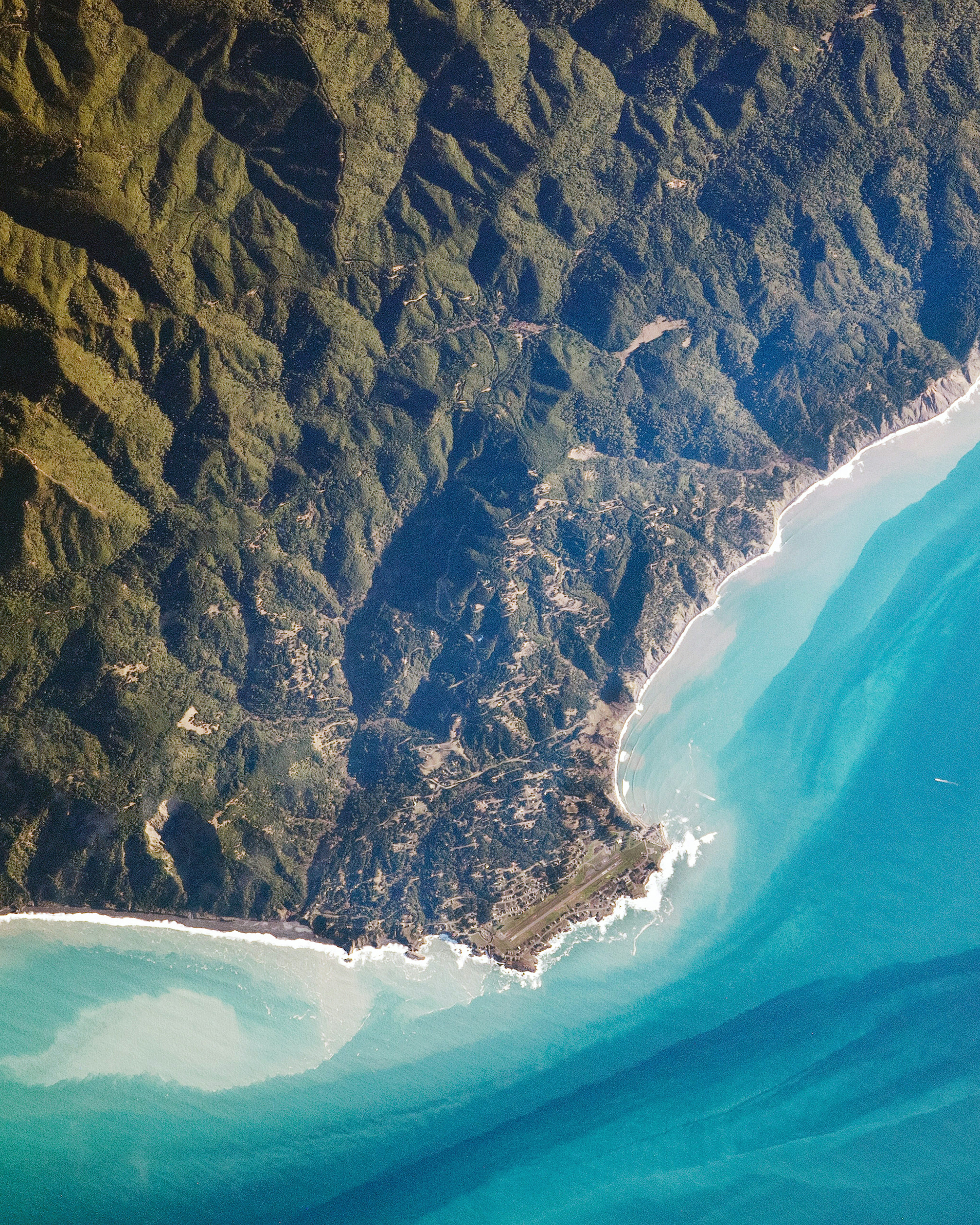
Shelter Cove
40.027778°,-124.073333° - NASA
Shelter Cove is a small, remote community located along the “Lost Coast” of northern California, where the King Range meets the Pacific Ocean. Due to its rugged terrain, the Lost Coast region has no major highways and is mostly natural and undeveloped. The one-runway Shelter Cove Airport, seen at the bottom of this Overview, helps visitors access the area when weather permits.
Serrania de Hornocal
-23.338950°,-65.171590° - Maxar
The Serrania de Hornocal is a range of colorful mountains in northern Argentina. The peaks reach an elevation of 15,620 feet (4761 meters) above sea level and get their incredible colors and patterns from an exposed limestone formation known as Yacoraite. The visual variations within the rock layers results from historical changes in sea levels.
SFO International Terminal
37.616800°,-122.380732° - Nearmap
San Francisco International Airport is the twenty-first busiest airport in the world by passenger traffic accommodating more than 50 million passengers every year. In this Overview, three massive airliners are parked at the international terminal.
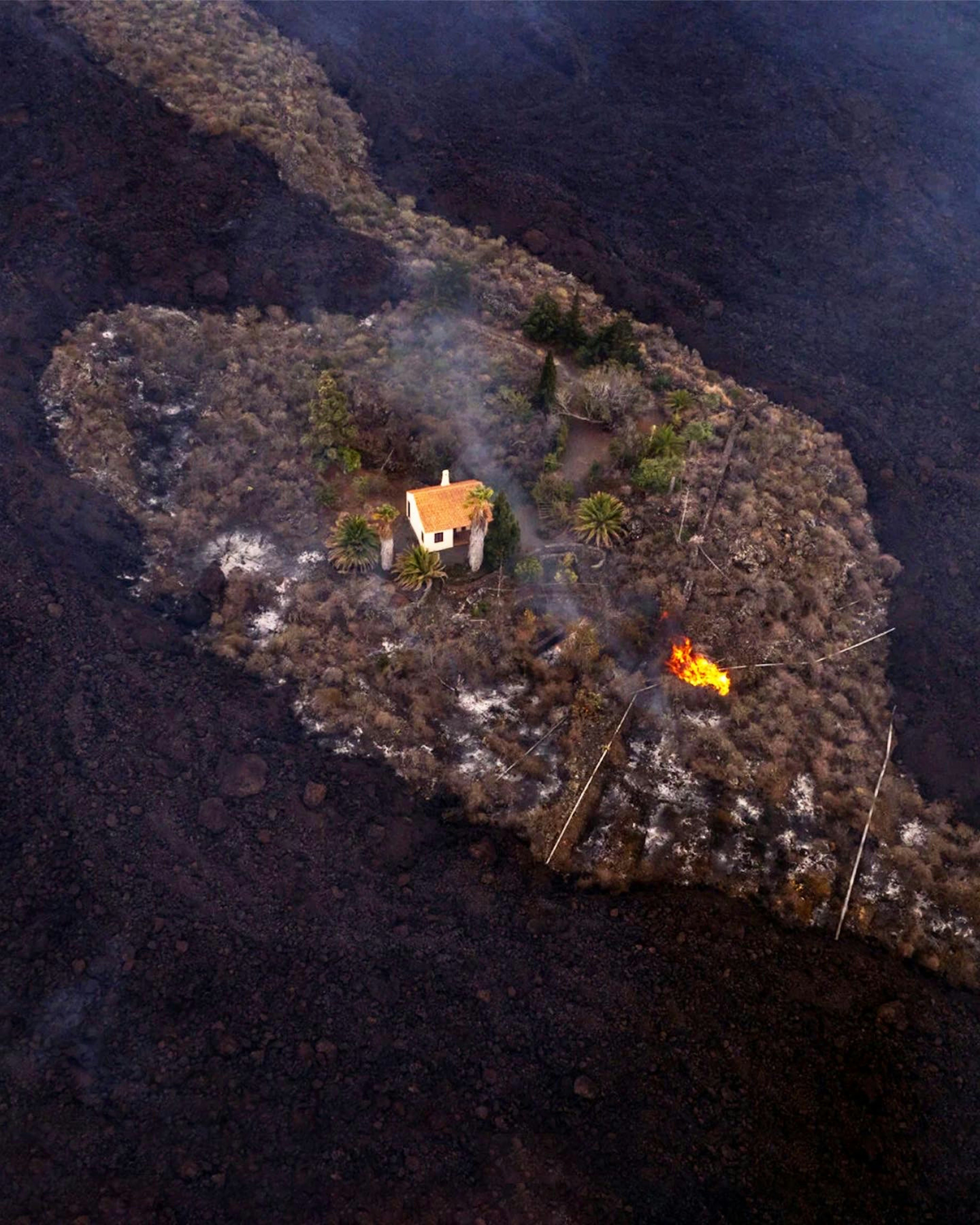
Cumbre Vieja Eruption
28.566667°,-17.833333° - Alfonso Escalero
Lava flow surrounds a home on the Spanish Canary Island of La Palma, where the Cumbre Vieja volcano erupted on Sunday. Spurred by more than 20,000 earthquake tremors in the span of a week, it is the first major eruption here since 1971. Intense lava sprays and plumes of smoke have caused thousands to be evacuated from the surrounding area and many structures have already been destroyed.
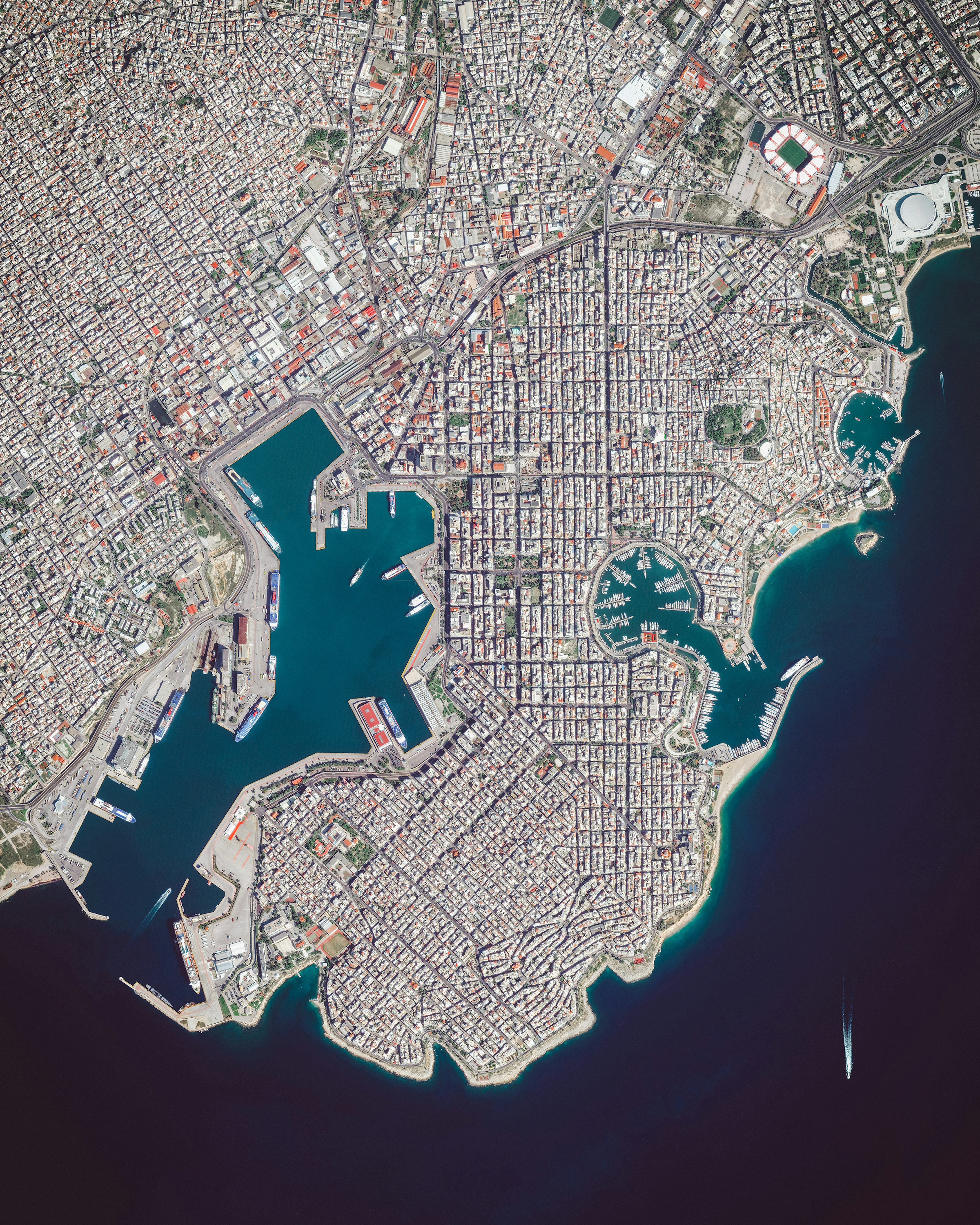
Piraeus
37.936194°,23.642250° - Maxar
Piraeus is a port city in Greece, roughly 7 miles (12 km) outside Athens. Since ancient times, it has served as a vital trade and transportation hub, and its port is currently the busiest passenger port in the country. In fact, the Port of Piraeus was the busiest in all of Europe in 2014, when it handled 18.6 million passengers.
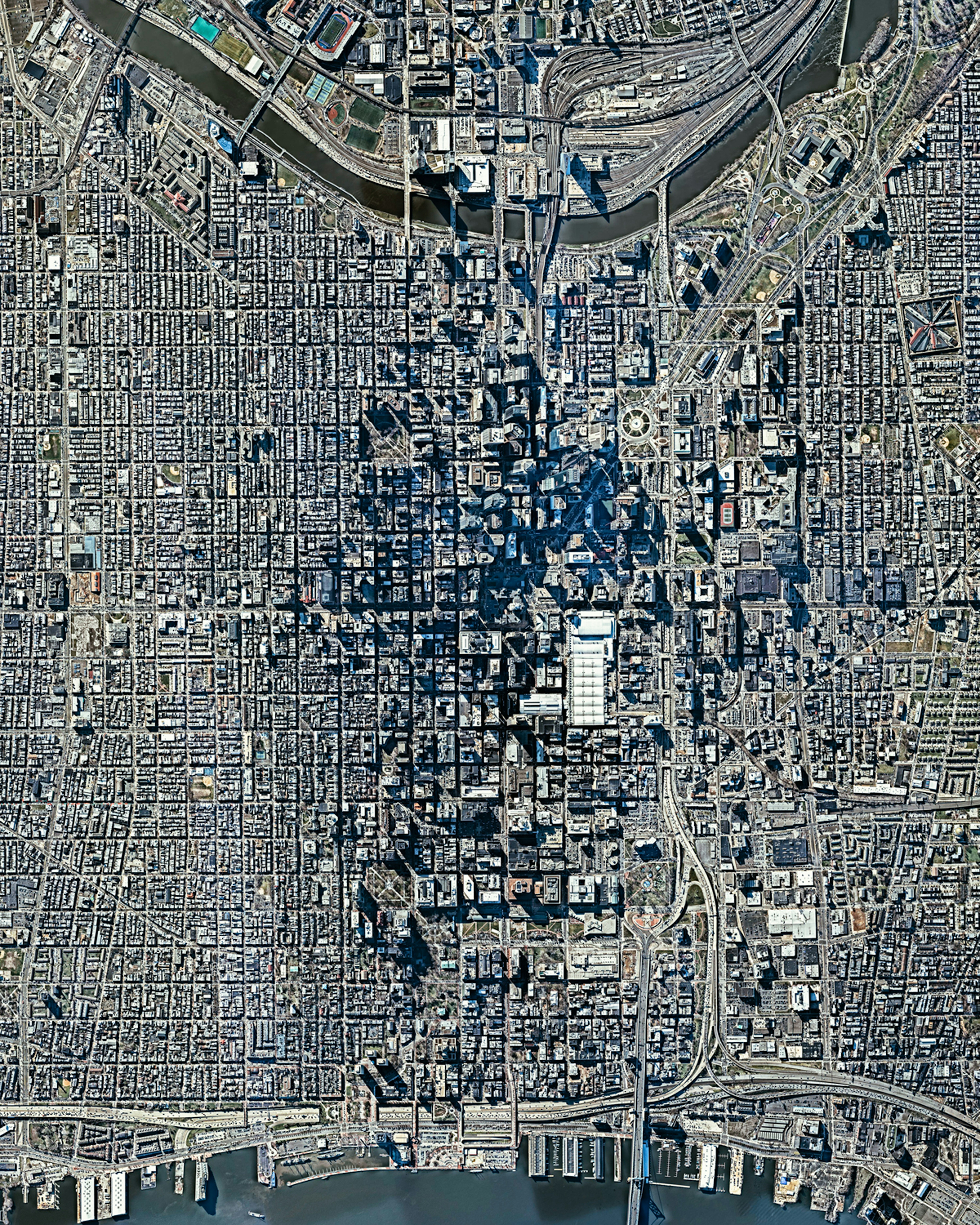
Philadelphia
39.945667°,-75.164889° - Nearmap
Philadelphia is the largest city in the Commonwealth of Pennsylvania and the sixth-most populous city in the United States, with a population of more than 1.6 million. The city played a pivotal role during the American Revolution, when it provided a setting for the signing of the Declaration of Independence in 1776 and the U.S. Constitution in 1787.
Nebraska Sand Hills
40.864476°,-99.743275° - Maxar
Farmland plains meet the Nebraska Sand Hills just north of Lexington, Nebraska. This unique region, which covers roughly 20,000 square miles (51,000 square km), contains mixed-grass prairies and grass-stabilized sand dunes. Average elevation here gradually increases from 1,800 feet (550 m) in the east to nearly 3,600 feet (1,100 m) in the west, as the sand hills approach the foothills of the Rocky Mountains.
Itaipu Reservoir
-22.959186°,-43.047163° - Maxar
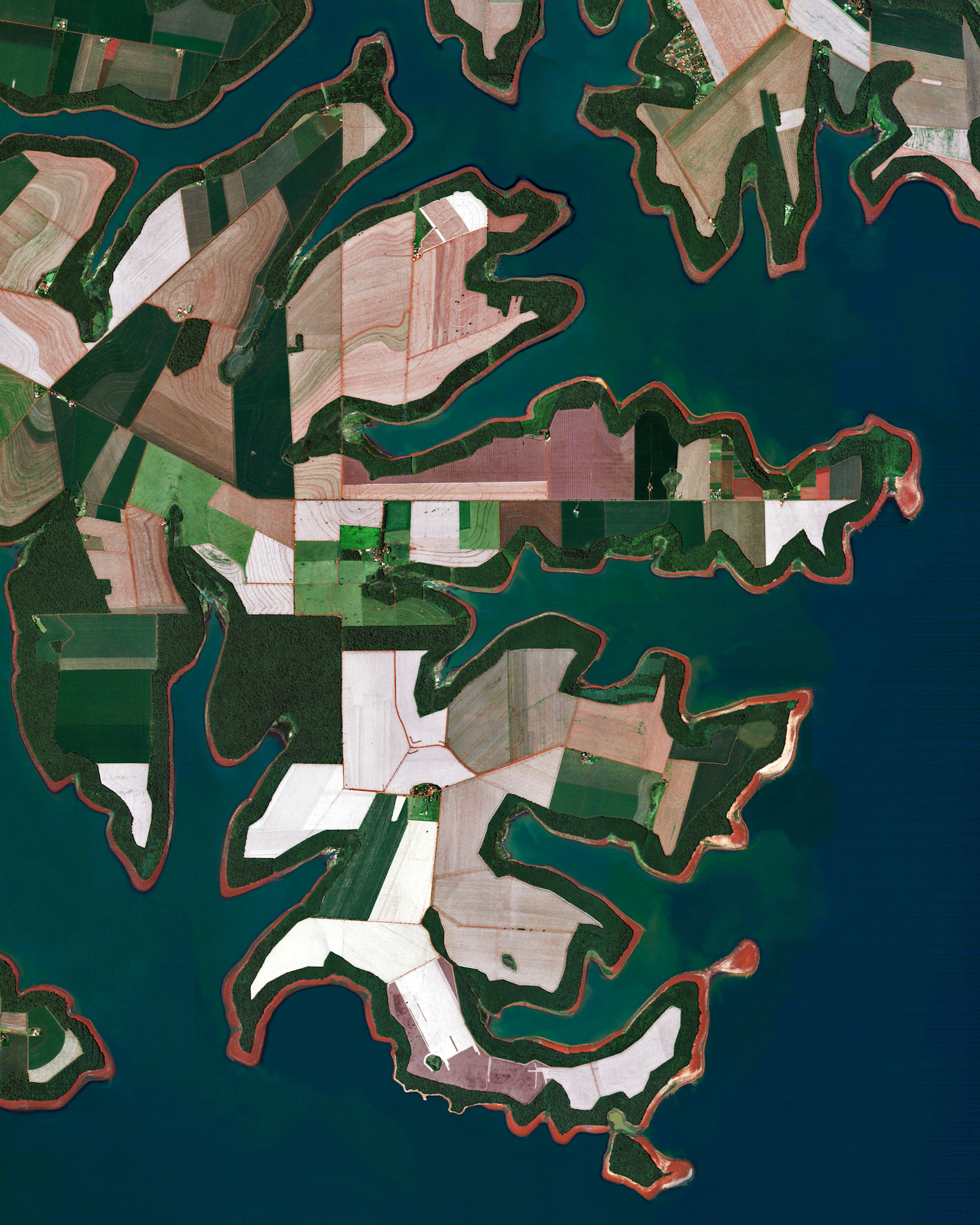
Agricultural fields line the shores of the Itaipu Reservoir — a body of water that forms the border between Brazil and Paraguay. The area’s tropical climate makes it an ideal place to grow sugarcane, coffee, tea, and cotton.
Golden Gate Park
37.769722°,-122.476944° - Maxar
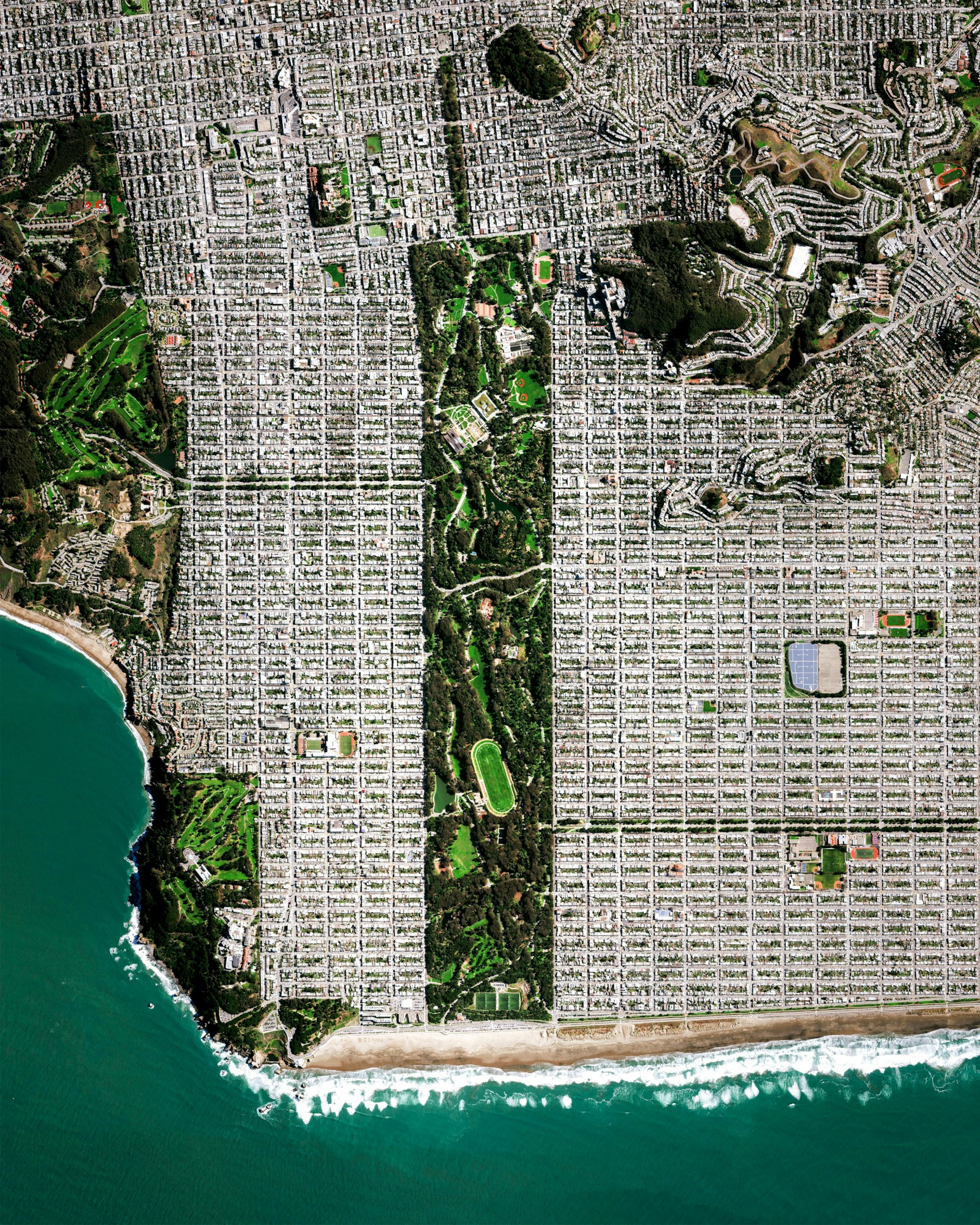
Golden Gate Park is a 1,017-acre (412-hectare) urban park located in San Francisco, California. Its rectangular shape makes it comparable to Central Park in New York City; however, it is 20 percent larger, measuring roughly 3 miles (4.8 km) east to west and half a mile (0.8 km) north to south. With 24 million annual visitors in a typical year, Golden Gate Park is the third most-visited city park in the United States.
Atlasov Island
50.860833°,155.564167° - NASA
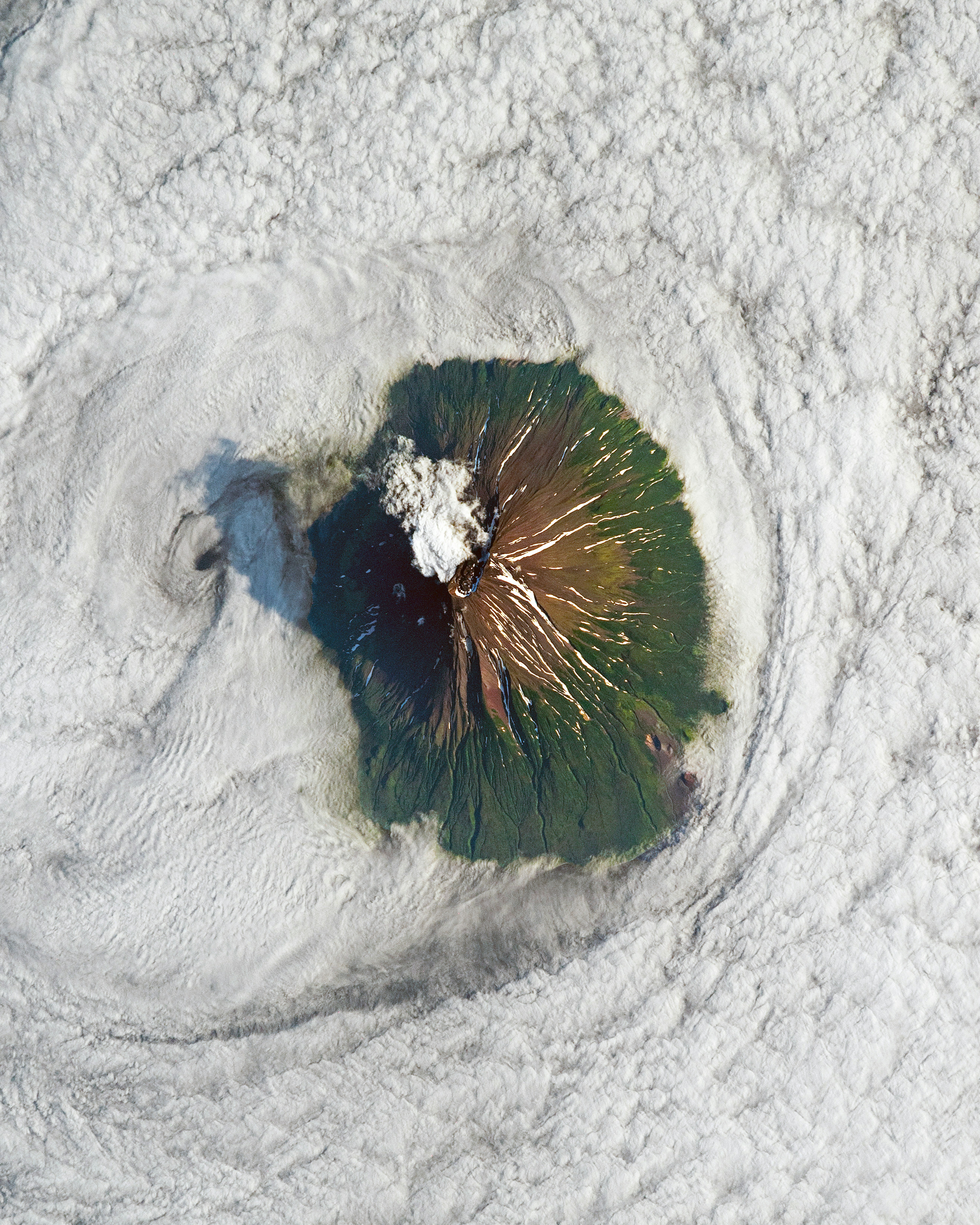
Clouds surround the volcanic peak of Atlasov Island in Russia. Recorded volcanic activity here dates back to 1790 and continues to present day, as seen with the ash plumes in this Overview captured in August 2019. Atlasov, the northernmost of the Kuril Islands, is uninhabited and rises 7,674 feet (2,339 meters) above the Sea of Okhotsk.
Jakarta
-6.200000°,106.816667° - Airbus Space
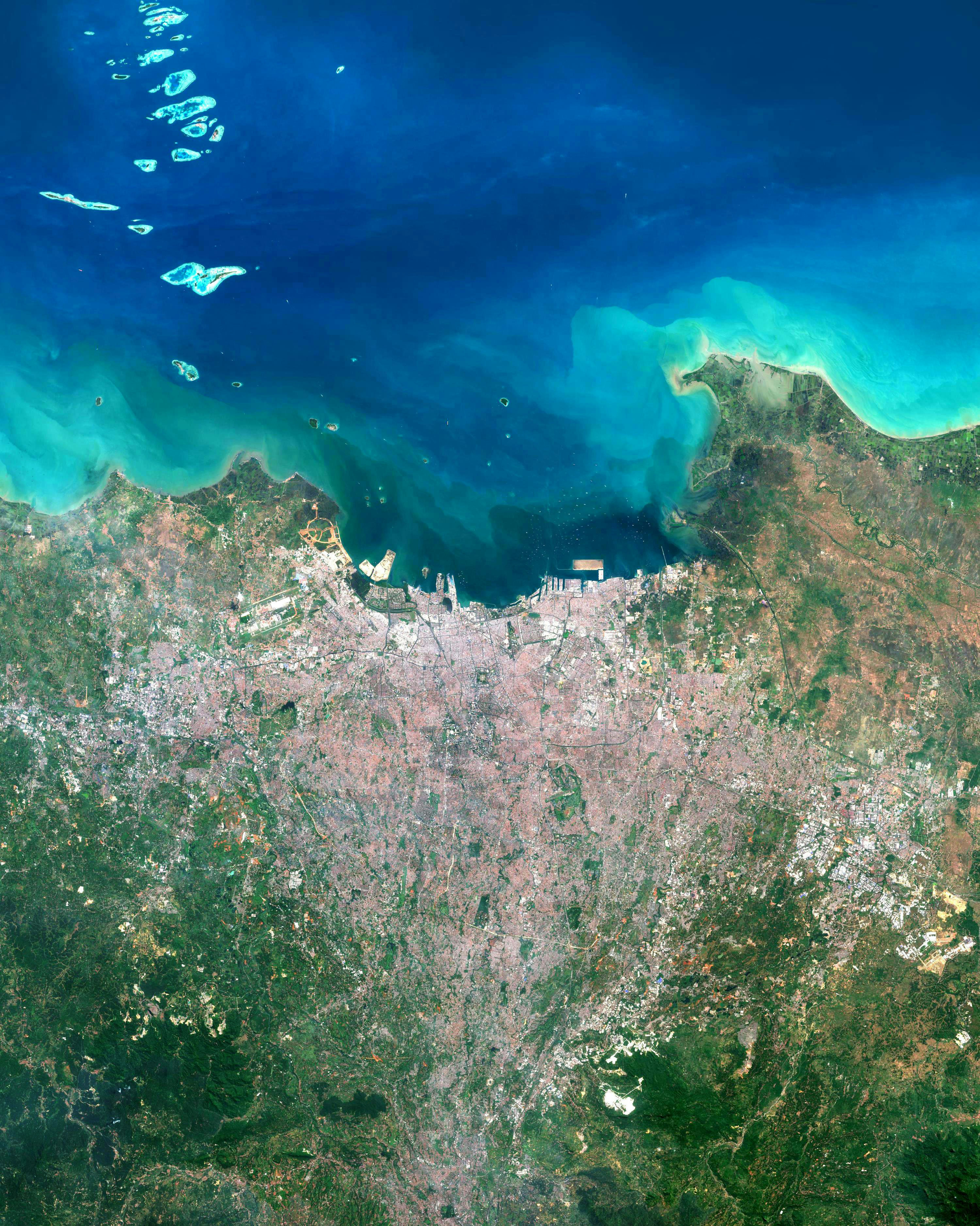
Jakarta, the capital city of Indonesia, lies on the northwest coast of the island of Java. Its metropolitan area covers 2,468 square miles (6,392 square km) and is home to nearly 36 million people, making it the world’s second-most populous urban area, after Tokyo. This Overview shows the massive city along the Java Sea, with some of Indonesia’s “Thousand Islands” archipelago visible offshore.
Dubai Whirlpool Interchange
25.055816°,55.248835° - Maxar
A whirlpool interchange connects three major roads by the Miracle Garden in Dubai, United Arab Emirates. When construction of this junction began in 2006, Dubai contained 30,000 industrial cranes — 25% of all cranes on the planet.
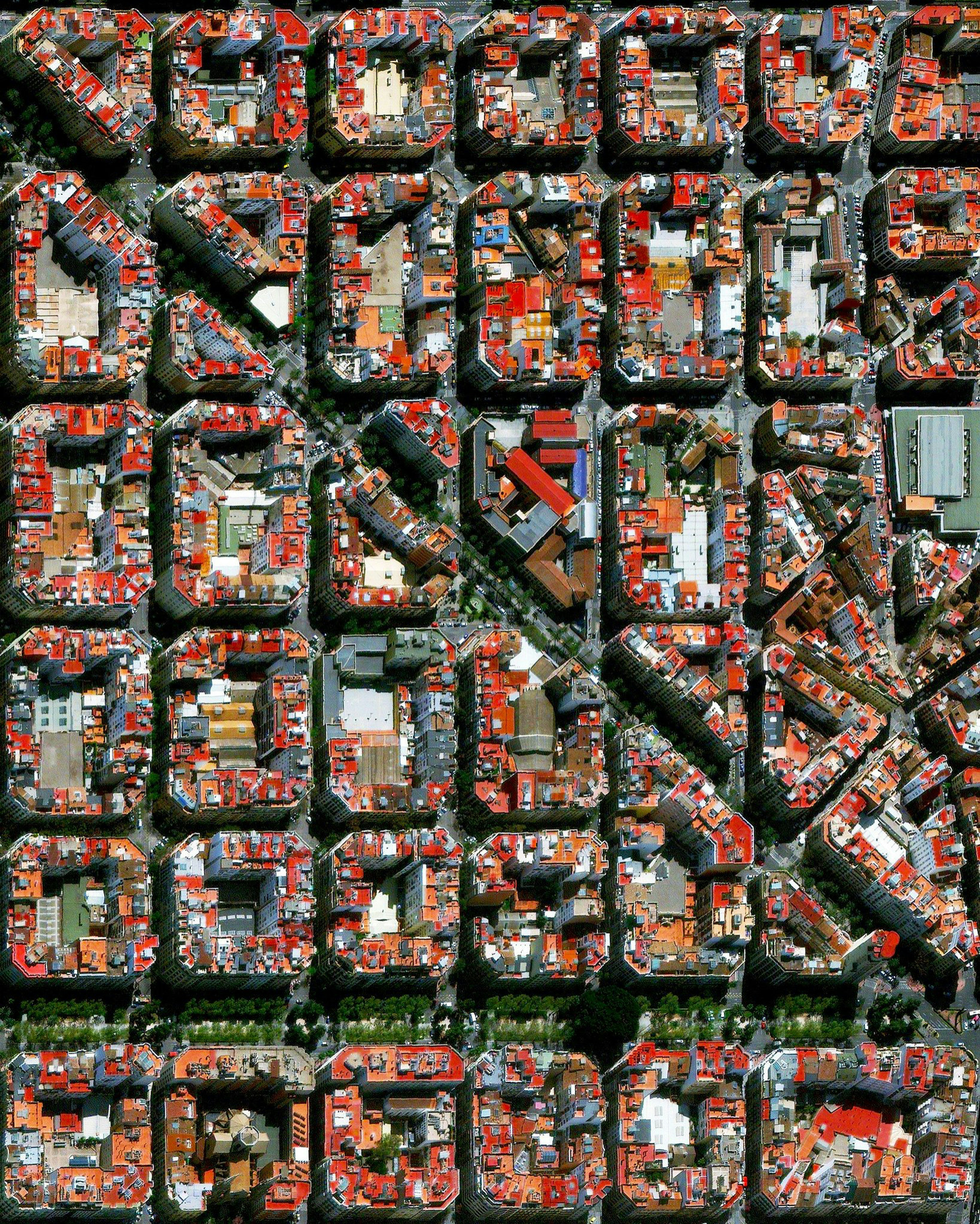
L'Eixample, Valenica
39.464722°,-0.370000° - Maxar
The urban plan of the L’Eixample district in Valencia, Spain, is characterized by long straight streets, a strict grid pattern crossed by wide avenues, and apartments with communal courtyards. A similar layout was used for the district of the same name in Barcelona.
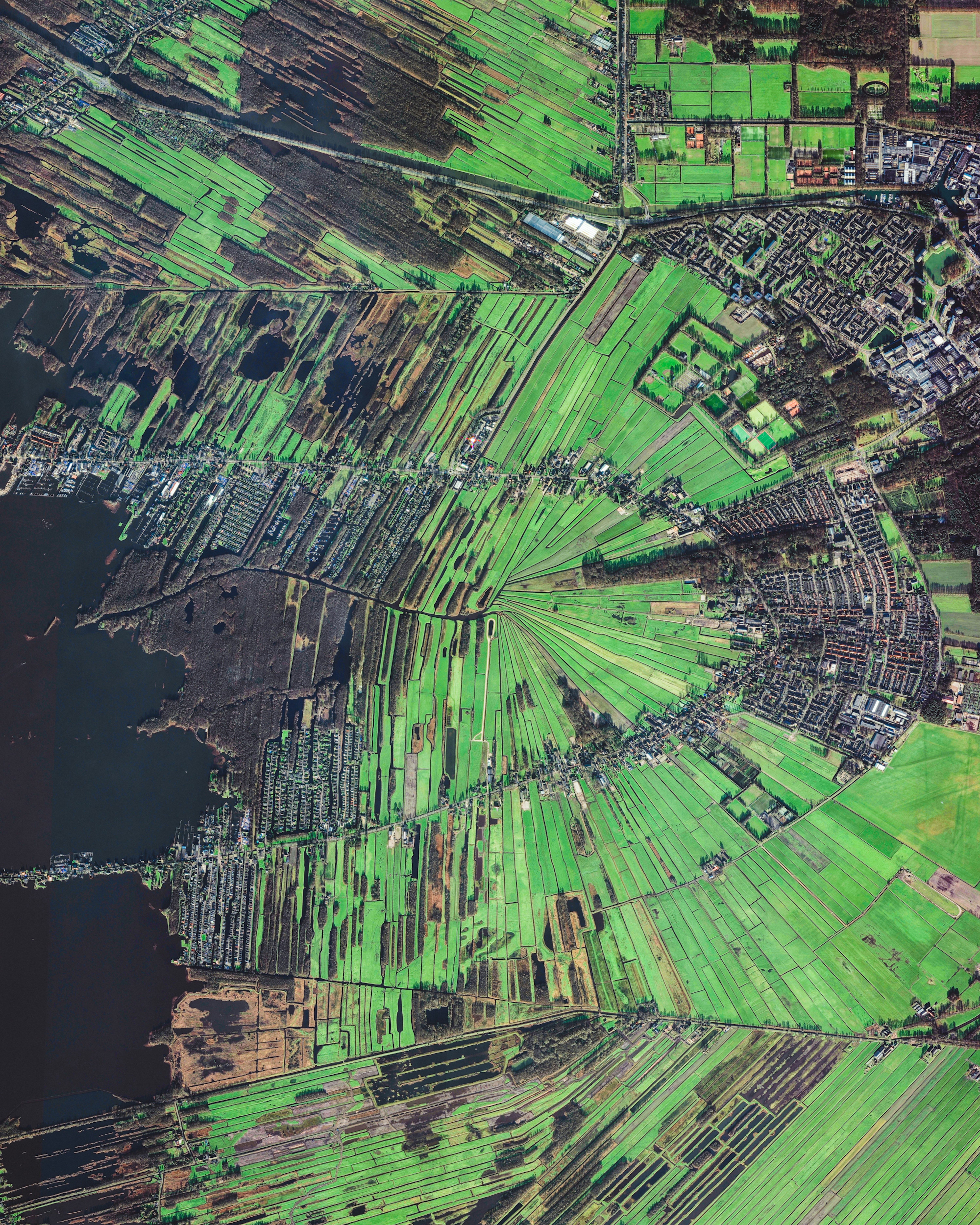
Loosdrecht
52.200556°,5.115222° - Maxar
Loosdrecht is a town of roughly 8,600 inhabitants in the North Holland Province of the Netherlands. It is known for its lakes, the Loosdrechtse Plassen, which attract thousands of tourists each year. Surrounding these lakes are hundreds of peat polders — low-lying pieces of reclaimed land protected by dikes, around 4,000 of which exist in the Netherlands.
Samarkand
39.628146°,66.971960° - Maxar
Samarkand is the second most populous city in Uzbekistan and one of the oldest continuously inhabited cities in Central Asia. It is home to upwards of 500,000 people and has shown evidence of human activity since the late Paleolithic Era. This Overview shows the southeastern side of the city, with its traditional mud-brick Uzbek houses built around central courtyards and gardens.
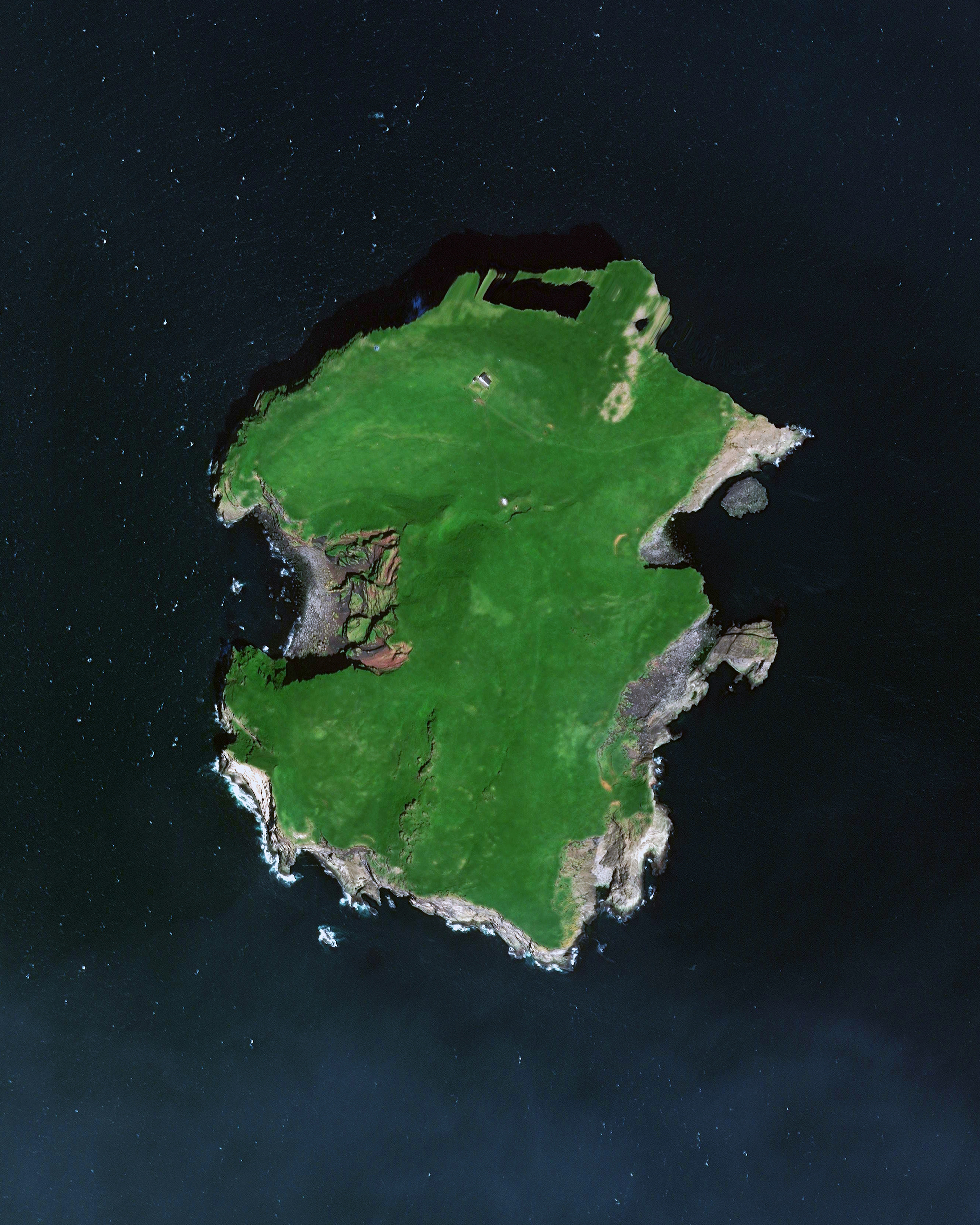
Elliðaey
63.465278°,-20.175000° - Maxar
Elliðaey is the most northeastern island of the Vestmannaeyjar (Westman Islands), located off the southern coast of Iceland. The island’s permanent population is zero and its only building is a hunting lodge built by the Elliðaey Hunting Association, which can be seen in this Overview on the northern end of the island. Due to its unique off-the-grid location, the lodge has earned Internet fame as “the loneliest house in the world.”
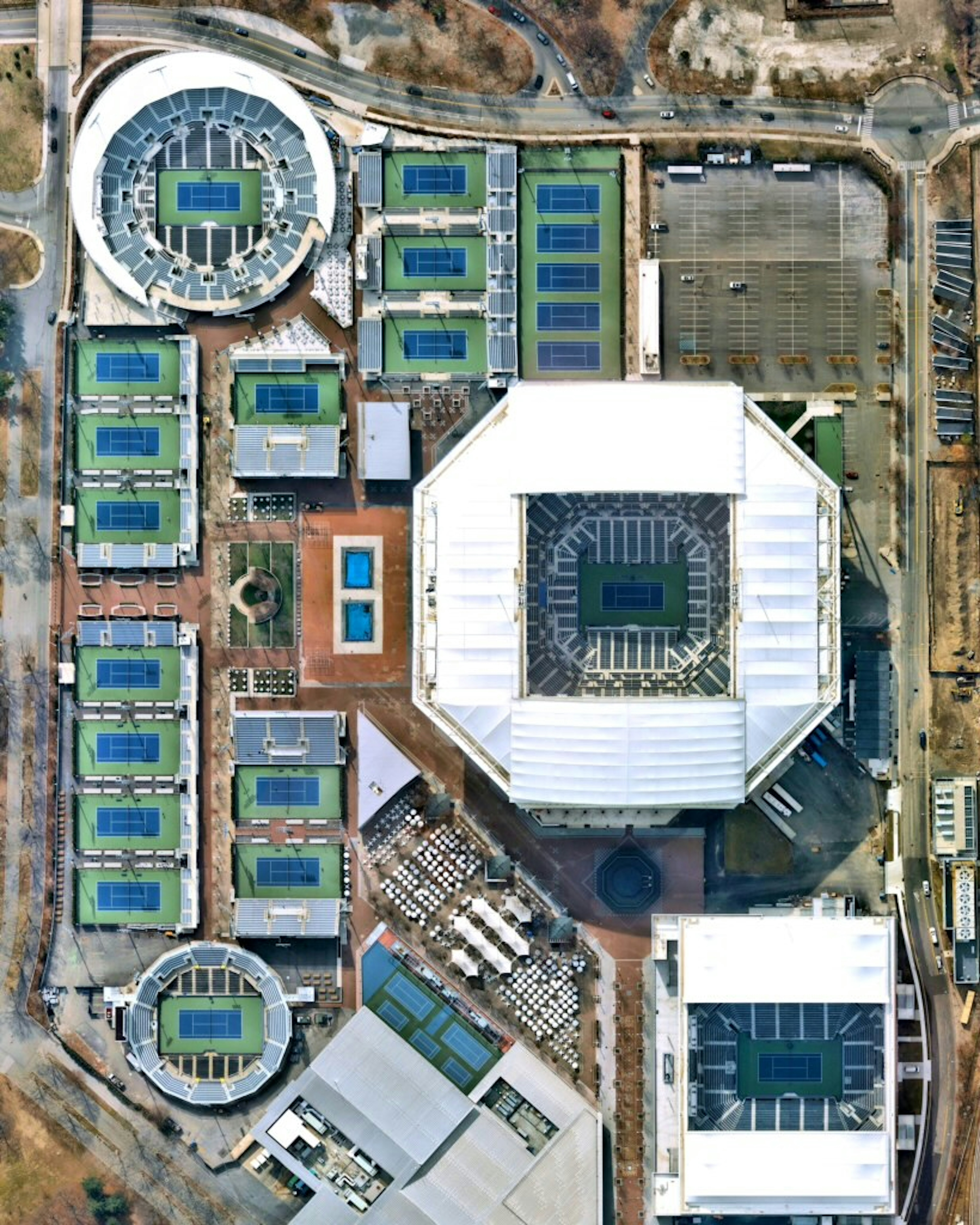
Billie Jean King National Tennis Center
40.749550°,-73.845643° - Nearmap
The USTA Billie Jean King National Tennis Center in Queens, New York City, has been the home of the US Open Tennis Championships since 1978. The 2021 tournament kicked off yesterday on the complex’s 22 courts, including three of the largest tennis stadiums in the world – Arthur Ashe Stadium, Louis Armstrong Stadium, and the Grandstand.
Sakha Republic Lakes
69.052056°,159.818972° - Maxar
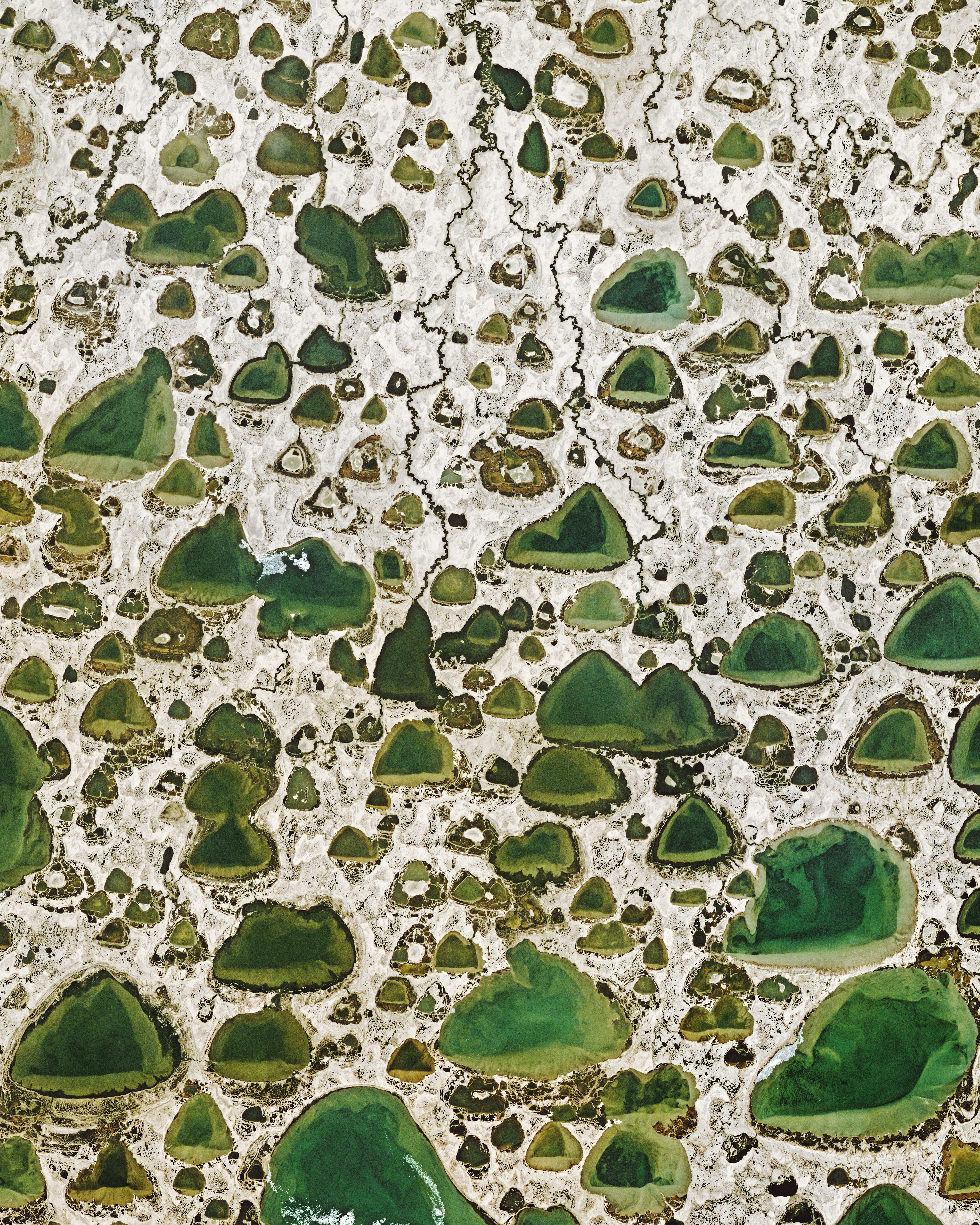
There are upwards of 800,000 lakes in Russia's Sakha Republic, many of which are found clustered in its northeastern corner. Sakha, also known as Yakutia, is the most expansive subnational entity in the world, covering nearly 1.2 million square miles (3.1 million square km) -- an area almost equal in size to India. About 40% of the republic is north of the Arctic Circle and covered by permafrost, which keeps many of its lakes frozen for 9-10 months of the year.
Dampier Creek
-17.959000°,122.247167° - Maxar
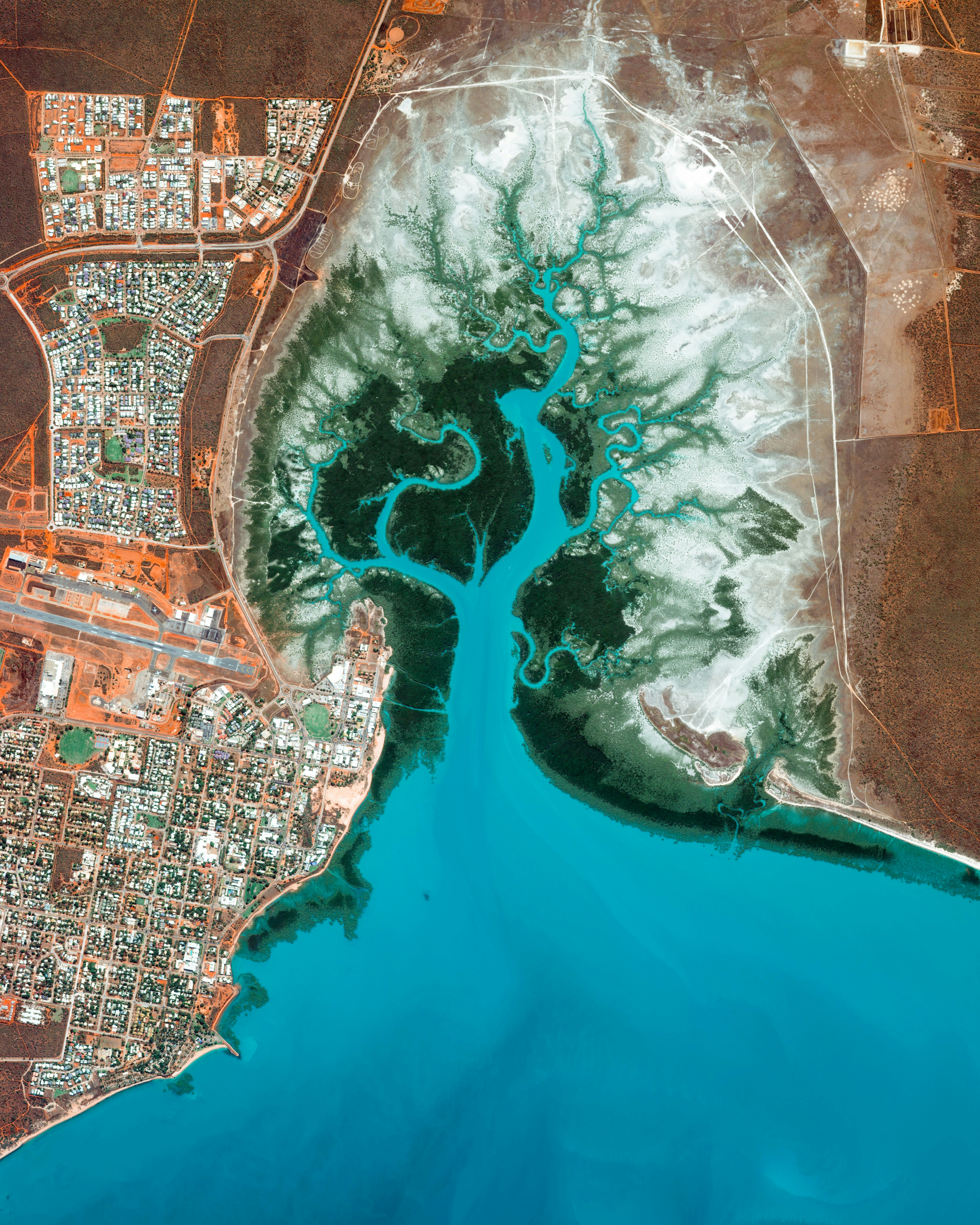
Dampier Creek winds its way inland to form the eastern border of Broome, a coastal town in Western Australia. Broome is home to roughly 14,000 people, but its population can grow to upwards of 45,000 per month during peak tourist season from June to August. Its 14-mile (22-km) white-sand Cable Beach, paleontology exhibits, pearl farms, and other attractions make it a popular destination for travelers around the world.
Yarra Yarra Lakes
-29.689000°,115.887000° - Planet
The Yarra Yarra Lakes Nature Reserve is a system of small salt lakes near the town of Carnamah, Western Australia. Once the site of a great river, this landscape has formed due to changes in land and sea level, a drier climate, and infrequent rains. Lakes here will change color throughout the year, turning blue in the winter as they fill with water and pink in the summer as they evaporate and leave behind salt.
