Daily
One regular dose of Earth from above
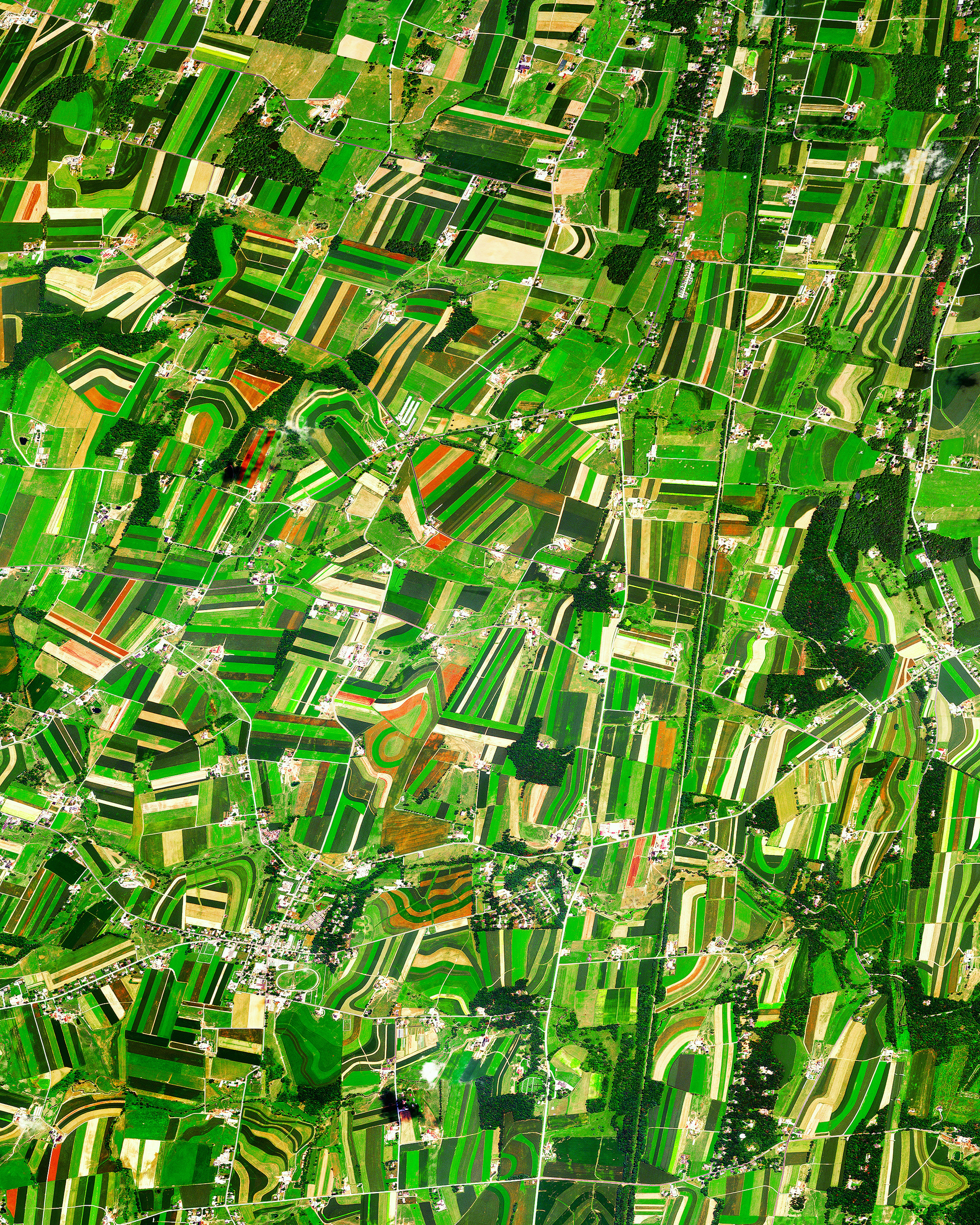
Lancaster County Farmland
39.940734°,-76.063725° - Maxar
Farm fields trace the gently sloping contours of Lancaster County, Pennsylvania. With some of the most fertile non-irrigated soil in the U.S., this area generates nearly one-fifth of Pennsylvania’s agricultural output—primarily through dairy, poultry and egg production. The county is also home to the world’s largest Amish settlement, with about 37,000 residents.
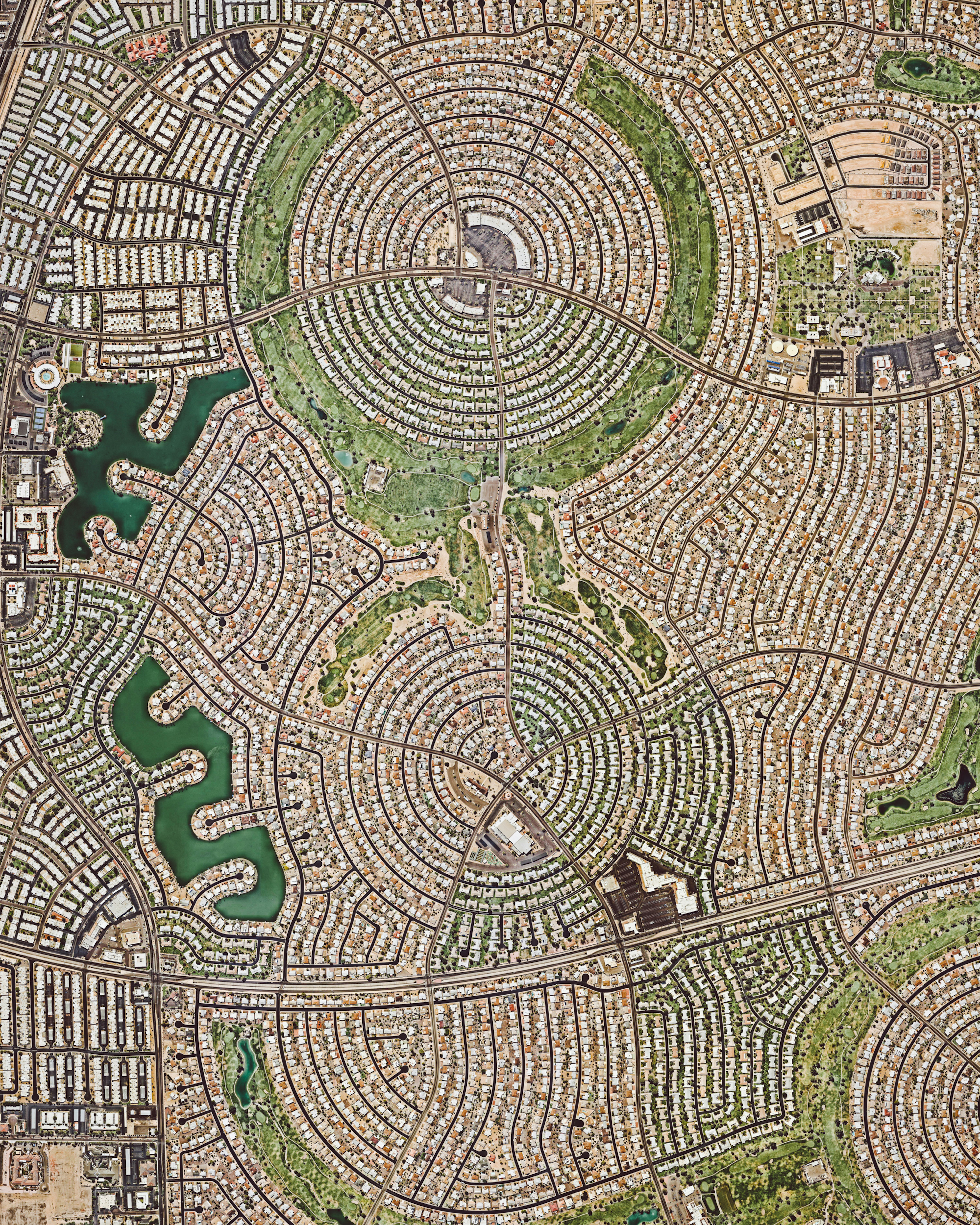
Sun City, Arizona
33.618306°,-112.280917° - Nearmap
Sun City, Arizona, is a retirement community located within the Phoenix metropolitan area. It has a population of roughly 38,000 and an adjoining sister city — Sun City West — which houses an additional 25,000 residents. When Sun City opened on January 1, 1960, it attracted a crowd of more than 100,000 onlookers and the "futuristic development" was featured on the cover of Time magazine.
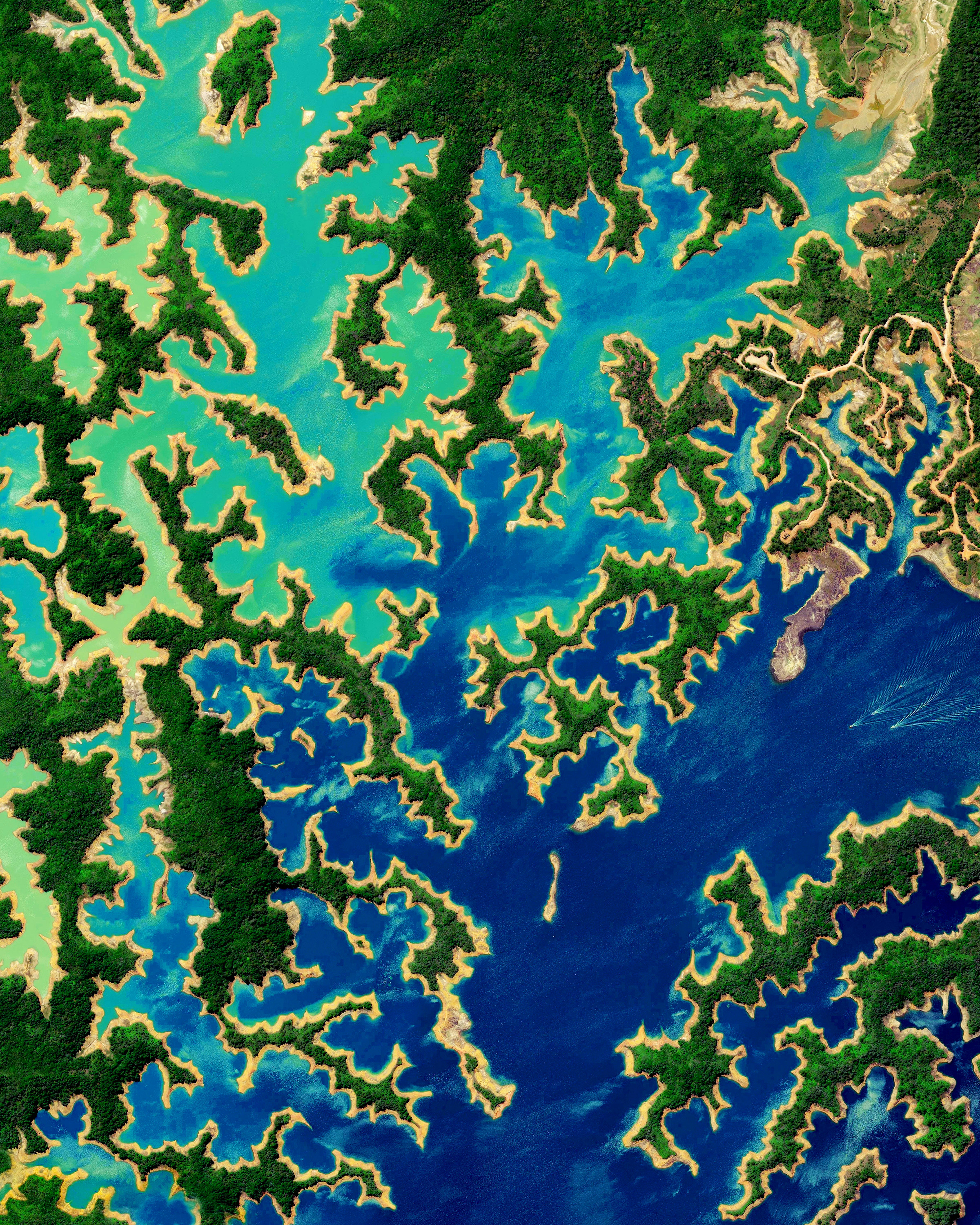
Peñol-Guatapé Reservoir
6.261000°,-75.190000° - Maxar
The Peñol-Guatapé Reservoir, also called the Guatapé Dam, is located east of Medellín, Colombia. With its construction in the 1970s, the city center of El Peñol (founded in 1714) was demolished and relocated. The dam generates hydroelectric power and the reservoir serves as a popular site for water sports, boating, and sailing.
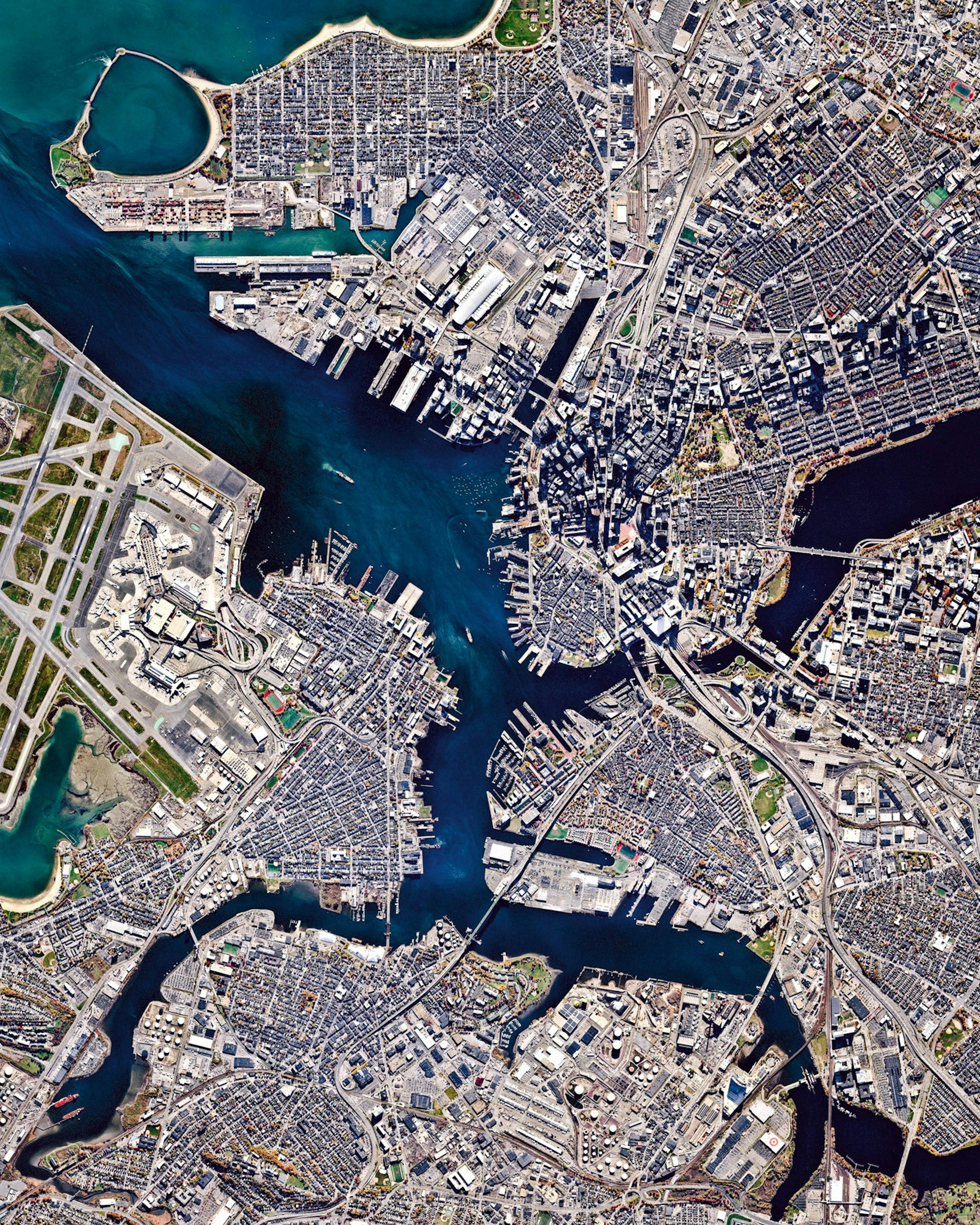
Boston
42.352238°,-71.159486° - Nearmap
Boston is the capital and most populous city in the Commonwealth of Massachusetts, with more than 4.6 million people in its metro area. In this Overview, three waterways can be seen flowing through the city and emptying into Boston Harbor — Chelsea Creek at left; the Mystic River in the center; and the Charles River at right.
Kentucky Tornado Damage
36.738803°,-88.642175° - Nearmap / Maxar
More than 50 tornadoes whipped through the southern and midwestern U.S. this past weekend, hitting the state of Kentucky especially hard. In the city of Mayfield, storms flattened numerous homes, businesses and structures, including the water tower pictured here. This Overview shows a small segment of the more than 200-mile (322-km) path carved by the tornadoes. Arkansas, Illinois, Indiana, Mississippi, Missouri, Ohio and Tennessee are all impacted. Follow us on Instagram @dailyoverview to see more.
Akaroa Harbour
-43.844600°,172.925200° - Airbus Space
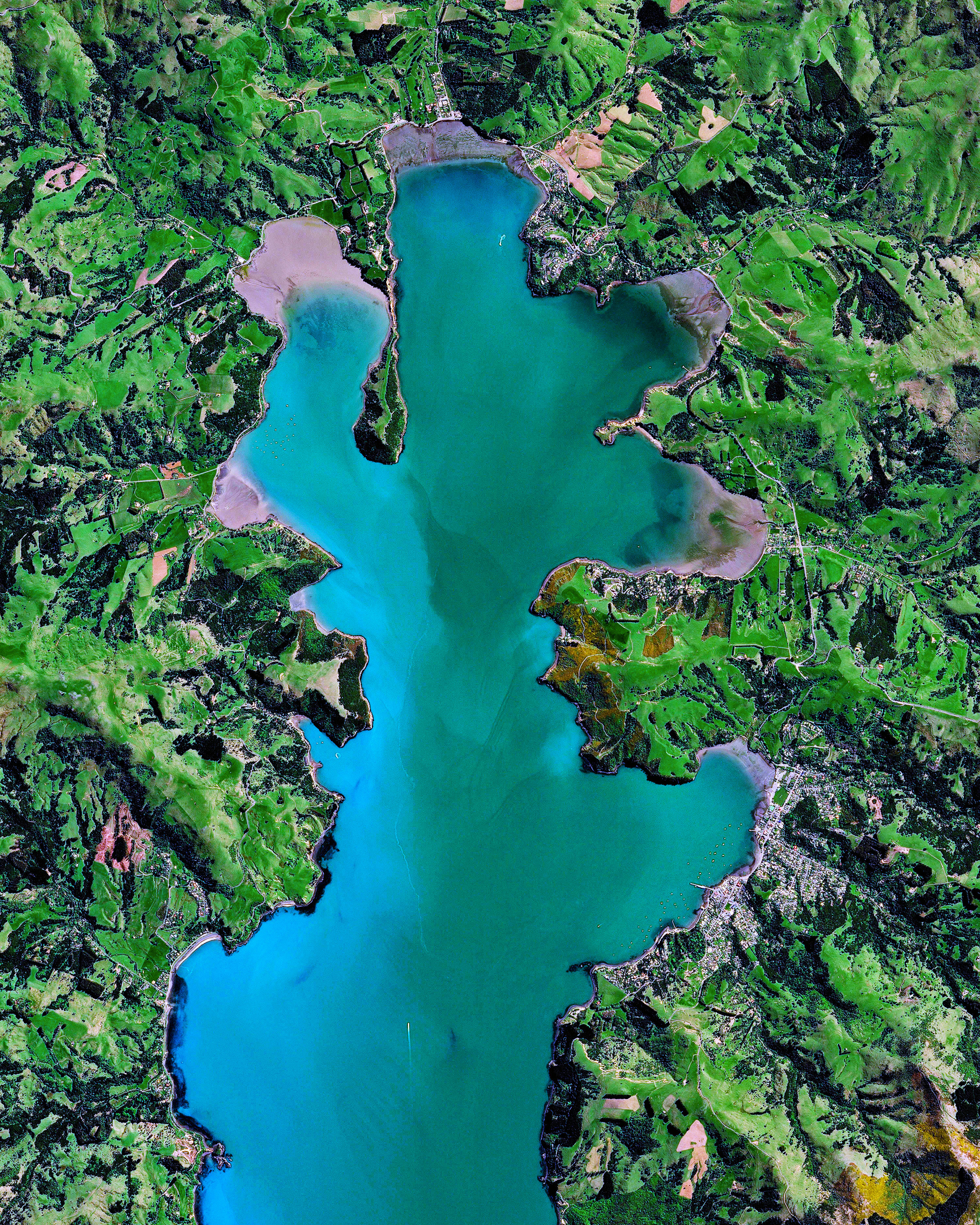
Akaroa Harbour is a large natural harbor on Banks Peninsula in Canterbury, New Zealand. Formed by the eroded center of an extinct volcano, Akaroa—which means “Long Harbor” in Kāi Tahu Māori—extends about 10 miles inland from the South Pacific Ocean. Along it’s shoreline are several small villages with a collective population of about 1,500.
New York City
40.712778°,-74.006111° - Planet
Nearly all of New York City’s 300 square miles (778 square km) can be seen within this Overview. Comprised of five boroughs where the Hudson River meets the Atlantic Ocean, the “Big Apple” has upwards of 8.8 million residents—more than any other city in the United States.
Playa Zapotal
10.504692°,-85.797443° - Maxar
Lindblad Expeditions presents an Overview of Playa Zapotal—a remote and unspoiled beach on the Pacific Coast of Costa Rica. The beach offers visitors incredible adventure with dives to offshore submarine rocks, swarmed by multi-colored tropical fish. The nearby gallery forest is also home to hundreds of birds such as flit tanagers, euphonias, and parrots who reside in the canopy and soar above the treetops. To learn more or see how you can explore the Guanacaste region yourself, check out Lindblad Expeditions at expeditions.com
Ciudad Nezahualcóyotl
19.400000°,-98.988889° - Maxar
Ciudad Nezahualcóyotl—a municipality of Mexico City, Mexico—is characterized by its long, straight, and gridded streets. With a population of more than one million people (the entirety of Mexico City contains approximately 9 million residents), the area is home to many of the capital’s citizens who have migrated there from other parts of the country.
Casablanca
33.548213°,-7.574324° - Maxar
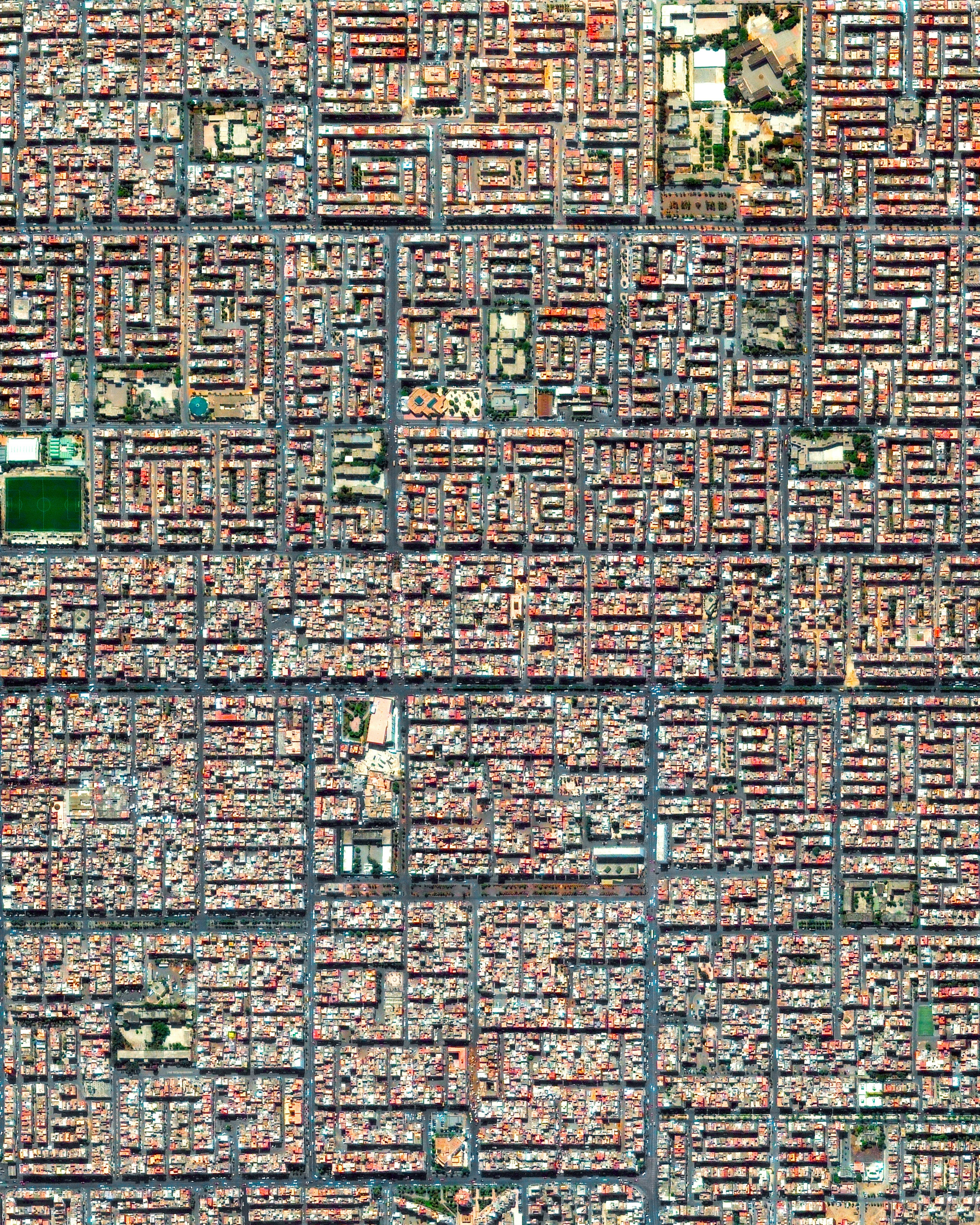
Casablanca is the largest city in Morocco with roughly 3.8 million residents, accounting for 11% of the entire country's population. Many officials believe these figures are underestimated and the total population is actually somewhere between 5 and 6 million. The Cite Djemaa neighborhood, located in the southeast of the city, is seen here.
Jeddah Corniche Circuit
21.623611°,39.108333° - Formula 1
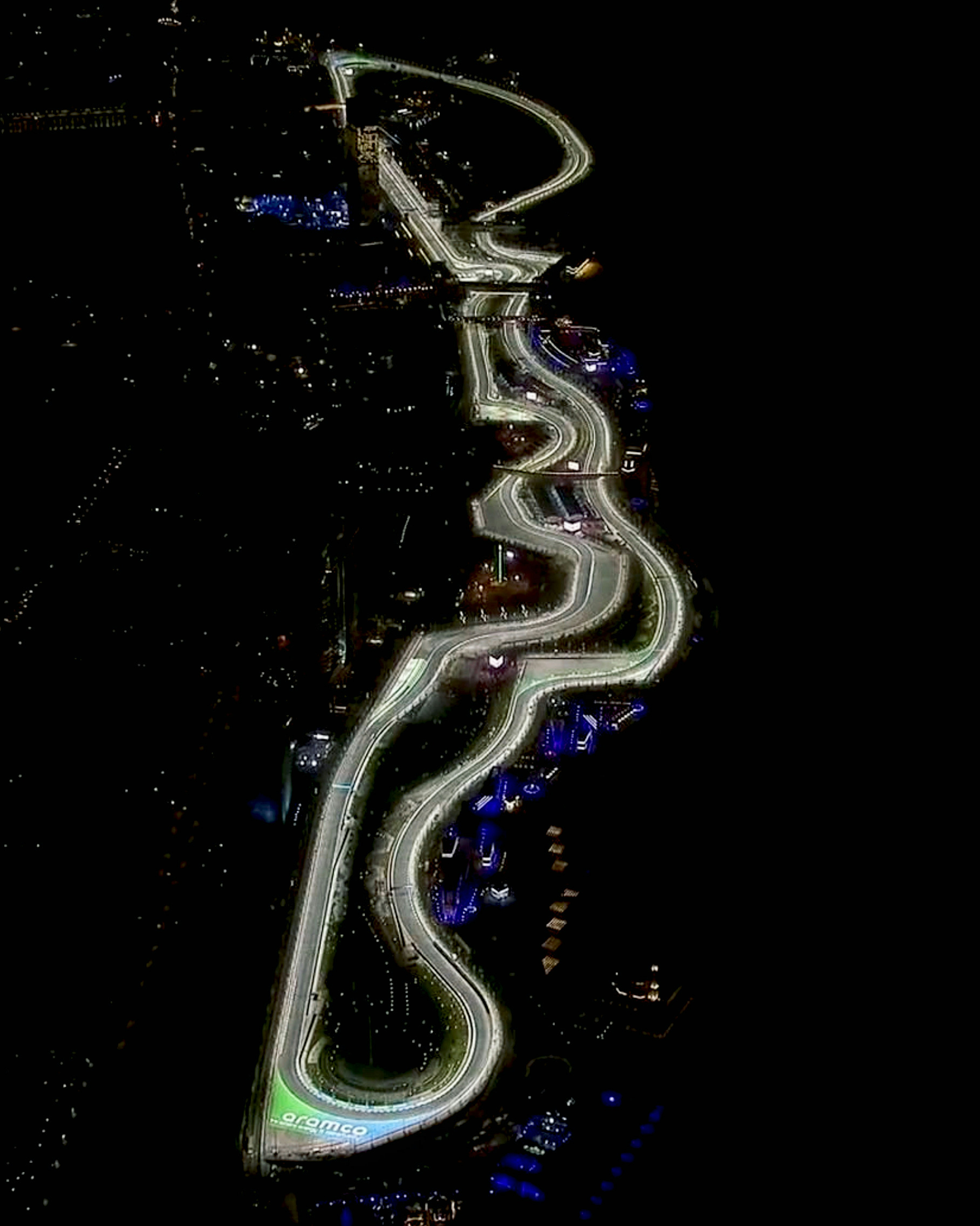
The Jeddah Corniche Circuit will play host to the first-ever Saudi Arabian F1 Grand Prix tomorrow, December 5th. Featuring 27 turns and measuring 3.8 miles (6.2 km), it is one of the longest tracks in use by Formula 1. Coming into the circuit’s final corner, it is expected that drivers will reach speeds as high as 200 mph (322 km/h).
San Francisco Bay
37.670000°,-122.270000° - Planet
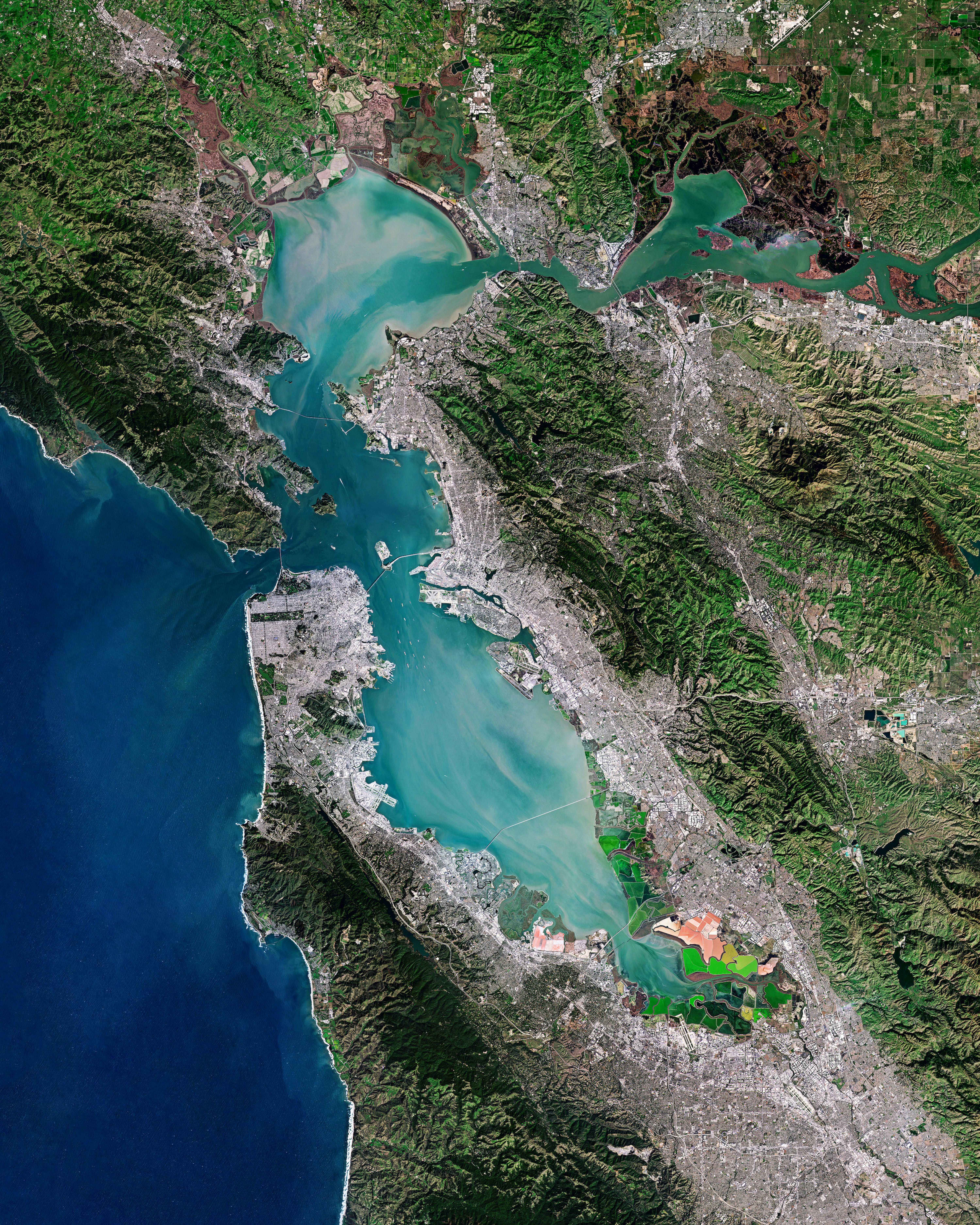
Water and sediment swirl through San Francisco Bay, mixing with the Pacific Ocean on the west coast of California. The Bay, which covers roughly 1,600 square miles (4,000 square km), drains water from approximately 40% of the state — including the Sacramento and San Joaquin rivers and the Sierra Nevada mountains. Surrounding the Bay are the cities of San Francisco, San Jose, and Oakland.
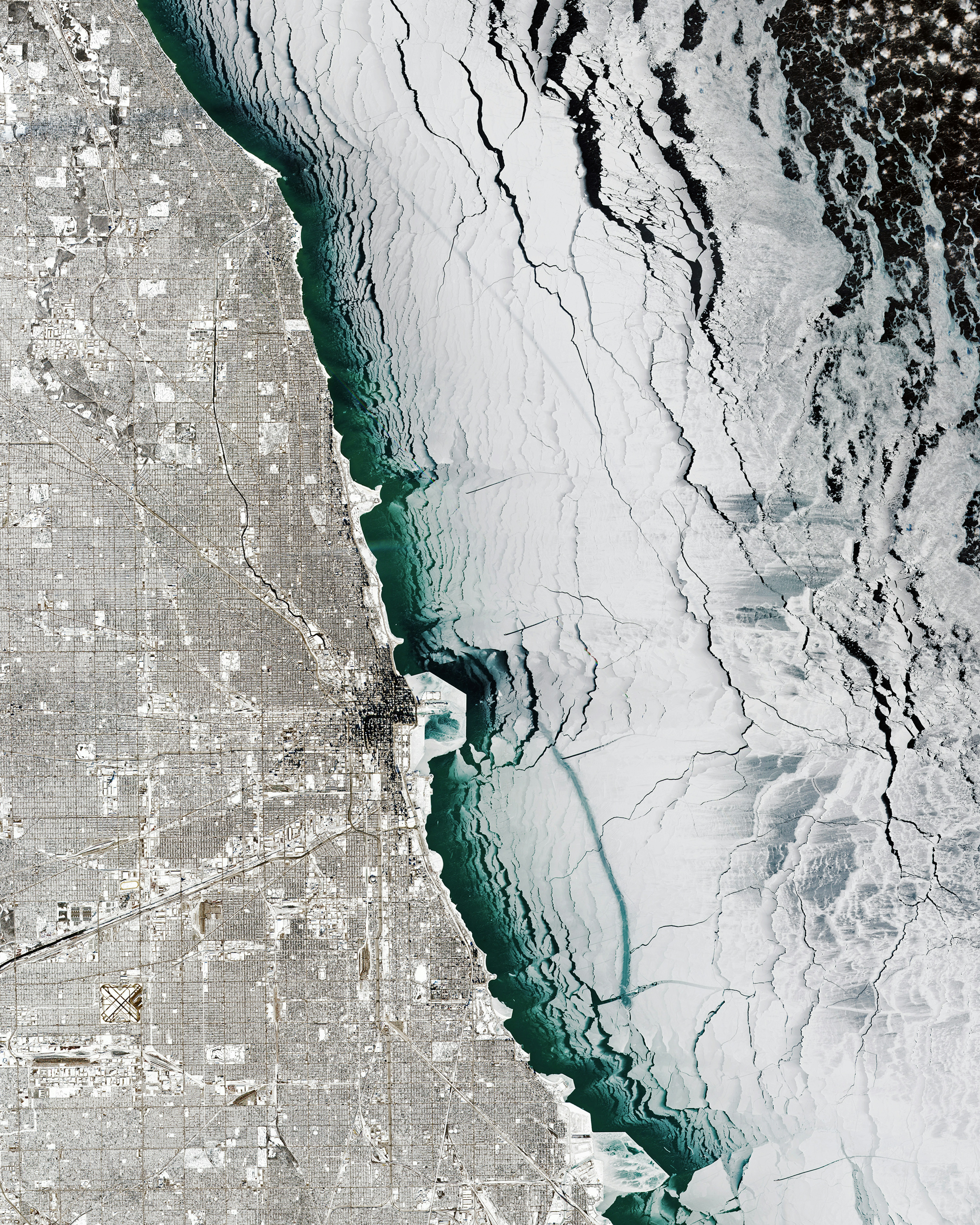
Chicago Polar Vortex
41.833647°,-87.872390° - ESA
The frozen waters of Lake Michigan border the snow-covered city of Chicago, Illinois, USA, during the polar vortex that occurred in January 2019. Chicago finished off that January with 13 consecutive days of snow and some of its coldest temperatures in more than three decades.
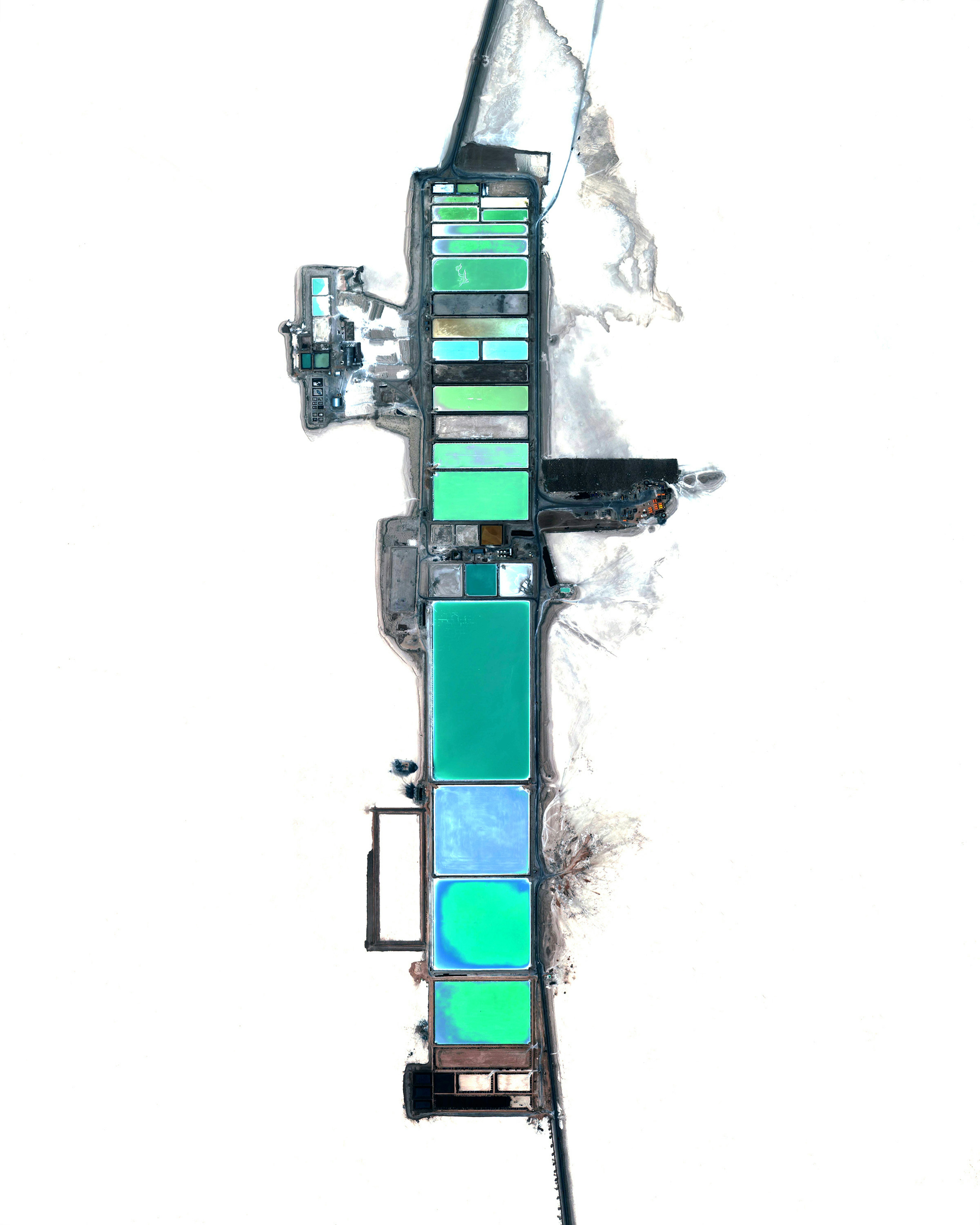
Bolivia Lithium Mining
-20.563929°,-67.376575° - Maxar
Lithium mining operations are visible at Salar de Uyuni, the world’s largest salt flat in Bolivia. The white surface surrounding these evaporation ponds is the natural color of the salt flats. Lithium is a reactive alkali metal primarily used to create lithium-ion batteries, which power everything from smartphones to electric vehicles. The mining process begins by drilling and pumping water into holes in the salt flats to bring salty, mineral-rich brines to the surface. The brine is left in pools to evaporate for months, creating a mixture of minerals that are continuously filtered until enough lithium carbonate can be extracted.
Antarctic Sea Ice Melt
-65.539300°,101.884100° - Maxar
Sea ice breaks apart in various block sizes roughly 40 miles (64 kilometers) off the coast of Antarctica. Antarctic sea ice extends far north in the winter and retreats almost to the coastline every summer. In the 1980s, Antarctica lost 40 billion tons (36.3 billion metric tons) of ice every year. In the last decade, that figure was estimated at a staggering 252 billion tons (229 billion metric tons) per year.
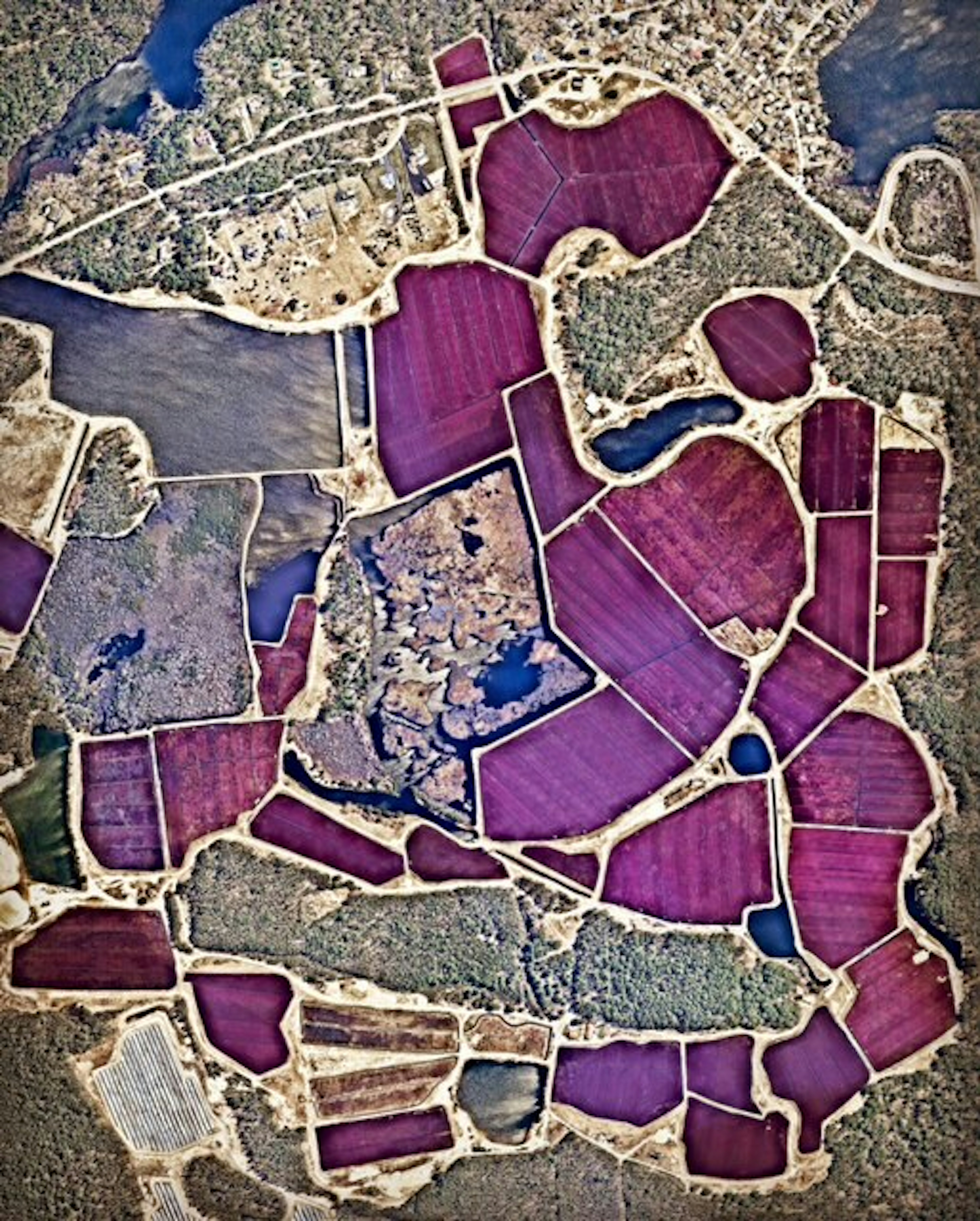
Cranberry Bogs
41.914292°,-70.792761° - Nearmap
If you put cranberries on your Thanksgiving turkey today, there’s a chance they came from these bogs in Plymouth, Massachusetts, USA. Cranberries are a Native American wetland fruit that are grown on low-lying vines, floating in beds of water layered with sand, peat, gravel, and clay. Coincidentally, the town of Plymouth is also the site of the colony founded by the Pilgrims in 1620 and was the home to the first Thanksgiving feast in 1621. Happy Thanksgiving from Daily Overview!
Fafan Zone
9.493153°,43.105028° - Planet
Agricultural fields surround several small villages in the Fafan Zone of Ethiopia. Located on Ethiopia’s eastern border with Somalia, this region contains some small cities but is mostly agrarian. Farmers here raise livestock and grow cereals like sorghum, maize and teff—a grass native to the Horn of Africa.
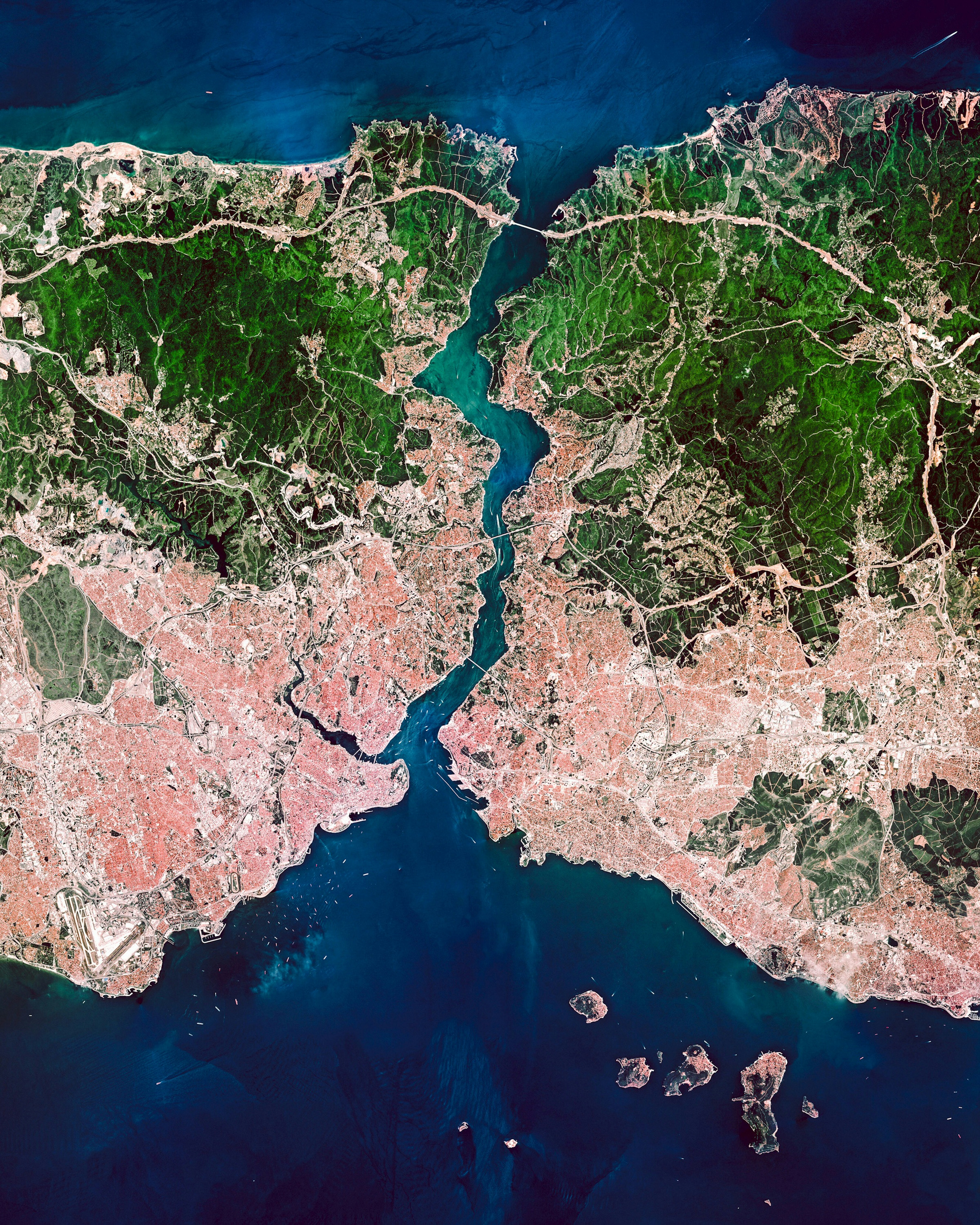
Istanbul
41.013611°,28.955000° - Planet
Istanbul is the most populous city in Turkey with roughly 15.5 million residents. As seen in this Overview, it is a transcontinental city - straddling both sides of the Bosporus Strait between Europe and Asia. Istanbul’s strategic position between the Black and Mediterranean Seas has made the city a gateway for the spread of people, goods, and ideas throughout its history.
Willemstad, Netherlands
51.691944°,4.437778° - Maxar
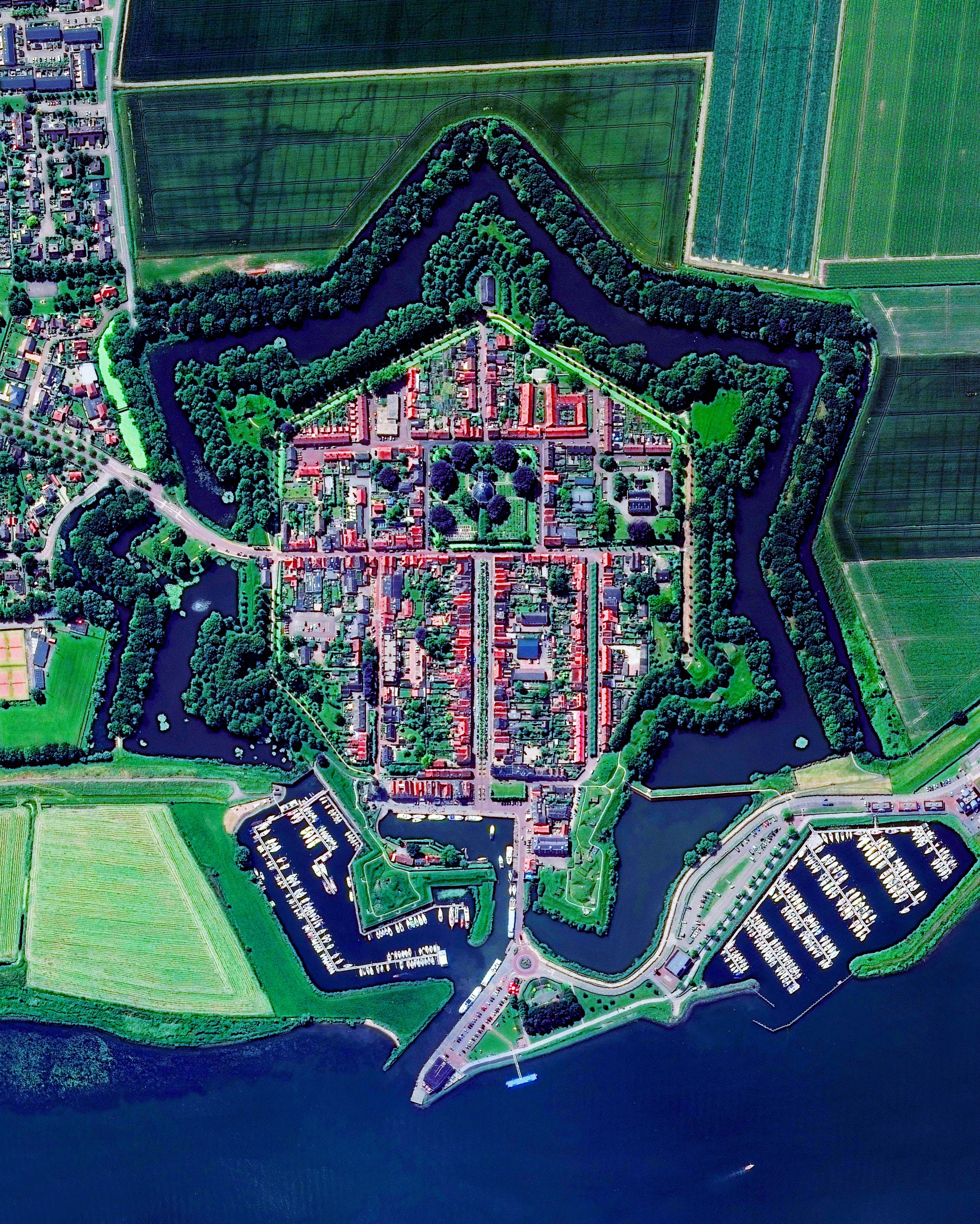
Willemstad is a city of 3,125 in the Noord-Brabant province of the Netherlands. Its historic center lies within a 17th century star fort on the south bank of the Hollands Diep river. Willemstad is the namesake for the capital city of Curaçao, an island country in the Dutch Caribbean.
San Francisco Low Angle
37.777500°,-122.416389° - Maxar
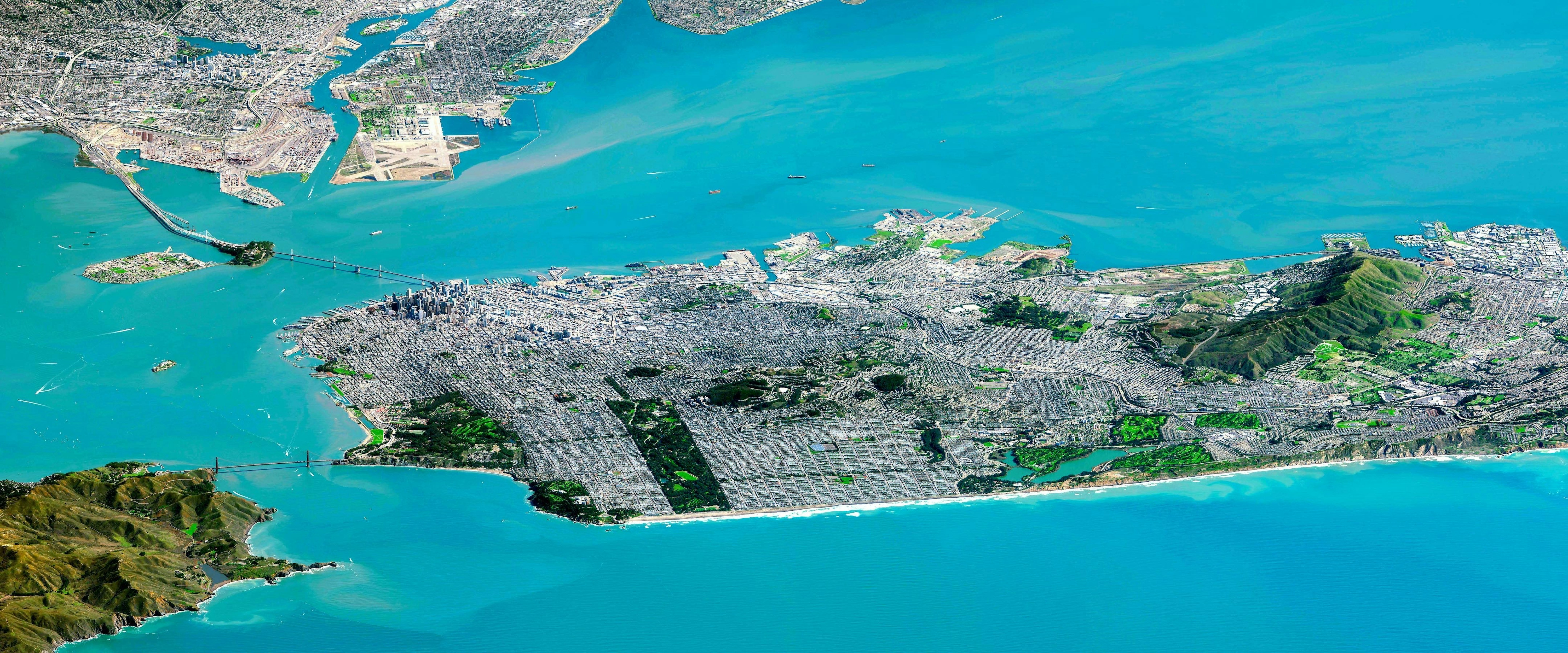
This breathtaking Overview captures the city of San Francisco, California and the surrounding 'Bay Area' like you've never seen it before! DigitalGlobe's WorldView-3 satellite was a remarkable 800 miles away over the Pacific Ocean when this image was captured. The focal length of the satellite camera is 32 times longer than a standard DSLR camera, making a view like this possible. Within the frame, many of the city's landmarks are visible, including the Golden Gate and Bay Bridges, Alcatraz, and Golden Gate Park.
